
The group did a rather “chill” hike today, as some days has to be easy and some hard. Today was the former.
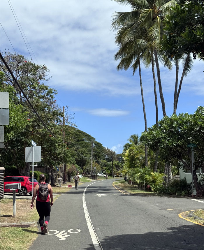
Enchanted Lakes
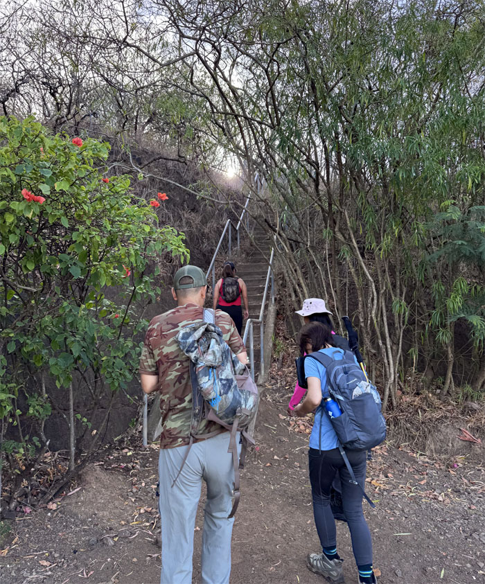
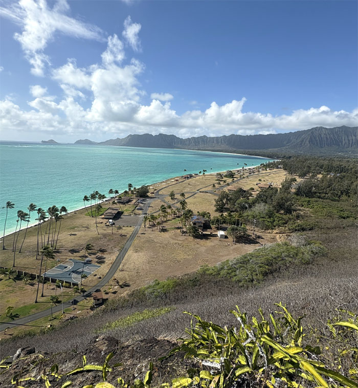
We secured parking in the neighborhood that was created in 1959 by partially filling in Ka’elepulu Pond, a historical Hawaiian fishing pond. A similar fate was in store for Kuapa Pond on the East side in 1961, which created the community of Hawaii Kai.
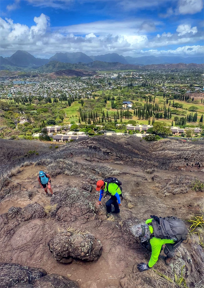
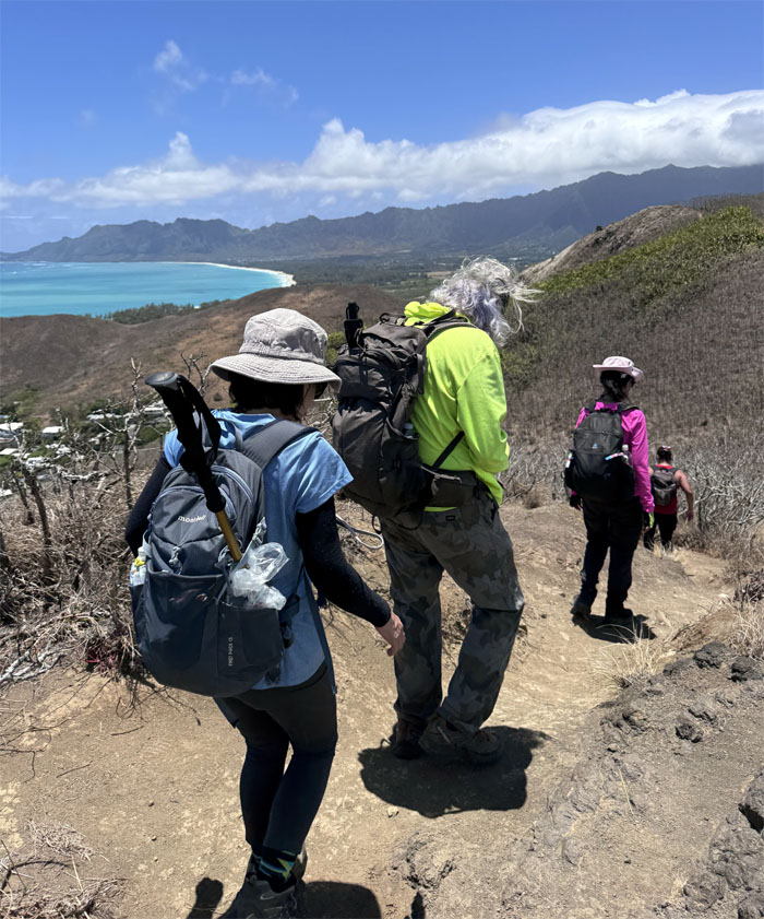
Ka’iwa Ridge
The group scrambling up the hill passing the invasive koa haole trees that were deemed amongst the top 100 worst invasive species in the world. The diminished Ka’elepulu Pond surrounded by homes can be seen in the background. In 1979, the US Army Corps of Engineers ruled that the pond was a navigable water of the US and therefore open to the public. The issue died a quiet death after the US Supreme Court ruled that Kuapa Pond while also being navigable, was not open to the public as well. Money talks, public access walks.
Ka’iwa Ridge
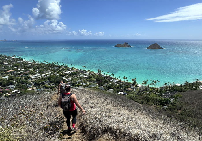
Panoramic views of Kailua Bay and beyond. Is this the three rocks or three kooks?
Ka’iwa Ridge
Getting down was more awkward for some than others.
Ka’iwa Ridge
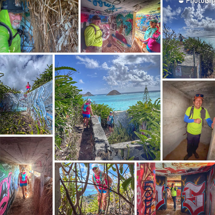
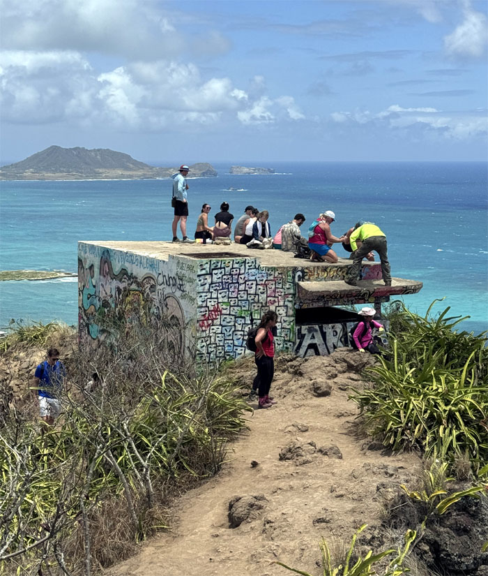
We took a short detour to check out what appeared to be a bunker. Objects may be larger than they appear. And we are not even driving.
Ka’iwa Ridge
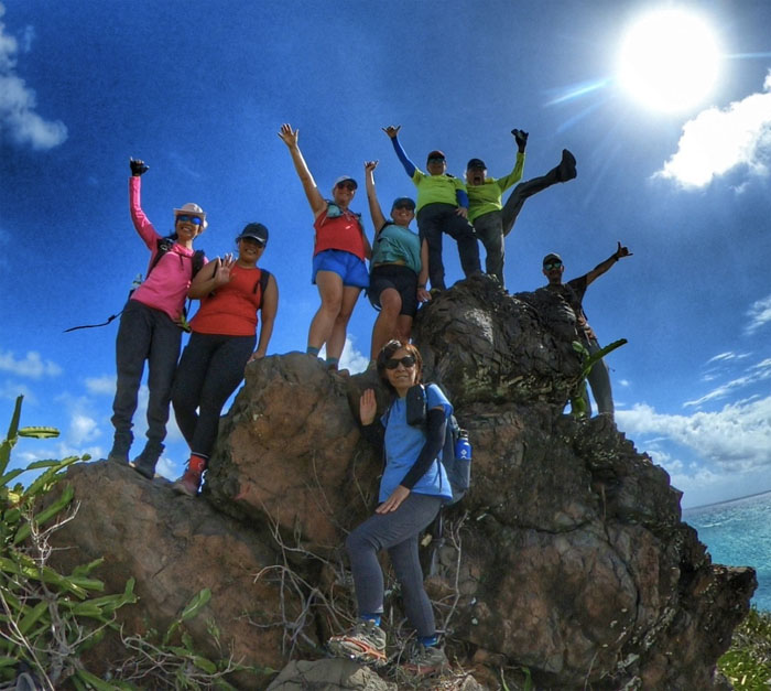
Group photo on top of the small structure of unknown utility.
Ka’iwa Ridge
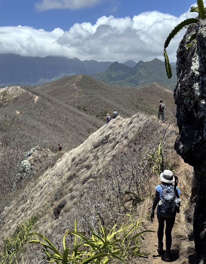
Following the undulating ridge line that was bordered with US Government signs warning of no trespassing into Bellows Field.
Ka’iwa Ridge
What goes down, must come back up.
Ka’iwa Ridge
Looking out towards Bellows Field, when its airstrips were shuttered in 1958, the area became a recreation area for military personnel.
Ka’iwa Ridge
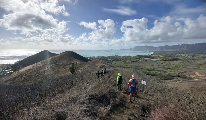
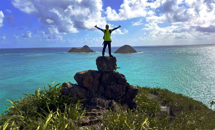
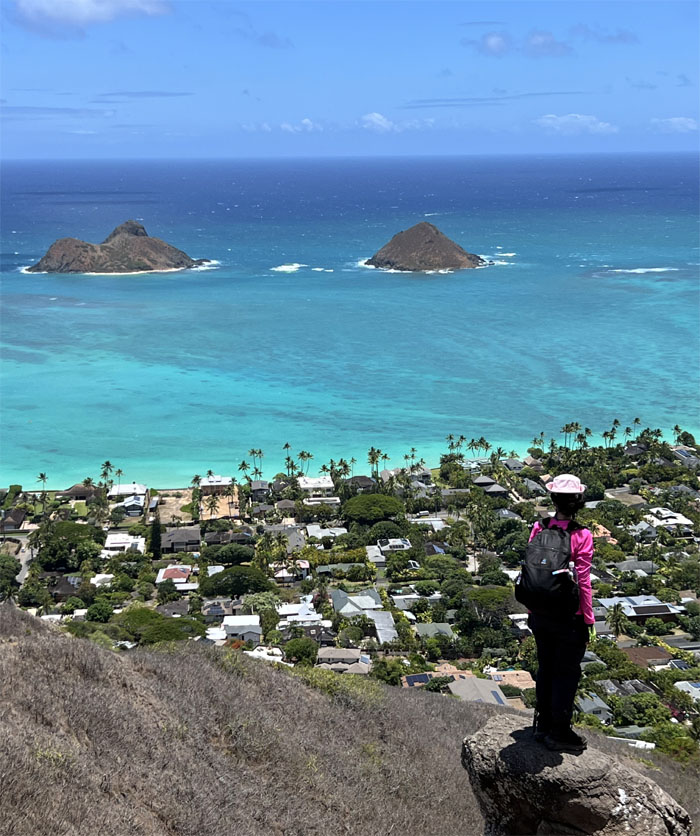
Approaching the oft photographed spot of Na Mokulua (two islands), the original Hawaiian names have been lost to posterity.
Ka’iwa Ridge
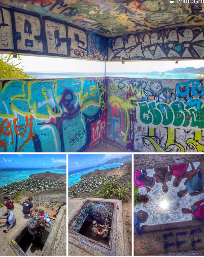
We followed the dragon fruit corridor to do some bunker exploration; where we would find insane overgrowth, expected graffiti, surprisingly small spaces and an unexpected scare.
Battery Wailea
Standing on the remains of what used to be the gun emplacement that was used for coastal defense from 1942-1945.

Wailea Point
Chico found out where the trail ends. Private property. In old Hawaii, before European contact, the concept of private property did not exist. All lands were owned by the different gods and managed by the ruling class. The Great Mahele of 1848 was passed under the guise of providing titled land to the Hawaiians, in reality, it opened the door for the fire sale of land to the Westerners who eventually displaced the native Hawaiians in the name of development.
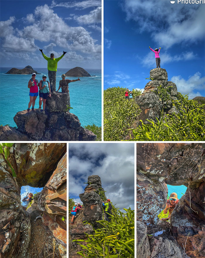
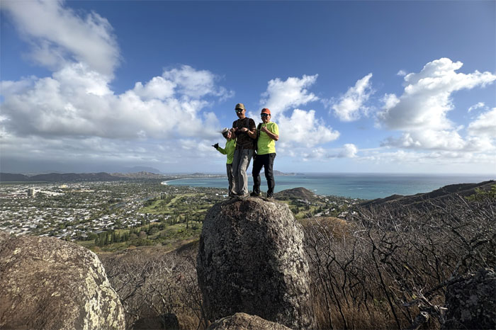
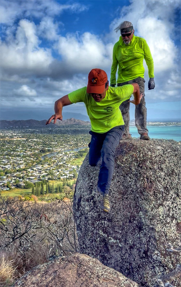
Thee Rocks
Playing on rocks.
Thee Rocks
Fitting eight people on three rocks. Mathematical shortcut.
Ka’iwa Ridge
One step at a time.
Ka’iwa Ridge
Leaving the ridge line behind and getting back into civilization. No 7-11’s around. Are we not civilized?
Lanikai
Walking through the neighborhood that was originally called Ka’ohao which means to join together. Charles Frazier purchased the land with the intentions of building an exclusive beachside community in 1924. Frazier wanted to give it a name that meant “heavenly sea,” but instead of calling it the grammatically correct, Kailani, he called it Lanikai.

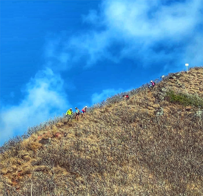
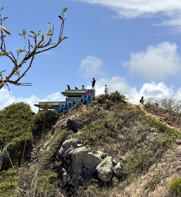
Ka’iwa Ridge
Joining the throngs of tourist and locals to hike up to the WW2 structures that have become a victim of social media and its own popularity. Crushing crowds, trail erosions and environmental impacts have all contributed to its current situation with nearby residents demanding that the State manage the area more effectively for the betterment of the trail, homeowners and hikers alike.
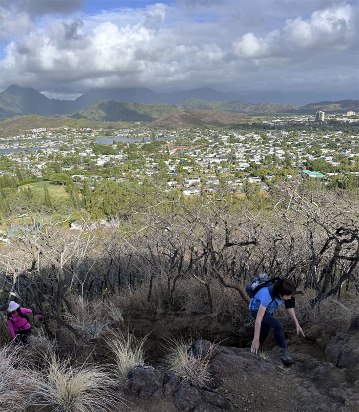
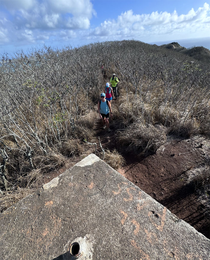
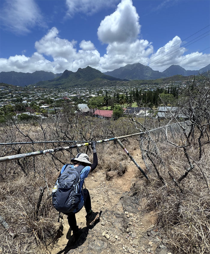
Ka’iwa Ridge
Scrambling up the trail.
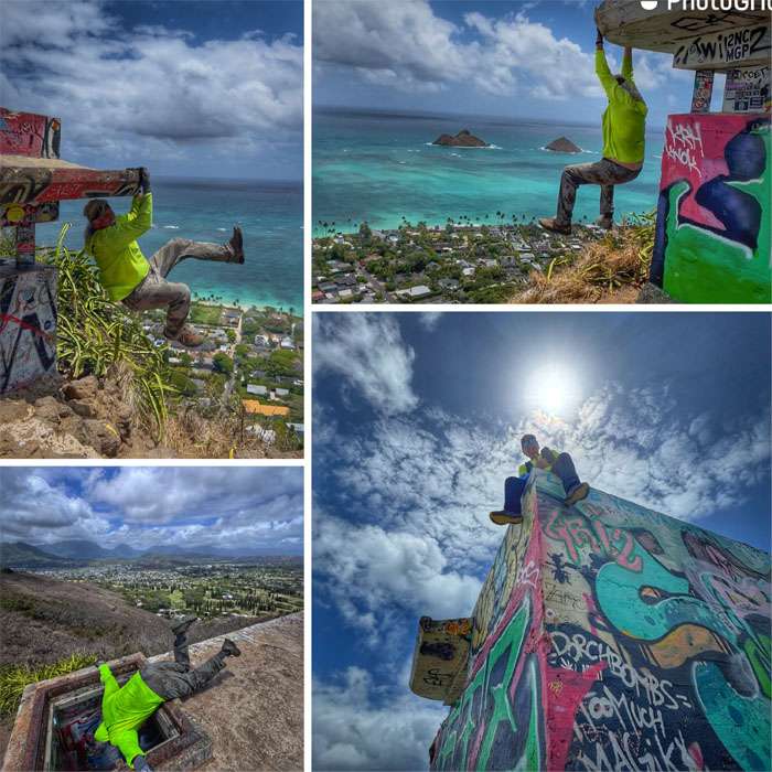
Fire Control Station Podmore
Hanging out at the single story North Structure (29A) which was built as an observation station to support Battery Wailea and nearby artillery batteries.
Fire Control Station Podmore
Group photo at what most people call one of the Lanikai Pillboxes. The name is a misnomer as a pillbox is a defensive structure usually bristling with machine guns and other armaments. Tomato. Tomatoe.
Ka’iwa Ridge
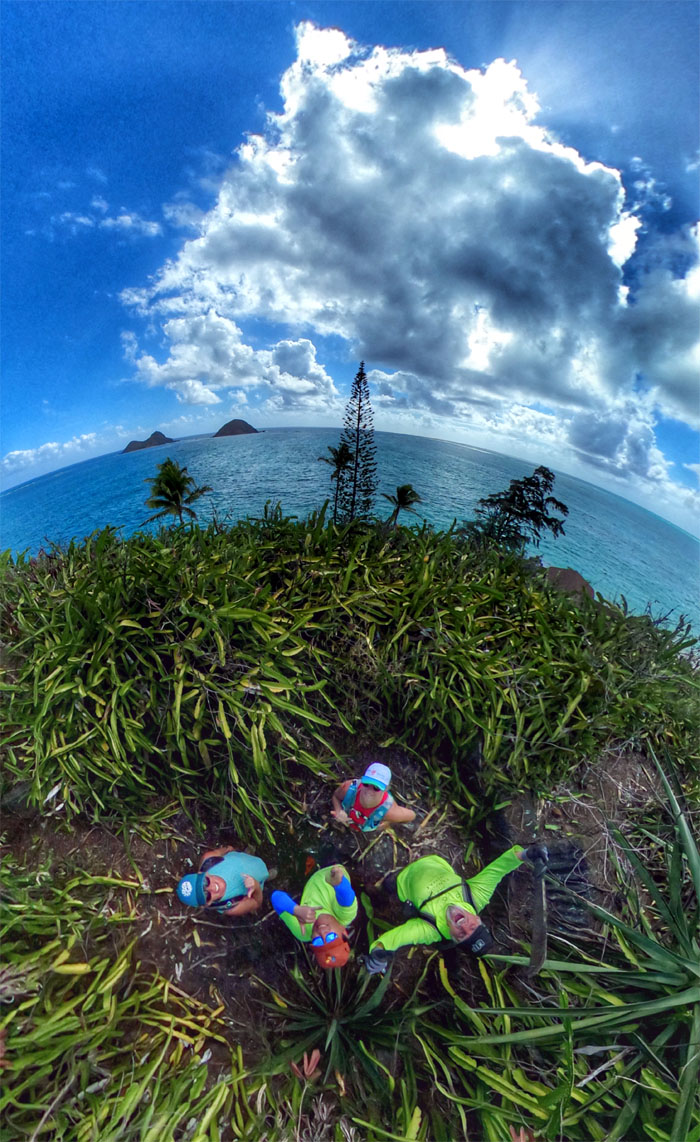
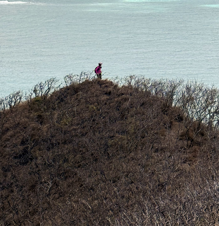
Some took longer than others to leave the first structure. Perhaps it was to soak in the panoramic views of the Windward coast. Perhaps it was documentation for personal consumption.
Ka’iwa Ridge
It was a hop, skip and a jump to the second WW2 structure.
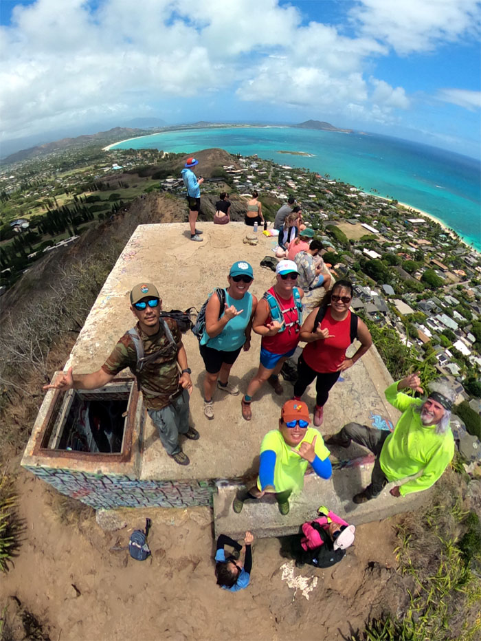
Fire Control Station Podmore
Waiting for the Korean Army to leave before checking out the two-tiered South Structure (29B & 29C).
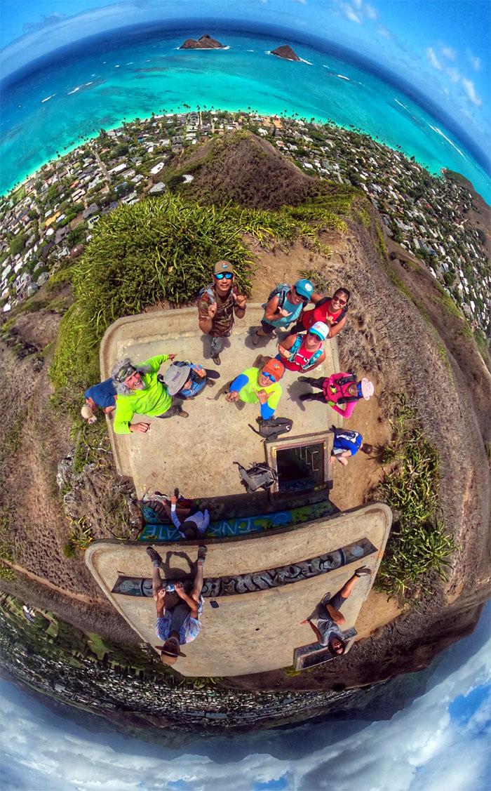
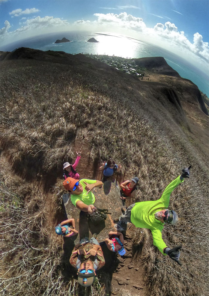
Fire Control Station Podmore
Final group photo of the day. Many clean up groups periodically come up and remove the graffiti from the WW2 structures. Losing battle. These are man-made structures, they will get tagged and most of them are actually approaching “art.” Beauty is in the eye of the beholder.
Ka’iwa Ridge
Taking the trail back down to our cars.
Ka’iwa Ridge
One rock is just as good as three rocks.
Ka’iwa Ridge
I heard there was supposed to have been a race on this trail. Just a rumor? Just as well, it was hot as heck on the ridge today.
All pau
We got back down to our cars and back into a civilized air conditioning environment.

GPS Tracks
Our scenic loop hike covered 4.57 miles with a fun group. Thanks to Allison for putting this together. Post hike meal at Round Table Pizza, where the eyes were bigger than the stomachs. The Korean place was closed.
Photos taken by Aida Gordon, Akira Suzuki, Allison Banks, Chico Cantu, Mari Saito, Marilyn Bermudez, Susan Katz, and yours truly. Not necessarily in order.
Note: I have been made aware that some hikers have been using my blog as a hiking guide and getting lost on the trails. Please note that this blog was made to document the hike for the crew(s) that did it. That is why some of my comments will seem to have no relevance or meaning to anybody outside of the crew(s) that hiked that trail. My blog was never meant as a hiking guide, so please do not treat it as such. If you find inspiration and entertainment from these hikes, that is more than enough. If you plan on replicating these hikes, do so in the knowledge that you should do your own research accordingly as trail conditions, access, legalities and so forth are constantly in flux. What was current today is most likely yesterdays news. Please be prepared to accept any risks and responsibilities on your own as you should know your own limitations, experience and abilities before you even set foot on a trail, as even the “simplest” or “easiest” of trails can present potential pitfalls for even the most “experienced” hikers. One should also always let somebody know of your hiking plans in case something doesn’t go as planned, better safe than sorry.
{ 3 comments… read them below or add one }
Hot as heck indeed! I didn’t realize it was less than5 miles altogether! Thanksfor waiting for me for the group pics!
Aloha Aida,
Yep hot hike. Thanks as always for the company.
Mahalo
a.scott@trustedsupportteam.com