
Plan A was dismissed for lack of permit, Plan B was discarded due to lack of commitment, and so it was down to Plan C today.
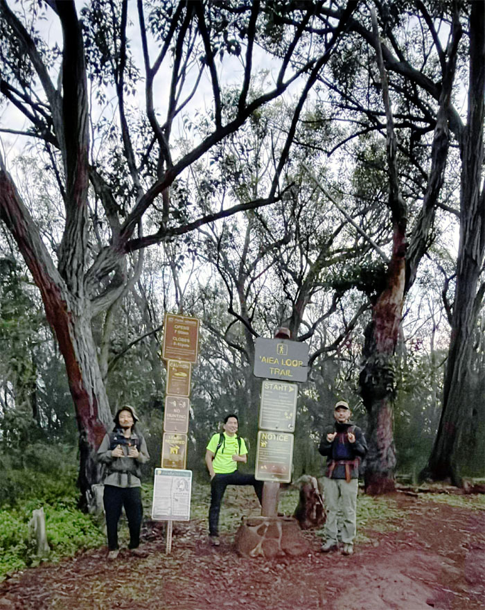
Aiea Loop
Thanks to Tessa for dropping us off at the park as they opened the gates, perfect timing as it saved us 10 minutes of walking. We are part-time hikers.
Aiea Loop Trail
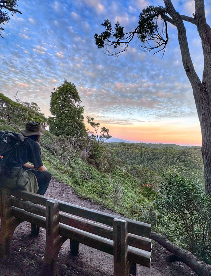
Bench with a semi-sunrise view on the trail that follows the historic railway that operated between 1898 to 1947 that supported the sugar industry.
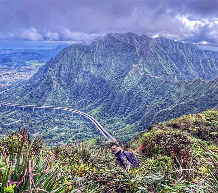
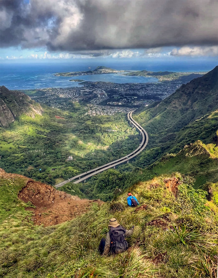
Aiea Ridge Trail
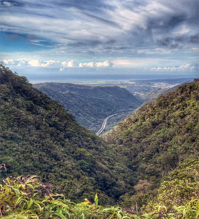
Looking back at the John A Burns Freeway that was mired in controversy before its opening in 1997, but the passage of time has proven its effectiveness as another transportation corridor that helps to reduce clogged traffic on the island.
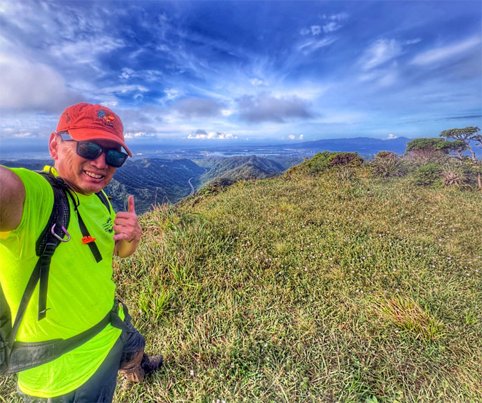
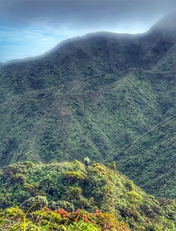
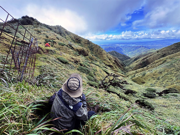
Pu’u Kawaipo’o
My office view today from the 2,441′ hill.
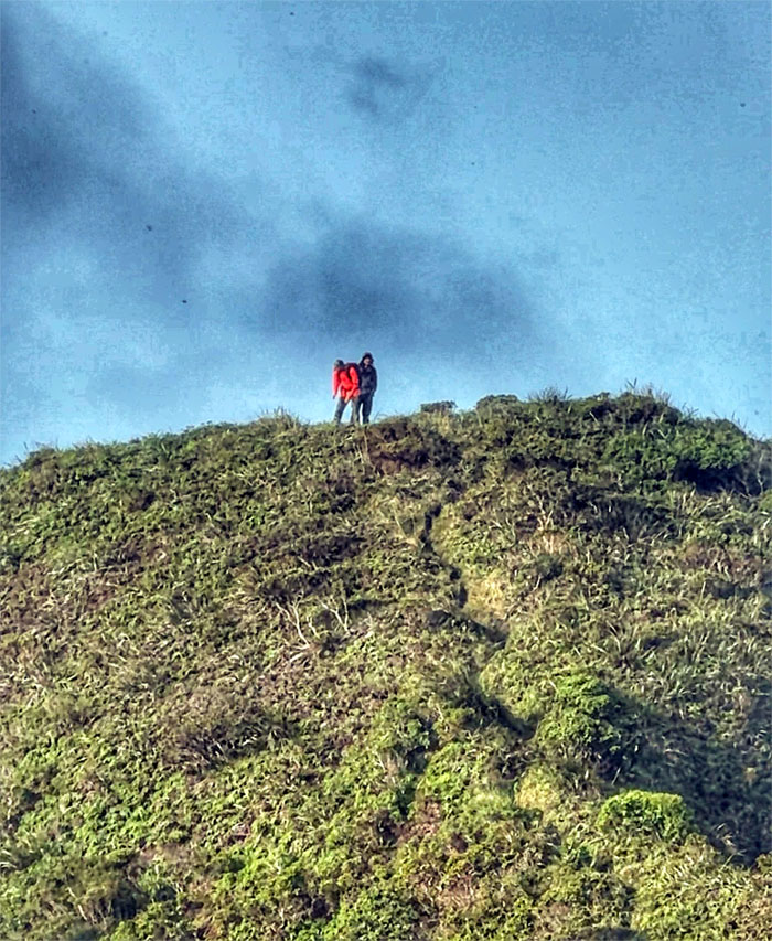
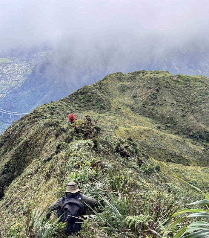
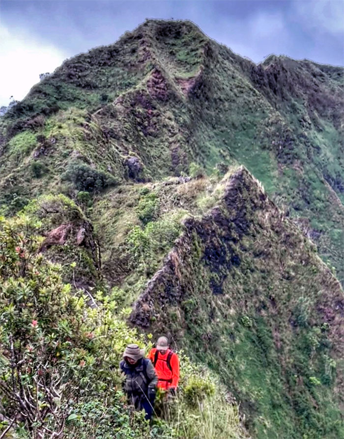
Aiea Ridge Trail
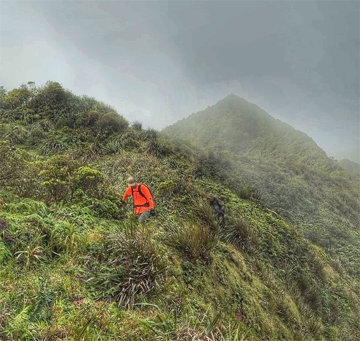
Hiking over one of multiple humps on the ridge line.
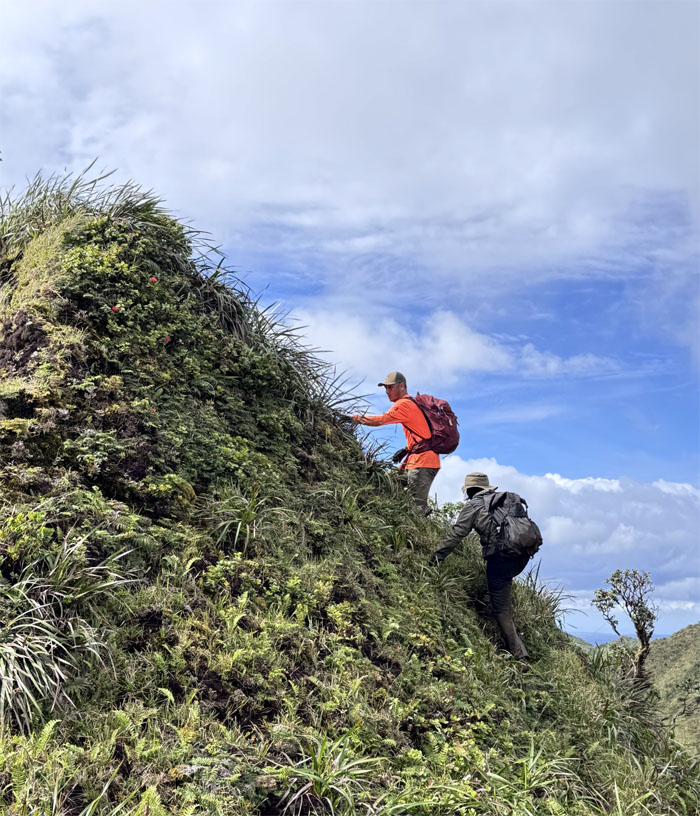
Aiea Ridge Trail
Akira and Kenny making their way on the muddy trail.
Aiea Ridge Trail
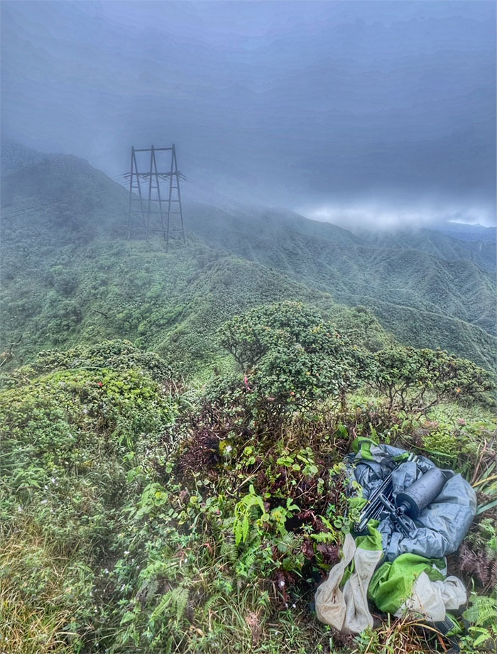
Passing somebody’s discarded tent on the trail. Perhaps the original occupant will come back to claim it, if not, CB said he will put it to good use on his next visit.
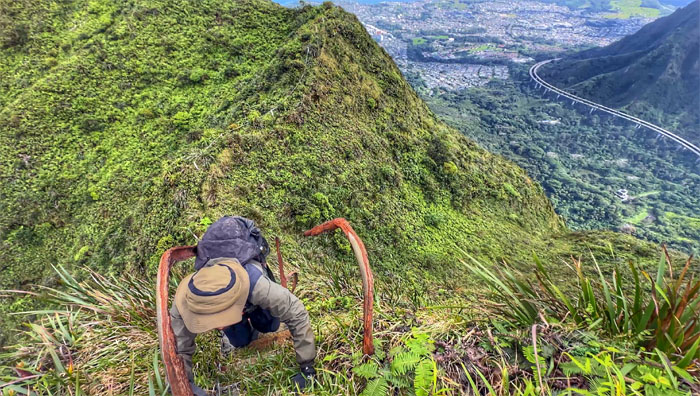
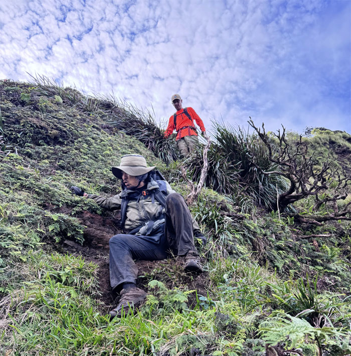
Aiea Ridge Trail
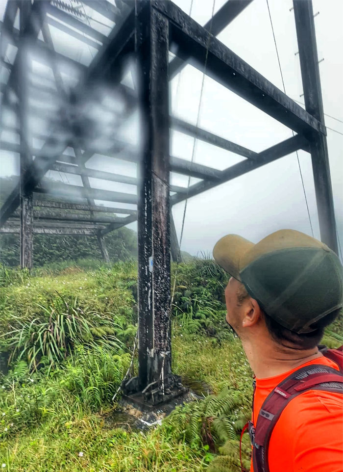
Akira passing near the crackling powerline transmission tower that is part of the infrastructure that keeps the islands humming with electricity.
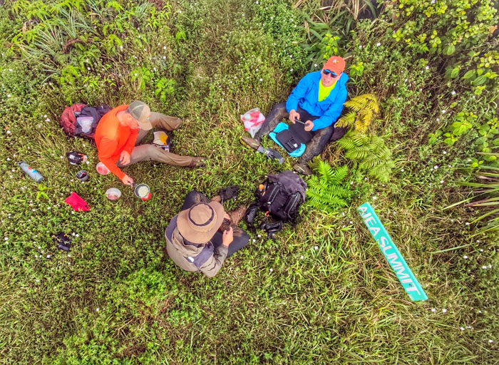
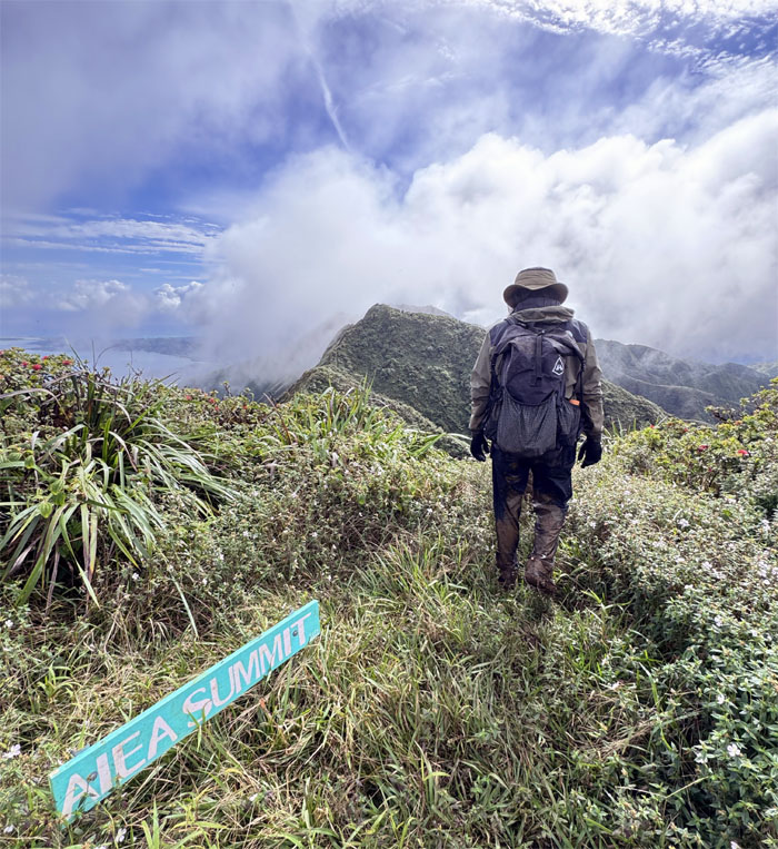
Aiea Summit
Drone view of the socked in 2,805′ summit.
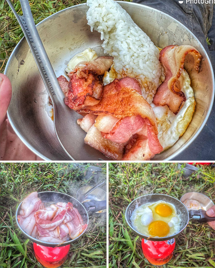
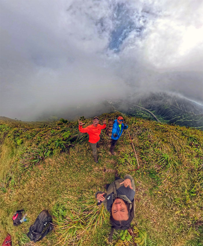
Aiea Summit
Thanks to Chef Suzuki for the bacon, eggs and rice brunch at the socked in and soggy summit.
Aiea Summit
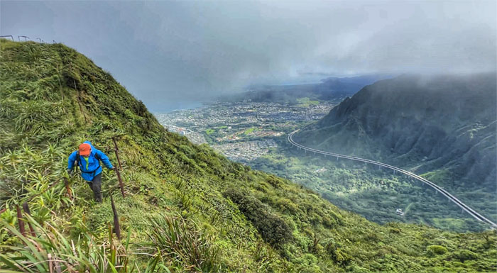
Leaving the summit as we stepped foot on the spine of the Ko’olau Mountains that were thankfully shedding the cloud coverage.
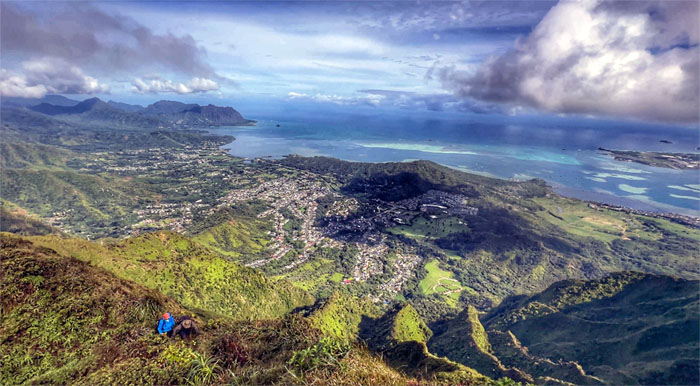
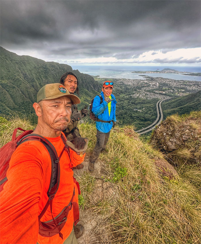
Ko’olau Summit Ridge Trail (KSRT)
Enjoying the expansive views of Kaneohe Bay and beyond while somebody else was focused on keeping his footing steady on the ridge line.
KSRT
Cramping with the verdant valley views that were strangely devoid of the normally present strong circulation movements aka wind. No complaints here.
KSRT
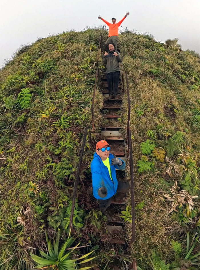
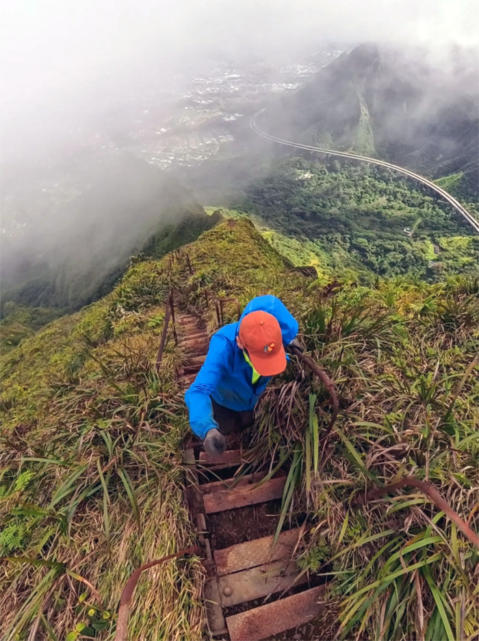
Descending towards what has been called a raft of different names: Haiku Hidden Stairs, North Haiku Stairs and the more common Stairway to Hell.
Stairway to Hell
Welcome to Stairway to Hell, the red-headed stepchild of Stairway to Heaven.
Stairway to Hell
Group shot on the dilapidated stairs that are slowly returning to Mother Nature.
Stairway to Hell
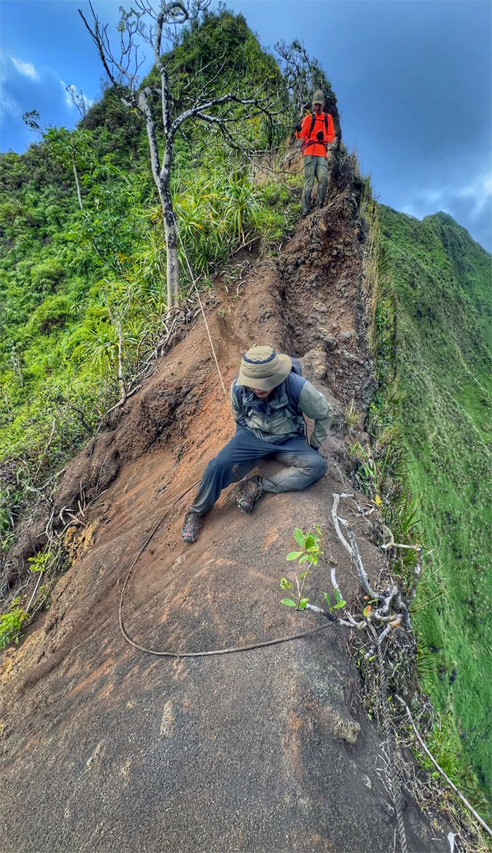
Climbing back up the stairs that were left incomplete by the US Navy due to the ridge topography that doesn’t lend itself well to man-made infrastructure.
Stairway to Hell
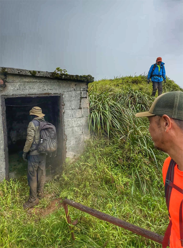
Exploring the bunker that was pleasantly clean and devoid of the rank smell of ammonia from past visits.
Stairway to Hell
Threading our way through the tetanus spikes that were once part of the railings and are now slowly rusting away.
Stairway to Hell
Passing through one of multiple platforms that were once home to A-Frames that hung suspended antenna cables across the valley.
Stairway to Hell
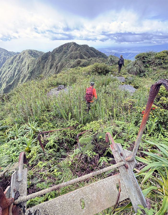
Climbing the rusted stairs out of Hell.
KSRT
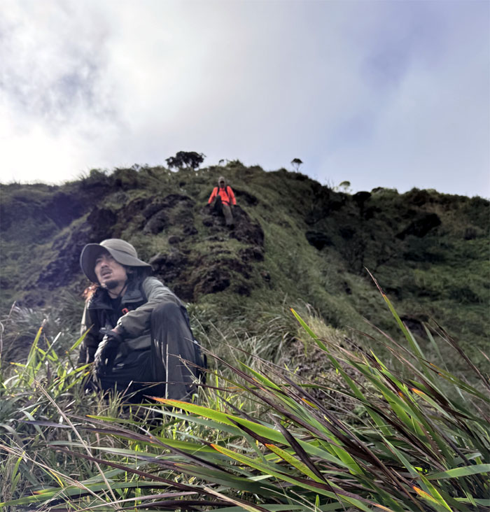
Going up a small hill to be soon replaced by bigger hills.
KSRT
Kenny making his way down the trail with the presumably vacant Stairway to Heaven beckoning to us from across the valley.
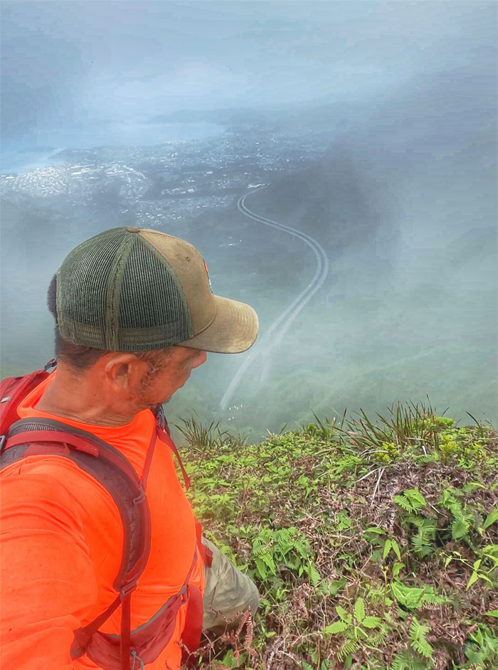
KSRT
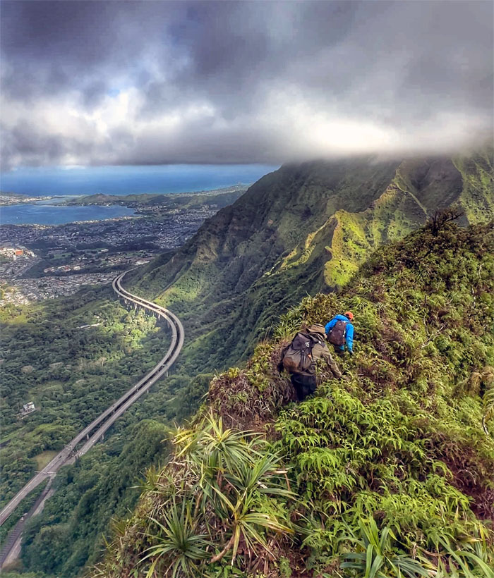
Akira hiking on the edge of the pali (cliff) overlooking the H-3 Freeway as the traffic noise wafted up to the ridge line.
Red Hill Summit
The guys approaching the summit that looked like it was recently cleared as it was almost unrecognizable from my last visit.
Moanalua Saddle
Striking out towards the Western half of what is considered the “easiest” of the three main saddles on the KST.
Moanalua Saddle
One has to crawl before one can walk.
Moanalua Saddle
Akira climbing down the rockface section while Kenny contemplates the meaning of life or thinking he could be relaxing in his new home instead of subjecting himself to today’s hike.
Moanalua Saddle
Making our way down the saddle against the backdrop of Halawa Valley.
Moanalua Saddle
Standing and scooting our way down the grassy ridge line.

Moanalua Saddle
Descending down the long line as I like to call it.
Moanalua Saddle
Leaving the imposing and intimidating looking mountains behind us.
Kulana’ahane Summit
Our final group photo at the summit before heading down into the valley and the 28 stream crossings and the endless road out. We left the summit at 1630 and hustled our way out in two hours as we didn’t want to test the police presence that shuts the park down at 1900 and we also wanted time to wash our muddy shoes.
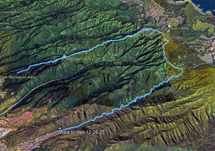
GPS Tracks
Our virgin saddle hike covered 11.5 miles to hell and back. Great job on Kenny’s part as he works on overcoming his acrophobia. Post hike meal was at Plan A which was Pepper Lunch but too crowded. Plan B was Alley Restaurant which was also too crowded. We ended up at BBQ Chicken which was not crowded, where we were joined by Tessa and Marilyn.
Photos taken by Akira Suzuki, Kenny Lui, and yours truly. Not necessarily in order.
Note: I have been made aware that some hikers have been using my blog as a hiking guide and getting lost on the trails. Please note that this blog was made to document the hike for the crew(s) that did it. That is why some of my comments will seem to have no relevance or meaning to anybody outside of the crew(s) that hiked that trail. My blog was never meant as a hiking guide, so please do not treat it as such. If you find inspiration and entertainment from these hikes, that is more than enough. If you plan on replicating these hikes, do so in the knowledge that you should do your own research accordingly as trail conditions, access, legalities and so forth are constantly in flux. What was current today is most likely yesterdays news. Please be prepared to accept any risks and responsibilities on your own as you should know your own limitations, experience and abilities before you even set foot on a trail, as even the “simplest” or “easiest” of trails can present potential pitfalls for even the most “experienced” hikers. One should also always let somebody know of your hiking plans in case something doesn’t go as planned, better safe than sorry.
{ 0 comments… add one now }