
We drove to the suburbs of Westminster to stay and briefly hang out with the Bennett and West families the day before and was treated to a delicious BBQ dinner with all the fixings. My last day in Colorado, Andy and I did a short hike before my flight back home. Thanks to Kirsten for the recommendation of Flatirons as she said it was such an iconic Boulder landmark.
Flatirons Trail
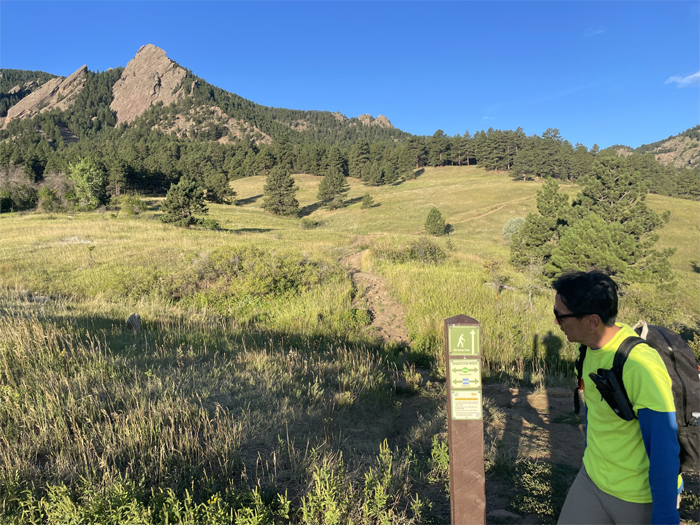
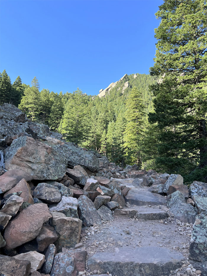
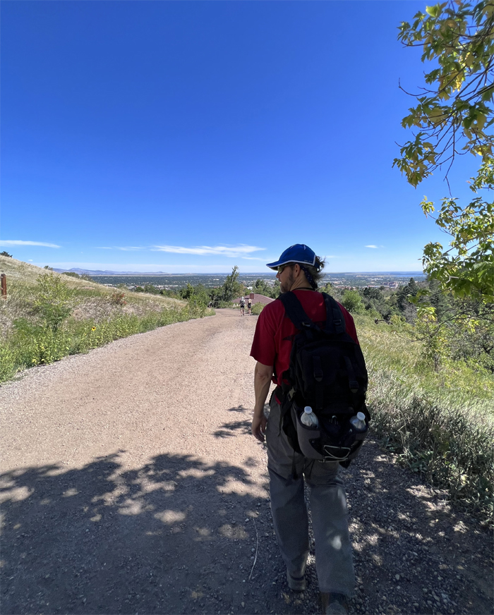
Parked at the Chautauqua Trailhead where some folks were trying to figure out how to pay for parking whiles others just used wireless payment. We followed the signs to start our hike towards the slanted rock formations.
Flatirons Trail
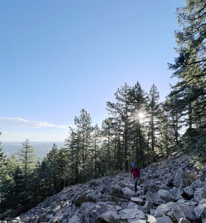
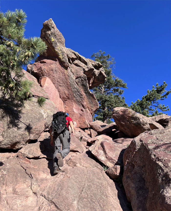
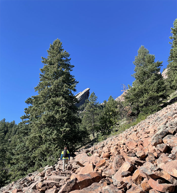
Andy leaving the treeline behind as we made our way over the boulder field.
Flatirons Trail
Those shoes were made for rock climbing. Ours were made for hiking.
Flatirons Trail
We had our own rocks to climb. We didn’t need rock climbing shoes.
Flatirons Trail
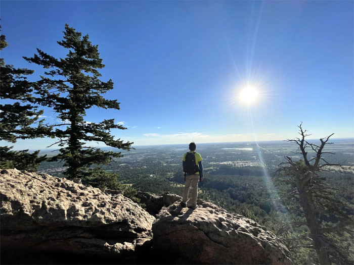
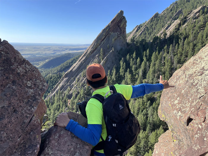
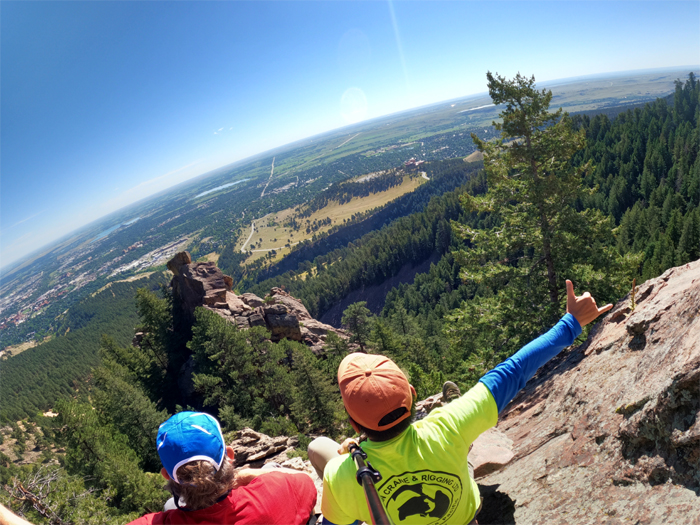
Looking out over the city of Boulder, where the carbon tax was first imposed on businesses.
Flatirons Trail
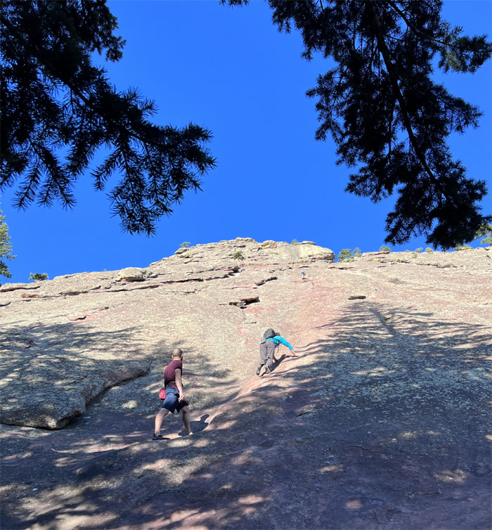
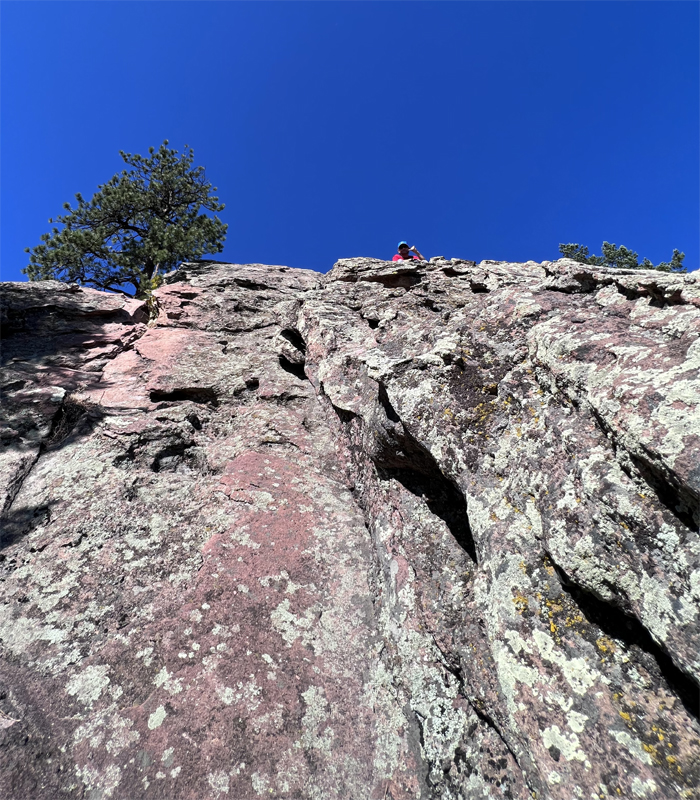
Watching rock climbers make their way up the sloped rocks.

Flatirons Trail
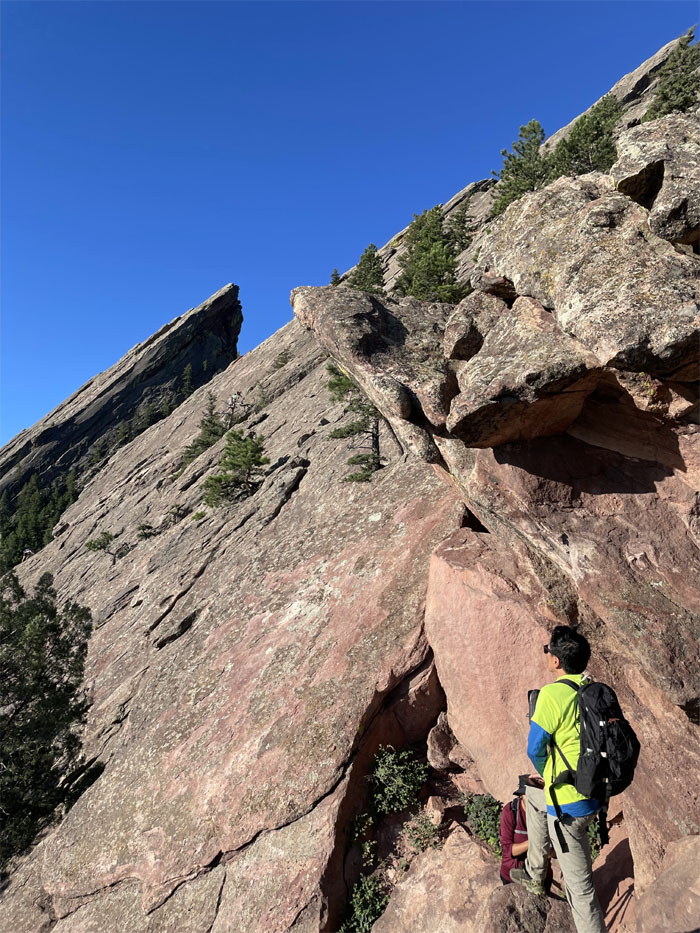
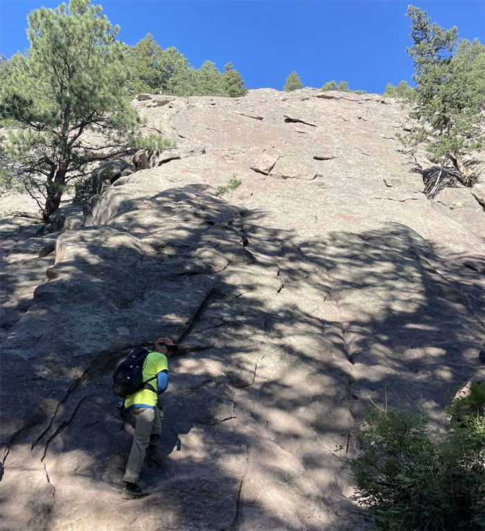
Going uphill towards the angled rock of the second flatiron.
Flatirons Trail
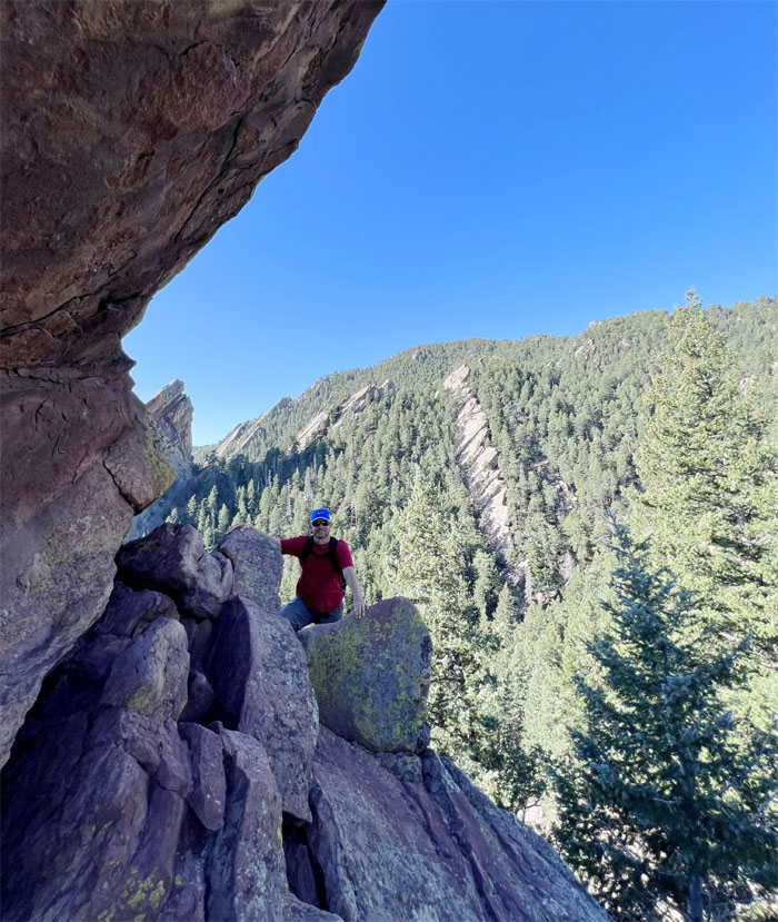
Andy with the background of the canyon that separates flatiron#2 and #3.
Flatiron #3
Looking out towards one of the five flatirons that are roughly 300 million years old and were formerly known as “Chautauqua Slabs” or “The Crags.”
Flatirons Trail
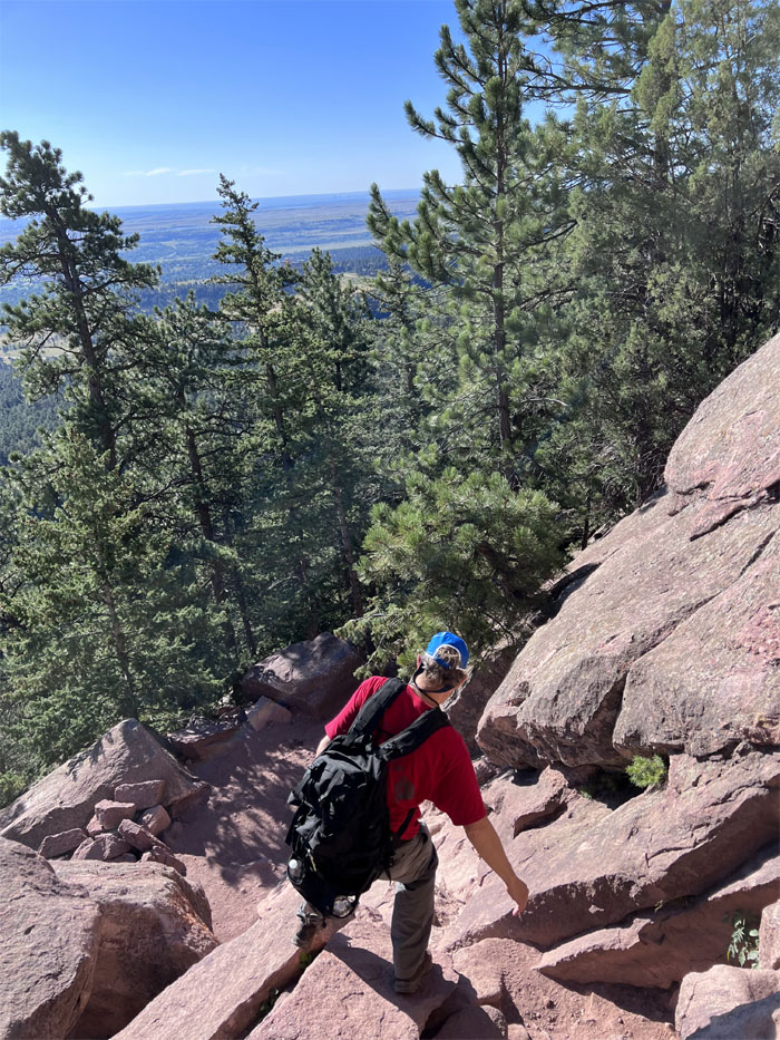
Climbing our way back down the trail.
Flatirons Trail
Scrambling over another scree field.
Flatirons Trail
Standing at the base of the flatiron#3? I heard people have done this on roller skates, under the illumination of the full moon and naked?
Royal Arch Trail
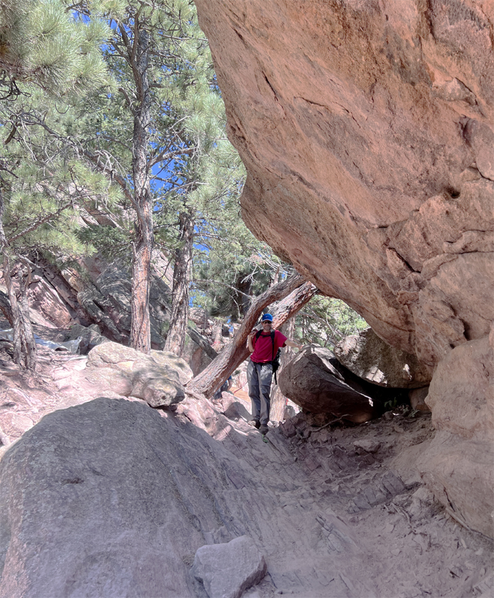
We soon left the loop trail and headed on the Royal Arch trail, as we crossed a bridge and hiked up stone steps through another boulder field.

Royal Arch Trail
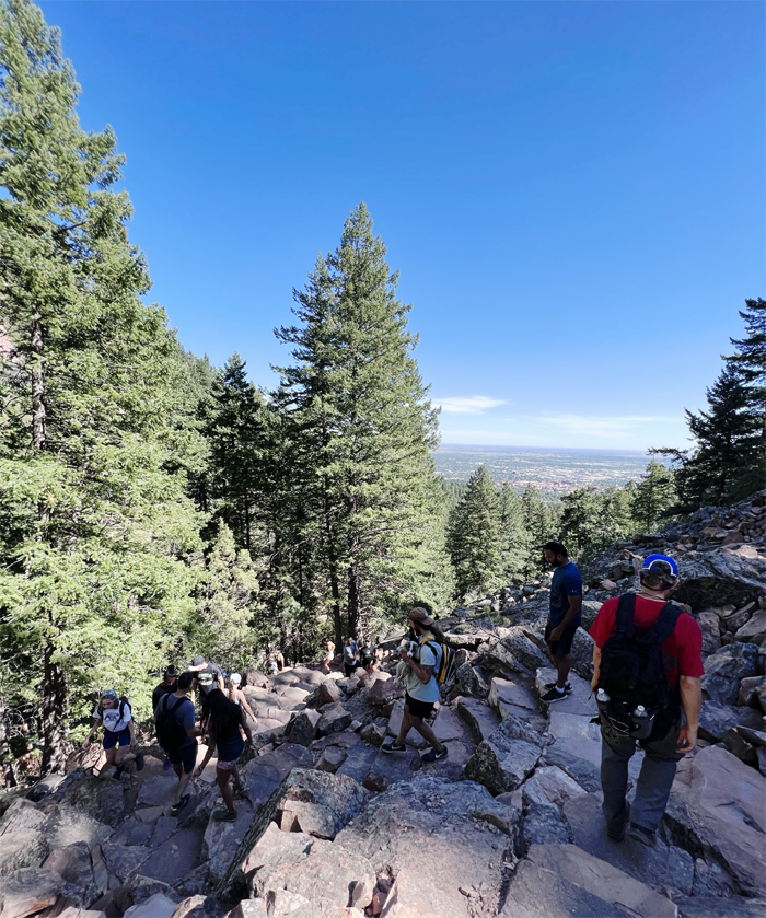
Gaining elevation as we passed fallen trees, dogs, and a lot of hikers going up and down the trail.
Royal Arch Trail
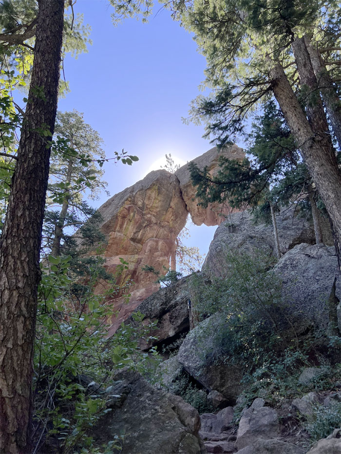
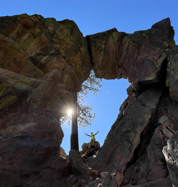
Approaching the sandstone formation that sits roughly 20′ off the ground.
Royal Arch Trail
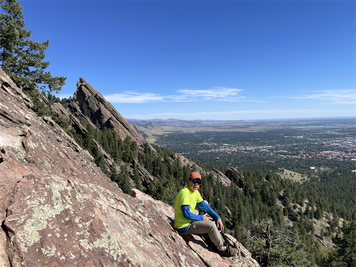
Found my own spot away from the crowds.
Royal Arch Trail
I decided to scramble down a bit. Nobody wanted to follow.
Royal Arch Trail
Group photo with the city of Boulder sprawled out in front of us.
Royal Arch Trail
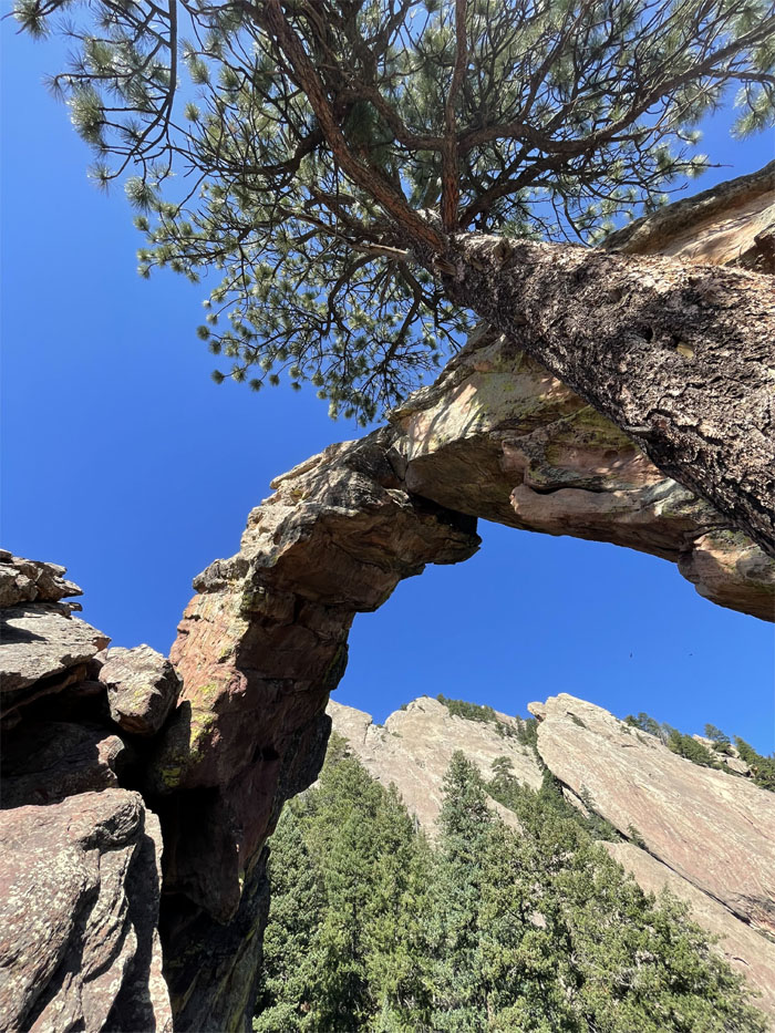
Sitting in the eye of the arch.
Royal Arch Trail
Hiking our way back up to Sentinel Pass.
Royal Arch Trail
Going back down the trail where a lot of attention was being paid to a cute dog being carried by his owner.
All pau
We took the Bluebell Mesa trail down back to our car and the ranger cottage where bathrooms and information were to be found. Only one was used.
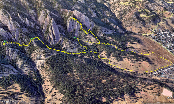
GPS Tracks
Our loop hike covered five miles amongst the iconic flatirons and the natural gem of the royal arch as the hike made its way through alpine forests, gullies, scree fields and panoramic views of the surrounding mountains and urban areas.
Post hike meal at Popeye’s Chicken before I caught my flight that was delayed by rolling thunderstorms coming over the Rockies. The plane shook six ways from Sunday but didn’t get sparked by lightning. Ran to catch my connecting flight and made it with time to spare as the plane was only several gates down the terminal. Thanks to the Defelice, West and Bennett families for their gracious hospitality during our stay in Colorado. Mahalo to Andy for being the designated driver and great company in and out of the mountains. Danke schon. Thank you Colorado! You was awesome!
Photos taken by Andy Wiegand and yours truly. Not necessarily in order.
Note: I have been made aware that some hikers have been using my blog as a hiking guide and getting lost on the trails. Please note that this blog was made to document the hike for the crew(s) that did it. That is why some of my comments will seem to have no relevance or meaning to anybody outside of the crew(s) that hiked that trail. My blog was never meant as a hiking guide, so please do not treat it as such. If you find inspiration and entertainment from these hikes, that is more than enough. If you plan on replicating these hikes, do so in the knowledge that you should do your own research accordingly as trail conditions, access, legalities and so forth are constantly in flux. What was current today is most likely yesterdays news. Please be prepared to accept any risks and responsibilities on your own as you should know your own limitations, experience and abilities before you even set foot on a trail, as even the “simplest” or “easiest” of trails can present potential pitfalls for even the most “experienced” hikers. One should also always let somebody know of your hiking plans in case something doesn’t go as planned, better safe than sorry.
{ 0 comments… add one now }