
It was time to hit up the mountains one last time before our trip to Europe. Why not make it a saddle hike?
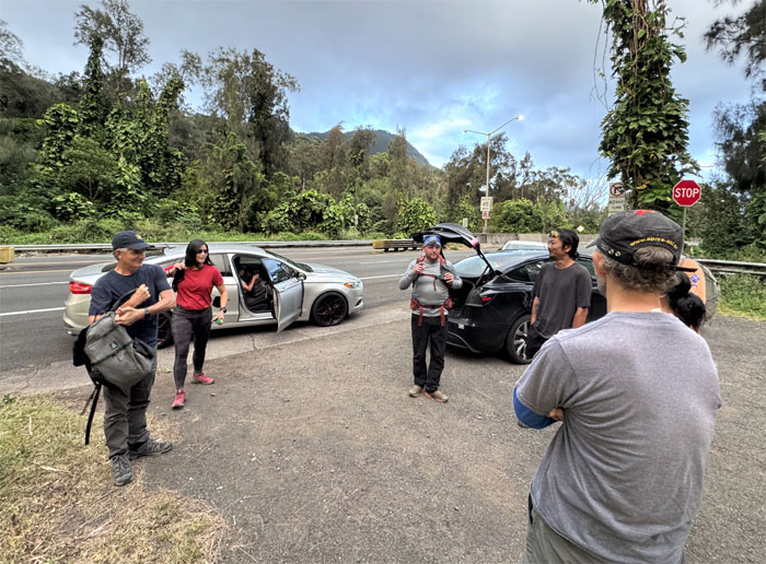
Route 63
Thanks to Aileen’s friend, Kenny and Tessa for dropping us off on the side of the highway named after King David Kalakaua’s sister.
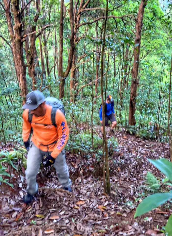
Kalihi Valley
Making our way up the short and steep trail used by HECO workers to service the powerline poles at the top.
Kalihi Saddle
Trade winds greeted us at the top which was a welcome relief from the oppressive humidity that existed in the land of the wallabies.
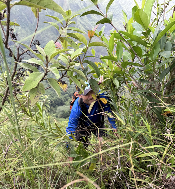
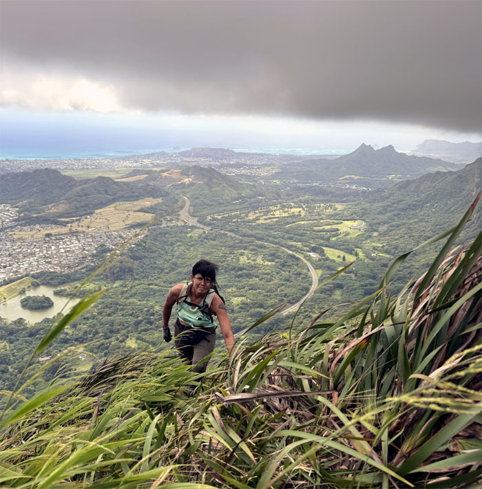
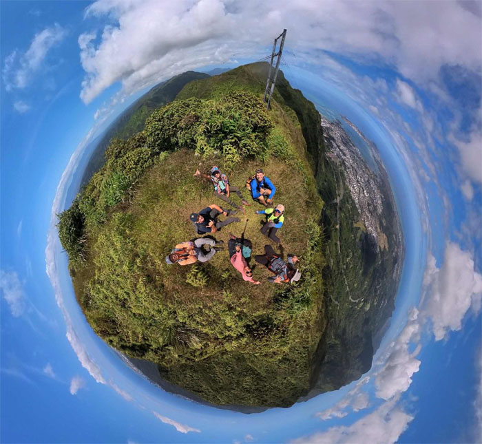
Camp Centipede
Glad no predatory arthropods came out to greet us.
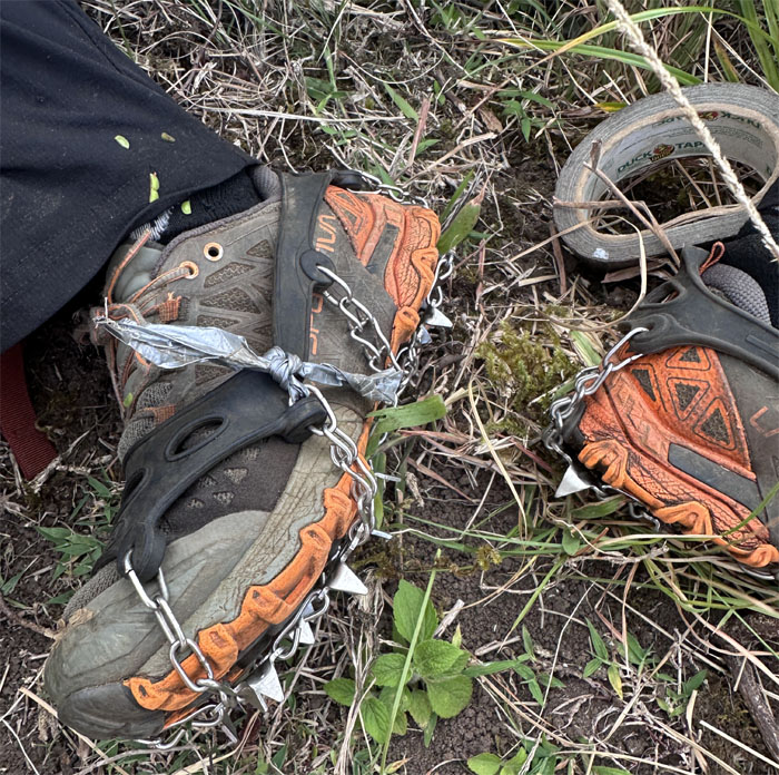
Camp Centipede
Duct tape can fix anything.
Kalihi Saddle
We contoured around the knob as we set foot on the trail.
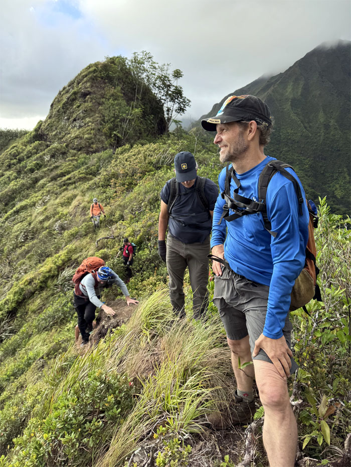
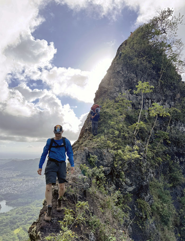
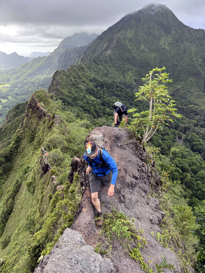
Kalihi Saddle
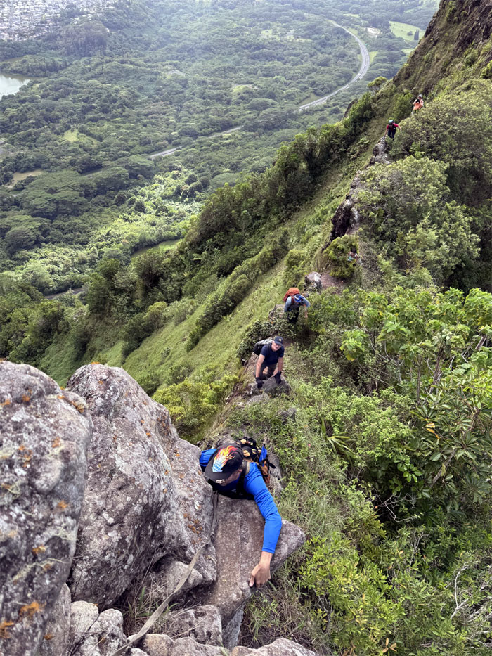
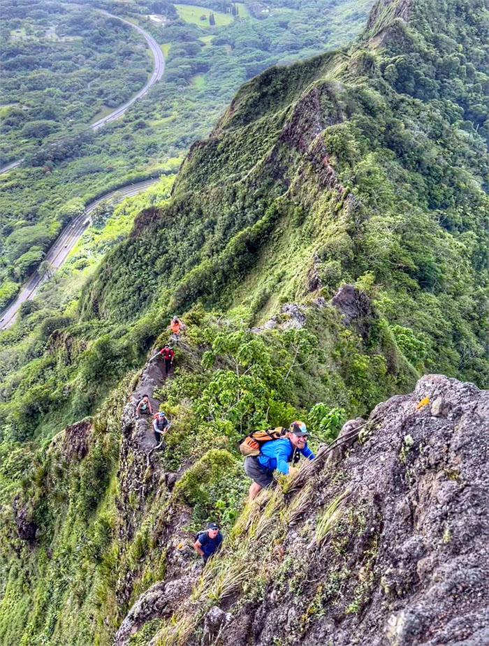
Threading our way on the narrow ridge line bordered by thick overgrowth on the Leeward side and sheer drops on the Windward side.
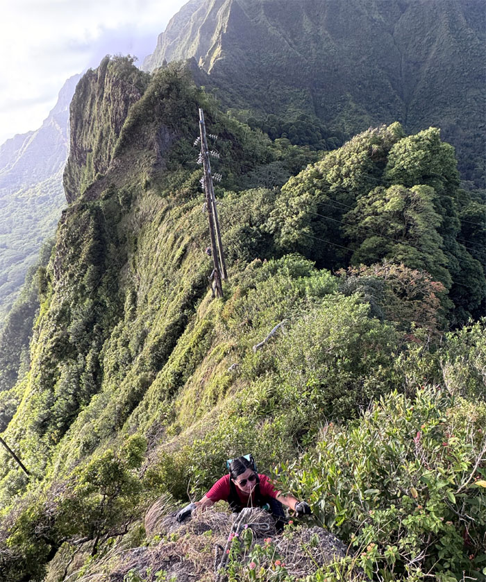
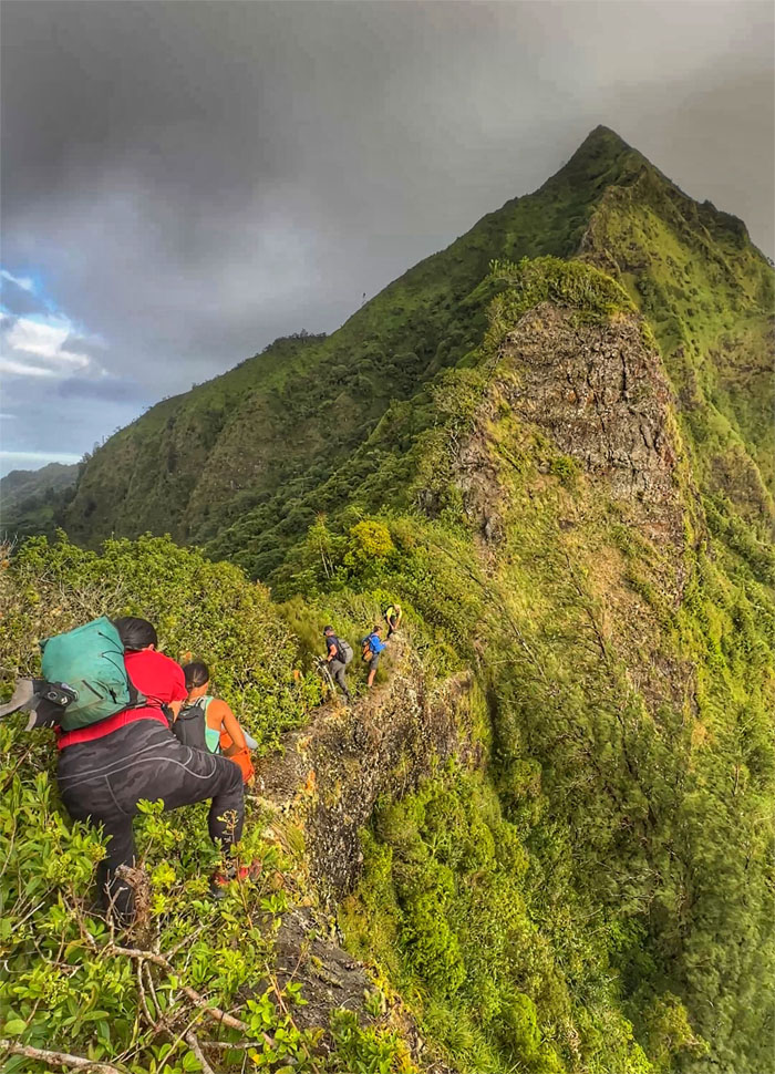
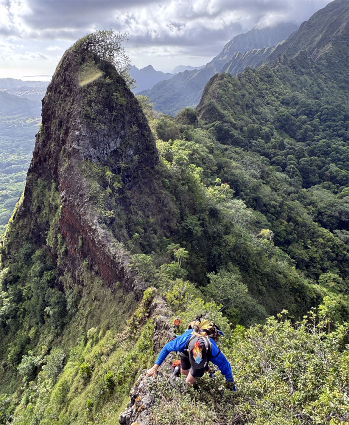
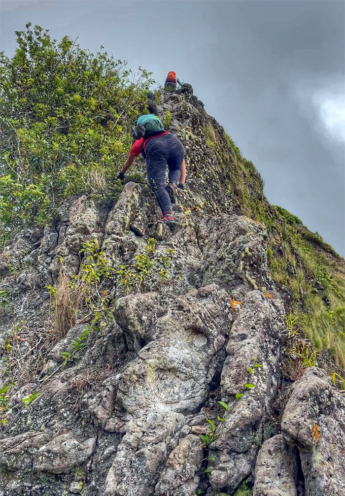
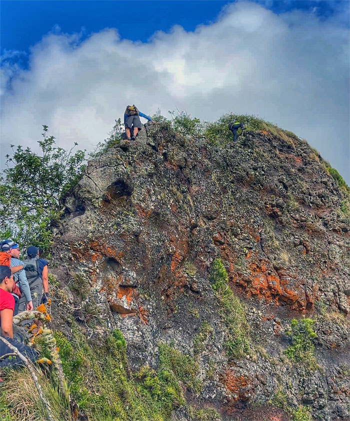
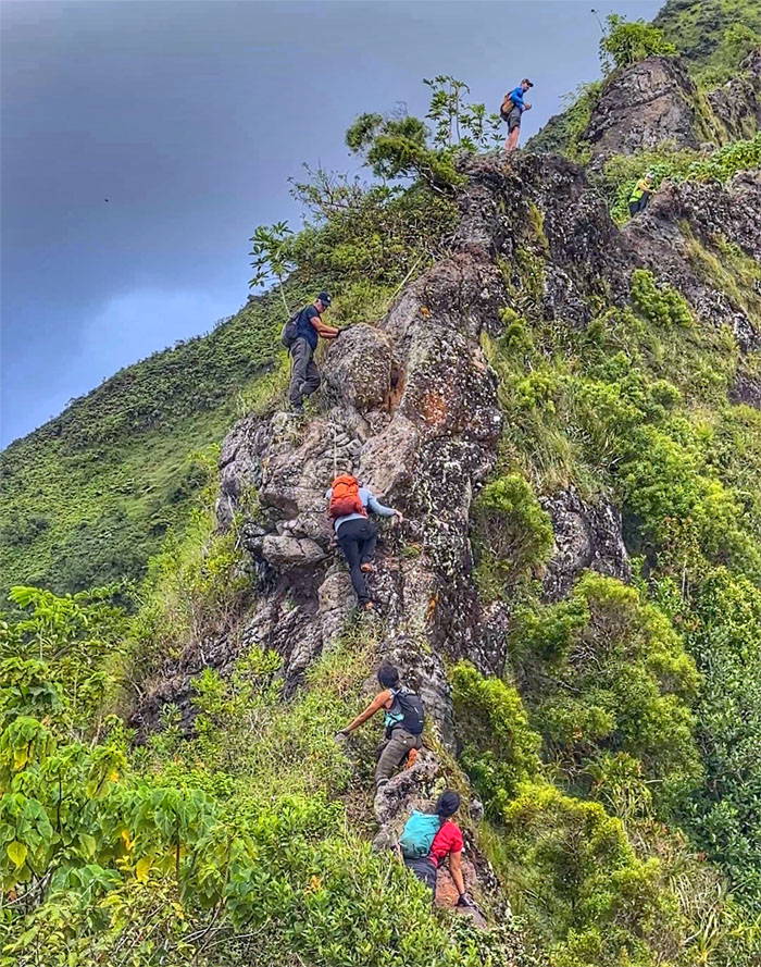
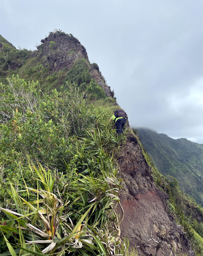
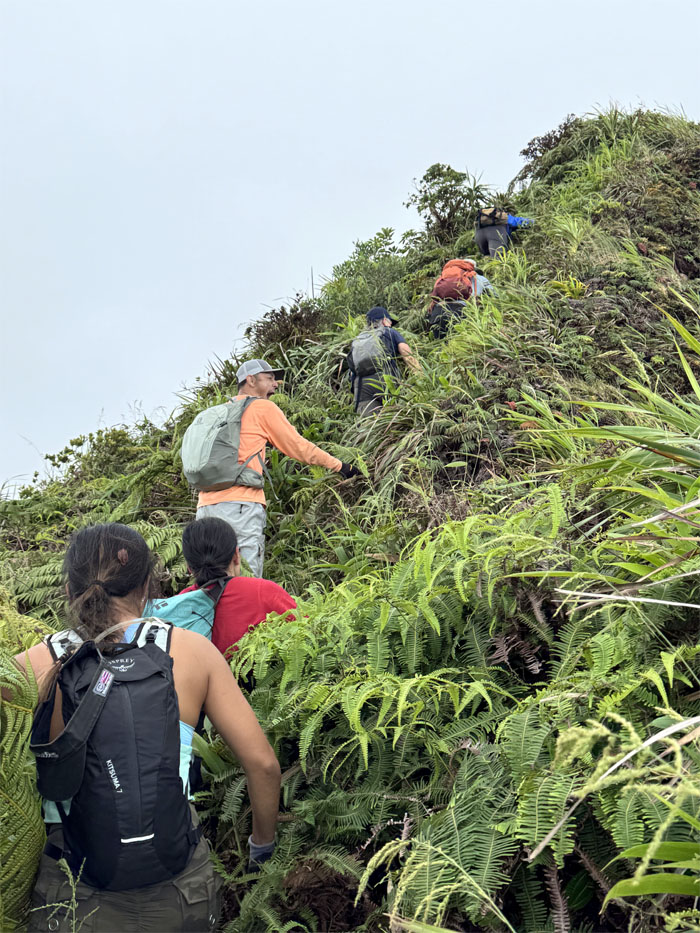
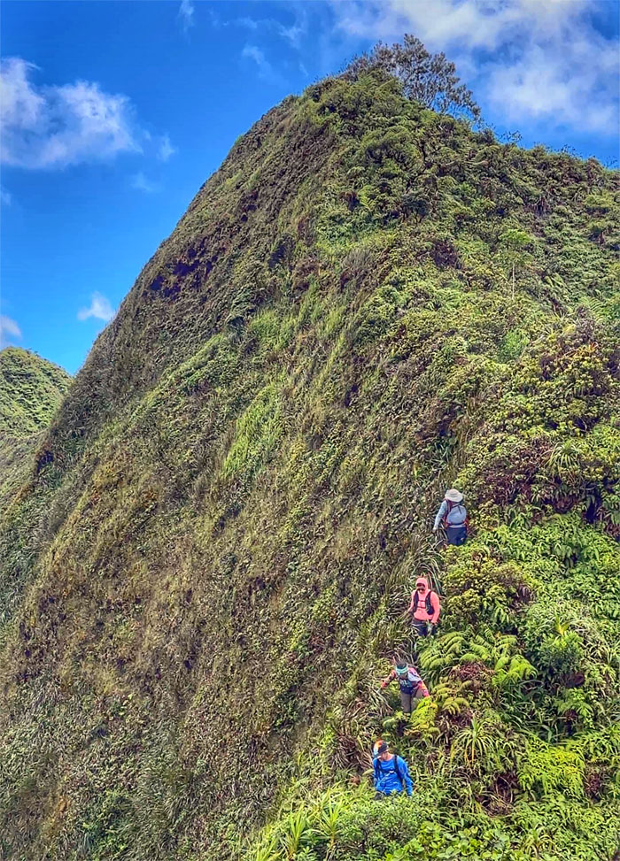
Witch’s Hat
The group climbing up using a mixture of grass, branches and old suspect webbing.
Witch’s Hat
Val watching Aileen scramble her way up the conical shaped peak.
Witch’s Hat
The group climbing down from the other side.
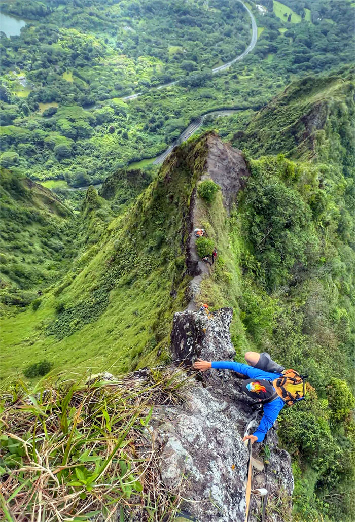
Kalihi Saddle
Scrambling and scooting on the space deficient ridge line.
Kalihi Saddle
Andy was probably muttering “Den Gipfel erreichen.”
Kalihi Saddle
Val scrambling up the fractured rocks.

Kalihi Saddle
Akira sprinting across one of many narrow stretches. No fear.
The Hump
Are we humping the mountain or is the mountain humping us? I think it’s the latter.
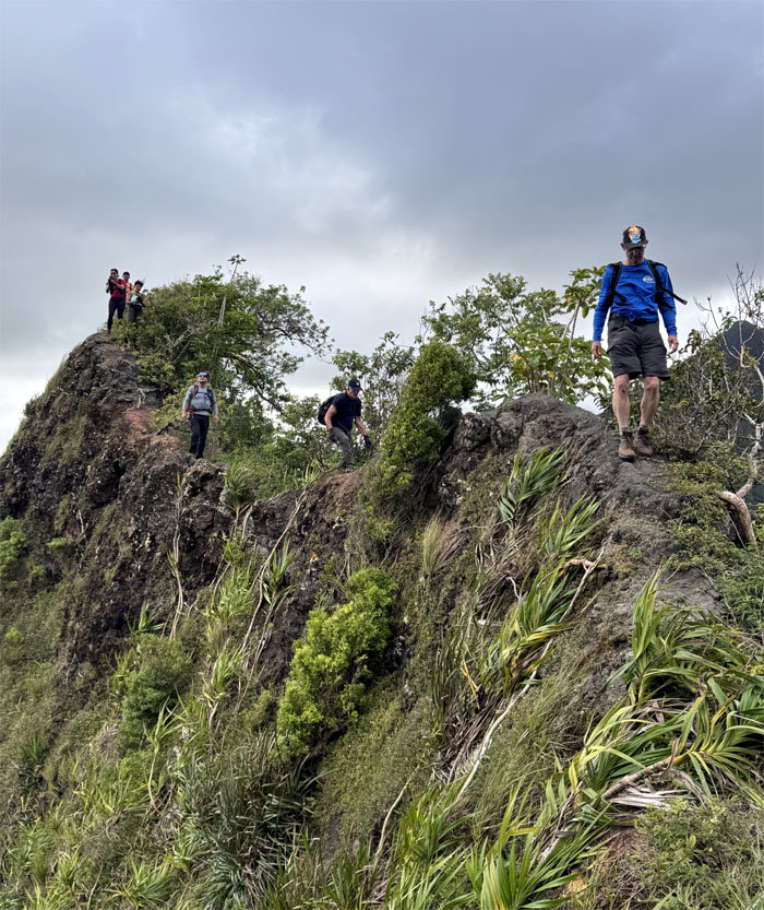
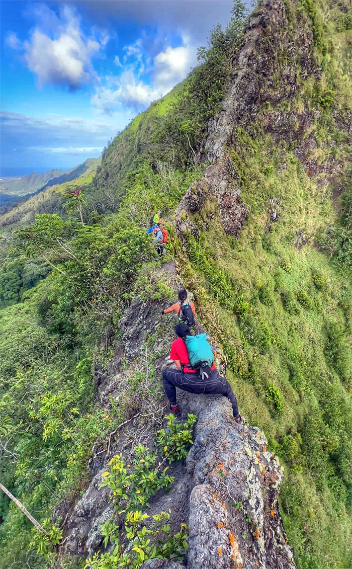
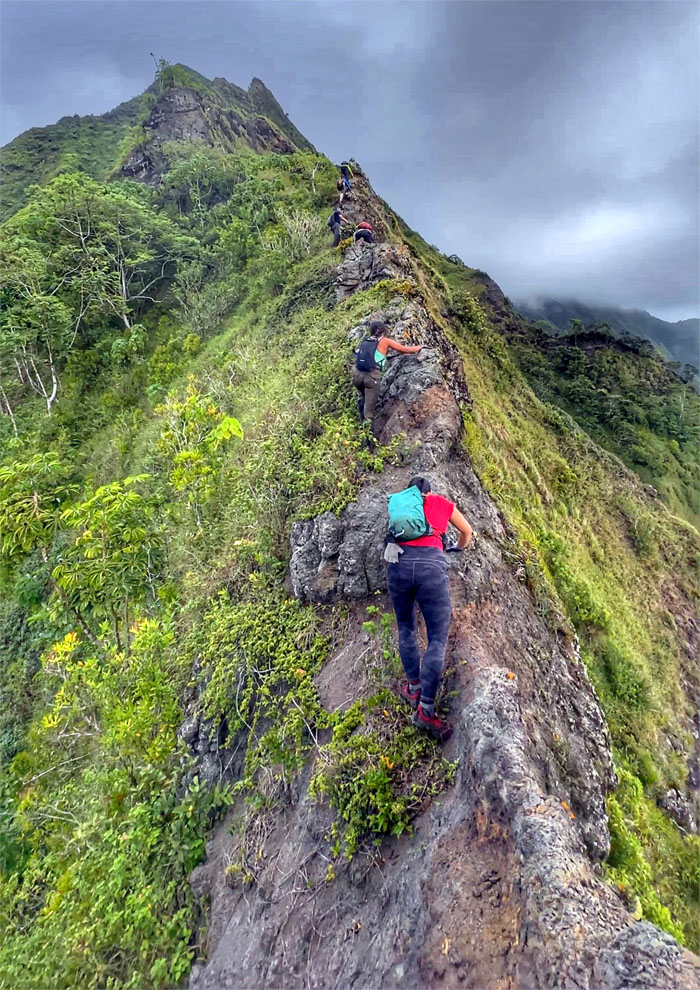
Kalihi Saddle
The group traversing over the rolling and restricted ridge line.
Tabletop
Andy trying to secure reservations or just a good handhold.
Tabletop
The rest of the group clambering over the oddly placed rocks.
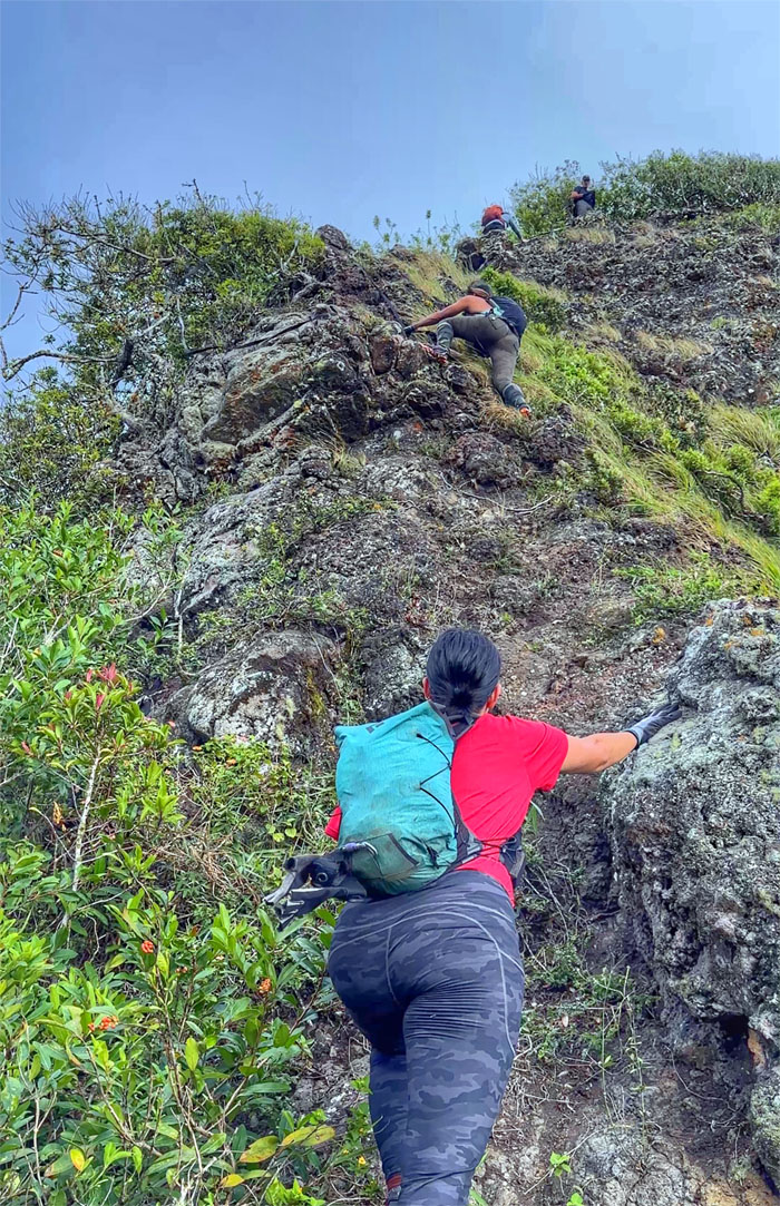
Kalihi Saddle
Hanging on by a very thin sliver of crumbly rock.
Kalihi Saddle
Val wasted no time on this narrow of narrow sections, not a good place to dawdle.
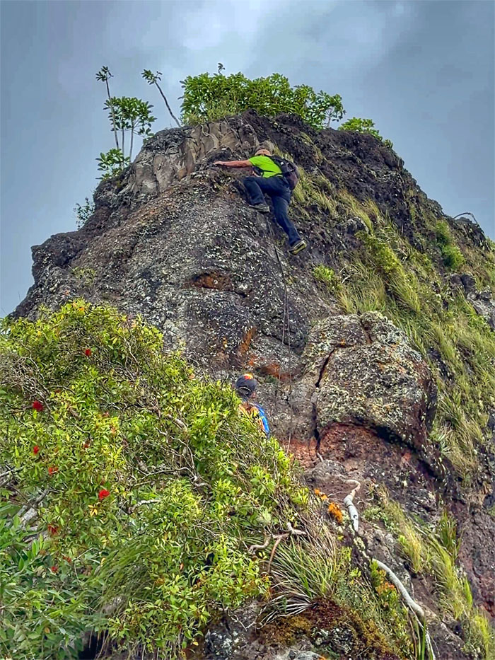
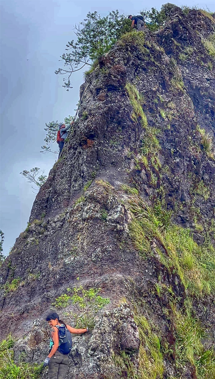
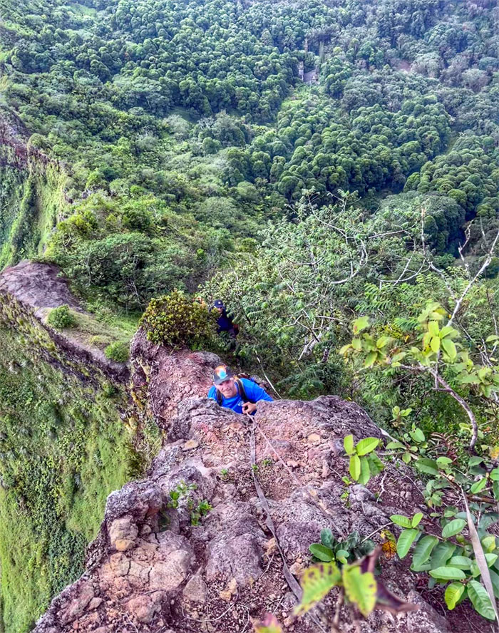
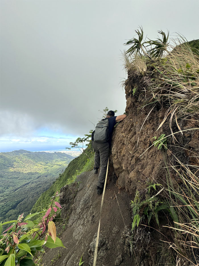
Rock Triangle #1
Climbing up on the Windward side of this rockface where I dislodged a good sized rock that plummeted down to the valley floor that gave somebody a panic attack.
Rock Triangle #1
Somebody was determined not to duplicate and pass on my anxiety inducing attacks.
Hot Wheel Tracks
Aileen making her way around the overhanging ledge.
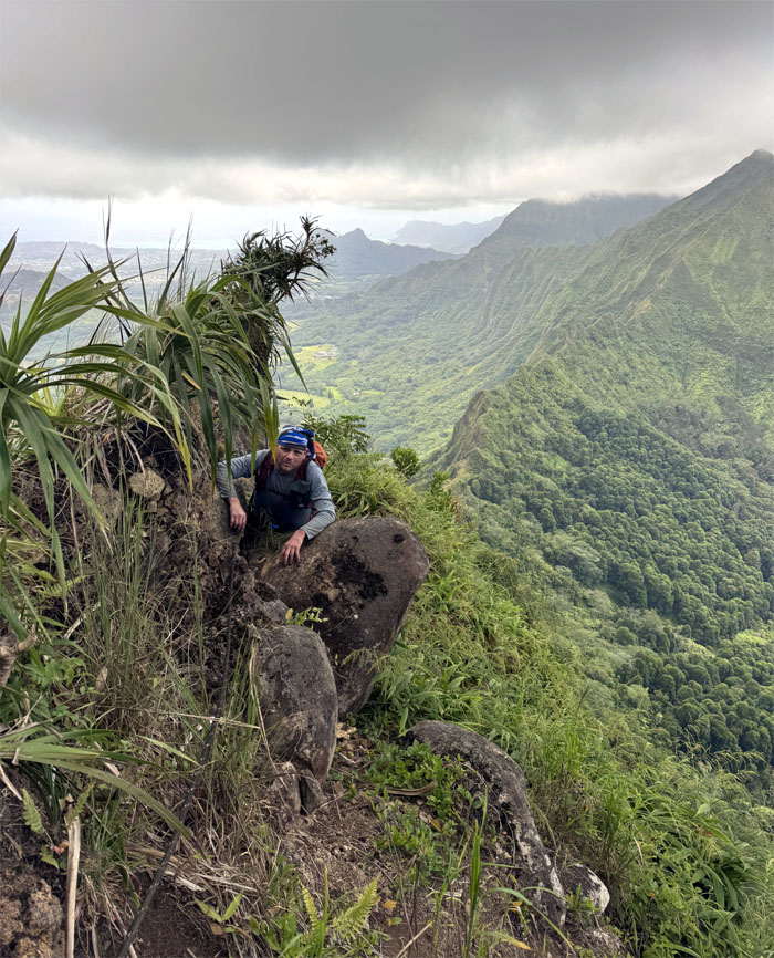
Rock Triangle #2
The rest of the group waiting for their turn to go up the second rockface. Which begs the question, is it better to go first, middle or last?
Rock Triangle #2
Jeremy using his USMC background to climb this very surmountable obstacle.
Kalihi Saddle
Passing over the area where a broken webbing was one of two witnesses to a hiker that fell two years ago from this same spot. A story best told after everybody has left the area.
Broken Wave
Scrambling my way up the trail of raining rocks.
Kalihi Saddle
The group preparing to leave the ridge line and plunge into heavy overgrowth.
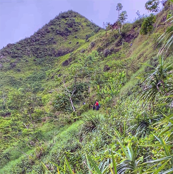
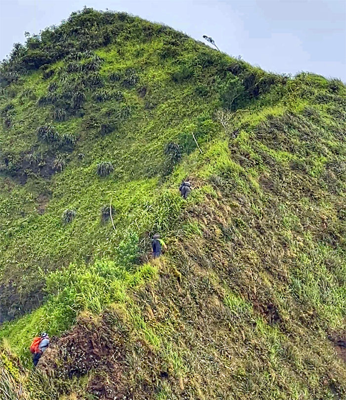
Dirty Slide
Can you see the hikers for the overgrowth? The passing rain shower didn’t help as well.
Kalihi Saddle
Everybody had to eat their Wheaties in order to make the exhausting climb up the flank to regain the ridge line.
Kalihi Saddle
Roger contouring his way around the slippery slope.
Kalihi Saddle
No rest for the weary.
Kalihi Saddle
Scrambling our way up the dirt ribbon of a ridge line.
Kalihi Saddle
Somebody said this was the hardest part of the saddle. Could it be a former member of the military branch that was established in 1775?
Kalihi Saddle
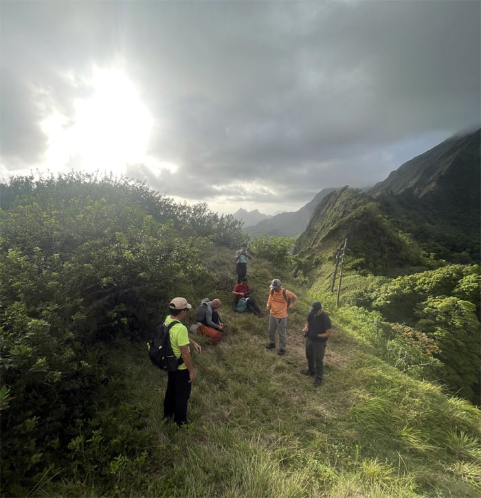
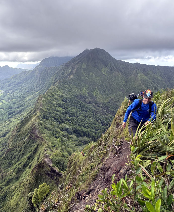
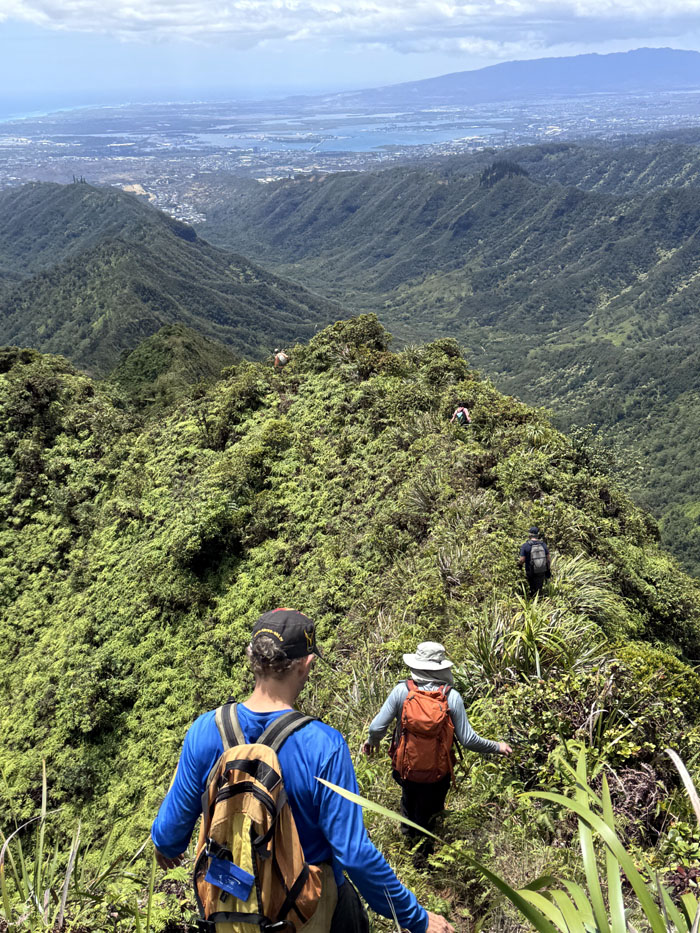
We left behind the “technical” and “sketchy” sections of the saddle to continue our hike on typical KST ridge lines filled with multiple false peaks.
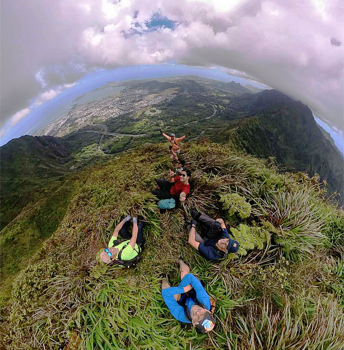
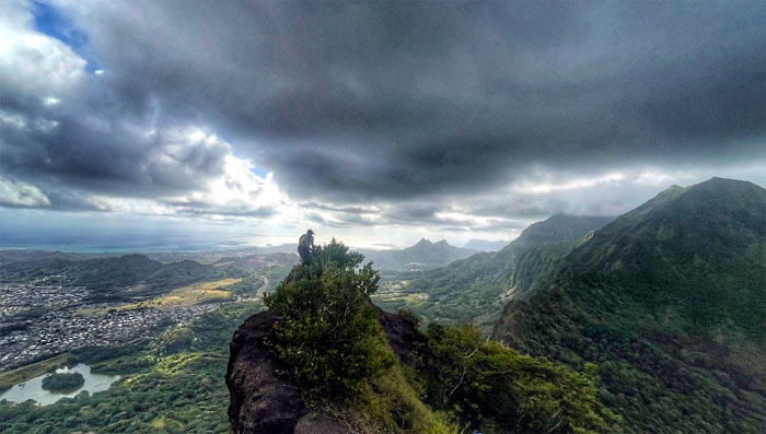
Bowman Summit
Group photo at the cleared 2,740′ summit. Views all around. Lunchtime.
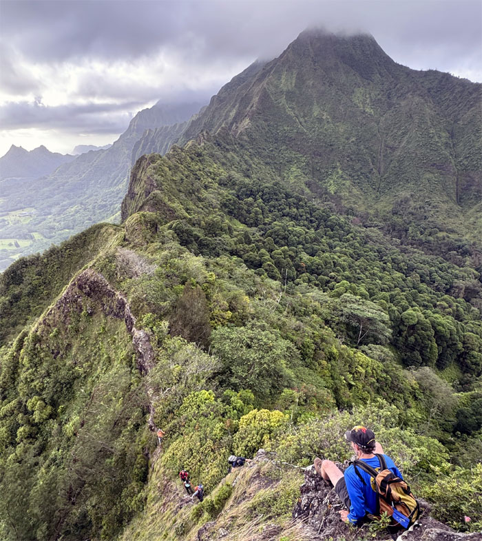
Ko’olau Summit RIdge Line (KSRT)
We left the saddle behind us as we resumed our hike on the dormant fragmented shield volcano. Yes dormant.
Tripler Summit
Our last summit photo with wrap around views of the Windward coastline.
Tripler Ridge
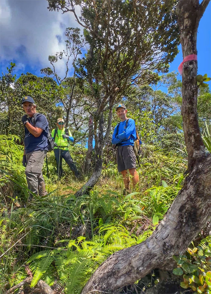
The group exiting the KST.
Tripler Ridge
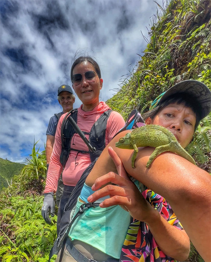
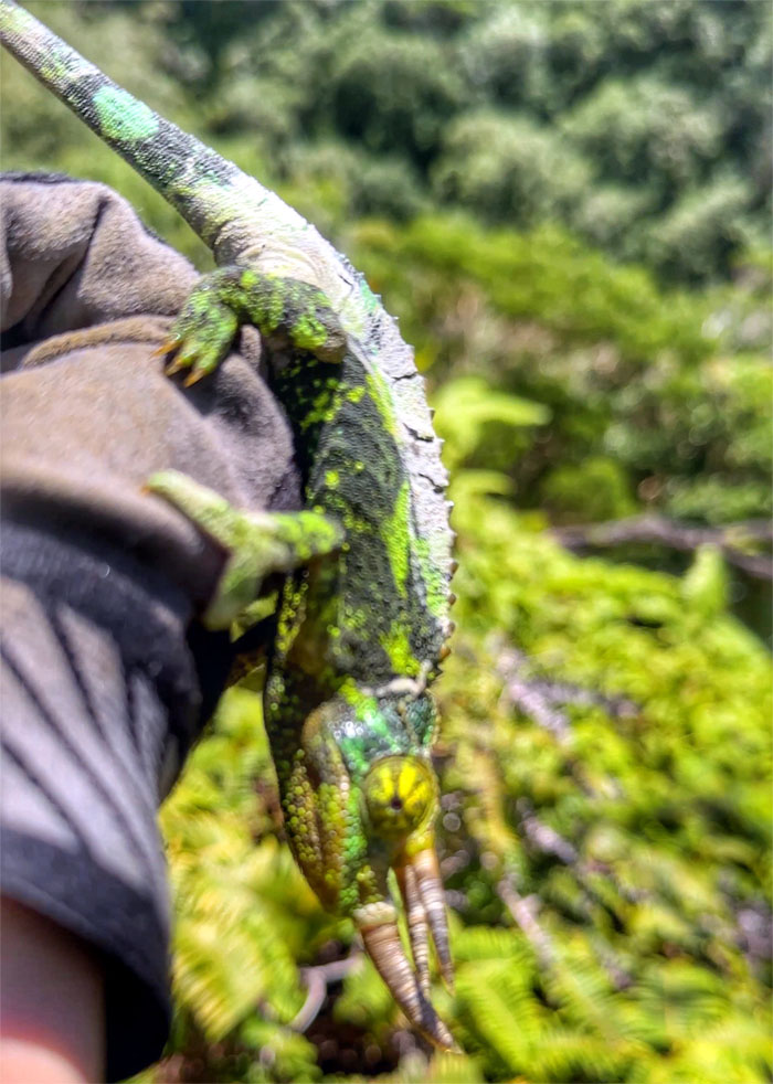
Aileen “Jackson Chameleon Whisperer” Agustin discovered a rather plump looking invasive lizard which were originally imported from Africa in 1972 as stocks for a pet shop. Then they were intentionally set loose and the rest is history.
Tripler Ridge
The group preparing to descend down a spur ridge into the valley.
End of the Road Trail
The three horned male version of the invasive lizard that eats native insects, spiders, and snails.
All pau
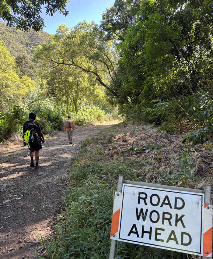
We soon dropped off the ridge and plunged into head high ginger plants and California grass. The overgrown trail eventually became a rather cleared road where we met Kenny and the collective group walked out of the valley and back to our cars.
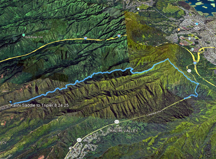
GPS Tracks
Our introductory saddle hike for some covered 6.43 miles, mileage may vary depending on whom you ask. Solid day with a great group that helped each other out on what many hikers consider as the “hardest” section of the KST to complete. Post hike meal venue was supposed to have been at Alley Restaurant, as somebody was pushing for their chocolate desserts. Excessive wait time forced us to consider Mexican. Closed. Chicken. No. We all then drove to Pearlridge Center to eat at Big City Diner where Aida, Kenny and Tessa joined us.
Photos taken by Aileen Agustin, Akira Suzuki, Andreas Wiegand, Jeremy Cannone, Roger Schiffman, Val Wang and yours truly. Not necessarily in order.
Note: I have been made aware that some hikers have been using my blog as a hiking guide and getting lost on the trails. Please note that this blog was made to document the hike for the crew(s) that did it. That is why some of my comments will seem to have no relevance or meaning to anybody outside of the crew(s) that hiked that trail. My blog was never meant as a hiking guide, so please do not treat it as such. If you find inspiration and entertainment from these hikes, that is more than enough. If you plan on replicating these hikes, do so in the knowledge that you should do your own research accordingly as trail conditions, access, legalities and so forth are constantly in flux. What was current today is most likely yesterdays news. Please be prepared to accept any risks and responsibilities on your own as you should know your own limitations, experience and abilities before you even set foot on a trail, as even the “simplest” or “easiest” of trails can present potential pitfalls for even the most “experienced” hikers. One should also always let somebody know of your hiking plans in case something doesn’t go as planned, better safe than sorry.
{ 0 comments… add one now }