
Despite rainy weather predictions, just a day earlier they were forecasting mostly sunny skies, I decided to return back to the Ko’olau Mountains. A crew of six joined me in the wee hours at Manana trailhead.

The early hunter gets the pig
No pig hunters and dogs were in sight. They must have hit the trail early.

There’s the sign
No cardiac hill and waterfalls for us today. Still have to pay the place a visit one day.

Back on the Manana trail
It was just two weeks ago that we were on this trail. Manana, we meet again.

Where did all the blood go?
The blood moon or total lunar eclipse had already left the sky. If you missed it, the next one will be on October 8th.

Drop on your right
Erosion at work.

How many hikers can fit on one bench?
The answer is seven. Just barely.

I smell Paella
As we headed towards the picnic shed on the hill, it reminded me of another group’s hike that was to happen later today. Part of the hike involved cooking a large mess of Paella, a Valencian rice dish. All we had was beef jerky, nuts and energy bars.

We have cellphone reception up here
James admiring the views while talking on the phone. Multi-tasking at its finest.

Headed into the hills
Back to the rollercoaster hike.

Last break before the summit
Summit was socked in with clouds. At least it wasn’t raining. Yet.

Flying Balloon
Thessa spotted a green balloon (circled in red) floating between the ridges. Where did it come from? Windward side? Talk about a cross-over.

The last hill
Making the final push to the summit.

Where’s the view?
Group photo at Manana summit left to right: Thessa, Chris, James, myself, Brian, Ryan and Jose.

Into the clouds
After a short break, we took a right to resume our hike on the KSRT or Ko’olau Summit Ridge Trail.

Eleao Meadow
Pu’u Eleao at 2,650′ elevation is home to a windswept bowl shaped meadow.

I can fly
The winds started to pick up. A taste of things to come. Photo by Thessa Bugay.

Going down the wrong ridge
The entire summit ridge was socked in which led us to go down the wrong ridge. After realizing our mistake and with the help of experience and Garmin, never leave home without them, we turned around.

Back where we started
Making navigational mistakes and learning from them is all part of hiking. As long we don’t have to call 911, I can live with that.

The clouds are clearing
We returned back to Pu’u Eleao where the clouds cooperated and cleared, revealing the summit ridge trail that we needed to be on. Keep to the left.

Back on the KSRT
Back on the narrow and overgrown trail again. At least the strong windward winds were pushing us into the trail and not the other way around.

Leeward view
The cloud deck lifted enough to see the ridges going down into the leeward side.

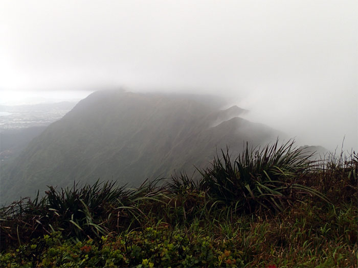
Ko’olau Mountain Range
The Ko’olaus are technically not a mountain range, but actually the remnants of a shield volcano that broke apart during prehistoric times.

Windward view
Looking into Waihee Valley bordered by two ridges; Ulimakoli on the left and Kalahaku Teeth on the right. Ryan proposed that we climb up Kalahaku Teeth, camp out at Waimalu summit and hike down the middle ridge the next day. Sounds like a plan.

Goats?
Brian was setting a blistering pace. I guess the trail running paid off.

Landslide
Mother Nature at work. Just don’t want to be around when it happens.

Waimano summit
Descending to our lunch spot.

Where’s the view? Again.
We actually had fleeting views of Waihee Valley, as compared to Manana summit where we had zero views.

Green cricket
Jose found this tiny critter hopping around.

Yellow Lehua
While red lehua flowers were quite numerous on the trail, I understand the yellow ones are harder to find in the wild. Somebody must have plucked one off the ohia tree, as rain started to fall. In Hawaiian mythology, when the lehua flower is separated from the ohia tree, the sky will fill with rain. The Waimano trail down was looking good right about now.

Going back up
Where’s the escalator?

Headed down…
Here it is. Manual powered. At least the rain went away.

…into Waimalu Meadow
The “mythical” spot that I have heard so much about. Waimalu meadow is probably one of the largest windswept grassy fields straddling the Ko’olaus. It’s definitely worth a visit.

Looking back
The strong winds started to push the clouds back, revealing the meadow and scenic windward views.

Middle of the meadow
We all climbed to the highest spot in the middle of the meadow, so that we could enjoy the nice cool breeze.

Wind vs. Hikers
The US National Weather Service defines a gale as 39-54 mph of sustained winds. We were past the minimums. It was a struggle just to stay on our feet climbing out of the meadow. Between the spongy ground and high winds, it was a challenge to say the least.

Old Tree Lady
Climbing out of the meadow, I noticed this tree that probably had its “back” bent by the strong mountain winds.

Last group photo
Top of Waimalu Middle Ridge looking down into the Windward side.

Going down
After making sure this was the right middle ridge, as clouds continued to hamper our visibility, we started to make our way down.

Waimalu Middle Ridge
Going down into Waimalu Valley.

Salmon Lehua
Another rare color of the lehua flower. Now if we could only find the “holy grail” – white lehua.

Uluhe sliding
The bottom half of the ridge was covered in dense uluhe ferns. Long pants and sleeves are highly recommended.

Wash day
Taking a break at the bottom of the ridge.

#2 stream crossing
We were going to do this a lot. 11 to be exact.

Hau tree tunnel
Dense thickets of hau trees lined the stream banks.

#6 stream crossing
The last time we were here, the water was deeper and moving faster.

Bamboo plants
Bamboo is actually part of the grass family and can grow to 100′ tall.

#10 stream crossing
After this stream crossing, we followed a rock strewn contour trail until darkness fell. That’s how long this trail was.

Water tunnel
I heard the water tunnels are walled off. No exploring allowed.

Voodoo?
A memorial to a pig hunter that died on the trail.

Last stream crossing
Last time on the trail to get our feet wet. After this, the trail worked its way up a steady climb out of the valley.

All uphill from here
The Waimalu Ditch Trail is a very long trail. It seems even longer at the end of a hike. When you get to the switchbacks, you are almost at the end. I was never so glad to see paved road at the end of Onikiniki Place.

GPS Tracks
The grinding hike totaled 13 miles, or 16 miles if you ask Ryan’s Garmin, and took us 15 hours. James and Brian wanted to head home to shower and sleep. I don’t blame them. We did smell a little ripe. The rest of us ate at Bravo’s. We did change into dry clothes to avoid being shown the door. Great hike with a great crew.
{ 2 comments… read them below or add one }
Thank you for this grinder… I had lots of fun, awesome crew to hike with, for a rookie and a tag along to any hikes .. I give this a 2thumbs up , we had the elements mud, little rain, strong winds, fog.. A must do hike for intermediate lvl hikers with good endurance . Survival kits needed, food, water, head lamps and a good navigator ????
Thanks for joining us Chris, you did great as usual. The Spartan Beast will be a piece of cake for you!