
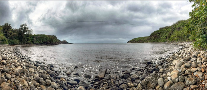
We flew to the second largest island in the Hawaiian archipelago to do some exploring this weekend.
Honoapi’ilani Highway
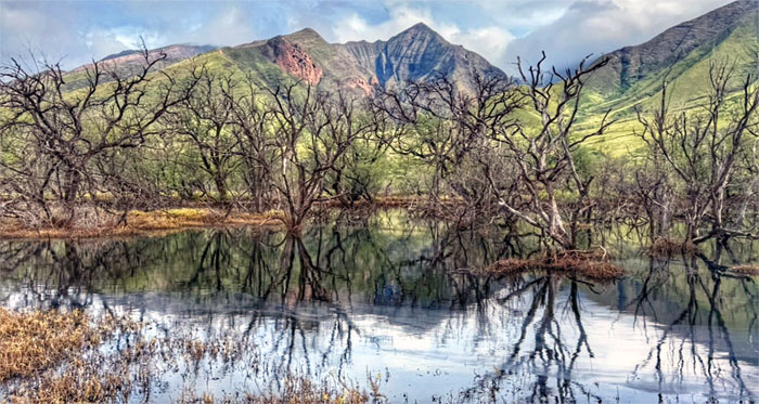
Matt picked us up at the airport and we decided to drive to the West side of the island to escape the rain that was showering the central part of the Valley Isle, motoring along the coastal highway that was built in 1927 to replace the 1900s dirt road that had 115 hairpin turns. Talk about getting carsick.
Honoapi’ilani Highway
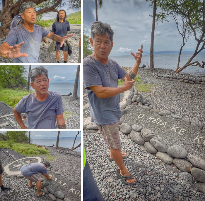
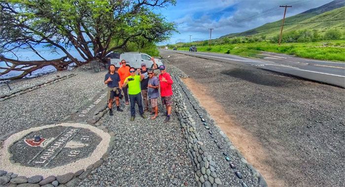
We stopped at the side of the highway and talked story with Alan “Yamaz” Yamamoto, a local Molokai boy, who is a graduate and retired employee of Lahainaluna School.
Honoapi’ilani Highway
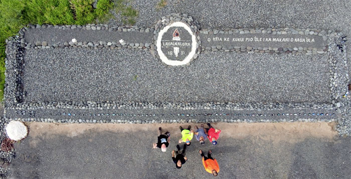
Yamaz cleared and started this rock garden after the 2020 COVID pandemic from rock and coral culled from nearby Olowalu Beach. The Hawaiian words “O Keia Ke Kukui Pio’ole I Ka Makani O Kaua’ula” roughly translate to “This torch can’t be extinguished by the winds off Kaua’ula.”
Honoapi’ilani Highway
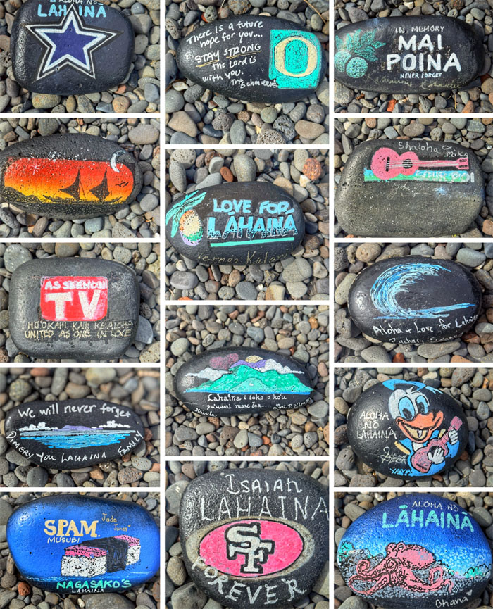
One of many “message rocks” that border the front of the rock garden.
Honoapi’ilani Highway
If you ever find yourself driving Westside, stop by and thank this guy for all his hard work. And maybe leave a “message rock” while you’re at it.
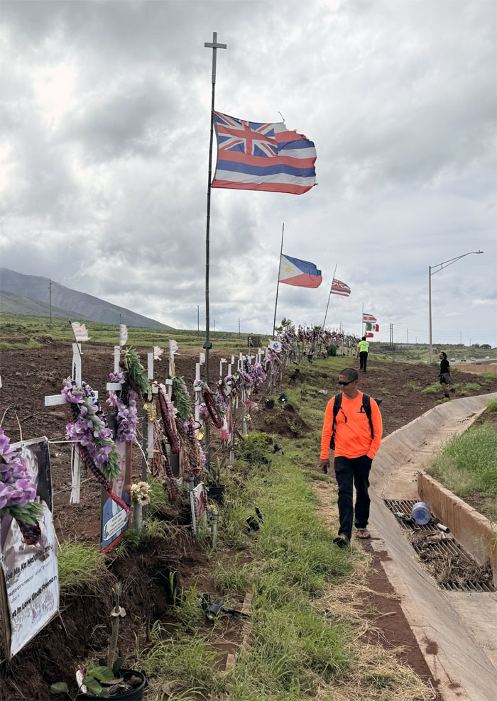
Lahaina Memorial
We paid our respects to the 115 crosses that represents each of the lives lost in the tragic fire that swept Lahaina on August 8, 2023. On a personal anecdote, a friend had told me he got a sweet deal on a place to stay in Lahaina two weeks prior to the fires. Luckily, he was able to walk out of town but lost all his personal belongings except his car which somehow survived intact.
Lahaina
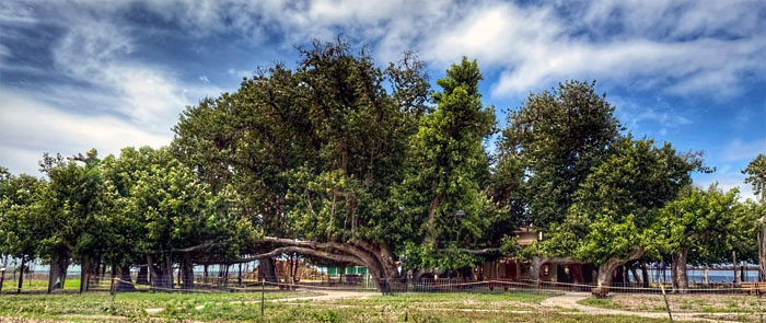
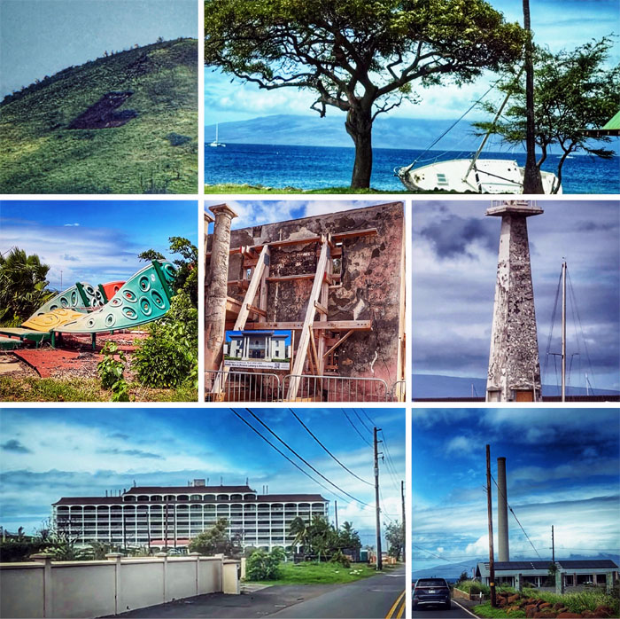
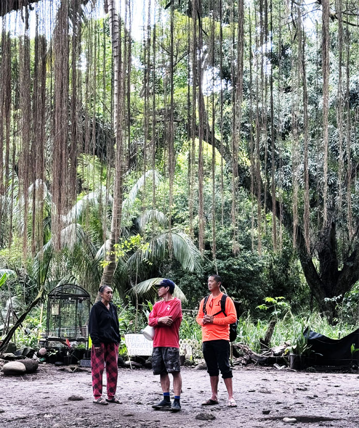
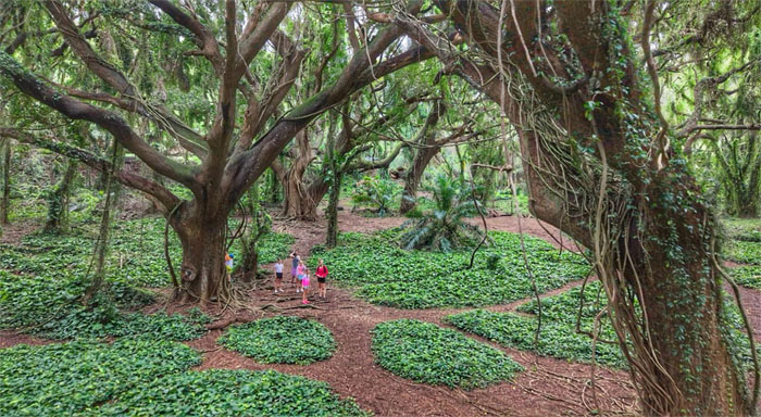
Looking at the first banyan tree planted in the Hawaiian islands on April 24, 1873 to mark the 50th anniversary of the first Protestant mission.
Lahaina
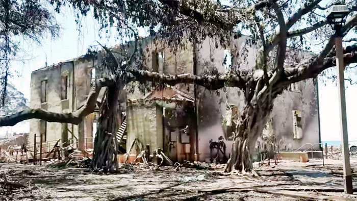
This is how the tree looked after the wildfires had ravaged the old whaling town. Its recovery symbolizes the hope and strength of the surrounding community. Photo by Dominick Del Vecchio.
Lahaina
The residential heart of Lahaina are slowly being rebuilt with the commercial areas moving at a kahuli pace. The 30′ “L” has been overlooking the town since 1929, the large letter is refreshed annually by the Lahainaluna students.
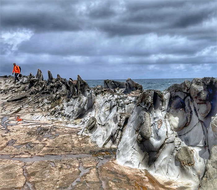
Makaluapuna Point
Walking alongside the lava formation known as Dragon’s Teeth.
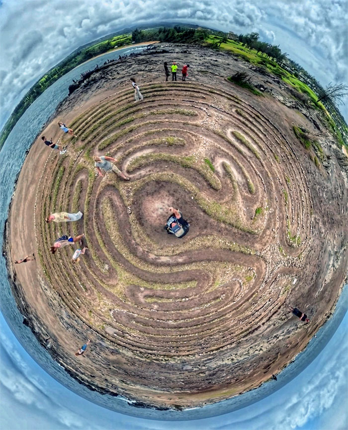
Makaluapuna Point
Chico circling inside the Kapalua labyrinth that was built in 2005 as a peace project.
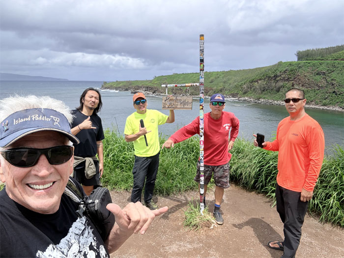
Honolua Bay
Scenic point at the bay famous for its long right hand point surf break.
Honolua Bay
We walked down to the bay shoreline and the normally turquoise blue waters were somewhat muddied due to all the recent heavy rain and runoff.
Honolua Bay
The guys talking to Leialoha Manuwa, descended from ali’i (noble ruling class) and claimant to the Crown Lands that we were standing on. Thought bubbles not included.
Honolua Bay
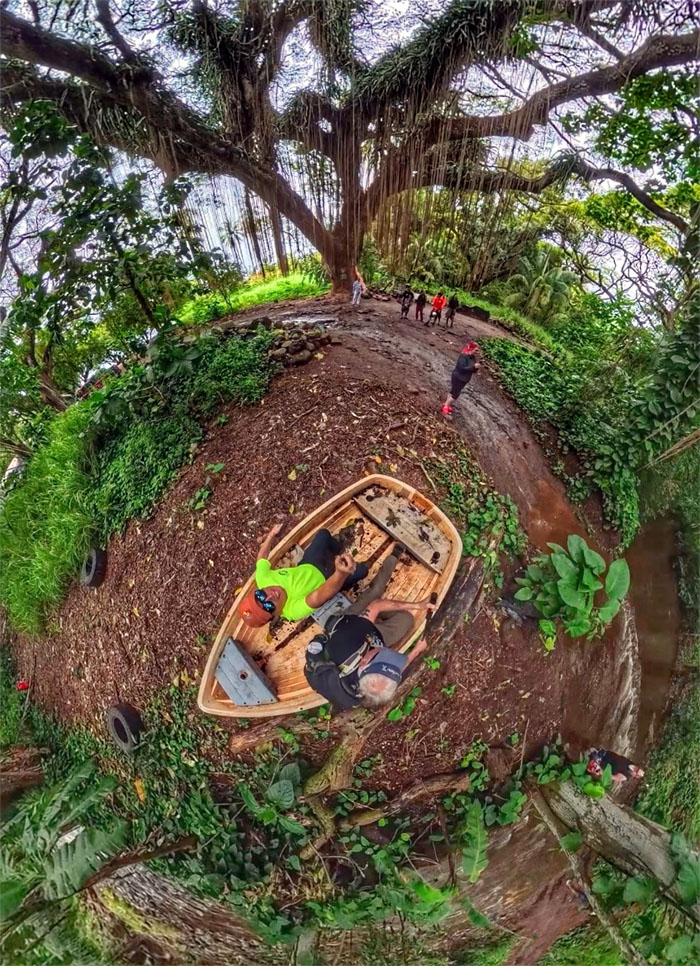
Rowing and rowing our boat and not getting anywhere. Maybe water would help and no holes in the boat.
Honolua Bay
This place looks like it’s straight out of a Harry Potter book. Enchanted. Magical. Mystical. Enthralled. Captivated. Mesmerized. Bedazzled. Running out of superlative adjectives.
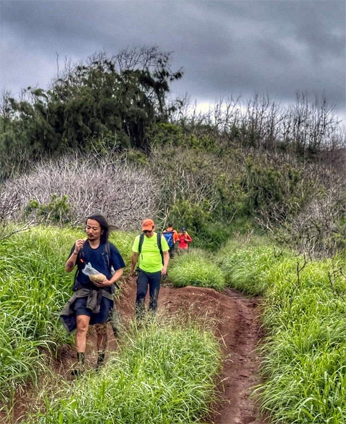
Chutes and Ladders
Matt angled and parked the van to ensure clean lines of sight as we stopped at our next adventure. A mother and daughter pair decided to follow us down the trail, hoping to see something enchanted. Wrong place.
Chutes and Ladders
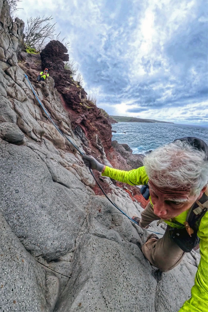
We had to bushwhack a bit to find the cliff going down. Maintaining three points of contact as the rocks were a tad slippery due to recent rain. The female duo decided to turn around as there was nothing to see. Move along.
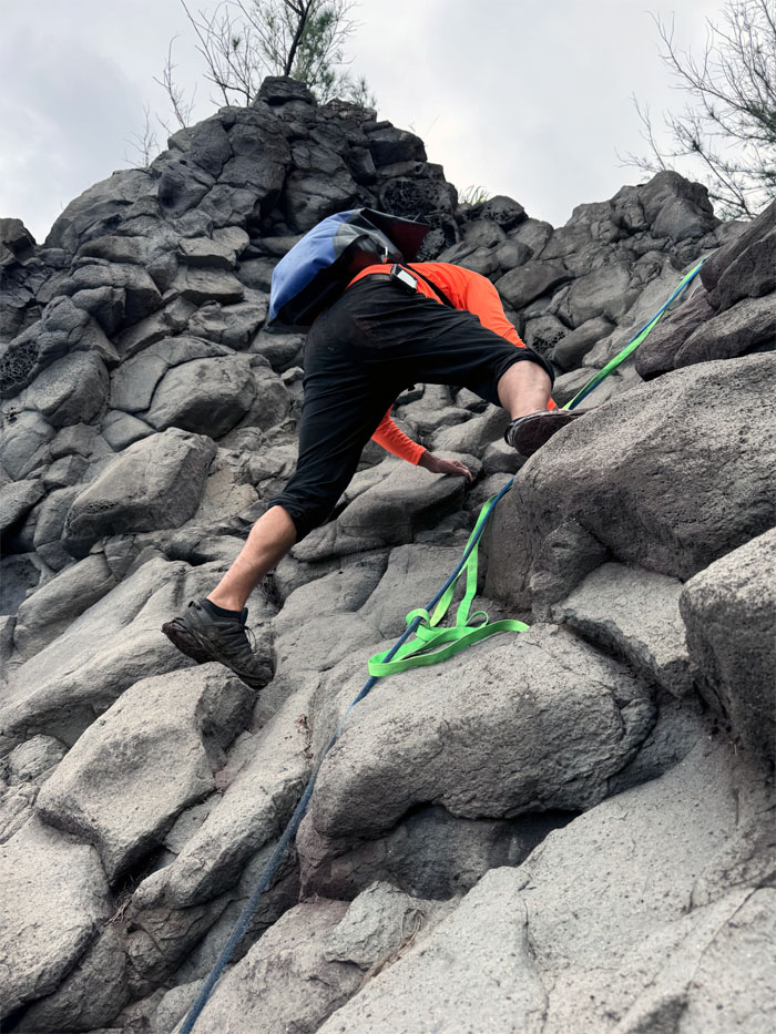
Chutes and Ladders
Scotty making his way down.
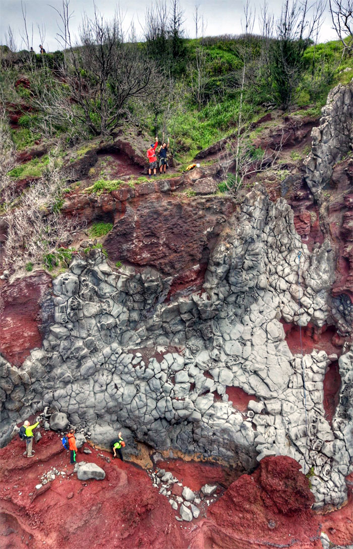
Chutes and Ladders
Chico climbing his down the roughly 40′ cliff face.
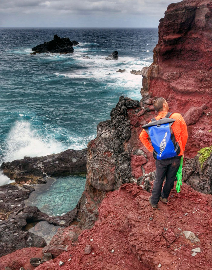
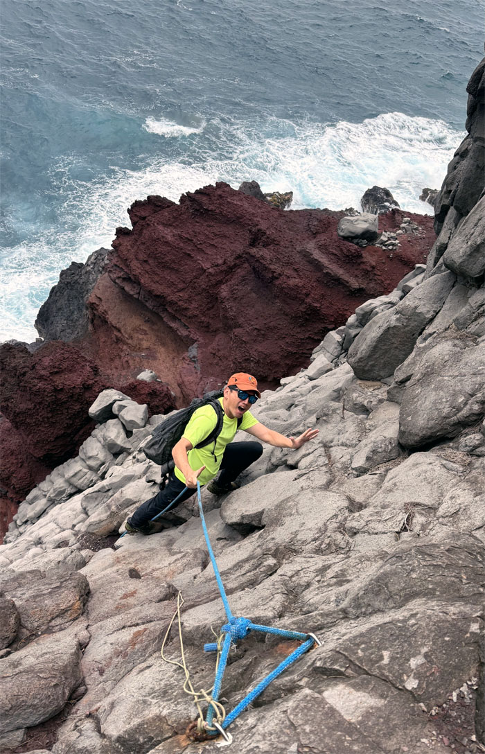
Chutes and Ladders
Scott approaching the tide pools that was on his bucket list. Look but don’t touch. Close enough.
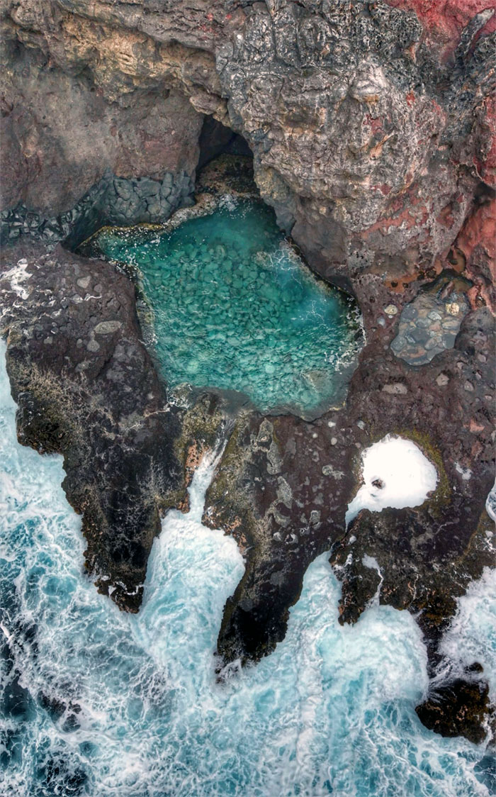
Chutes and Ladders
The blue-green tide pools get regularly flushed out by the ocean.
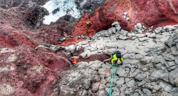
Chutes and Ladders
Our scattered group shot against the pebbly rock face.
Chutes and Ladders
Climbing back up the cliff face and to our next spot.
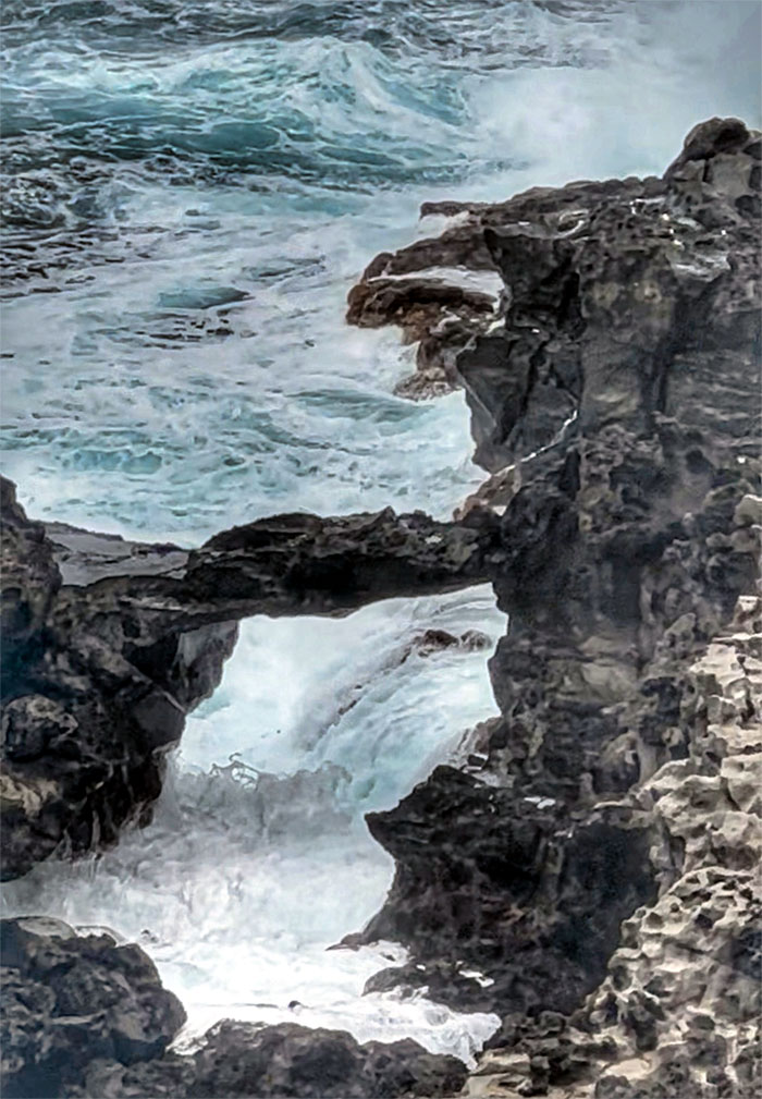
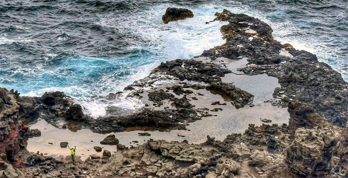
Nakalele Blowhole
Despite what the sign says, are we at Hanauma Bay Rock Bridge?
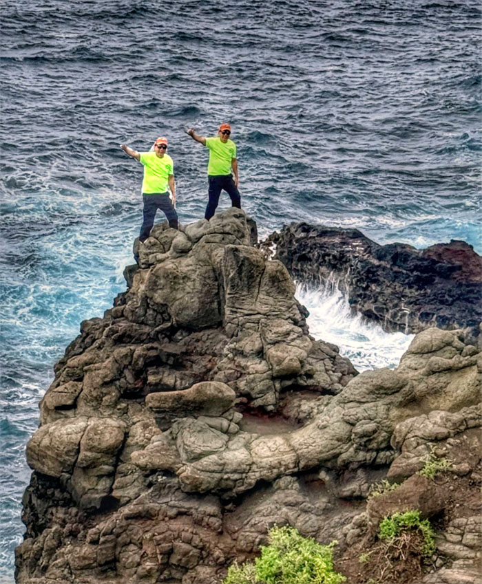
Nakalele Blowhole
Will the real blowhole please stand up? Thank you.
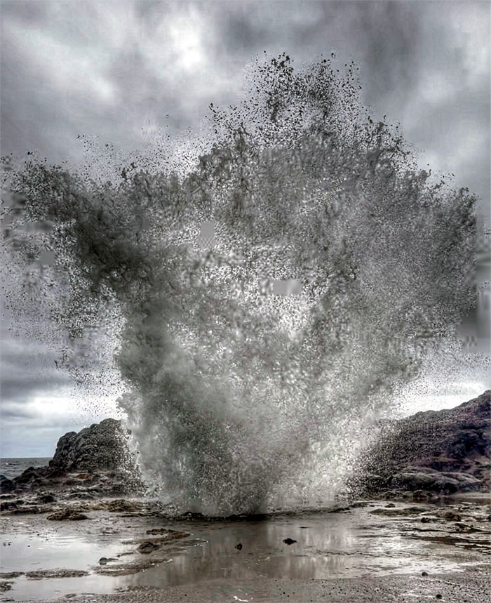
Nakalele Blowhole
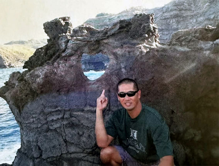
This is what the Nakalele Heart Rock used to look like.
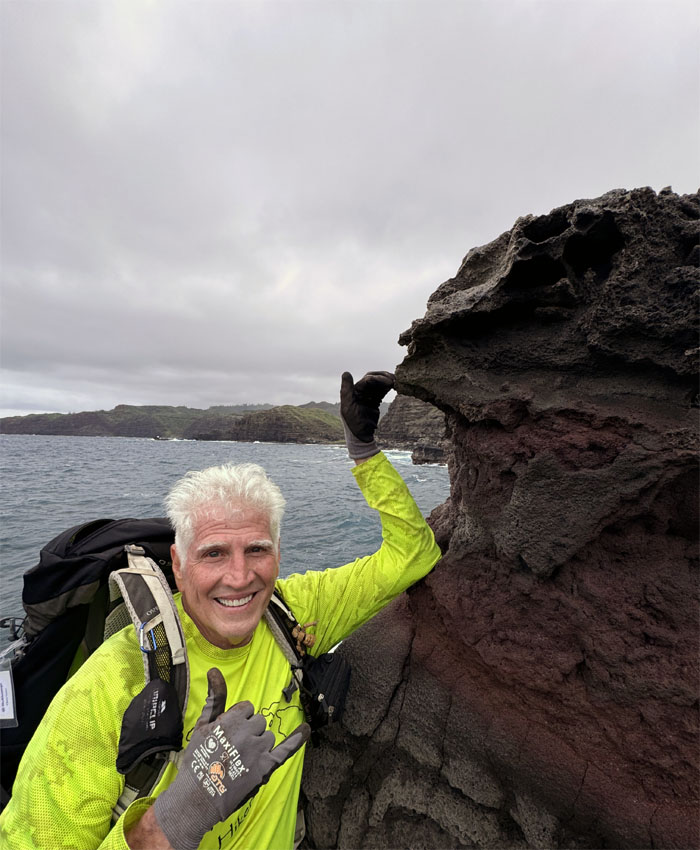
Nakalele Blowhole
Now it looks like this. Constant ocean erosion finally split the iconic rock formation in half as of January 2020. Another victim of the COVID pandemic?
Nakalele Blowhole
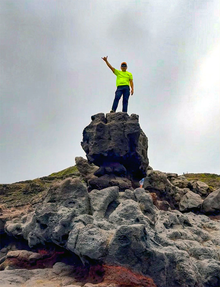
Well, if I can’t get a heart rock photo, I can at least get a shaka photo.
Nakalele Blowhole
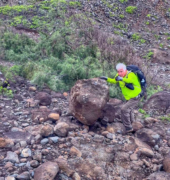
Going back up the trail, this dislodged turned runaway boulder almost split Chico in half. Luckily, he rolled and tumbled out of the boulder’s path. Nimble as a ninja or at least a Beverly Hills Ninja ala Chris Farley.
Olivine Pools
Some were convinced we were not at the right tide pools. The rest of us didn’t know any better.
Olivine Pools
Double exposure. One is more than enough.
Olivine Pools
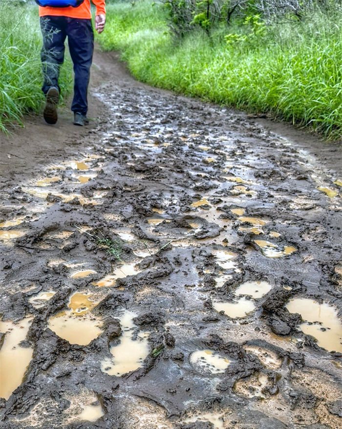
Leave only footprints. Muddy footprints.
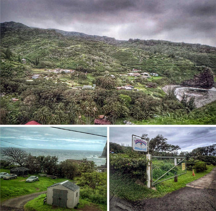
Kahukuloa
Driving through the isolated village that doesn’t appreciate any honking of the horns.
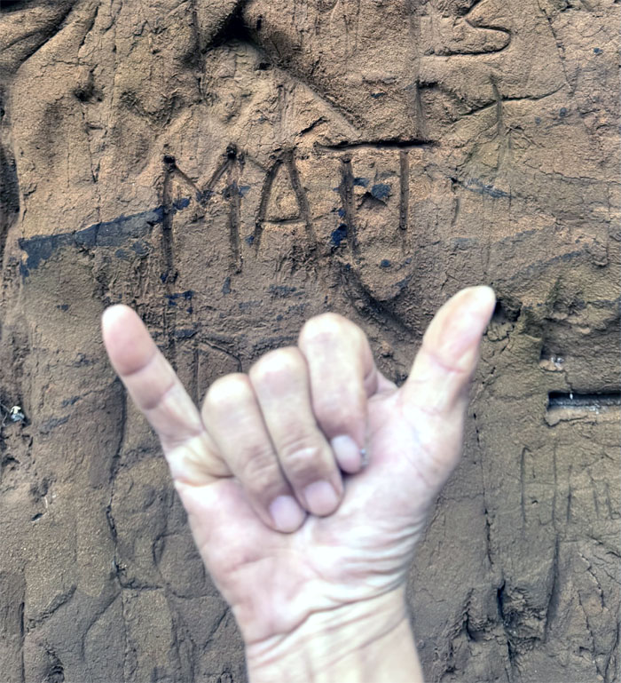
Kahekili Highway
Roadside recyclable graffiti.
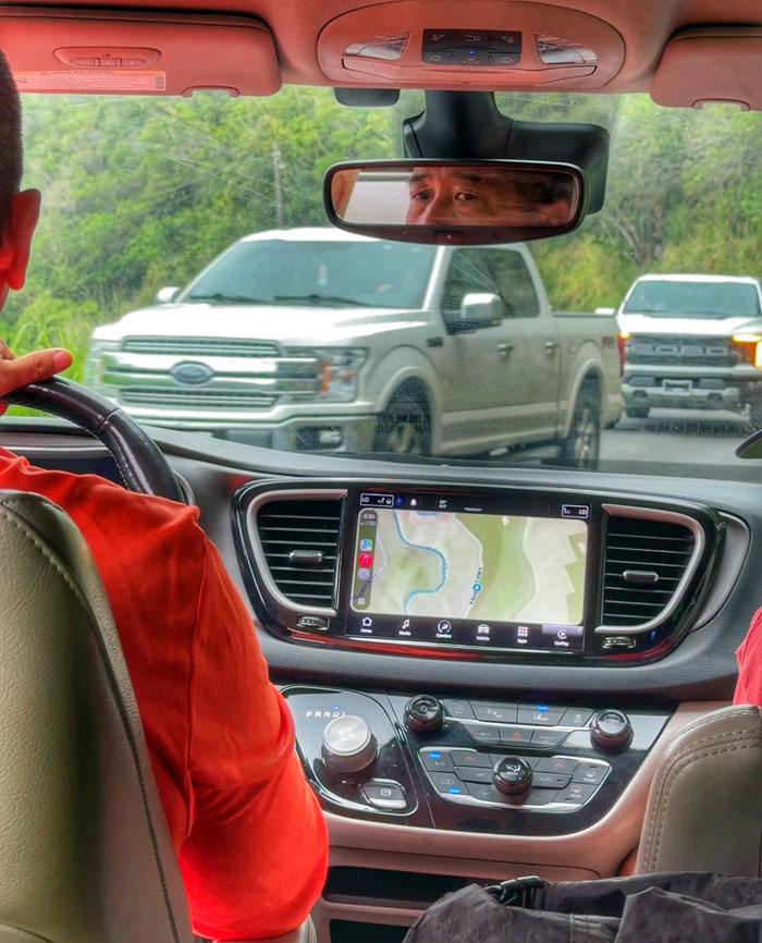
Kahekili Highway
Driving on this stretch of the road involves multiple hairpin turns, steep ocean drop offs often with no guardrails and narrow one-lane sections.
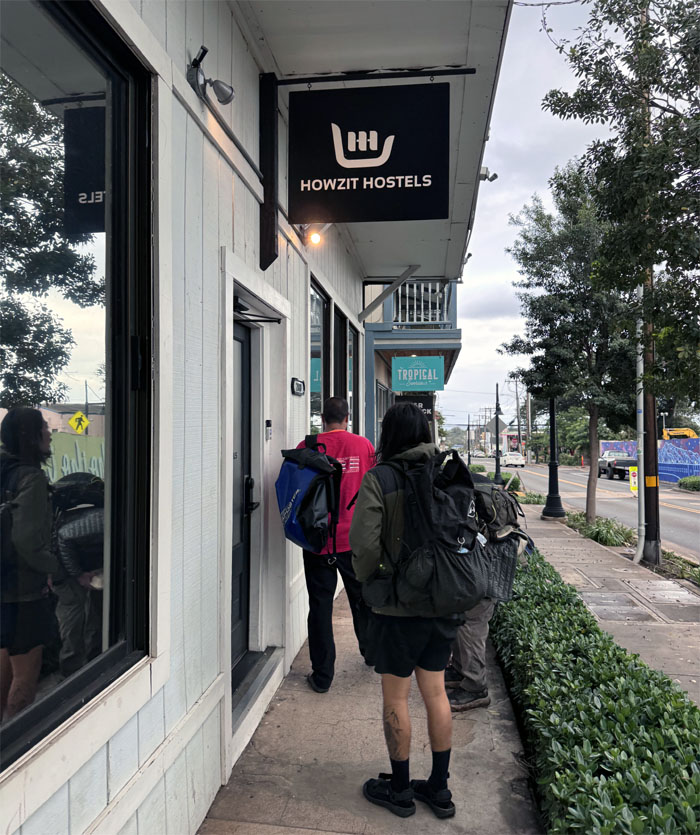
Howzit Hostels
We had time to kill so we ended up driving to Iao Valley for naught as the road was closed and somebody could have cared less, had dinner at Kalei’s Lunchbox and checked into our place for the night.
Wailuku
Day 2
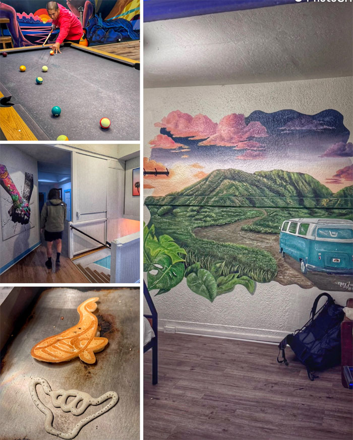
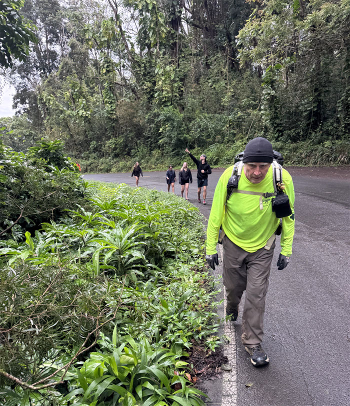
Checking out of our hostel where we missed the creative pancakes and picked up McDonald’s instead. Matt also picked up four new hiking friends in the form of Brittney (Canada), Steve (Chicago), Sophie (Germany) and Zollo (Texas). Social media influencer and hostel volunteers.
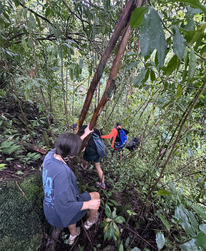
Sunny D
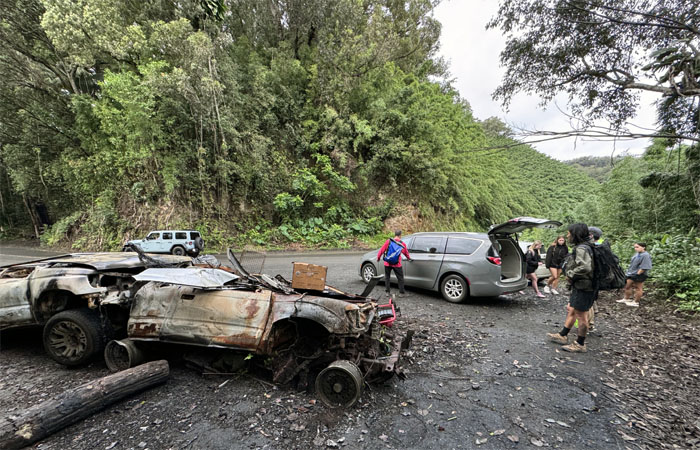
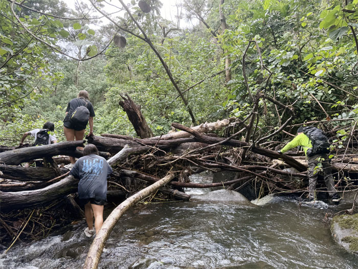
Passing the Car-BQ as we plunged into the jungle.
Sunny D
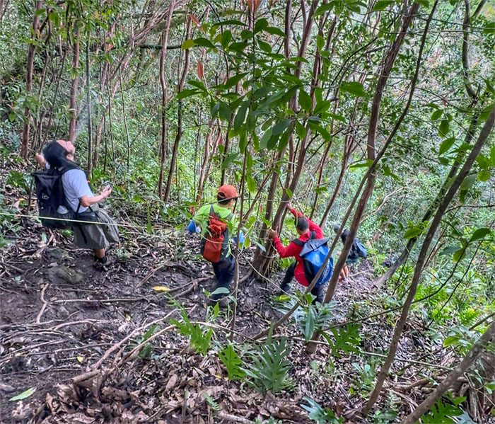
Climbing our way down to the stream.
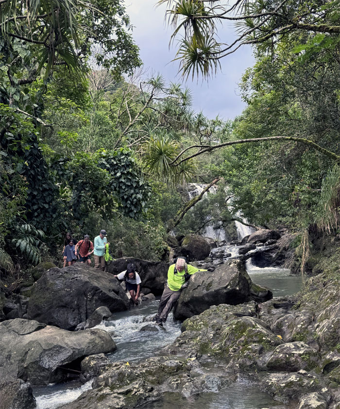
Sunny D
Passing a smaller waterfall as we followed the stream down. Some of us will be back.
Sunny D
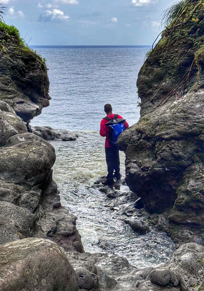
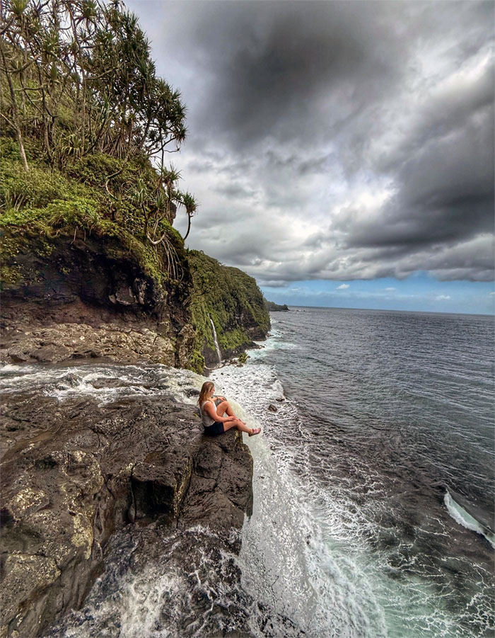
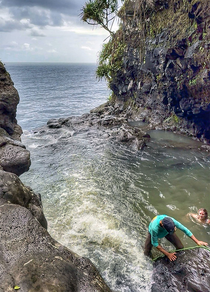
Scotty approaching the end of the waterfall and the beginning of the ocean.
Sunny D
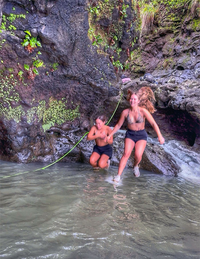
The girls wanted to make a splash in the deep pool.
Sunny D
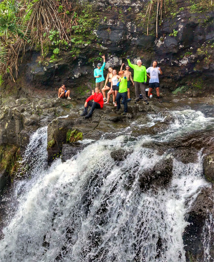
Group photo at the end of the waterfall that drops into the ocean.
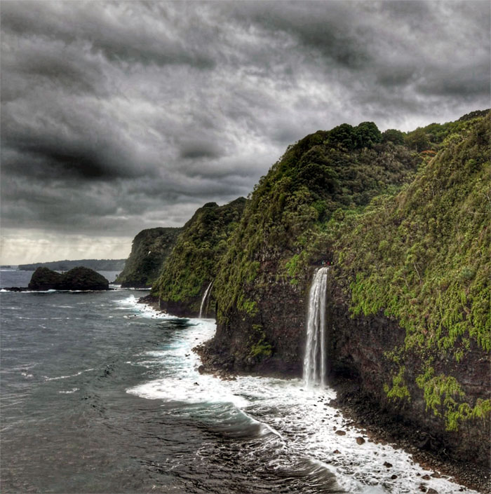
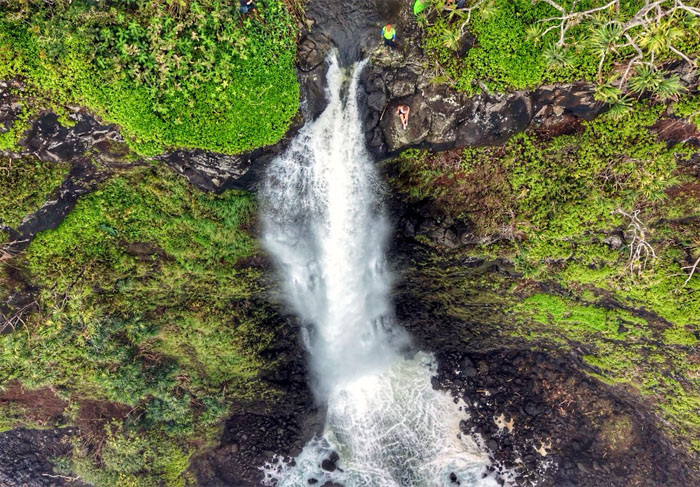
Sunny D
Pull back drone photo of the 150′ waterfall and other coastal waterfalls spilling into the ocean.
Sunny D
Brittney assured her nervous friends that her butt was wedged into the rock and she was locked in. No worries, she wasn’t going anywhere. Famous last words?
Sunny D
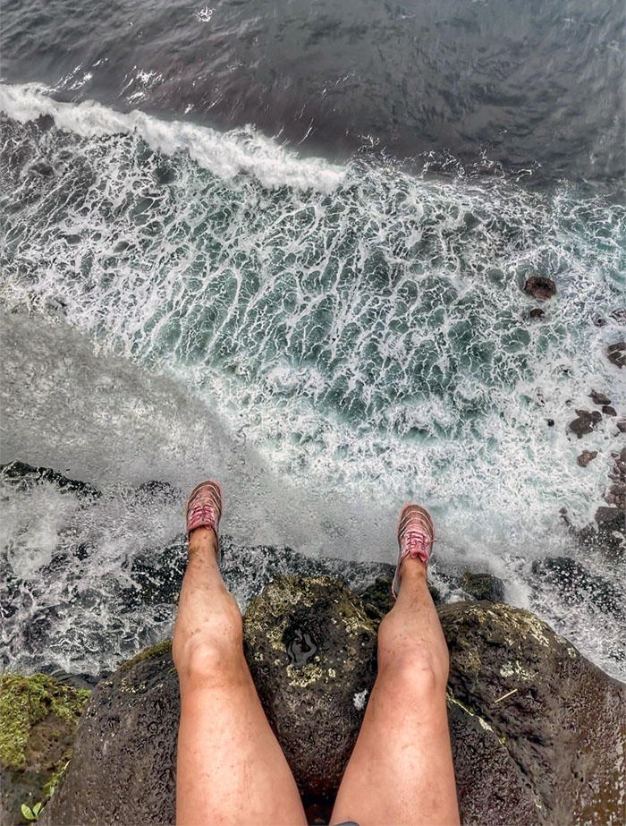
POV of the 45 meter drop to the ocean for our European friend.
Sunny D
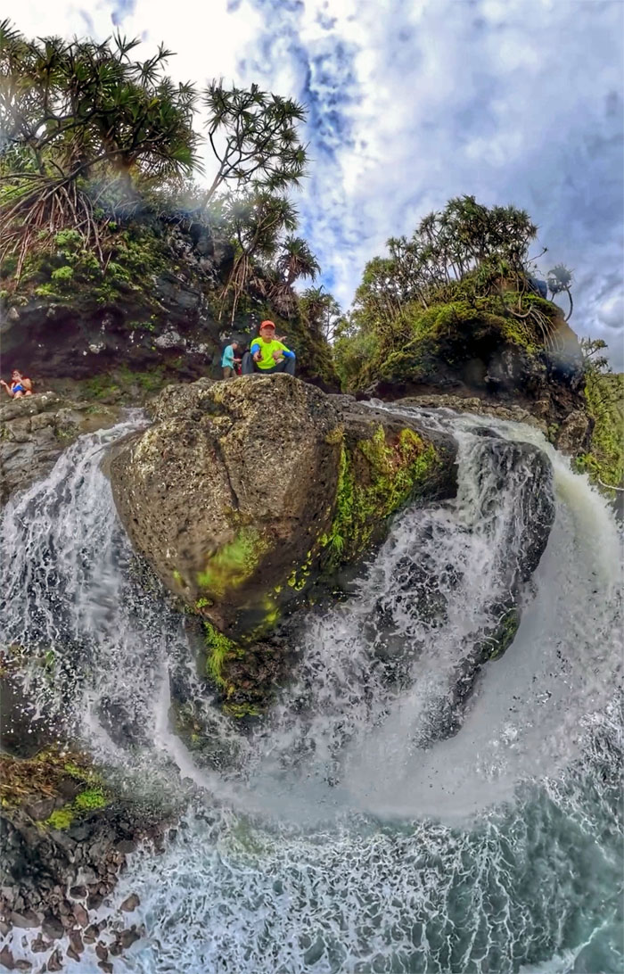
Peering over the edge with Insta360.
Sunny D
Leaving the tidefall behind us.
Sunny D
The rest of the group streamed to the smaller waterfall while Kenny, Scotty and myself climbed back up the hill.
Sunny D
Brittney swam out to the base of the waterfall as she was already wet.
Sunny D
Chico wanted to make a splash in the pool as he was already wet as well.
Sunny D
Somebody filming themselves on the trail. Who needs somebody to take their picture when you can do it yourself?
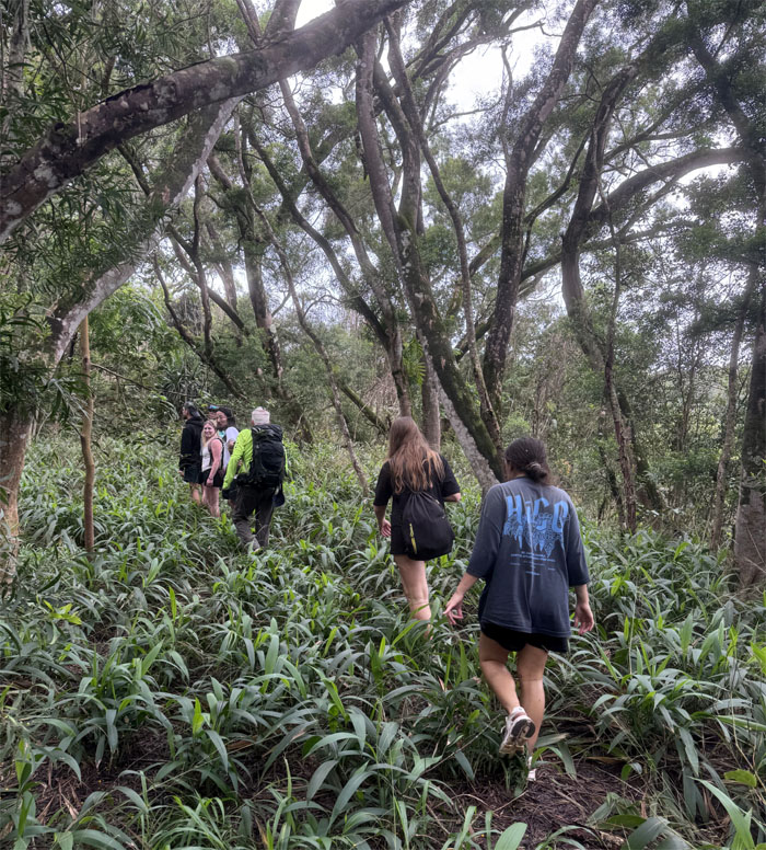
Squirts
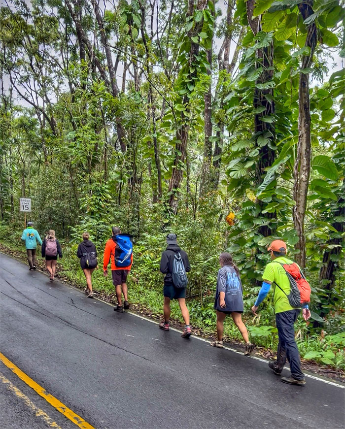
Walking to our next waterfall.
Squirts
This is not the trail. Turn around.
Squirts
Back on the road again.
Squirts
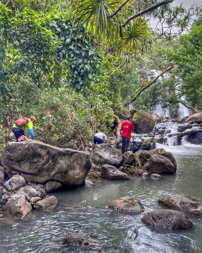
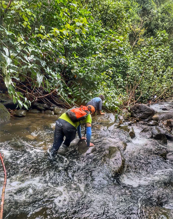
Following the sound of rushing water to its source.
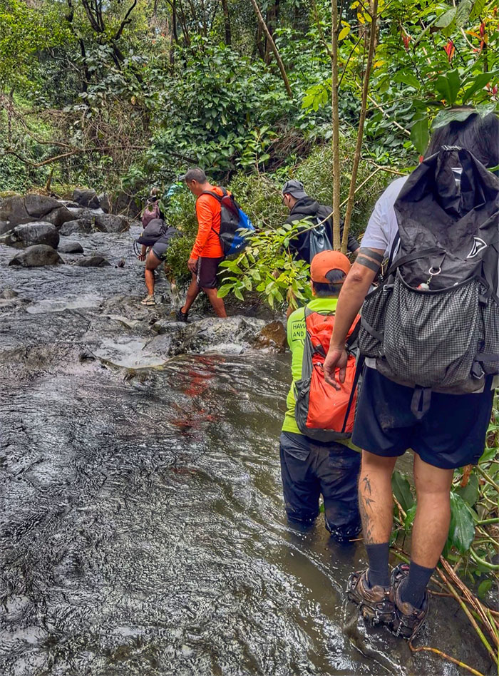
Squirts
Miles and miles, hours and hours of rock hopping. Actually it turned out to be around 40 minutes. It just seemed endless.
Squirts
How long more? Somebody threw in their shoes and turned back.
Squirts
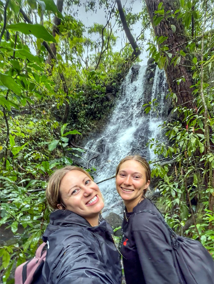
The girls next to a side waterfall.
Squirts
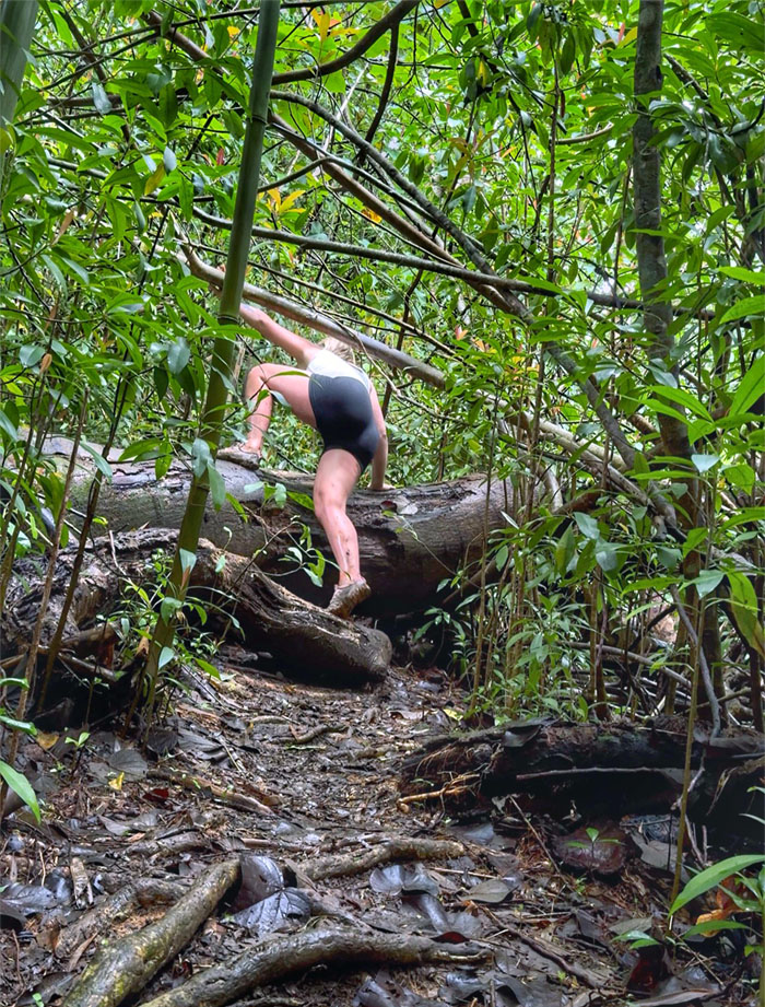
Climbing and contouring our way around a fallen tree.
Squirts
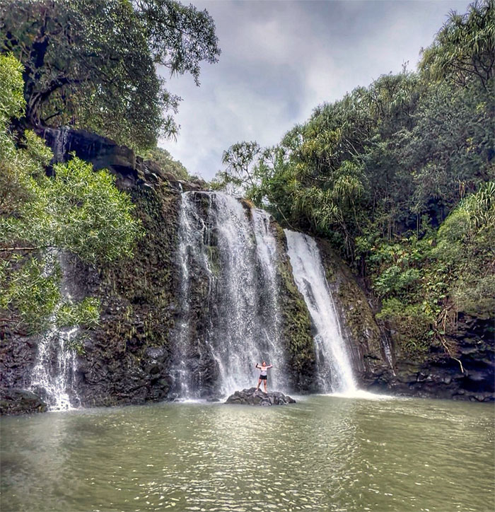
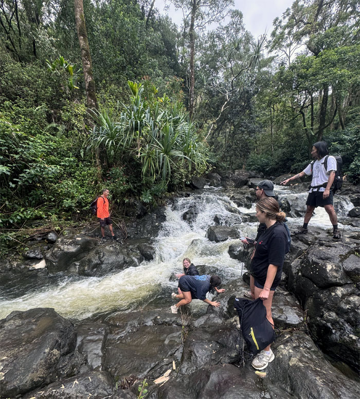
The end is in sight!
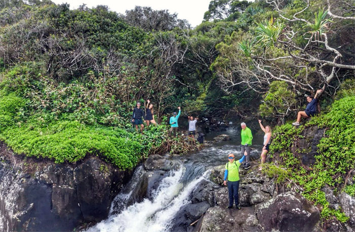
Squirts
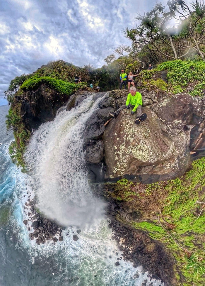
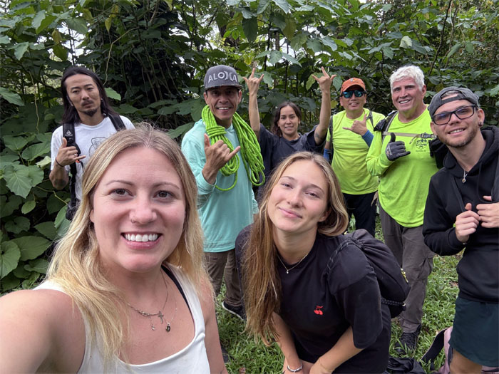
Group photo at the end of the coastal waterfall.
Squirts
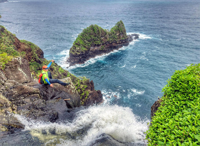
Jurassic Island in the background.
Squirts
Droning the 250′ falls crashing into the ocean below us.
Squirts
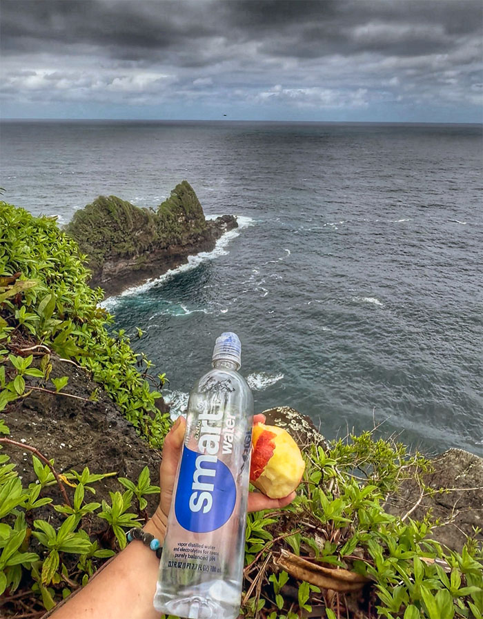
Product placement. Social media influencer and all. The apple got a free ride.
Squirts
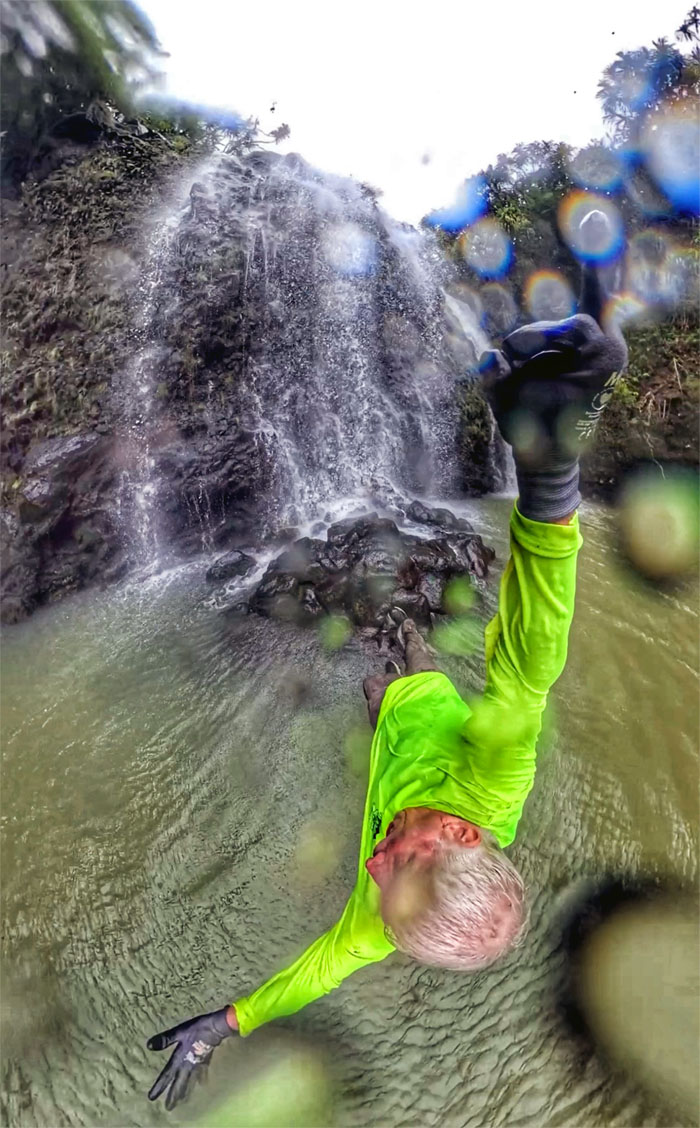
Chico peering over the edge with his Insta360.
Squirts
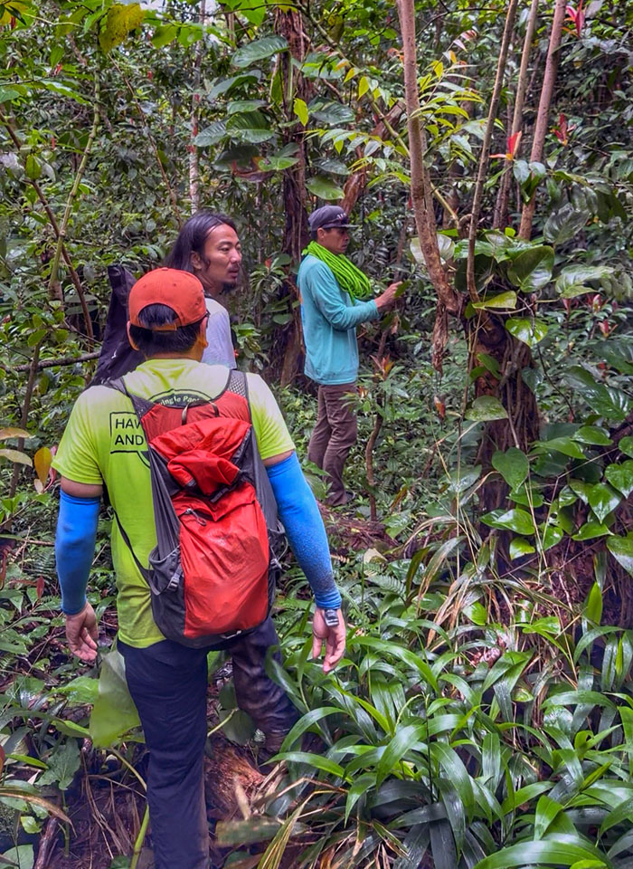
Forget Door Dash and Uber Eats, there is a little known service that delivers to remote areas called Sherpa.
Squirts
Much to our relief, we found the trail that bypassed the rock hopping stream and ended up taking roughly 10 minutes. Time saver.
Squirts
Back on the road.
Squirts
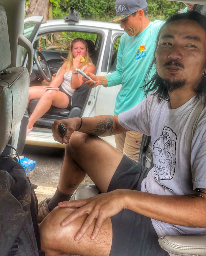
We walked back to our cars; airdropped photos, consumed earned calories and somebody talked smack.
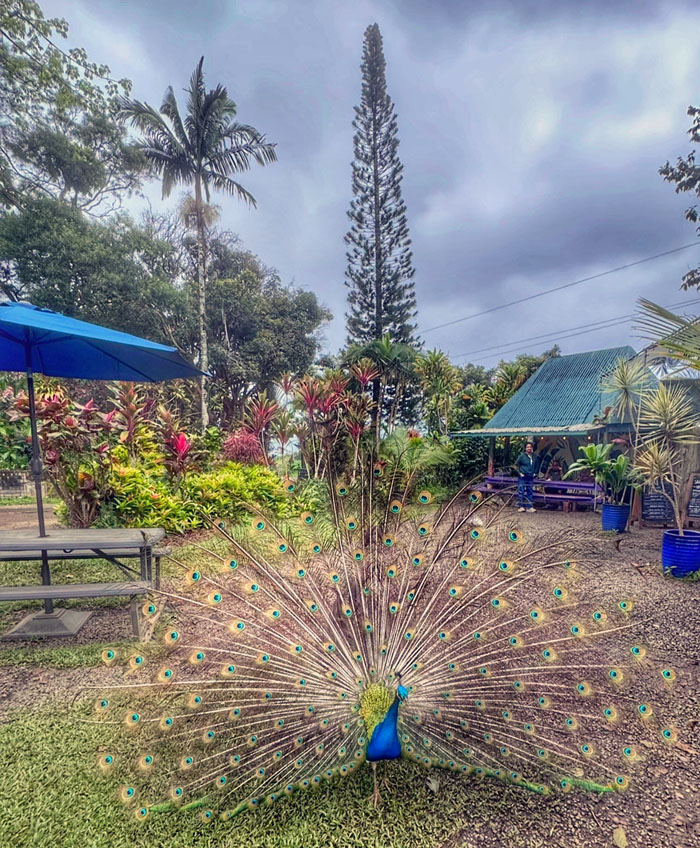
Savor Maui
Stopped at a nearby food truck to have pulled pork sandwiches and watched the preening peacock and food snatching peahens. These screeching birds, native to India, were introduced to Hawaii in 1860 and have since colonized all the major islands.
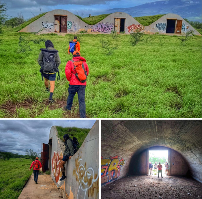
Naval Air Station Puunene
We tried to see some other bunkers but access was closed off. So we drove further down the road and checked out these abandoned structures that date back from WW2.
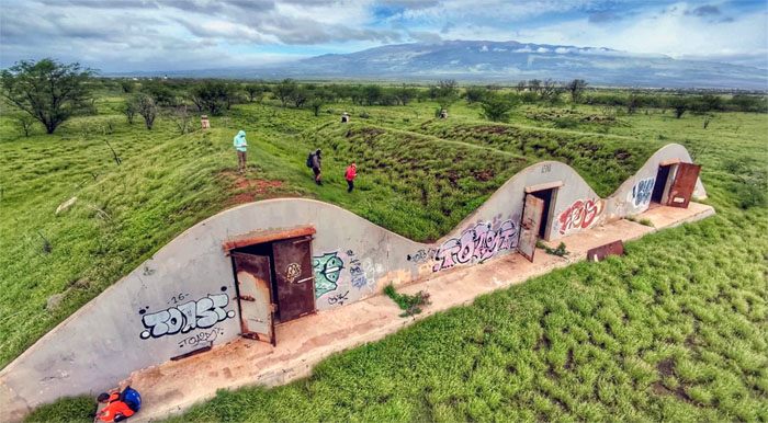
Naval Air Station Puunene
Running across the top of the earthen-bermed structures formerly used for ammunition storage.
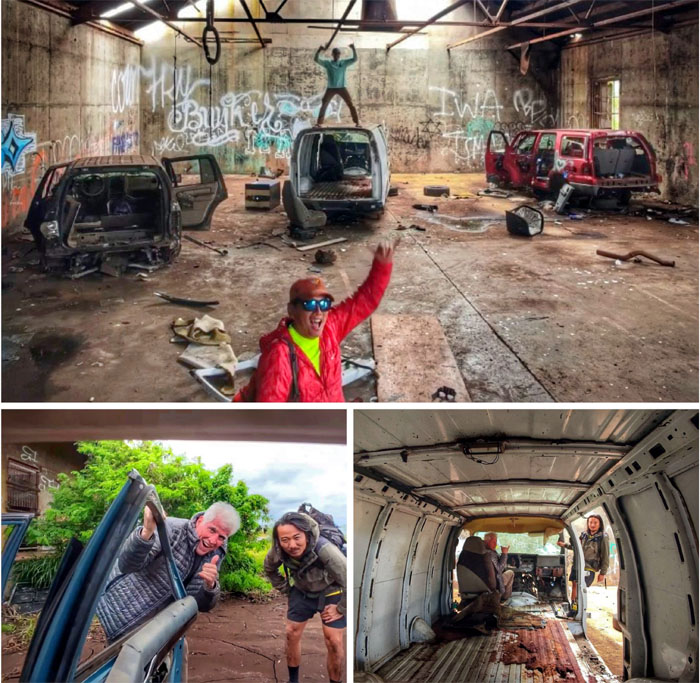
Naval Air Station Puunene
Practicing my collision avoidance skills in the old telephone exchange building turned chop shop.
Naval Air Station Puunene
We checked out a couple other abandoned structures, cleaned up the van, and had a late lunch at Sonic. Where are the carhops? Big shout out to Matt who rented the van and was our uber driver for the weekend and for showing us around the island. Thanks to the group for an amazing adventure filled with exploration, waterfalls and scenic spots.
Photos/Crew taken by Chico Cantu, Kenny Lui, Matt Vidaurri, Scott Dea, and yours truly. Not necessarily in order.
Note: I have been made aware that some hikers have been using my blog as a hiking guide and getting lost on the trails. Please note that this blog was made to document the hike for the crew(s) that did it. That is why some of my comments will seem to have no relevance or meaning to anybody outside of the crew(s) that hiked that trail. My blog was never meant as a hiking guide, so please do not treat it as such. If you find inspiration and entertainment from these hikes, that is more than enough. If you plan on replicating these hikes, do so in the knowledge that you should do your own research accordingly as trail conditions, access, legalities and so forth are constantly in flux. What was current today is most likely yesterdays news. Please be prepared to accept any risks and responsibilities on your own as you should know your own limitations, experience and abilities before you even set foot on a trail, as even the “simplest” or “easiest” of trails can present potential pitfalls for even the most “experienced” hikers. One should also always let somebody know of your hiking plans in case something doesn’t go as planned, better safe than sorry.
{ 0 comments… add one now }