
Somebody asked me to hike this section today for their birthday. I often get confused for the Make-A-Wish Foundation.
Wiliwilinui Trailhead
Thanks to Scott, Susan and Tessa for shuttling us to the trail nestled in the luxury neighborhood of Waialae Iki that was founded in the 1960s.
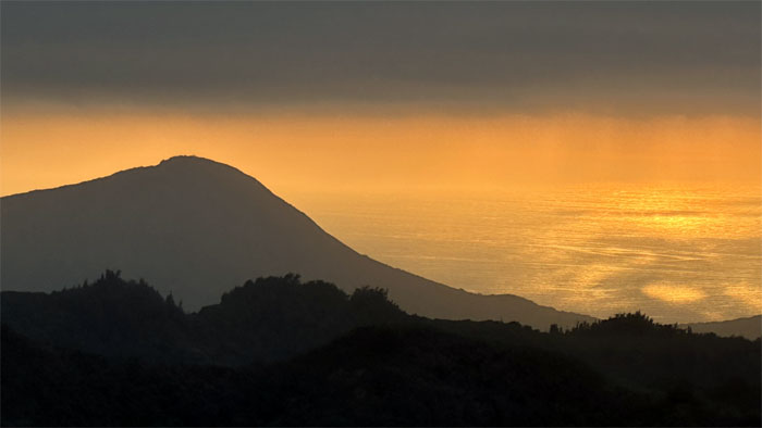
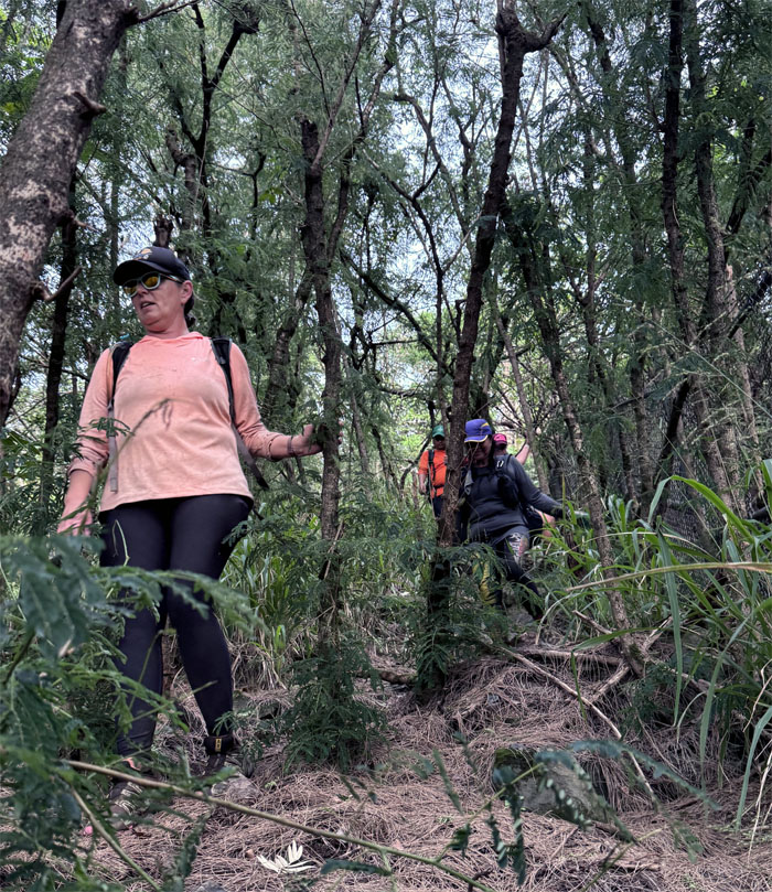
Wiliwilinui Trail
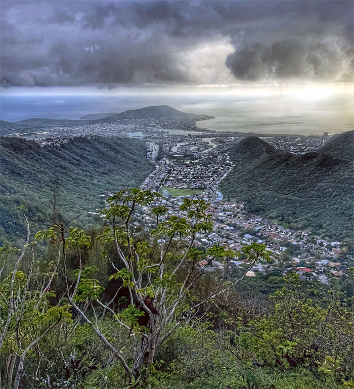
Looking back at the sunrise shimmering over the Pacific Ocean as we hiked up the trail that was originally a service road built by the US Army in 1941.
Wiliwilinui Trail
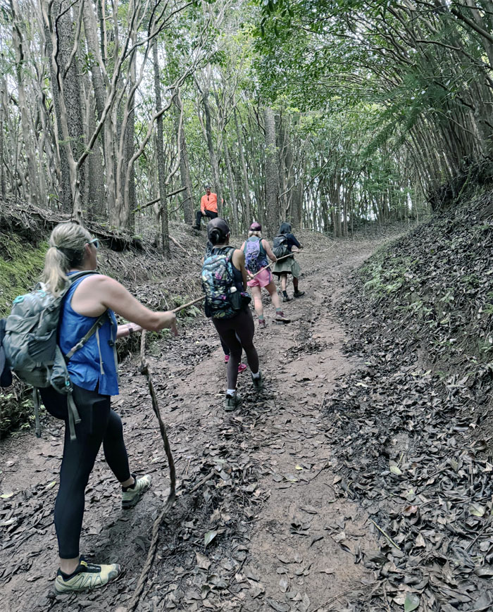
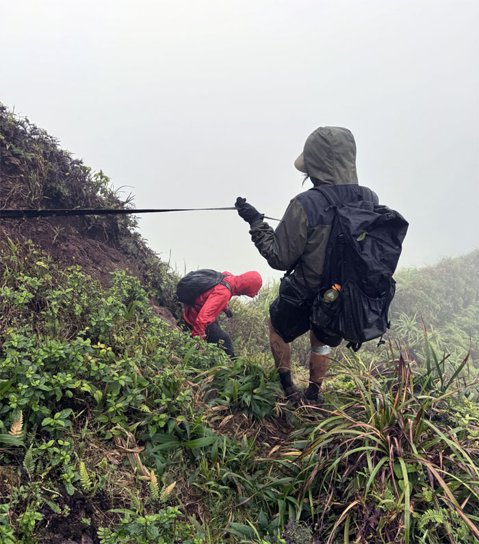
Reverse tug of war, where the mountain pulls you up the hill.
Wiliwilinui Trail
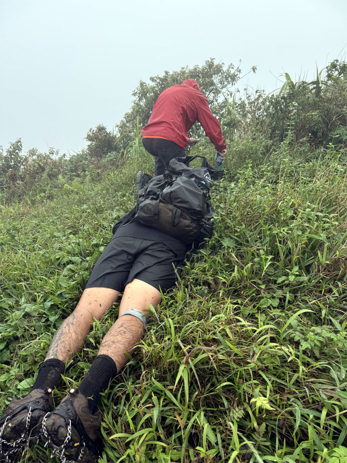
Somebody thought this was the end of the line and were about to turn around and call it a day. He was sadly mistaken.
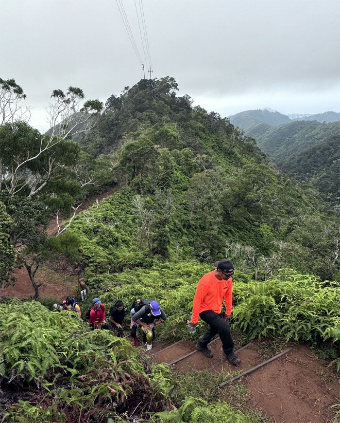
Wiliwilinui Trail
The show must go on. Reluctantly.
Wiliwilinui Trail
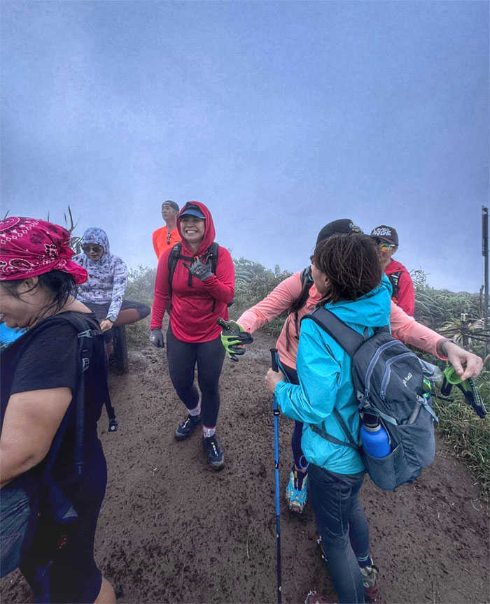
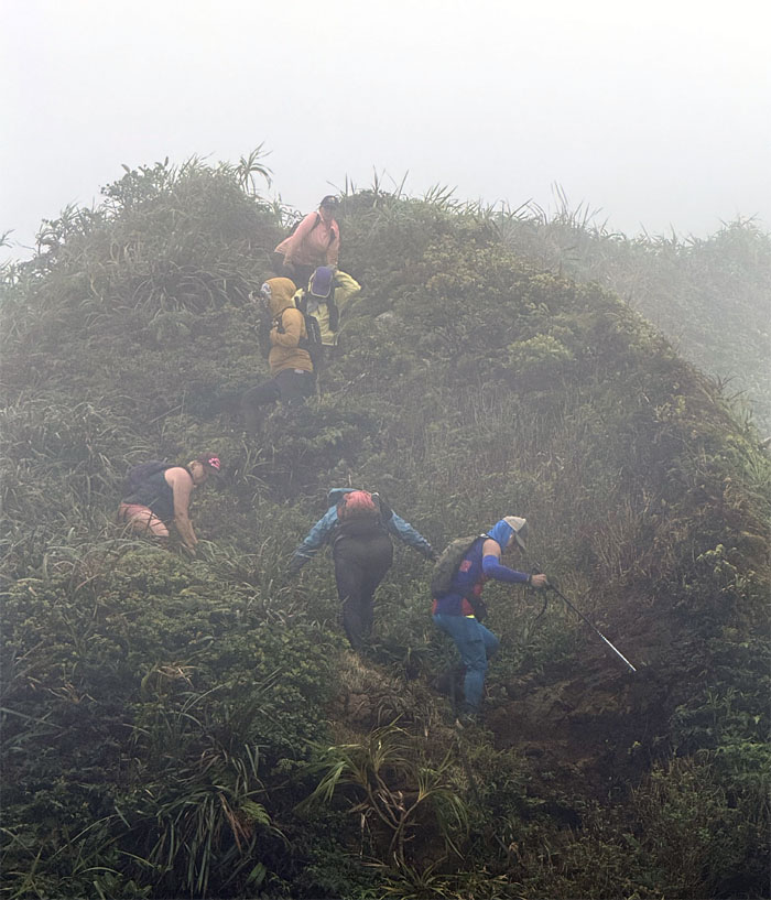
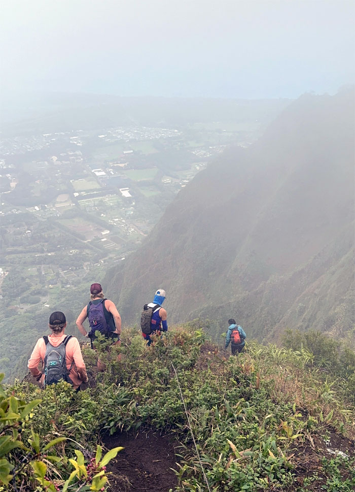
Staggering out the group to prevent trail erosion or maintain social pacing or was that distancing. Is that even a thing anymore?
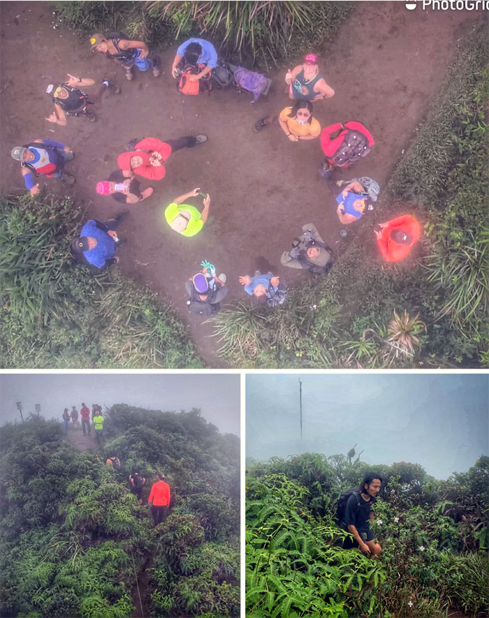
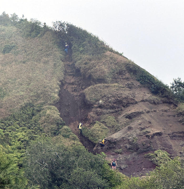
Wiliwilinui Summit
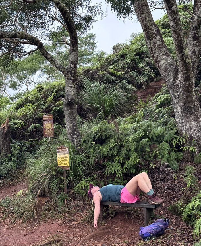
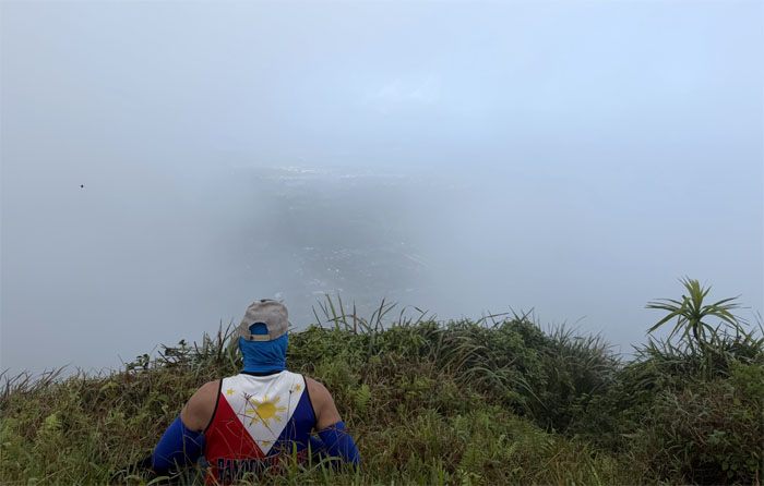
Arriving at the summit hoping for panoramic views of the East side only to have them dashed. Not all birthday wishes come true.
Wiliwilinui Summit
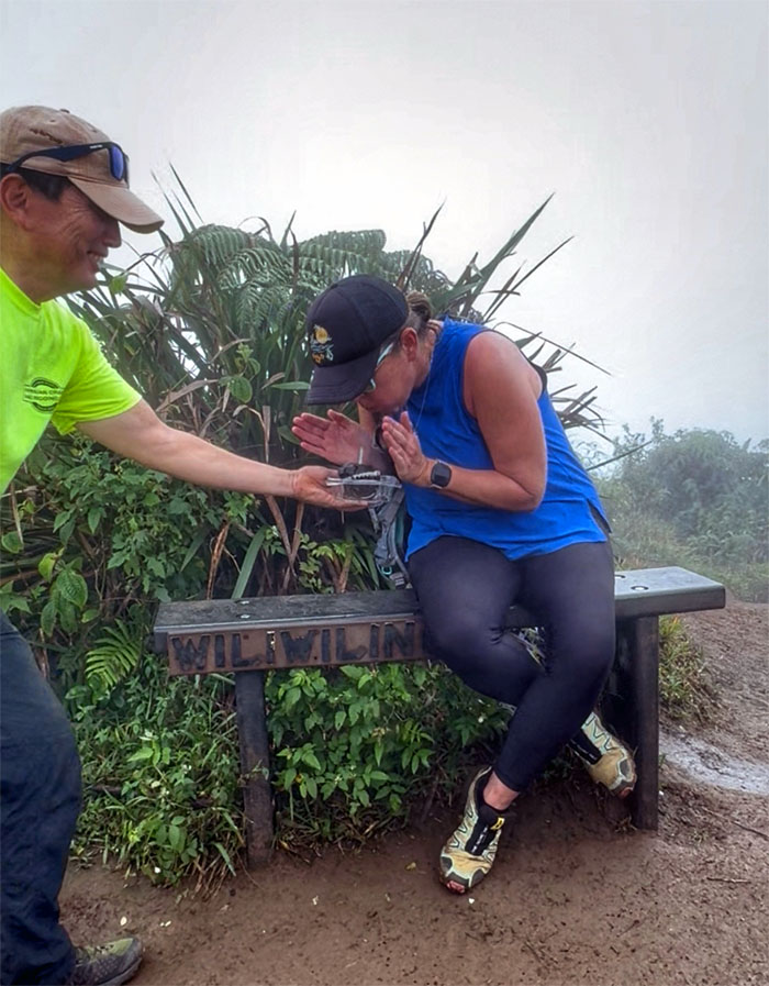
Happy Birthday Private School. Enjoy your public school made cup cake.
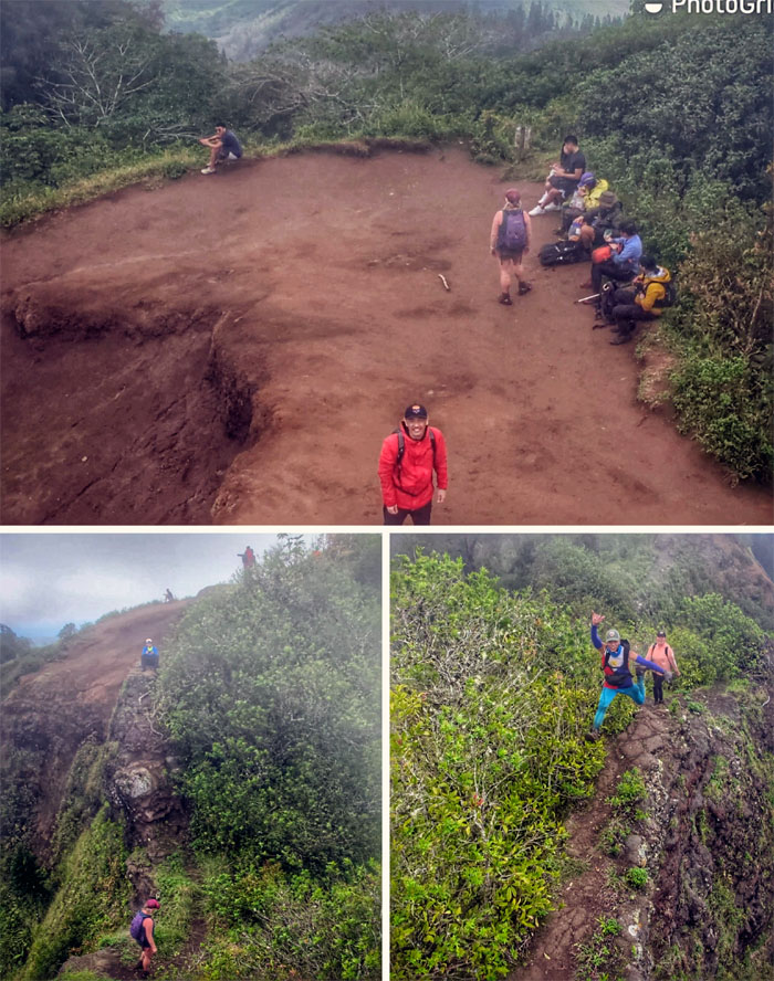
Wiliwilinui Summit
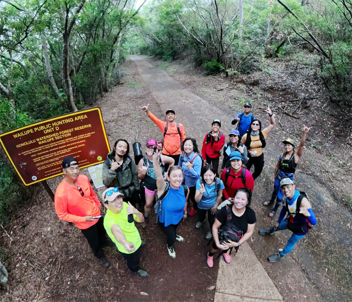
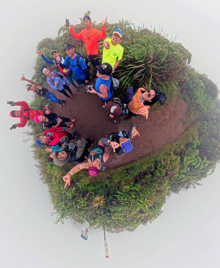
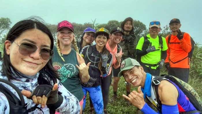
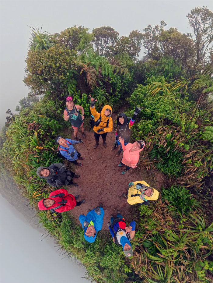
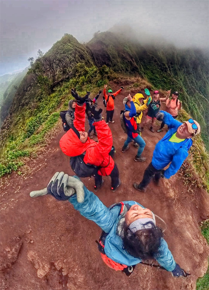
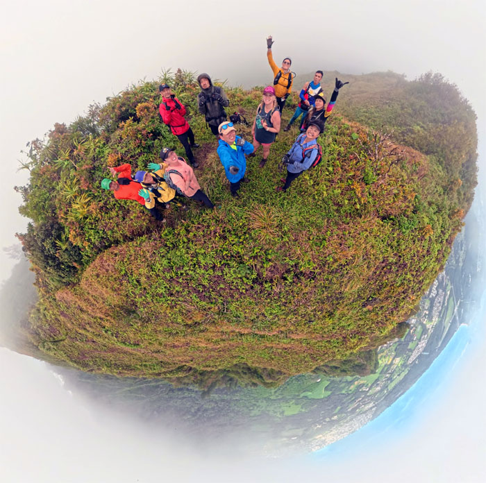
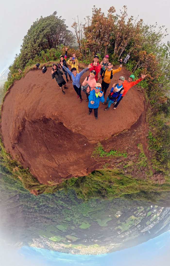
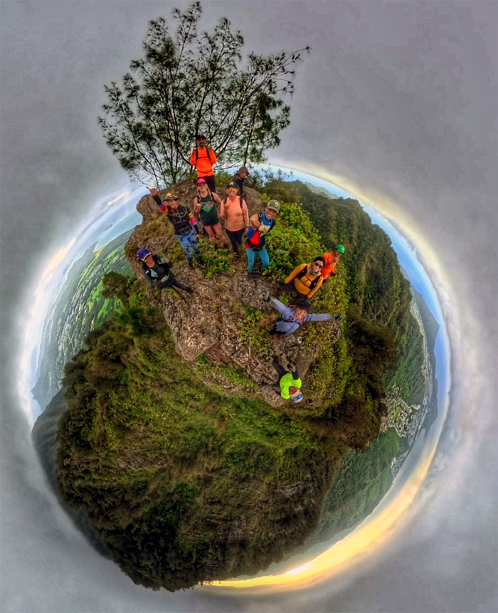
Group photo of the party of sixteen on the 2,700′ summit.
Wiliwilinui Summit
And then they were ten. Edgar, Joyce, Mari, Marilyn, Scott and Tessa departed the summit to go back down the trail. They had places to go and things to do and being on the KST was not one of them.
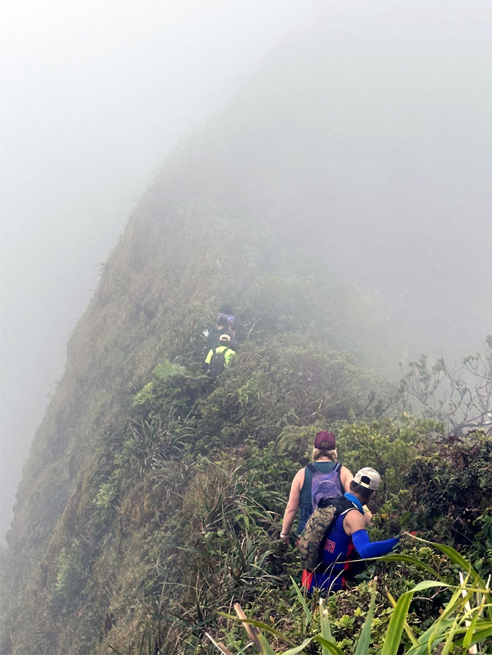
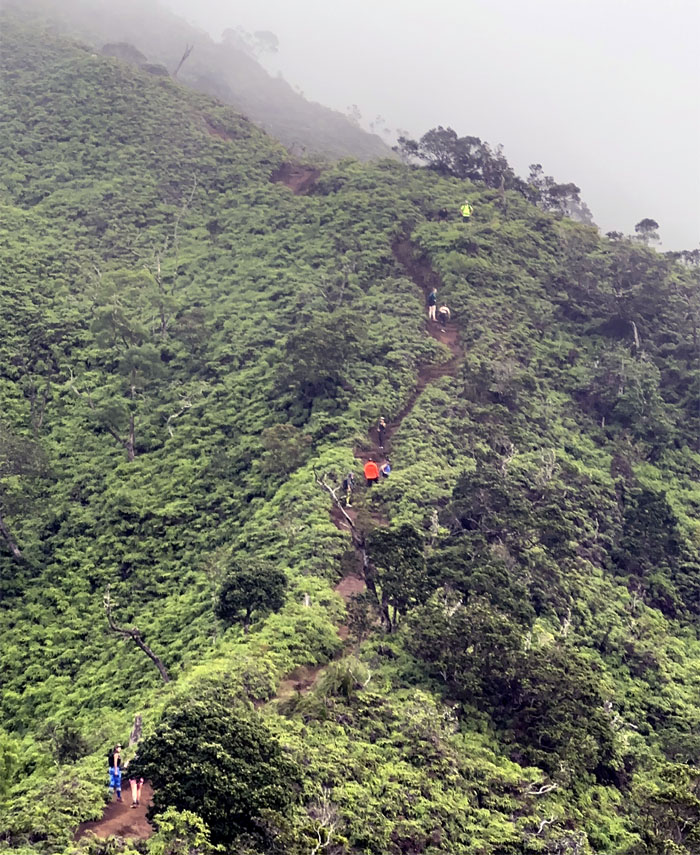
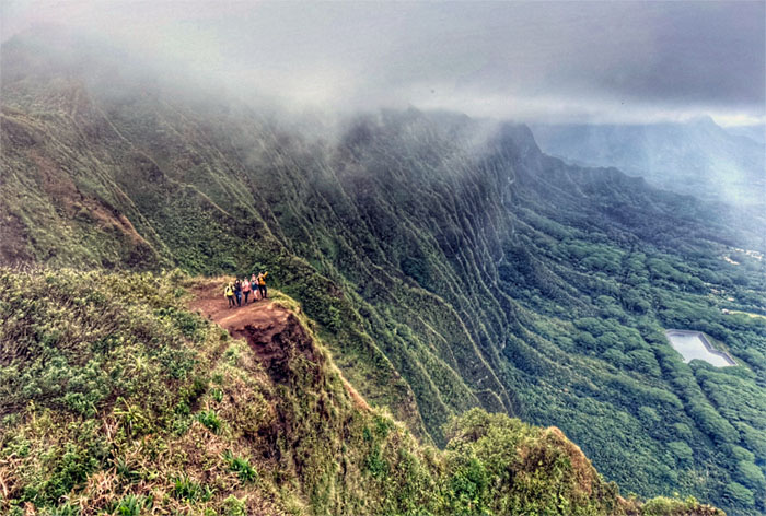
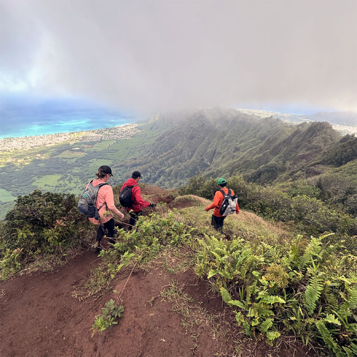
Ko’olau Summit Ridge Trail (KSRT)
Stepping foot on the spine of the Ko’olau Mountains that was shrouded in low hanging clouds which helped people with acrophobia.
KSRT
Capturing the moment before the shorts adjustment.
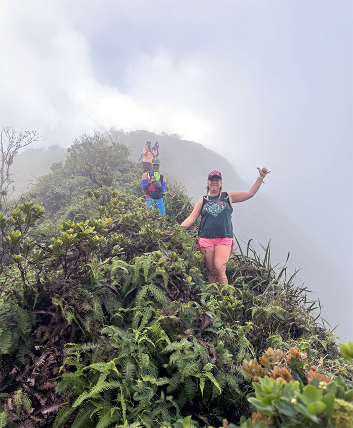
Wailupe Summit
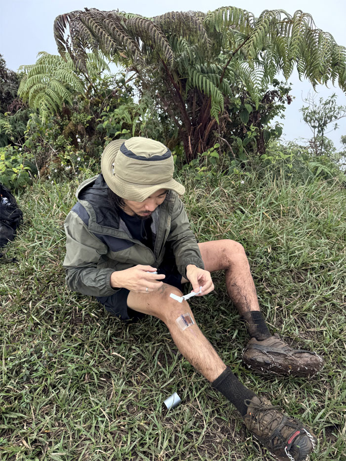
One of countless uses for duct tape, the ubiquitous adhesive that was invented in 1942.
Wailupe Summit
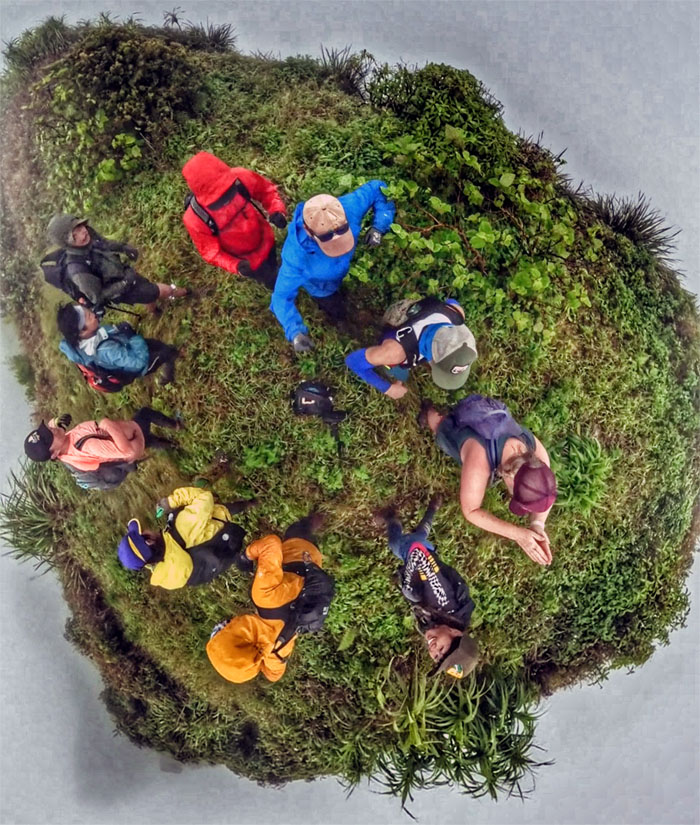
Group photo at the 2,580′ socked in summit.
KSRT
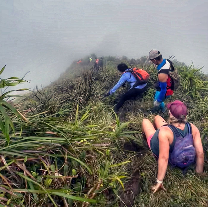
Sliding our way down into the cloud soaked ridge line.

KSRT
Some embraced the slide more than others.
Hawaii Loa Summit
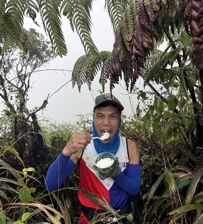
Most people eat trail mix or energy bars on the hike for energy. Ferlino eats rice. Not adobo with rice. Not multi-grain rice. Not brown rice. Just white rice. Carbs.
Hawaii Loa Summit
Enjoying our streak of continuous cloud coverage at the 2,520′ knob.
KSRT
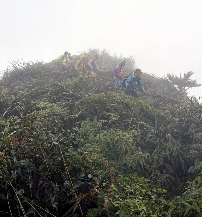
The group making their way down a steep section.
KSRT
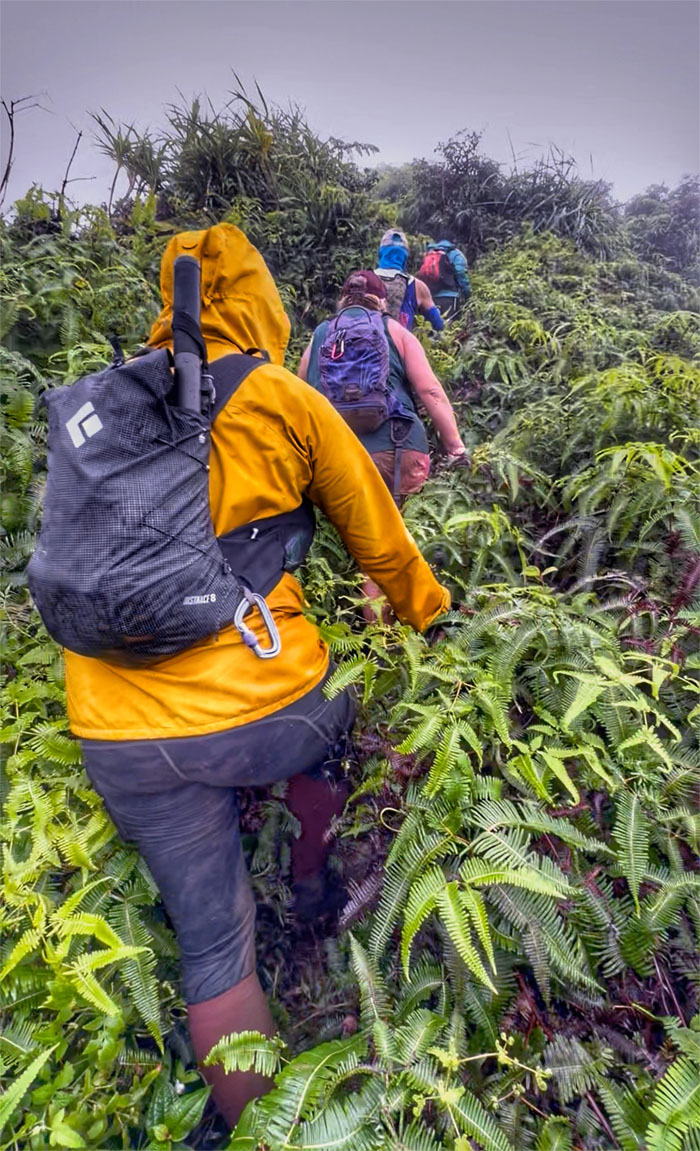
Pushing our way through the thick carpet of the contradictory invasive but indigenous uluhe ferns.
Kulepeamoa Summit
This was the flapping chicken summit and not the clapping chicken summit that tops out at 2,500′. Always one in the crowd.
KSRT
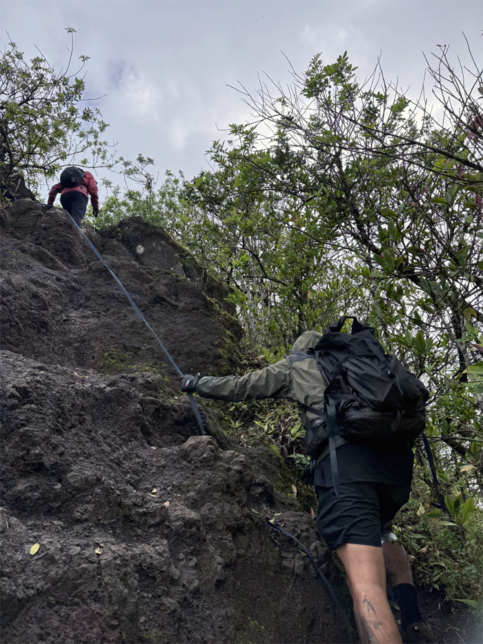
Kenny using an existing webbing to stabilize his descent down another steep section on the ridge line.
KSRT
The rest of the group making their way down the trail.
West Kuli’ou’ou Summit
Somebody was glad we had reached our lunch spot at the grassy hill.
West Kuli’ou’ou Summit
Ferlino enjoying the muted views with his bowl of white rice, where CB soon joined the group to finish out the hike.
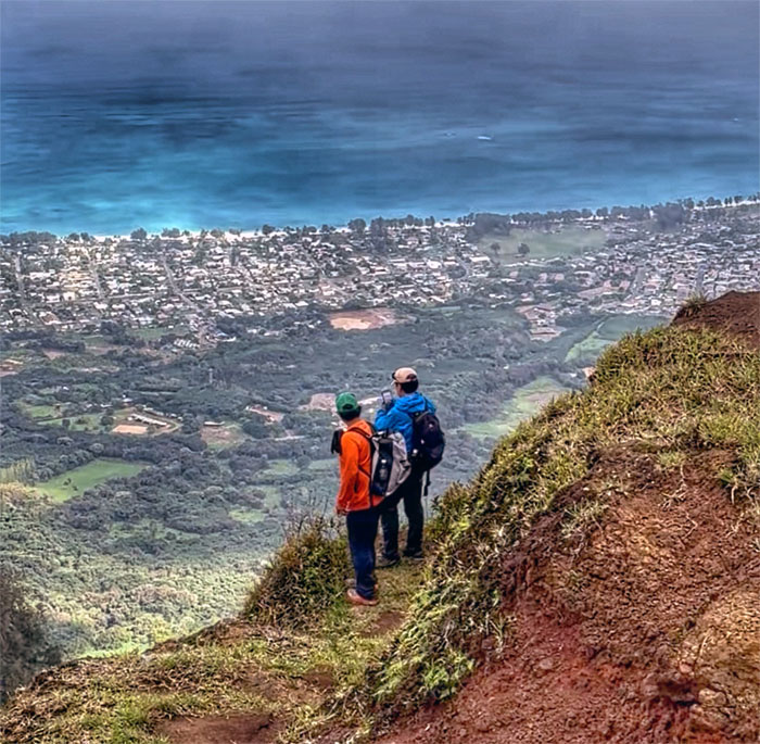
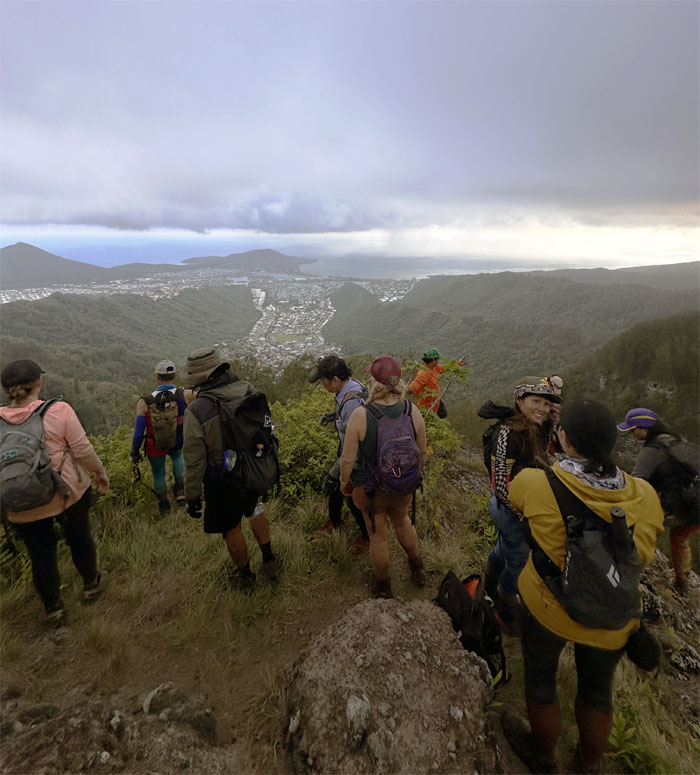
KSRT
Lower elevation translated into the much anticipated views.
KSRT
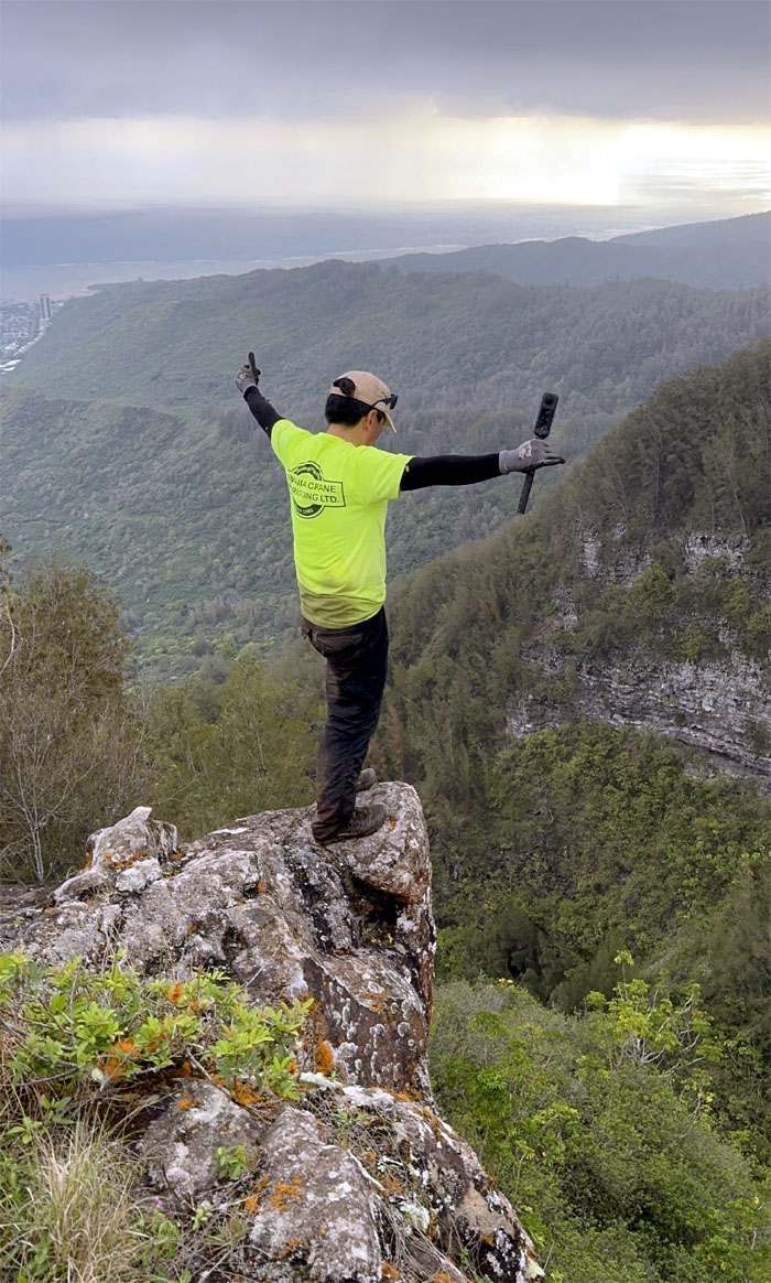
Kenny living life on the edge.
KSRT
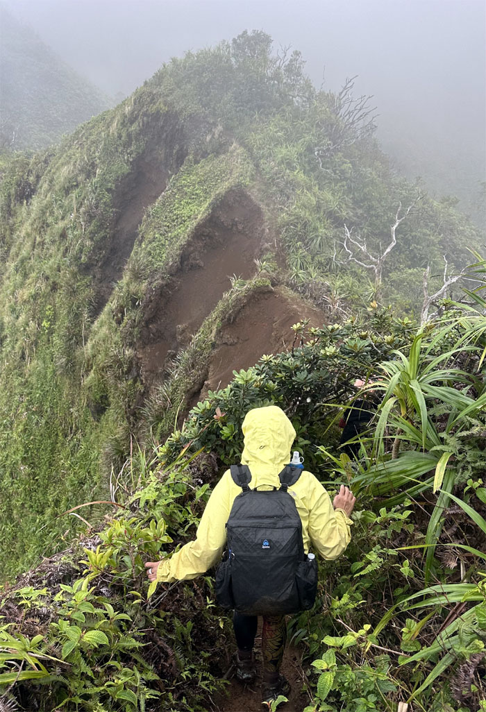
Cristy approaching the scalloped section.
KSRT
Just missing the tent and disco ball.
KSRT
Looking back at the gender segregated photo.
Bear Claw
Checking out the Windward ridge that sprawls down into Waimanalo.
Pu’u O Kona Summit
Close enough for hiking work. Group photo near the 2,200′ flat-topped hill.
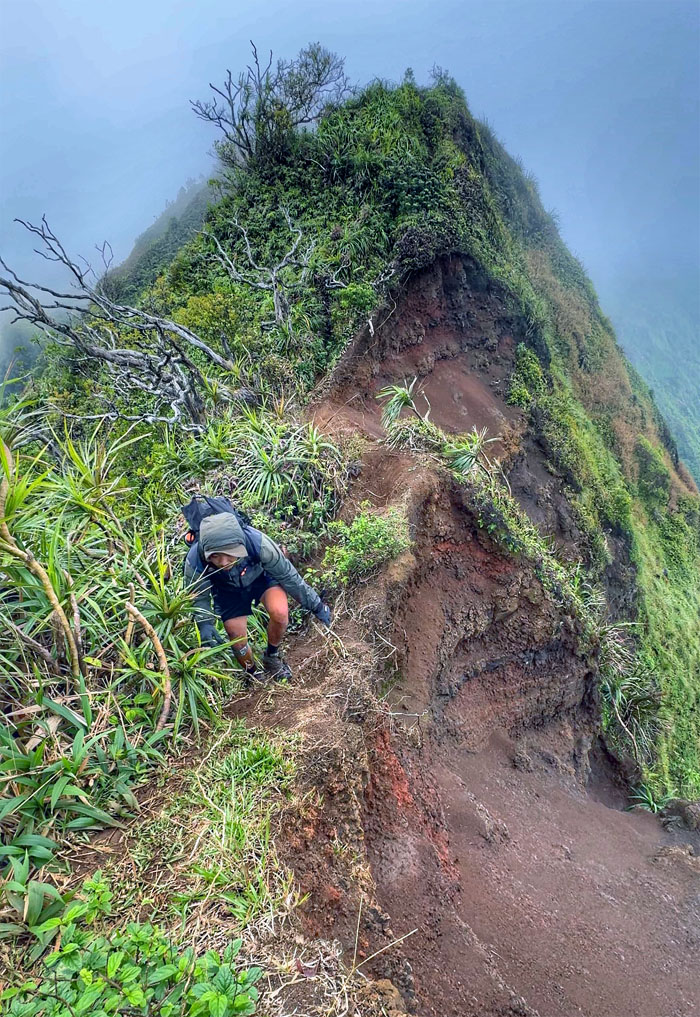
KSRT
Going up the eroded rockface.
KSRT
The rest of the group making their way down the heavily rutted side of the mountain.
Kuli’ou’ou Summit
Arriving at one of the most heavily trafficked trails on the island due to its relative ease of access and sweeping views from the top.
Kuli’ou’ou Summit
Group photo at the 2,028′ eroded hill.
KSRT
Leaving the summit for our last summit of the day.
KSRT
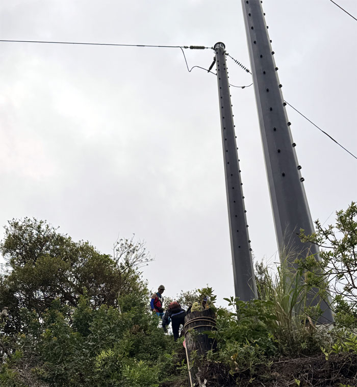
Passing through the first set of power lines on the ridge line.
KSRT
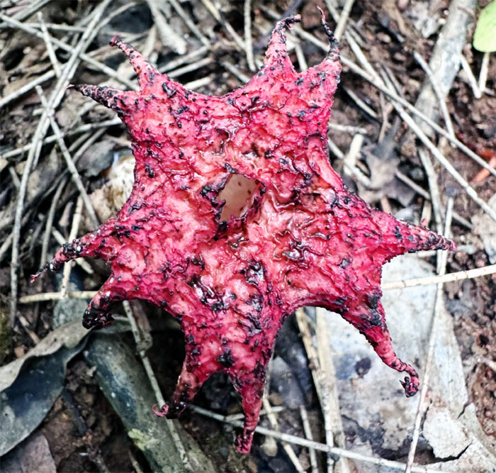
Inspecting this crimson colored starfish fungus, a distant relative of the starfish flower? Didn’t want to subject our olfactory senses to the smell test.
KSRT
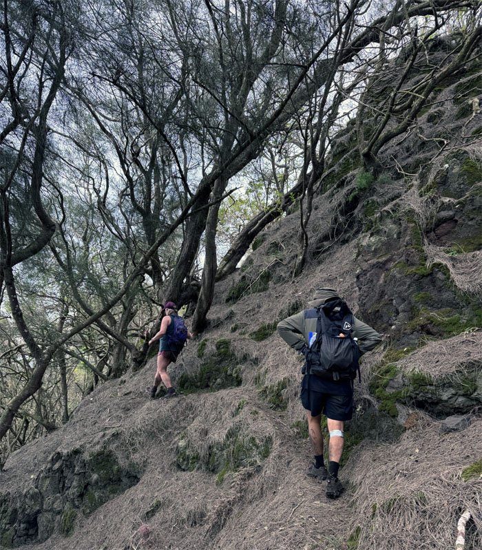
Twists and turns in the forest.
Hahaione Pyramid
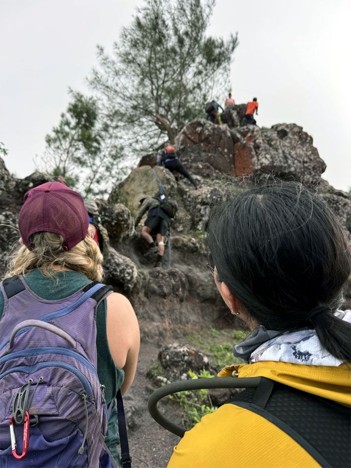
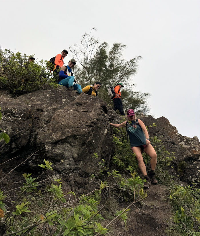
Some took the easy way. Some took the hard way. Depends whose direction you followed.
Hahaione Pyramid
Group photo at the 2,100′ apex of the triangular shaped hill.
Hahaione Pyramid
One has to know their limitations.
Pyramid Trail
Time to beat the sun down.
Pyramid Trail
Descending down the initial steep pitch of the trail, which was a more direct route than the discarded option of the valley route.
Pyramid Trail
Can you see the hiker for the tree?
All pau
We made it down to the valley floor with over an hour of daylight to spare.
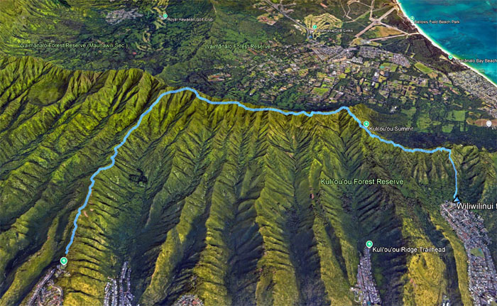
GPS Tracks
Our birthday hike covered 6.86 miles with a fun and large group. Post hike birthday dinner at Gyotaku where we arrived too late for the early bird specials. Happy Birthday Susan!
https://www.youtube.com/watch?v=pH4p3B2uSfY
Video by Edgar Gamiao of our birthday hike.
Photos taken by Aileen Augustin, Akira Suzuki, Allison Banks, Chris Bautista, Cristy CM, Edgar Gamiao, Ferlino Carinio, Joyce Uhlmer, Kenny Lui, Mari Saito, Marilyn Bermudez, Robin Farr, Scott Dea, Susan Katz, Tessa Bugay, Val Wang, and yours truly. Not necessarily in order.
Note: I have been made aware that some hikers have been using my blog as a hiking guide and getting lost on the trails. Please note that this blog was made to document the hike for the crew(s) that did it. That is why some of my comments will seem to have no relevance or meaning to anybody outside of the crew(s) that hiked that trail. My blog was never meant as a hiking guide, so please do not treat it as such. If you find inspiration and entertainment from these hikes, that is more than enough. If you plan on replicating these hikes, do so in the knowledge that you should do your own research accordingly as trail conditions, access, legalities and so forth are constantly in flux. What was current today is most likely yesterdays news. Please be prepared to accept any risks and responsibilities on your own as you should know your own limitations, experience and abilities before you even set foot on a trail, as even the “simplest” or “easiest” of trails can present potential pitfalls for even the most “experienced” hikers. One should also always let somebody know of your hiking plans in case something doesn’t go as planned, better safe than sorry.
{ 2 comments… read them below or add one }
Happy Birthday Susan! Nice hike and happy to be home again. Always great hiking with everyone.
Aloha Ferlino,
Welcome back!
Mahalo