
Day 1
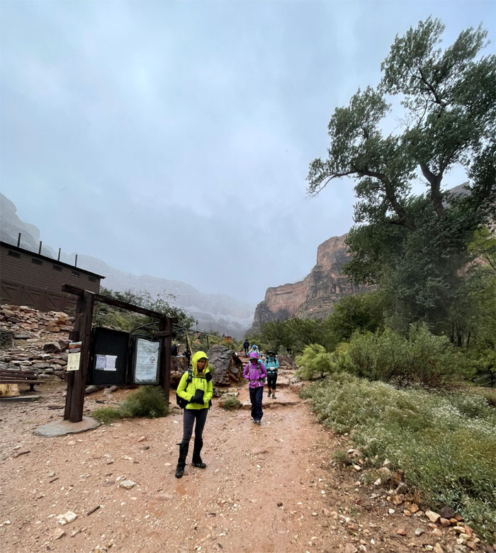
We parked our car and walked to the trailhead in the nippy morning to start our three day hike in the canyon. Well, actually some of us got dropped off and one of us walked to the trailhead. Photo by Lilyn Avendano.
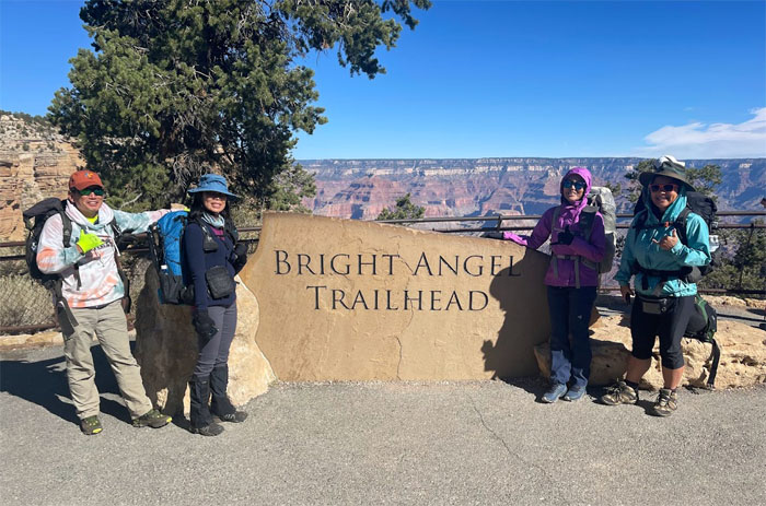
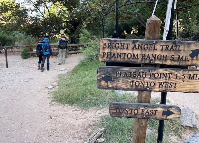
Bright Angel Trailhead
Group photo at the trailhead sign. The trail was turned over from private hands to the National Park Service in 1928.
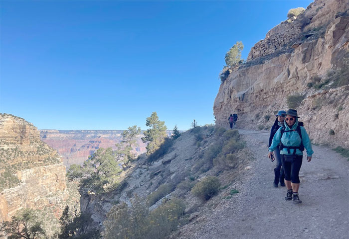
Bright Angel Trail
We left the Grand Canyon Village as we descended down the switchbacks from the 6,785′ rim. Photo by Lilyn Avendano.
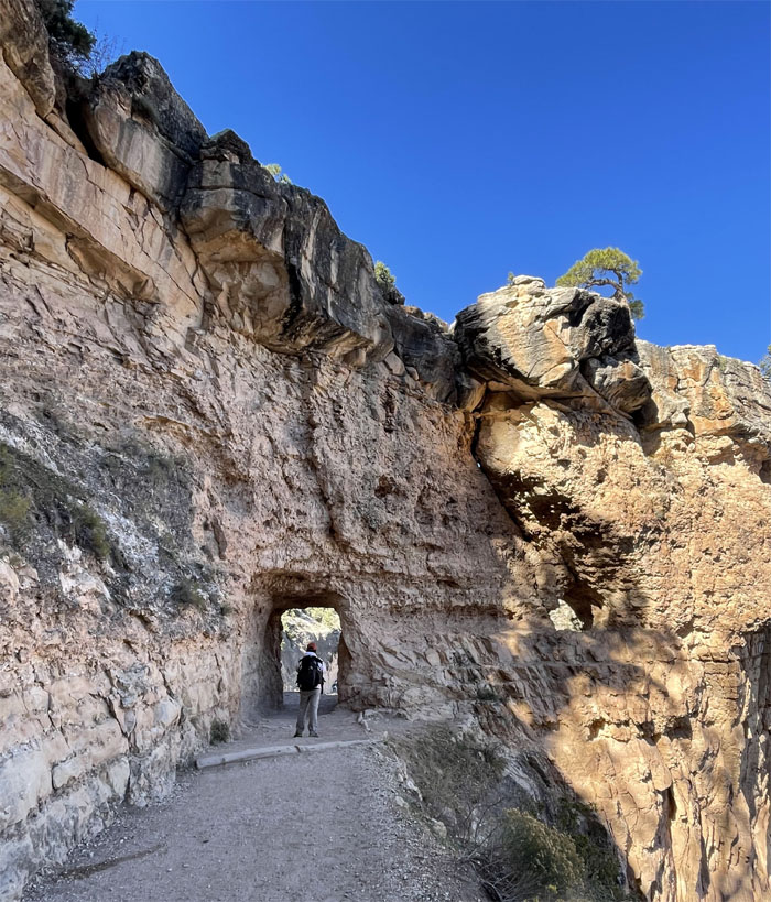
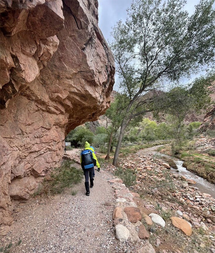
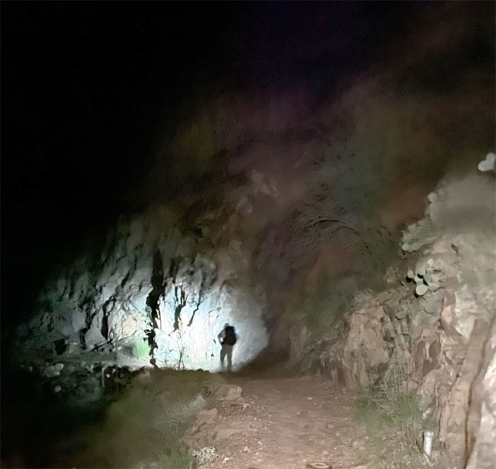
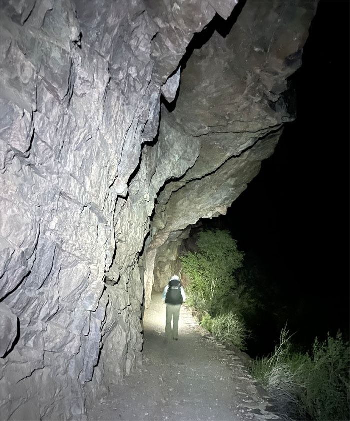
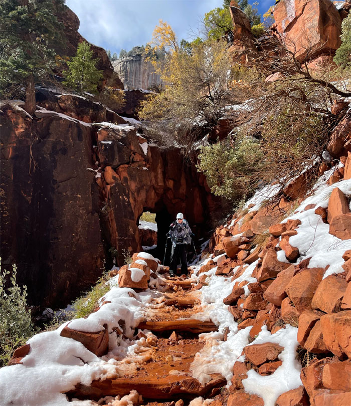
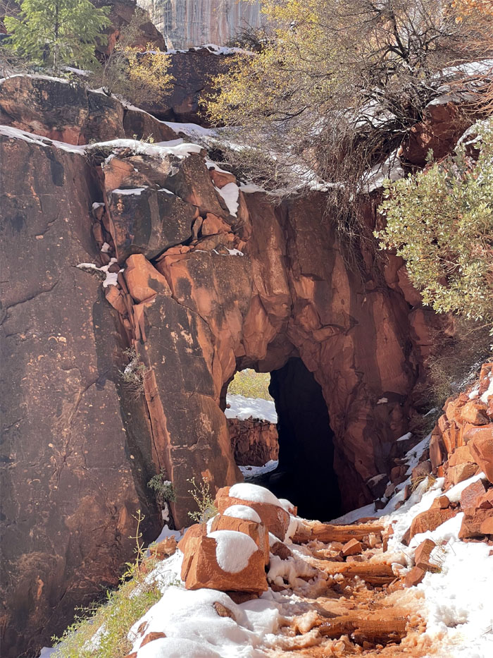
Bright Angel Trail
Passing through one of two tunnels on the trail. Photo by Lilyn Avendano.
Bright Angel Trail
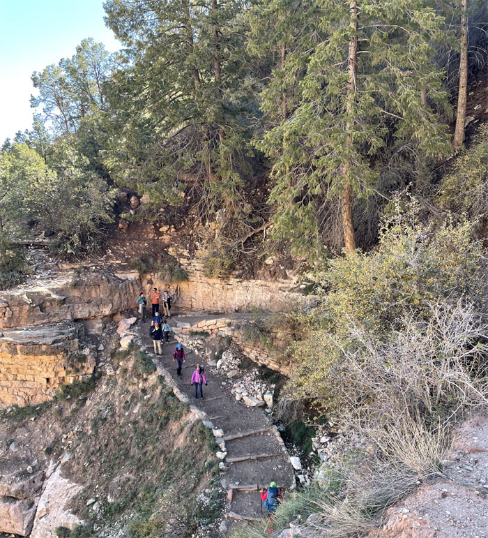
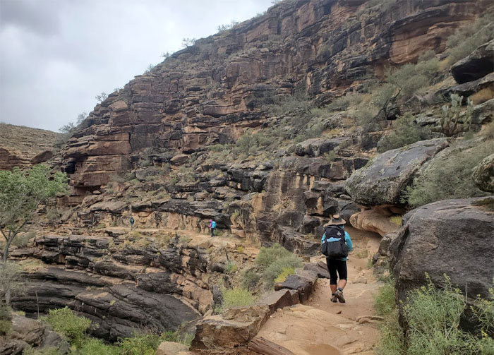
Going down the switchback trail that was originally built by the Havasupai people to access the water down in Garden Creek. Photo by Quan Haberstroh.
Bright Angel Trail
Hiking down the path that was originally called Cameron’s Trail after the person that improved upon the existing trail and charged a dollar toll to use it. Photo by Lilyn Avendano.
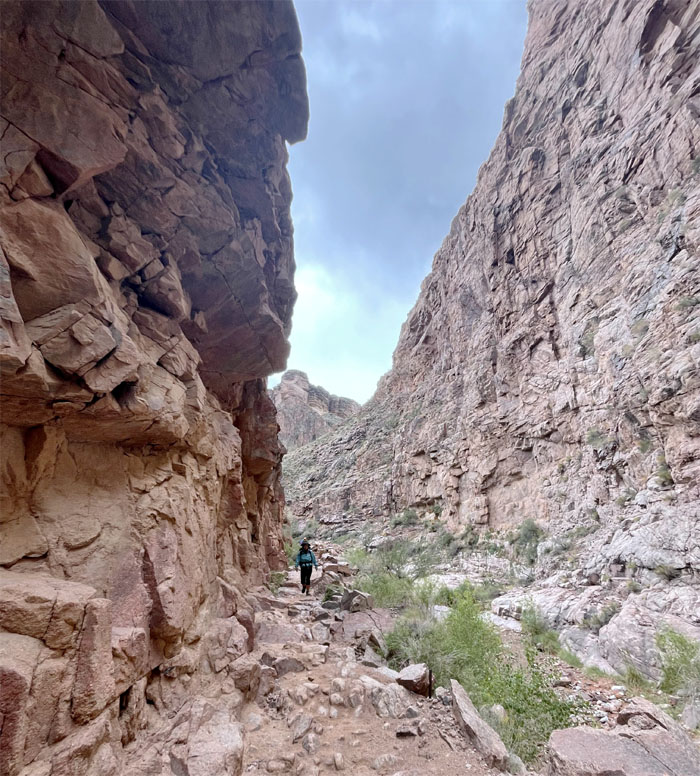
Bright Angel Trail
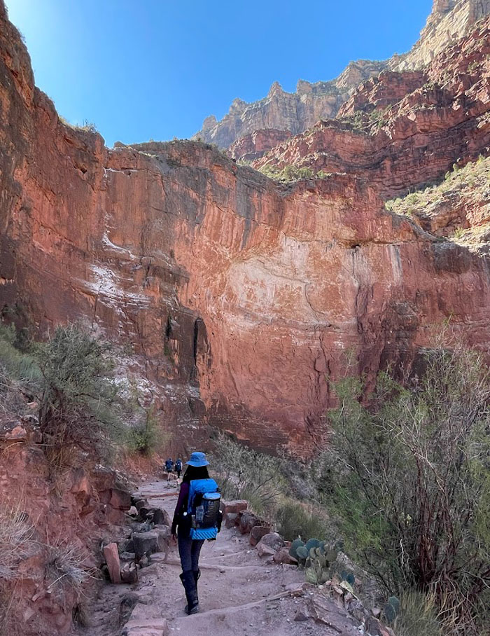
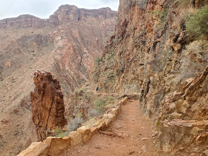
The trail hugged the towering canyon walls of Coconino sandstone.
Mile-and-a-half Resthouse
Dropping down towards the 1.5 mile marker and resthouse perched at 5,720′.
Mile-and-a-half Resthouse
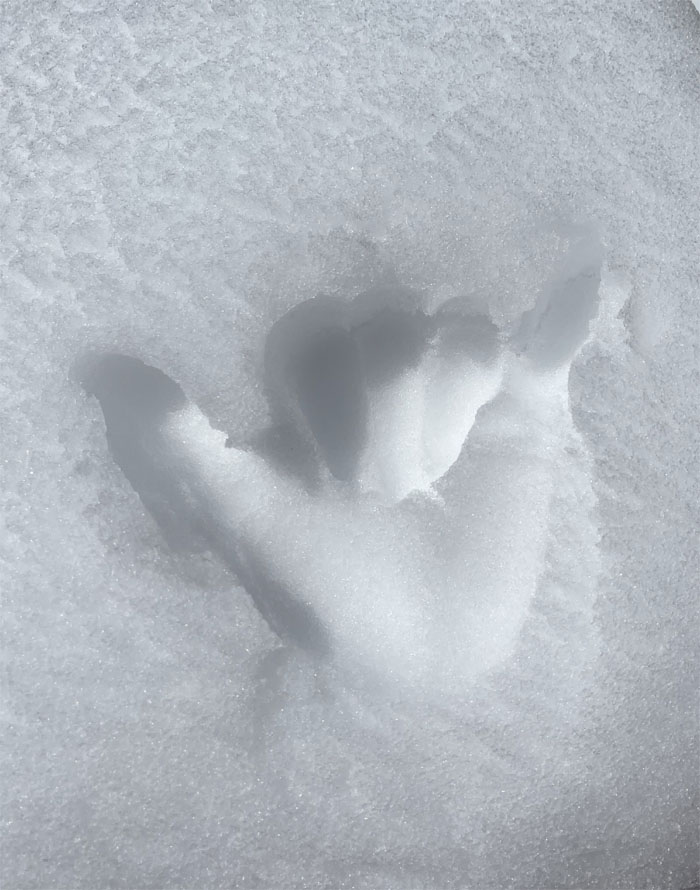
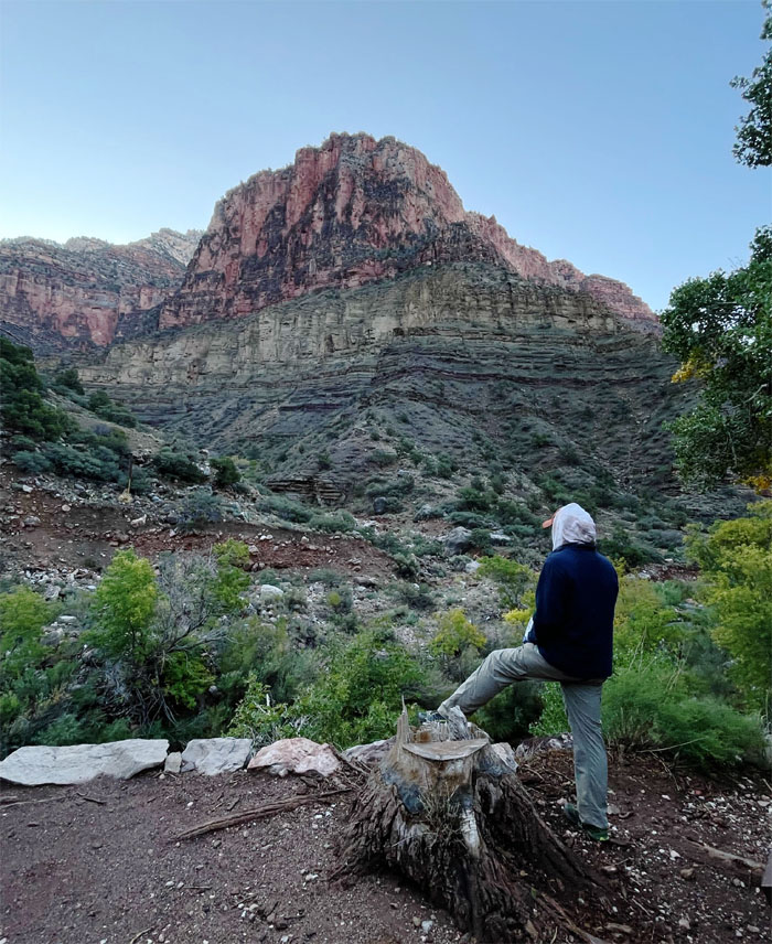
Did somebody wash their hands? Asking for the squirrel.
Bright Angel Trail
Group photo at a scenic spot. Monkey see, Monkey do. Other hikers soon followed suit.
Bright Angel Trail
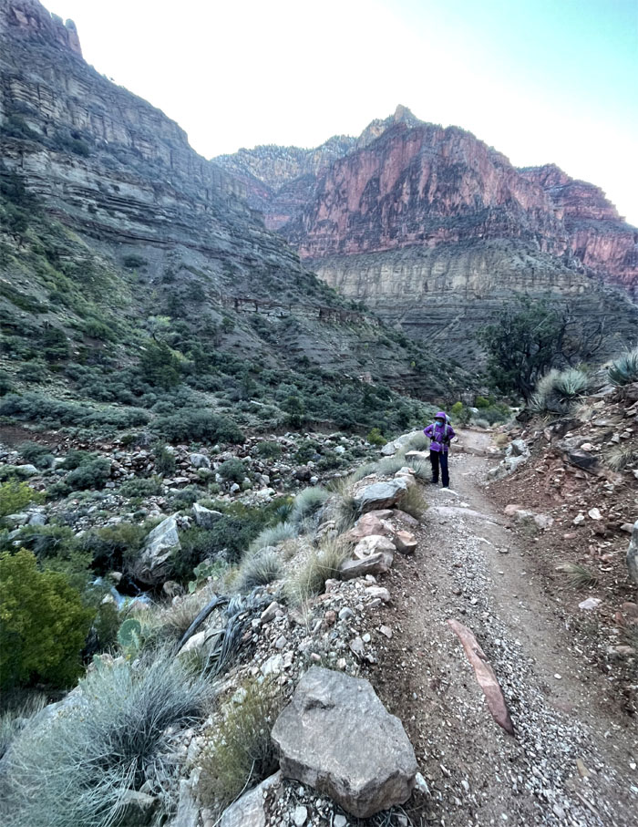
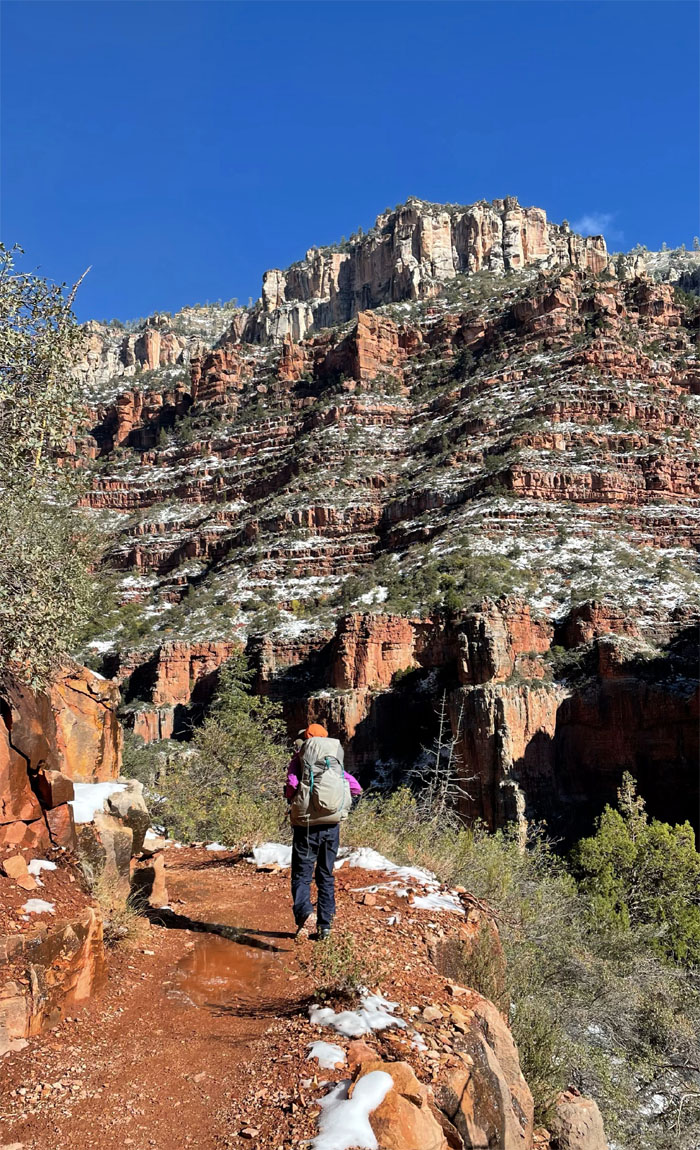
Hiking down the well graded and maintained trail. Quite a departure from Hawaii trails. Photo by Aida Gordon.
Bright Angel Trail
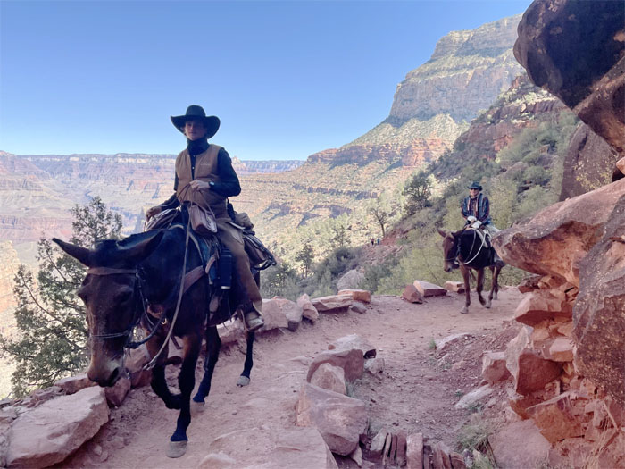
Mules have priority on the trails, plus they are bigger. So we made way for the beasts of burden.
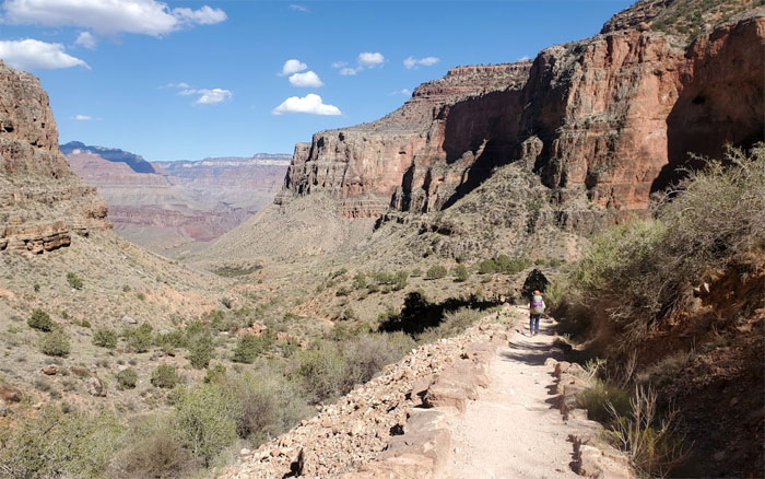
Bright Angel Trail
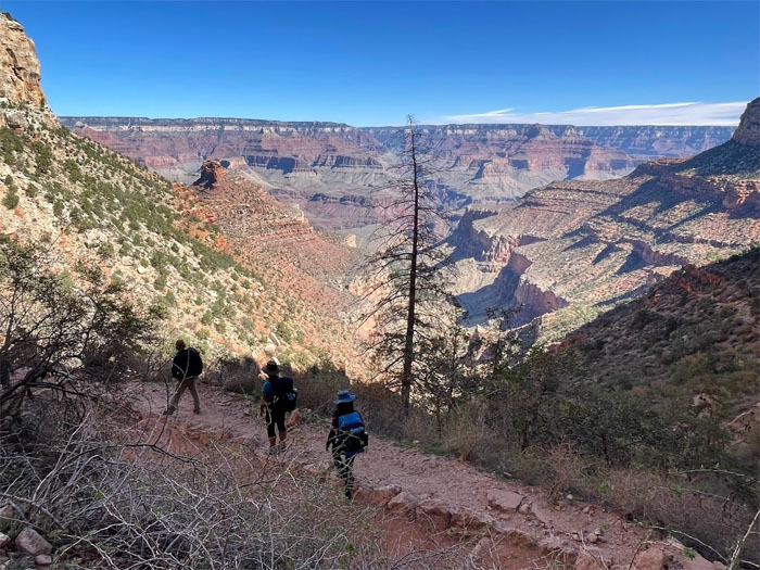
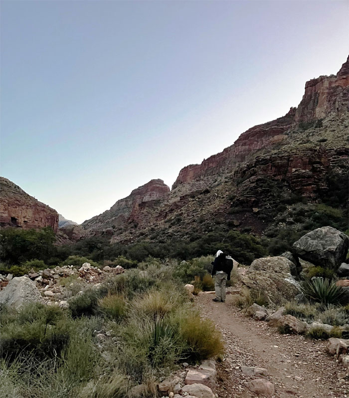
The trail has an average grade of 10% going down but the canyon views were always 100%.
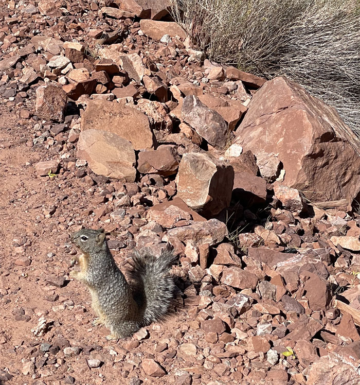
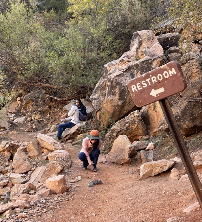
Rock Squirrel
The most dangerous animal in the canyon based on local emergency room visits. Believe it or not!

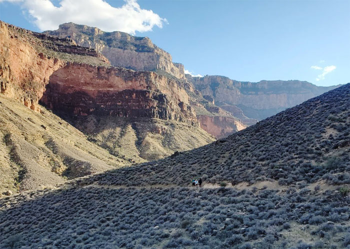
Three Mile Resthouse
Last chance to rest in the shade at 4,760′ elevation or fill up on water before the campground.
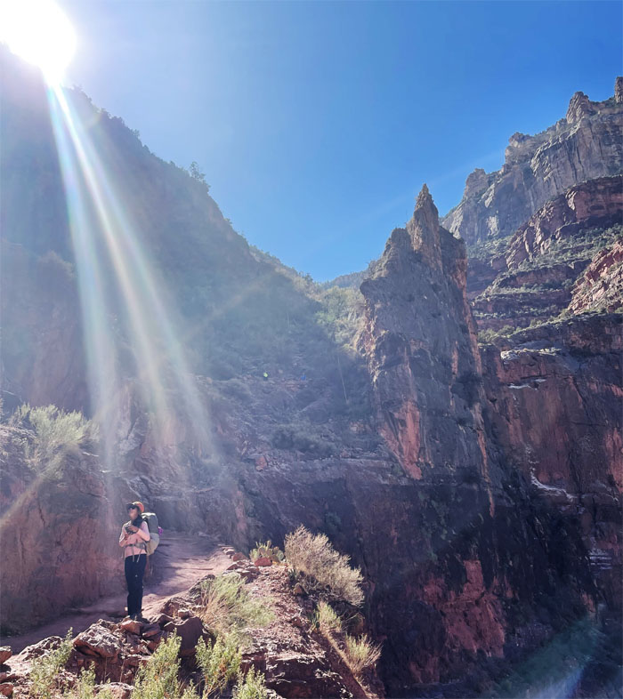
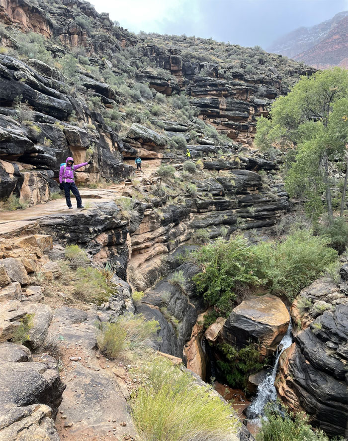
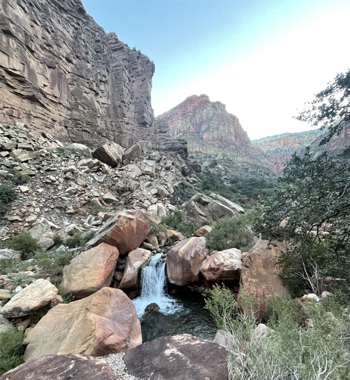
Bright Angel Trail
Passing through the cascading sunshine falls.
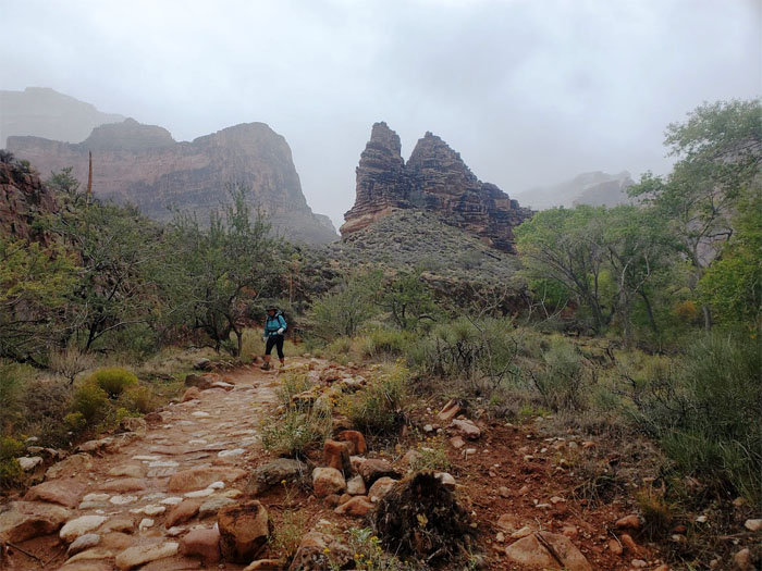
Bright Angel Trail
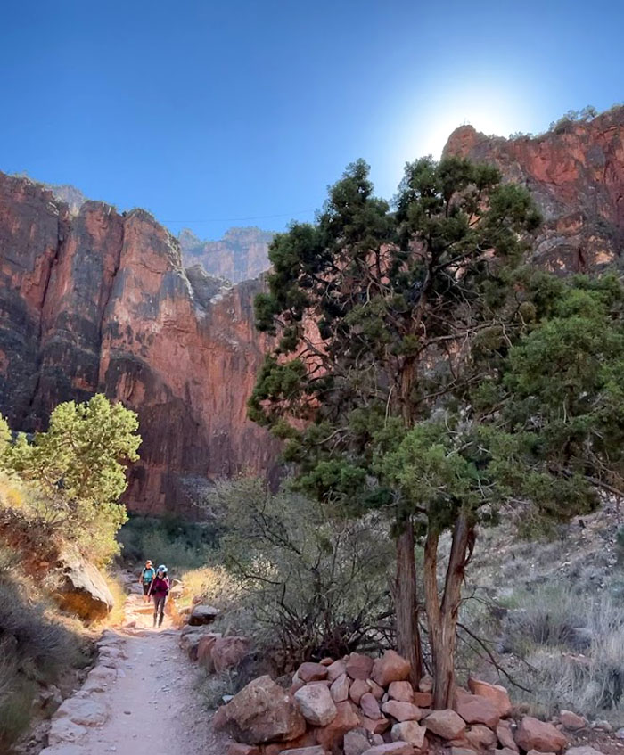
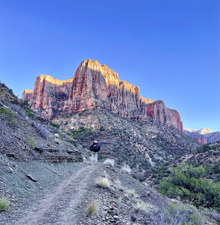
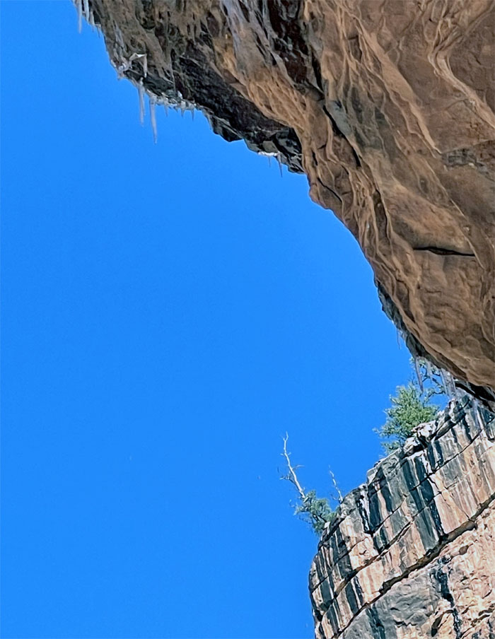
Approaching a cliff apparently spackled with snow as we went down Jacob’s Ladder, but it was just mineral coloration. We would see the real thing two days later. Photo by Lilyn Avendano.
Bright Angel Trail
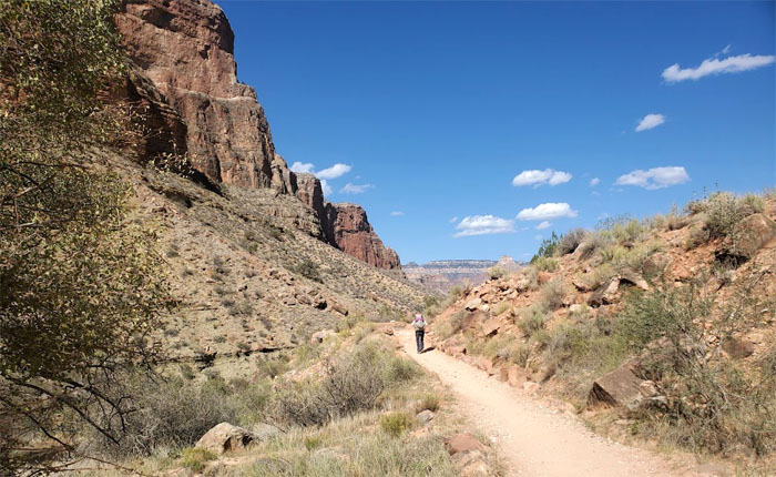
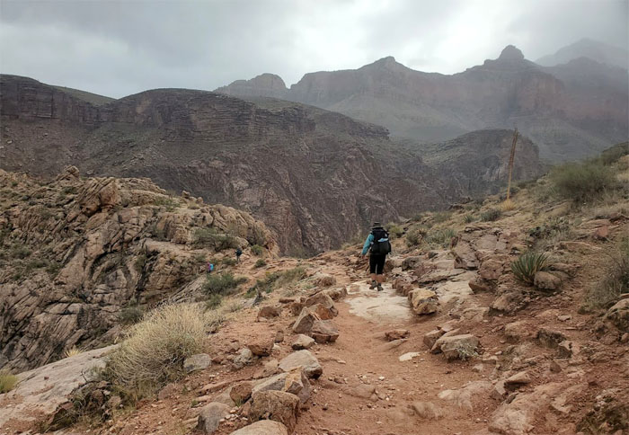
The steepness of the switchbacks soon dropped off as the trail began to level off, along with the dwindling traffic.
Bright Angel Trail
Leaving the almost 100 switchbacks behind us. I don’t think we were counting. Photo by Lilyn Avendano.
Bright Angel Trail
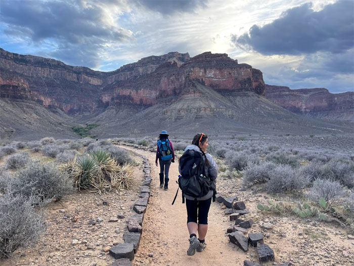
The temperature in the canyon became noticeably warmer as we dropped down in elevation. Photo by Aida Gordon.
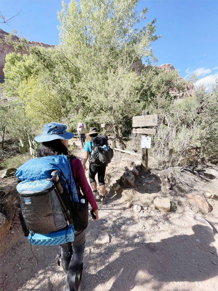
Indian Gardens
Leaving the trail to find a campsite for the night. This area was originally inhabited by the Havasupai people who were forced out by President Roosevelt back in 1928.
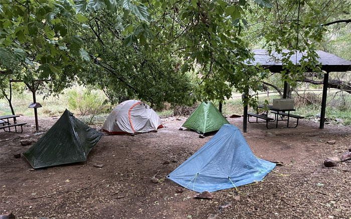
Indian Gardens
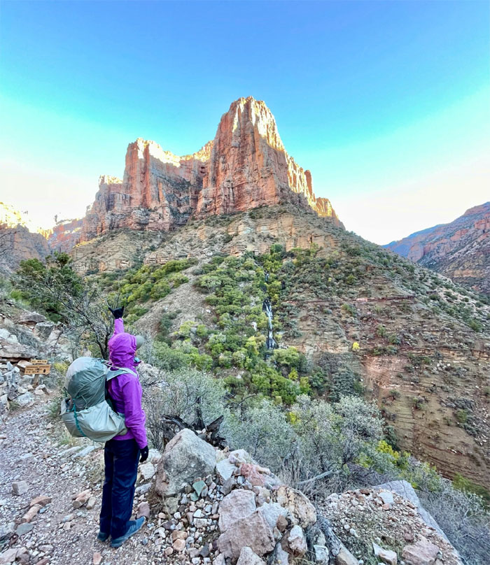
We pitched our tents at 3,800′ elevation with clean bathrooms and drinking water. A hiker we had met earlier on the trail had advised us to check out Plateau Point, so off we went to go look for the highly recommended vista.
Plateau Point Trail
Checking out the thermometer, which showed a comfortable 80 plus degrees. The temperature in the canyon often is 30 degrees lower than the top. Photo by Lilyn Avendano.
Plateau Point Trail
Hiking the mostly flat trail whose sandstone was covered with mostly grass. Photo by Aida Gordon.
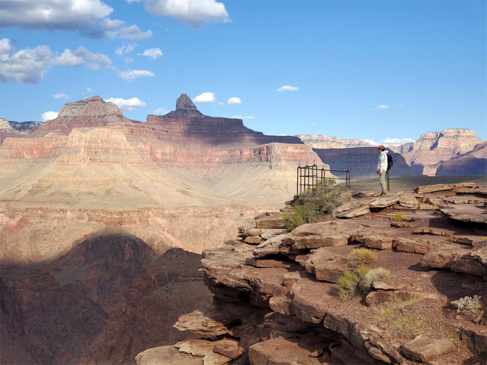
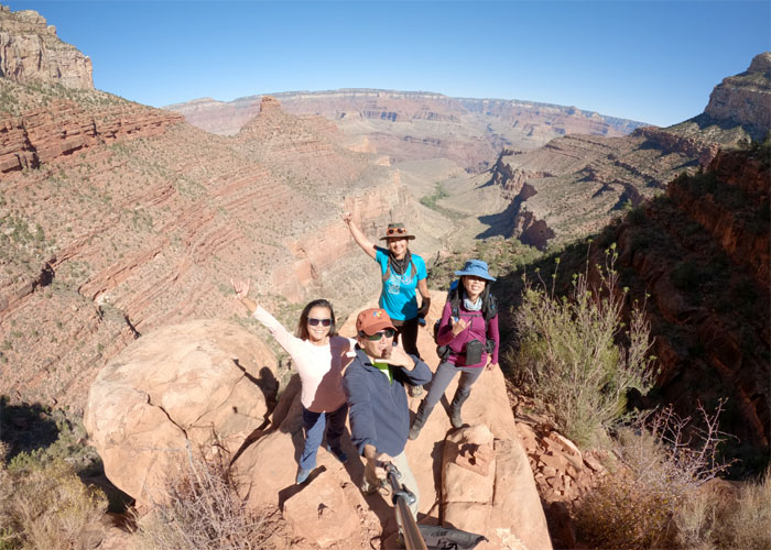
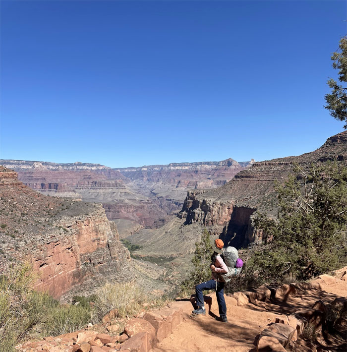
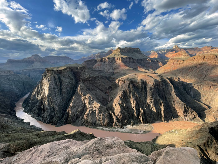
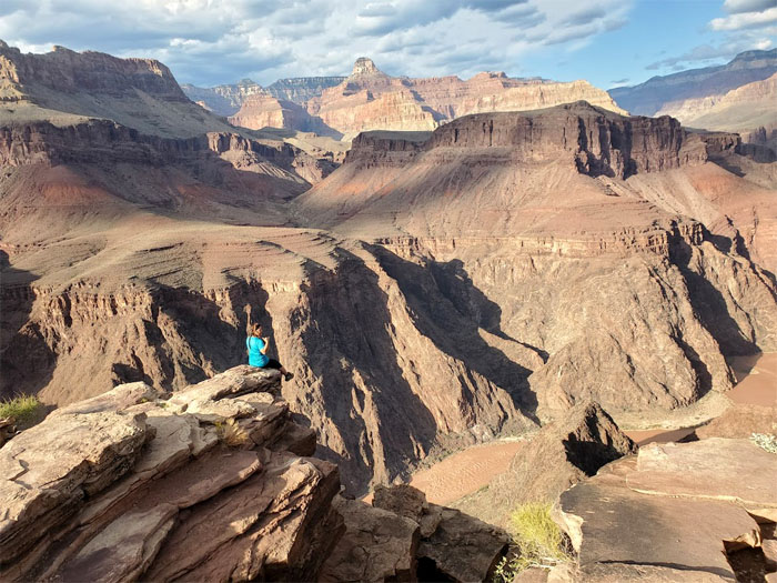
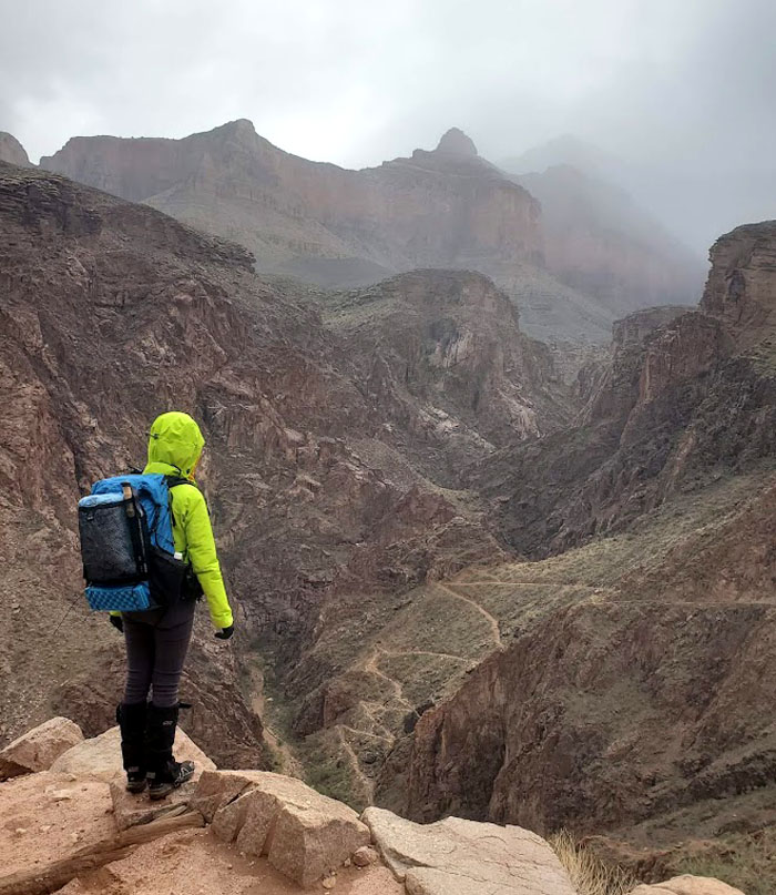
Plateau Point
Checking out the spectacular views at 3,770′ elevation. The winds were kicking something fierce. Photo by Aida Gordon.
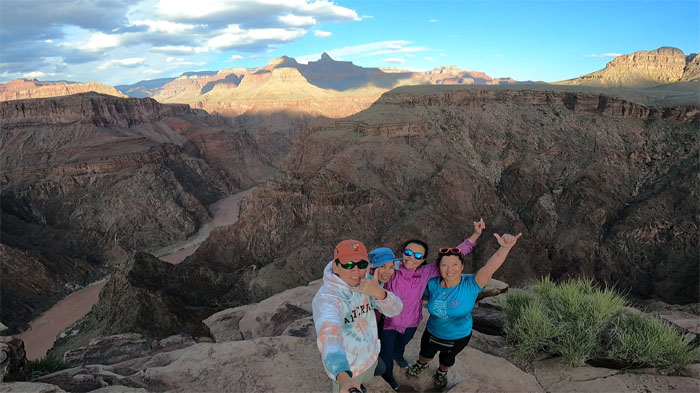
Plateau Point
Group photo with the rugged cliffs of Granite Gorge behind us.
Plateau Point
Looking down at the inner gorge composed of the oldest rocks in the canyon.
Plateau Point
There are supposed to be 71 California Condors calling the canyon home. We only saw two legged hikers on their gluteus at the point. Photo by Lilyn Avendano.
Plateau Point
How do I get down? Photo by Quan Haberstroh.
Plateau Point
Quan enjoying the 360 views of the canyon. Photo by Aida Gordon.
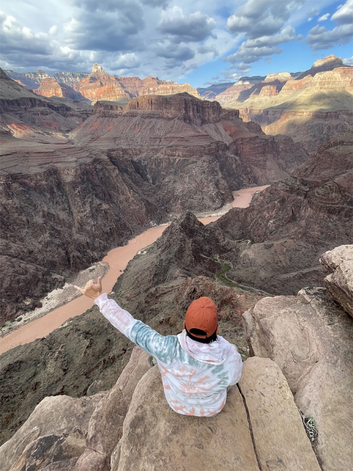
Plateau Point
The side hike was definitely worth the trip. Photo by Lilyn Avendano.
Plateau Point
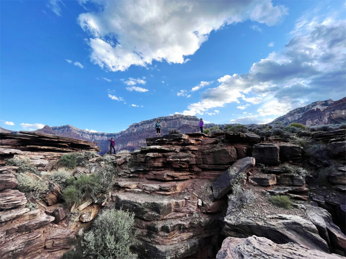
Some folks finally got off their gluteus and started to use their bipedal abilities.
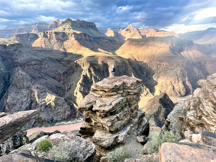
Plateau Point
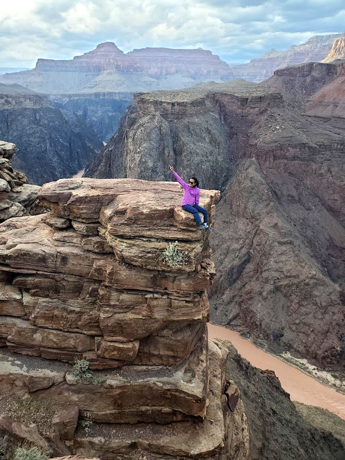
Standing on one of the isolated rocks. Photo by Lilyn Avendano.
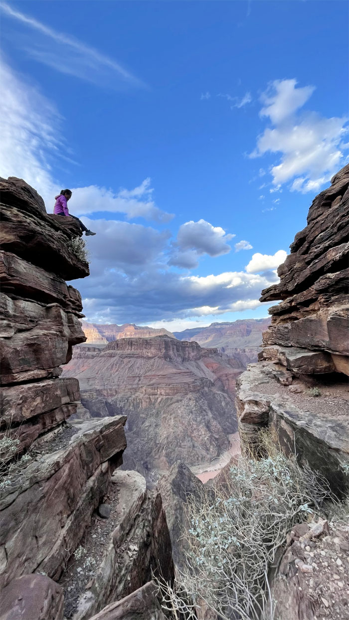
Plateau Point
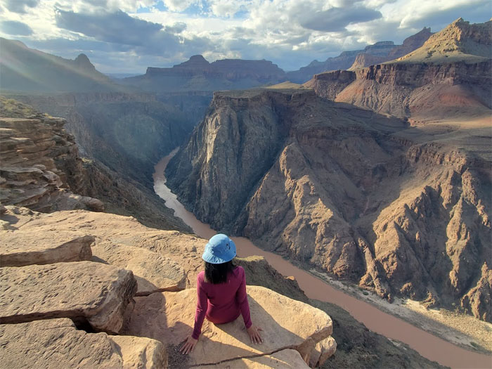
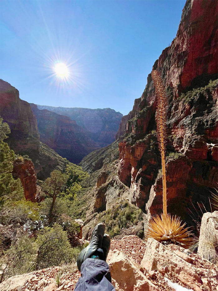
Lilyn dangling her feet 1,300′ above the Colorado River.
Plateau Point Trail
Leaving the windy lookout. Photo by Lilyn Avendano.
Plateau Point Trail
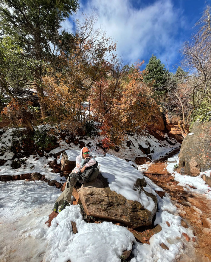
We hiked back to our campsite to cook our dinner and retired for the night as the forecasted freezing rain made good on its arrival. Photo by Aida Gordon.
Bright Angel Trail
Day 2
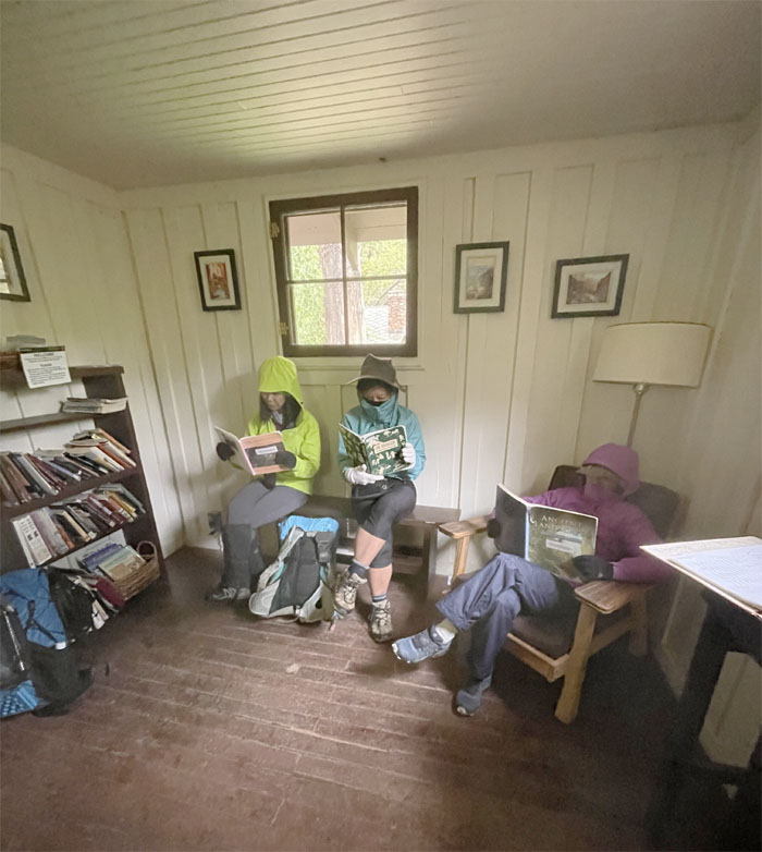
We packed our wet tents and broke down camp the next morning, some slower than the others. Stopped in the Grand Canyon Book of the Month Club as they were having their weekly reading.
Bright Angel Trail
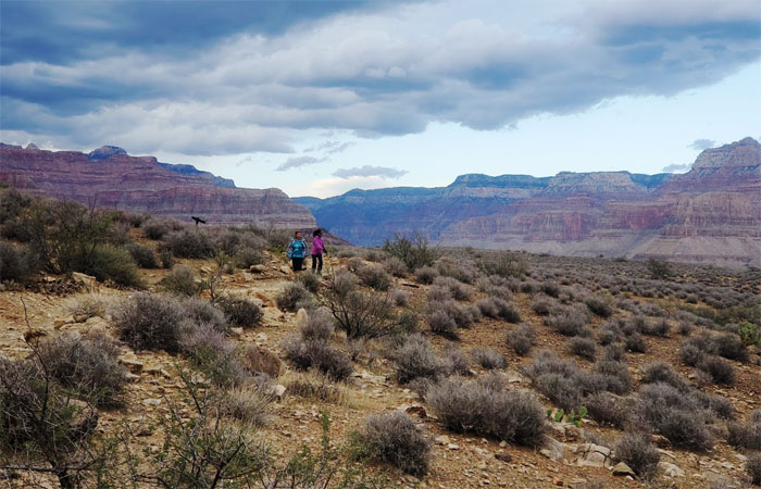
Enjoying our morning walk in the leftover rain from last night. Luckily, the temperature was just in the low 50s. Cold but not freezing.
Bright Angel Trail
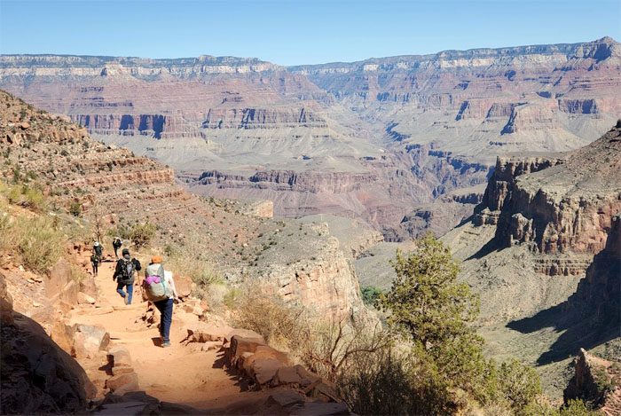
We began to encounter hikers coming from the opposite direction, but nothing that constituted a traffic jam. Photo by Aida Gordon.
Bright Angel Trail
The trail follows Bright Angel Creek which dumps into the Colorado River.
Bright Angel Trail
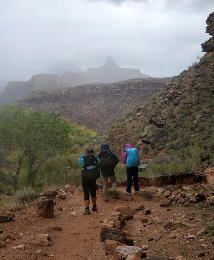
Looking ahead to the cloud soaked horizon rim. Photo by Aida Gordon.
Bright Angel Trail
Making our way through the rock formations shaped by erosion in the form of water and wind. Photo by Aida Gordon.
Bright Angel Trail
Going down to a dip in the trail that had a small waterfall to our left. Photo by Aida Gordon.
Bright Angel Trail
Aida looking down at the series of switchbacks known as Devils Corkscrew. Photo by Lilyn Avendano.
Bright Angel Trail
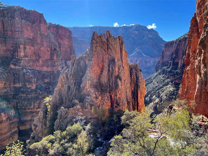
Descending down the trail past an isolated rock tower that had to be climbed and sat on. Photo by Aida Gordon.
Bright Angel Trail
Quan making her way down the trail.
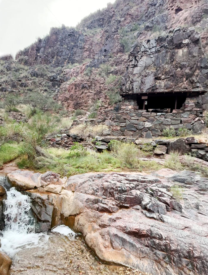
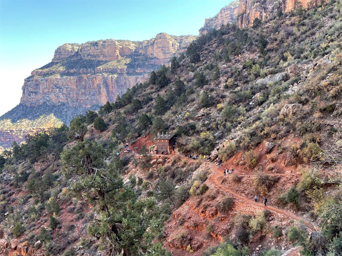
River Resthouse
Stopped at the stone structure to bone up on the history and sign the log book.
River Resthouse
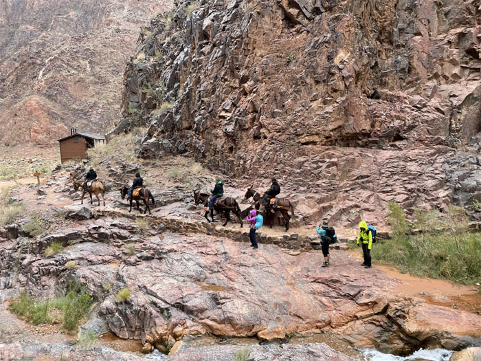
The girls making way for the pack of mules.
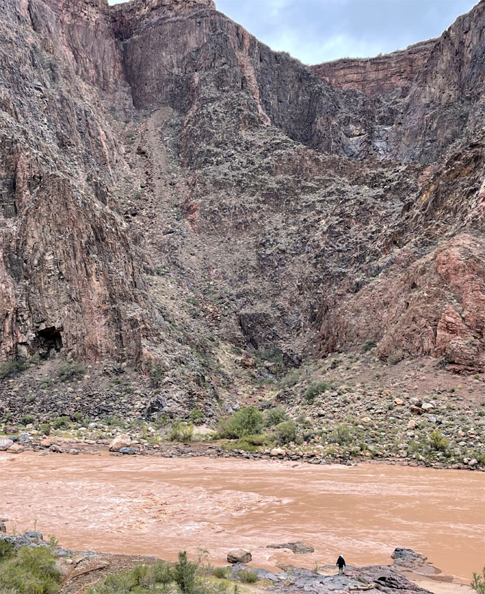
Pipe Creek Beach
First contact with the powerful Colorado River that carved and shaped this canyon. The 1,450 mile long river starts from the Rocky Mountains before draining into the Gulf of California. Photo by Lilyn Avendano.
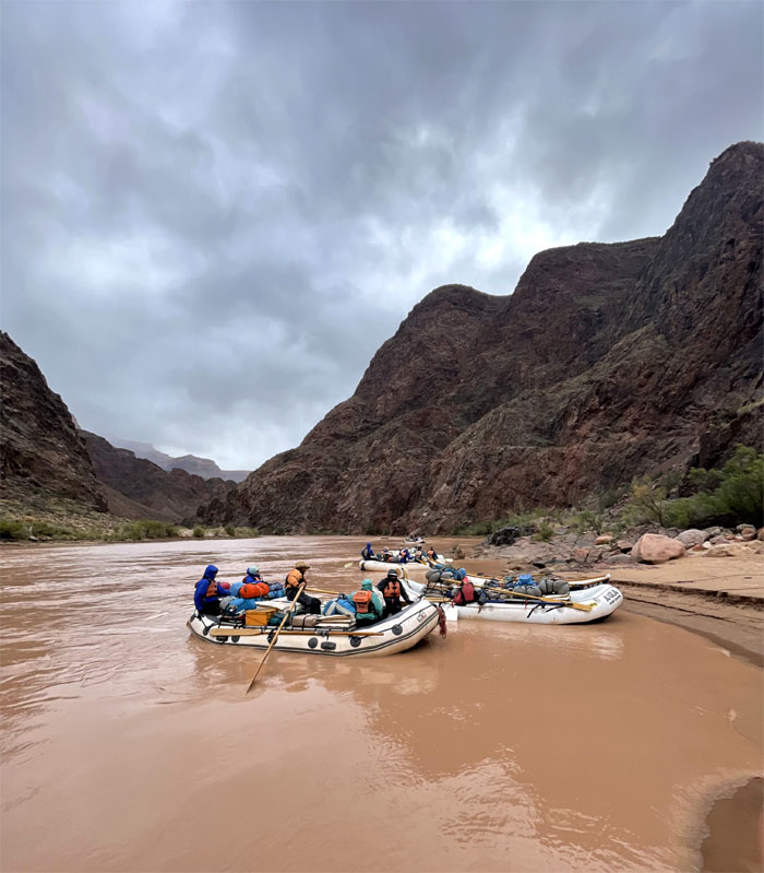
Pipe Creek Beach
A group of rafters making shore and linking up with the rest of their party that had hiked down from the South Rim.
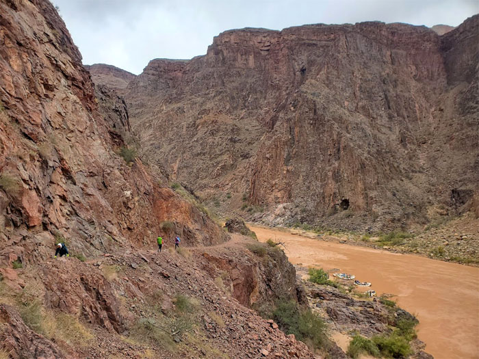
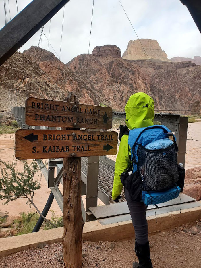
River Trail
Going up the connector trail that links Bright Angel Trail to North Kaibab Trail. Photo by Aida Gordon.
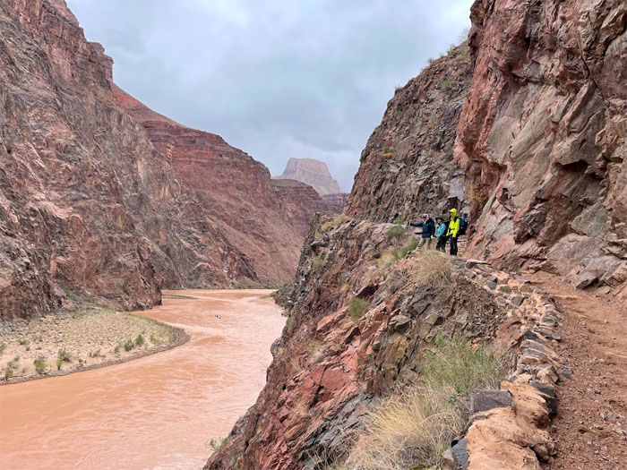
River Trail
Photo by Lilyn Avendano.
River Trail
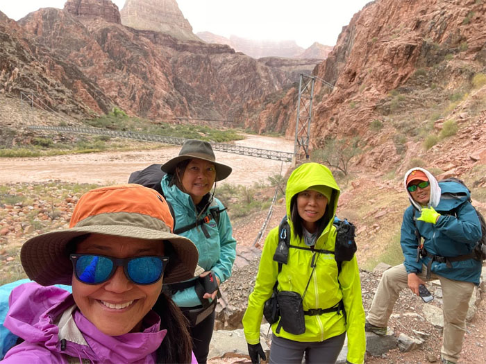
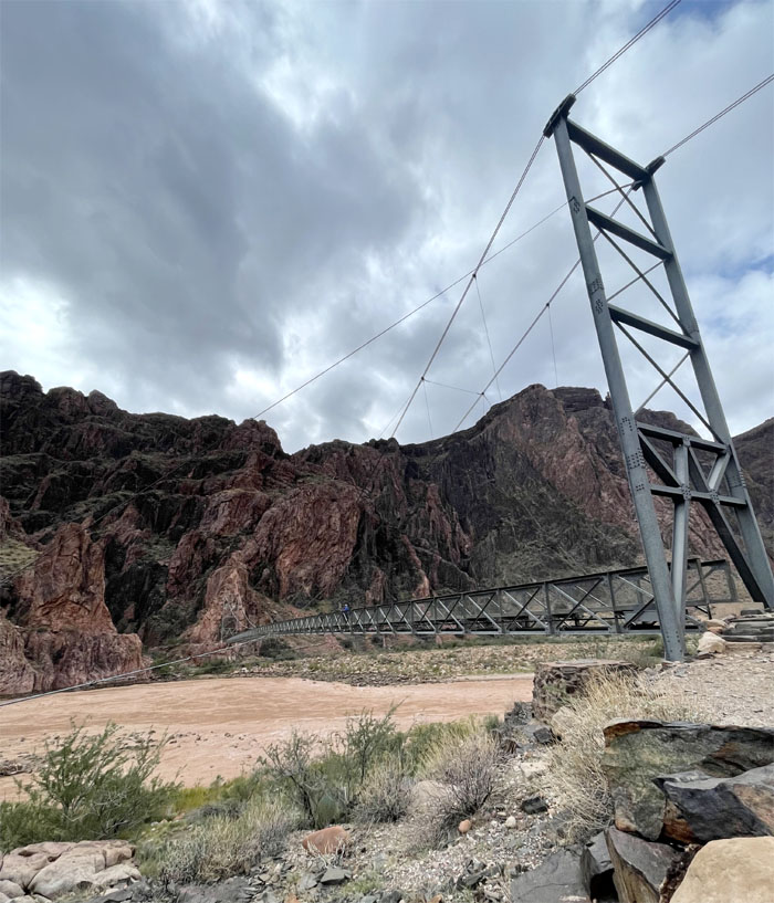
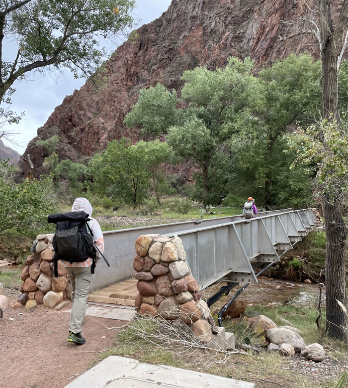
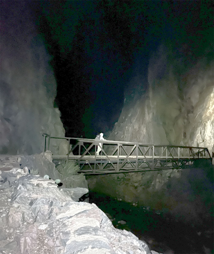
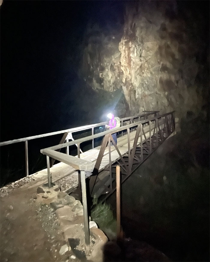
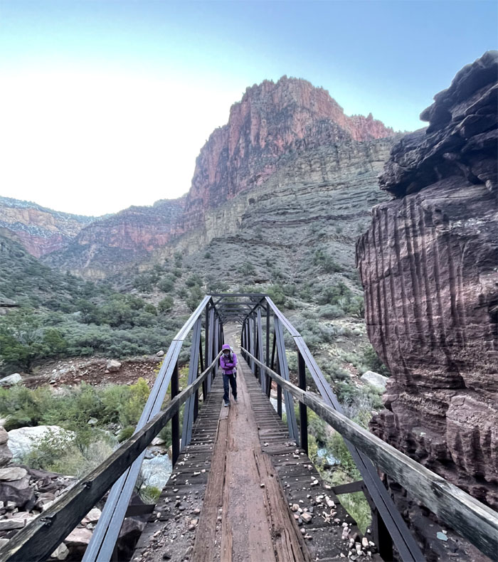
Group photo by Lilyn Avendano with the Silver Bridge (foreground) built in the 1960s and the Black Bridge (background) built in the 1920s.
Silver Bridge
Aida about to set foot on the 522′ long bridge that is only open to hikers. Mules are allowed to only travel on the Black Bridge. Photo by Lilyn Avendano.
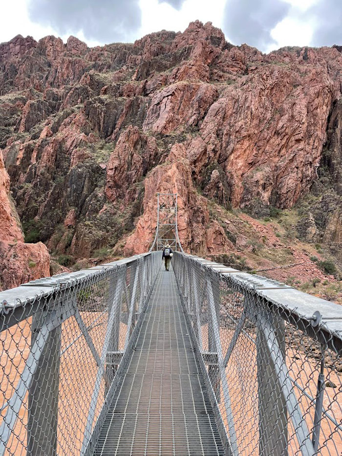
Silver Bridge
Quan crossing the suspension bridge that hangs 55′ above the chocolate colored river. Photo by Lilyn Avendano.
Silver Bridge
The engineering marvel that not only allows hikers to cross the Colorado River but also supports a water pipeline that transports 500,000 gallons of water a day from the North Rim to the South Rim.
River Trail
We are not animals. The jury is still out on that one.
River Trail
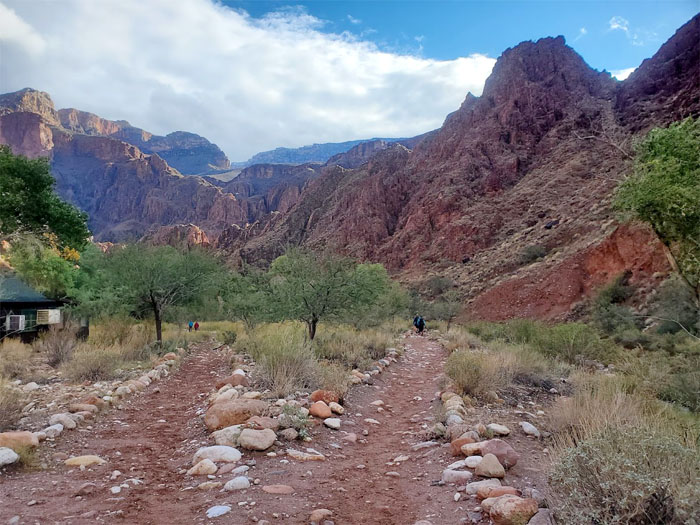
Making our way to the campground which paralleled Bright Angel Creek.
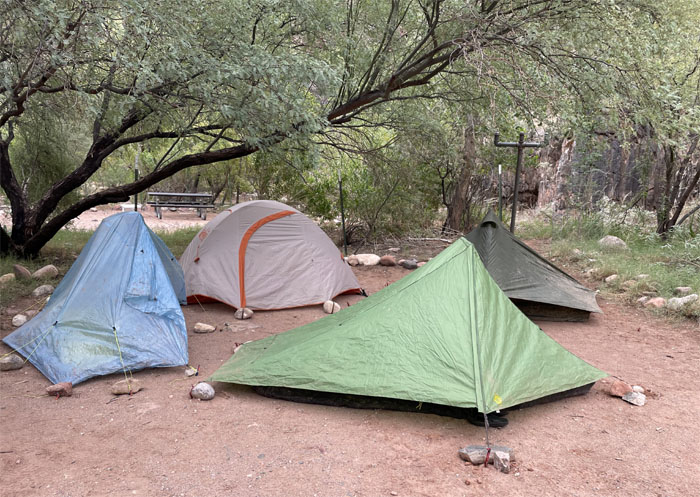
Bright Angel Campground
We set up our tents at campsite #26 and secured our food in the provided metal boxes. We didn’t want to find a comatose skunk in our tents when we came back.
River Trail
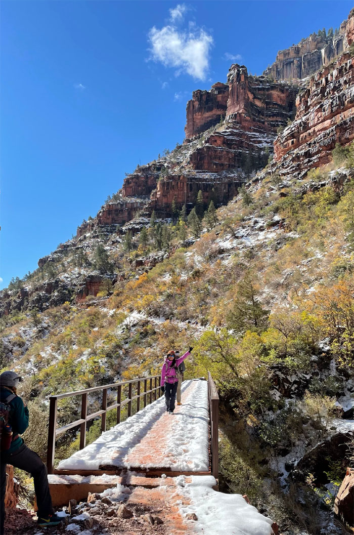
Leaving the campgrounds as we crossed another bridge. Photo by Quan Haberstroh.
River Trail
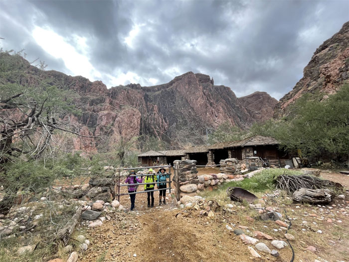
Heading to the ranch that was built back in 1922 and was going to be originally named Roosevelt Chalet but instead they used a name based on the nearby creek and canyon.
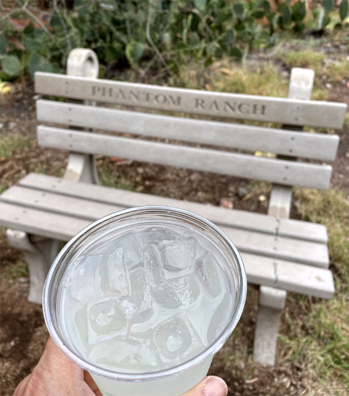
Phantom Ranch
Any lemonade will taste sweet, especially after a day of hiking. Somebody chowed down on the chips and cookies, like it was going out of style. No lodge cancellations.
North Kaibab Trail
We hiked up a bit past the ranch to check out the trail conditions and then turned around where we also stopped at the ranger station to get a weather update (snow) and phone coverage (spotty near the top). The plan for our final day was that Lilyn and myself would hike up to the North Rim and Aida and Quan would return back to the South Rim. We were banking on securing a ride on the shuttle back to our lodging for the night. If not, then our friends would hopefully make the four hour drive and pick us up. Otherwise, it was going to be a cold and freezing night in the snow and in the company of bears, hopefully not.
Bright Angel Campground
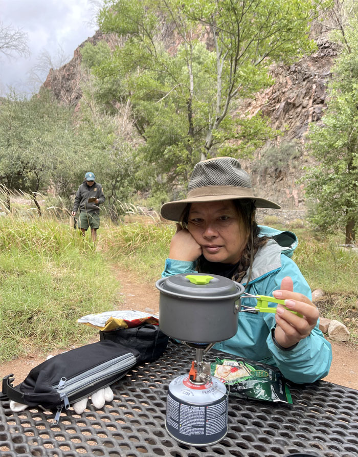
Somebody was not leaving until the stove was off the table and on the ground. Photo by Lilyn Avendano.
Park Ranger
Good night. Photo by Lilyn Avendano.
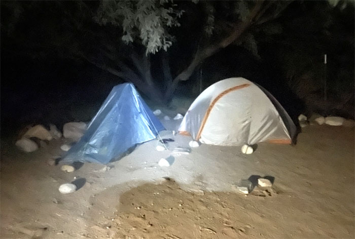
Bright Angel Campground
Day 3
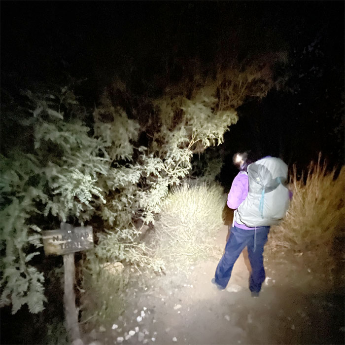
And then there were two left. Lilyn and I broke down our tents and made ready to leave around 0300.
Bright Angel Campground
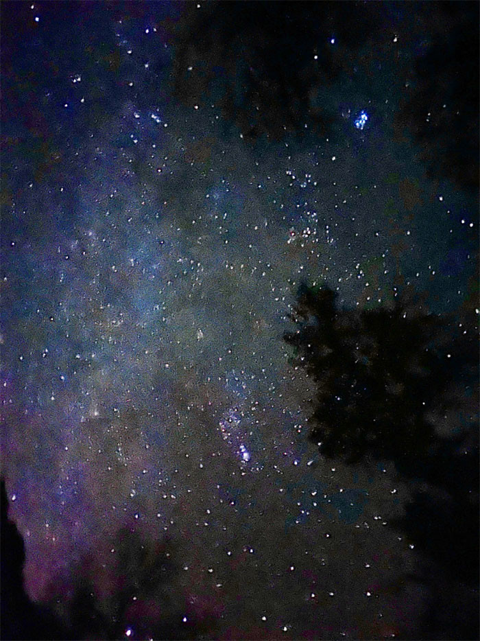
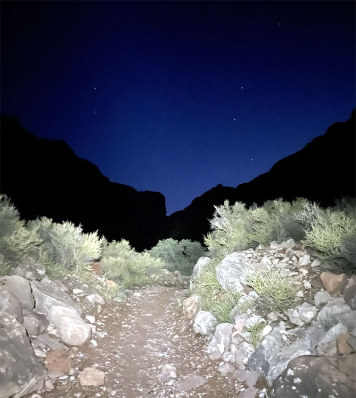
Looking up at Nature’s night lights. Photo by Lilyn Avendano.
North Kaibab Trail
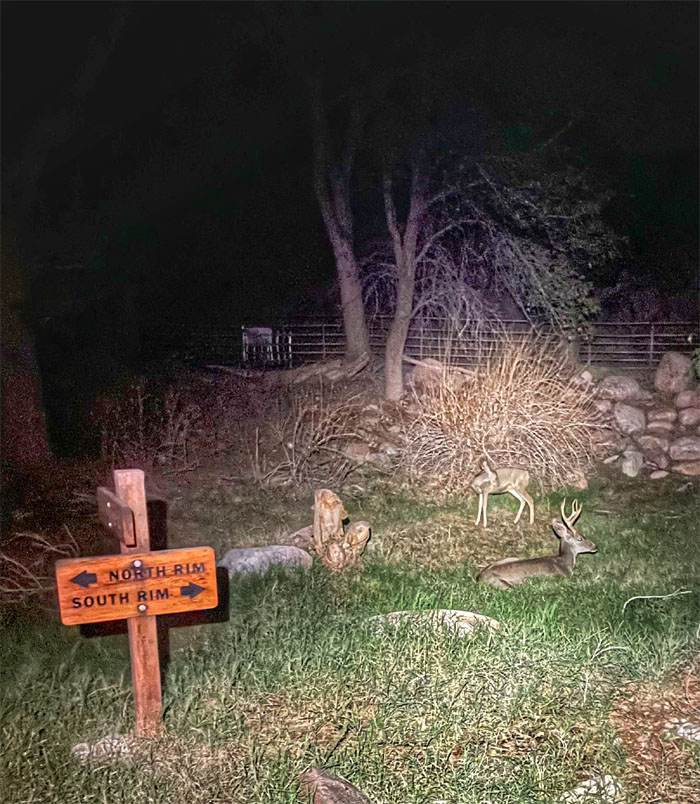
We were surprised to see a group of deer grazing by the trail. They didn’t seem fazed at all by us.
North Kaibab Trail
Have lights, will hike. The only thoughts going through my head were are there any animals out there that can eat us?
North Kaibab Trail
Hiking on the trail that hugged the cliffs on the right and the stream on the left. Photo by Lilyn Avendano.
North Kaibab Trail
Crossing one of seven bridges on the trail. Back in the 1920s, there used to be over 94 creek crossings. Thank goodness for modern engineering. Photo by Lilyn Avendano.
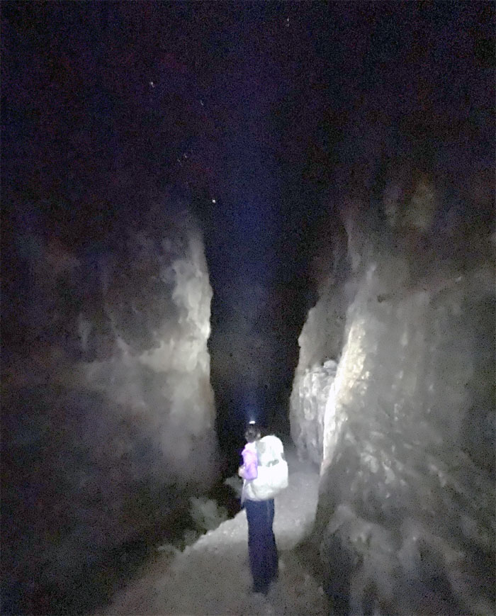
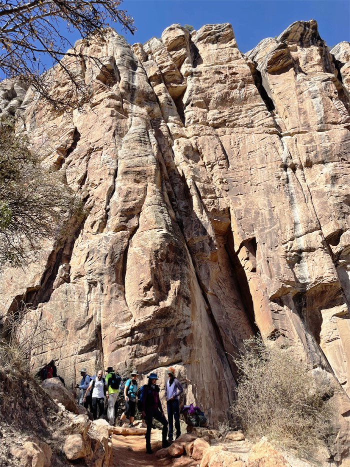
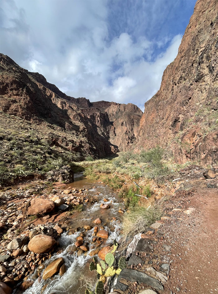
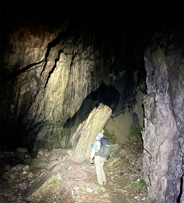
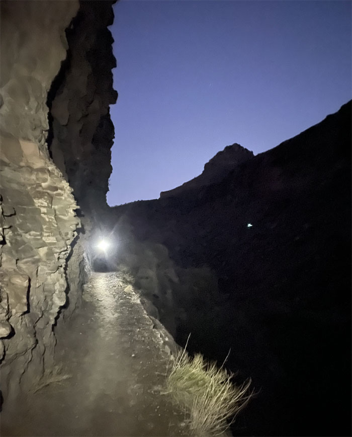
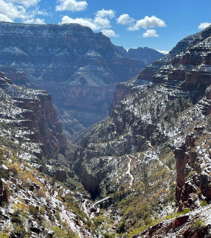
The Box
Shedding some light on the towering cliffs of Vishnu schist, the oldest rock layer to be found in the canyon.
The Box
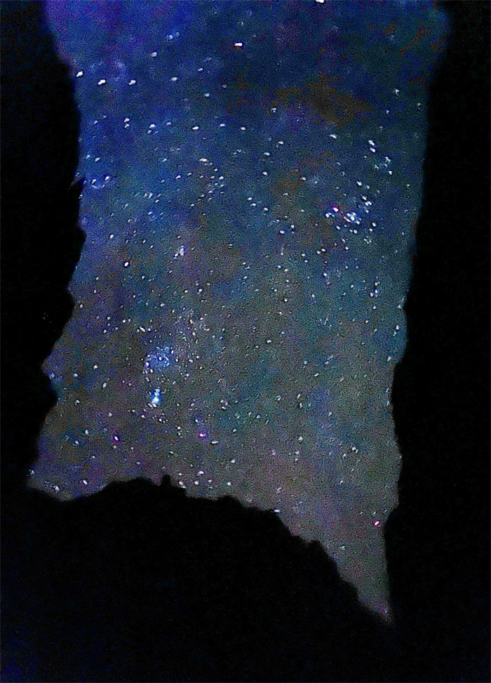
Is that the Milky Way? All stars look the same at night. Photo by Lilyn Avendano.
The Box
Leaving the four mile corridor that is reputedly the hottest section of the trail. We didn’t have to worry about that this early morning. Photo by Lilyn Avendano.
North Kaibab Trail
We got out of the box and became a little disoriented in a dry creek bed and eventually found the trail. Shades of Waiahole Valley. Photo by Lilyn Avendano.
North Kaibab Trail
Is this the last bridge crossing?
North Kaibab Trail
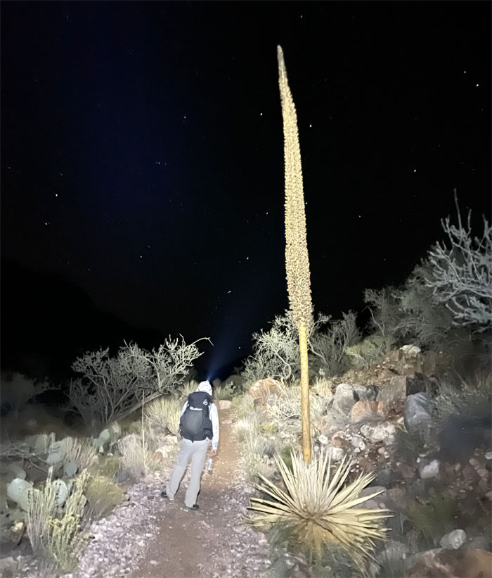
Passing one of many flowering century plants. Photo by Lilyn Avendano.
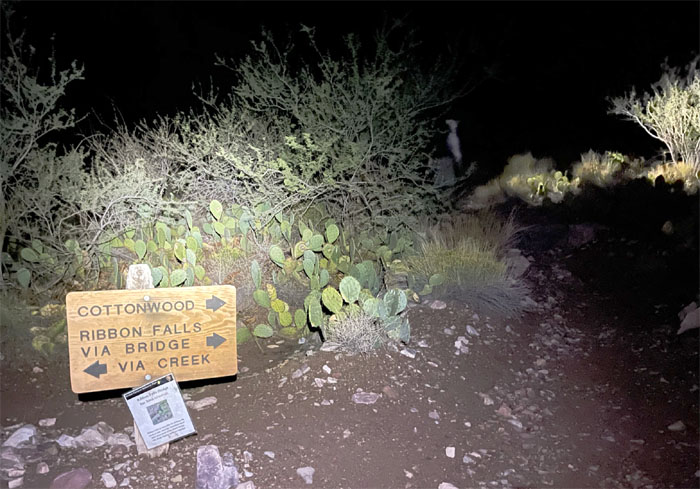
Ribbon Falls
The bridge to the 100′ falls was out of commission, it’s not like we had the time or daylight to visit anyway. Photo by Lilyn Avendano.
North Kaibab Trail
Looking up at the North Rim, somebody said they saw lights coming from the Grand Canyon Lodge. All I saw were the shining eyes from deers and critters in the bushes.
North Kaibab Trail
Descending down the trail.
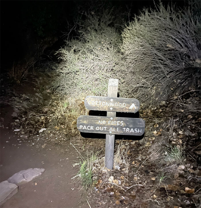
Cottonwood
We soon arrived at the Cottonwood camp, which is roughly the halfway point on the Kaibab trail, where we filled up on our water and noticed most of the campsites were empty. So much for no permits being available.
North Kaibab Trail
Sunlight breaking in the canyon. Photo by Lilyn Avendano.
North Kaibab Trail
The water flowing its way down to drain into the Colorado River.
North Kaibab Trail
Somebody was still shivering as she crossed another bridge on the trail.
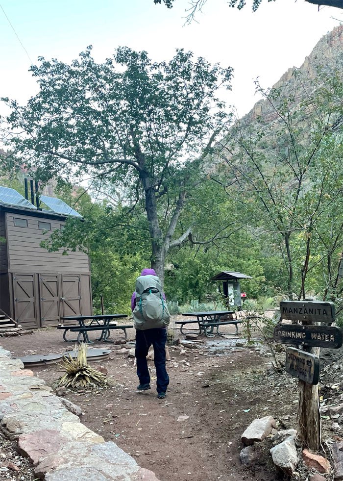
Manzanita
Taking a break at the rest area formerly known as the Pumphouse Ranger Station. We also met up with a couple that gave us the number to the shuttle but said don’t get your hopes up as they are usually booked solid weeks in advance. The power of positive thinking.
Manzanita
Enjoying the scenery with the constant drip in the background. Photo by Lilyn Avendano.
North Kaibab Trail
Leaving Bright Angel Canyon as we started our slow and steady climb.
North Kaibab Trail
Entering Roaring Springs Canyon as the sun started to light up the rocks. Photo by Lilyn Avendano.
Roaring Springs
Hearing and seeing the water source for the entire canyon which is at 5,200′ elevation.

North Kaibab Trail
Looking at the different layers of rock that the Colorado River over millions of years have carved over a mile down to the “basement.” Photo by Lilyn Avendano.
North Kaibab Trail
Lilyn taking a load off her feet. Photo by Lilyn Avendano.
North Kaibab Trail
The trail continued to hug the cliff as the canyon narrowed in some parts.
North Kaibab Trail
We started to see more snow on the trail as we continued to gain elevation.
Redwall Bridge
Crossing the last bridge on the trail.
North Kaibab Trail
Hanging hazards.
North Kaibab Trail
It was around this spot that I was able to get cell reception and made the call to Trans-Canyon Shuttle. They had spots open! We just had to make the top by 1400. No sweat.
North Kaibab Trail
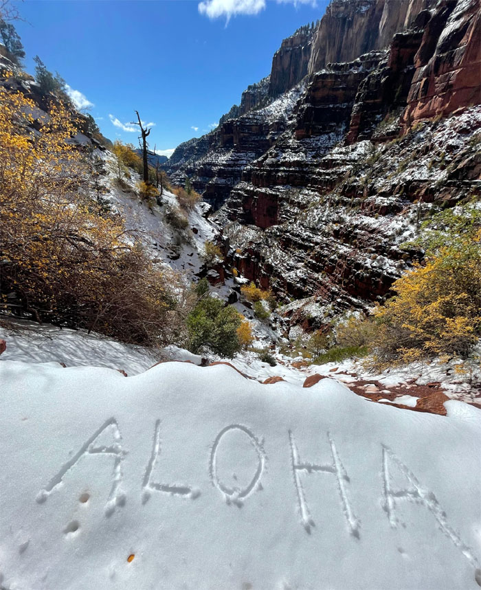
Spreading aloha and leaving no trace when the sun comes out. Photo by Lilyn Avendano.
North Kaibab Trail
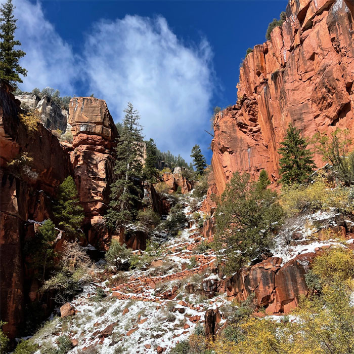
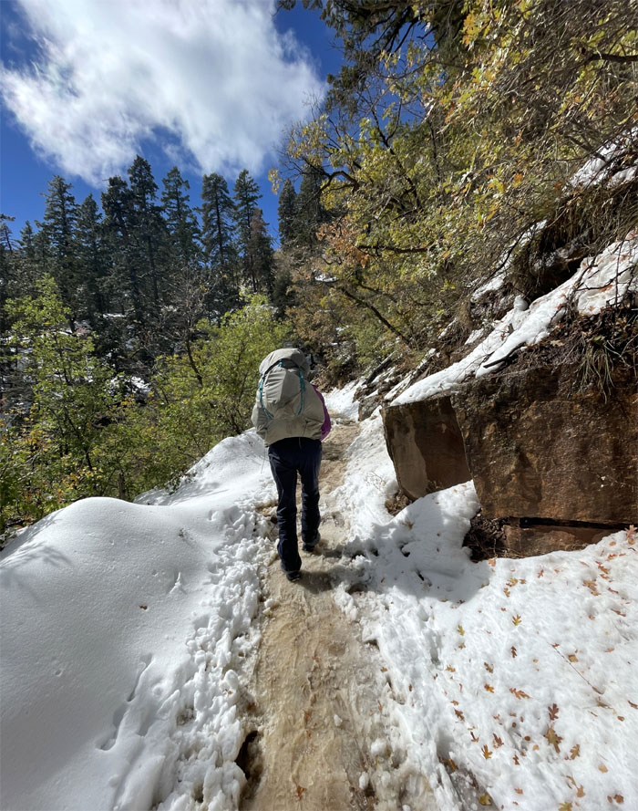
Looking ahead to the snowy and steep switchbacks going up through the Supai Formation.
Supai Tunnel
Trudging through the cocktail slurry of melted snow, mud and mule manure. Photo by Lilyn Avendano.
Supai Tunnel
It was hard waiting trying to find a relatively dry spot to sit in the snow covered rocks. Photo by Lilyn Avendano.
Supai Tunnel
Looking back at the 20′ long tunnel that was blasted out of the red rock back in the 1930s.
Supai Tunnel
I don’t need water. I need food.
North Kaibab Trail
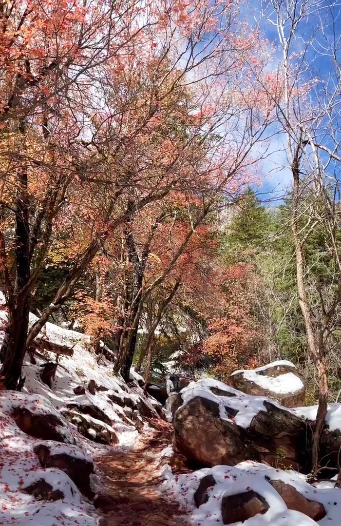
Going up the trail that was carpeted with fall foliage. Photo by Lilyn Avendano.

North Kaibab Trail
We continued gaining elevation as the temperature dropped which meant the snow slowed its melting on the trail. Slippery slope going up.
North Kaibab Trail
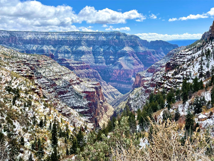
Postcard perfect.
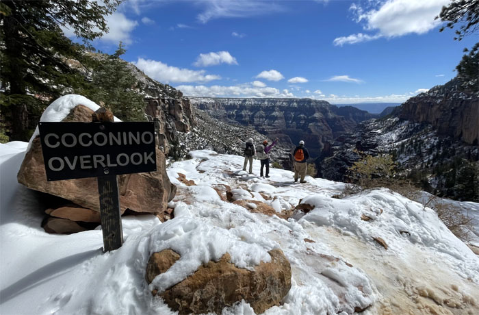
Coconino Overlook
We were just 500′ below the rim at the spot that overlooks the scenic surroundings.
North Kaibab Trail
Making the final push to the 8,241′ trailhead that was dominated by pine trees and 4-5″ of snow.

All pau
All smiles as we finished our rim to rim hike with 30 minutes to spare for the shuttle, which dropped us off at the Thunderbird lodge as night fell.
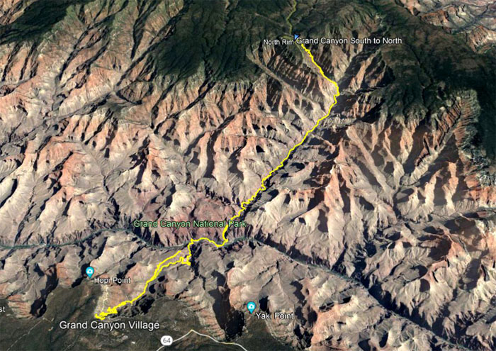
GPS Tracks
Our 28 mile hike into one of the seven natural wonders of the world did not disappoint. Filled with jaw dropping scenery of multiple colored rocks and textures, wildlife, and the forces of nature that have shaped this chasm was an experience that will stay with us for quite some time. Post hike meal was at El Tovar where fine dining was taken out in cardboard boxes and plastic utensils.
Note: I have been made aware that some hikers have been using my blog as a hiking guide and getting lost on the trails. Please note that this blog was made to document the hike for the crew(s) that did it. That is why some of my comments will seem to have no relevance or meaning to anybody outside of the crew(s) that hiked that trail. My blog was never meant as a hiking guide, so please do not treat it as such. If you find inspiration and entertainment from these hikes, that is more than enough. If you plan on replicating these hikes, do so in the knowledge that you should do your own research accordingly as trail conditions, access, legalities and so forth are constantly in flux. What was current today is most likely yesterdays news. Please be prepared to accept any risks and responsibilities on your own as you should know your own limitations, experience and abilities before you even set foot on a trail, as even the “simplest” or “easiest” of trails can present potential pitfalls for even the most “experienced” hikers.
{ 0 comments… add one now }