
We woke up to another rain free day in Hilo and drove over to the Ventura house to enjoy another home cooked breakfast. Portugese sausage leftovers. Life doesn’t get any better.
Waipio Valley Lookout
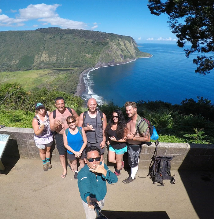
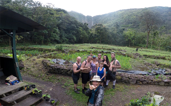
Drove to the Hamakua Coast to mingle with the other tourists and get our group photo that overlooked the land of tall cliffs.
Hitchhiker
Allison testing the waters. No flesh was exposed or needed at this time.
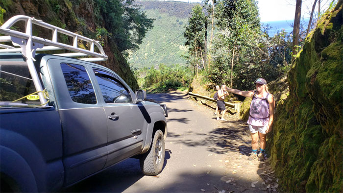
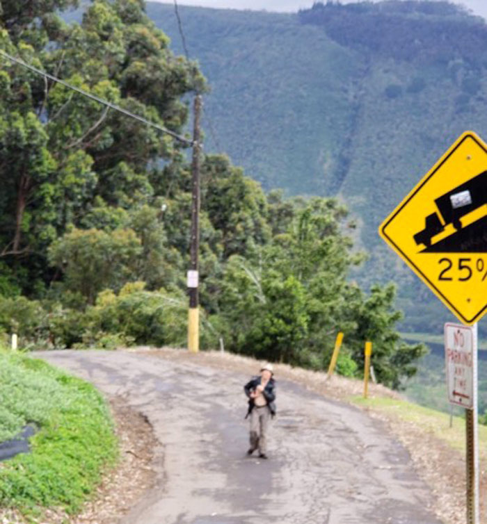
25% Grade
Dropping 800 feet down the steepest road of its length in the country. Photo by Tina Ray.
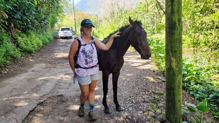
Horse Whisperer
Wild horses came out from the black sand beaches looking for handouts and rubdowns. One out of two aren’t that bad.
Valley of the Kings
Joining the ranks of the 200,000 people that annually visit the deeply cut valley that contains fertile farms and historical Hawaiian temples (heiau).
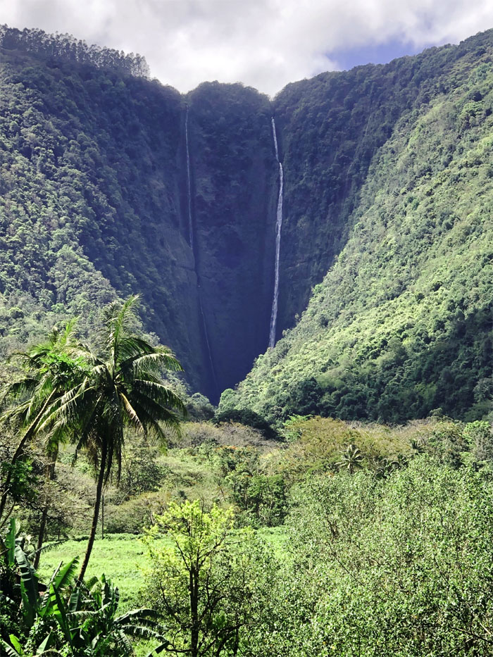
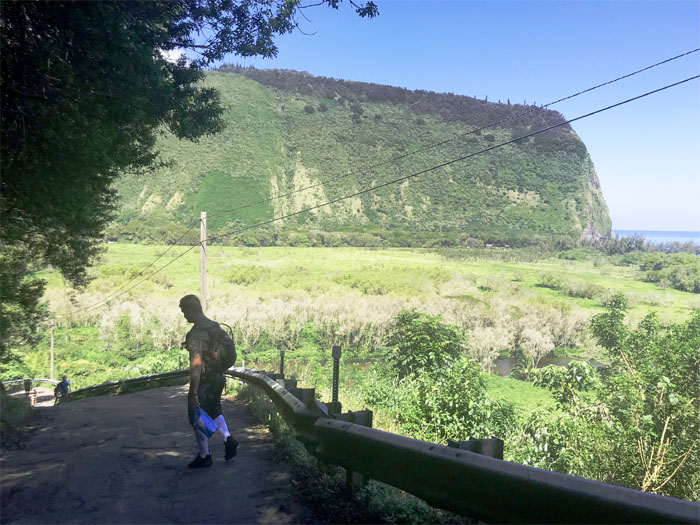
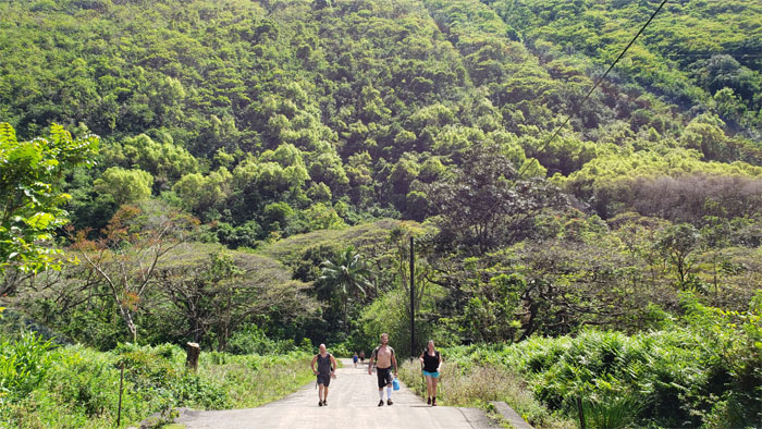
Waipio Valley Road
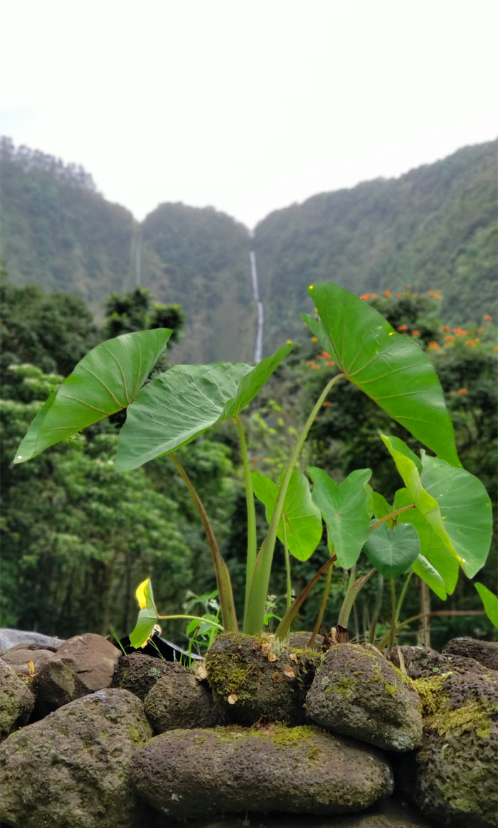
Catching our first glimpse of the tallest waterfalls in the islands which are fed by Lalakea Stream. Photo by Greg Ventura.
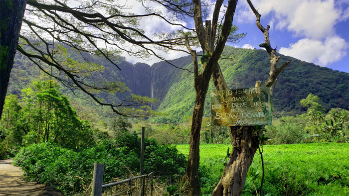
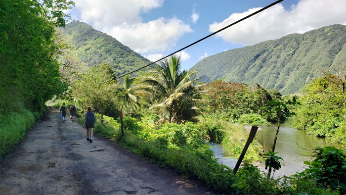
Road to Heaven
We walked with aloha since we couldn’t drive like hell.
7-11
Cody carrying the bag of alleged cat meat. We did not come empty handed.
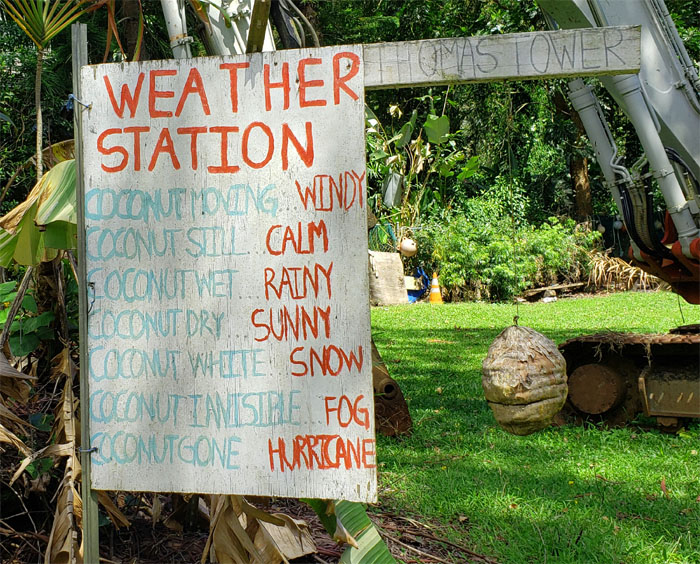
Meteorologist vs. Weatherman vs. Coconut
I almost mistook this coconut for Guy Hagi.
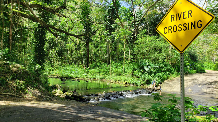
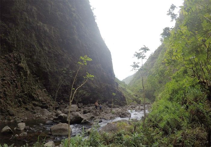
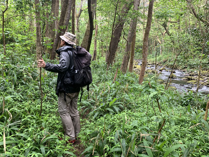
A River Too Far
We stopped at Hi’ilawe Stream crossing where the meetup was to take place. When that meeting failed to materialize, Cody and Tina went in search of our host.
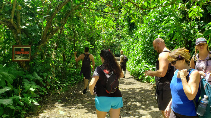
No Tresspassing
Going down the right road. The private road.
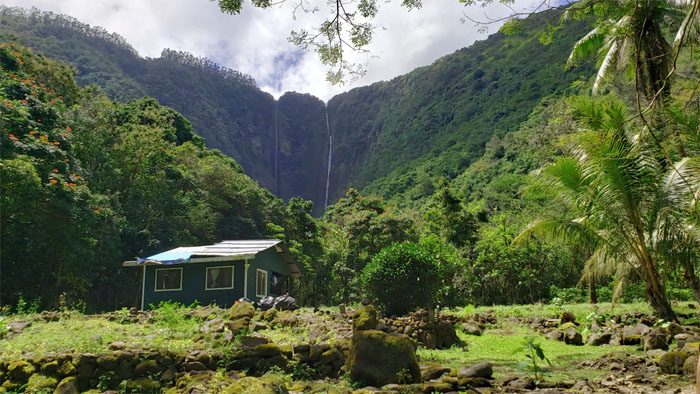
Waipio Valley
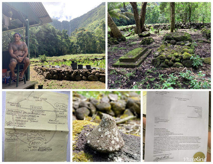
Stepping foot on Dwayne Li’a Vicente’s property, that has been in his family since the late 1800’s.
Vicente hale
Li’a was gracious enough to share his patch of paradise and the attendant history behind it with us.
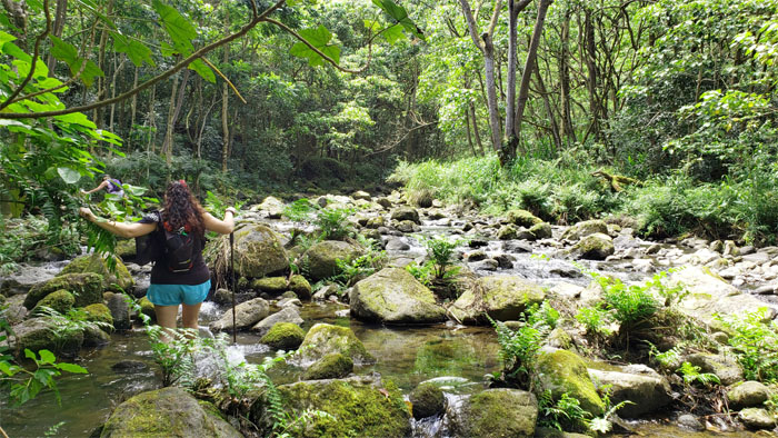
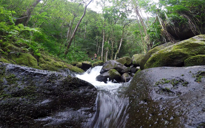
Hi’ilawe Stream
Following the trail upstream after our abbreviated immersion.
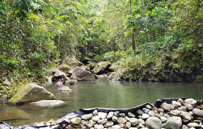
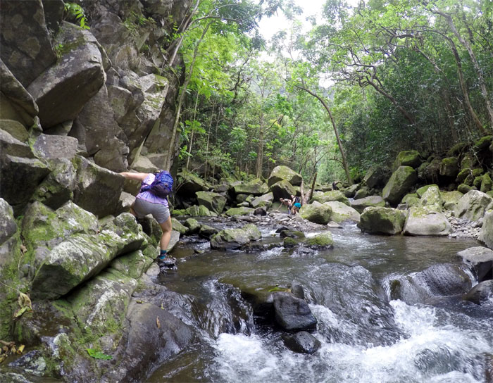
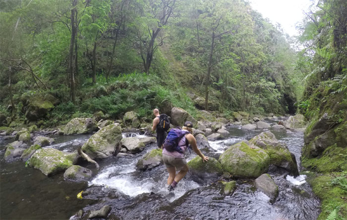
Water rights
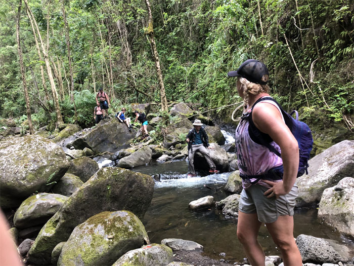
We skirted the man-made dam that irrigates the farms in the valley and plunged into the ice cold chest deep water.
Hi’ilawe Stream
Rock hopping up the stream.
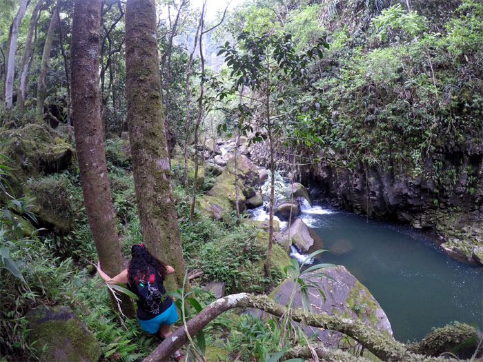
Hi’ilawe Stream
Tina squeezing in between two trees.
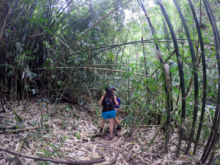
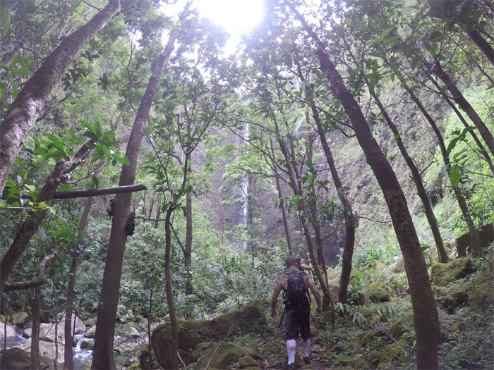
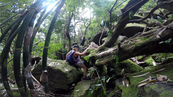
Waipio River
Making our way through a forest of rustling bamboo grass.
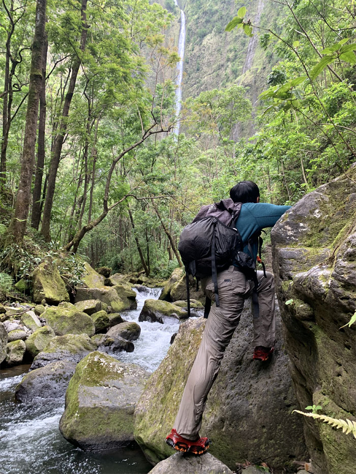
Hi’ilawe Stream
A foot on a moss covered tree is worth two on moss covered rocks. Photo by Allison Banks
Hi’ilawe Stream
Trying to stay dry on the rocks. A mostly futile effort. Photo by Allison Banks
Ti House
Looking for the resort restaurant that they built and nobody came.
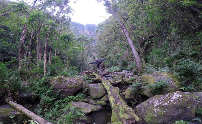
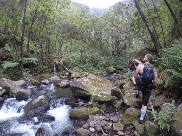
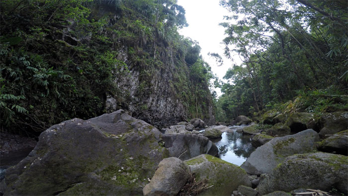
Hi’ilawe Stream
The tall trees could not contain the view of the falls for long.
Hi’ilawe Falls
Following the curved water to the base of the falls.
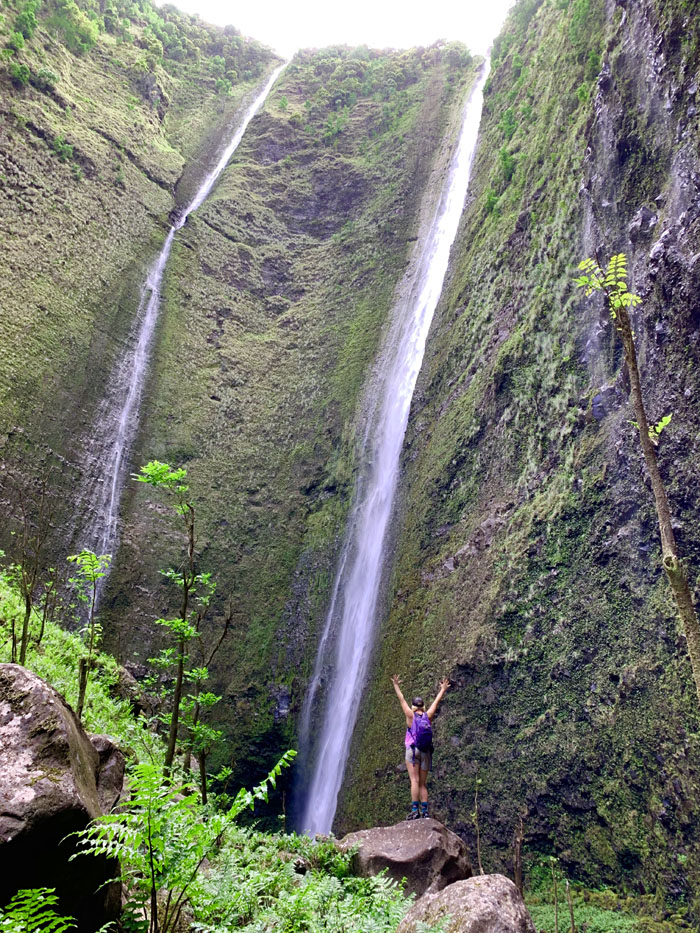
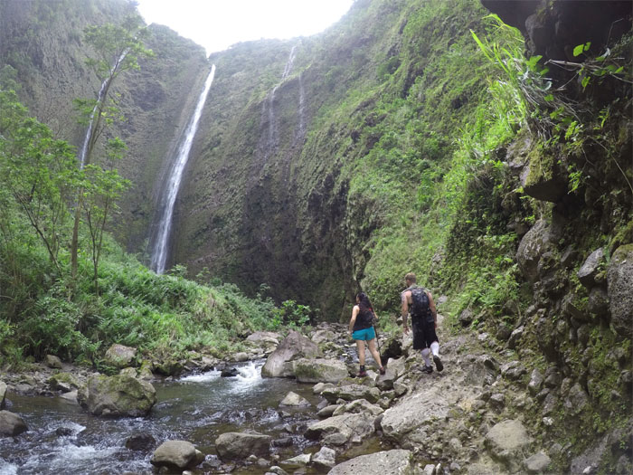
Hi’ilawe Falls
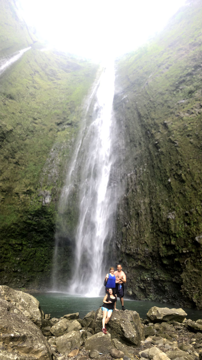
Allison taking in the twin waterfalls of Hakalaoa and Hi’ilawe, spilling over the towering valley cliffs.
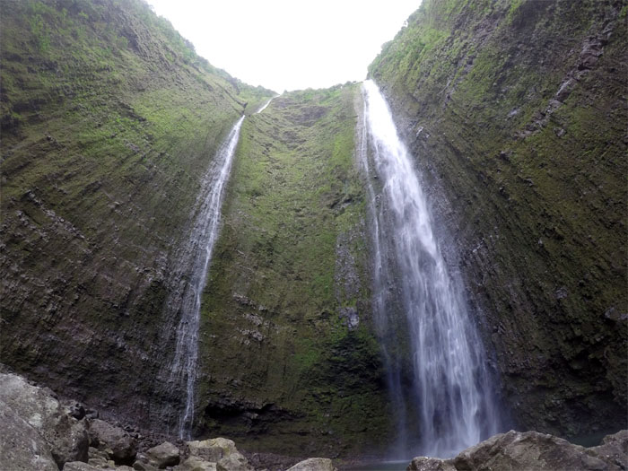
Hi’ilawe Falls
Pictures can’t convey the true scale of the waterfalls that drops about 1,450′.
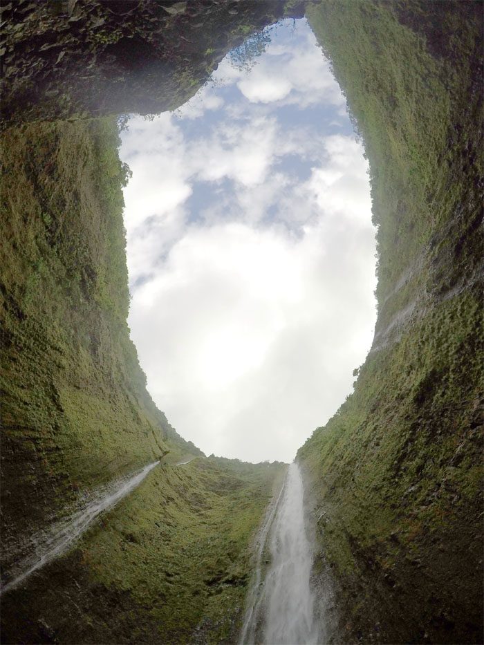
Blue Hole of Hawaii
Looking up at the contracted view of the falls.
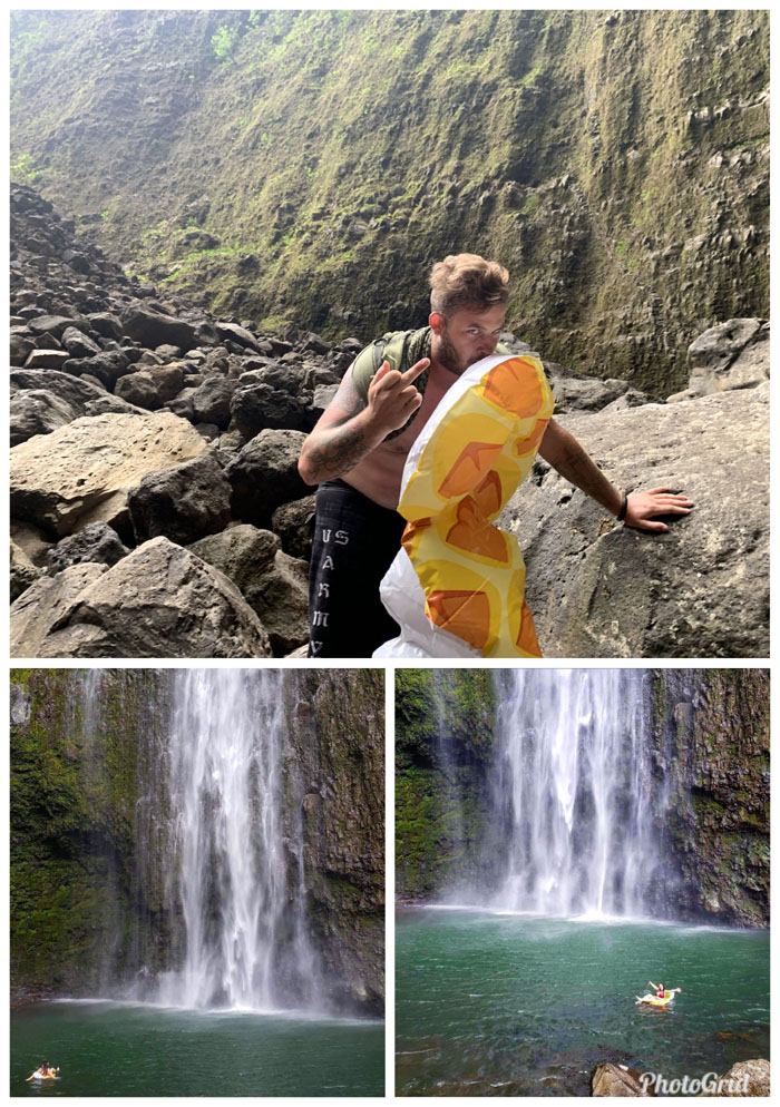
Hot air
Cody putting his lips to good use. Photos by Allison Banks and Cody Slaughter.
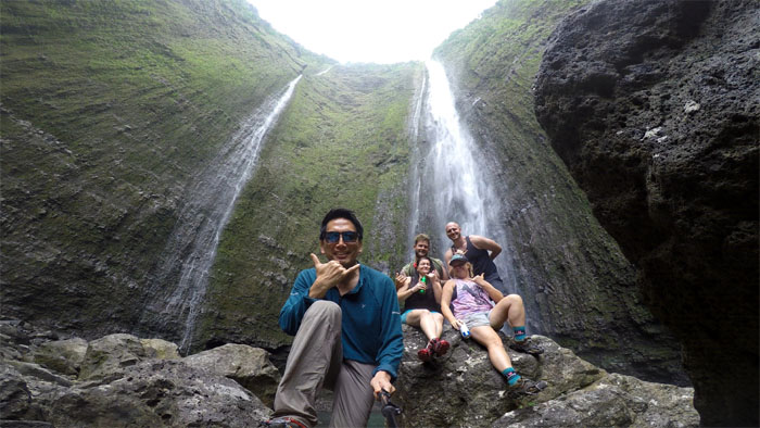
Hi’ilawe Falls
Group photo at the base of the tallest waterfall in Hawaii.
Hi’ilawe Falls
Anna and Greg catching up with the group.
Hi’ilawe Falls
The rest of the group photo. Photo by Cody Slaughter.
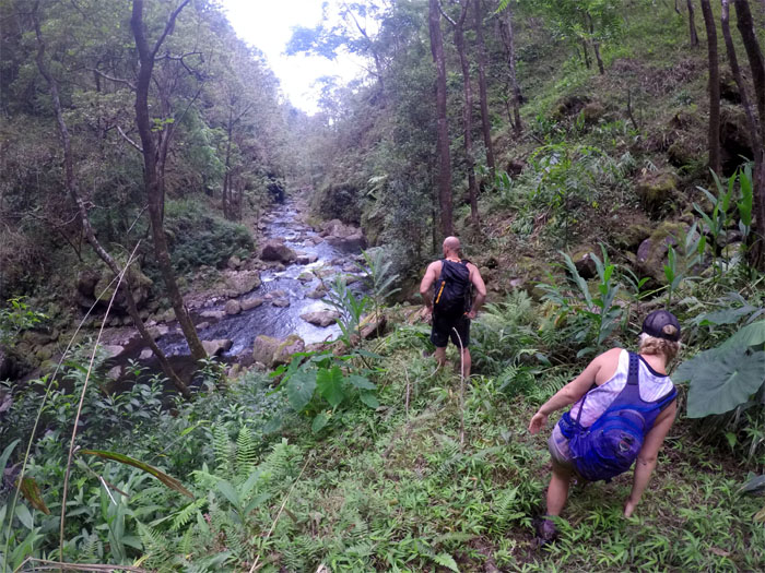
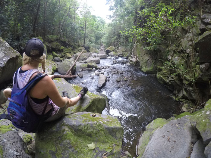
Hi’ilawe Stream
Going with the flow as we followed the river back down.
Hi’ilawe Stream
Allison and Michael fording one of many river crossings.
Hi’ilawe Stream
Looking back at the rest of the group making their way down.
Hi’ilawe Stream
Glad that we had “low tides” on our hike today.
Waipio Valley
Allison between a rock and a hard tree.
Hi’ilawe Stream
Stepping our way over the different sized stones in the river. Photo by Michael Boonstra.
Hi’ilawe Stream
Looking ahead to our last stream crossing.
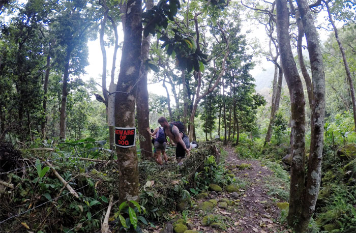
Beware of Dog
Now the only question was, which side of the barbed wire fence does the four legged canine call home?
Waipio Valley
Finding our way back home. Photo by Allison Banks.
Vicente home
We all made it back, some without shoes and thanked Li’a again for his wonderful hospitality and wished him well on his traffic reduction plan, commercialization redirection and lawsuit lottery.
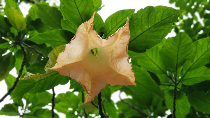
Angel’s Trumpet
Passing the hanging bell shaped flowers on our way out. Hallucinations and hospitalizations were not covered under todays hiking plan.
All pau
A tit too late. It was just for show. A poor showing at that. Or perhaps it was just a manifestation of my desire for self-gratification to take my mind off walking in solitude back up the hill. Blurry photo by Cody Slaughter.
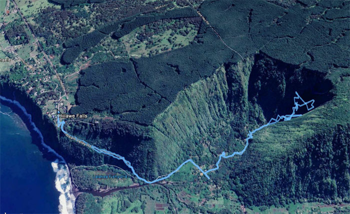
GPS Tracks
We ended our six mile hike into the culturally and scenic rich valley with not much time left, that precluded us from sampling the world famous malasadas from Tex Drive In, but we did manage to make a pit stop at Zippy’s before flying back home. Many thanks to Anna and Greg for their generous hospitality during our stay and the rest of the group for the great company and good laughs.
Note: I have been made aware that some hikers have been using my blog as a hiking guide and getting lost on the trails. Please note that this blog was made to document the hike for the crew(s) that did it. That is why some of my comments will seem to have no relevance or meaning to anybody outside of the crew(s) that hiked that trail. My blog was never meant as a hiking guide, so please do not treat it as such. If you find inspiration and entertainment from these hikes, that is more than enough. If you plan on replicating these hikes, do so in the knowledge that you should do your own research accordingly as trail conditions, access, legalities and so forth are constantly in flux. What was current today is most likely yesterdays news. Please be prepared to accept any risks and responsibilities on your own as you should know your own limitations, experience and abilities before you even set foot on a trail, as even the “simplest” or “easiest” of trails can present potential pitfalls for even the most “experienced” hikers.
{ 6 comments… read them below or add one }
Have you noticed how sometimes Hakalaoa falls seems to stop about halfway down? Some pictures almost make it look like a water diversion tunnel was dug halfway up (although that wouldn’t really make sense). The few times I’ve been, the water from that fall never made all the way down. So where is it going?
Aloha,
To be honest, I’ve never noticed that. Good question. If you find out, LMK.
Mahalo
Hi! I’ve been wanting to experience the awe that is hiking up to Hi’ilawe Falls. How did you get in contact with Li’a to grant you guys permission to hike through his farm? My bf and I will be visiting from Oahu in August and would love to be granted the opportunity to hike there. Any advice will help! Thank you!
Aloha Christina,
The person that arranged the meeting has since moved off the island. I will reach out and see if I get anything back. But there’s another problem that probably renders all this moot, as the road going down to Waipio Valley is closed to the public for at least several years according to the DLNR person I spoke too.
Mahalo
hi!
i have the same question. i should be able to get down into the valley just fine, but i would love to hike to hiilawe falls and get proper permission first. i’d love to get in contact with Li’a or anyone else who could grant permission to make the hike! i’d want to respect the falls and the people and the aina.
thank you!
Aloha Aidan,
Sorry for the late reply. The contact person is on IG, handle is Li’a Vicente. Hope this helps.
Mahalo