
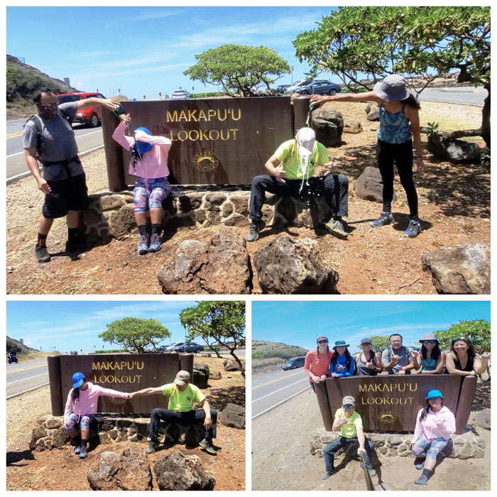
Picking up where we left off from last week; met up with Aida, Art, Cinja, Lilyn, Marilyn, Quan and Tessa at the end of an East Oahu neighborhood. Photo by Art Young.
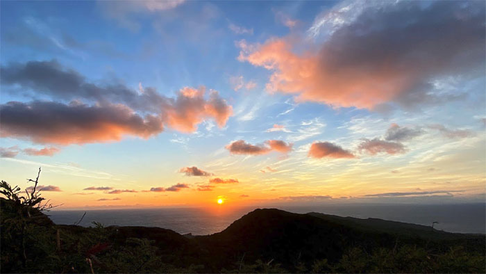
Sunrise
Early hikers get the view of the sun seemingly breaking the horizon plane. It’s actually the earth’s rotation. Photo by Tessa Bugay.
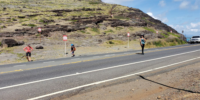
Kamehame Road
I guess we came before visiting hours, but you wouldn’t know it by the amount of people walking up and down the road.
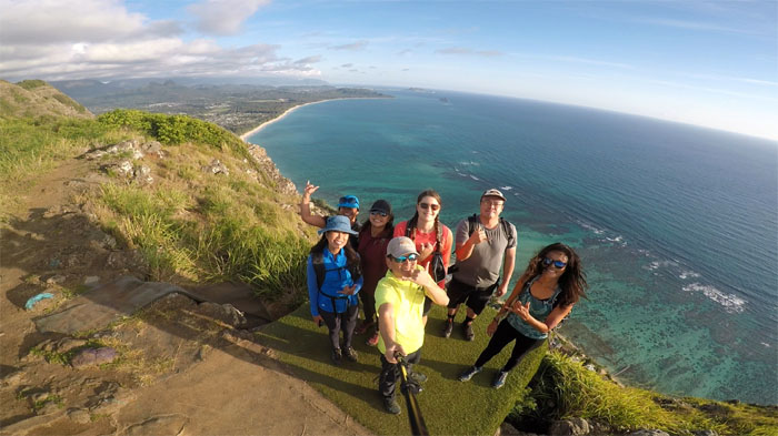
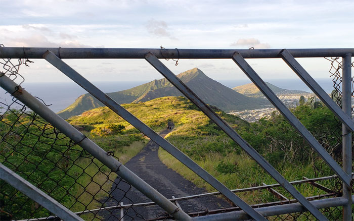
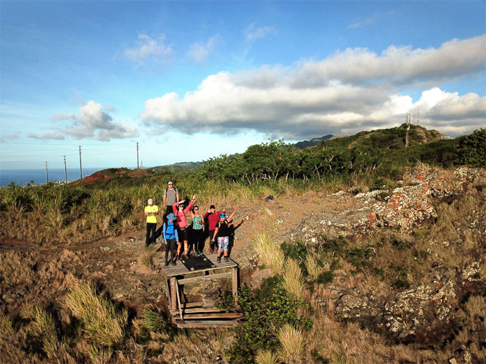
Ko’olau Summit Ridge Trail (KSRT)
It was our turn to take our group photo on this small plot of artificial grass with sweeping views of the Southern and Windward coastlines.
KSRT
Skirting the fenced compound so as not to awaken the neighbors. Photo by Tessa Bugay.
KSRT
Trying to get the hang of flying my drone at the second hang gliding platform. Need more practice.
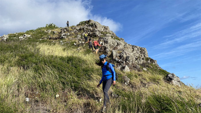
KSRT
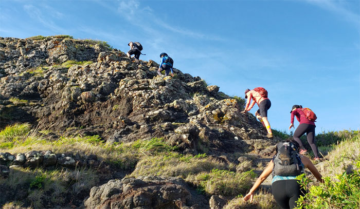
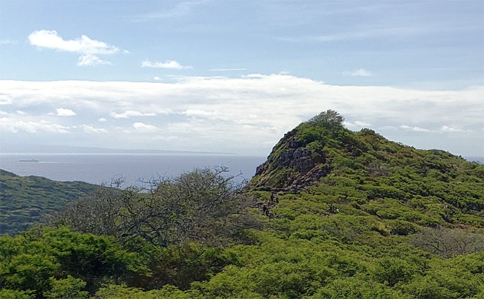
Scrambling up a small hill. Thankfully not many hills on this section of the trail.
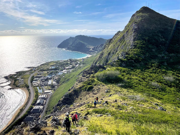
KSRT
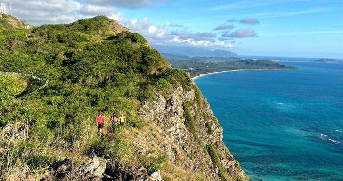
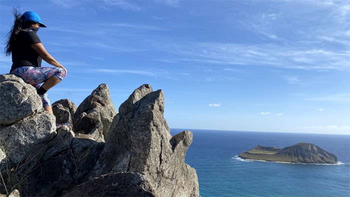
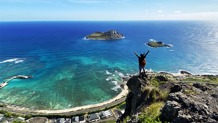
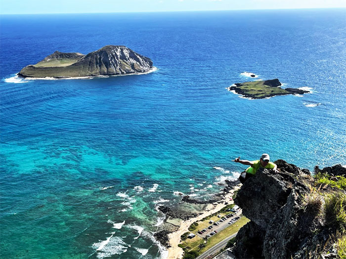
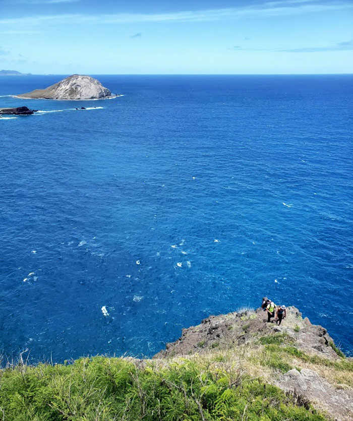
Going down the hill with expansive views of Makai Pier, Sea Life Park and the islands of Manana (Rabbit) and Kaohika’ipu (Black Rock).
KSRT
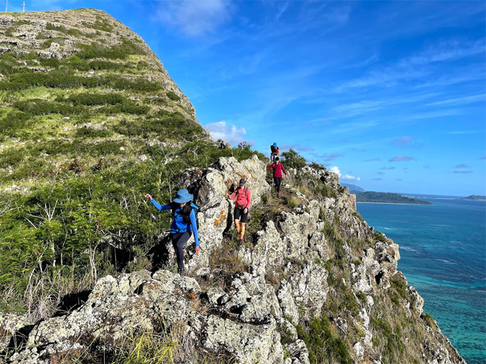
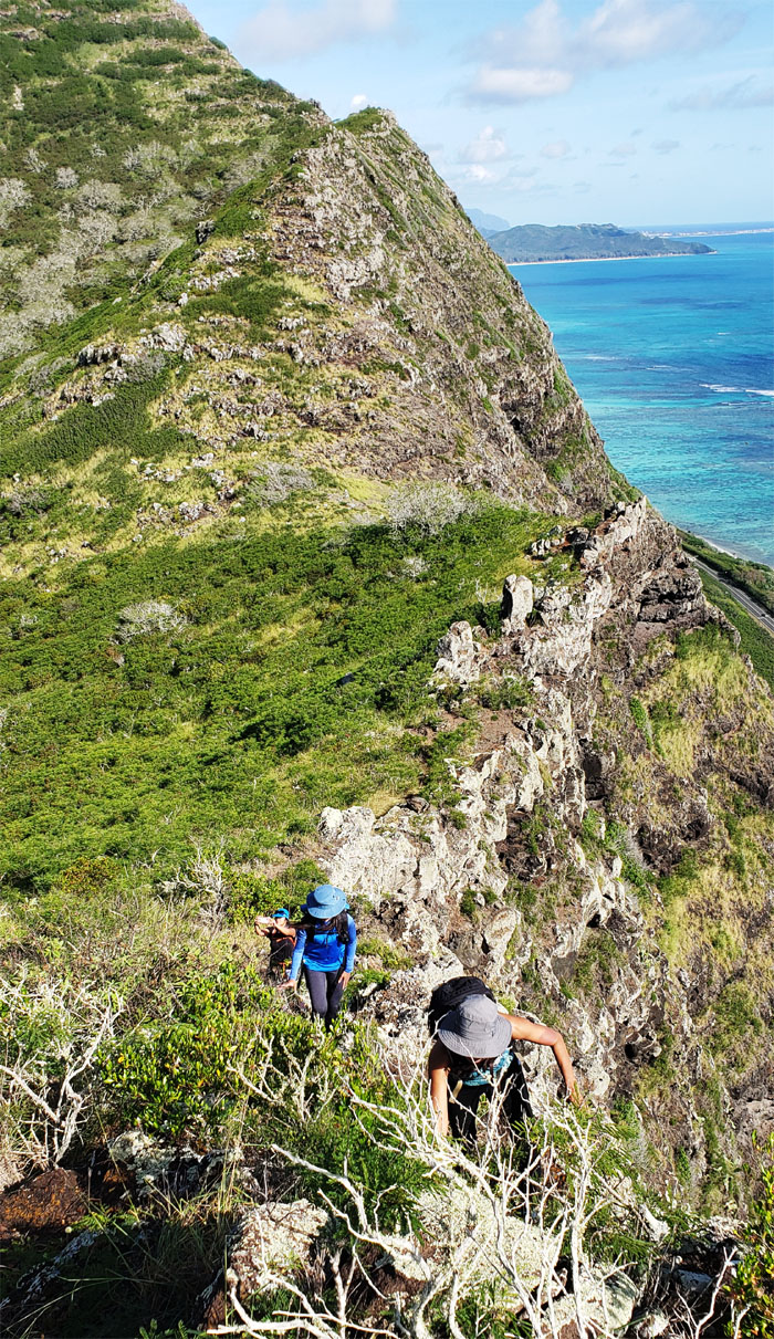
Picking our way along the uneven rock studded ridge line. Photo by Art Young.

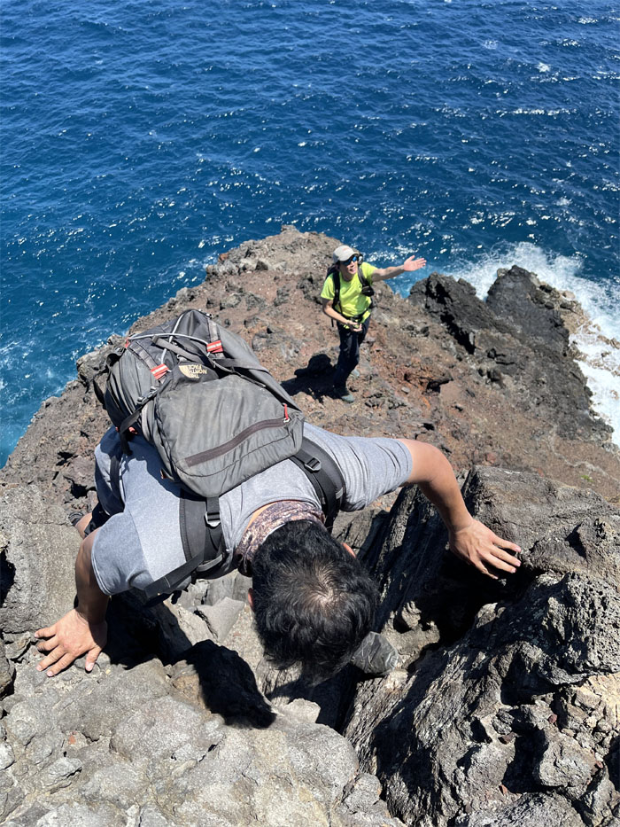
KSRT
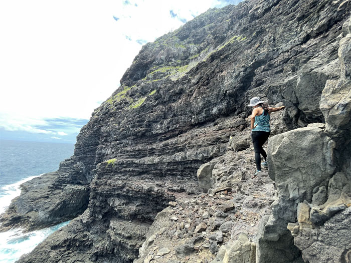
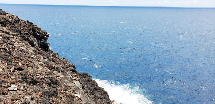
Hiking on the edge of the cliff. Photo by Tessa Bugay.
KSRT
Silhouetted hikers against the morning skies. Photo by Lilyn Avendano.
KSRT
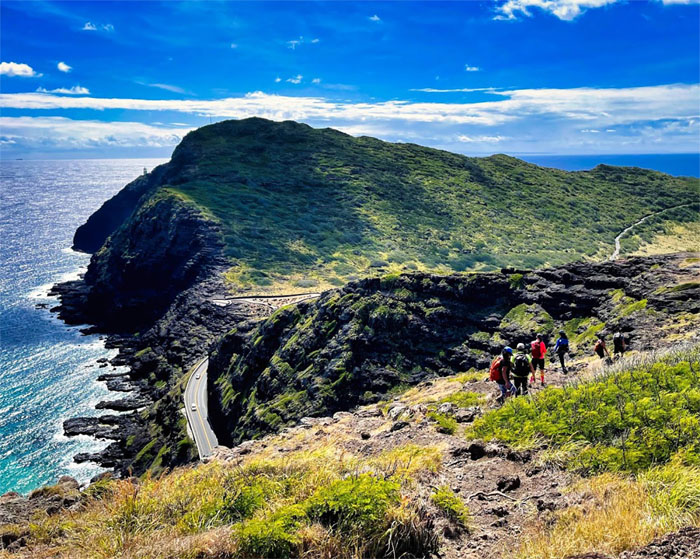
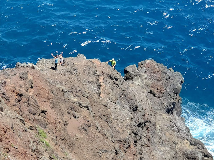
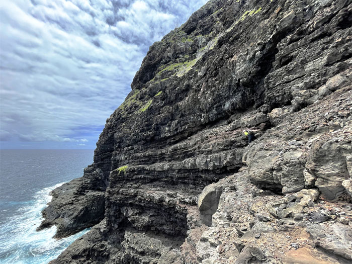
The trail soon worked itself away from the edge towards more solid footing. Photo by Tessa Bugay.
KSRT
Approaching the cluster of rocks which I like to call Hawaii’s Stonehenge. Photo by Lilyn Avendano.
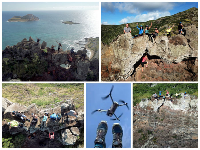
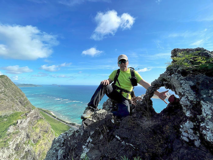
Makapu’u Puka
Drone views.
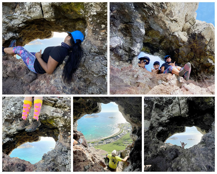
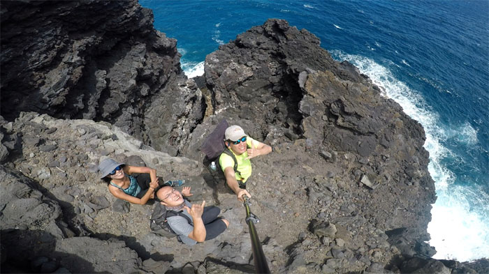
Makapu’u Puka
Selfie views.
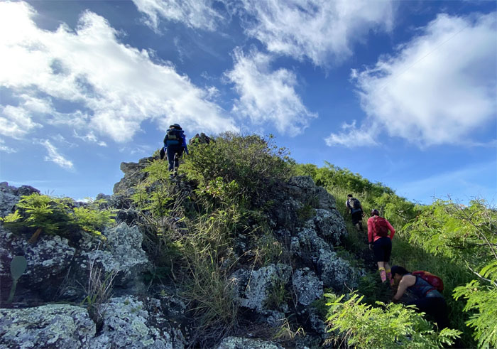
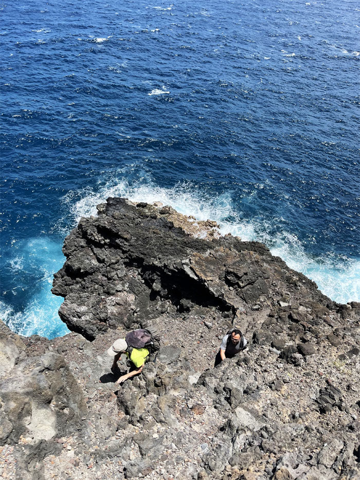
KSRT
It was a hop, skip and a jump to the next rock to climb.
Thinker
Top down views. Now which way do we climb down?
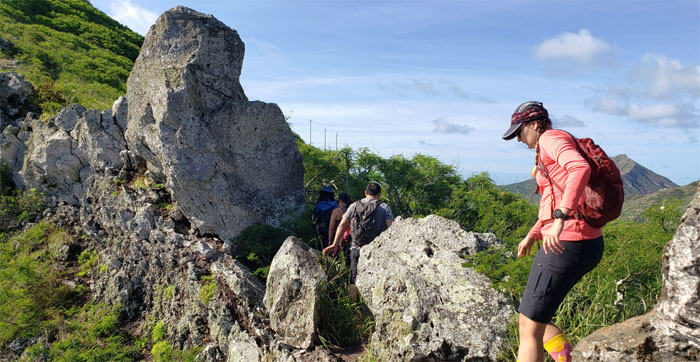
KSRT
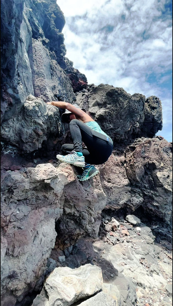
Tessa finding her own views. Photo by Lilyn Avendano.
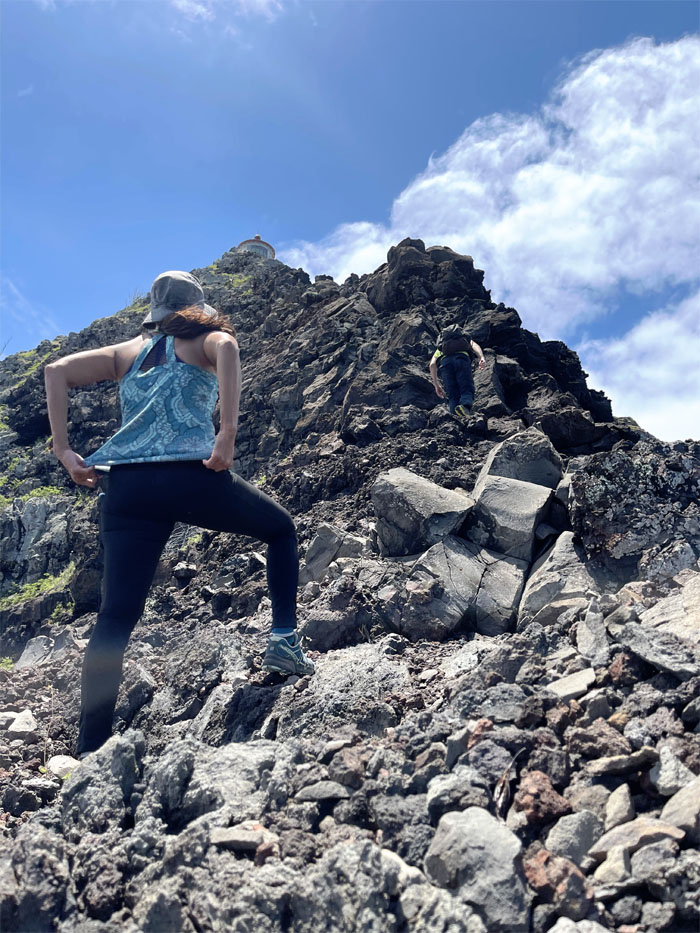
KSRT
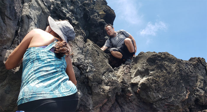
The group scrambling out of the saddle.
KSRT
Some of us took the high road and the others took the low road.
Puka Lite
Hanging loose in the hole. Photo by Lilyn Avendano.
KSRT
The correct way of taking a scenic picture. Photo by Lilyn Avendano.
KSRT
The incorrect way. Photo by Lilyn Avendano.
KSRT
We saw a rather large group of hikers headed towards us but they took the contour trail to avoid meeting us. Social distancing.

KSRT
3. 3. 3. Someone obviously had no idea of the concept of a countdown.
KSRT
Going down the rocky, downhill climb. Photo by Lilyn Avendano.
Kalaniana’ole Highway
Looking both ways before crossing to avoid becoming roadkill. The most dangerous part of the hike.
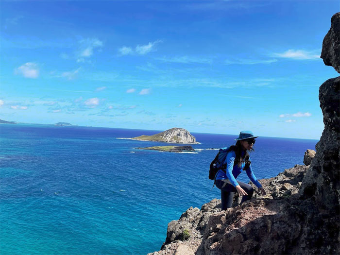
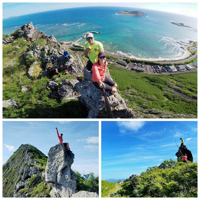
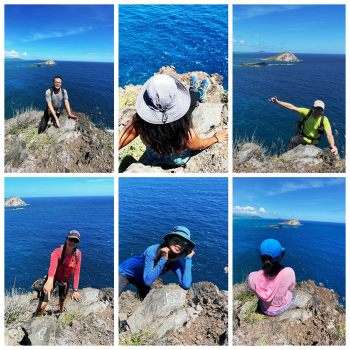
Makapu’u Point
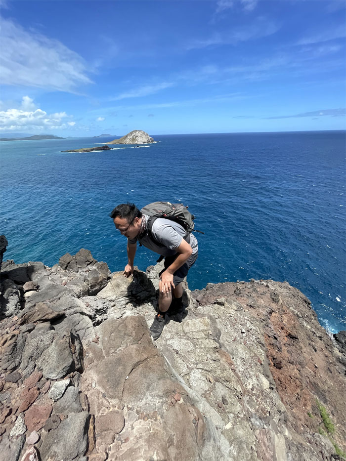
Aida scrambling up the rocks. Photo by Lilyn Avendano.
Makapu’u Point
What happened to my belayer? Photo by Lilyn Avendano.
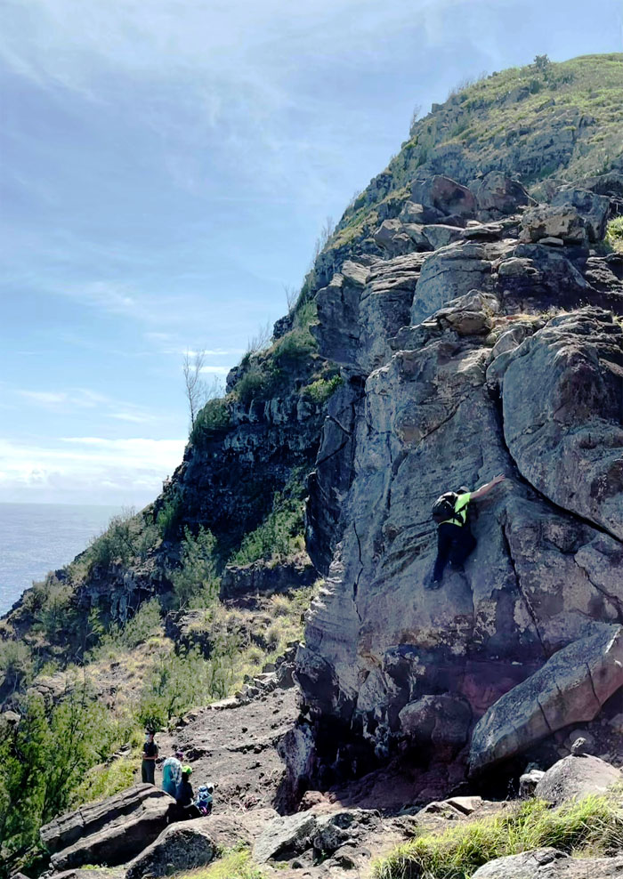
Makapu’u Point
The rest of the group were monopolizing the climbing crag with photo shoots.
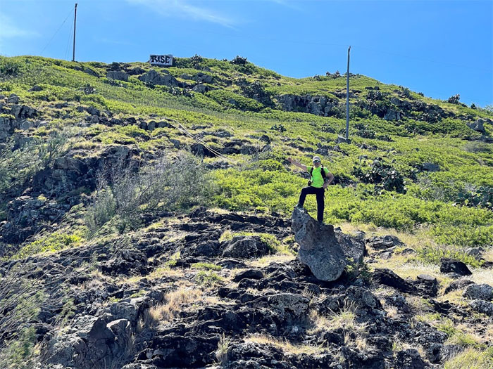
Makapu’u Point
I found my own piece of rock to stand on. Somebody take my picture. Photo by Art Young.
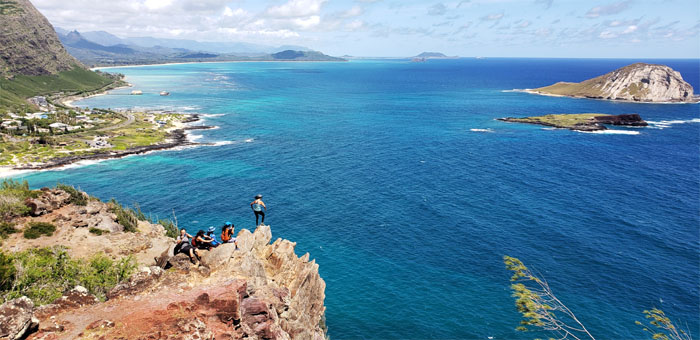
Makapu’u Point
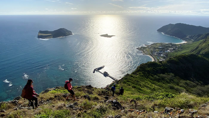
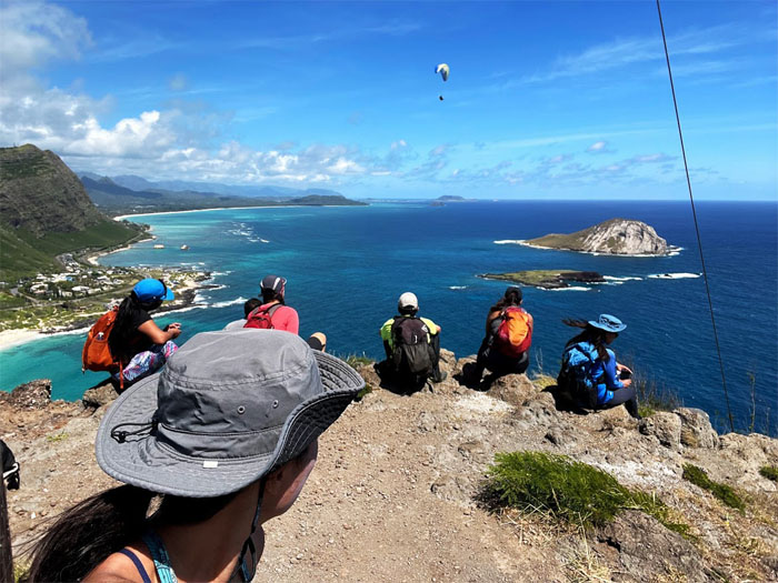
We crested to the top of the ridge and took a break to enjoy the hang gliders circling around the area. Photo by Lilyn Avendano.
Makapu’u Point
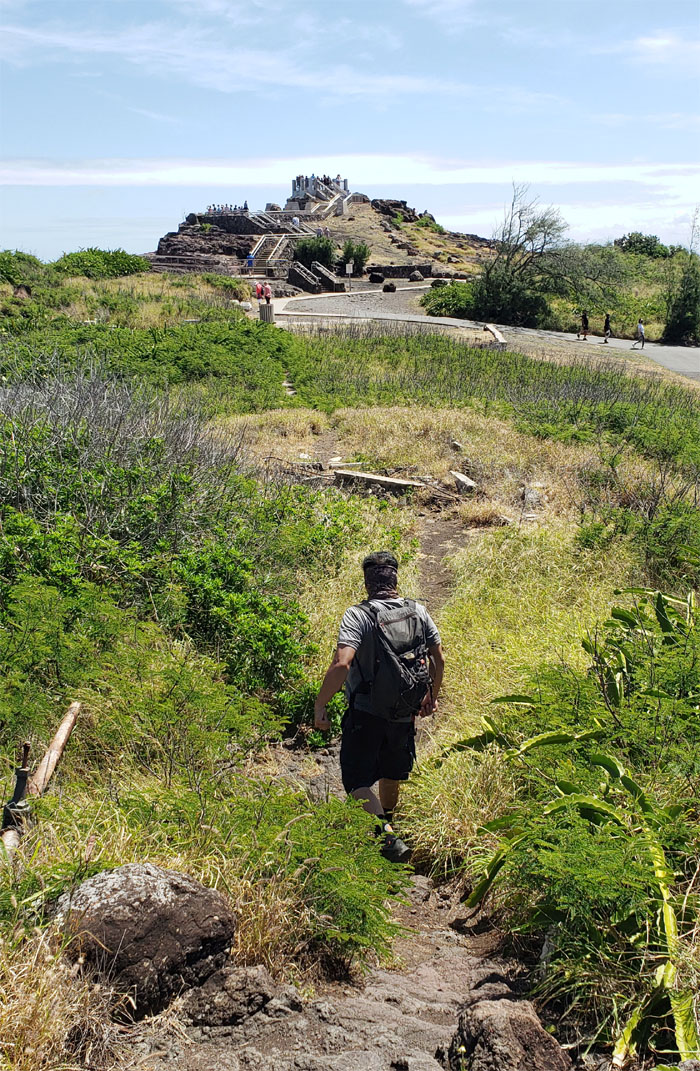
Approaching the crowded lookout.
Makapu’u Point
Bypassing the crowds to enjoy our own lookout. Photo by Lilyn Avendano.
Makapu’u Point
What happened to my spotter? Photo by Art Young.
Makapu’u Point
Spotting duties. Photo by Tessa Bugay.
Makapu’u Point
Going down the less traveled trail to the lighthouse. Photo by Aida Gordon.
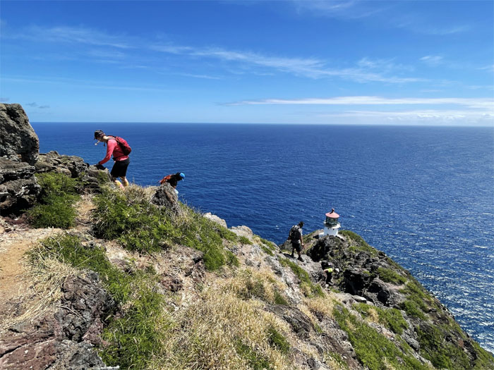
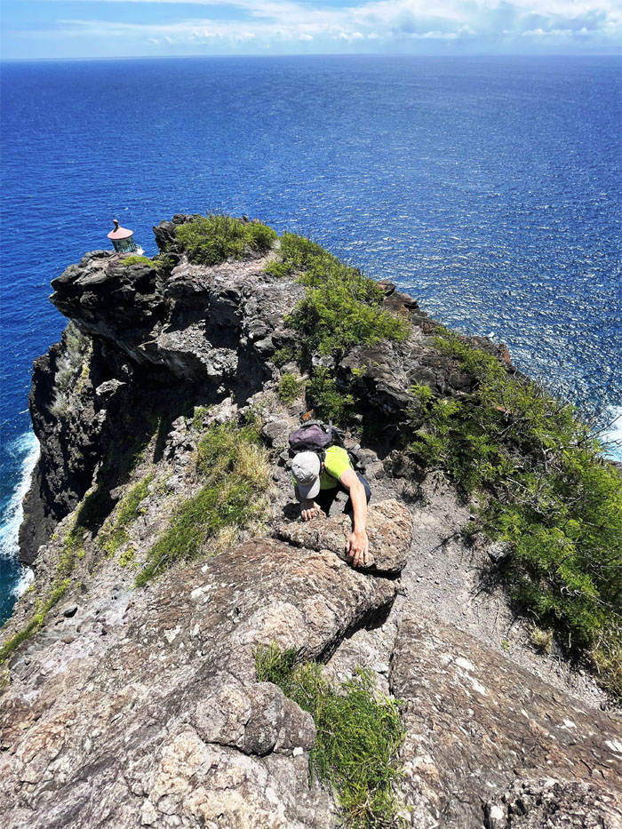
Makapu’u Point
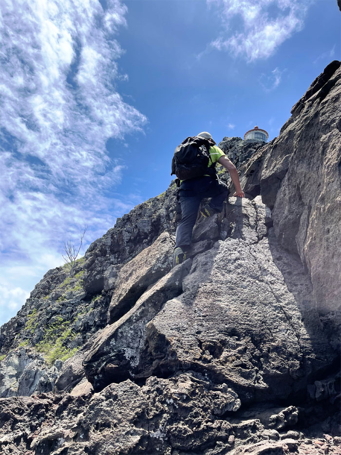
Climbing down to the notch that was blasted out of the lava rocks to build the lighthouse. Photo by Tessa Bugay.
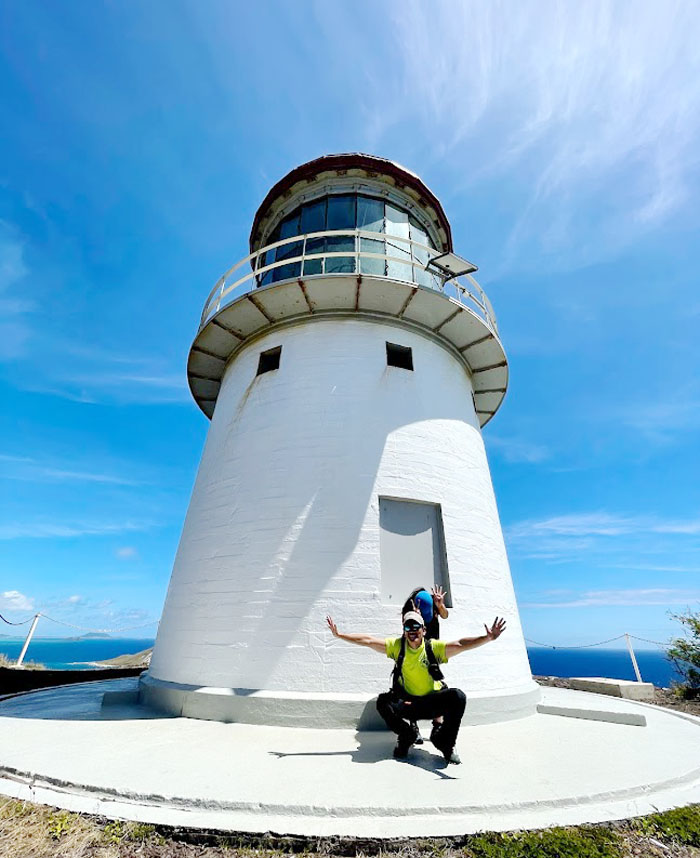
Makapu’u Lighthouse
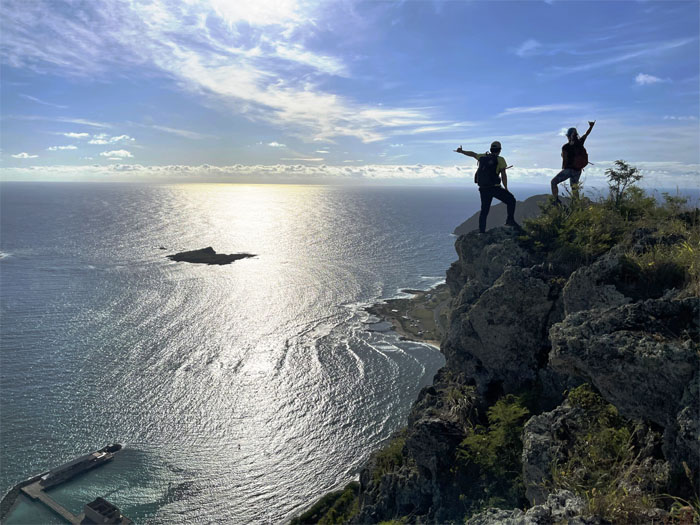
Celebrating our completions of the Ko’olau Summit Trail (KST). #4 for Tessa and #12 for myself.
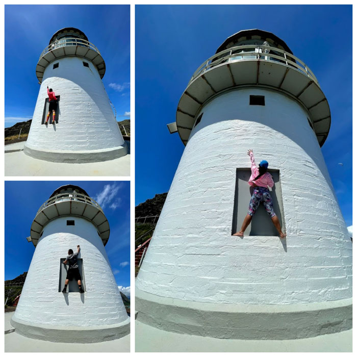
Makapu’u Lighthouse
Some of us could reach higher than the others.
Makapu’u Point
Following the arrow like lemmings off a seaside cliff. Literally.
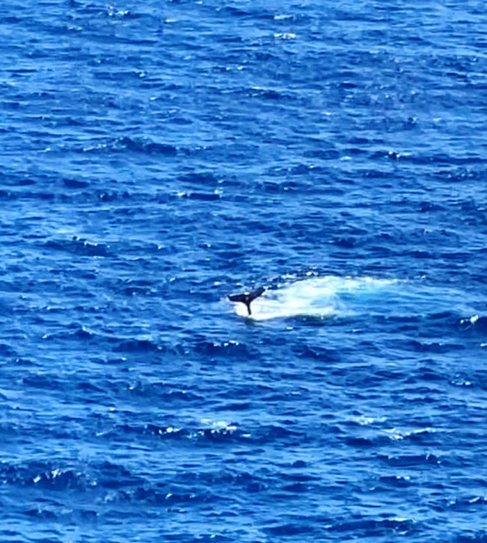
Whale Watching
All hiking was temporarily suspended to watch the gentle giants slapping the waters with their tails. Photo by Lilyn Avendano.
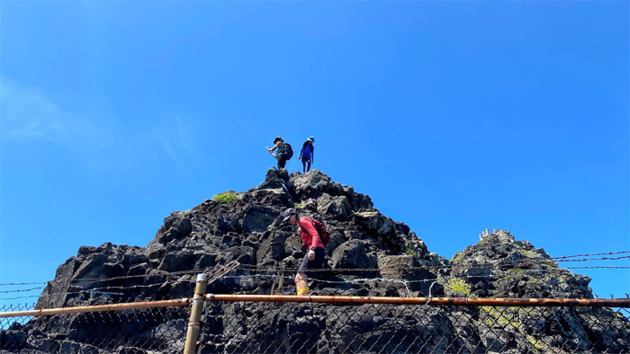
Makapu’u Point
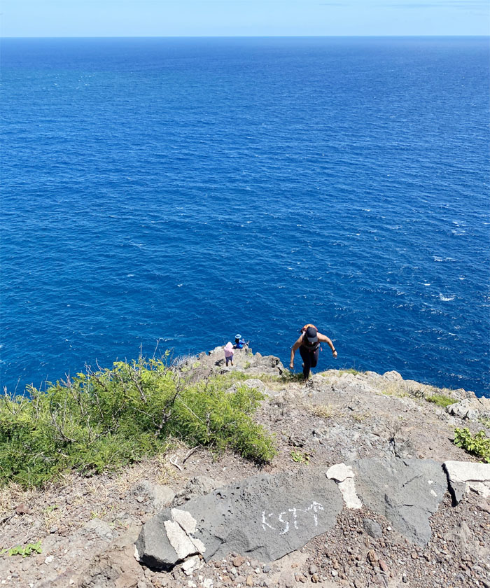
The group climbing down to find the “official” end of the KST.
Makapu’u Point
Will the real KST finisher please stand up?
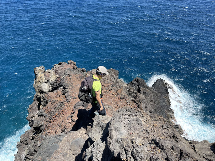
Makapu’u Point
Who’s coming down with me? Crickets. Only two of them followed me down. Photo by Art Young.
Makapu’u Point
Art climbing down the side of the crumbly rocks to the narrow ledge below him.
Makapu’u Point
Testing the rocks as we made our way down. Photo by Art Young.
Makapu’u Point
Somebody wanted to call it. I turned up my ELO music.
Makapu’u Point
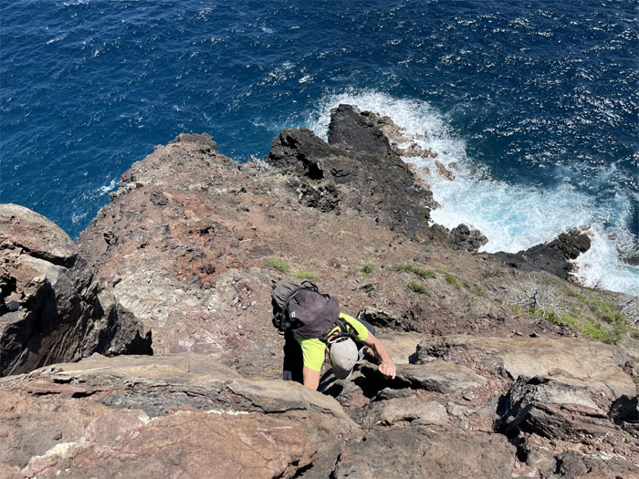
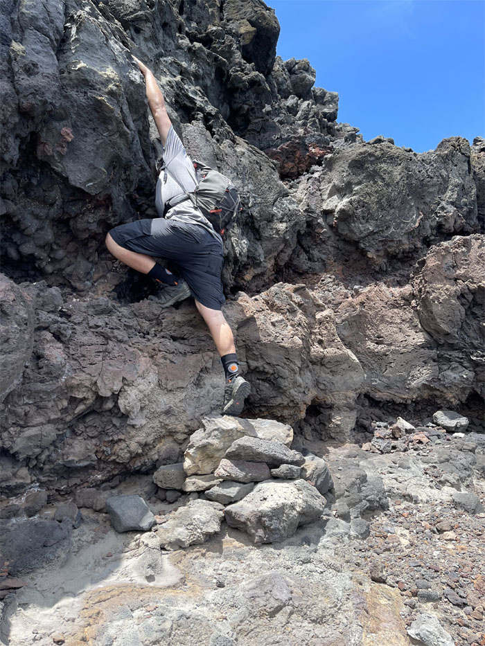
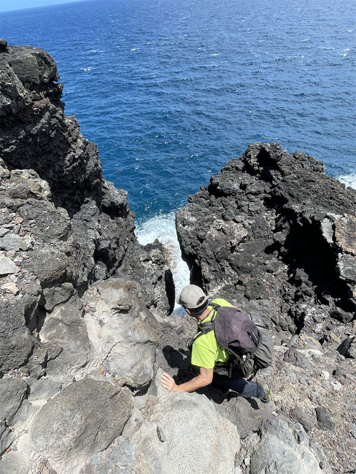
Forward progress was stalled by a steep cliff, so we contoured to our right. Photo by Art Young.
Makapu’u Point
Sliding down the crumbly rocks.
Makapu’u Point
Art climbing his way down. Photo by Lilyn Avendano.
Makapu’u Point
The rest of the group watching our progress from the safety of the lighthouse. I’m pretty sure some of my crickets wanted to be topside as well. Photo by Aida Gordon.
Makapu’u Point
Checking to make sure we could climb back up after each down climb.
Makapu’u Point
Art stretching his glutes on his way down to the stack of rocks. Photo by Lilyn Avendano.
Makapu’u Point
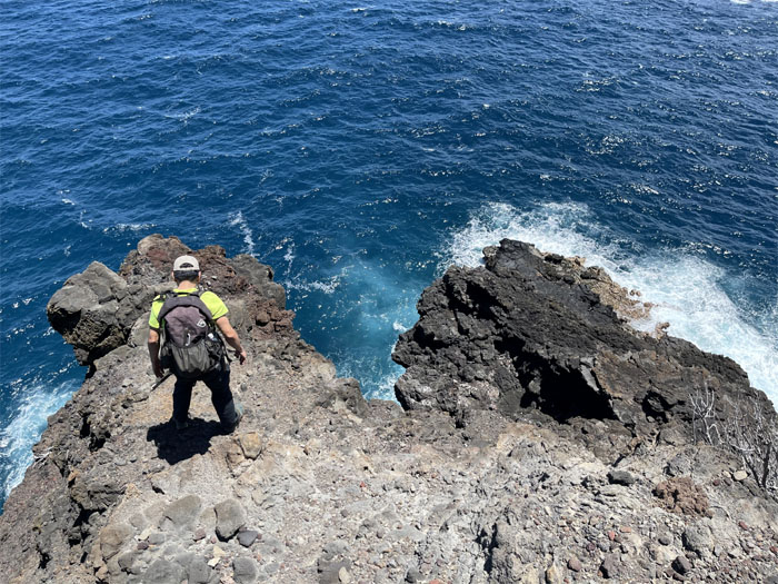
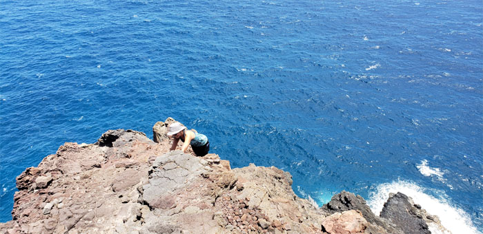
We could smell the ocean. We were that close. So close, yet so far. Photo by Lilyn Avendano.
Makapu’u Point
The buck stops here. Or at least this hiker does. Photo by Art Young.
Makapu’u Point
Lilyn watching my progress from a safe distance.
Makapu’u Point
End of the cliff for us. Photo by Lilyn Avendano.
Makapu’u Point
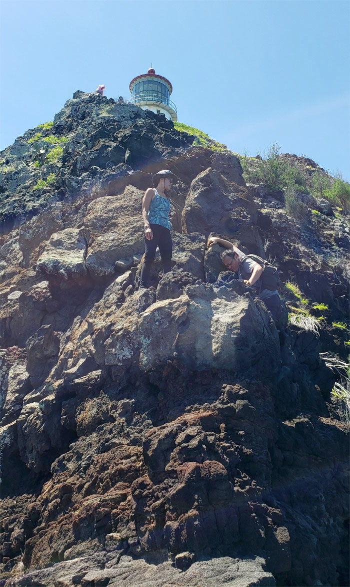
We retreated back on the trail and found the most suitable flat spot to take our group photo.
Makapu’u Point
Lilyn scrambling back up to the narrow ledge. Photo by Art Young.
Makapu’u Point
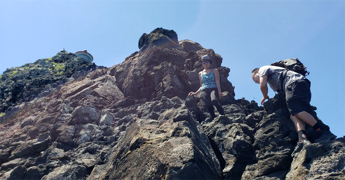
Making our way back up the ridge. Photo by Lilyn Avendano.
Makapu’u Point
It was a lot easier climbing our way back up. Photo by Art Young.
Makapu’u Point
Lilyn pulling herself up.
Makapu’u Point
Climbing up the slabs of rocks. Photo by Lilyn Avendano.
Makapu’u Point
Art coming up the ridge line. Photo by Lilyn Avendano.
Makapu’u Point
Almost there. Photo by Lilyn Avendano.
Makapu’u Point
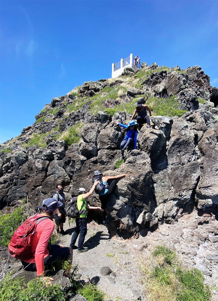
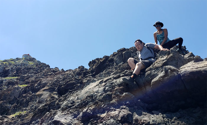
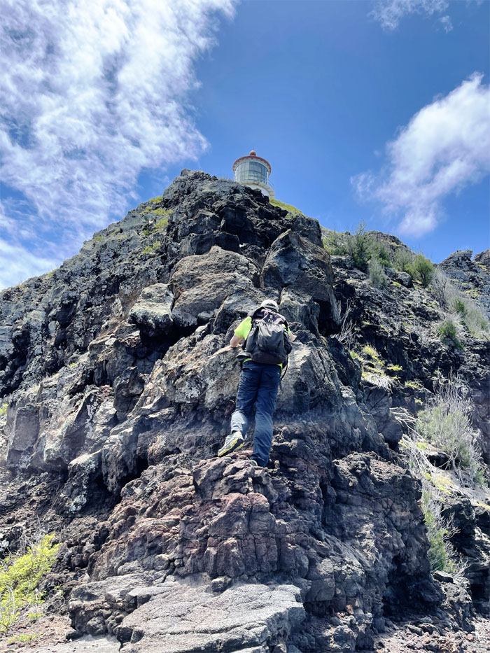
Climbing our way back to the lighthouse. Photo by Aida Gordon.
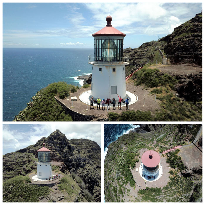
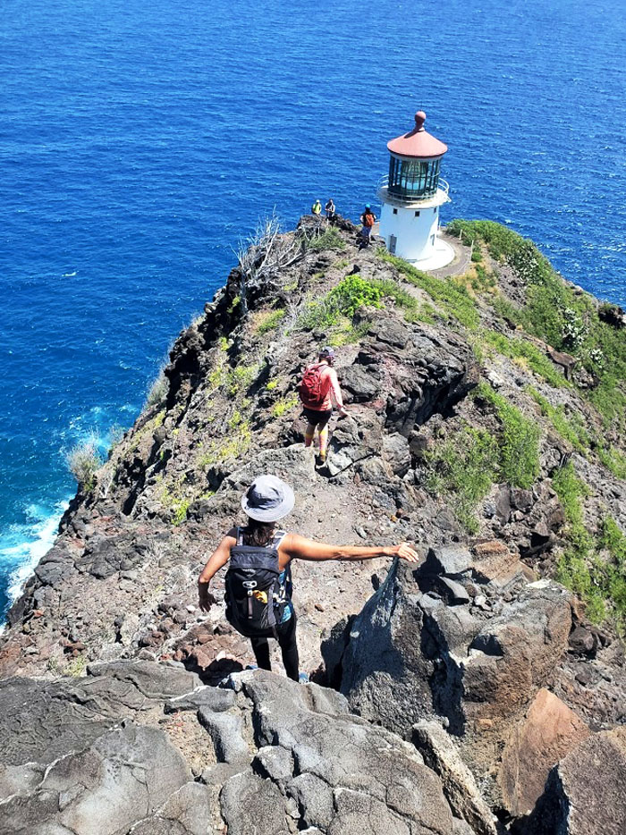
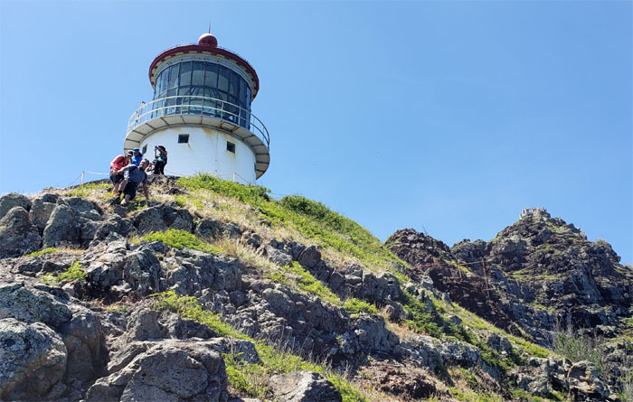
Makapu’u Lighthouse
Aerial views of the 35′ concrete tower that holds the largest hyperradiant lens in the country. The lighthouse sits 395′ above the water serving as a navigational aid to ships that ply the nearby Hawaiian waters.
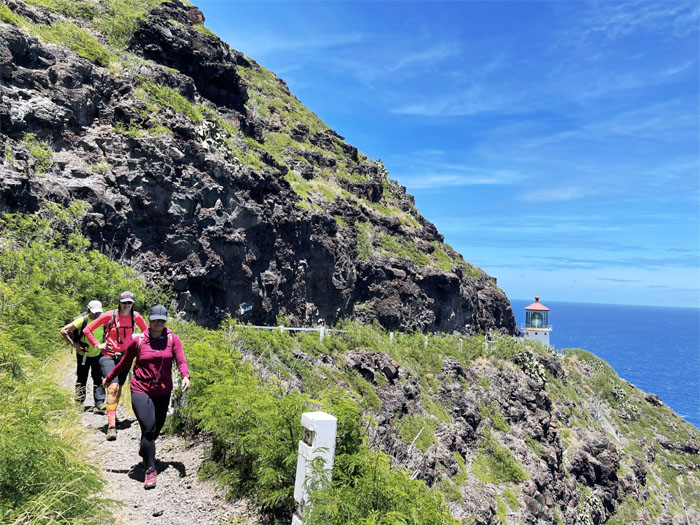
Makapu’u Lighthouse Trail
Watching out for falling rocks on our way out. Photo by Art Young.
Makapu’u Lighthouse Trail
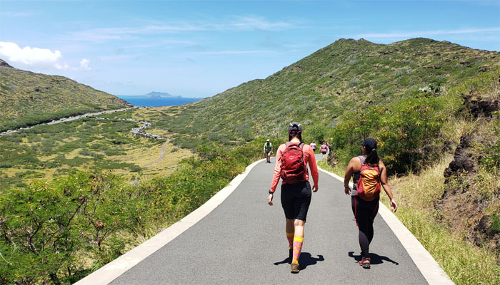
Walking down the hot, paved road that were teeming with hikers.
All pau
Champagne ceremony. I think I prefer to be on the giving end rather than on the receiving end. Thanks to Quan and Lilyn for shuttling us back to our cars.
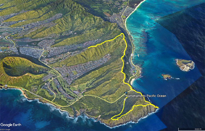
GPS Tracks
Our short day covered a little over five miles where we almost touched the waters of the Pacific Ocean, but content in our adventure and accomplishments. Fun day with a great group of friends. Post hike meal at Island Brew Coffeehouse which did not sit well with some of us, so we went to Uncle Clay’s to fill up our tummies.
Note: I have been made aware that some hikers have been using my blog as a hiking guide and getting lost on the trails. Please note that this blog was made to document the hike for the crew(s) that did it. That is why some of my comments will seem to have no relevance or meaning to anybody outside of the crew(s) that hiked that trail. My blog was never meant as a hiking guide, so please do not treat it as such. If you find inspiration and entertainment from these hikes, that is more than enough. If you plan on replicating these hikes, do so in the knowledge that you should do your own research accordingly as trail conditions, access, legalities and so forth are constantly in flux. What was current today is most likely yesterdays news. Please be prepared to accept any risks and responsibilities on your own as you should know your own limitations, experience and abilities before you even set foot on a trail, as even the “simplest” or “easiest” of trails can present potential pitfalls for even the most “experienced” hikers.
{ 2 comments… read them below or add one }
#12 & #4, YAY to us! LOL… Fun day with fun crew!
Aloha Tessa,
Yup, congrats again on your number four finish!
Mahalo