
Wanting to do a twist on the Kamiloiki hike that I had done over a month ago, and not wanting to thrash my legs again, we decided to hike from Kamiloiki ridge to Makapu’u. We parked one car at the Makapu’u lookout and then drove to find parking on Waioli Street , where we walked up Makahuena Place to start our hike.

Pahua Heiau
I never knew or imagined that an ancient Hawaiian temple or heiau was located smack dab in the middle of the sleepy suburbs in Hawaii Kai. But then again, the temple was here long before Henry Kaiser turned Kuapa Pond into his planned residential development in East Oahu. The trailhead starts from the left side of the heiau, where we followed the trail through hale koa and dried grass to make the top of the ridgeline.

Rainbow over Kuapa pond
We quickly gained elevation and saw this beautiful rainbow over a drastically shrunken Kuapa Pond and Hawaii Kai neighborhood.

Rain over Kamiloiki Valley
Rainbows do not exist without raindrops, as we were about to find out when several passing clouds dumped rain on us as we walked on the exposed part of the ridge. As we neared the summit, clumps of trees provided much needed shade from the hot sun, which quickly replaced the rain.

Waimanalo
We made the summit in about two hours, where blue skies greeted us along with views of Mount Olomana and Waimanalo.

Abandoned Nike Missile Site
We then followed the trail to the right which descended into a saddle and then back up to the ridge where the abandoned Nike Missile Site sits. It looks steep from afar, but once you get up close and personal, it’s just another climb up the mountain. Nothing to get excited about. Well, that’s what I kept telling my friend.

Koko Crater and Koko Head
After making our way through the abandoned Nike missile complex and checking out the views of Koko Crater and Hawaii Kai, we followed the paved road until we found the ribbon marking the Makapu’u trail on our left. Climbing up the dirt steps, we saw one of two hang gliding platforms which had fantastic views of the ocean and the Waimanalo coastline. Speaking of hang gliding platforms, that reminds me that I better use my Groupon coupon for paragliding lessons before it expires in November.

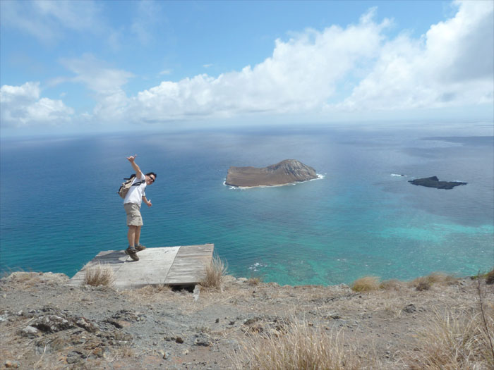
Rabbit Island
This part of the trail until Makapu’u is completely exposed, there is no shade from the withering sun. We brought sunscreen but failed to use it, so much for the supposed intelligence of some higher primates.

Makapu'u Puka
There is a natural rock formation coming down the trail that is called the Makapu’u Puka, which can also be seen from the road down below. Hawaiian legend has it that an archer saw a rat on the ridge and shot it with his arrow from his canoe, thus creating the hole that exists today. We also met another group that was doing the hike from the opposite way, after talking story a little bit, we went our opposite ways.

Makapu'u Lighthouse
We could see the Makapu’u Lighthouse in the distance, which was established in 1909 and has the largest lighthouse lens in the country.

Makapu'u Lookout
After hiking six hours in the hot sun and rocky cliffs, we arrived back at the Makapu’u Lookout. Now we had to complete the most dangerous part of the hike, crossing the road without getting hit or run over by the speeding cars.
{ 0 comments… add one now }