
I went out the West side to dry out this weekend with Charlie, CJ and Tessa. Thanks to Matt for dropping us off at Schofield Barracks. Citizens of all country are welcome.
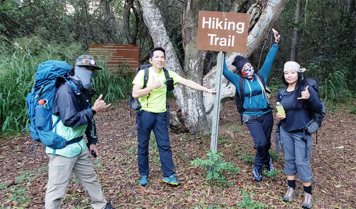
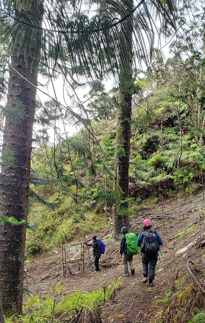
Trailhead
The start of the trail was teeming with hikers. We got a jump on them before the trail got too congested. Photo by Matt Vidaurri.
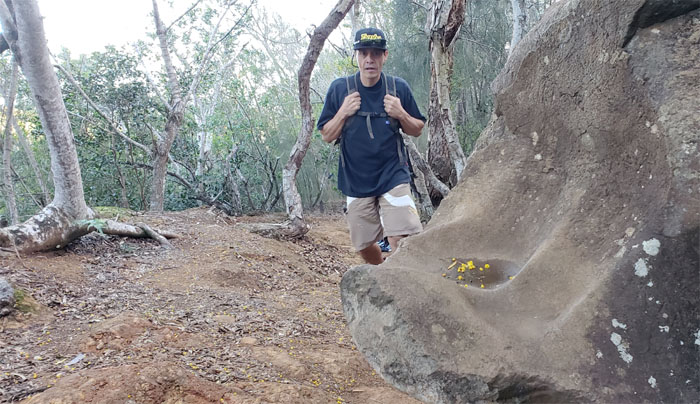
KoleKole Pass Rock
I hope heads will not be rolling today.
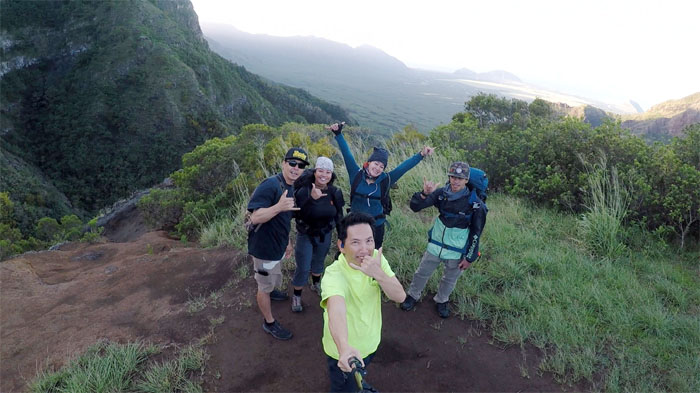
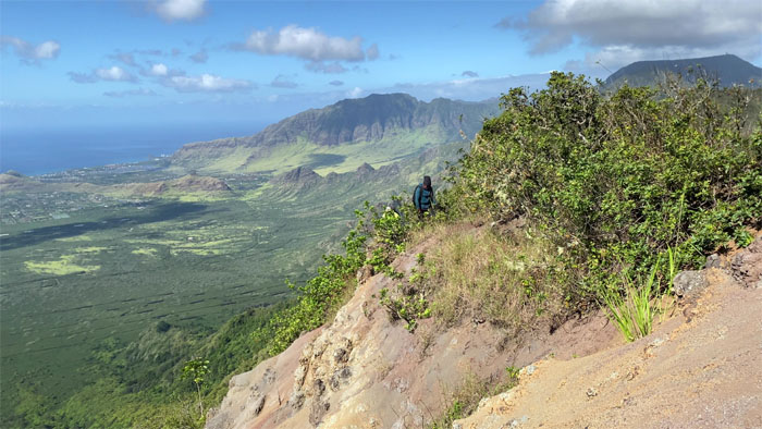
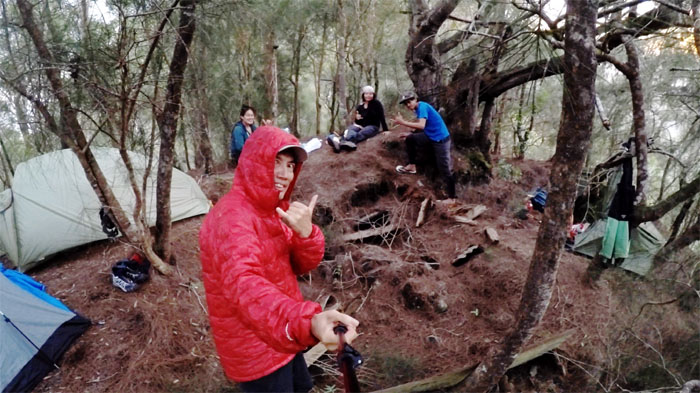
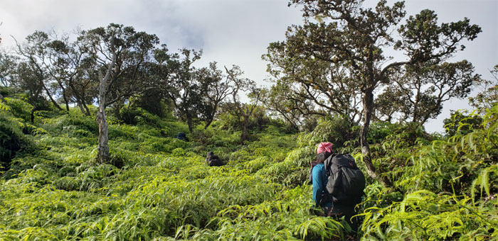
Meadows
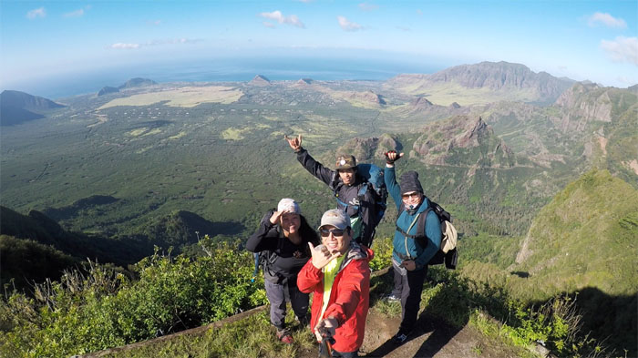
Group photo before Matt took his leave of us, left to right: Matt, Tessa, myself, CJ and Charlie. The brisk winds aborted Matt’s attempt at some drone shots. So he called it a day and bade us farewell.
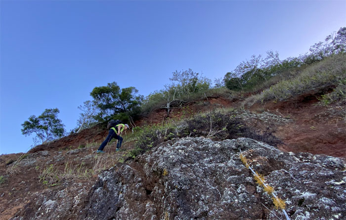
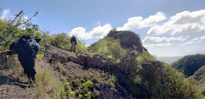
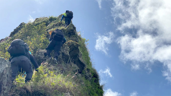
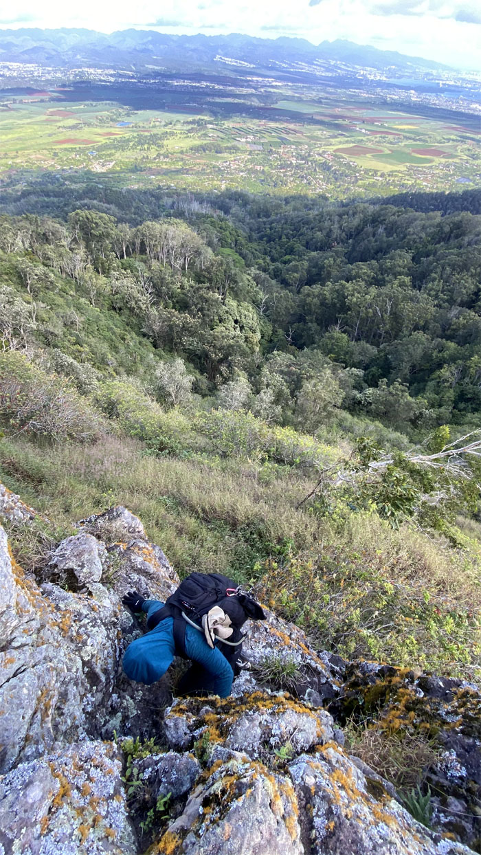
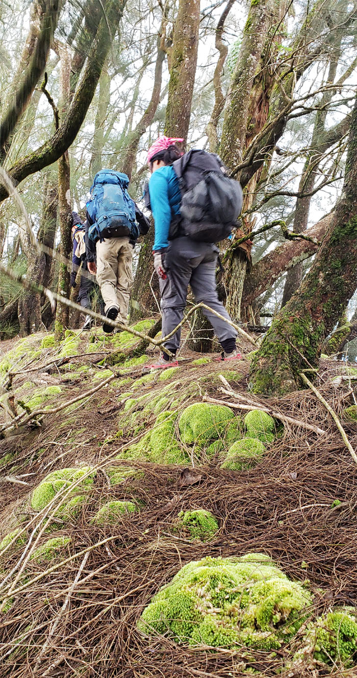
Hapapa Trail
We took the crumbly and direct route up. Photo by Charlie Antonio.
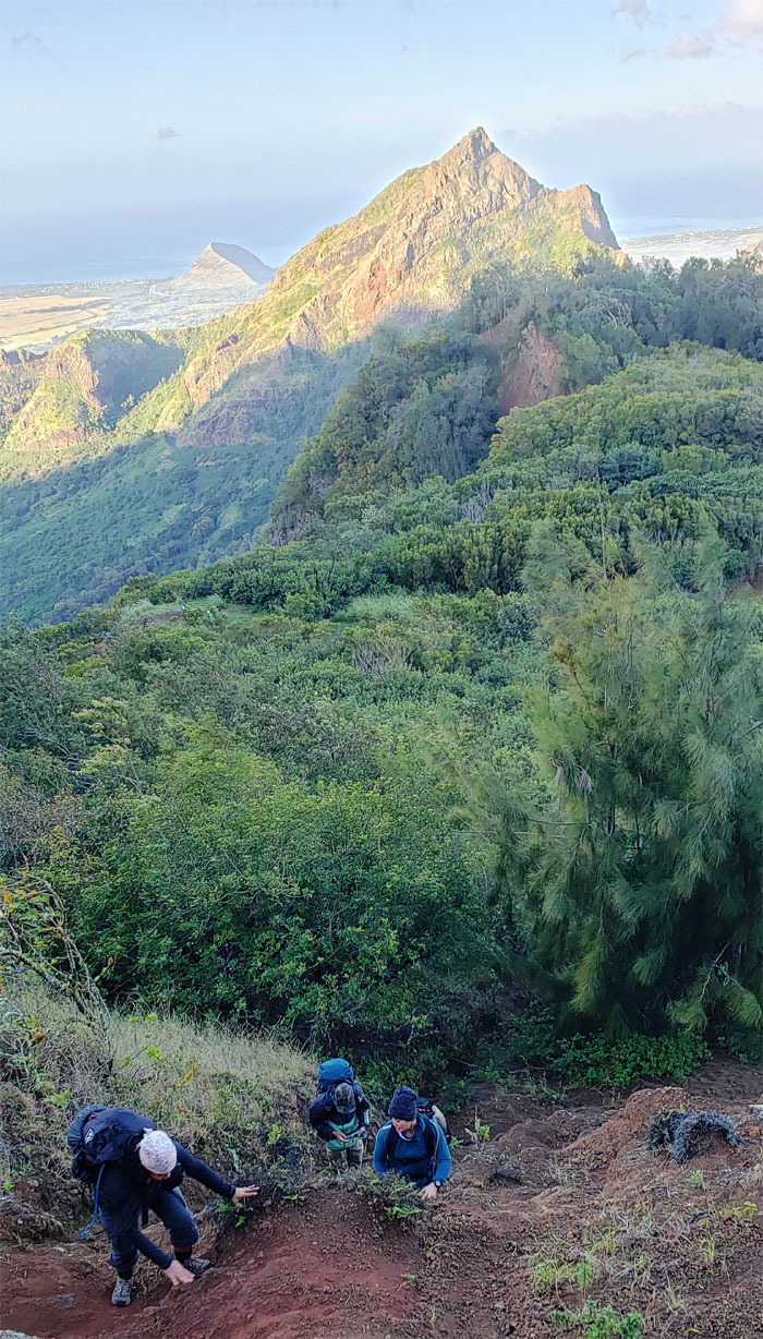
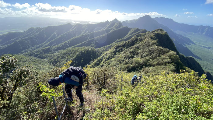
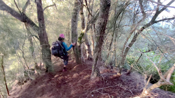
Hapapa Trail
The rest of the group making their way up. Somehow, somebody got lost on their way up. Excuse me, he was exploring. LOL.
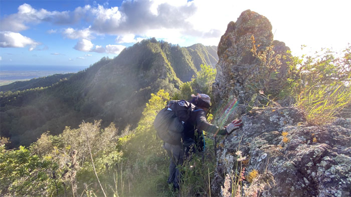
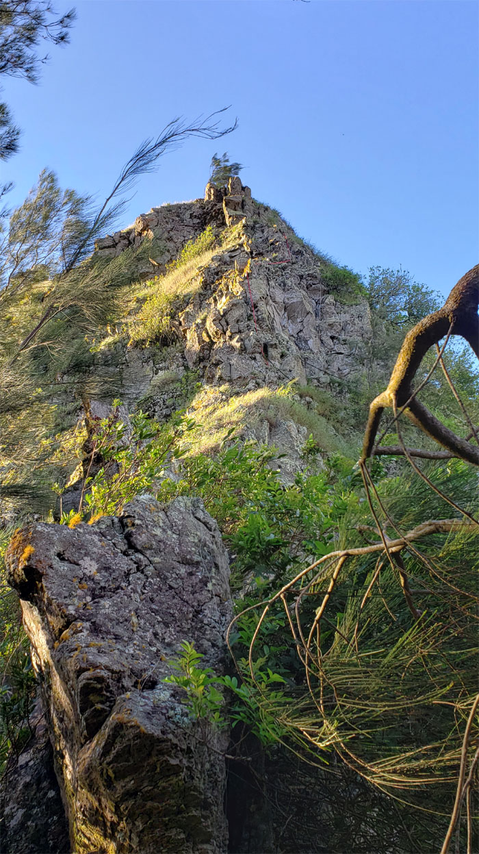
Hapapa Trail
We made our way through the stand of paperbark trees and soon found ourselves at the towering rock dike. Photo by Charlie Antonio.
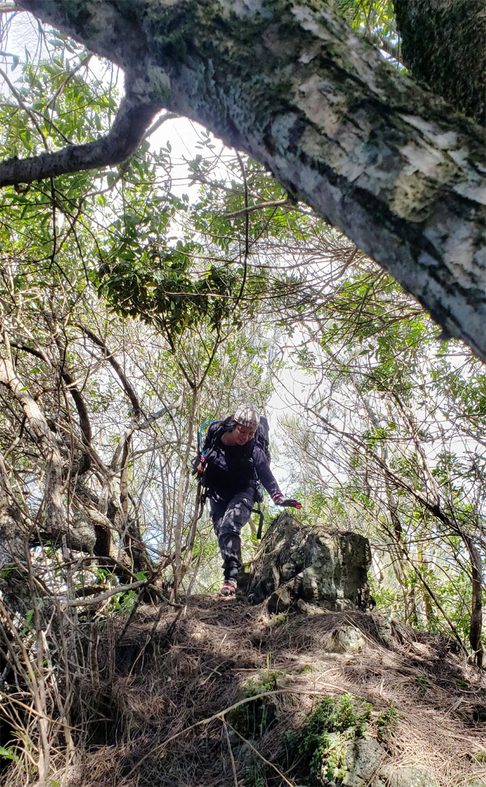
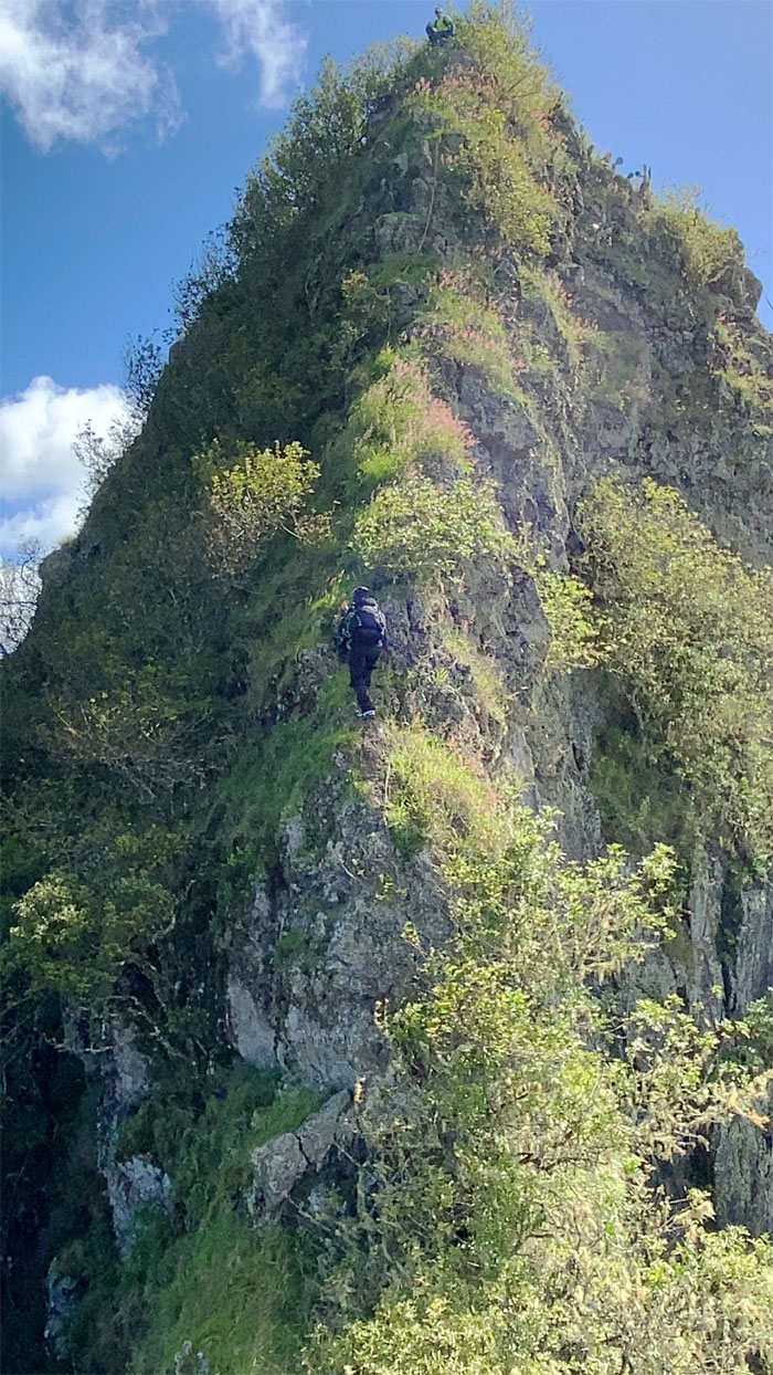
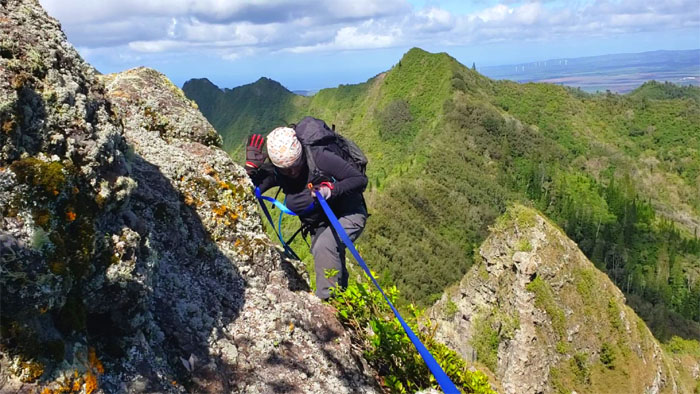
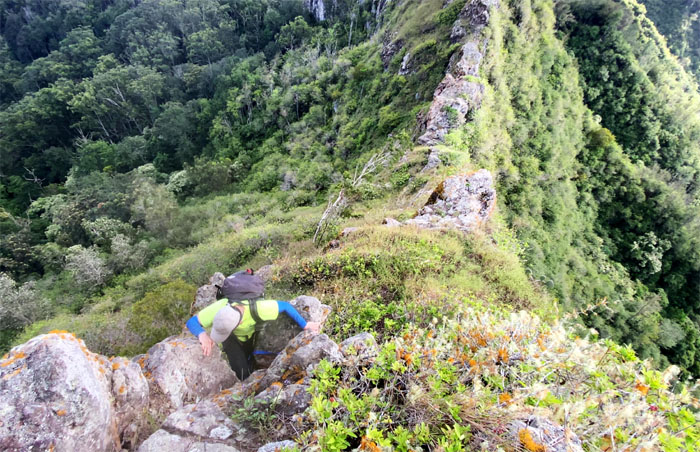
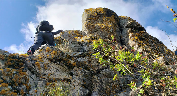
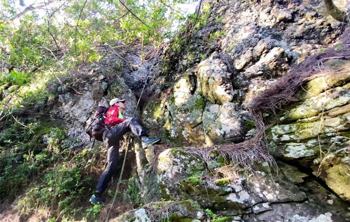
Hapapa Trail
Climbing down to start our climb up the first notch. Photo by Charlie Antonio.
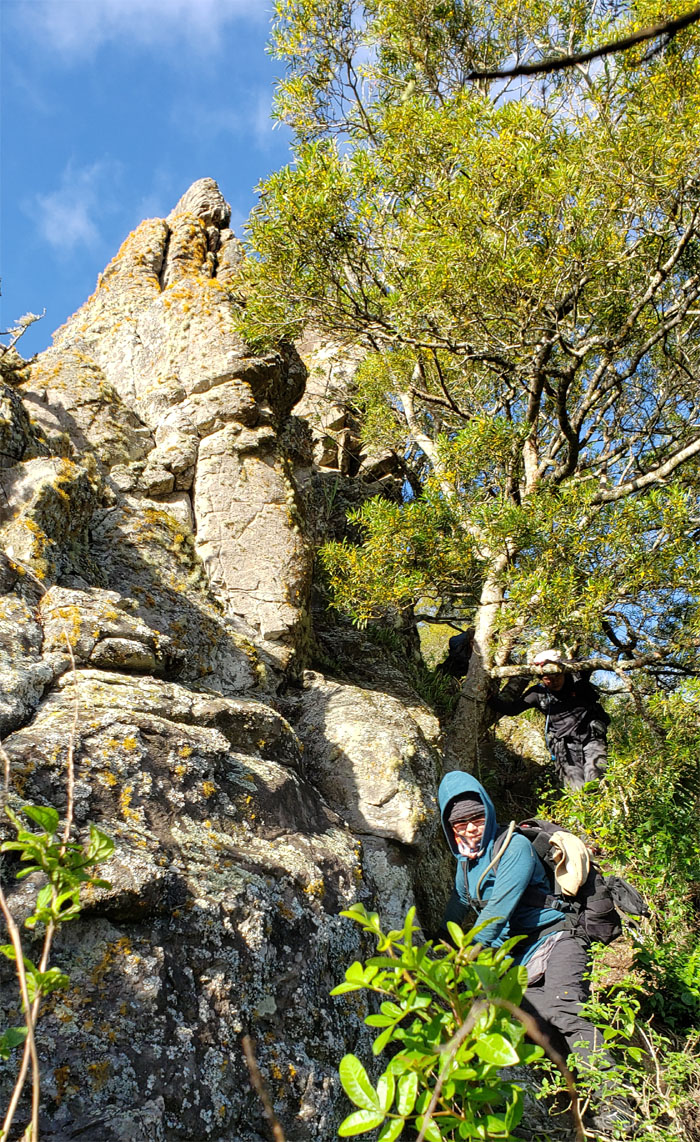
Hapapa Trail
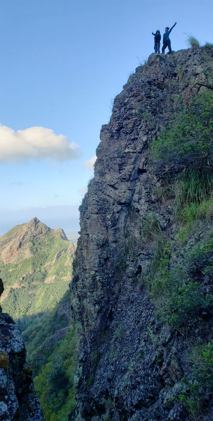
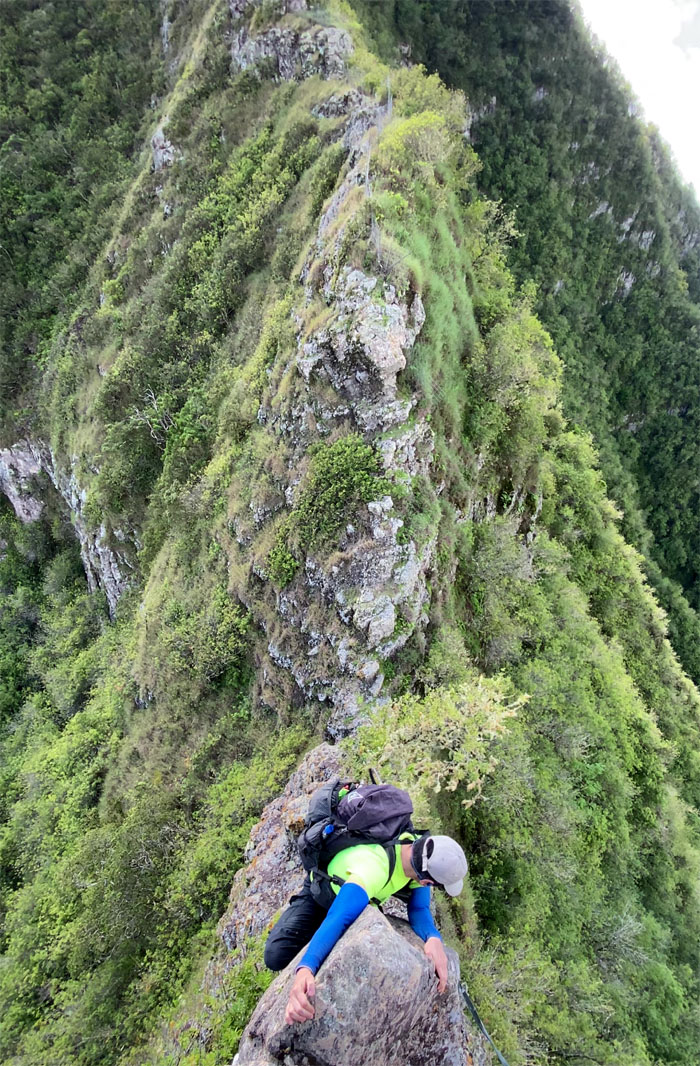
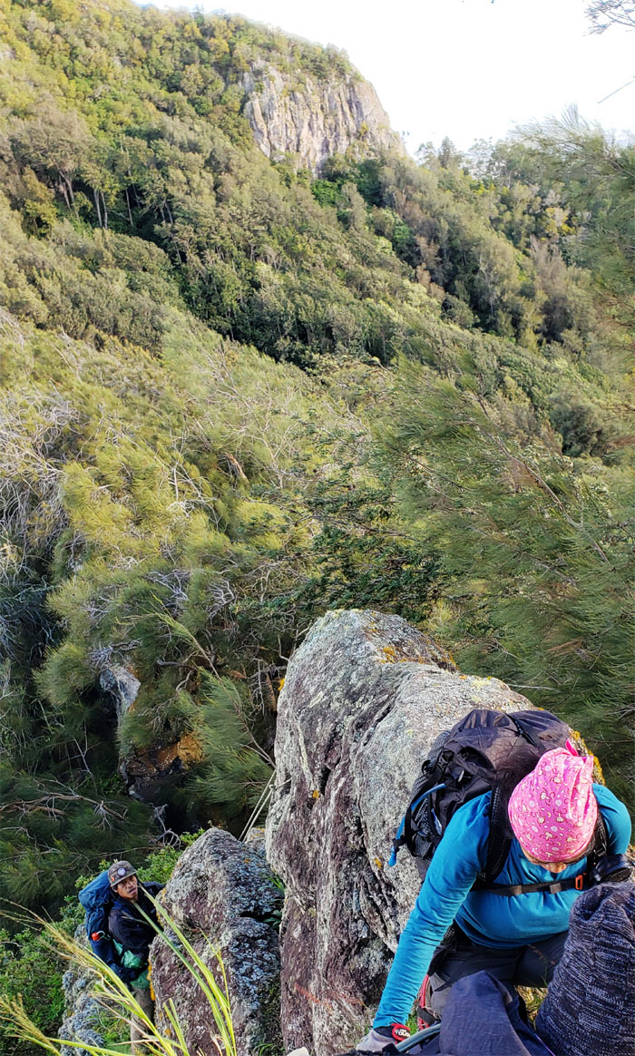
CJ and Tessa on the photogenic dike.
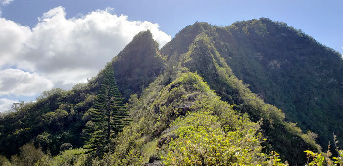
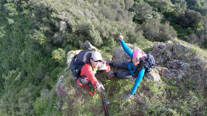
Hapapa Trail
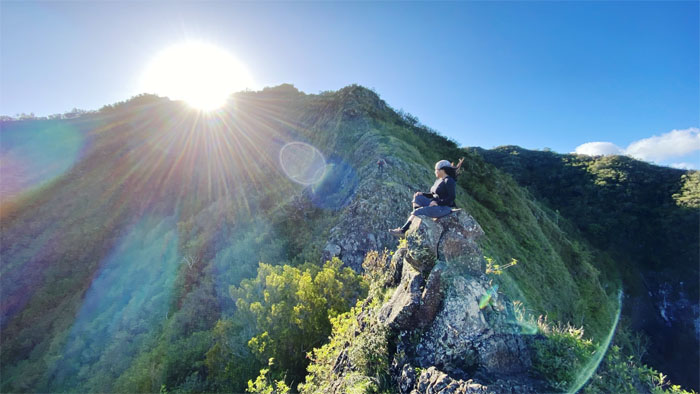
Tessa sitting on her perch in the mountains. Photo by CJ Mendiola.
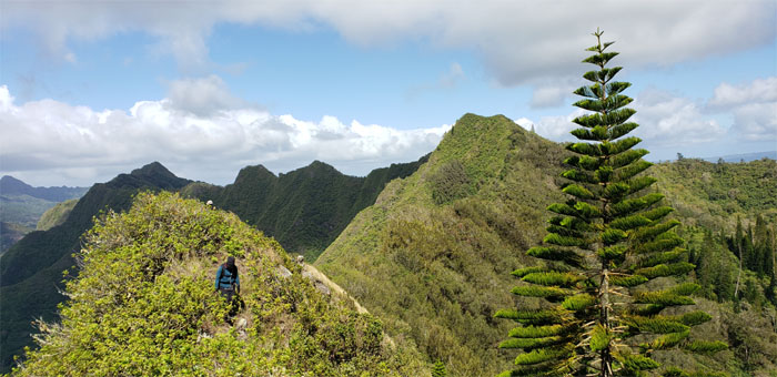
Hapapa Trail
The girls on top of the second notch.
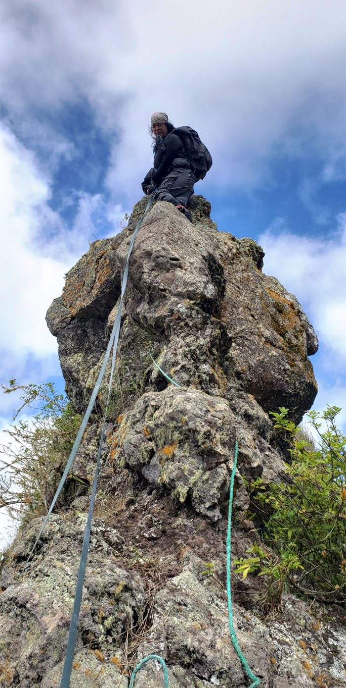
Hapapa Trail
Are we home for the night? Photo by Tessa Bugay.
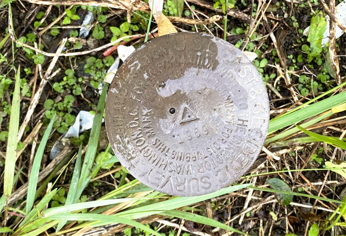
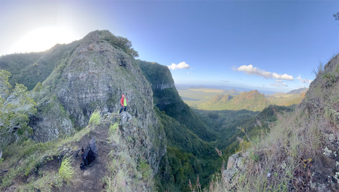
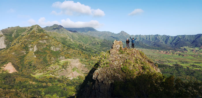
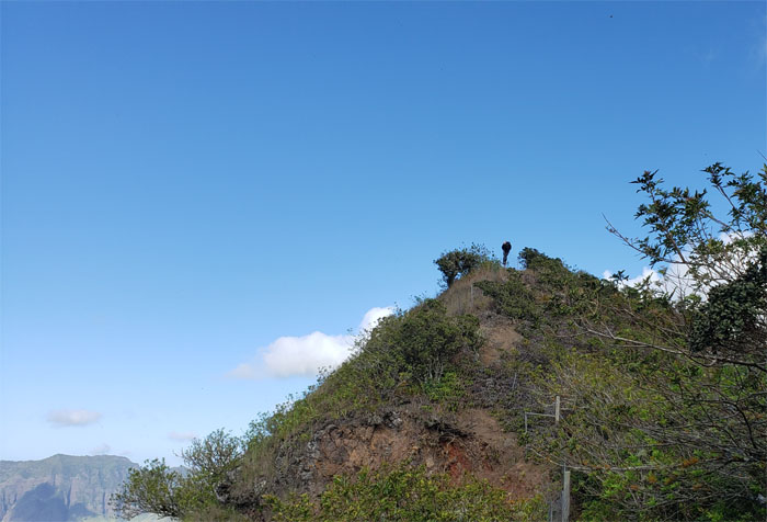
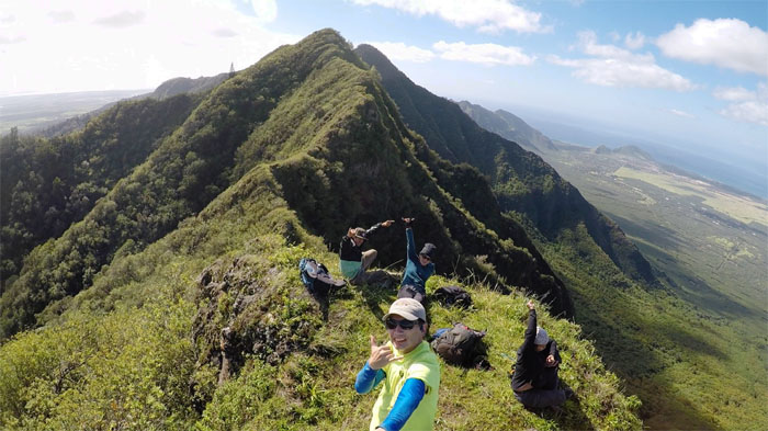
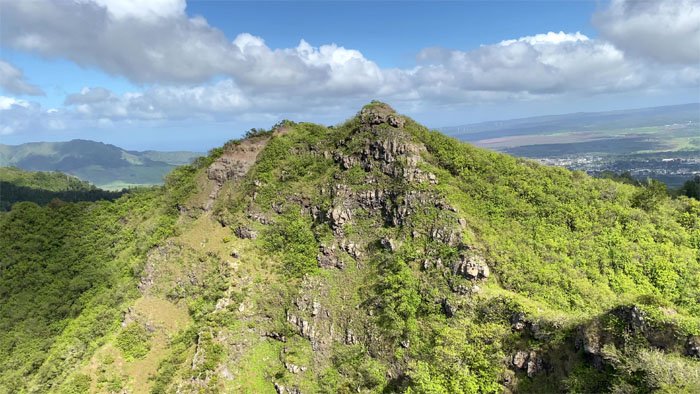
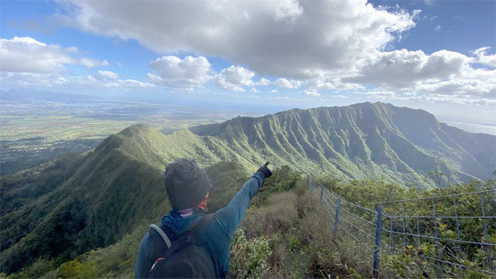
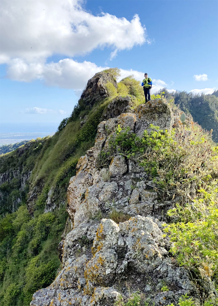
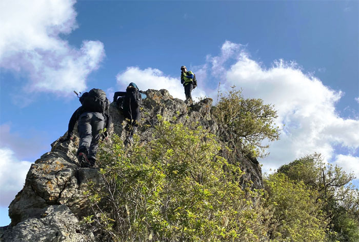
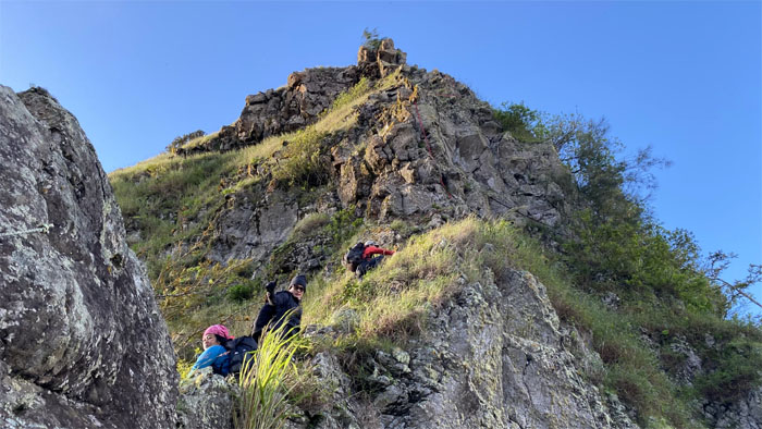
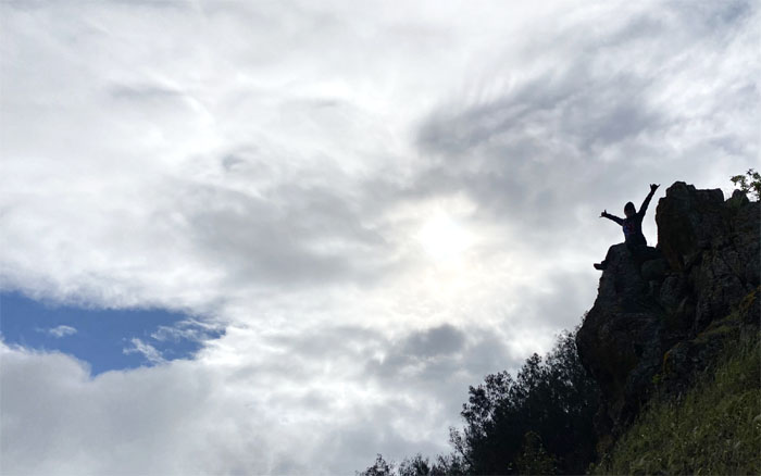
Pu’u Hapapa
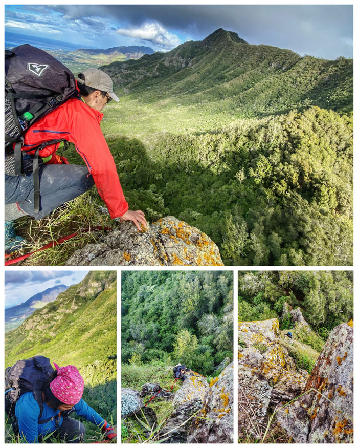
Group photo on the square summit overlooking the West side. The best side.
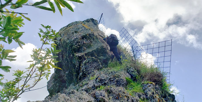
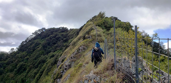
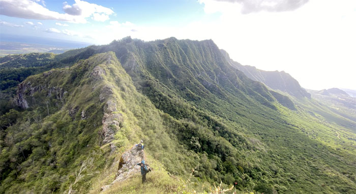
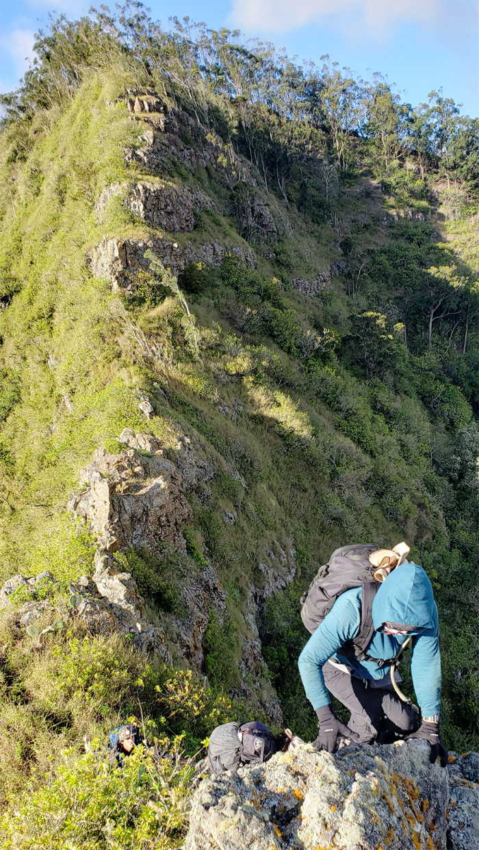
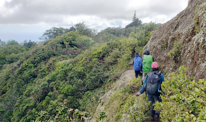
Waianae Summit Trail (WST)
We left the 2,883′ summit to begin our hike on the fenced trail. Photo by Tessa Bugay.
WST
Looking back as Tessa climbs over one of many fenced junctions.
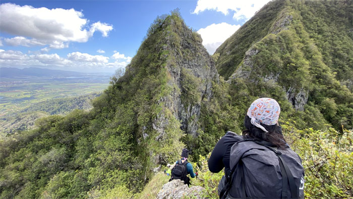
WST
Descending down towards the imposing rock dike which interrupts the ridge line. Photo by Tessa Bugay.
WST
Making our way around the eroded section. Photo by Charlie Antonio.
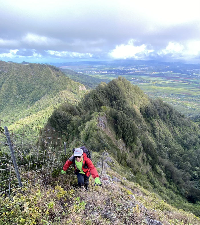
WST
Heading towards the knob of Kanehoa.
Pu’u Kanehoa
Group photo at the 2,778′ summit that offered splendid panoramic views.
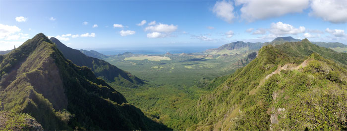
Pu’u Kanehoa
One of the splendid views from the top.
WST
Looking back at the exposed summit. Photo by Charlie Antonio.
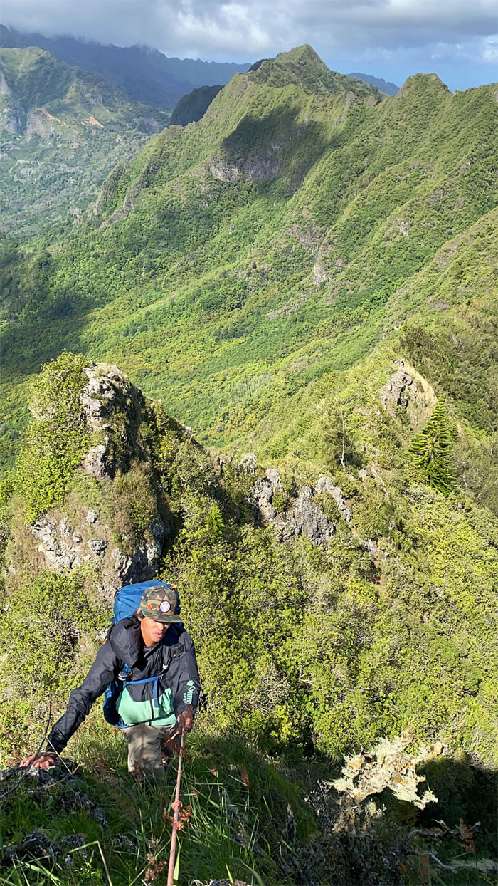
WST
Tessa hiking through the mixed tree section of the ridge.
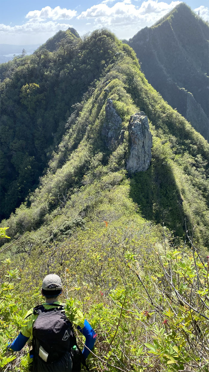
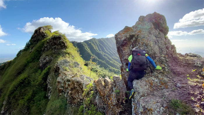
WST
Approaching the “Christmas Tree” which is the gateway to the first set of obstacles before us.
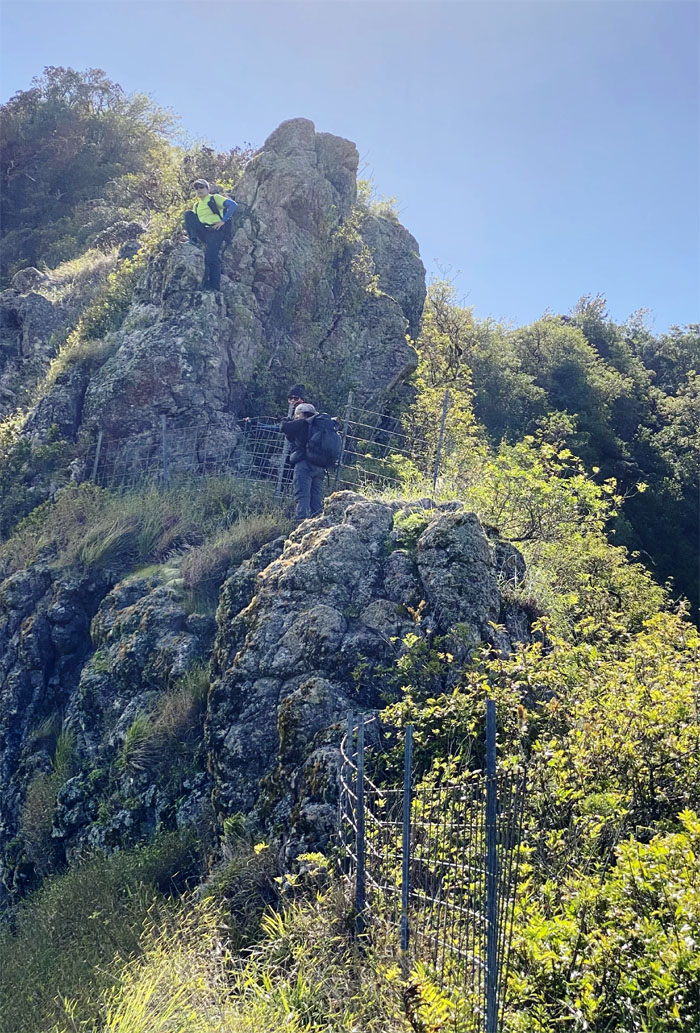
WST
CJ and Tessa cresting over the small hill.
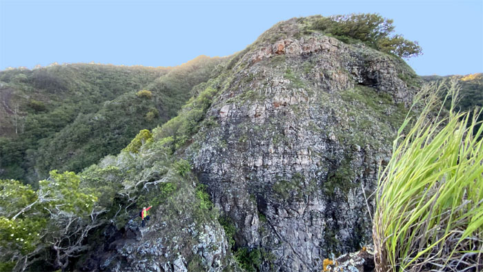
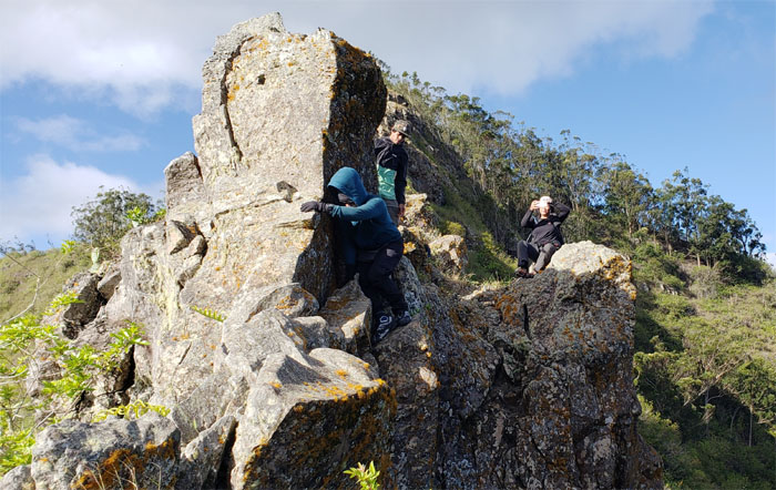
Gorilla Heads
Scrambling up the smaller head. Photo by Charlie Antonio.
Gorilla Heads
Climbing down towards the bigger head. Don’t touch it too much. Photo by Charlie Antonio.
Gorilla Heads
CJ making her way up. Photo by Tessa Bugay.
Gorilla Heads
Charlie bringing up the rear. Photo by CJ Mendiola.
Gorilla Heads
Looking for my next foothold. Where’s my spotter? Photo by Tessa Bugay.
Gorilla Heads
Tessa’s turn to climb down. Step by step. Heart to heart. Left, right, Left. We all fall down. Wait, don’t follow the last lyric.
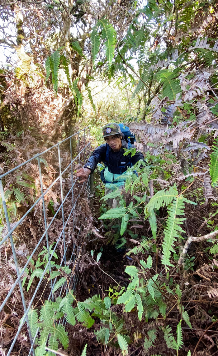
WST
CJ making her way up the interrupted fence line. Hard for the fence installers to follow the pitches of the ridge line.
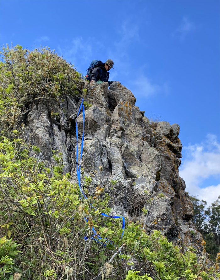
Need webbing?
We soon left the fence line to climb up a rock face. Photo by Charlie Antonio.
Bee in my bonnet
Tessa was being buzzed and it wasn’t from alcohol. I was of no help. Luckily CJ had a stick handy and flicked the bee out.
WST
Back on the fence line.
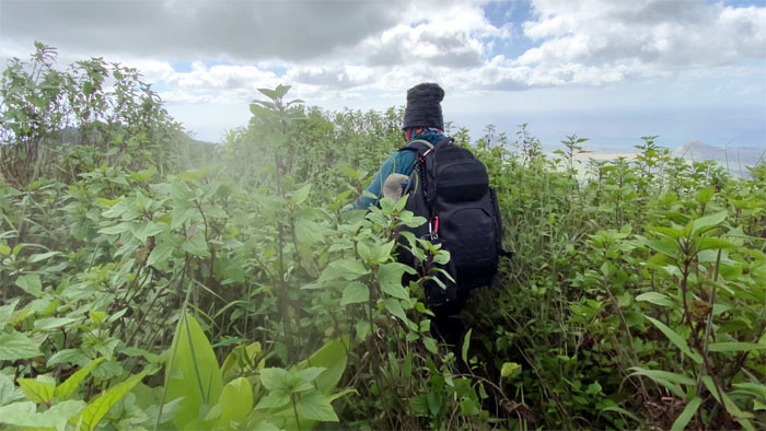
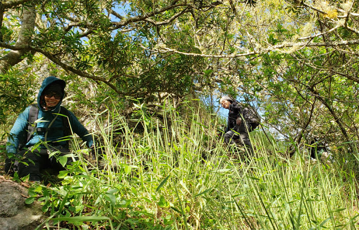
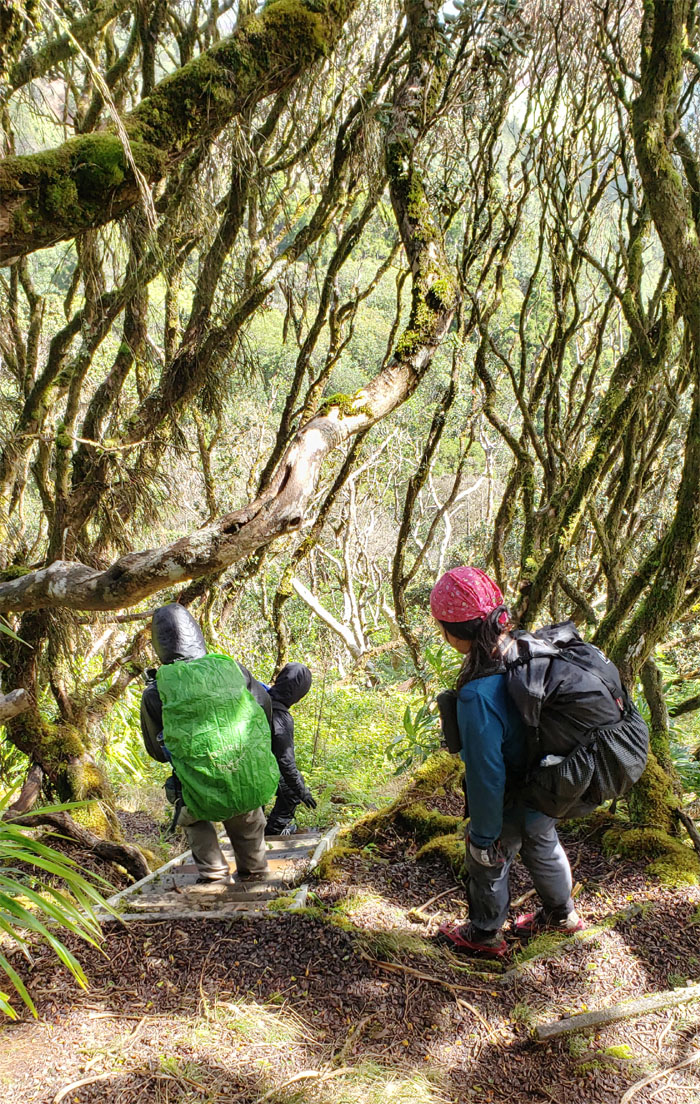
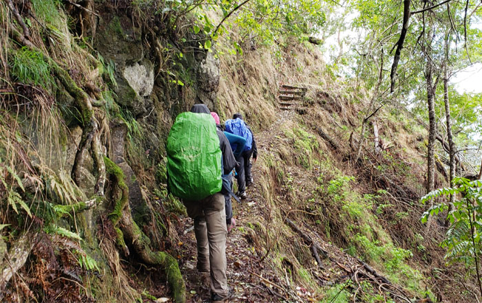
WST
Charlie pushing through the overgrowth. Visibility was mostly uluhe ferns in your face. Photo by Tessa Bugay.
Pu’u Kaua
The 3,127′ summit was extremely overgrown, no stop here. Photo by Charlie Antonio.
WST
Back on the fence line with CJ pointing at our destination, which was still far away. Photo by Charlie Antonio.
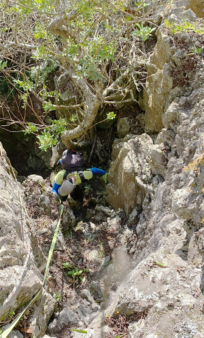
WST
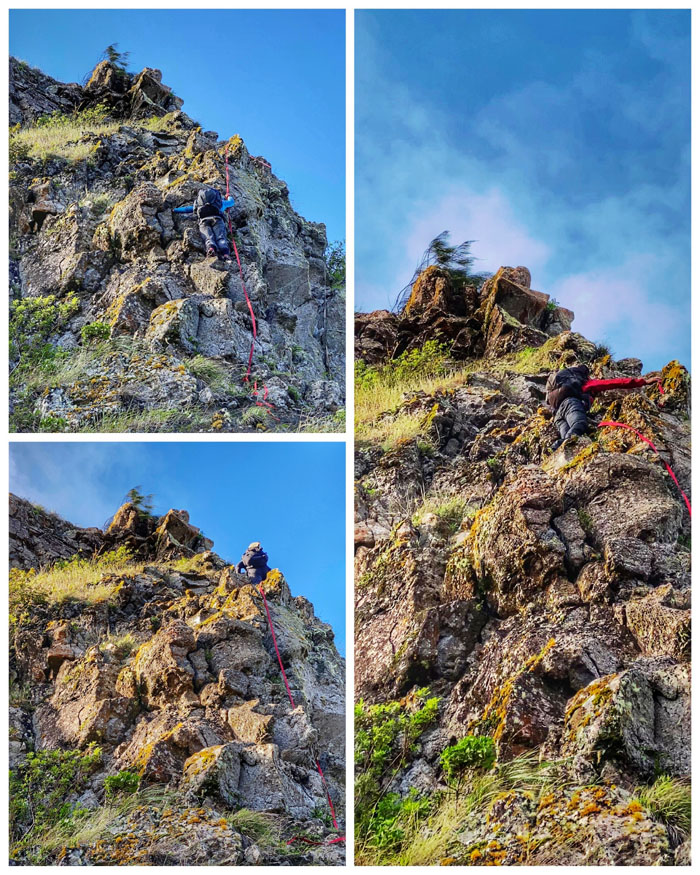
Climbing my way down. The start of the most rock climbing this side of the WST. Photo by CJ Mendiola.
WST
Charlie ready to climb down.
WST
Looking for our next rock face to climb down. Photo by Charlie Antonio.
WST
CJ making short work of the rock face. Photo by Tessa Bugay.
WST
Tessa climbing down the correct route.
WST
The other two decided on an “easier” descent and ended up losing their webbing. Apparently my words of advice were drowned out in the wind. LOL. Photo by Tessa Bugay.
WST
Contouring a somewhat tricky rock face. Photo by Tessa Bugay.
WST
The others following in my footsteps. Pack optional.
WST
Scrambling up another rockface. After another. And another. You get the picture. Photo by Charlie Antonio.
WST
Give me your hand and forget about losing your manhood.
WST
Contouring around the tree line to stay on trail.
WST
Tessa dropping off the ridge line. Photo by Charlie Antonio.
WST
The group hugging the rockface as we made our way down the sliver of a trail.
WST
Making my way down a short drop. Photo by Tessa Bugay.
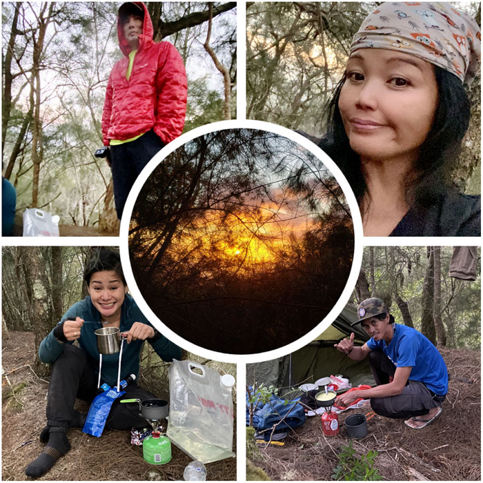
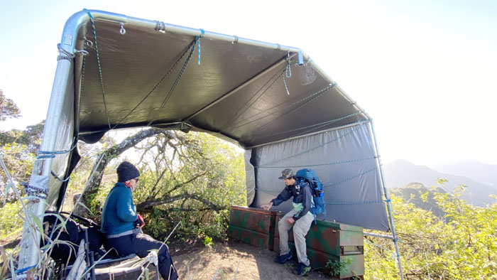
Camp Pohakea
Camp life. We could have survived for quite some time in the mountains what with Charlie’s industrial sized can of butane fuel and copious amounts of unfiltered water. We were just missing enough food. We didn’t look appetizing to each other.
Camp Pohakea
Camp site. We pitched tent on what looked like the remains of another cabin or bunker. We were not breaking new ground.

Camp Pohakea
Good night from the Waianae Mountains. Photo by Charlie Antonio.
Camp Pohakea
We woke up the next morning after rain showers pelted our campsite, made breakfast, broke down camp and left to tackle the biggest obstacle in the mountains. Photo by Charlie Antonio.
Pohakea Pass
I won’t lie. Every time I see this 80′ crumbly cliff, I get butterflies in my stomach.
Pohakea Pass
Climbing and contouring our way up. Photo by Charlie Antonio.
Pohakea Pass
The group queued up at the base of the cliff.
Pohakea Pass
Everybody ready to climb? Photo by Charlie Antonio.
Pohakea Pass
The climb up was greatly assisted with the red webbing that another group had left. Caution was still exercised as never fully trust webbing that wasn’t set by your own hands. It pays to also have somebody that can safely free climb obstacles in case webbing is suspect or lacking.
Pohakea Pass
Checking out the group coming up, the wind stalled somebody’s progress immeasurably. But everybody made it up safely. In the end, that’s all that matters.
Pohakea Pass
CJ perched on her rock. Photo by Tessa Bugay.
Pohakea Pass
Hello from the top of the pass.
Bonsai Trail
Leaving the pass behind us.
WST
It was another steep climb up the fenced ridge line. Photo by Tessa Bugay.
WST
Wading through the sea of forest green uluhell.
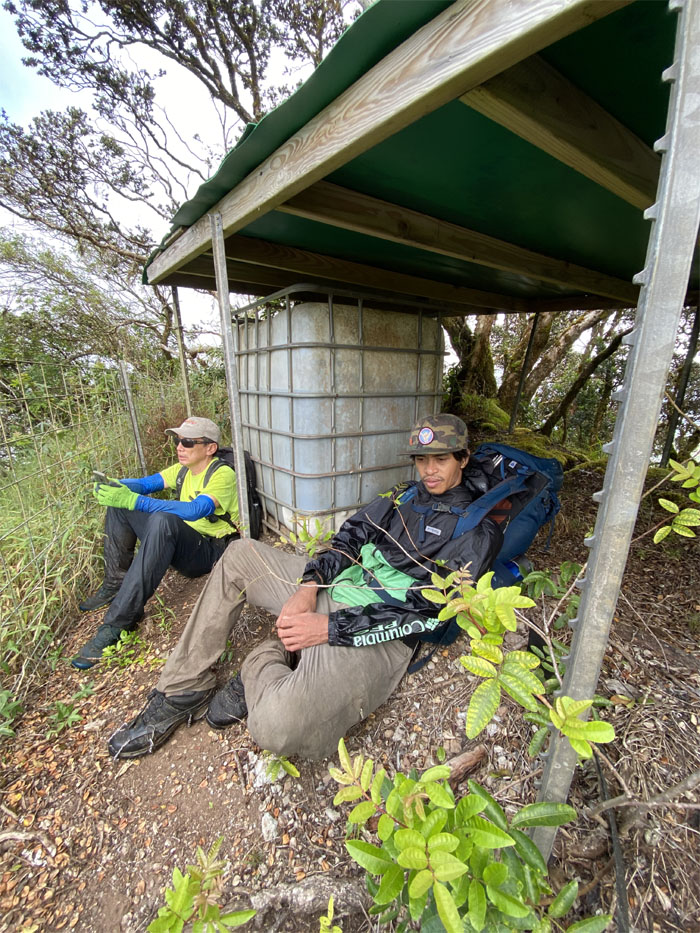
WST
Water catchment break. Photo by CJ Mendiola.
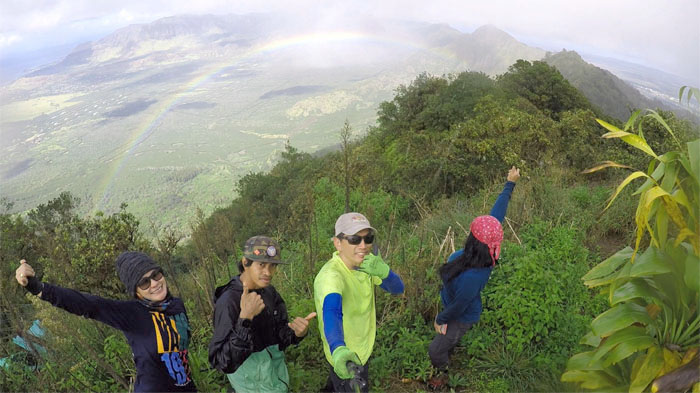
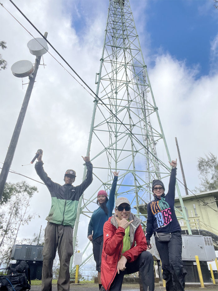
Palikea Summit
Group photo with the rainbow behind us in Lualualei Valley.
Palehua
Going down the stairs. We must be nearing civilization.
Palehua
Leaving the forest of pine trees as we left the gated area.
Palehua
Traversing the trail cut from the side of the cliff.
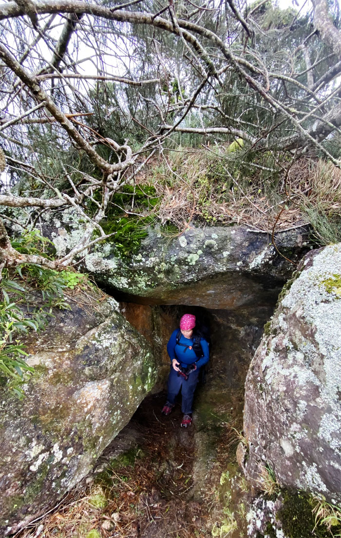
Palehua
Indiana Bugay coming through the boulder tunnel. Photo by Charlie Antonio.
Palehua
Switch backing our way to the bamboo forest.
Palehua
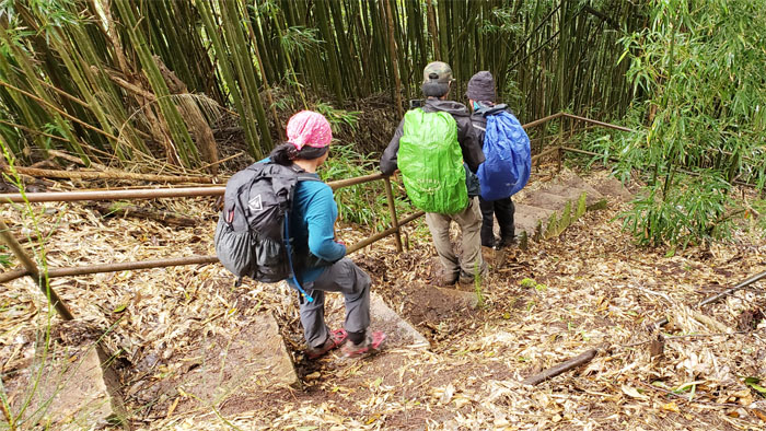
Going down the last set of stairs for the day.
Palehua
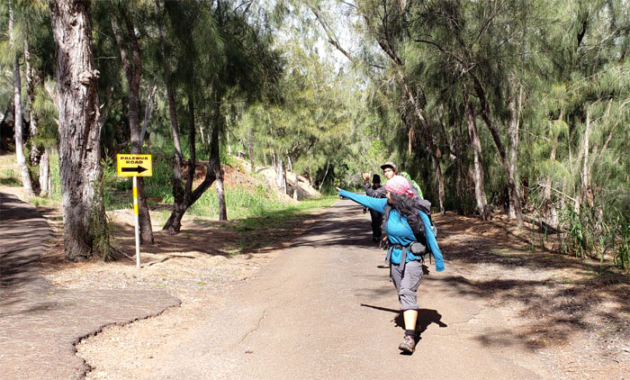
End of the trail and beginning of the road. We are not out of the woods yet.
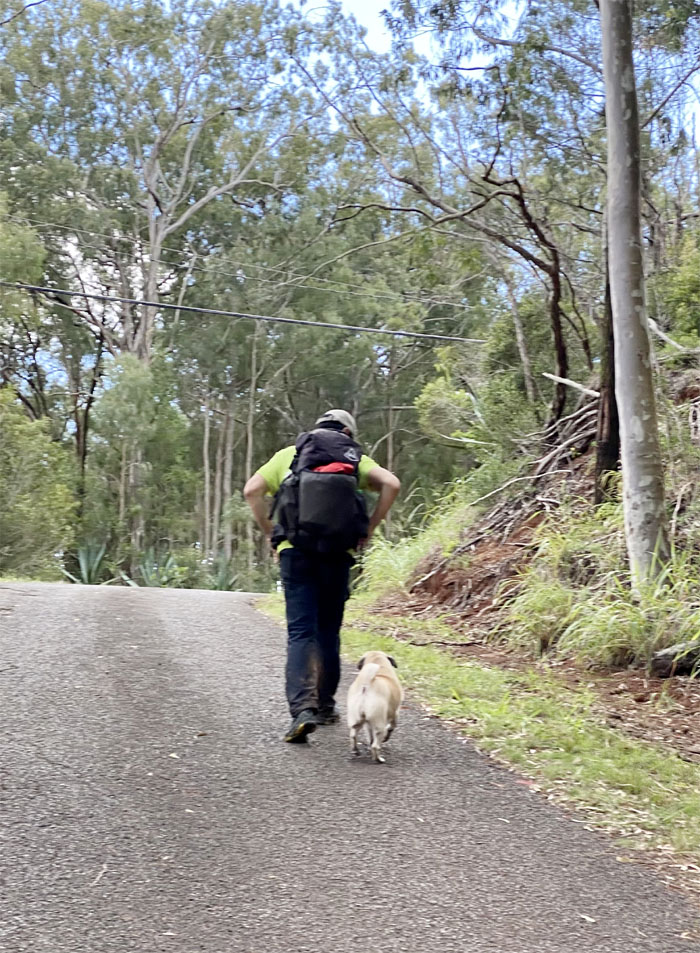
Hiker Humane Society
I am not your Daddy! Photo by Charlie Antonio.
All pau
Mahalo to Quan for picking us up halfway on the road.
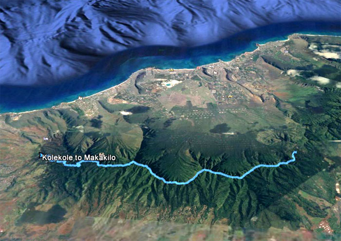
GPS Tracks
Our two day camping and climbing hike in the Waianae Mountains covered 9.5 miles with fun company and marked my fifth time completing the Waianae Summit Trail (WST). Post hike meal at Outback Steakhouse where Aida, Chris, Lilyn and Quan also joined us on two separate tables. No clam chowder on the menu. What is this world coming to?
Note: I have been made aware that some hikers have been using my blog as a hiking guide and getting lost on the trails. Please note that this blog was made to document the hike for the crew(s) that did it. That is why some of my comments will seem to have no relevance or meaning to anybody outside of the crew(s) that hiked that trail. My blog was never meant as a hiking guide, so please do not treat it as such. If you find inspiration and entertainment from these hikes, that is more than enough. If you plan on replicating these hikes, do so in the knowledge that you should do your own research accordingly as trail conditions, access, legalities and so forth are constantly in flux. What was current today is most likely yesterdays news. Please be prepared to accept any risks and responsibilities on your own as you should know your own limitations, experience and abilities before you even set foot on a trail, as even the “simplest” or “easiest” of trails can present potential pitfalls for even the most “experienced” hikers.
{ 4 comments… read them below or add one }
Its was really fun and exciting adventure for me’ ????????
Aloha CJ,
Thanks and glad you had fun on our adventure!
Mahalo
Hahaha… I hear buzzing in my right ear.. from BEE.. hilarious!! Charlie afraid he turned Bakla on this hike.. BAKLA was the most word I heard all day!
Thank you Kenji for leading us on this adventure. See ya next time.
Aloha Tessa,
Another great hike in the books. Thanks for coming.
Mahalo