
We were supposed to celebrate Leon Day, but one of the participants wasn’t feeling up to snuff, so Plan B it was for today.
Makapu’u
Thanks to Akira for shuttling Alexis, Kenny and myself from our end point to our starting point. The neighborhood watch was out in full force, coning the street and asking questions. Good job.
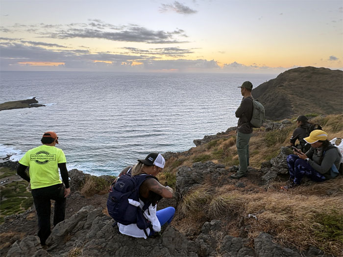
Makapu’u
Staking out our spot for the 0550 sunrise viewing event.
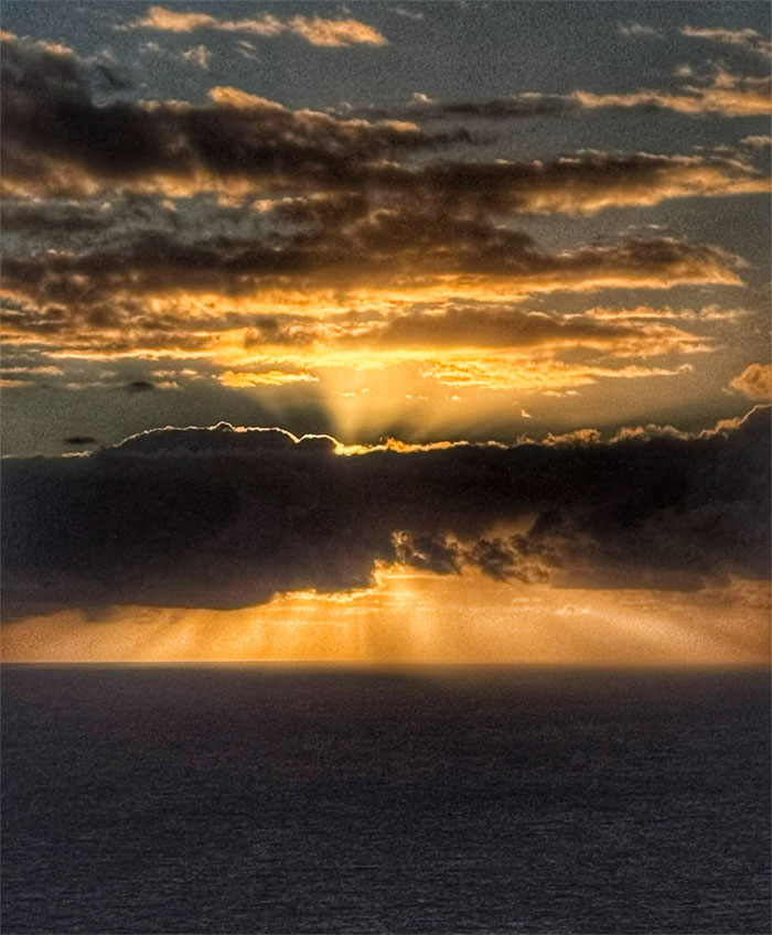
Makapu’u
Witnessing the cloud muted plasma orb thanks to Earth’s rotation around the sun.
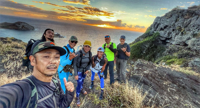
Makapu’u
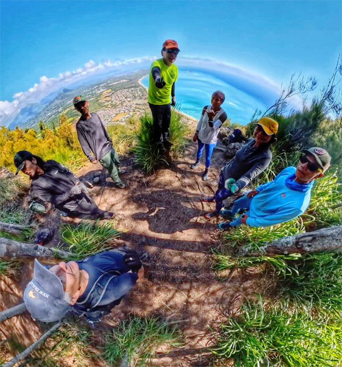
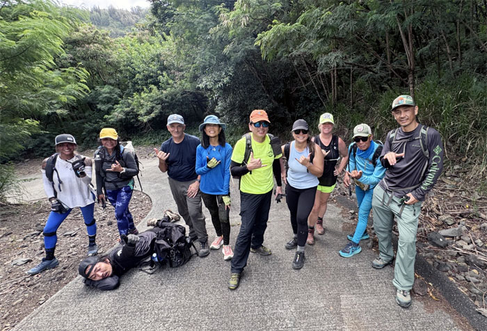
Kuya, let me take the group selfie. I have a YouTube channel.
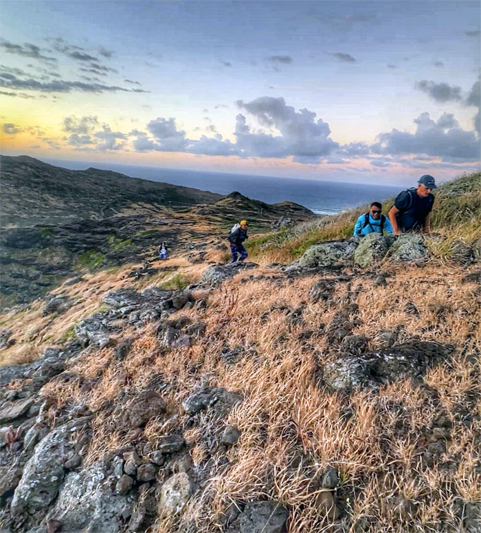
Makapu’u
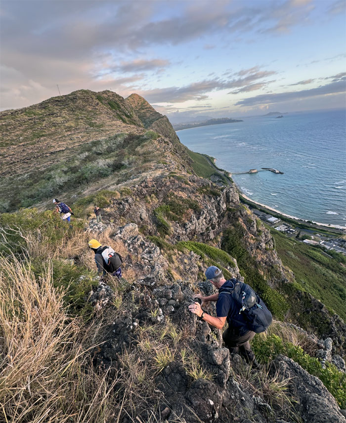
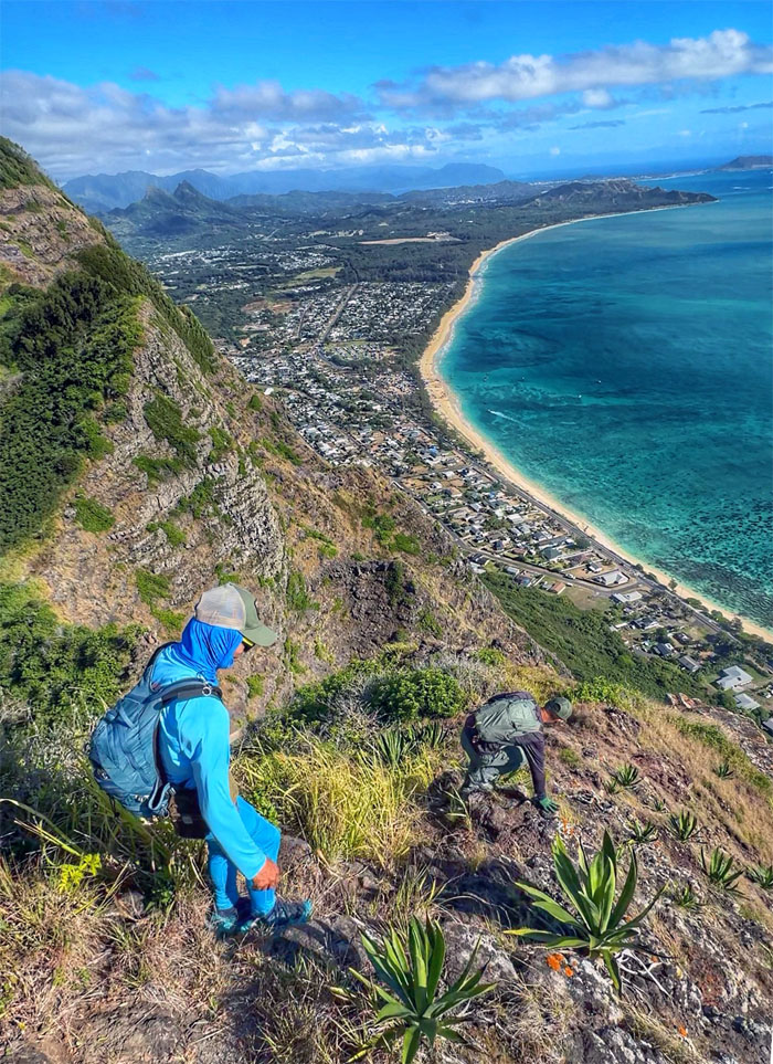
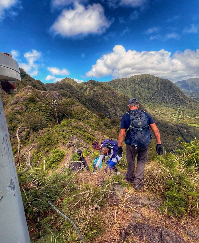
Back to our regularly scheduled program of climbing up the mountain.
Makapu’u
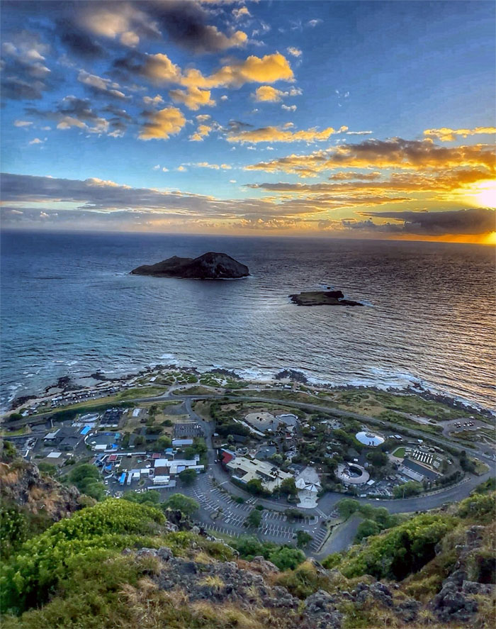
Looking down at Sea Life Park that opened in 1964 and the islands of Manana (Rabbit) and Kaohika’ipu (Black Rock) in the background.
Makapu’u
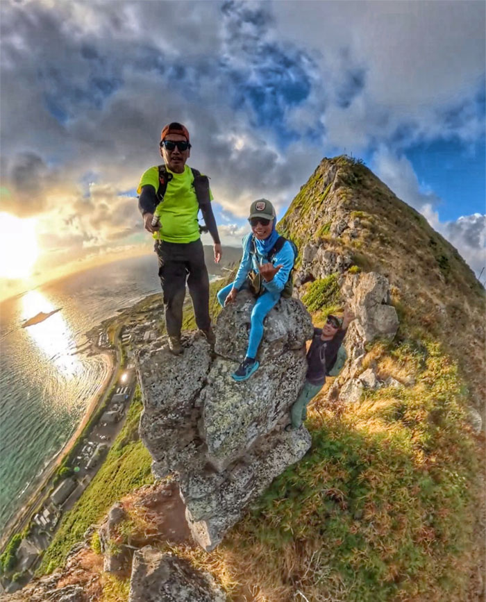
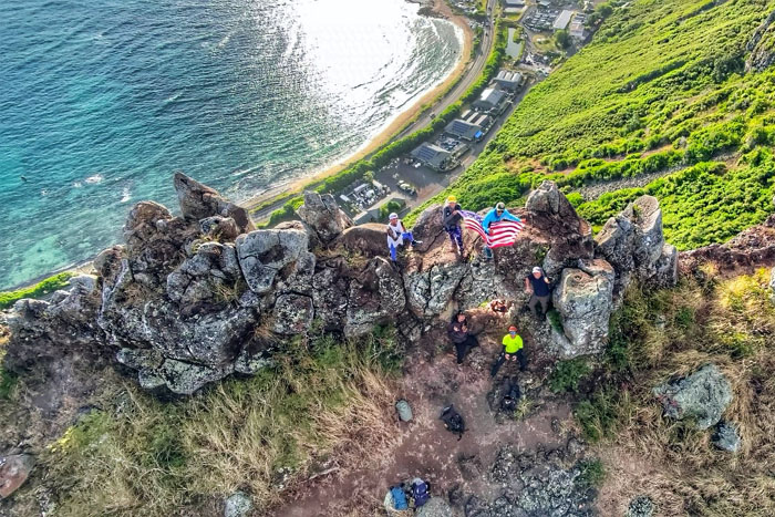
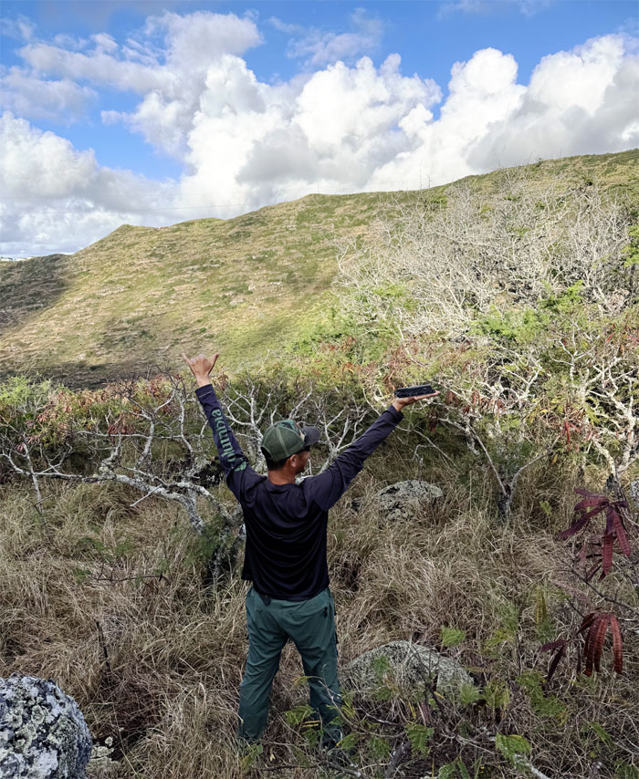
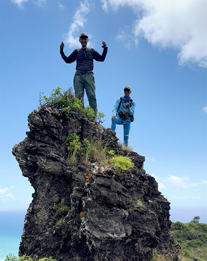
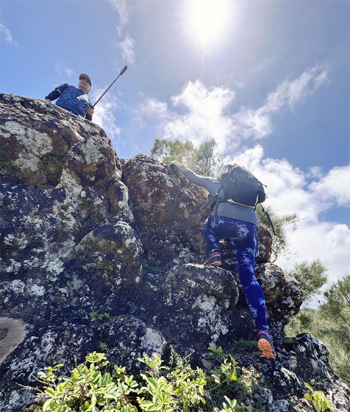
Playing and posing in what I call Hawaii’s Stonehenge, a collection of rocks that are roughly aligned with the ridgeline.
Makapu’u
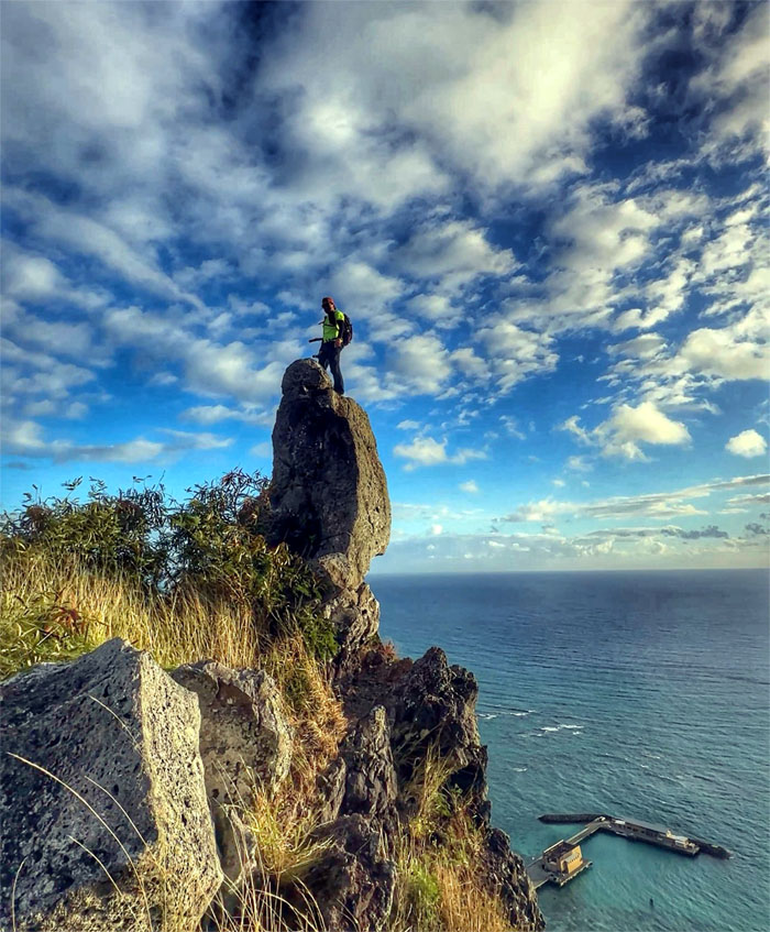
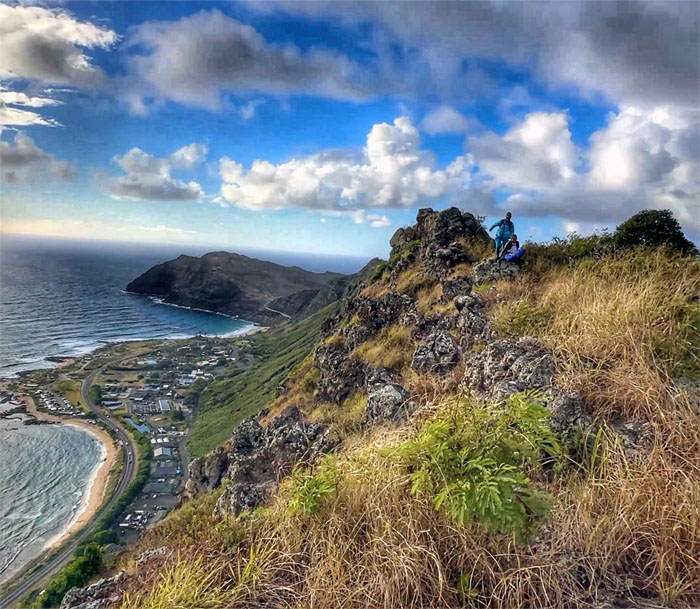
Overlooking Makai Research Pier, built in the 1960s by the State of Hawaii to support marine research and is also a popular spot with fishermen and divers.
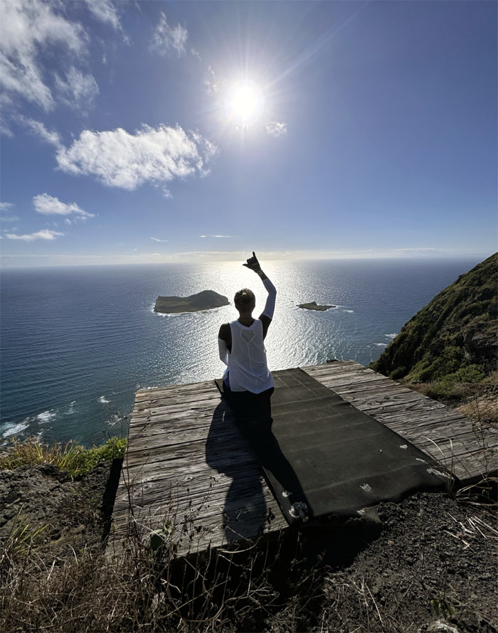
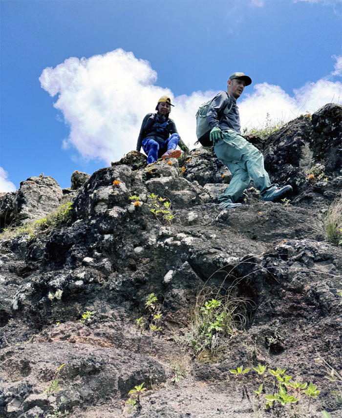
Makapu’u
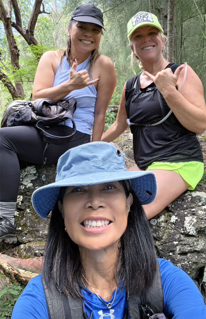
Three’s a crowd.
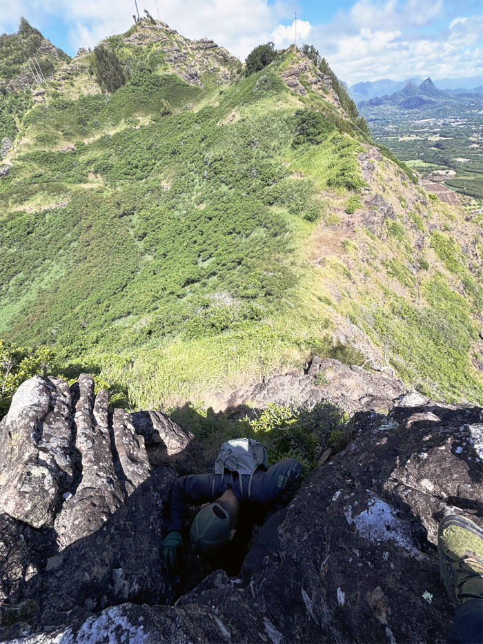
Makapu’u Puka
Up, …
Makapu’u Puka
… Up …
Makapu’u Puka
… and Away. My drone got caught in a thermal updraft as it kept gaining elevation while ignoring my commands to descend, as it kept soaring higher and commingling with the birds circling overhead.
Makapu’u Puka
It turned out to be a waiting game as the battery would soon run out of juice and the drone would drop like a rock from the sky, luckily the return home function worked and thanks to Akira for catching my drone when it landed.
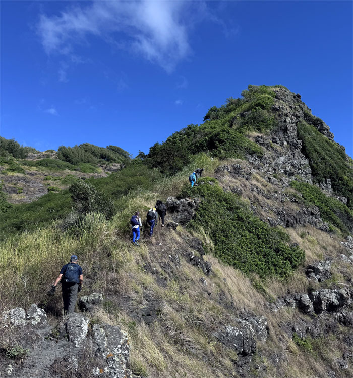
Ko’olau Summit Ridge Trail (KSRT)
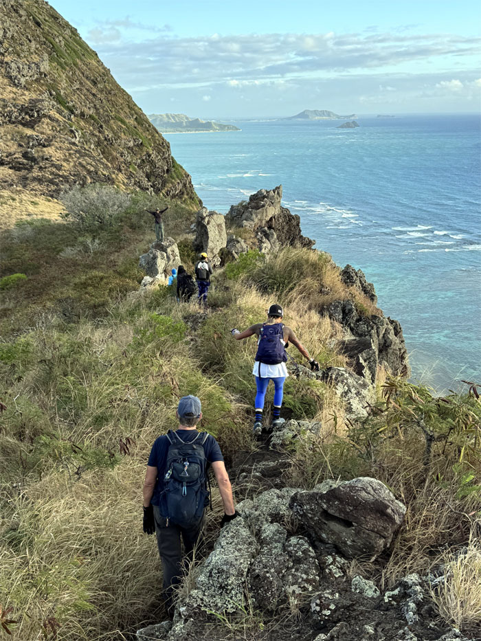
Hugging the coastline as we resumed our hike. The 15 minutes of drama was over.
KSRT
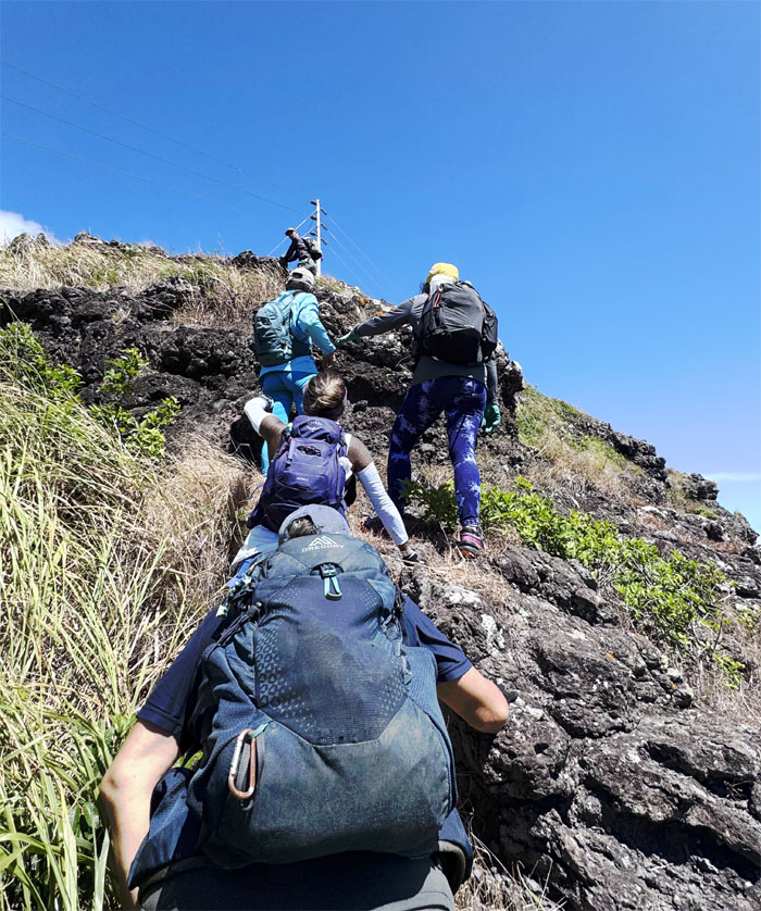
Kenny climbing his way up towards the “Three Crosses of Salvation.”
KSRT
Are we there yet? 15 more minutes! If you believe that, I have an affordable home I wish to sell.
KSRT
Sunshine and shadows on the hang gliding platform.
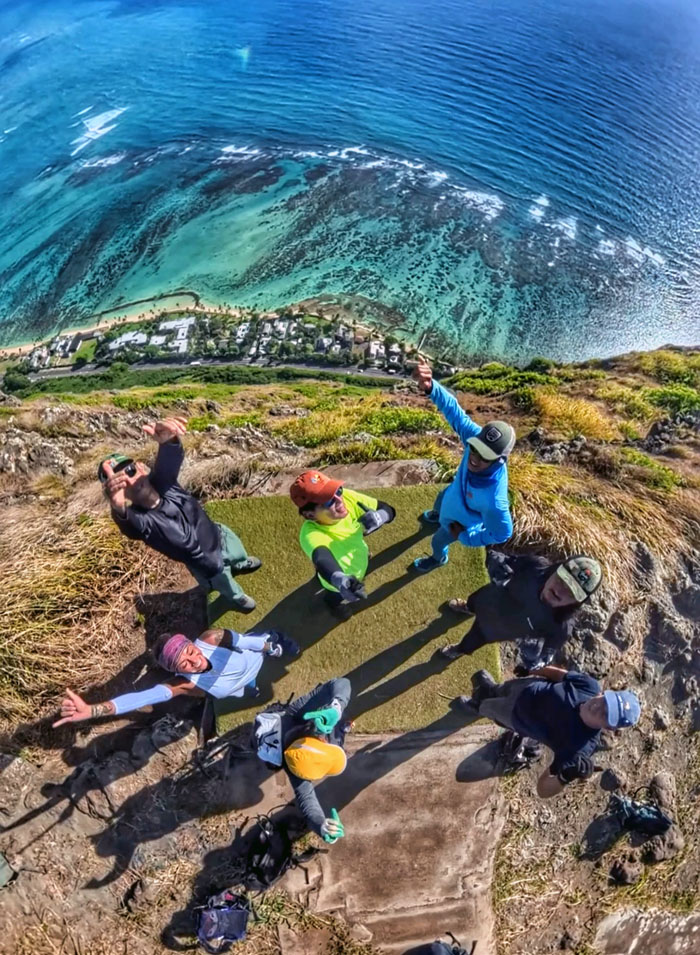
KSRT
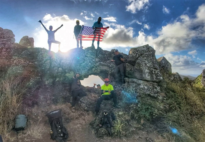
Group photo on the second platform that many erroneously call Dead Man’s Catwalk. The real concrete slab was jack hammered out of existence back in 2016.
Kamehame Road
Walking up the road that could use some landscaping services.
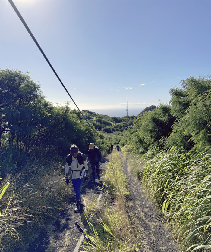
KSRT
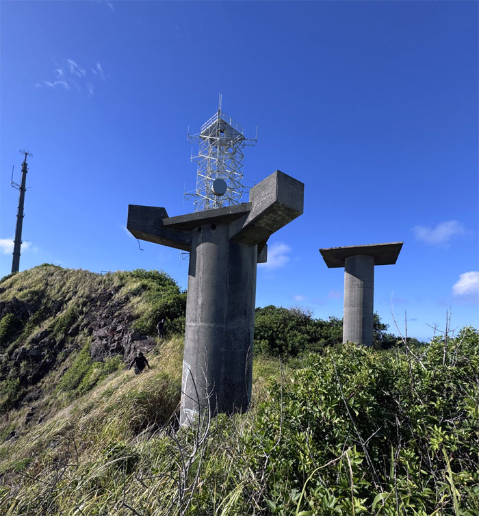
Skirting our way around the abandoned communication towers that used to make up the Nike Missile Integrated Fire Control site that used to track targets for the missiles that used to be garrisoned below at Bellows in the 1960s.
KSRT
Descending down into the saddle.
KSRT
Climbing our way towards shade and relief from the sun that was baking the landscape and any travelers.
Kamiloiki Summit
KSRT
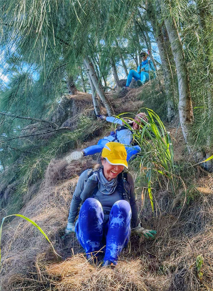
Sliding our way down the pine needle covered hill. Just missing the cardboard boxes.
KSRT
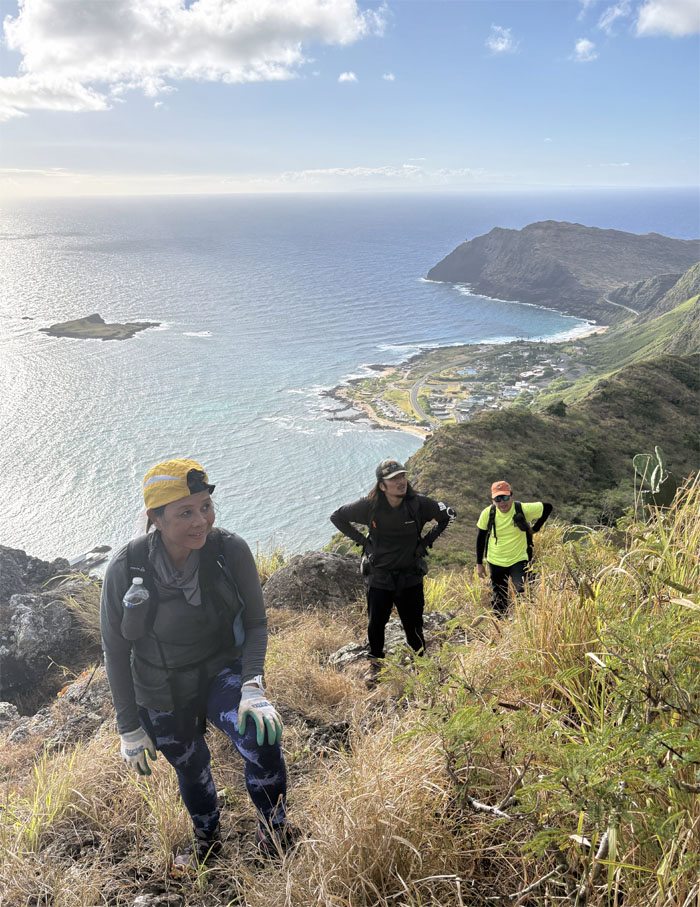
Climbing our way down while the rest of the group contoured their way around.
KSRT
Somebody is always camera ready for that postcard picture.
KSRT
You ask for mustard and you get hot sauce. Same color. Same results.
KSRT
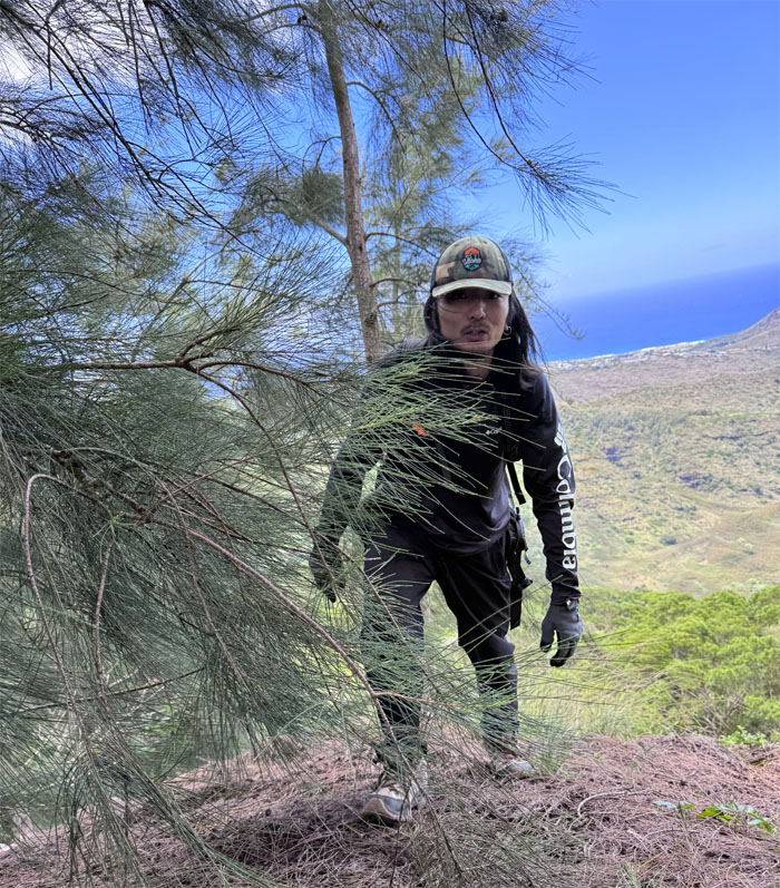
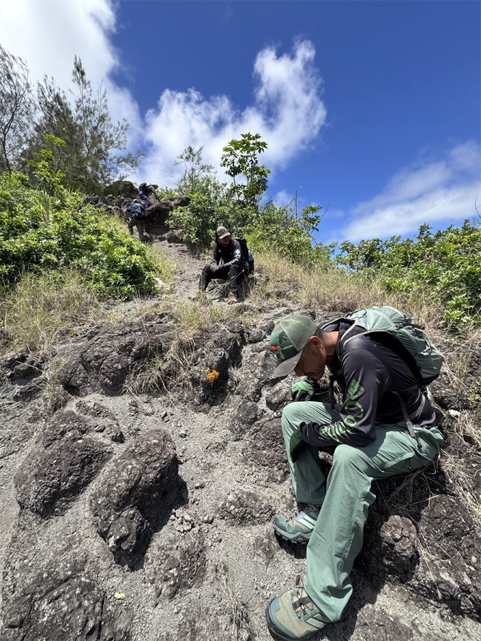
Climbing our way up through the hardscrabble terrain while the sun was just roasting us from the inside out. Slight exaggeration but another reason why this is my least favorite section of the KST.
Tom-Tom Summit
Traversing through the summit marked by HECO powerlines and named after Tom McGuire and Tom Cadle that scouted and popularized the ancient Hawaiian trail.
KSRT
Poor man’s version of Bell Tower. Less effort. Less risk. Less reward.
Hahaione Ridge
Meanwhile, a couple ridges over, Edgar and the girls were climbing towards the pyramid to meet us.
KSRT
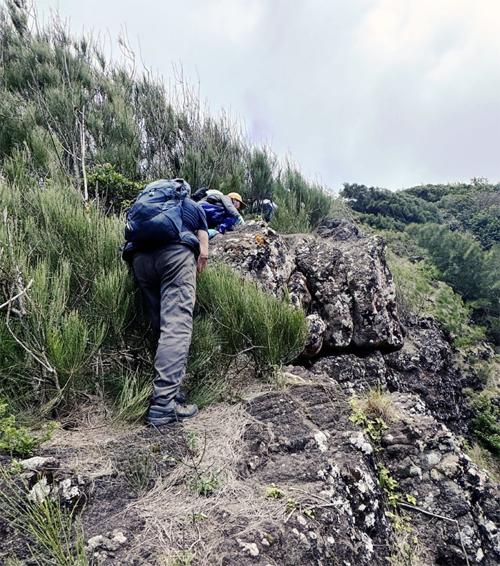
Climbing our way up a cliff with the help of a printer/electrical cable that has been around for over at least a decade.
KSRT
Are we there yet? Not quite.
KSRT
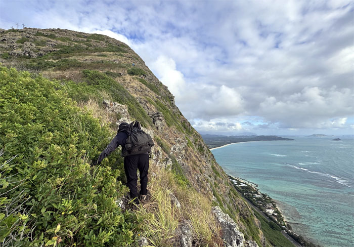
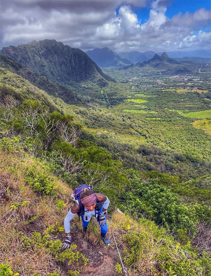
We left the shaded canopy and soft feathery ferns and made our way up the exposed rocky ridgeline.
Kaluanui (Mariner’s Ridge) Summit
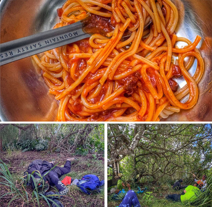
Enjoying our lunch under the shade. The sun was brutal today.
Kaluanui (Mariner’s Ridge) Summit
Group photo at the summit that the Bishop Estate shut down the trail that leads to it back in 2013.
KSRT
Some climbed down the cliff while the others contoured down the trail. To each their own.
KSRT
Double cramping, Doublemint twins. Double your pain, double your misery. We soon saw stick figures on our destination.
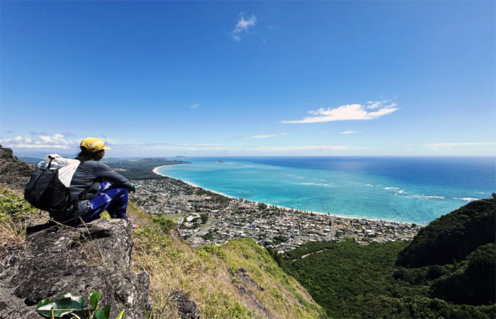
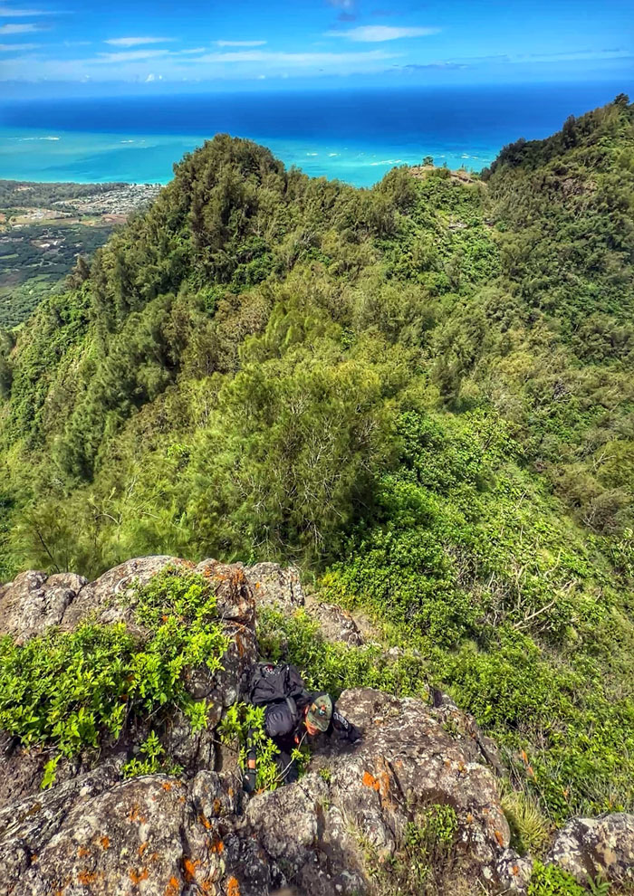
KSRT
View from the pyramid.
KSRT
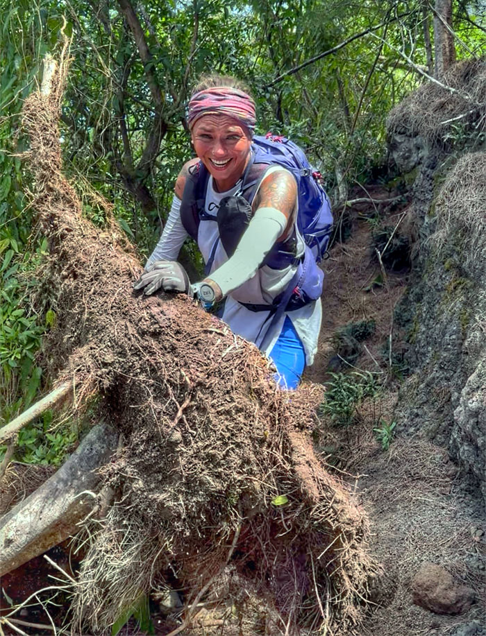
Alexis trying to clear a fallen tree from the trail. Futility at its finest.
Hahaione Pyramid
Cristy climbing towards the summit while Edgar stands ready with his Insta360 to record for posterity’s sake.
Hahione Pyramid
Is this the easy way or the hard way? Take a wild guess.
Hahaione Pyramid
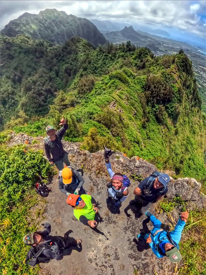
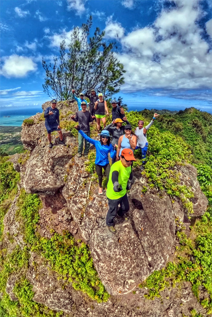
Group photo at the top of the triangular shaped peak where we met up with Aida, Allison, Edgar and Marilyn.
Hahaione Trail
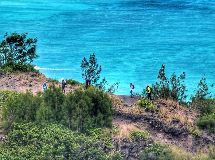
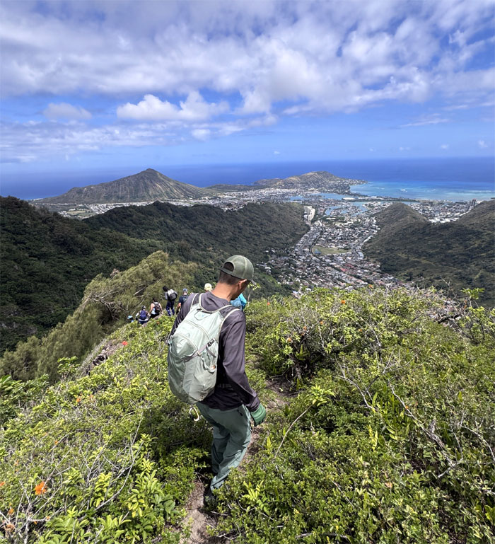
Descending down towards the valley of shifting sands which evolved from Hawaiian farms to cattle ranches and to the current suburban community sprawled out below us.
All pau
Our last group photo of the day, just missing Edgar as he took a different trail out.
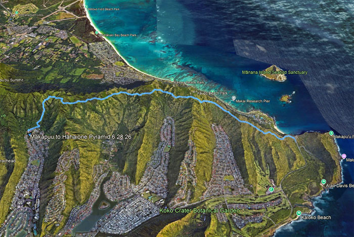
GPS Tracks
Our hot as heck hike that was unevenly tempered with trade winds covered 5.54 miles with fun company. Post hike meal at Gyotaku where we had to wait half an hour before they opened for early dinner.
https://www.youtube.com/watch?v=hIho23J3CoA
Video by Edgar Gamiao of our hike.
Photos/Crew taken by Aida Gordon, Akira Suzuki, Alexis Catarina, Allison Banks, Cristy Meador, Edgar Gamiao, Ferlino Carinio, Kenny Lui, Marilyn Bermudez, Roger Schiffman, and yours truly. Not necessarily in order.
Note: I have been made aware that some hikers have been using my blog as a hiking guide and getting lost on the trails. Please note that this blog was made to document the hike for the crew(s) that did it. That is why some of my comments will seem to have no relevance or meaning to anybody outside of the crew(s) that hiked that trail. My blog was never meant as a hiking guide, so please do not treat it as such. If you find inspiration and entertainment from these hikes, that is more than enough. If you plan on replicating these hikes, do so in the knowledge that you should do your own research accordingly as trail conditions, access, legalities and so forth are constantly in flux. What was current today is most likely yesterdays news. Please be prepared to accept any risks and responsibilities on your own as you should know your own limitations, experience and abilities before you even set foot on a trail, as even the “simplest” or “easiest” of trails can present potential pitfalls for even the most “experienced” hikers. One should also always let somebody know of your hiking plans in case something doesn’t go as planned, better safe than sorry.
{ 2 comments… read them below or add one }
You guys were phenomenal hiking in the hot sun! Still reading information about this section I did not know about tilll now. And that printer cable? Almost two decades…used it in 2008 when I first did the TomTom to Hahaione. Glad everyone was safe and sound and hydrated by the time we got back down.
Aloha Aida,
Yep it was a scorcher of a hike. Not my fav section by far.
Mahalo