
I decided to recreate a hike that we did for Chico’s finish almost two years ago. Too close for comfort.

Trailhead
Parked in the neighborhood that started off as the Manana ahupua’a which was turned into pineapple fields and evolved into the residential neighborhood as it exists today. Solitary hike today as the usual suspects had other plans on the platter.
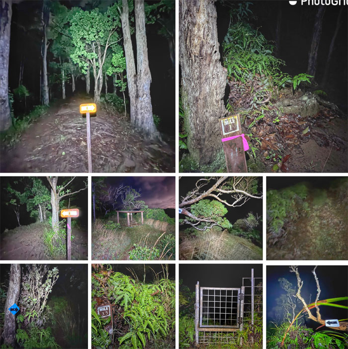
Manana Trail
Hiked the 5.5 miles of the ungraded ridge trail that was seemingly comprised of endless humps and knobs as the darkness slowly began to be erased by the increasing illumination of the sunrise.
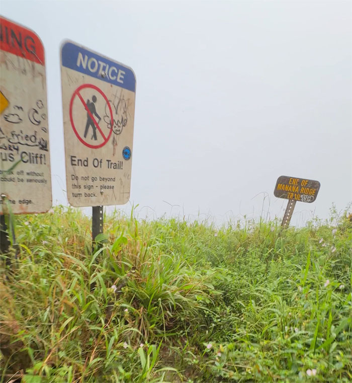
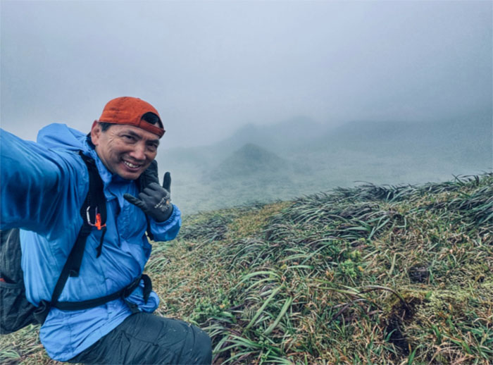
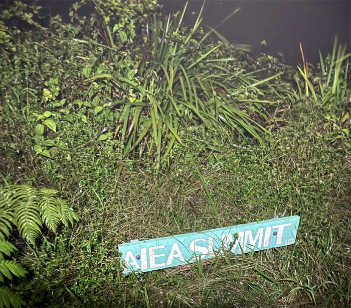
Manana Summit
Arrived at the 2,660′ dew soaked summit to be met by a wall of whiteout. Expect nothing. Get nothing. Turned right on the spine of the Ko’olau Mountains to continue my hike in the clouds.
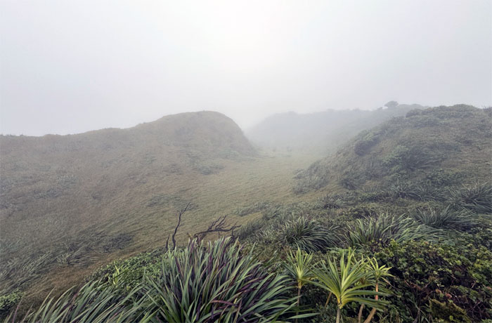
Eleao Meadows
Passing through the wind swept grassy area that we had once foolishly camped overnight. Needless to say, we did not enjoy a good night’s sleep.
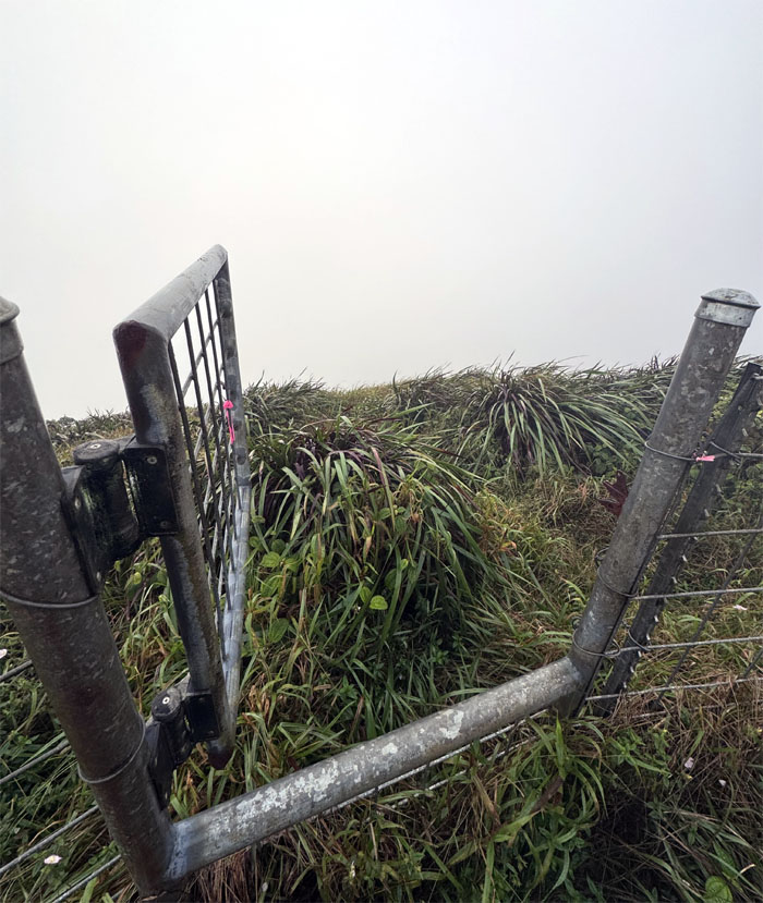
Ko’olau Summit Ridge Trail (KSRT)
Followed the fence line until the gate breached it and allowed me passage down the hill to regain the ridge line.

KSRT
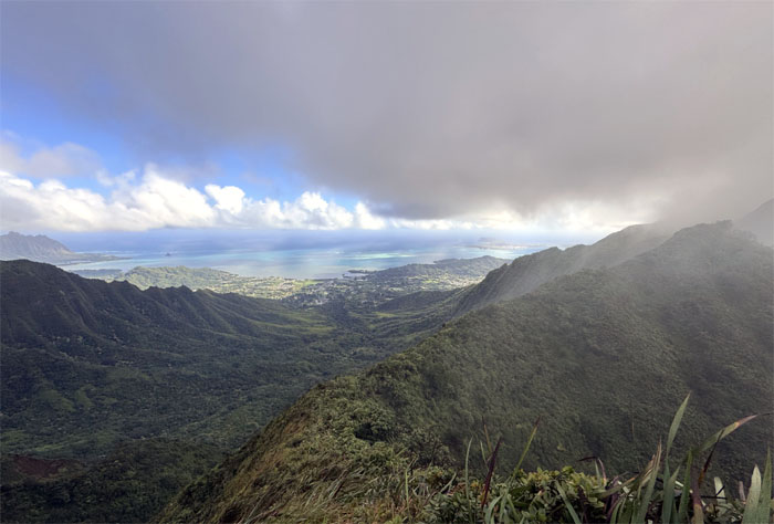
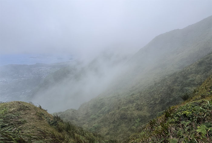
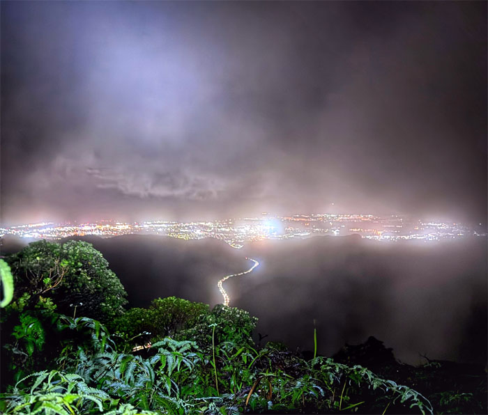
I soon caught a break as airflow, temperature and moisture intersected to provide a window into the valley views.
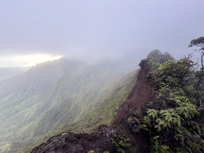
KSRT
Passing the large landslide as I descended towards the saddle and the reflective sign that marked the 2,160′ summit of Waimano.
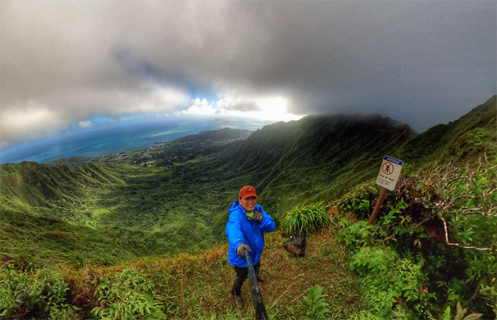
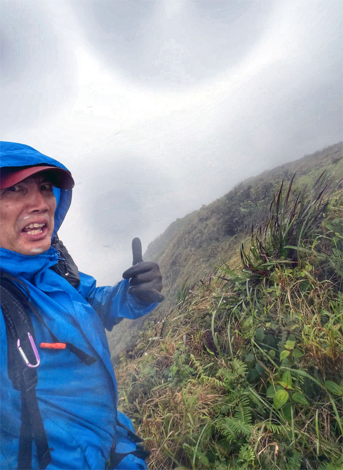
Waimano Summit
Photo of myself with the background of Waihe’e Valley bordered between Kalahaku Teeth and Eleao Windward. I contemplated going down Waimano Trail as the mud soaked trail, intermittent rain showers and overgrowth from Manana was trying to tell me something. However, I had barely scratched the morning and was hard of hearing, so I decided to press forward on the trail.
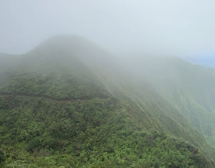
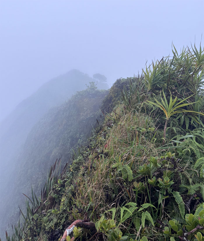
KSRT
Scrambling out of the saddle, I looked back to see the seven mile graded trail beckoning to me. I was also myopic.
KSRT
Traversing over the stretch of cardio hills and false summits that was aggravated by overgrowth that gave me unwanted acupuncture treatments many times over and mud slicked trails that resulted in my hands cramping for the first time ever as I had to compensate for the loss of traction by disproportionately using more of my upper body strength climbing up the multiple hills. Just falling victim to Father Time.
Waimalu Meadows
Climbing up the spongy hill as I made my way out of the neither mythical nor magical meadows today.
KSRT
Working my way in and out of the clouds.
KSRT
Pitter patter of rain that soon turned into a wet mess that was sandwiched between a downpour and torrential rain.
KSRT
The trail that kept giving.
Aiea Summit
I reached the 2,805′ summit shortly after dark. My dreams were dashed of finishing the hike when the sun was still out. Time to make new dreams.
Aiea Ridge Trail
Going down the gem of a ridge as described by Stuart Ball, I have never felt more exhausted by a trail as today. I felt like cowboy camping on the lower parts of the trail. The only thing that stopped me was a streak of stubbornness and the fact that I was saturated and soaked head to toe.
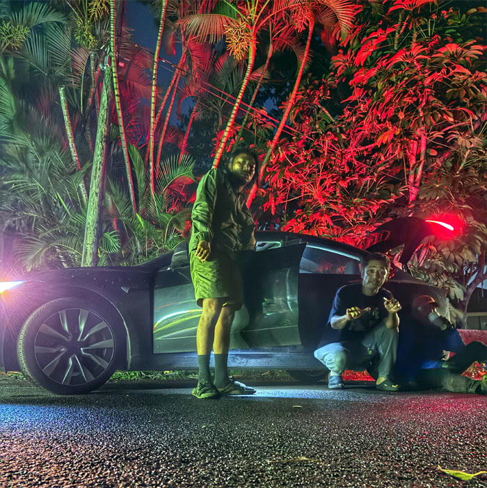
All pau
My 14.02 mile hike that didn’t turn out as well as I expected tested me to my limits today. Many thanks to Kenny and Akira who met me at the deserted road where a neighbor couldn’t believe that I had finished hiking at this ungodly hour. Thanks to Kenny who drove me home and saved me from a potential accident on the road and Chico who drove me the next morning to collect my vehicle.
Note: I have been made aware that some hikers have been using my blog as a hiking guide and getting lost on the trails. Please note that this blog was made to document the hike for the crew(s) that did it. That is why some of my comments will seem to have no relevance or meaning to anybody outside of the crew(s) that hiked that trail. My blog was never meant as a hiking guide, so please do not treat it as such. If you find inspiration and entertainment from these hikes, that is more than enough. If you plan on replicating these hikes, do so in the knowledge that you should do your own research accordingly as trail conditions, access, legalities and so forth are constantly in flux. What was current today is most likely yesterdays news. Please be prepared to accept any risks and responsibilities on your own as you should know your own limitations, experience and abilities before you even set foot on a trail, as even the “simplest” or “easiest” of trails can present potential pitfalls for even the most “experienced” hikers. One should also always let somebody know of your hiking plans in case something doesn’t go as planned, better safe than sorry.
{ 4 comments… read them below or add one }
Beautiful pics, and I really enjoyed the narrative
Aloha Evan,
Thanks, glad you enjoyed my rambling. lol.
Mahalo
Whoahhh! Very long hike but it’s nothing new. You loveddddd long gnarly hikes lol
Aloha Tessa,
I think the long grinders are getting to me, must be getting old. lol.
Mahalo