
Saturday May 25, 2019
You’ll have fun they said. It’s a life changing experience they said. That is how I found myself on the Big Island with Analyn, Cisco, Matt and Quan to hike up the world’s largest volcano. We endured the almost out of the door TSA line as it was a holiday weekend and then found ourselves waiting over an hour for our rental car. Payless. Wait more. Wait, it was actually pay more as well. Insult to injury. After finally picking up our car, we drove to the local stores to stock up on our supplies and had lunch at Restaurant Kenichi, the local spot for comfort food.
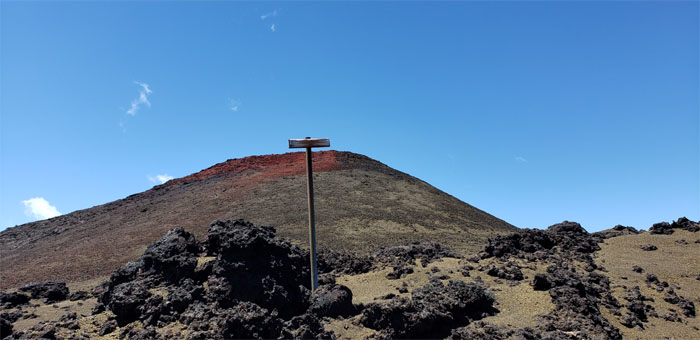
Pu’u Huluhulu Cinder Cone Parking Lot
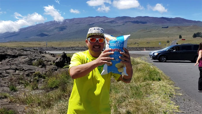
We stopped at the hairy hill parking lot as somebody had to empty their bladder, while our chip bag expanded due to the atmospheric forces equalizing the different pressures at roughly 4,000′ elevation. Photo by Matt Vidaurri
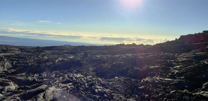
Mauna Loa Observatory Road
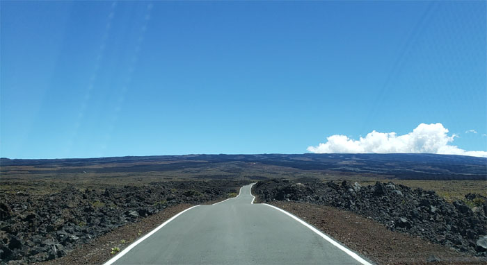
Driving on the narrow ribbon of asphalt that cut through the lava fields. Photo by Matt Vidaurri
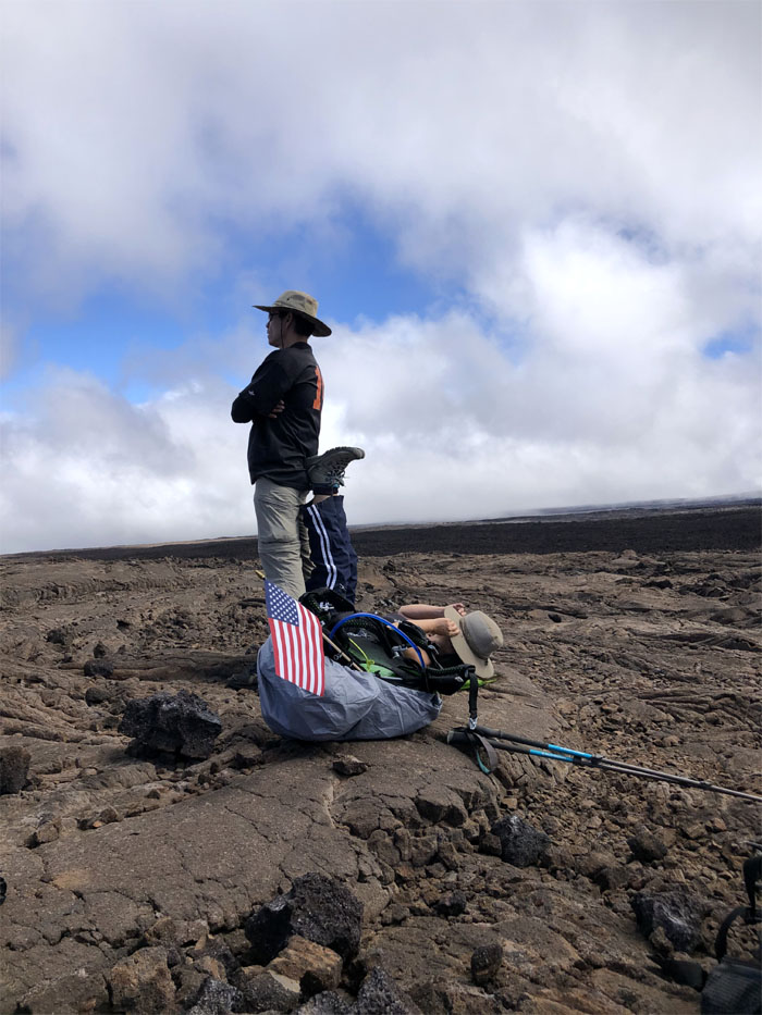
Mauna Loa Observatory Road
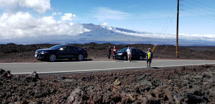
We pulled our cars over at roughly 10,000′ to see how our bodies would react to the thin air. Photo by Matt Vidaurri.
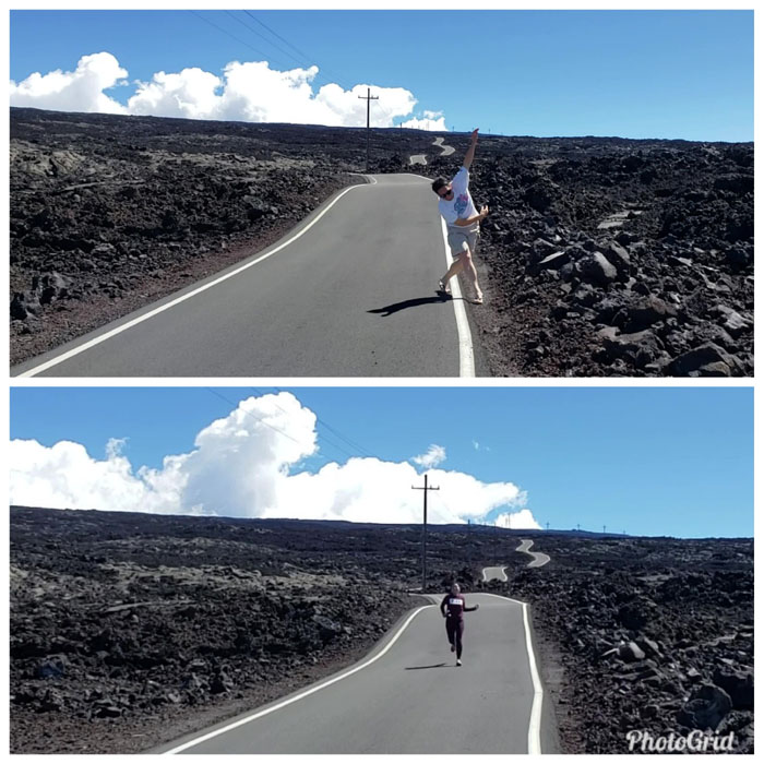
Mauna Loa Observatory Road
Some of us tried to run or wobble down a straight line. Photos by Matt Vidaurri.
Mauna Loa Observatory Road
Others practiced their breathing techniques, two sniffs and one puff. Practice makes perfect. Photos by Matt Vidaurri.
Mauna Loa Observatory Road
We piled back into the cars after an abbreviated acclimatization and continued our rolling and winding drive down the road. Photo by Matt Vidaurri
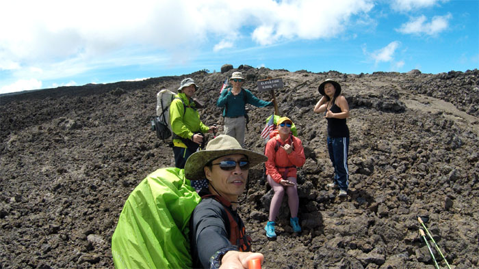
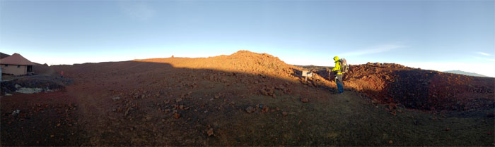
Mauna Loa Observatory
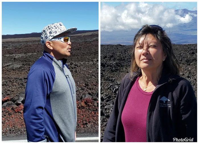
Group photo left to right: Matt, myself, Larry, Cisco, Analyn and Quan; where we bumped into a HTMC group from Oahu that were coming down from the summit. Larry informed us that gas stoves burn slowly or not at all at higher altitudes, but he threw in a caveat that was with propane stoves back in the day. So we went back to our cars and tried with our butane stove and it flamed out while a waterfall was pouring in the background. So we had to rethink our food strategy as hot food was seemingly out the window. We left my car at the parking lot as that was our planned exit and drove down to the local KTA store to buy replacement food. Our dinner was planned at the Hawaiian Style Cafe but was thwarted due to long lines, so we settled for Tetsumen Ramen where I ordered the special chicken dish instead of the ramen.

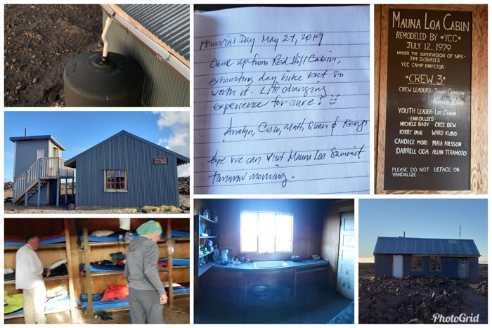
Cabin #63
We checked in late to the Kilauea Military Camp (KMC) at 4,000′ elevation and were upgraded to a four-room cabin. Rank has its privileges.

Cabin #63
Reorganizing our packs as we discarded stoves and dehydrated meals and replaced them with tortilla wraps, spam slices, tuna, cooked rice and cold curry before turning in for the night. Matt was the only one to take butane fuel with him as he wanted to see for himself if it would work up in the mountains.
Shower singer
Sunday May 26, 2019
I did not add the audio to spare the sensibilities of anybody that may run across this post. Suffice to say, we were involuntarily treated to renditions of hits from the 80’s.
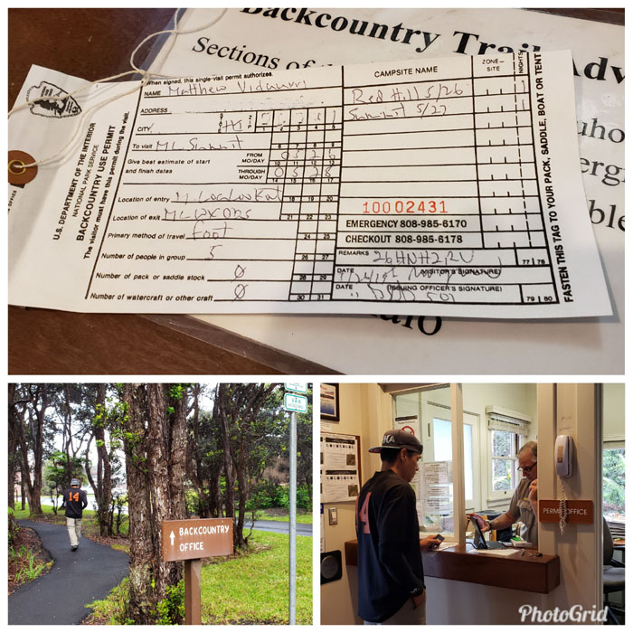
Backcountry Office
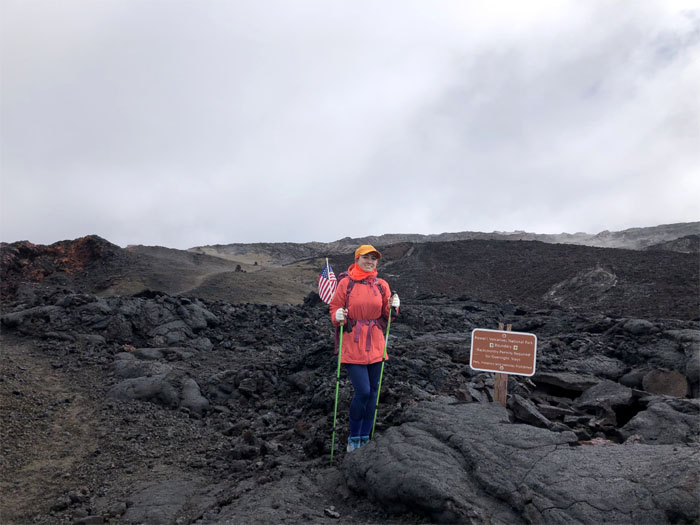
Shower sprinkles greeted our departure from the cabin and the short drive to the Backcountry office where Greg was kind enough to open the office earlier than business hours where we paid for our permits, which were $10 per person, that you can pay for a week in advance but have to pick up the permits in person the day before as seismic or weather conditions may deep six the hike. Gave our personal information and found out that only a few of us were bright enough to have bright colors. Got the skinny for our hike as to what to look for and what route to stay on. We found out that the supposed number of hikers staying at Red Hill Cabin had now increased from 10 to 15. Available bunks were 8. Maximum permitted were 24. Don’t understand the math. He said it was first come, first serve. So bring a tent as some of you may be sleeping outside. Good news was that both water tanks were full, based on a check several months ago.
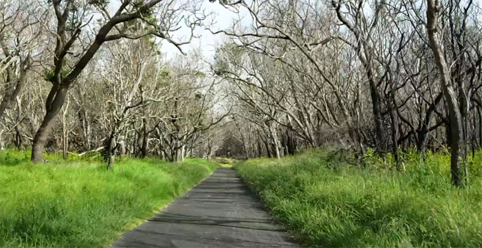
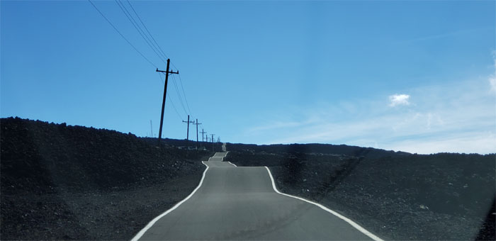
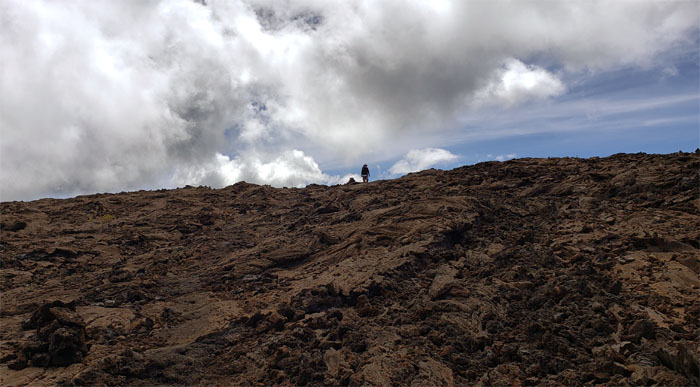
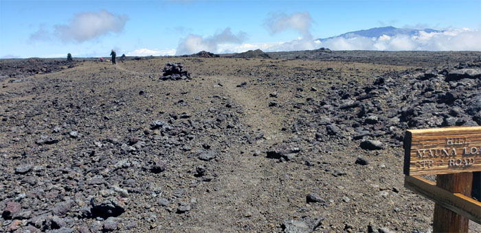
Mauna Loa Road
Driving up the 11 mile road that cut through through old lava flows and dominant koa forests. It was built by prison labor back in 1951. Photo by Matt Vidaurri

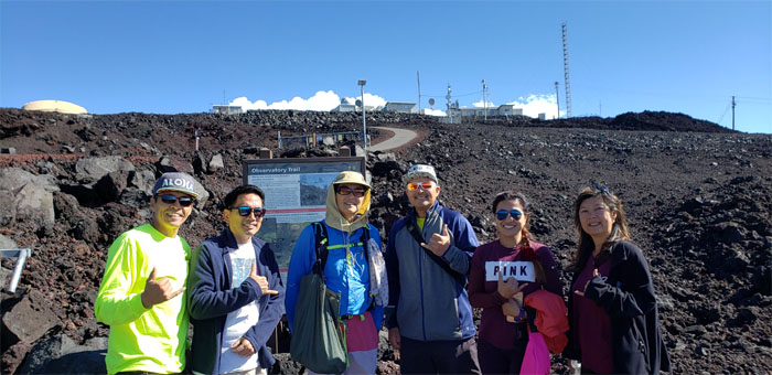
Trailhead
Matt had been hoping against hope that the other hikers would not get up to the trailhead before us. Three parked trucks greeted us at the trailhead. Who brought the tent? Why isn’t Quan waving her flag?
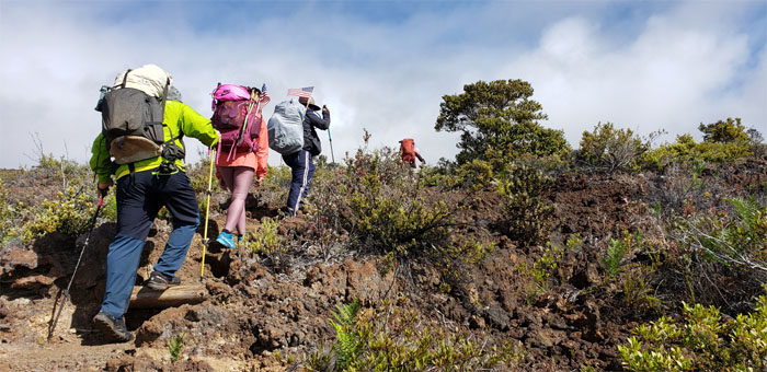
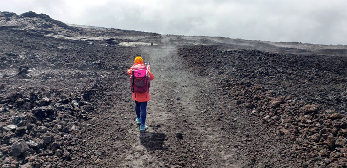
Mauna Loa Trail
Starting off at 6,600′ through mostly native forest on the trail built by Buffalo soldiers from the 25th Infantry Division back in 1915.
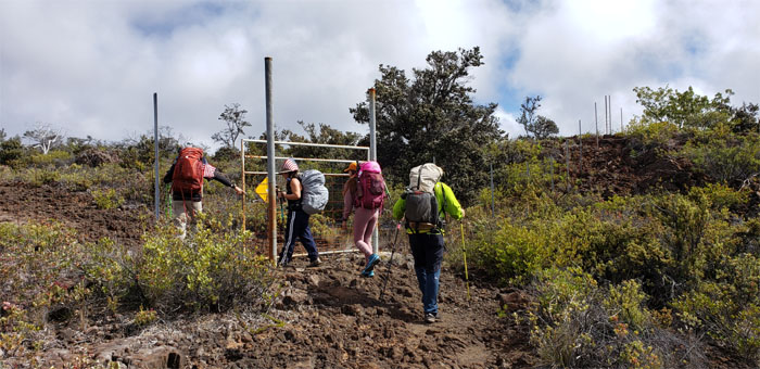
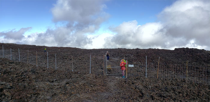
Mauna Loa Trail
Passing through the gated fence meant to keep out hoofed animals.
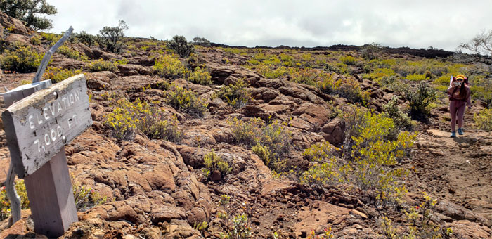
7,000′ Elevation
We gained 400′ in elevation with no noticeable side effects, some of our group had started taking Diamox, physician prescribed medication, to prepare for the high altitude climb.
Mauna Loa Trail
Enjoying the shade while we still could.
Mauna Loa Trail
Analyn climbing up the rope ladder left by Pele. Photo by Matt Vidaurri.
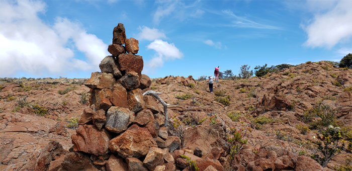
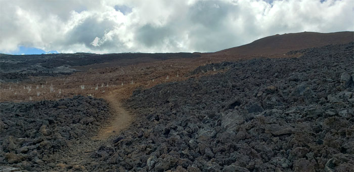
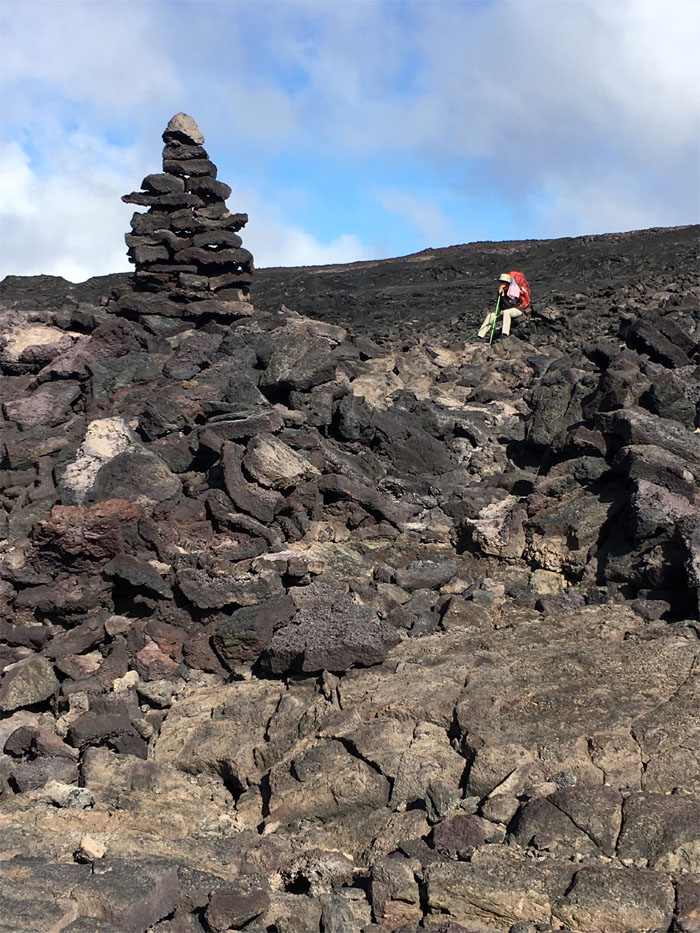
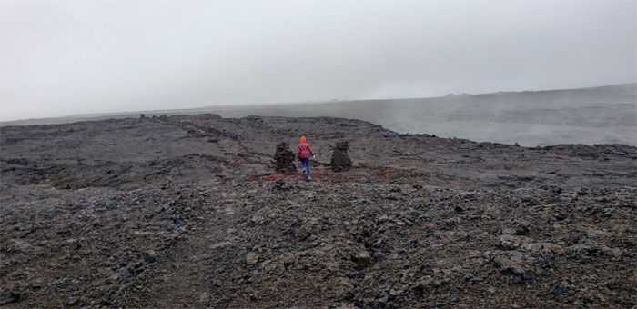
Mauna Loa Trail
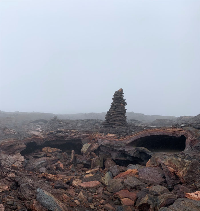
Most of the ahu (cairn) stacked on the trail blended in with the background, some had white branches stuck in them for better visibility. Photo by Matt Vidaurri.
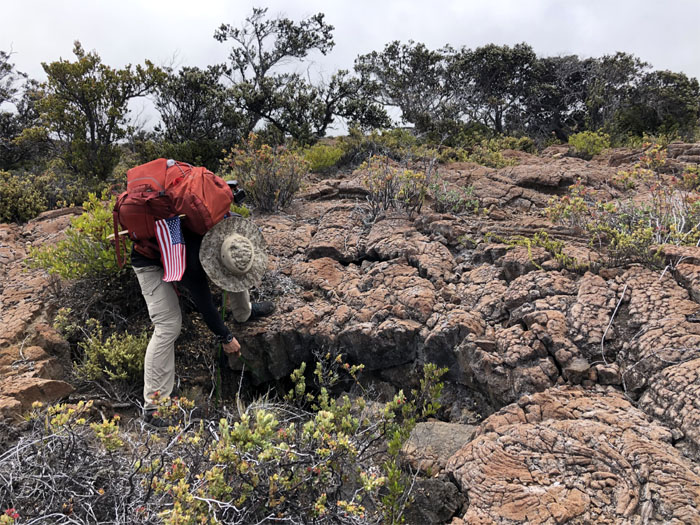
Mauna Loa Trail
Matt poking around the crevice to make sure there were no critters in case we needed emergency shelter. Let’s hope it doesn’t come to that. Photo by Analyn Baliscao.
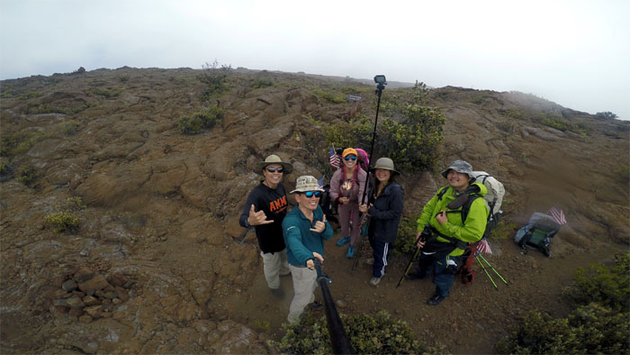
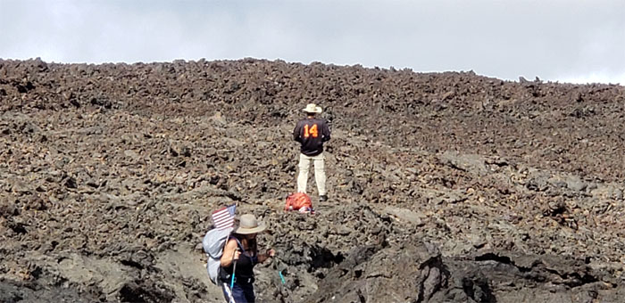
8,000′ Elevation
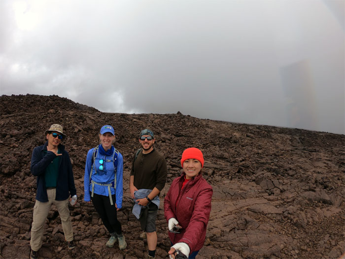
Our first group photo on the trail, left to right: Matt, myself, Analyn, Quan and Cisco.
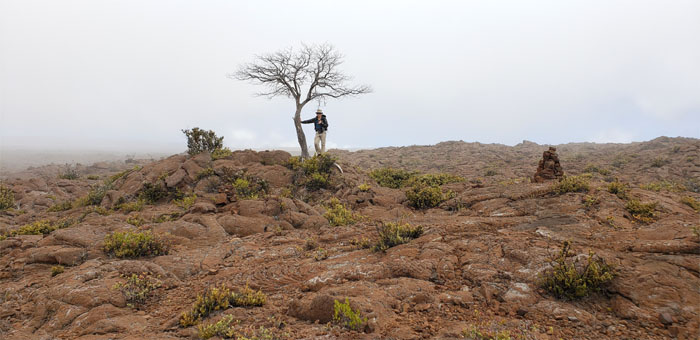
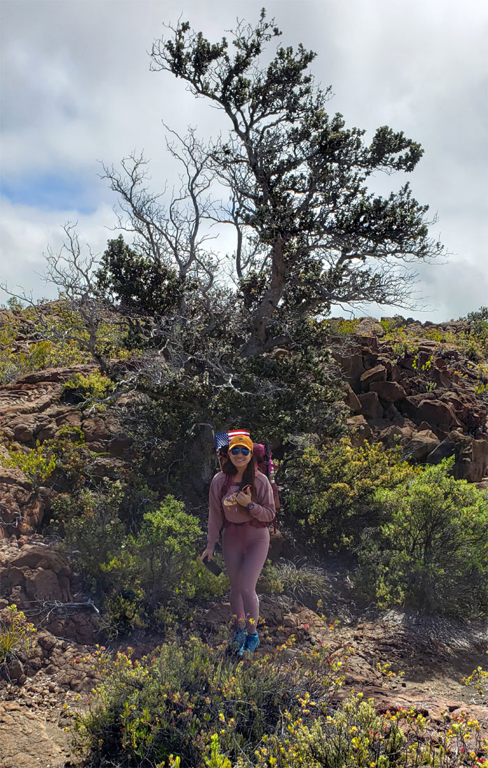
Mauna Loa Trail
Standing under the last dead ‘ohi’a tree. Photo by Matt Vidaurri.
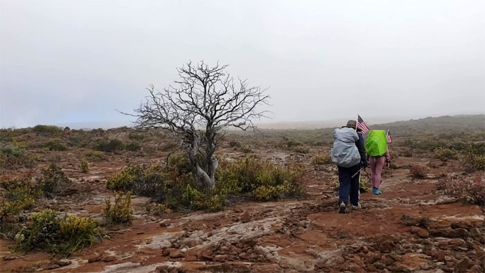
Mauna Loa Trail
Will the real dead tree please stand up? Photo by Matt Vidaurri.
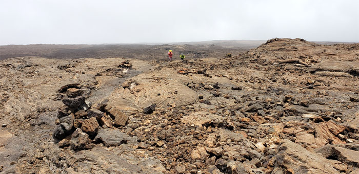
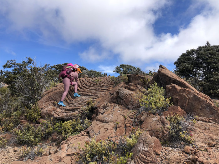
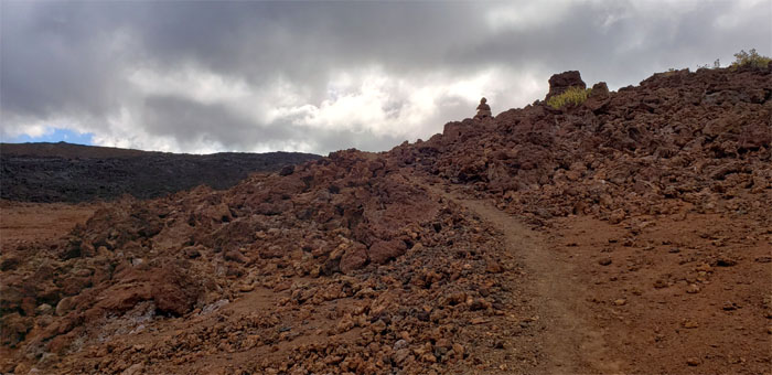
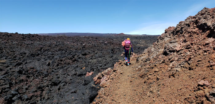
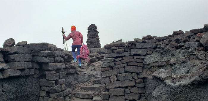
Mauna Loa Trail
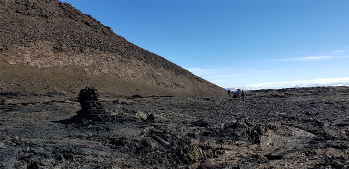
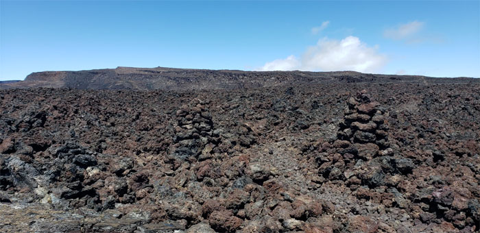
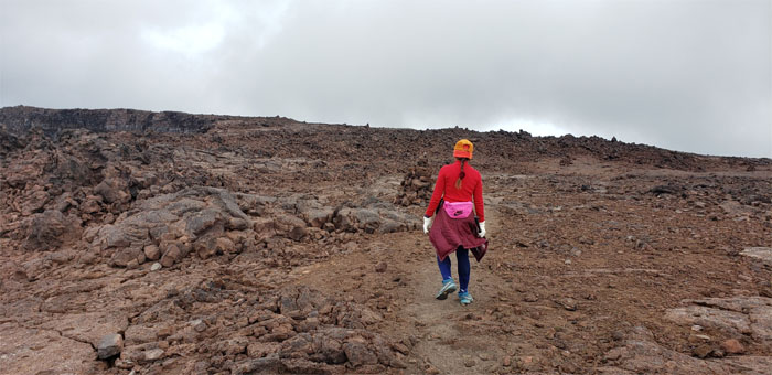
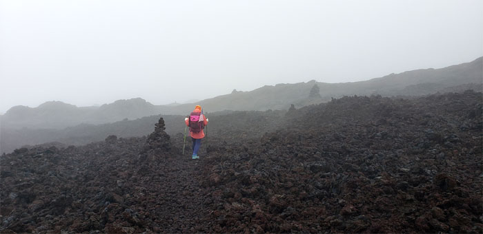
Hiking our way through the irregularly colored rocks and textured terrain, with only the ahu (rock cairns) to keep us on the trail as the massive dome of Mauna Loa lay ahead of us.

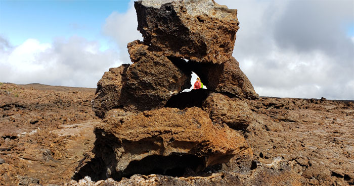
Mauna Loa Trail
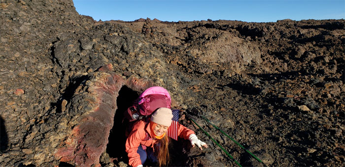
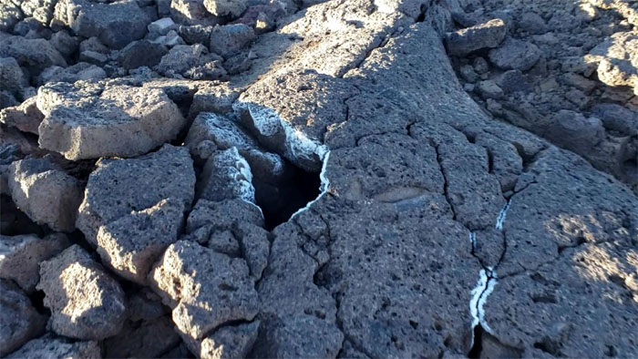
Let’s check out this lava tube and make Kenji wait ahead. That’s his fault for not stopping and smelling the sulfur. Photo by Matt Vidaurri.
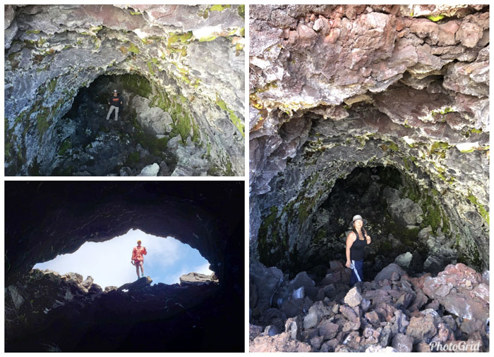
Lava tube
The tube was dark and deep enough so that the end could not be reached. Besides, somebody was waiting.
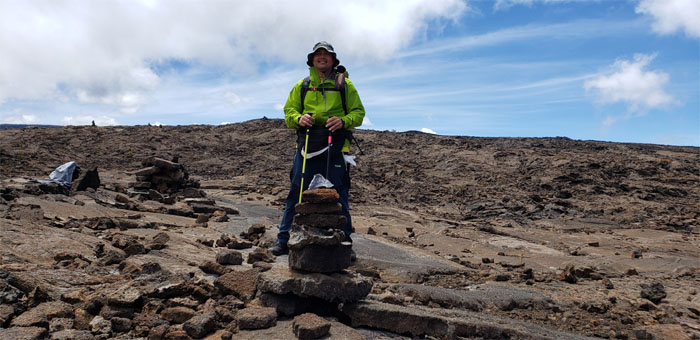
Ahu
The ahu (cairn) that Cisco made.
9,000′ Elevation
Glad everybody could make it for the group photo.
Mauna Loa Trail
I spotted a group of hikers descending down from the summit. Upon exchanging pleasantries, they let me know that only a grandfather and his grandson were currently occupying the Red Hill Cabin. I got excited and yelled at the others to pick up the pace before those numbers changed again.
Elevated elevation
Quan trying to force more blood cells to her brain with Matt’s assistance.
Mauna Loa Trail
Analyn coming up the trail.
Mauna Loa Trail
Passing through another invasive control fence line. Still no signs of any hoofed animals.
Mauna Loa Trail
Quan passing the Matt made waterfall.
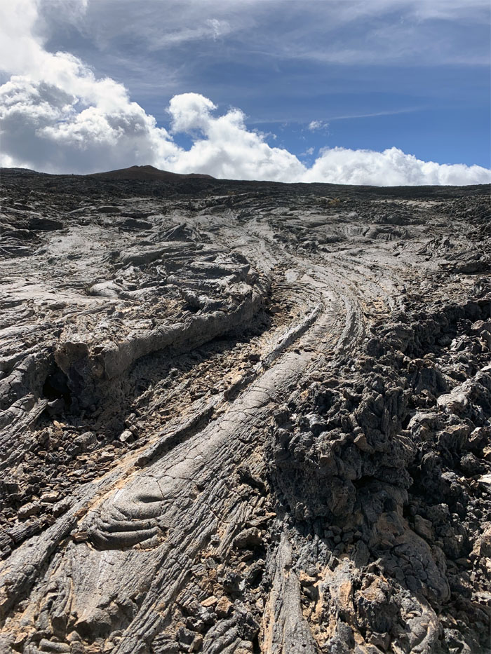
Mauna Loa Trail
Slowly moving rivers of molten lava frozen in time. Photo by Cisco Quintanilla.
Mauna Loa Trail
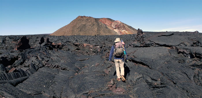
Approaching the 8,500+ year old spatter cone that has since oxidized over time, resulting in the name of Pu’u ‘Ula’Ula or Red Hill.
Mauna Loa Trail
Passing through a patch of bluegrass sprouting from the lava fields, the poor mans silverswords.
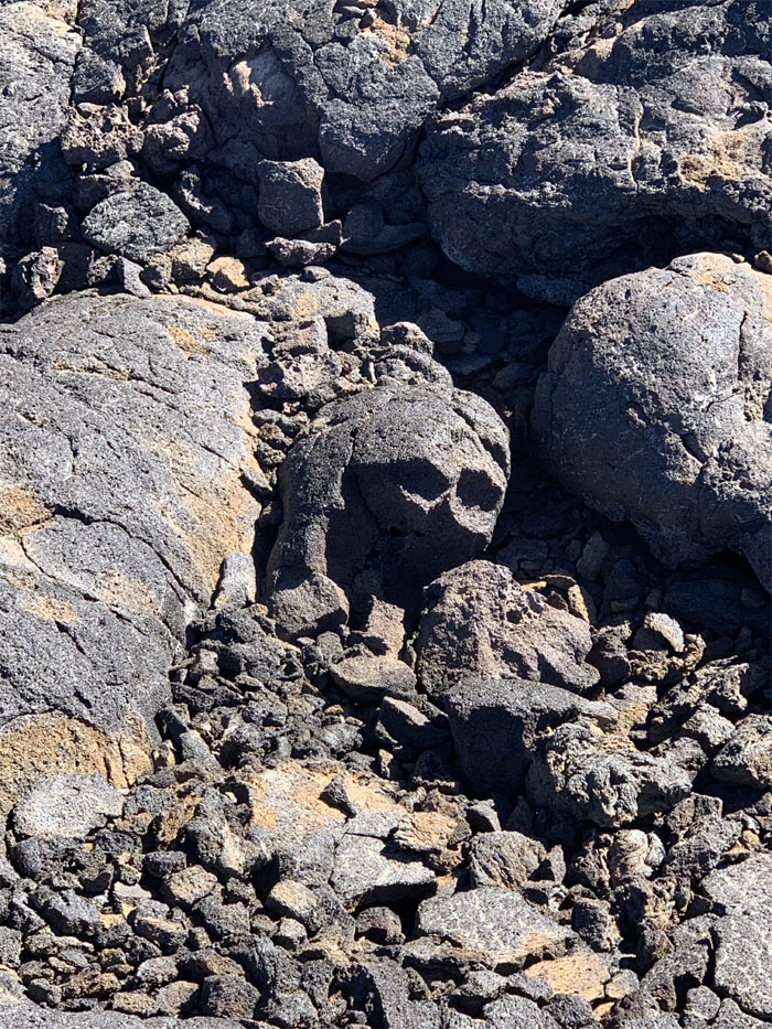
The Hills have Eyes
The rock formation that threw everybody off as it looked like somebody was watching us as we came up the trail.
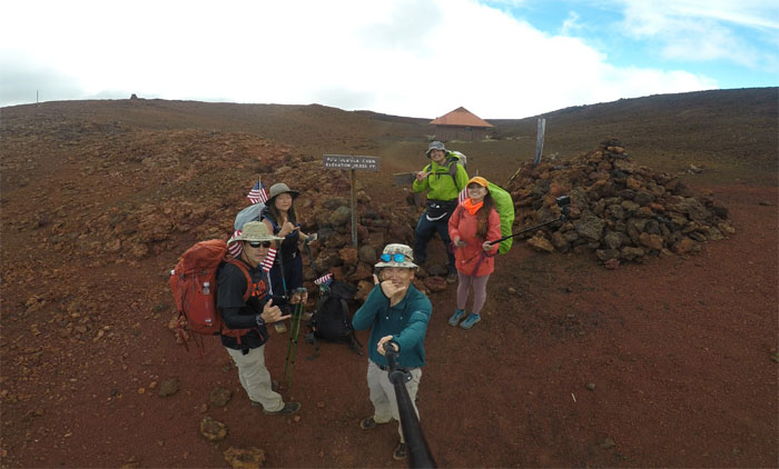
10,035′ Elevation
We arrived at our cabin for the night that was built back in 1996, that replaced the original 1915 one. Now to see if everybody had bunks for the night.
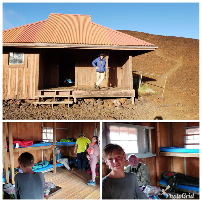
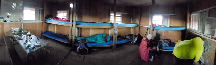
Pu’u ‘Ula’Ula Cabin
The reports were true, Connor and his grandfather were the only hikers in the cabin. There were two depressions bordered by low lying rock walls outside the cabin that displaced hikers could pitch their tents in.
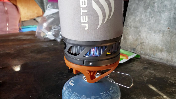
Pu’u ‘Ula’Ula Cabin
Yes Virginia, butane stoves do work in high altitude cabins. Photo by Matt Vidaurri.
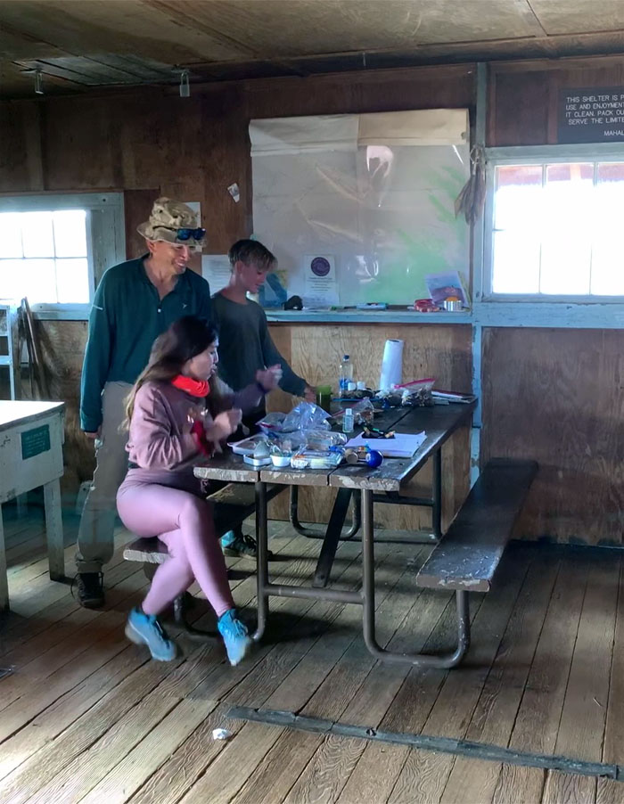
Bugs and cards
Guess who came to dinner? A plastic centipede. A girl’s best friend. We also played a game of bullshit. No shit. Photo by Cisco Quintanilla.
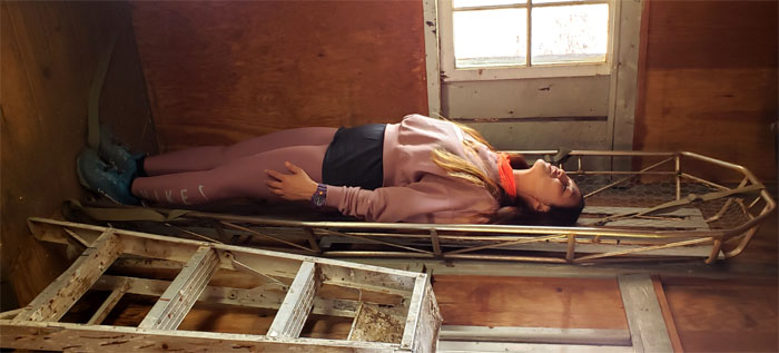
Pu’u ‘Ula’Ula Cabin
Analyn ready to be evacuated. Call the chopper.
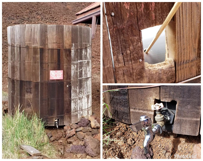
Pu’u ‘Ula’Ula Cabin
The water tank that can be checked for depth and the valve gate that must be turned off and the spigot cleared lest the residual water freeze. That’s why it’s best to fill up ones water before turning in for the night. Photos by Matt Vidaurri.
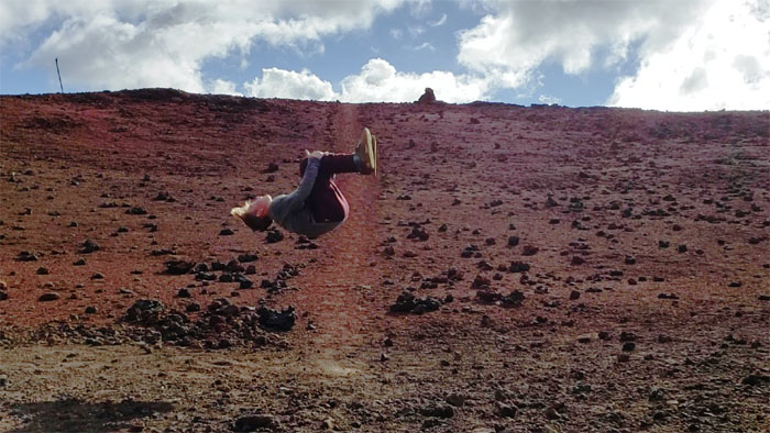
Backflip
Connor showing us how it’s done.
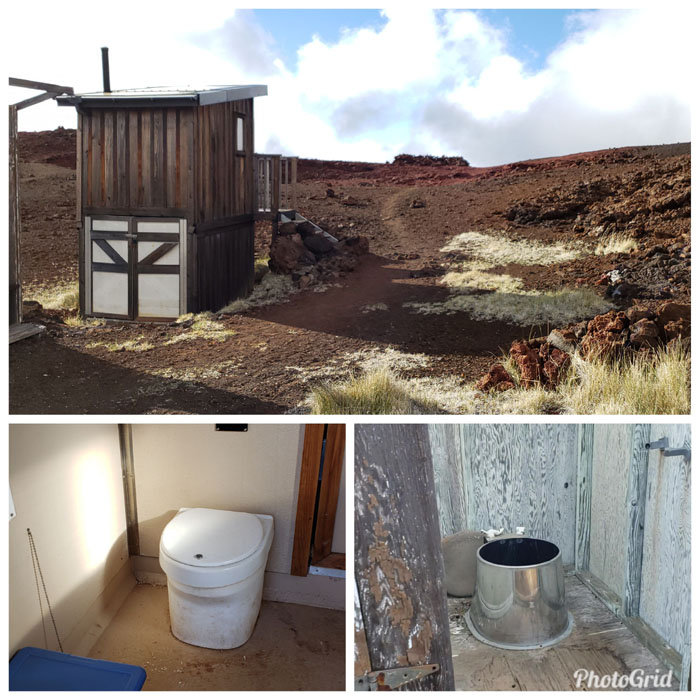
Pu’u ‘Ula’Ula Cabin
The old and new toilet. We’ll stick with the new. Photos by Matt Vidaurri.
Pu’u ‘Ula’Ula
After picking our bunks and settling in, we made the short climb to the top of Red Hill to catch the sunset. Bare feet, slippers and shoes and all.
Pu’u ‘Ula’Ula
Looking down at the cabin as the creeping clouds cast doubts on any sunset viewing and the temperature began dropping. Time to go back down the hill.

Pu’u ‘Ula’Ula
Connor’s reward for being pressed into service as a photographer. Photo by Matt Vidaurri.
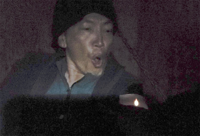
Make a wish
Who can resist a fig newton for their birthday? Photo by Matt Vidaurri.
Video by Matt Vidaurri of our first day on Mauna Loa.

Pu’u ‘Ula’Ula Cabin
Monday Memorial Day May 27, 2019
Sunrise in the mountains. It’s too cold, send out the boy to take the pic. Photo by Connor Krauss.
Pu’u ‘Ula’Ula Cabin
Packing up and getting ready for our second day of hiking. Some of us left extra food and butane fuel in the cabin to lighten our loads going up.
Pu’u ‘Ula’Ula Cabin
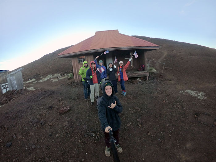
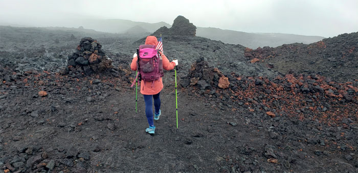
Celebrating Memorial Day with the free flags that we had picked up at Ace Hardware the day before. We said our goodbyes to Connor and Mike who were planning to head back down the trail.
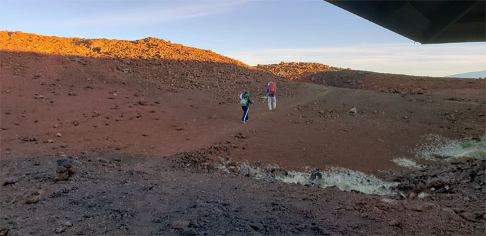
Mauna Loa Trail
Matt and Quan left ahead of our group to get a head start.
Mauna Loa Trail
Somebody still needed more time before they got left behind.
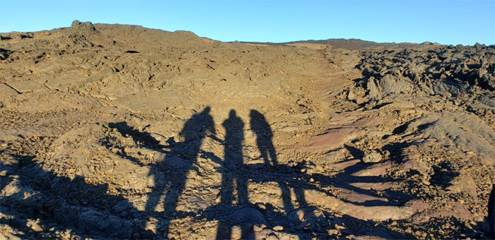
Shadows
Group photo left to right: Cisco, myself and Analyn.
Mauna Loa Trail
Leaving Red Hill behind us, some of us with ginger chews in our mouths as it helped to combat the effects of thin air. Another helpful hint from Larry.
Mauna Loa Trail
Seeking shelter in all the wrong places.
Mauna Loa Trail
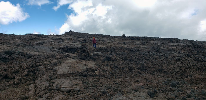
The terrain was unforgiving and rewarding. Brutal and charming. Contradictions that are best experienced in person.
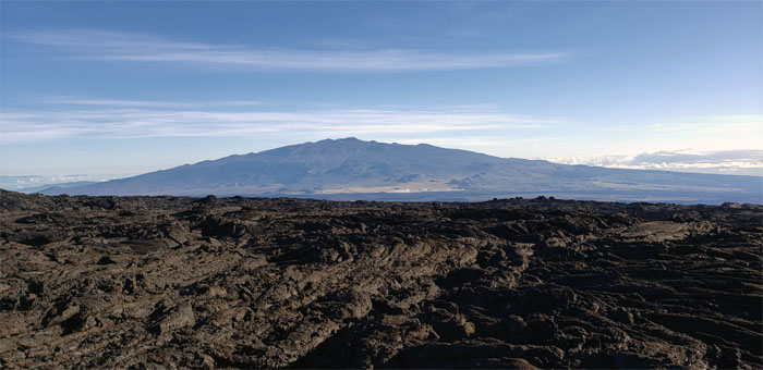
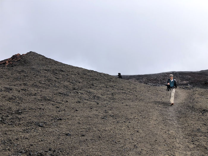
Mauna Loa Trail
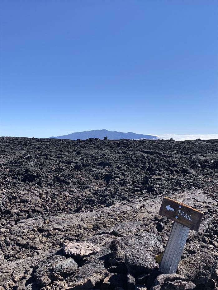
Looking towards Mauna Kea, which at 13,803′ is the highest point in the Hawaiian islands.
Mauna Loa Trail
The red and black spatter cones from the 1800’s that dotted the landscape. Photo by Analyn Baliscao.
Mauna Loa Trail
Perhaps Matt was offering himself as a human sacrifice? Photo by Quan Haberstroh.

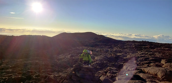
11,000′ Elevation
Most folks start exhibiting signs of acute mountain sickness around this elevation. The only cure is to go back down. Pressing further would only invite serious complications. Luckily, everybody seemed to be weathering the high altitude, albeit in slow motion.
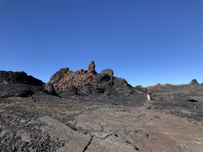
Pukauahi
Heading towards the prehistoric smoke hole surrounded by 1984 lava flows. Photo by Matt Vidaurri.

Mauna Loa Trail
Sunbeam dancing on the smoothly rippled and undulating obsidian surfaces. It pays to slather liberal amounts of sunscreen and lip balm due to the higher elevation and absence of cloud cover. Photo by Analyn Baliscao.
Mauna Loa Trail
Contouring around one of the older spatter cones.
Rorschach Test
Instead of inkblots, what do you see in the lava rocks? Photo by Cisco Quintanilla.

Mauna Loa Trail
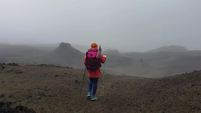
Mauna Kea above the sea of clouds.
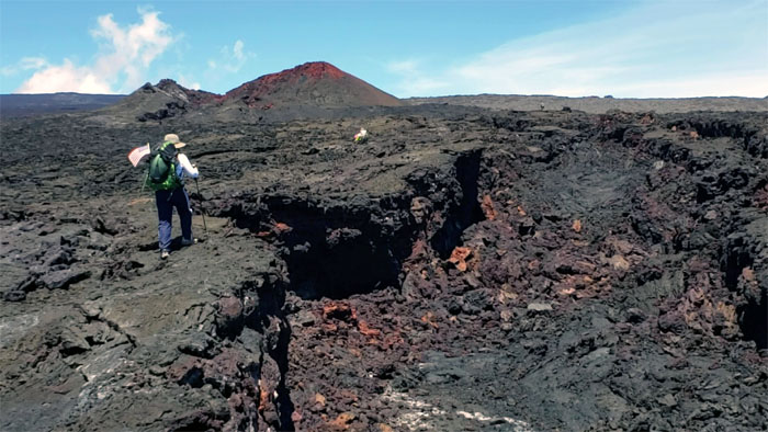
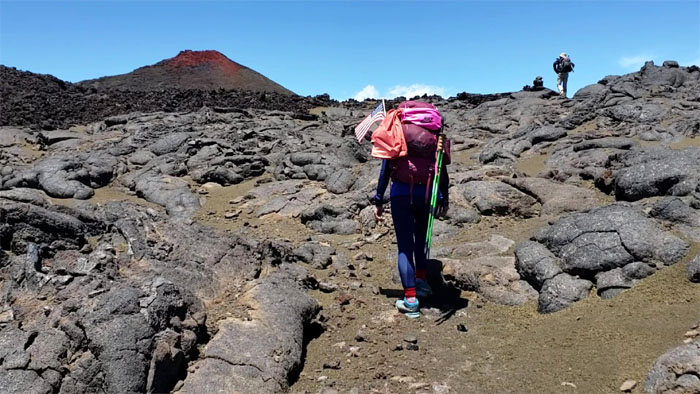
Dewey Cone
Passing by the cinder cone formed during the 1899 eruption and named after US Navy Admiral Thomas Dewey.
Mauna Loa Trail
The marked difference between new and old lava. We stuck with the old.
Mauna Loa Trail
Quan hiking next to the huge trench. Photo by Matt Vidaurri
Mauna Loa Trail
Matt elevated and shaded in a patch of olivine crystals, common lime-green minerals that have separated from the basaltic rocks.
Mauna Loa Trail
Rock hopping our way through the olivine patch. Photo by Matt Vidaurri.
Steaming Cone
Spatter cone that was formed in the 1855 eruption and has since run out of steam.
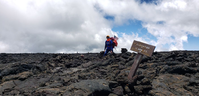
12,000′ Elevation
3,658 meters to the rest of the world.
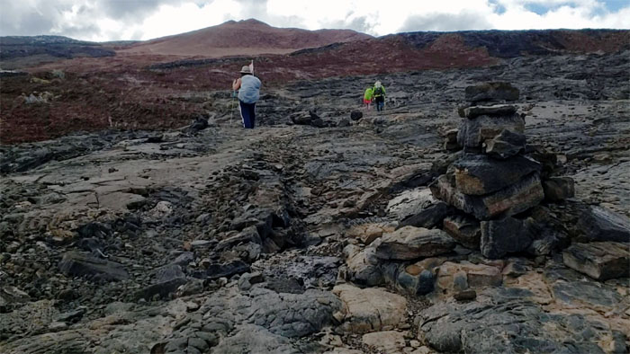
Mauna Loa Trail
Approaching the prehistoric Pohaku Hanalei spatter cone.
Long Mountain
The volcano living up to its name as we dragged ourselves up the trail.
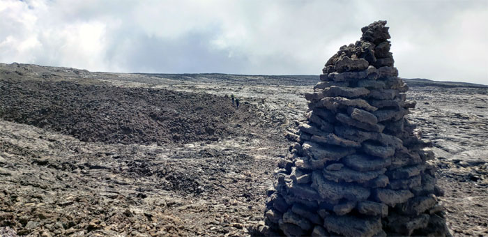
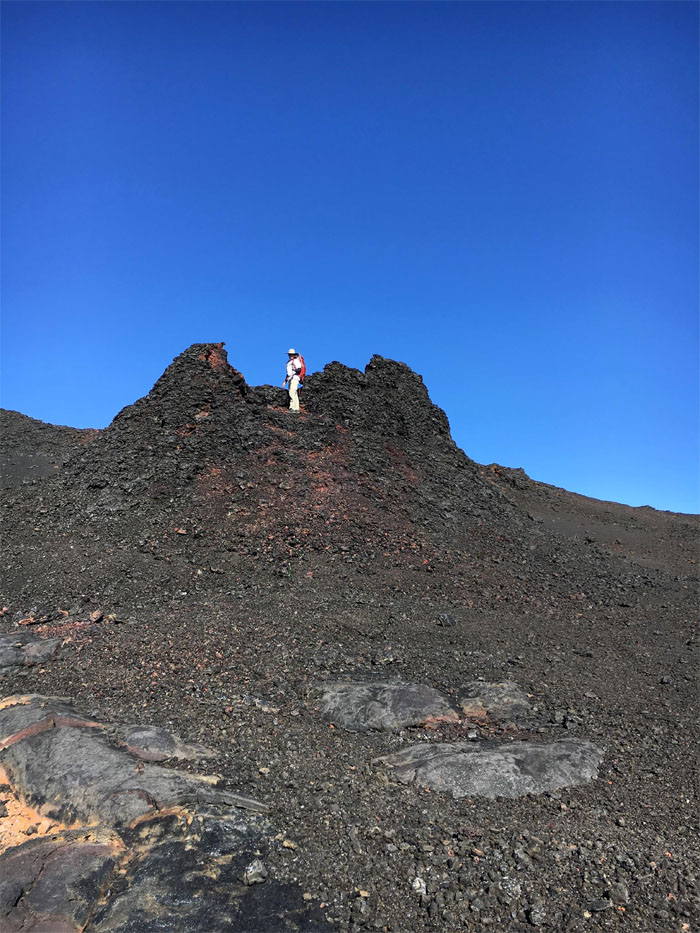
Mauna Loa Trail
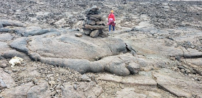
One of the taller and densely stacked ahus on the trail. Photo by Matt Vidaurri.
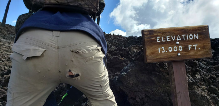
13,000′ Elevation
What happens when you sit on a’a (sharp) rocks and not pahoehoe (smooth) rocks. Photo by Analyn Baliscao.
Mauna Loa Trail
Analyn crossing over a fissure in the fields.
Mauna Loa Trail
Crunching on the carpet of clinkers as we neared the pit.
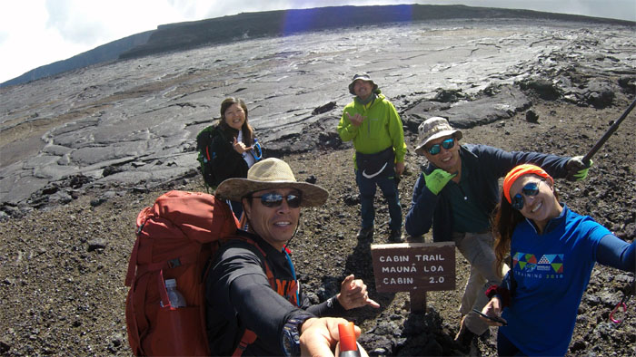
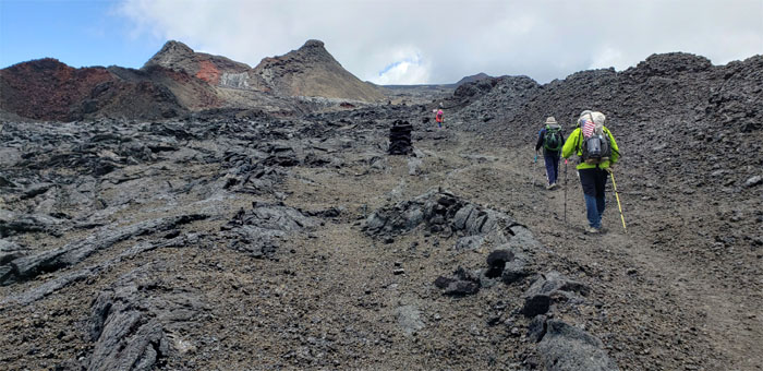
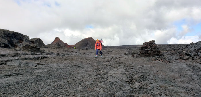
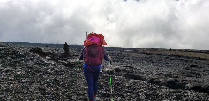
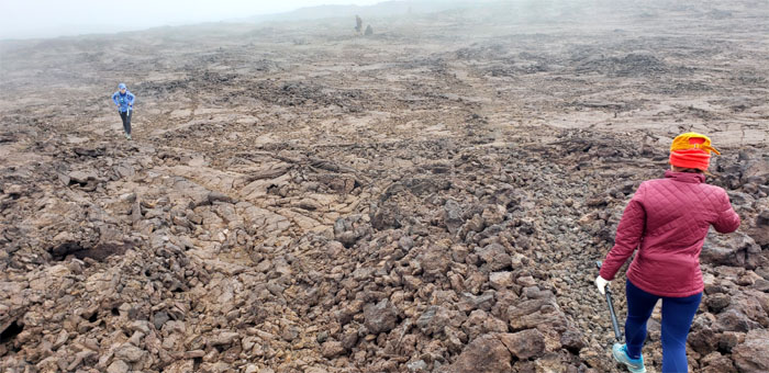
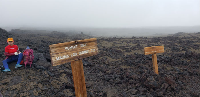
Cabin Trail
Only two more miles to go. What many say are the hardest and longest two miles of the hike. Made harder by the fact that some in our group started feeling the higher altitude.
Cabin Trail
Dropping into the steaming North Pit. Yes, this is an active volcano.

Cabin Trail
Smooth walking on the 1984 pahoehoe lava.
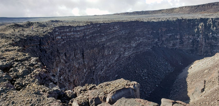
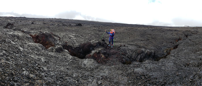
Lua Poholo
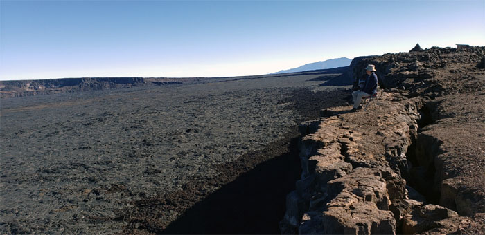
Skirting the cracked rim bordering the yawning pit that’s over two hundred feet deep.
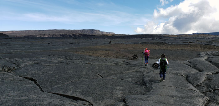
Cabin Trail
Taking it slowly on our way to the top of the caldera wall. Photo by Analyn Baliscao.
Cabin Trail
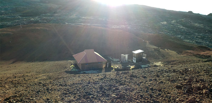
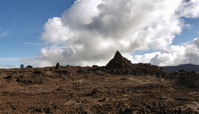
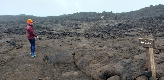
A welcome sight for our tired eyes, sore feet and aching lungs. The cabin that was dwarfed by the largest ahu on the trail. Somebody had ample time on their hands.
Cabin Trail
Passing the old outhouse with a view from the South Rim.
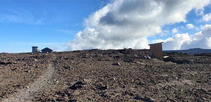
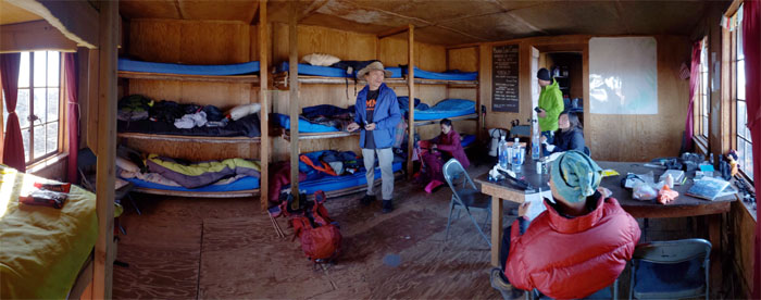
Mauna Loa Cabin
There was mutual surprise to find two hikers from Washington occupying the cabin built in 1934. No worries, there were still 10 bunks left for the five of us. They had the only hot stove in the cabin. Some of us were drooling over the prospect of hot left overs. Others had to get up during the middle of the night to quench their parched mouths and empty their bladders. One thing we noticed was that the other hikers hung their camelbaks near their bunk, so they could just take a sip when needed without moving around too much.
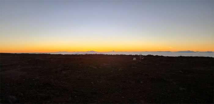
Sunrise
Tuesday May 28, 2019
Catching the sunrise at 13,250′. Photo by Matt Vidaurri.
Frosted rocks
The overnight temperatures must have plummeted to freezing as evidenced by frost on the rocks and a chunk of ice that fell from the water catchment. Photo by Matt Vidaurri.
Mauna Loa Cabin
Packing up and deciding if the group was going to hike the summit trail. Some had already decided.
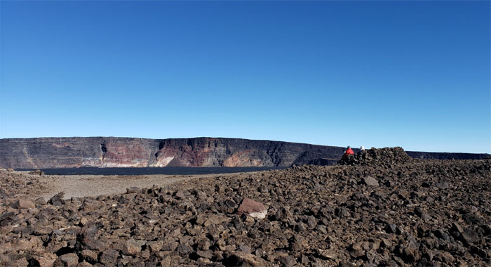
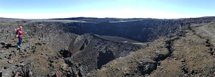
Moku’aweoweo Caldera
Group photo with the backdrop of the island of lurid burning, although it was more lurid smoking than burning.
Moku’aweoweo Crater
Looking across the caldera to the North Rim where the true summit is located.
Moku’aweoweo Caldera
Ring side seat to the massive sunken pit that encompasses seven square miles and is over 600′ deep. Photo by Analyn Baliscao.
Cabin Trail
We said our goodbyes to the two Washington hikers that were enjoying their morning java and caldera views.
Cabin Trail
Starting our third day of hiking at high altitude.
Cabin Trail
Glimpsing Mauna Kea with her glinting observatories perched on the summit. Photo by Cisco Quintanilla.
Lua Poholo
Panoramic view of the crater.

Cabin Trail
The rest of the group climbing out of North Pit. Photo by Analyn Baliscao.
Mauna Loa Trail
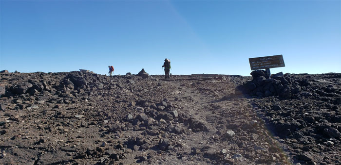
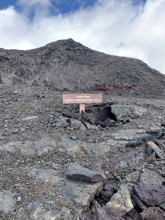
Making our way to the junction where we could go up to the summit or down to the observatory.
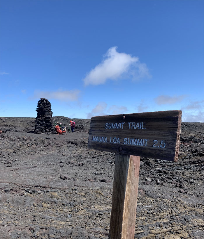
Mauna Loa Trail
C’mon guys, it’s only 2.5 miles to the summit! Photo by Cisco Quintanilla.
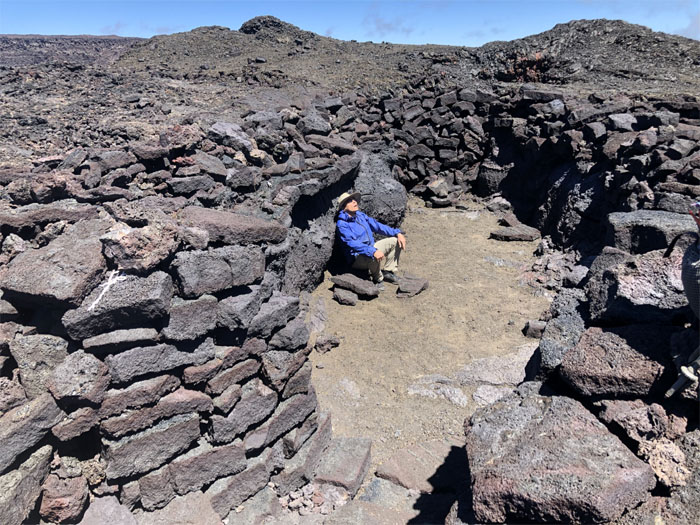
Jagger’s Cave
Decisions. Decisions. Decisions. Cisco, Matt and Quan were still suffering from altitude sickness and the decision was made for them to continue down the trail. Analyn and myself seemed unaffected by the thin air and decided to press on to the summit after depositing our packs in the cave to lighten our load.
Summit Trail
The summit looked so close and yet was so far away.
Summit Trail
Analyn had to double back as she had forgotten her phone at Jagger’s Cave, which afforded me a half hour nap.
Summit Trail
Only two more miles. We got this.
Summit Trail
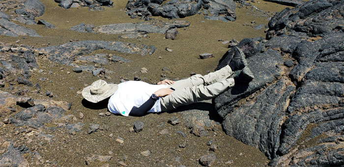
Passing the carcass of a dead bird. Perhaps fallen by acute mountain sickness.
Summit Trail
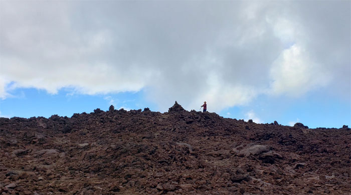
We thought we had reached the summit, but it was actually the remains of the original Mauna Loa Observatory. Looking ahead we still saw the ahus dotting the trail that continued to wrap around the rim.
Summit Trail
Making the final push to the top.
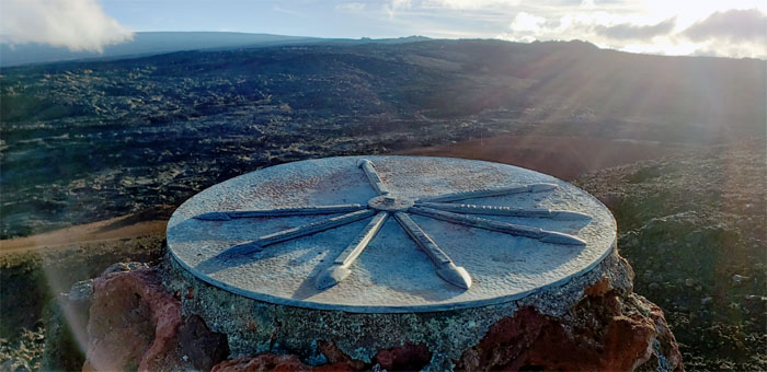
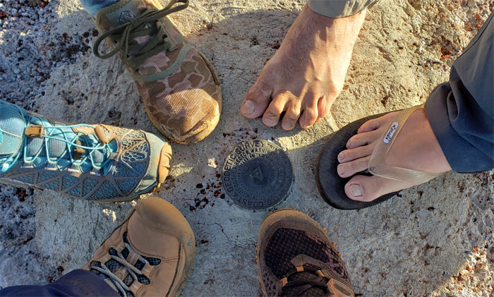
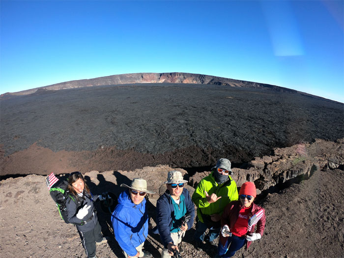
Mauna Loa Summit
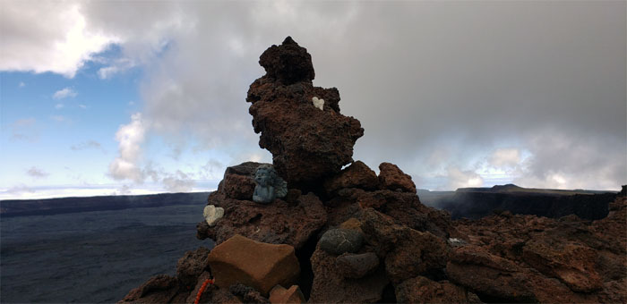
The summit was not marked with a sign but simply another irregularly stacked ahu sprinkled with trinkets and mementos left by others that had preceded us to the top. We must have missed the logbook. Darn.
Mauna Loa Summit
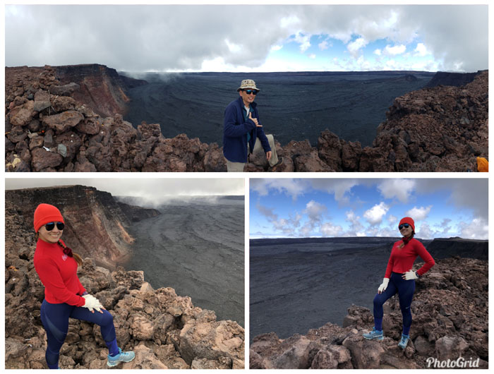
The caldera was even more majestic and massive from our lofty perch. Analyn noticed the Mauna Loa Cabin across the crater.
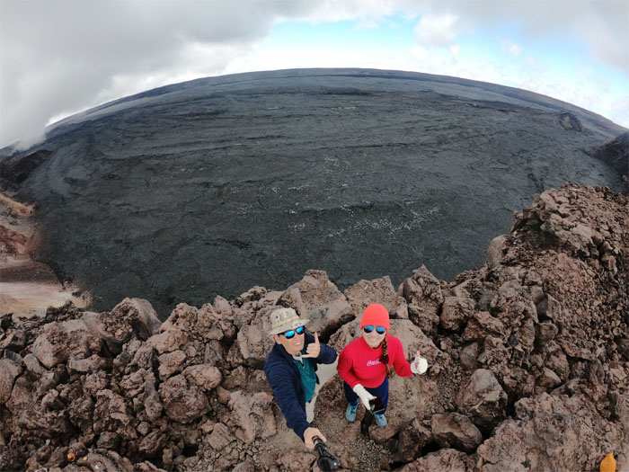
Mauna Loa Summit
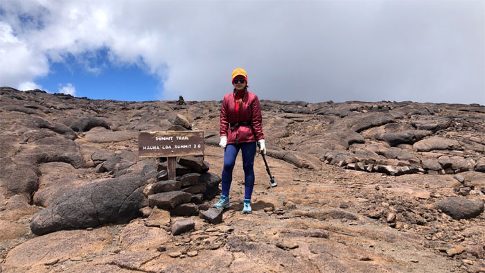
Group photo at the 13,678′ summit. Breath taking. Literally.
Mauna Loa Summit
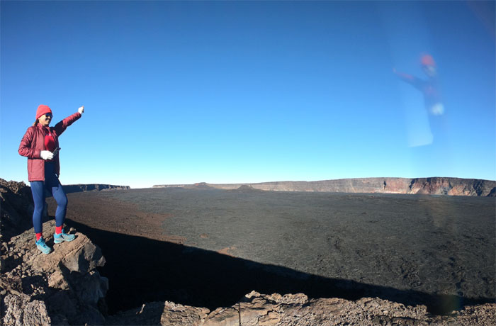
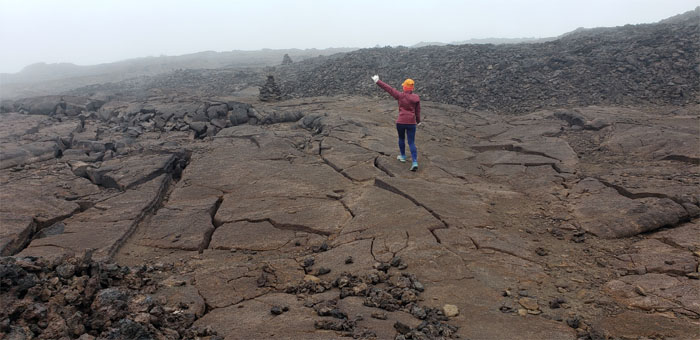
Time waits for no one, except another photo shoot.
Summit Trail
Going down as the clouds starting to roll in over the landscape. Whiteout and darkness are two conditions you don’t want to encounter on the trail as it will increase ones chances of getting lost up here.
Summit Trail
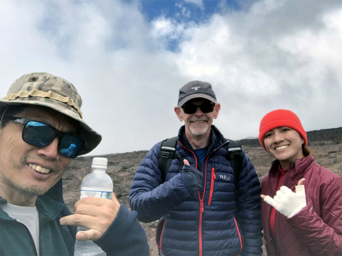
Random trail meetings with Robert, a hiker from England.
Summit Trail
Drizzling rain followed the clouds.
Summit Trail
Another random trail meeting with Rob and Megan and their trailing friend.
Summit Trail
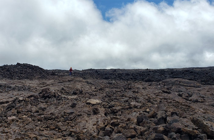
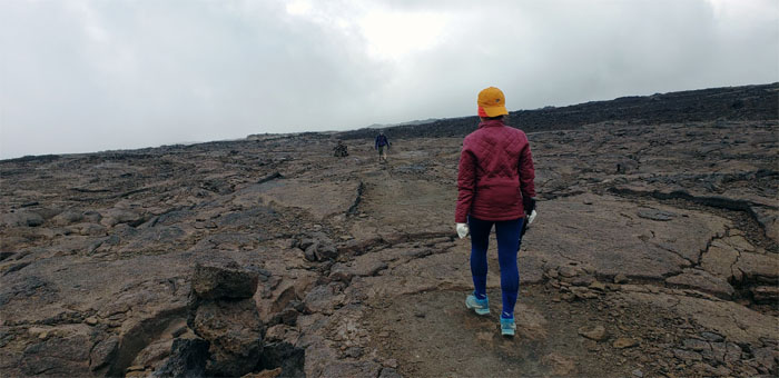
Hiking over the fractured lava landscape that was riddled with tubes, fissures, trenches and coated with jagged a’a rocks and spots of smooth pahoehoe lava.
Summit Trail
Back at the junction.
Summit Trail
The drizzling rain had increased the steam output from the caldera.
Jagger’s Cave
We recovered our intact packs and took a short break before our final trek down the volcano.
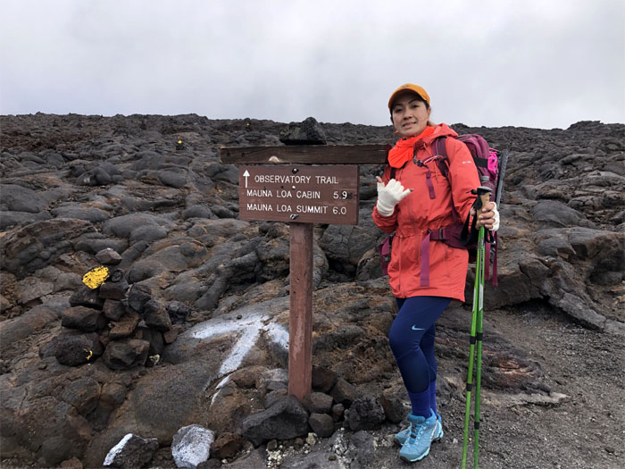
Observatory Trail
Looking out towards the lime-green pumice sprinkled among the a’a rocks.
Observatory Trail
Descending past the junction.
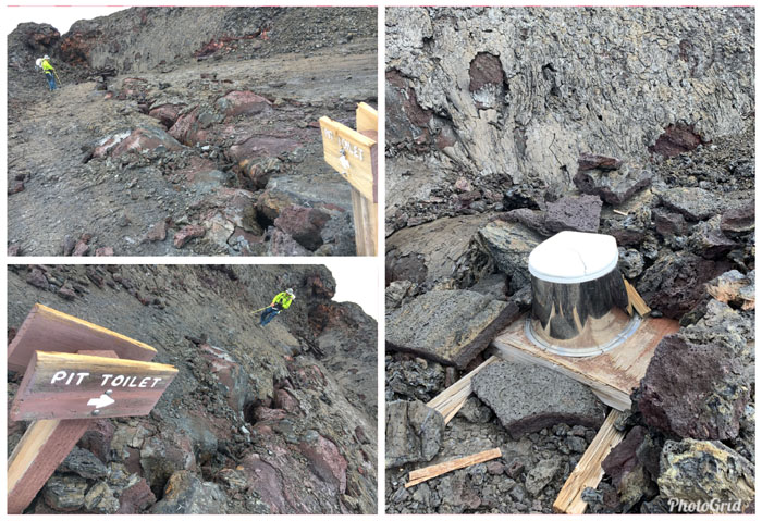
Pit Toilet
When you got to go, you got to go. Luckily, we didn’t need to go.
Observatory Trail
Most of the group had decided to use hiking sticks that afforded better balance when hiking on the uneven terrain.
Observatory Trail
Coming down on the old lava trail. Photo by Analyn Baliscao.
Observatory Trail
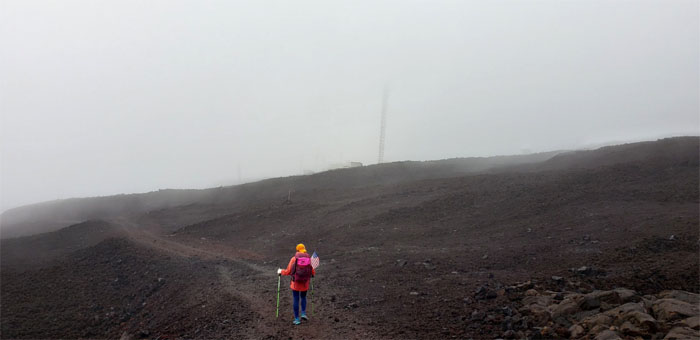
Hiking through the cloud soaked landscaped which muted the cairns and cones.
Jeep Trail
Leaving the trail temporarily as it intersected with the jeep trail.
Jeep Trail
Walking down the road, hoping that a truck would come along and give us a ride to the bottom. No such luck.

Jeep Trail
Getting back on the trail. If we had missed the shortcut, the road would still have deposited us at the bottom. It just would have been a longer day.
Observatory Trail
We noticed yellow splashes of paint on the rocks as we made our way down, probably to help locate the trail during times of low visibility.
Observatory Trail
Passing a cavernous lava tube stacked with two large ahu. Last chance for shelter. Photo by Cisco Quintanilla.
Observatory Trail
The end of the six mile trail from the summit.
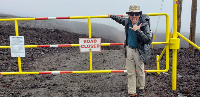
Mauna Loa Observatory
Trudging down the dusty road covered with small and rough a’a rocks as we passed the atmospheric baseline station.
All pau
Our journey up and down the world’s largest volcano had come to its conclusion. Glad to have done it with this great bunch of friends. We joined the rest of the them who were waiting for us in our staged car at 11,055′ elevation.
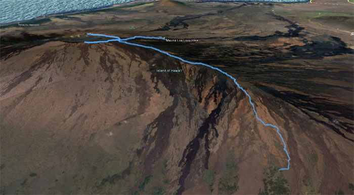
GPS Tracks
The three day hike covered 29.7 miles through heaven and hell. Our hunger for protein was denied by a long wait at Hilo Bay Café, so we drove to Jackie Rey’s for that open table. We should have waited. Walking back to our cars, the ladies were serenaded by the male coqui frogs chirping their high pitched mating and marking calls. We later checked in to KMC where Matt had booked a cabin with a jacuzzi to massage our tired muscles. I think everybody was too tired to use it and turned in for the night after a nice hot shower.
Note: I have been made aware that some hikers have been using my blog as a hiking guide and getting lost on the trails. Please note that this blog was made to document the hike for the crew(s) that did it. That is why some of my comments will seem to have no relevance or meaning to anybody outside of the crew(s) that hiked that trail. My blog was never meant as a hiking guide, so please do not treat it as such. If you find inspiration and entertainment from these hikes, that is more than enough. If you plan on replicating these hikes, do so in the knowledge that you should do your own research accordingly as trail conditions, access, legalities and so forth are constantly in flux. What was current today is most likely yesterdays news. Please be prepared to accept any risks and responsibilities on your own as you should know your own limitations, experience and abilities before you even set foot on a trail, as even the “simplest” or “easiest” of trails can present potential pitfalls for even the most “experienced” hikers.
{ 4 comments… read them below or add one }
Great write up Kenji. Let’s do it again sometime. Next time from ainapo
Aloha Matt,
Thanks again for your help in coordinating the hike. I’m down for ainapo!
Mahalo
Awesome Epic Adventure…
Aloha Cisco,
Yes it was. Thanks for coming, cold and all. You should come for the next one and make it to the summit.
Mahalo