
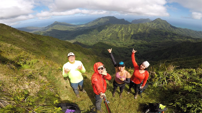
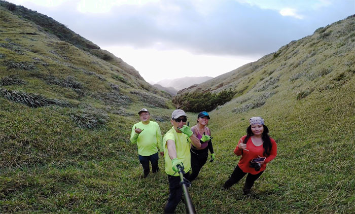
It was another deja vu camping hike for me this weekend. Thanks to Bill for taking Art, Katie, Tessa and myself up the Poamoho Jeep Road and for wishing us a dry day on the trail.

Trailhead
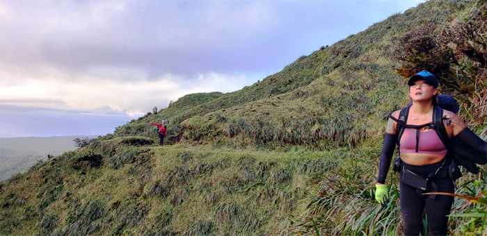
Starting off on the wet foot. Have rain jacket, will hike.
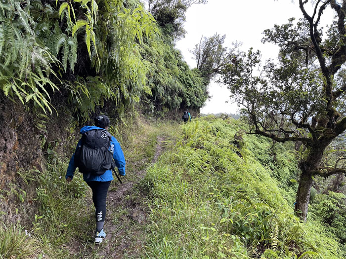
Poamoho Trail
Stepping foot on the mostly graded trail that was peppered with small landslides and blowdowns. Photo by Art Young.
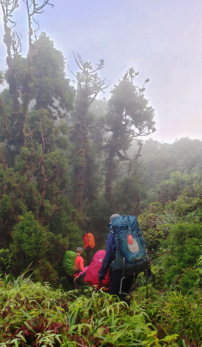
Poamoho Trail
Sloshing through the muddy trail. Setting the tone for the weekend. Photo by Katie Bingham.
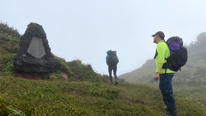
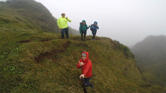
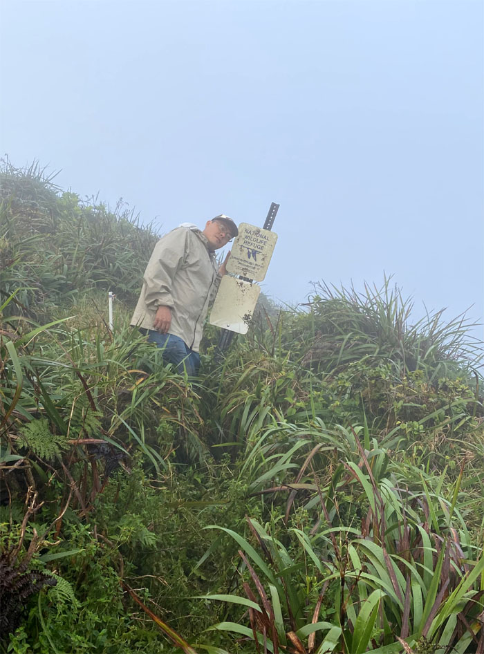
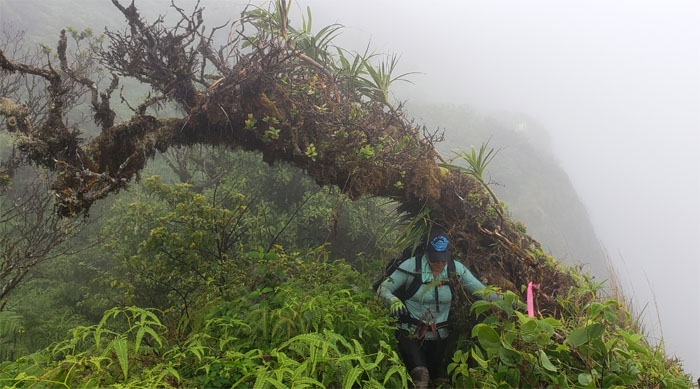
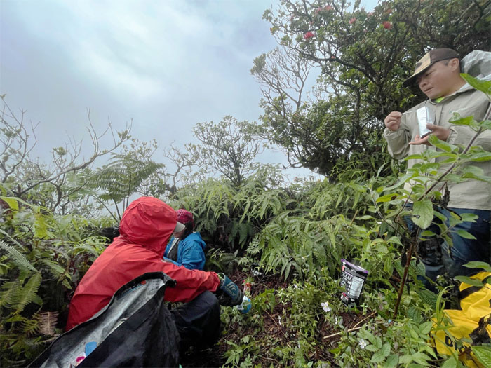
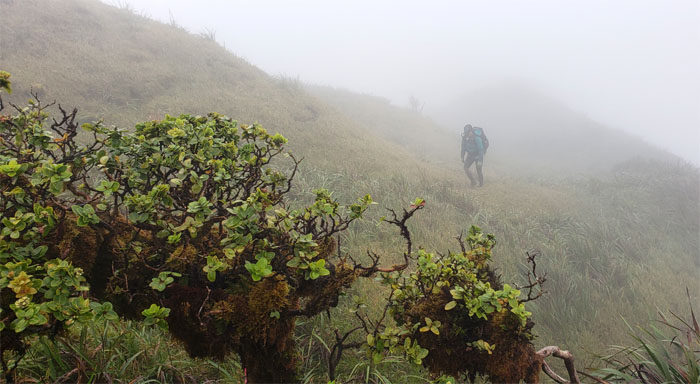
Cline Memorial
Art trying to figure out the mileage to our destination. Hint: It’s not listed. Photo by Tessa Bugay.
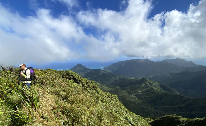
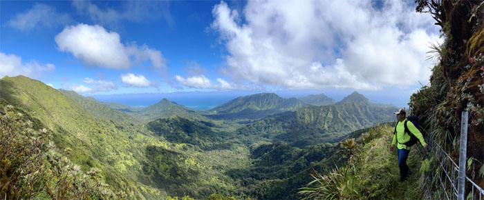
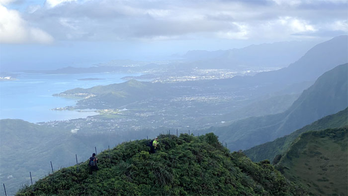
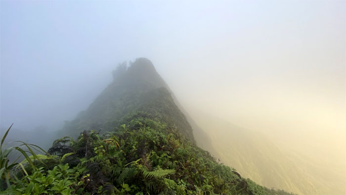
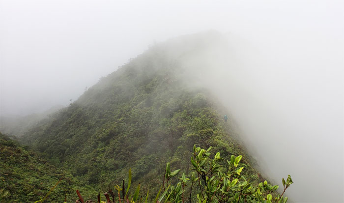
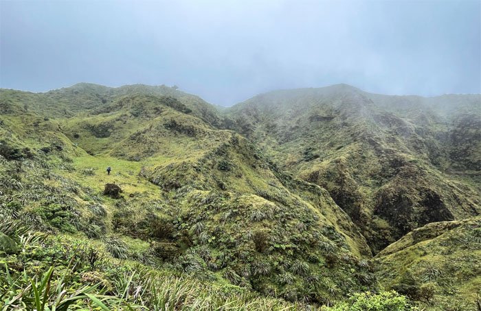
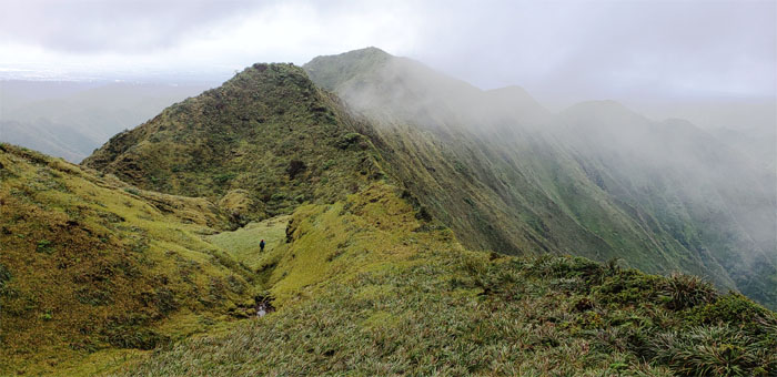
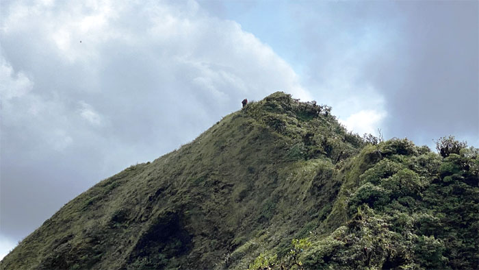
Poamoho Summit
The views were noticeably absent on the wind blasted summit. Let’s take our photo anyway for posterity’s sake.
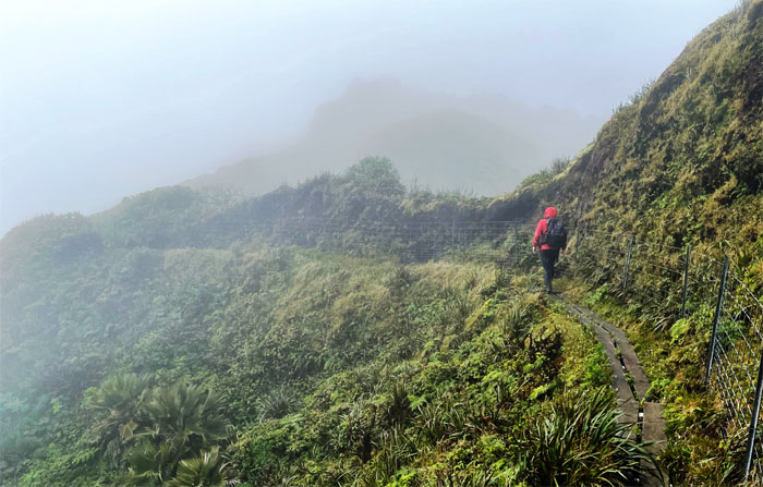
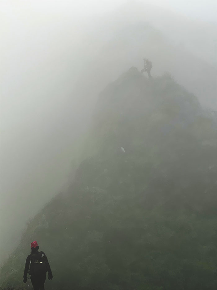
Ko’olau Summit Trail (KST)
Making our way on the boardwalk, somebody probably wished the whole KST was laid out in this manner. Photo by Katie Bingham.
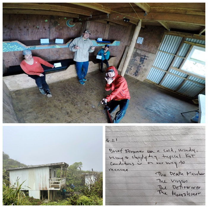
Poamoho Cabin
The reports of overcrowding were greatly exaggerated. Reservation place cards were on the four bunks. Honoring them was another question entirely.
KST
Our bladders and bottles topped off, we pushed off from the cabin to resume our hike on the Leeward side. Photo by Art Young.
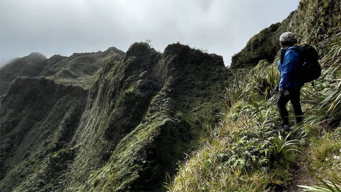
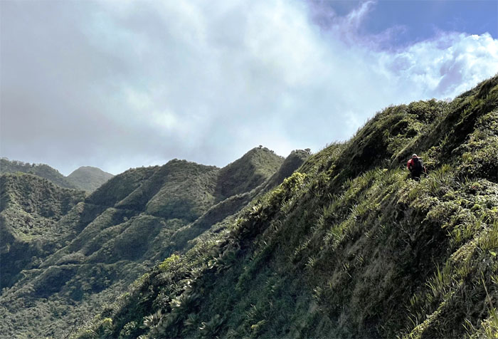
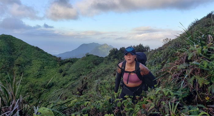
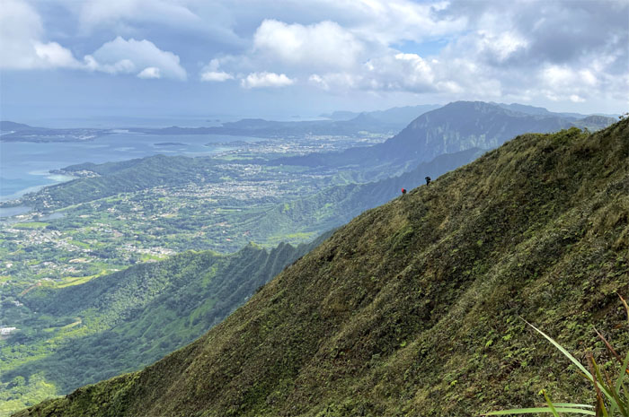
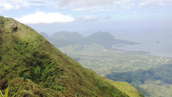
KST
Art on the exposed trail and exposed views. Photo by Tessa Bugay.
KST
Preparing to hike on a trail that was blasted and dug out of the mountains back in the 1930s. Photo by Art Young.
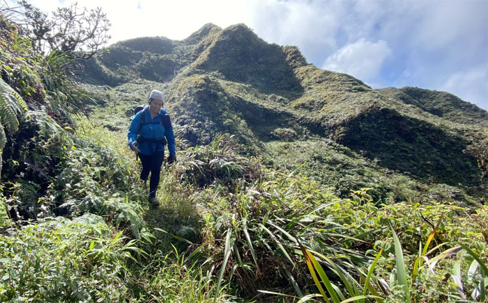
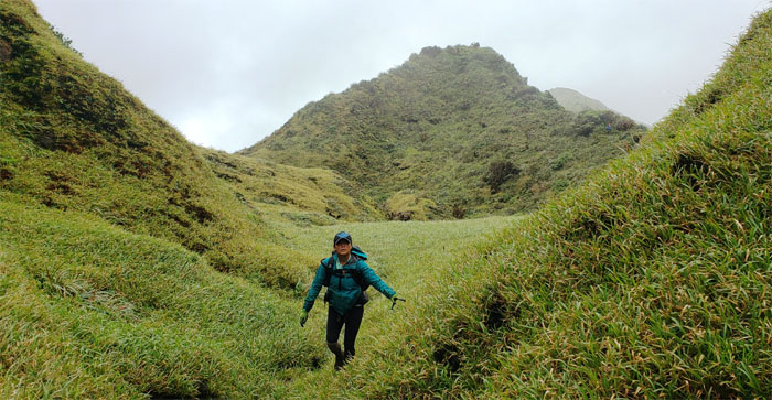
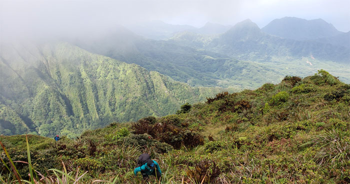
KST
Tessa passing through one of many meadows on this side of the mountains. Photo by Art Young.

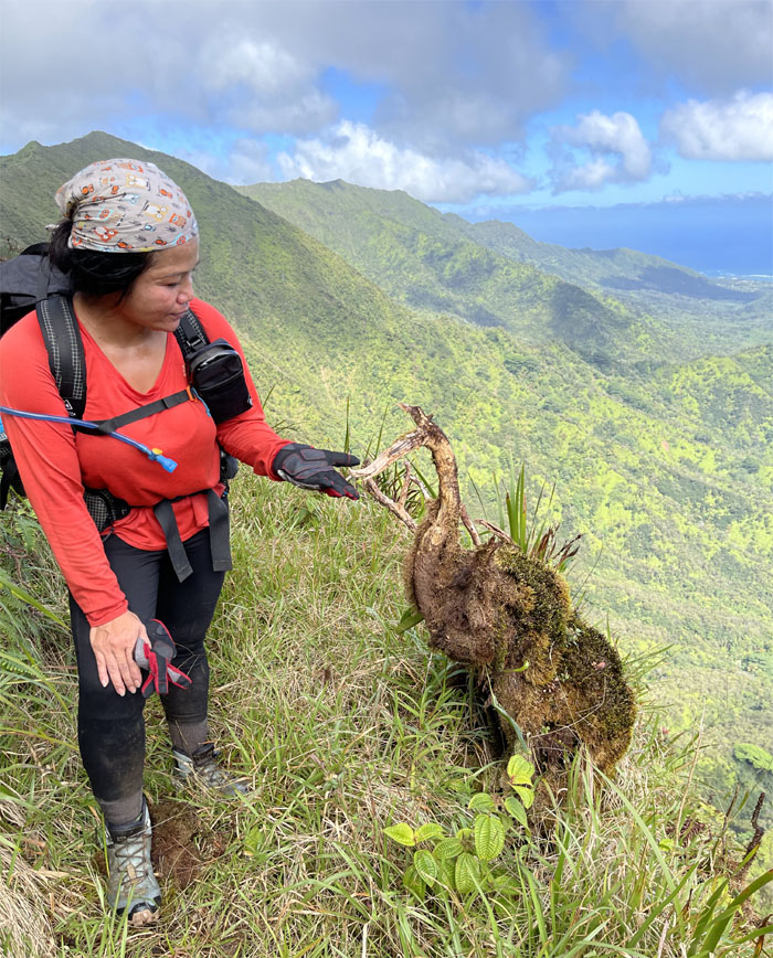
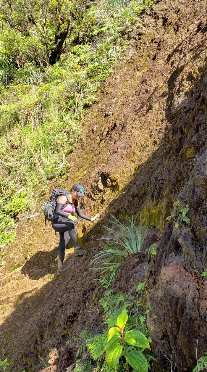
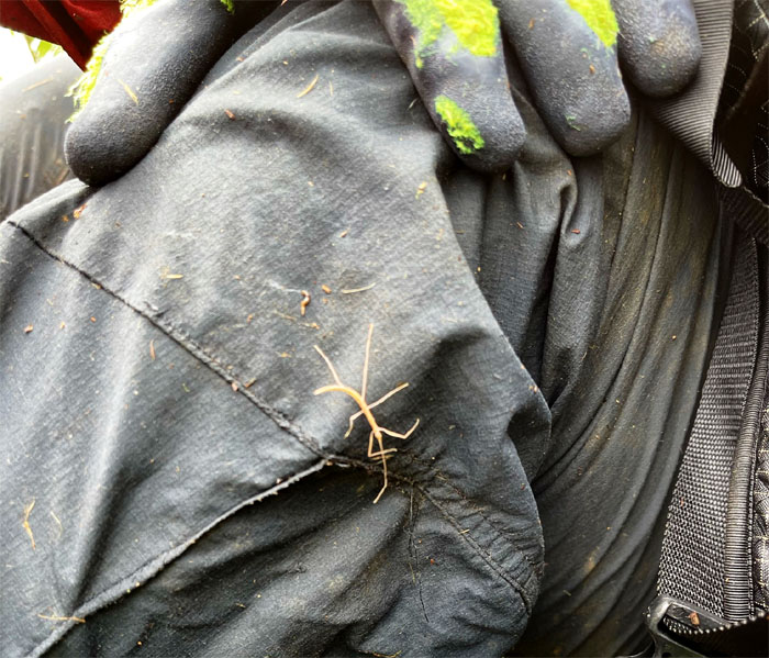
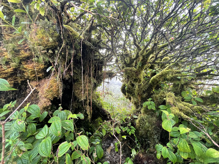
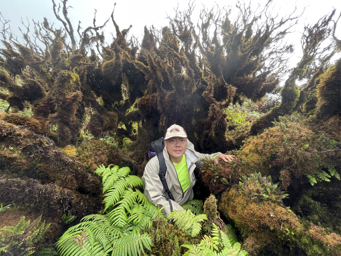
Schizaea robusta
Art finally found his toothbrush fern in the wild after looking for many years. Now he just needed to find extremi longiores foris dentifricium to complete his search. Photo by Art Young.
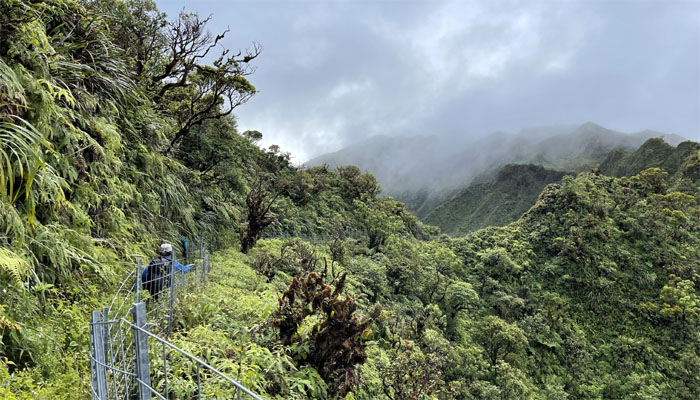
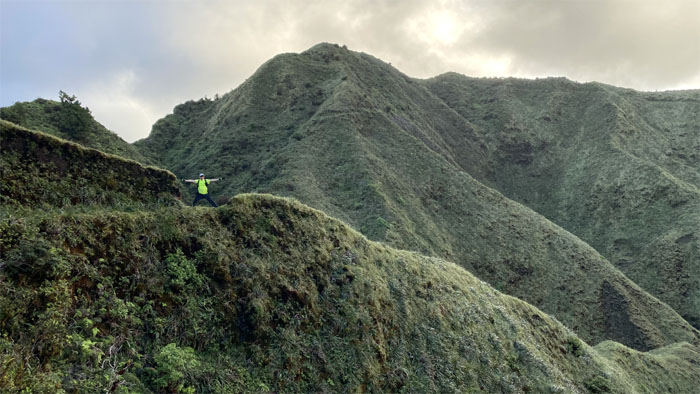
KST
Hiking with views. Not a bad way to spend the weekend. Photo by Art Young.
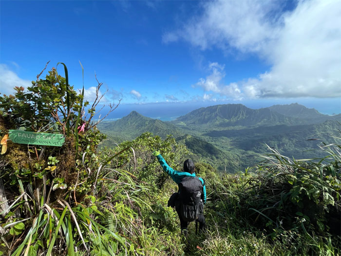
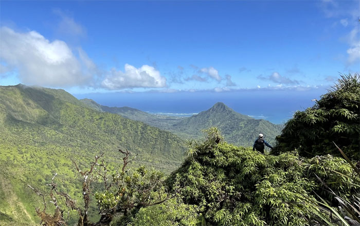
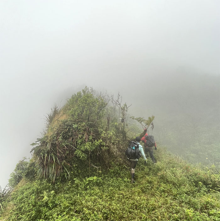
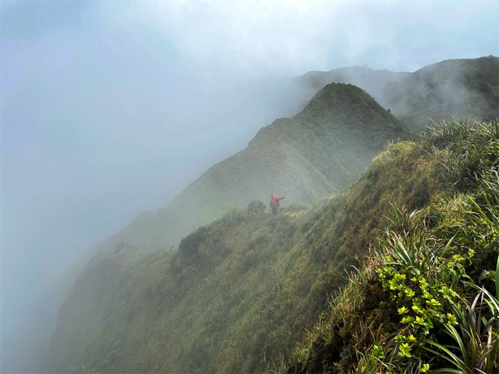
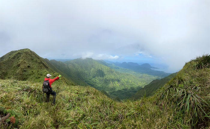
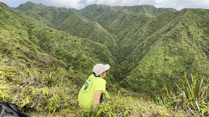
Pauao Junction
Looking down into Kahana and her surrounding valleys.
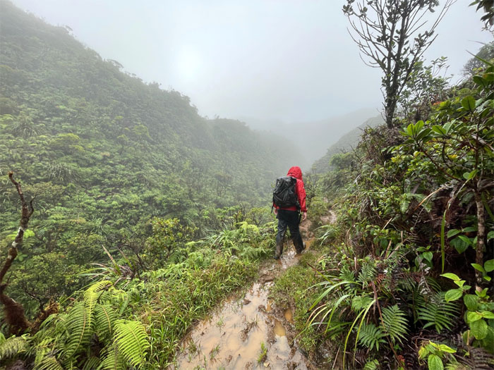
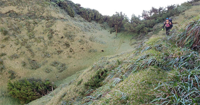
KSRT
Traversing on the trail pitted with false holes and landslides. Photo by Art Young.
KST
Wrap around views of the spectacular scenery. Photo by Tessa Bugay.
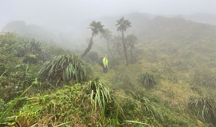
Ko’olau Goose
No feeding or petting of wild animals allowed. Some people are just born rebels. Photo by Art Young.
Schofield-Waikane Junction
At least we got views at this summit stop.
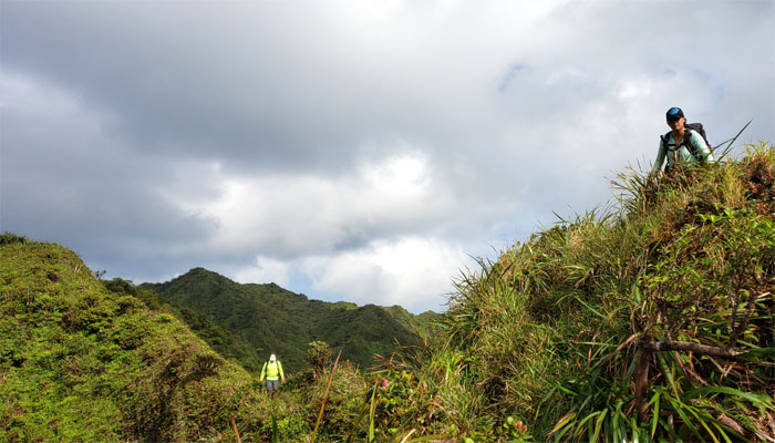
KST
Heading towards the fork in the trail. Photo by Katie Bingham.
Waikane-Waiahole Junction
Tessa mistaking the marker for a resting pole. A common occurrence in the mountains. Photo by Art Young.
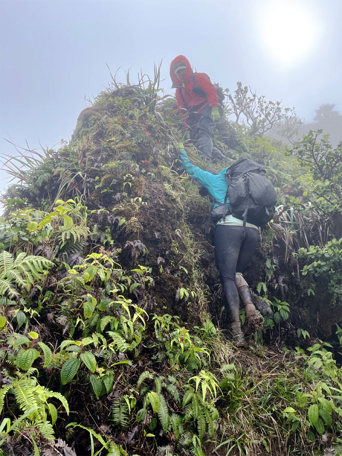
KST
Going uphill. Photo by Art Young.
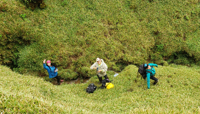
KST
Katie traversing the well trodden landslide.
KST
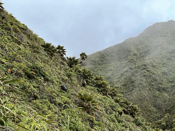
The trail interrupting a line of native loulu palm trees running down the mountain. Photo by Art Young.
KST
If you look closely, you will find a couple gold earrings that was surrendered to the uluhell overgrowth. Finders keepers.
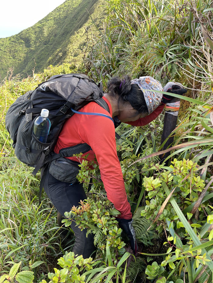
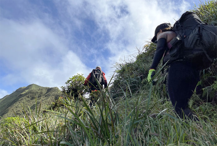
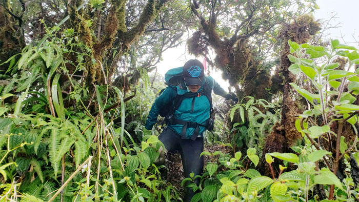
KST
Meandering our way through the contour trails. Photo by Art Young.
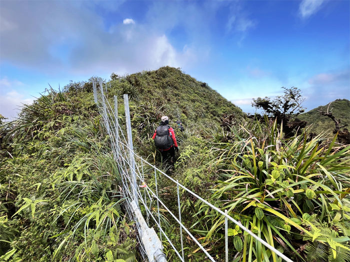
KST
One of many fence crossings that we went over on the trail. Photo by Art Young.
KST
Somebody was asking why can’t the entire trail be like this section. You can ask. Just don’t expect an answer.
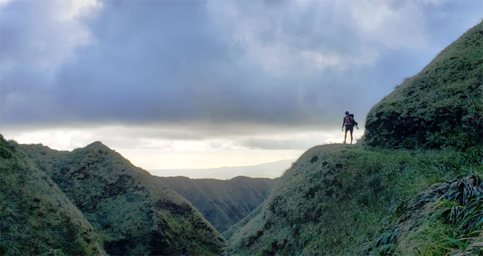
KST
Dropping down towards the wind blasted meadows. Photo by Tessa Bugay.
Tree of Life
To camp or not to camp? Photo by Tessa Bugay.
Tree of Life
Group photo with the horizontal leaning sugi pine tree. If we stayed any longer, we would be horizontal leaning as well.
Tree of Life
We had no wish to camp here, so we picked up and pressed on.
KST
Are we there yet?
KST
We are home! Photo by Katie Bingham.
KST
Is that somebody waving at us? Somebody that is 5’11” and orange?
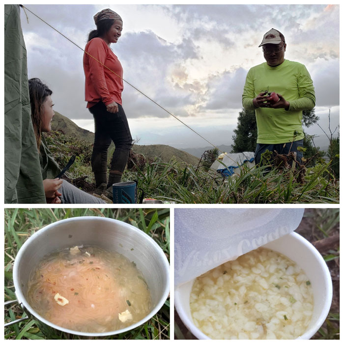
Camp Rusty
Art demonstrating to Tessa that butane cans are our friends and not to be feared. What’s for dinner?
Camp Rusty
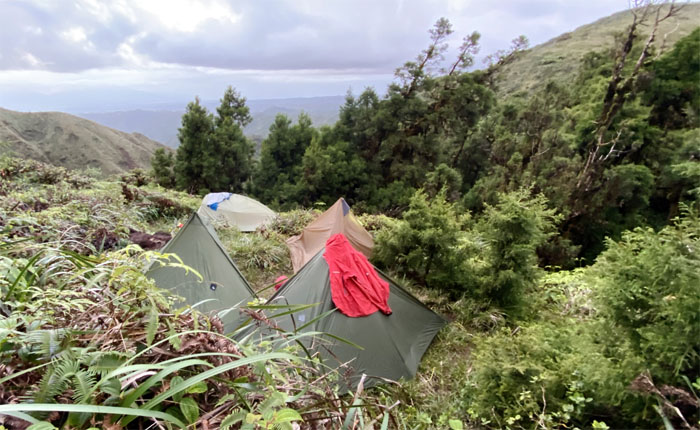
Our camp site for the night, nestled in the grove of sugi pine trees at the base of Waiahole. Photo by Tessa Bugay.

Camp Rusty
The audio has been deleted to protect the innocent. Claims of partially obstructed breathing from the male side of the camp were dubiously made.
Camp Rusty
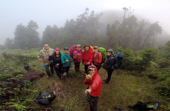
Cinja’s group came down from the mountains to crash our camp site. Group photo left to right: Art, Tessa, Katie, Tess, Somphet, myself, Cinja and Leslie.
Camp Rusty
The group heading towards Poamoho and an unfortunate date with rolling. And not rolling with laughter either.
KST
Back on the ridge line to see … well nothing.
Kipapa Summit
Art trying to be one with the sign. Lean more to the left. Photo by Tessa Bugay.
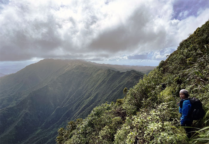
Ko’olau Summit Ridge Trail (KSRT)
The cloudy start to our constant climbing for the day. Photo by Art Young.
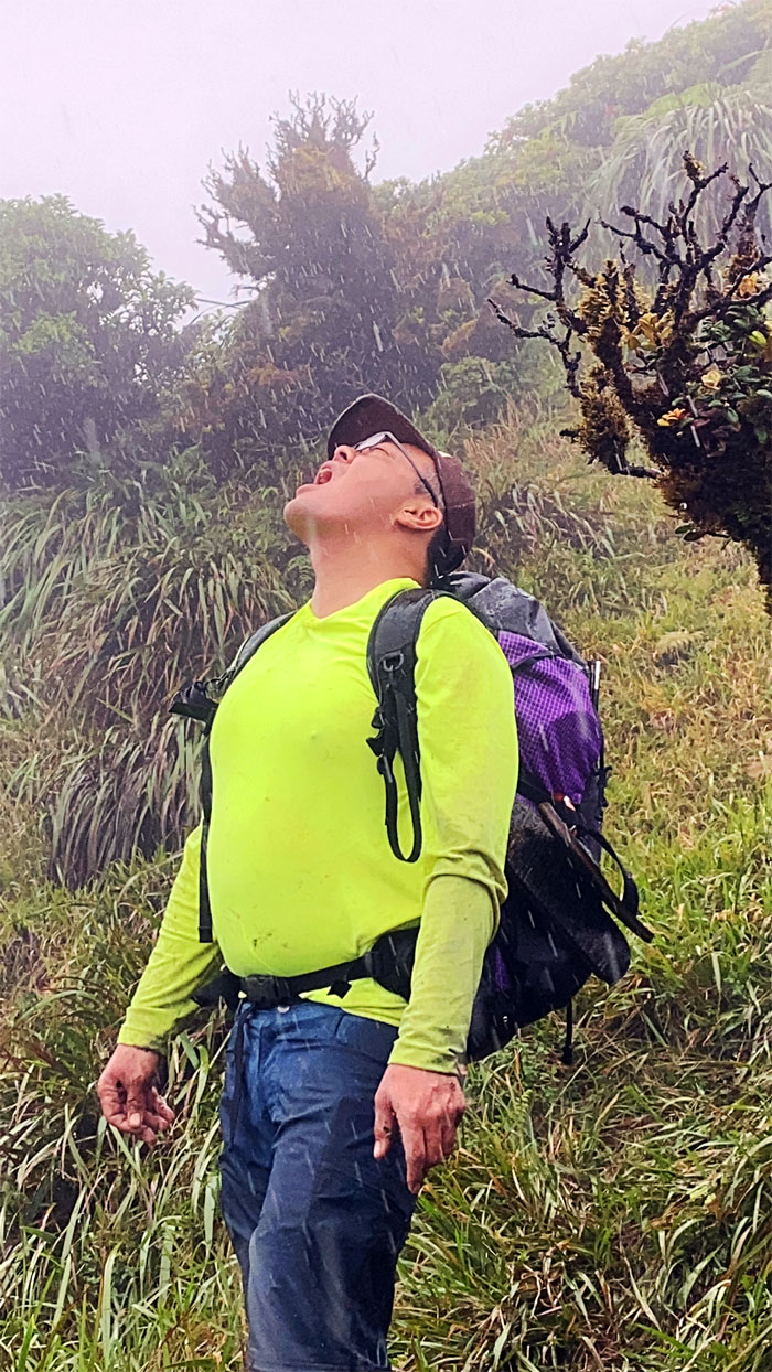
Raindrops keep falling into my mouth
Why wait for the water, when the water comes to you? Photo by Tessa Bugay.
KSRT
The group making their way down to another meadow and one of my old camp sites.
KSRT
Passing through a landslide area that seems to be slowly being taken over by clumps of white lichen?
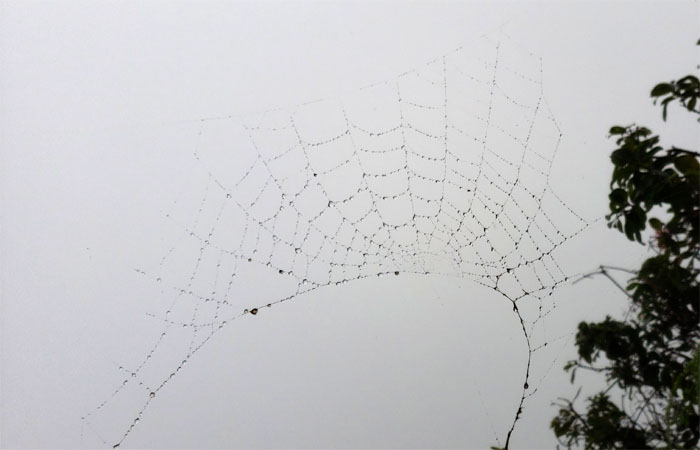
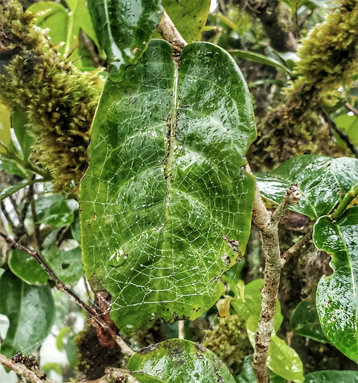
KSRT
The spiderwebs on the trail were catching nothing but dewdrops and our faces.
Waiawa Gap
Low clearance trees.
Waiawa Gap
Smile for the camera. Photo by Art Young.
Waiawa Gap
We quickly passed through the once bee infested ridge line to start our soggy hike up the hill. Photo by Tessa Bugay.
KSRT
High clearance trees. Somebody lost their Garmin GPS in the general vicinity. Need another Garmin to locate the missing Garmin.
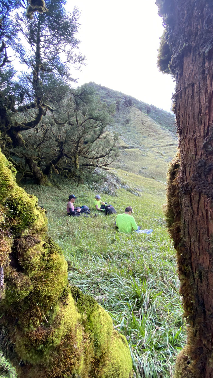
Lunch break
Time for some hot food and a hot belly. Both inside and outside. Photo by Katie Bingham.
Hitchhiker
Sorry, no free rides here. Photo by Katie Bingham
KSRT
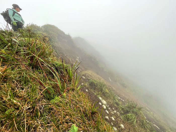
The ridge line keeping the clouds at bay on the Windward side.
Allstate
Need a helping hand or just a good hand? Photo by Art Young.
KSRT
Katie crossing another meadow to stay on the ridge line.
KSRT
It appeared the ridge line was slowly breaking up and dissipating the clouds back into the atmosphere. Photo by Katie Bingham.
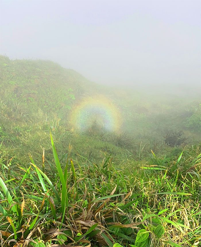
Broken Spectre
Only seen by the three of us, the person in the front just got to hear stories about it. Photo by Tessa Bugay.
KSRT
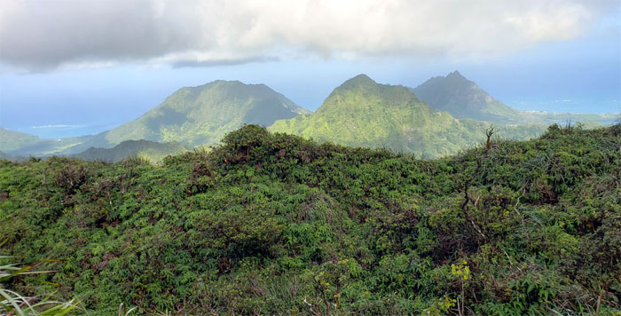
Looking back at the mountainous terrain we had covered this past weekend. Photo by Katie Bingham.
KSRT
Going through the tree tunnel. Photo by Tessa Bugay.
KSRT
Leaving the ridge line for the meadow with the running creek. Running did you say? Photo by Tessa Bugay.
Corner
Seeking water in stagnant pools.
Corner
Look! Up in the sky! It’s a bird! It’s a plane! It’s our picture being taken!
Corner
Leaving the creek with our bags slightly heavier but content knowing we would not be dehydrated anytime soon.
KSRT
Art on his throne of mossy ohia trees.
KSRT
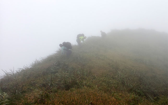
The group making their way around the tricky turn.
KSRT
Going down the ridge line. And back up. We should be used to it by now. Photo by Art Young.
KSRT
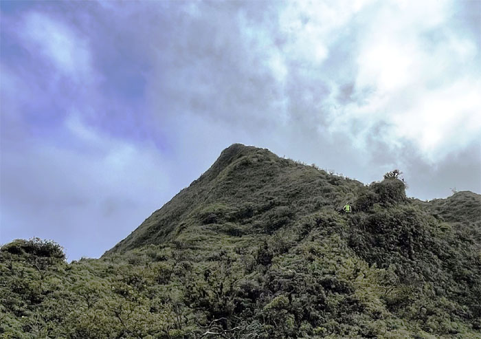
Reaching the summit of Manana. Photo by Tessa Bugay.
KSRT
The group ascending the ridge to join me at the 2,660′ knob.

Manana Summit
Katie tried to capture the steam coming off of Art’s overheated body, but only ended up photographing Tessa taking a selfie.
Manana Summit
Our last group photo of the day.
Manana Trail
Going up and down the 5.5 miles of roller coaster ridge line that can’t come to an end soon enough.
Manana Trail
Enjoying the views from the helipad. Photo by Tessa Bugay.
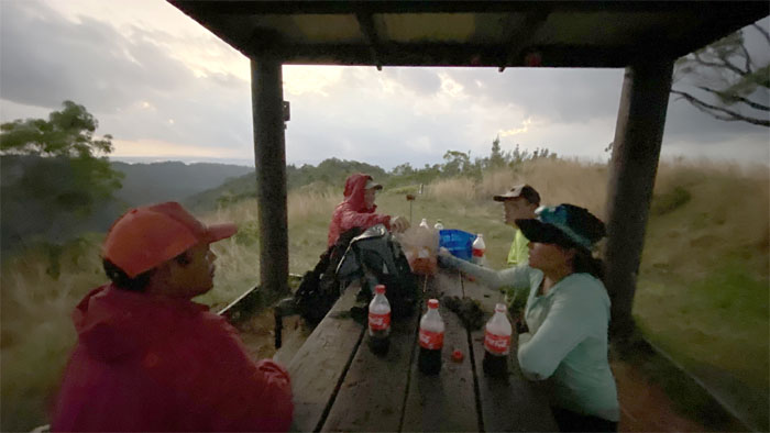
Manana Trail
A big shout out to Chris who met us at the picnic shelter with a bag of fried chicken and a cooler of cold carbonated Coke. Photo by Tessa Bugay.

All pau
Exiting the trail into the Pacific Palisades neighborhood and our ride home. Photo by Katie Bingham.
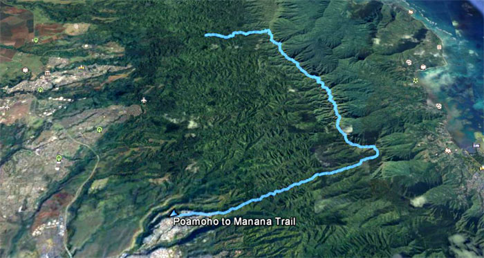
GPS Tracks
Our weekend camping hike covered 16.8 miles through rugged terrain and jaw dropping scenery when Mother Nature permitted them. Fun times with good friends. Thanks to Chris for taking us back to our cars. Post hike meal at Zippy’s. The nearby Popeyes was sorely tempting, but we just had chicken as our appetizer. Next stop was Zippy’s after all.
Note: I have been made aware that some hikers have been using my blog as a hiking guide and getting lost on the trails. Please note that this blog was made to document the hike for the crew(s) that did it. That is why some of my comments will seem to have no relevance or meaning to anybody outside of the crew(s) that hiked that trail. My blog was never meant as a hiking guide, so please do not treat it as such. If you find inspiration and entertainment from these hikes, that is more than enough. If you plan on replicating these hikes, do so in the knowledge that you should do your own research accordingly as trail conditions, access, legalities and so forth are constantly in flux. What was current today is most likely yesterdays news. Please be prepared to accept any risks and responsibilities on your own as you should know your own limitations, experience and abilities before you even set foot on a trail, as even the “simplest” or “easiest” of trails can present potential pitfalls for even the most “experienced” hikers.
{ 2 comments… read them below or add one }
Awww, I miss camping. Always love this side of the KST, mud and all… Thank you Kenji for taking us!
Aloha Tessa,
Thanks for your yawyaw company!
Mahalo