
It was time for another camping weekend. I’m glad we didn’t listen to the weather forecast of rain and gloom. Met up with Chris, Ethan and Shirley in the wee hours of the morning. Somebody needed more packing time. That’s why it pays to start early. Have to adjust for Hawaiian time.
Poamoho Road
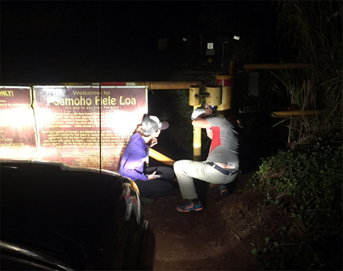
Thanks to Ethan’s friend, Kevin, for giving us a ride. Shirley trying to shed some light on the lock. Not very successful I might add. Photo by Chris.
Poamoho Road
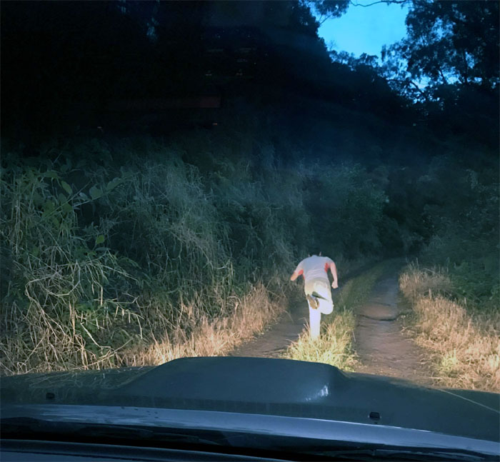
We ran across this fool who thought he could outrun a Tacoma. Photo by Shirley.
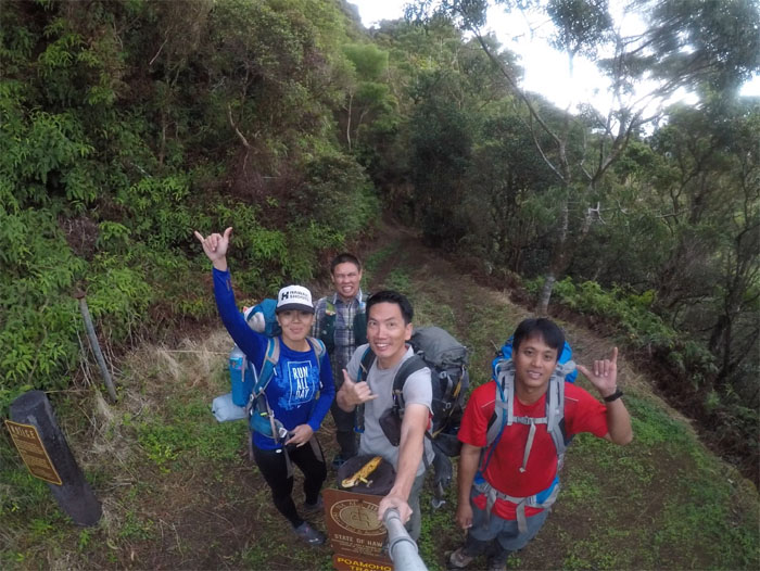
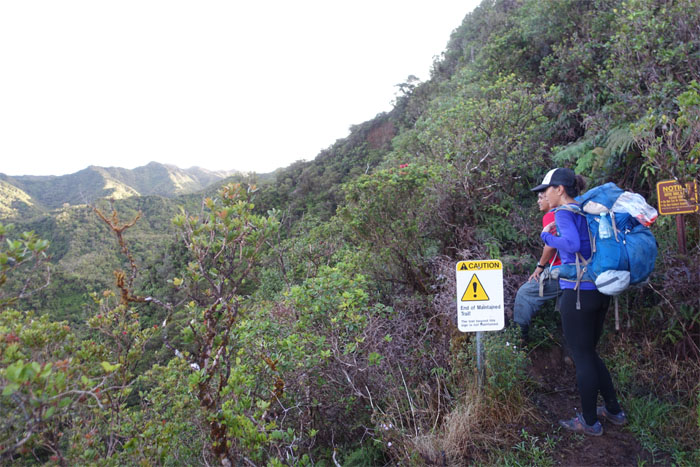
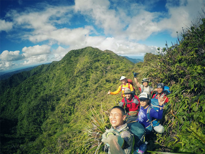
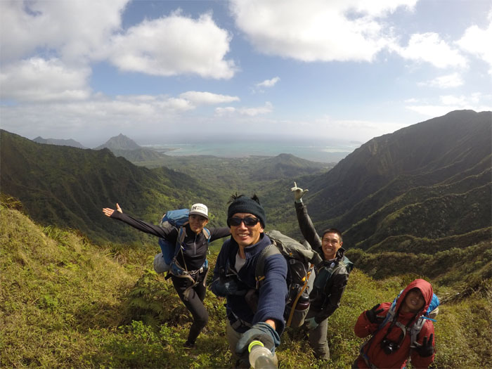
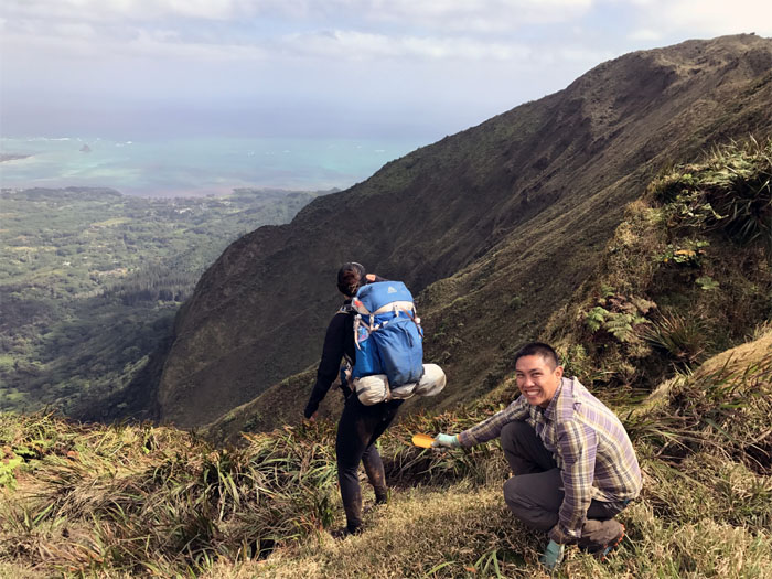
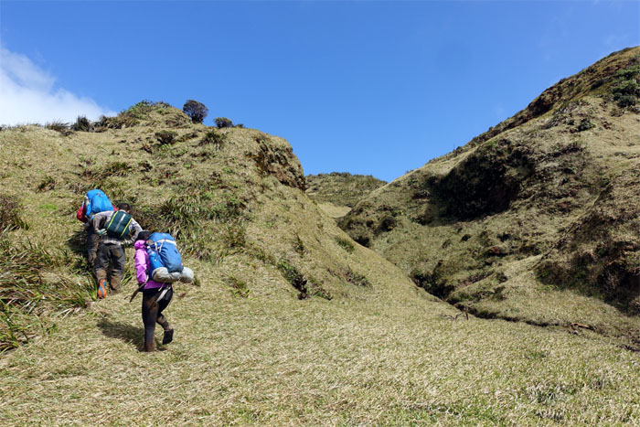
Trailhead
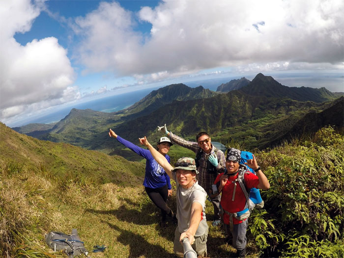
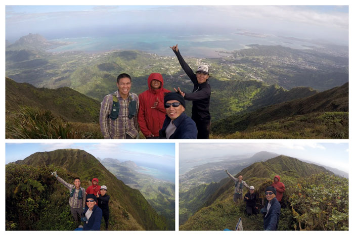
Group photo left to right: Shirley, Ethan, myself and Chris.
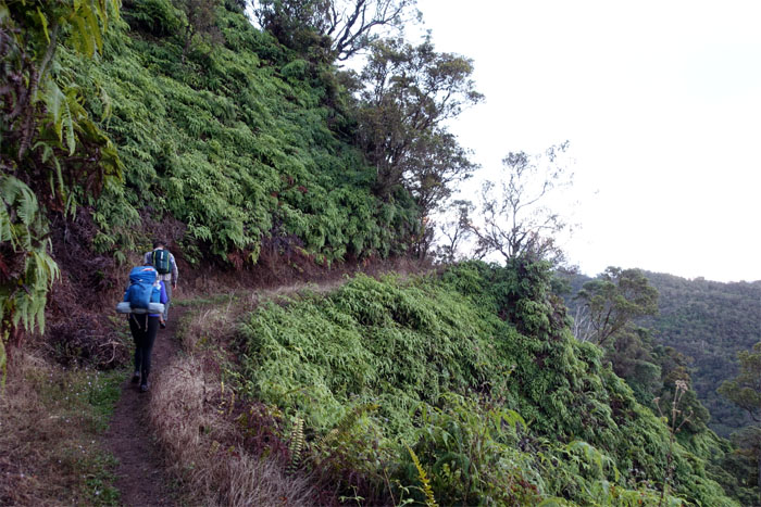
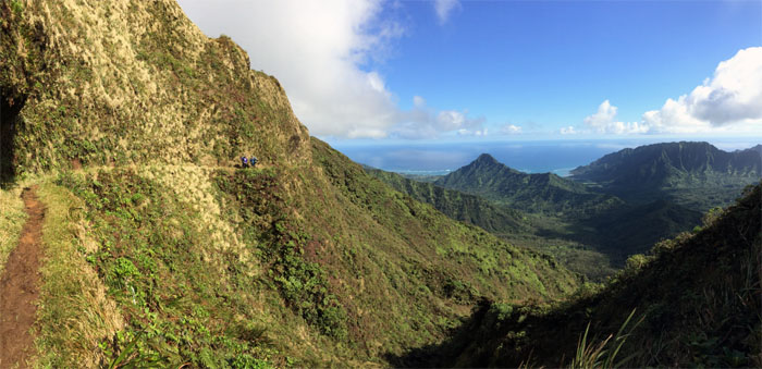
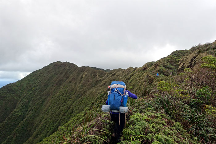
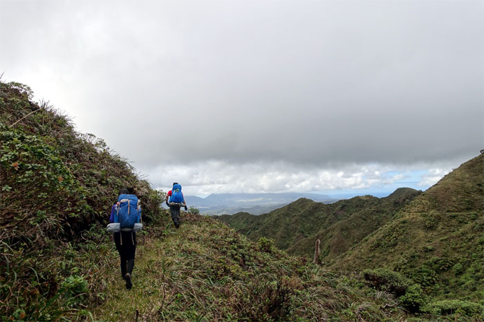
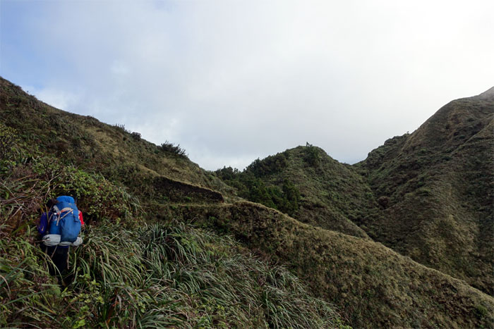
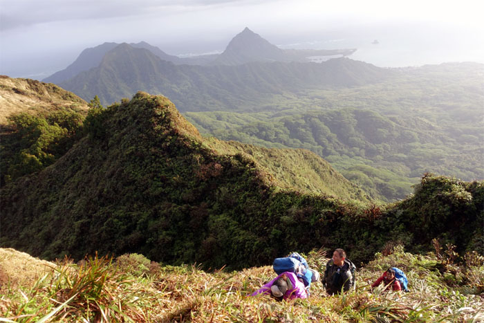
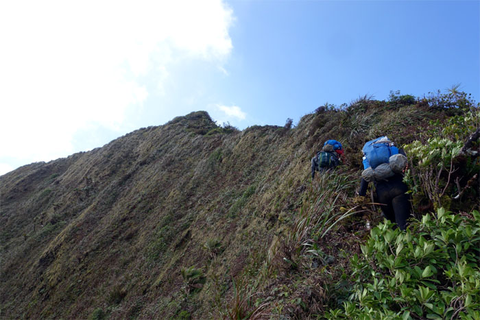
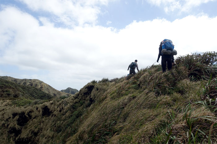
Poamoho Trail
We shouldered our packs, some heavier than others, and began making our way on the mostly graded trail.
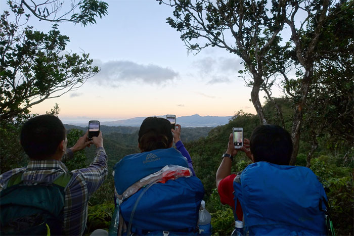
Poamoho Trail
Synchronized photo taking of the Waianae Mountain Range.
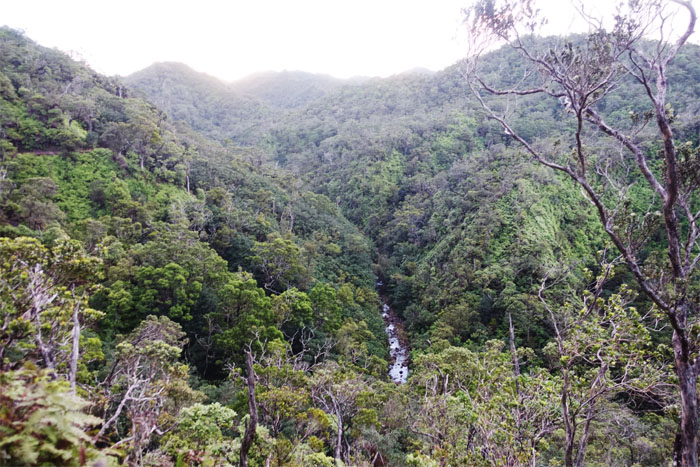
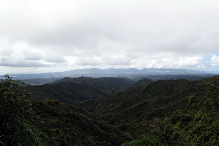
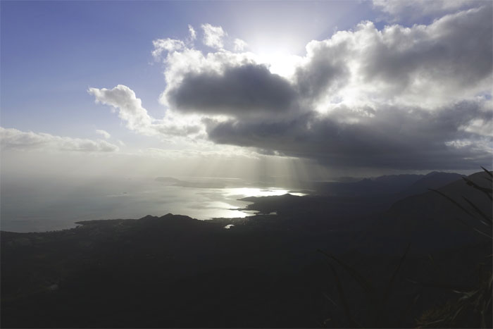
Helemano Stream
Looking down at the longest stream on the island and clear summits in the distance.
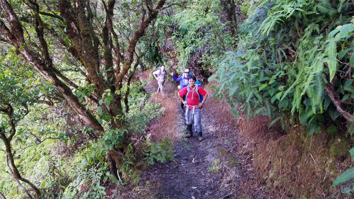
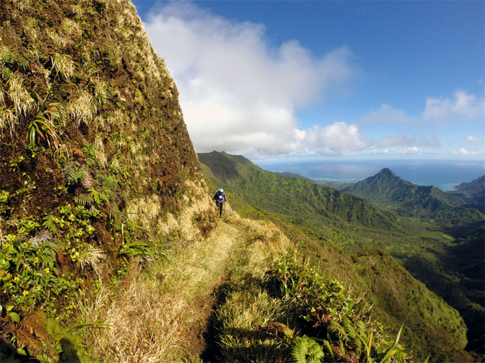
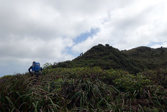
Poamoho Trail
Enjoying the maintained trail before it ends. Photo by Ethan Clavecillas.
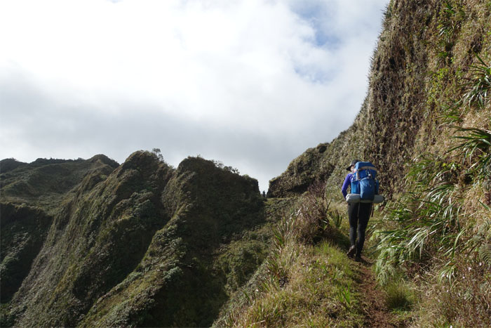
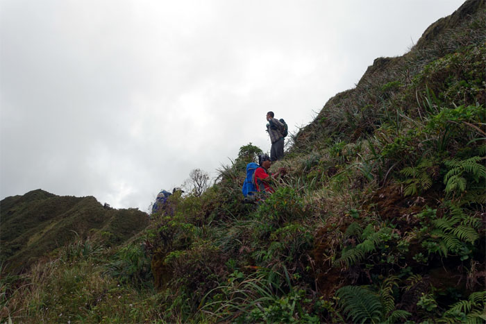
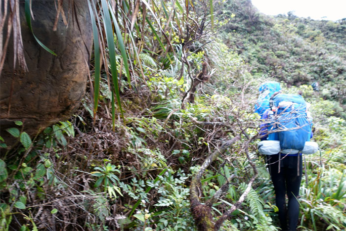
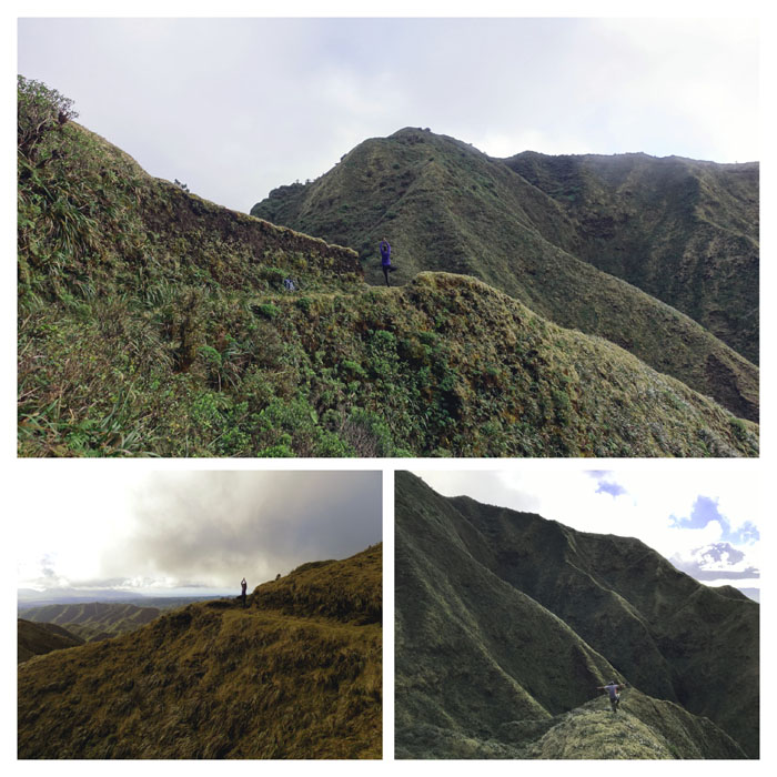
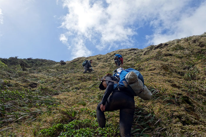
Poamoho Trail
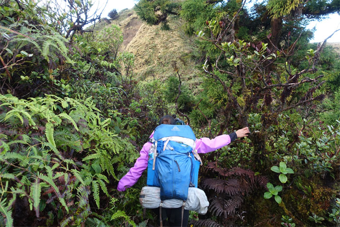
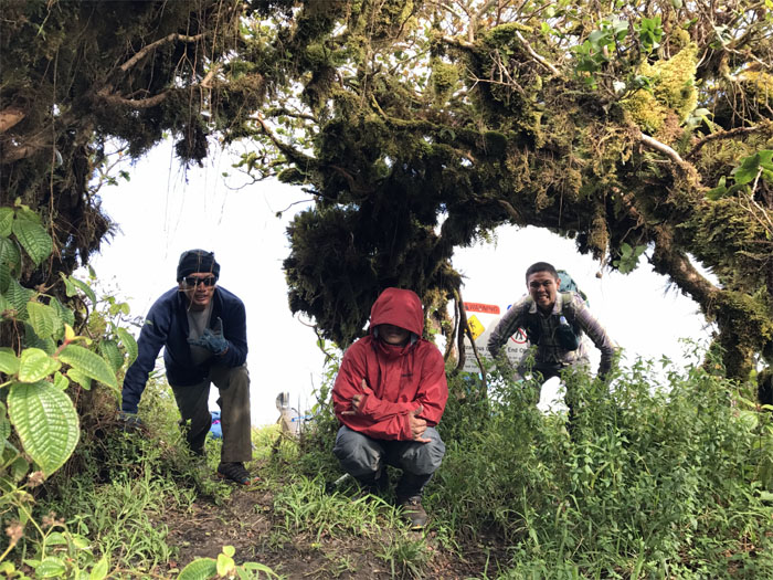
Pausing before we start hiking on the un-maintained trail. Fraught with overgrowth, uneven terrain and …
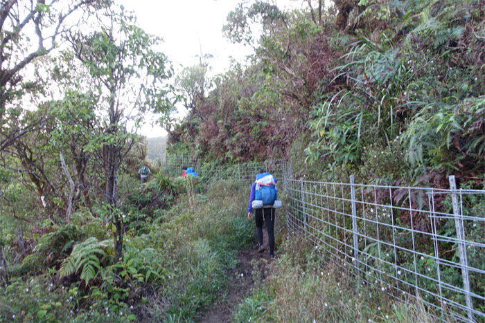
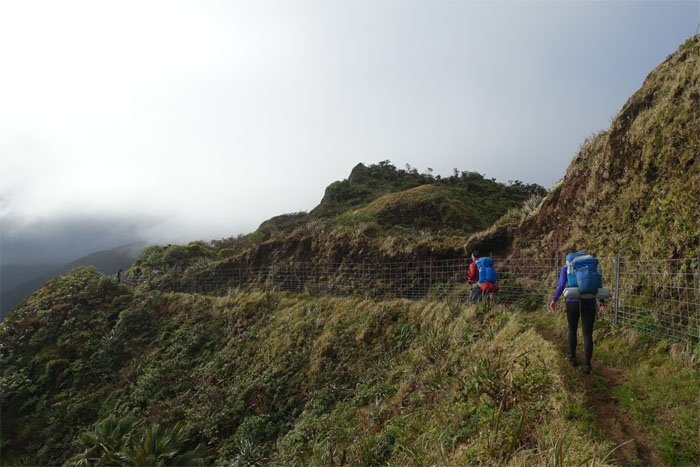
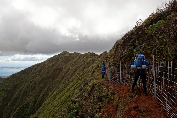
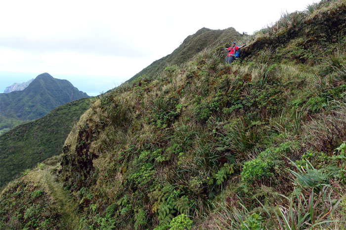
Poamoho Trail
… fence lines.

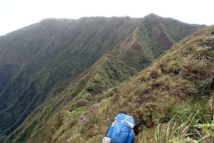
Poamoho Trail
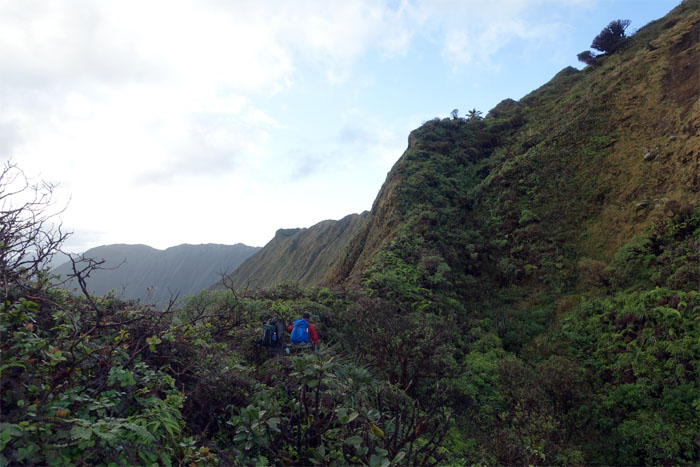
Chris and Shirley crossing over the landslide section of the trail.
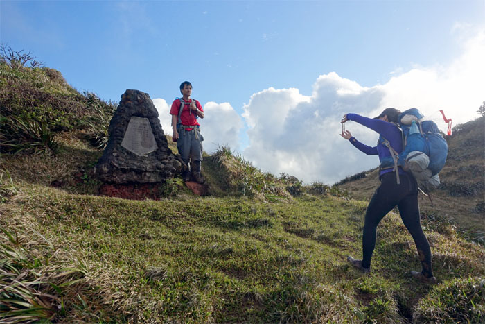
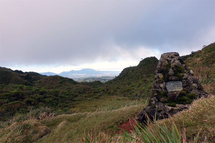
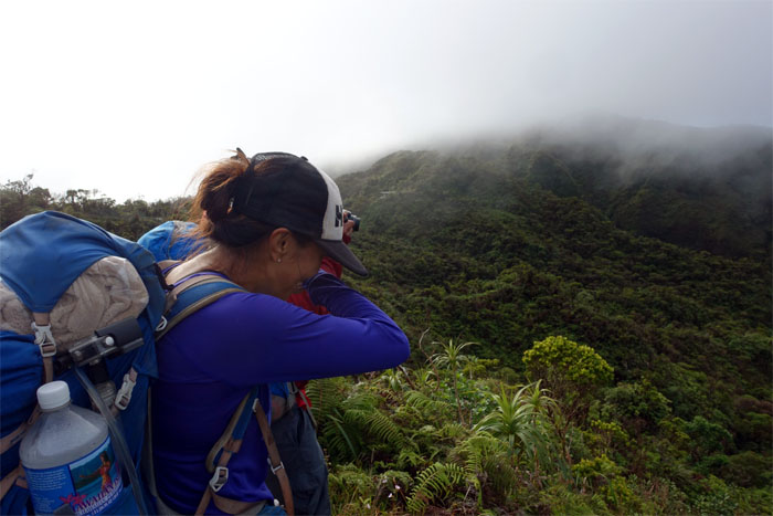
Clines Memorial
Shirley getting the contrast, exposure, framing, and lighting just right. Otherwise Chris may come out darky.
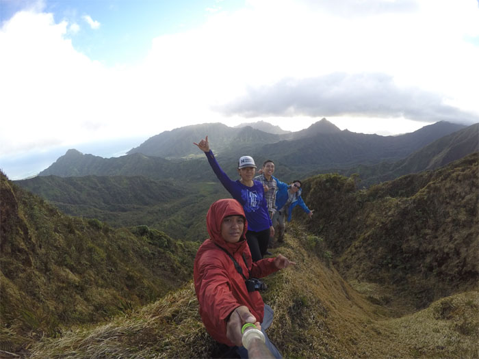
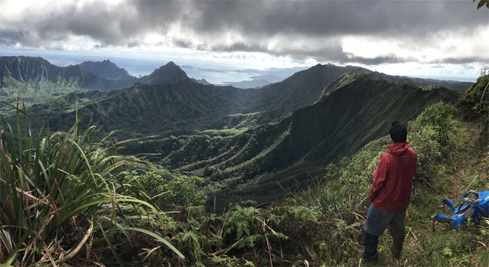
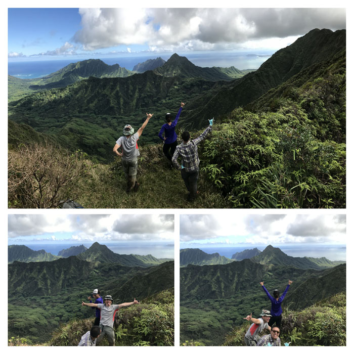
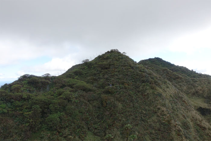
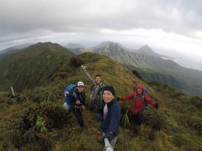
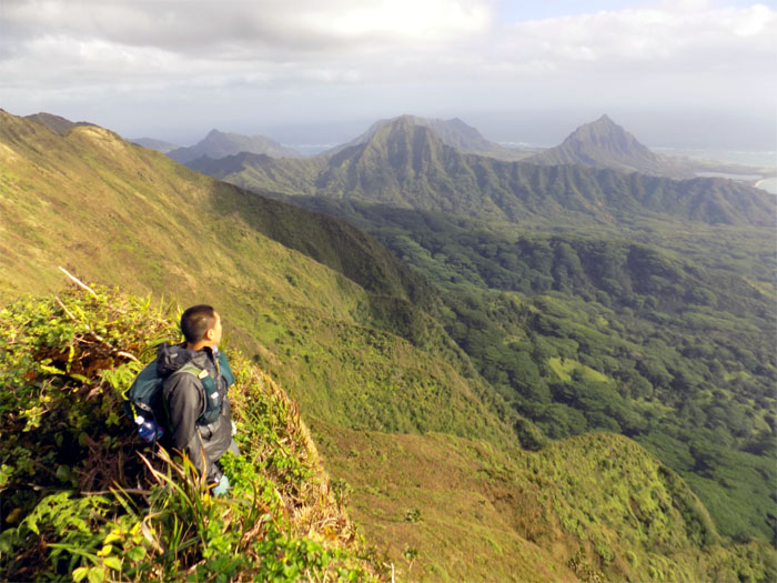
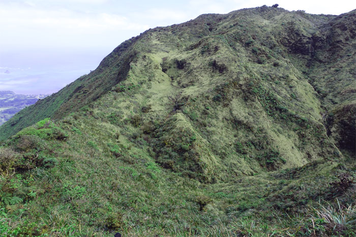
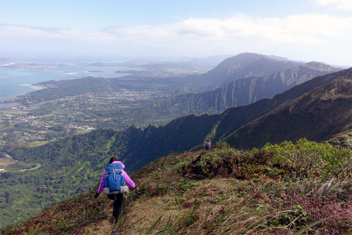
Poamoho Summit
Group photo by Chris at the 2,520′ summit, that overlooks Punalu’u and Kahana Valleys.
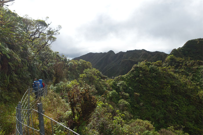
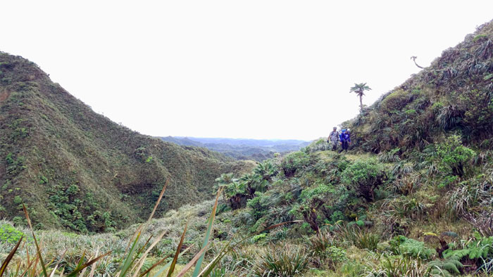
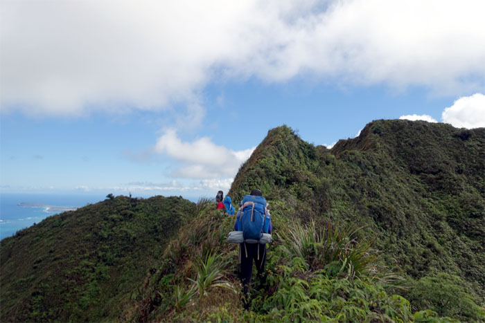
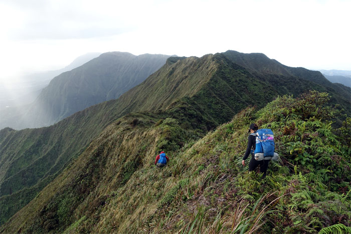
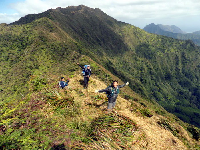
Koolau Summit Trail (KST)
We took our leave of the summit and made our way to the cabin.

Koolau Summit Trail (KST)
Passing the Private (PVT) junction. No cover. No salute.
Koolau Summit Trail (KST)
Shirley weeping with joy after seeing her first cabin on the KST or maybe she was just wiping her snot. I don’t recall.
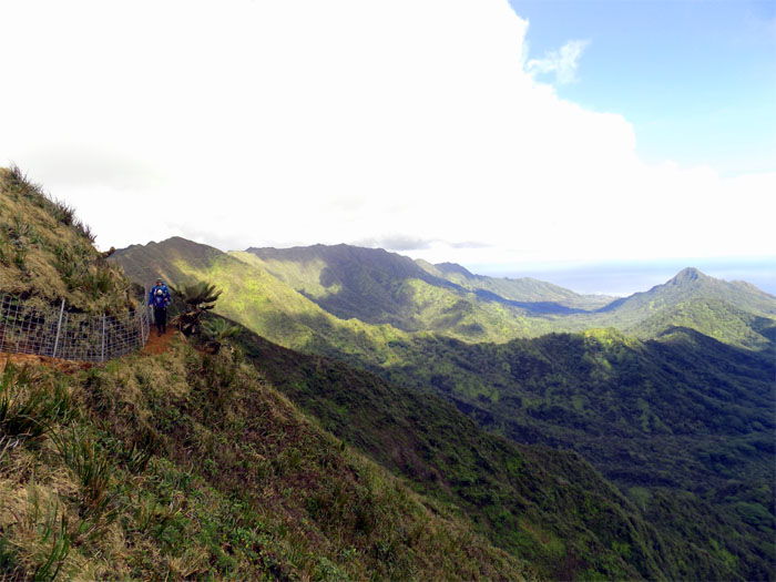
Koolau Summit Trail (KST)
The trail briefly popped back onto the Windward side, affording more Jurassic views of the valley.
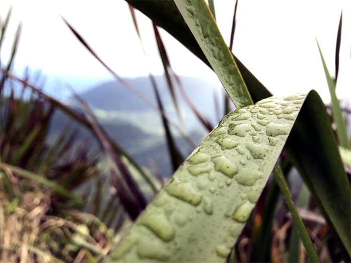
Koolau Summit Trail (KST)
Morning dew drops on the ubiquitous uki grass. Photo by Shirley.
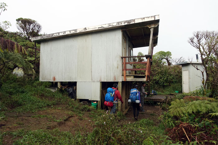
Poamoho Cabin
The fence workers had gone home for the weekend. We had the cabin all to ourselves and the other 25 hikers coming up the trail.
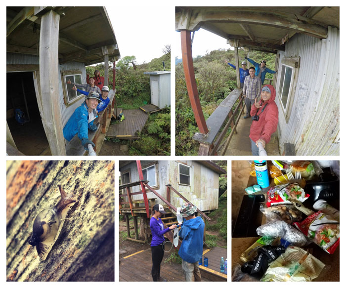
Poamoho Cabin
What happens at the cabin, stays at the cabin. Choosy hikers choose JIF.
KST
Following the fence on the Leeward side until we …
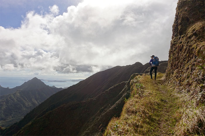
KST
… temporarily lost the fence and crossed over to the stunning Windward side of the trail.
KST
Looking back at the contoured trail carved into the side of the mountain. Photo by Chris.
KST
Making our way towards the man-made notch.
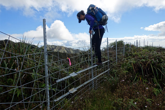
KST
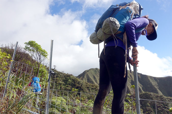
Shirley passing through the last fenced gate on the trail. For now. Photo by Chris.
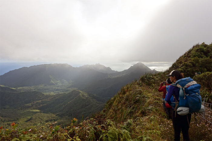
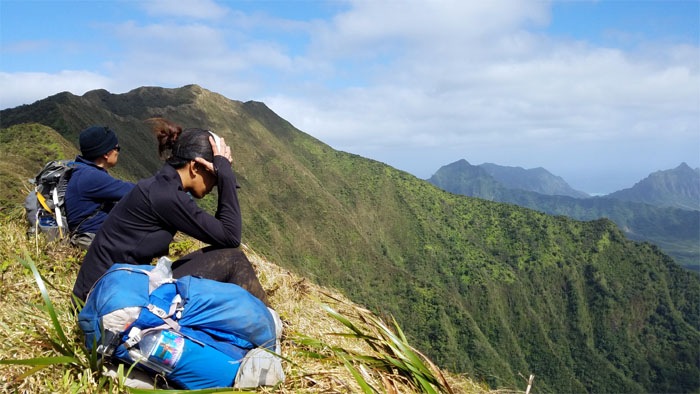
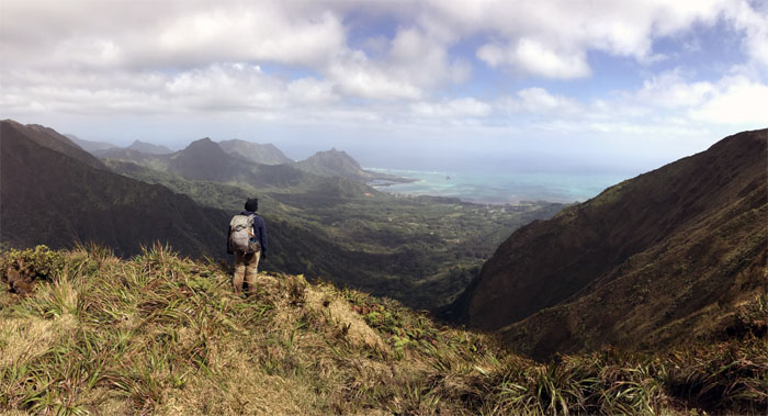
Pauao Junction
Chris looking into the valley. So many ridges and saddles to explore. Photo by Shirley.
KST
The fence workers have been busy.
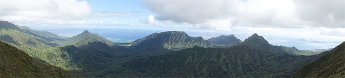
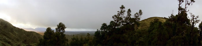
KST
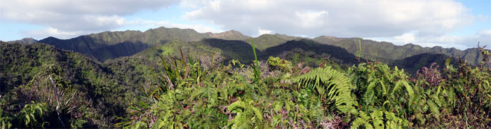
Panoramic view.
KST
Enjoying the cleared and relatively wide open fenced trail for now. Photo by Chris.
KST
The fence soon left the KST again and continued to follow the ridgeline above us.
IG Photo bombers
We just want our 15 minutes of social media fame too!
Schofield-Waikane Junction
Somebody needs to get with the program.
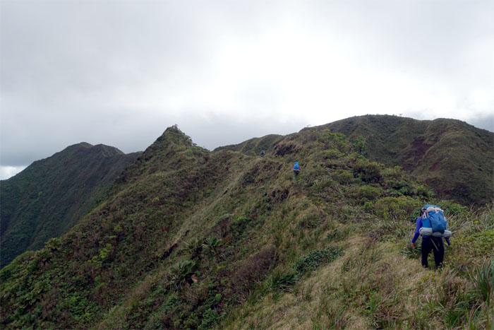
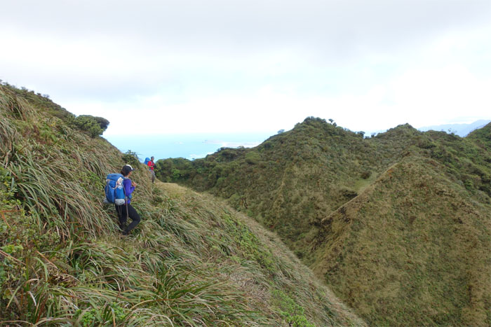
KST
We left the junction to resume our hike on the windswept ridgeline.
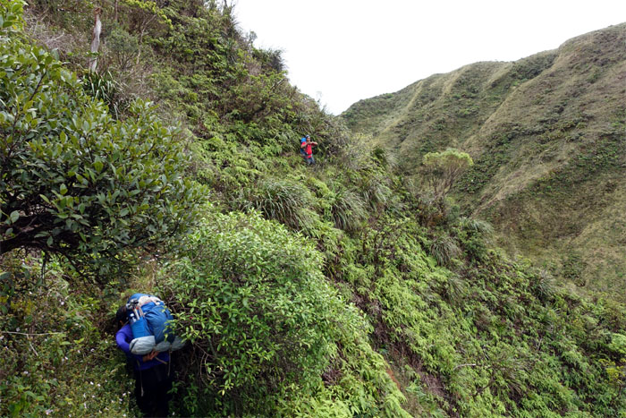
KST
Shirley plowing through the thick brush on the Leeward side.
KST
We contoured back to the ridgeline and saw the Waikane-Waiahole junction ahead of us.
Waikane-Waiahole Junction
One leads to the valley. One leads to the mountains.
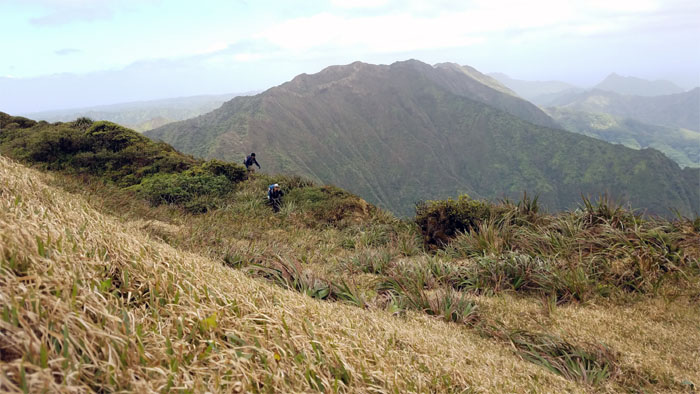
KST
Chris taking the higher road.
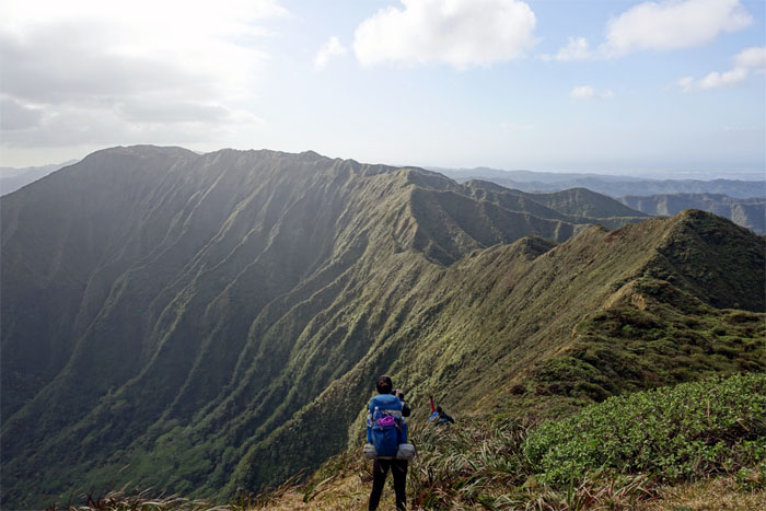
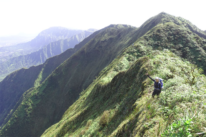
KST
Making our way through the convoluted topography of the Northern Ko’olaus. Photo by Chris.
KST
We were blessed with an overcast day tempered with gentle winds on our hike.
KST
Passing “HMK’s” rock. Which begs the question. Who is HMK?
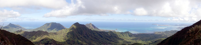
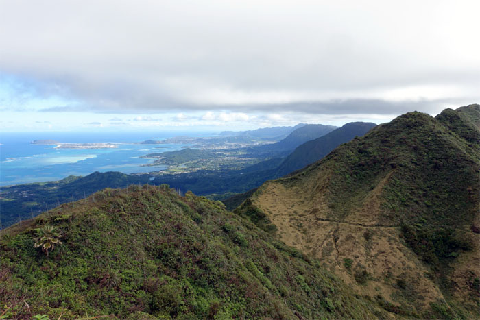
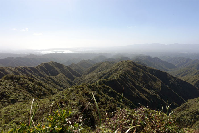
Waianae Mountain Range
Looking out towards the West side. Both ranges had clear views.
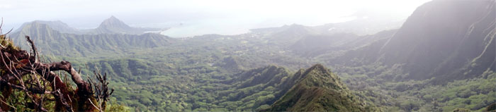
KST
Panoramic view of the rotating view of the valley as we continued to traverse the KST.
KST
A serendipitous encounter with two fellow hikers on the trail, Cisco and Justin. Congratulations to Cisco for completing the Ko’olau Summit Trail (KST) today. Photo by Ethan Clavecillas.
KST
Back on the ridgeline, not for long, as we contoured to the Leeward side.
KST
Build the fences and they will climb over them.
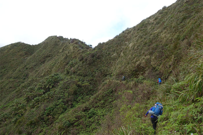
KST
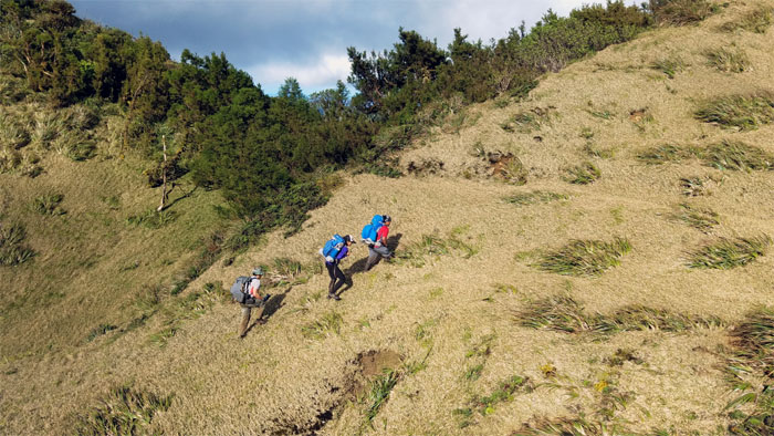
The “rolling hills” of the Northern Ko’olaus have a different and distinct flavor than the trails found on the Southern end of the mountain range.
KST
The fence continued to follow the ridgeline, while we followed the trail that contoured below it.
KST
We regained the fenced ridgeline and followed it down …
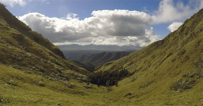
Meadow
… and dropped into the inviting meadow that usually funnels the air currents, inducing a wind tunnel effect on past visits. No such conditions today.
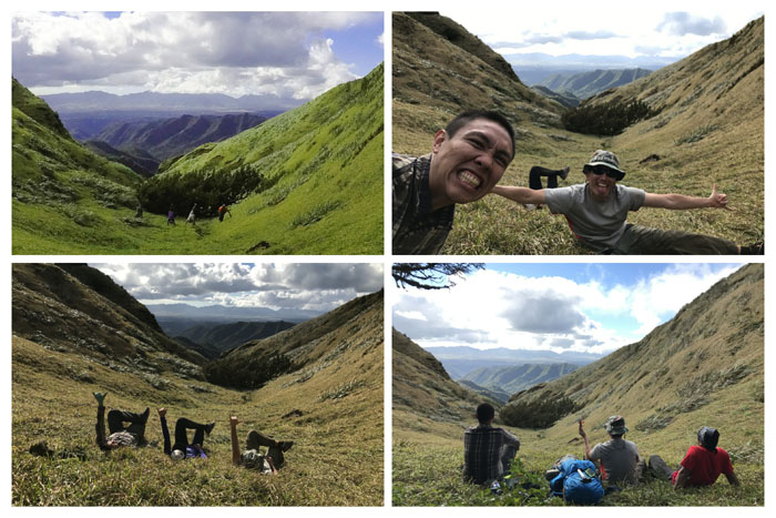
Meadow
Meadow life. Failed headstands. Photobombers. If you can’t beat ‘em, join ‘em. Chilling with Kikaida.
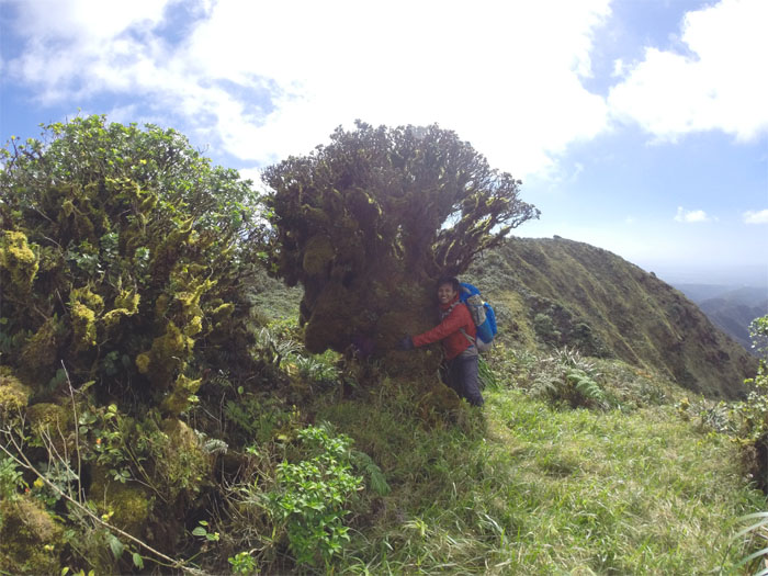
Meadow
Tree huggers.
Meadow
Leaving the meadow to gain the contour trail. Photo by Ethan Clavecillas.
KST
Shirley crossing over the Selfie Stick Junction. I guess we are going to be here for awhile.
KST
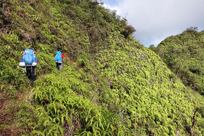
Passing through a cascading carpet of uluhe ferns.
KST
Shirley making her way to the notch. IG photo shoot time.
KST
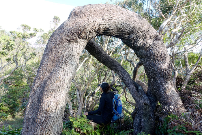
Mountain yoga. One was more successful than the other.
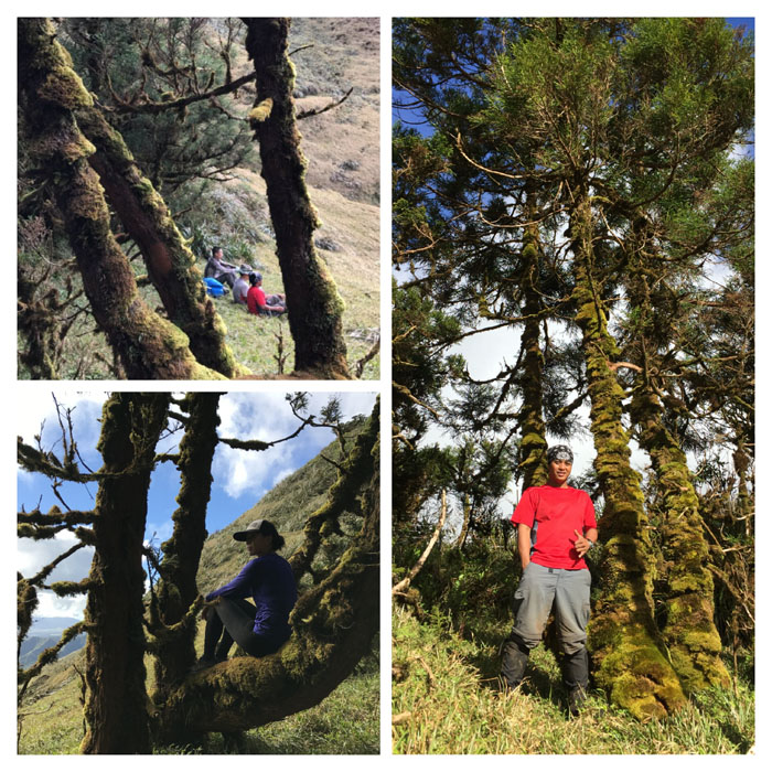
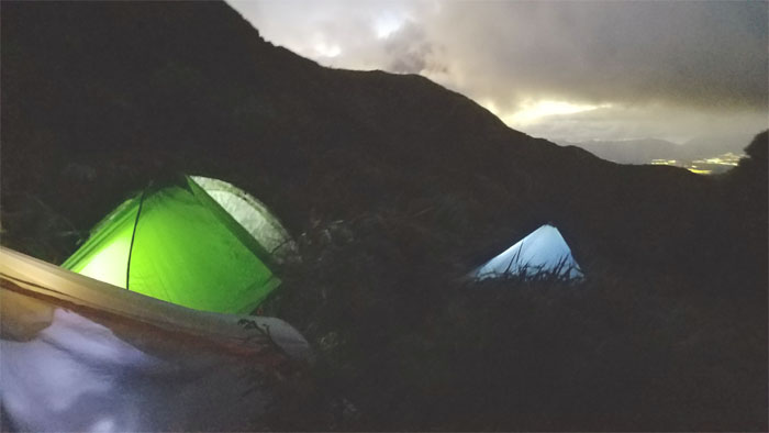
Campsite
We decided to camp for the night between the summits of Kipapa and Waiahole, nestled and sheltered amongst the Sugi pine tree grove.
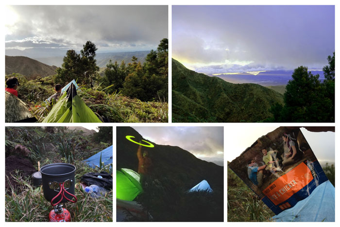
Campsite
Camp life. Pitching our tents on the rusted remains of the army cabin. Watching sunbeams shooting through the Waianae Mountains. Eating reconstituted meals and drinking hot coffee. Glow sticking without the ecstasy. Not a bad way to end the day.
Campsite
Honey whiskey and Tylenol makes the tent go round and round and facilitates drunk ranting and texting. Farting and snoring cut through the rustling wind and pelting rain showers throughout the night. Somebody had earplugs. Somebody wished they had earplugs.
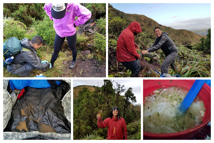
Campsite
Good morning from the Ko’olaus. Hot coffee, steaming pho and pop tarts for breakfast. Flooded tent. Somebody needed a demonstration on how to tie her shoelaces. Early morning bowel movement. Pushing and pulling Chris’s tent. Does this look wrong in any way?
KST
Making our way out of the Sugi pine tree grove.
KST
Crossing a narrow ravine to get up the ridge.
KST
Our sunrise for the morning. We couldn’t catch it from the campsite due to the early morning rain. I’m glad the rain went away for our hike.
KST
Climbing out of the campsite.
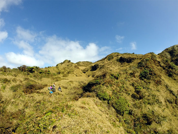
Kipapa Summit
Group photo at the windswept 2,786′ summit.
KSRT
We transitioned from the Ko’olau Summit Trail (KST) to the Ko’olau Summit Ridge Trail (KSRT) after passing the Kipapa Summit.
KSRT
Ethan checking out the views.
KSRT
Checking out a ridge for a future hike.
KSRT
Making our way to the Waiawa Gap.
Waiawa Gap
Descending into the heavily overgrown gap.
Waiawa Gap
Group photo in the notch. Somebody had to mark their territory.
Waiawa Gap
Climbing out of the gap.
KSRT
Grams equals Ounces. Ounces equal Pounds. Pounds equals Pain. A lesson that Shirley would take to heart and her lower back as well. Photo by Ethan Clavecillas.
KSRT
The glove junction with the summit of Waiahole behind us. Photo by Chris.
KSRT
The weather forecast got something right. The winds were blowing hard on the ridgeline.
KSRT
Enjoying a relatively flat lull between the hilly ridge.
KSRT
Crossing over from the ridgeline. Photo by Ethan Clavecillas.
KSRT
Stopping at the scenic spot for a pic … Photo by Shirley.
KSRT
… and assisted bowel movement.
KSRT
Are we there yet?
KSRT
We dropped down into this meadow and found a surprising flowing stream. Somewhat of a trickle, but enough to refill our water supply.
KSRT
Hot coffee and pho in the meadow. Life was good. Photo by Chris.
KST
Leaving our last meadow on the hike.
KSRT
Tree hugger. Photo by Shirley.
KSRT
Looking at the twin “sisters” of Eleao Windward and Kalahaku Teeth that borders Waihee Valley.
KSRT
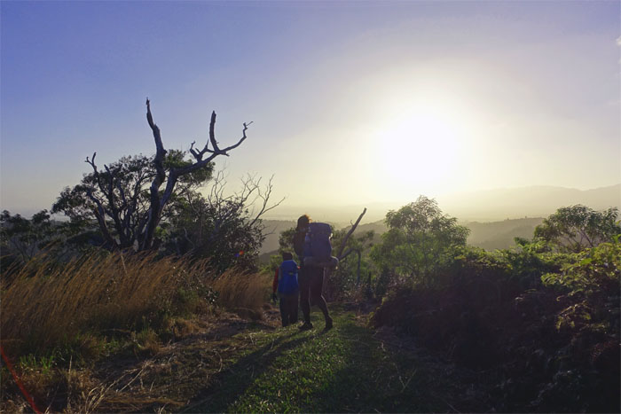
Almost there.
Manana Summit
Triple views ranging from Kahana Valley to Makapu’u at the 2,660′ summit.
Manana Summit
The “face” of Manana. Photo by Shirley.
Manana Trail
We still had to hike down close to six miles of the ungraded roller coasting ridge.
Manana Trail
Looking back at the Ko’olau Mountain Range and the points we had traversed. Ethan was speeding down the trail to take a shower. Chris was flapping around like Superman. Shirley was making her story. I was just plum tired.
Manana Trail
Lady in the tree.
Manana Trail
Racing the sun down to the bottom. The sun would win.
Manana Trail
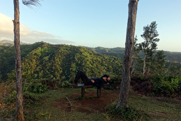
Too tired to rest on the bench.
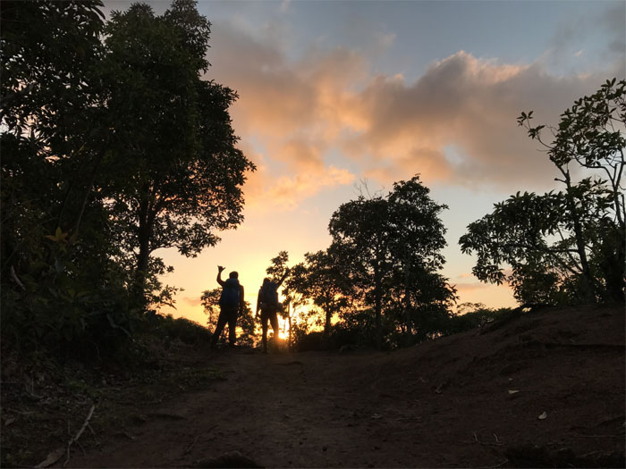
All pau
Sunset silhouettes. We made it back to our cars under the cover of twilight.
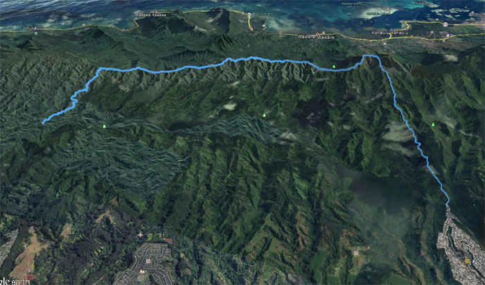
GPS Tracks
Our two day fun filled hike covered almost 20 miles with awesome adventure buddies. It was one of my best camping hikes. Blessed with good weather and company. Post hike meal at Buzz’s Original Steakhouse. Unlimited soda and soup. Not a bad deal.
Note: I have been made aware the some hikers have been using my blog as a hiking guide and getting lost on the trails. Please note that this blog was made to document the hike for the crew(s) that did it. That is why some of my comments will seem to have no relevance or meaning to anybody outside of the crew(s) that hiked that trail. My blog was never meant as a hiking guide, so please do not treat it as such. If you find inspiration and entertainment from these hikes, that is more than enough. If you plan on replicating these hikes, do so in the knowledge that you should do your own research accordingly as trail conditions, access, legalities and so forth are constantly in flux. What was current today is most likely yesterdays news. Please be prepared to accept any risks and responsibilities on your own as you should know your own limitations, experience and abilities before you even set foot on a trail, as even the “simplest” or “easiest” of trails can present potential pitfalls for even the most “experienced” hikers.
{ 2 comments… read them below or add one }
Great write-up as usual, Kenji! I should have read this one before last weekend, especially about the old Army cabin site between Kipapa and Waiahole. We camped at the top of Kipapa…. not sheltered from the wind at all. We saw the other site the next day. I wish we’d had the weather you guys did. We had driving rain both days. Definitely an interesting section of the KST. I need to go back someday when the weather is better and there are views.
Aloha Lonnie,
Thanks. I heard you had blustering winds and rain your entire hike, well at least you were building character! Yes the views on the Northern side are just stunning when the weather cooperates. Congratulations again on completing the KST!
Mahalo