
It was supposed to have been a beautiful day today for Aida’s WST finish hike. And it was on the West side. Never take anything for granted.
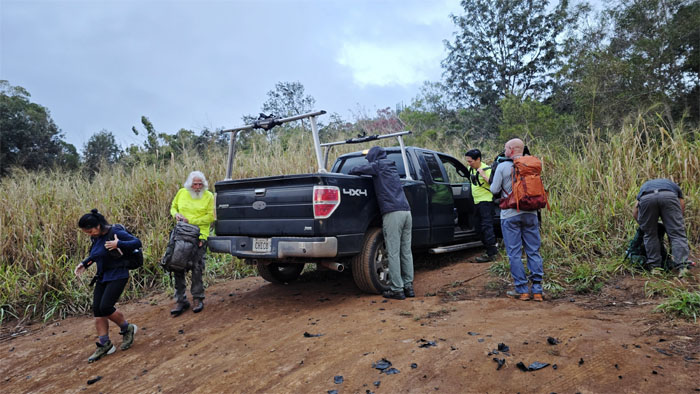
Kunia
Chico parked his truck near the trailhead on this chilly morning, for Hawaii people that means in the 60s and 70s.
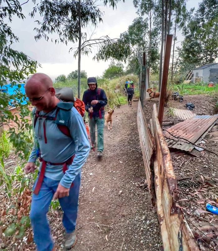
Kunia
Making our way through the re-routed access as roaming dogs shared our path. Lucky they were all bark and no bite.
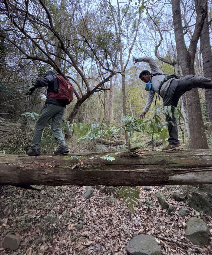
Kaua Trail
Akira and CB balancing their way on the trail.
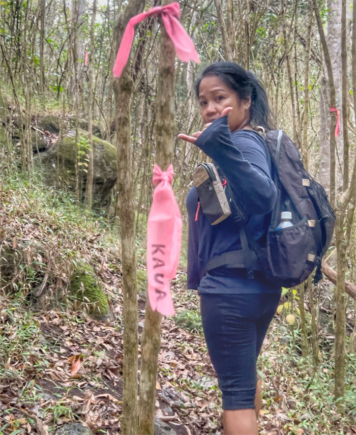
Kaua Trail
The pink ribbons mark the way.
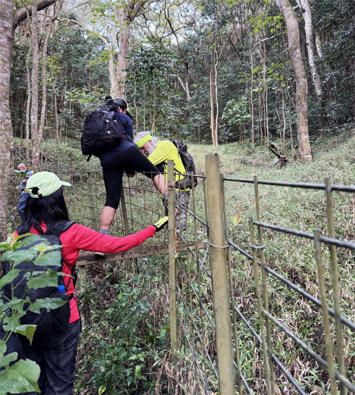
Kaua Trail
We soon passed the junction with the Honouliuli Contour Trail and crossed over the fence to continue on the trail.
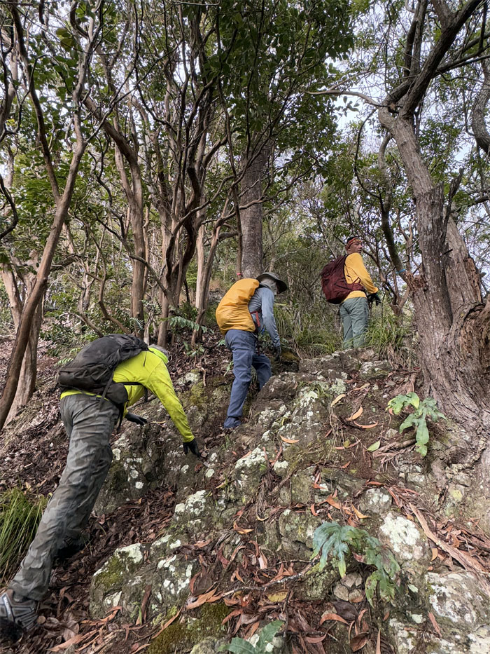
Kaua Trail
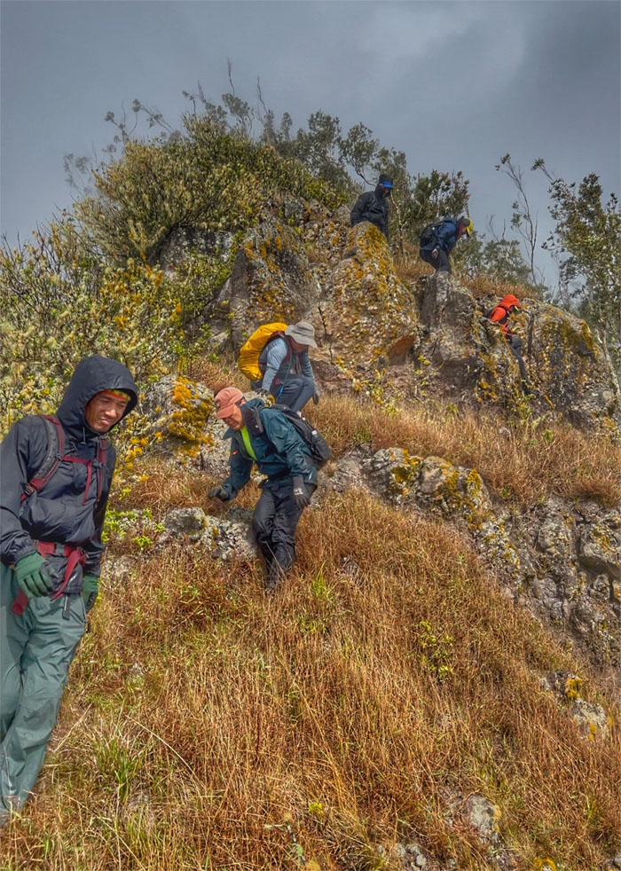
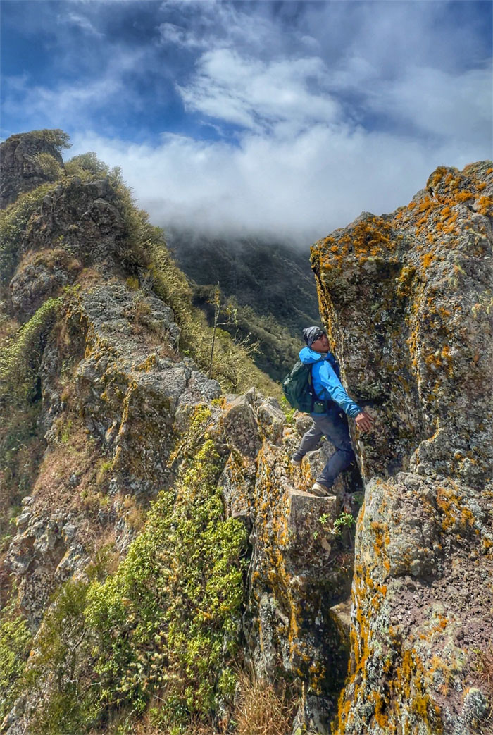
The grade of the trail started to get steeper as we gained elevation.
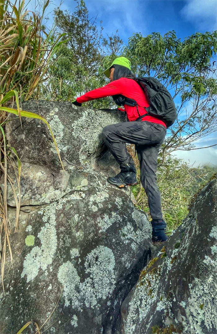
Kaua Trail
Aida negotiating her way over the slippery rocks.
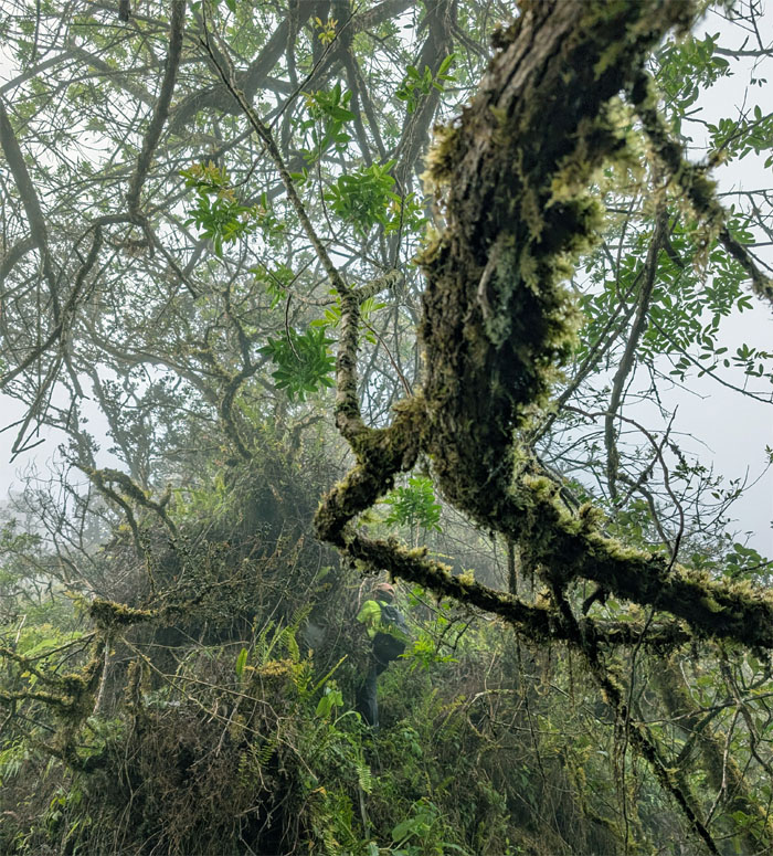
Kaua Trail
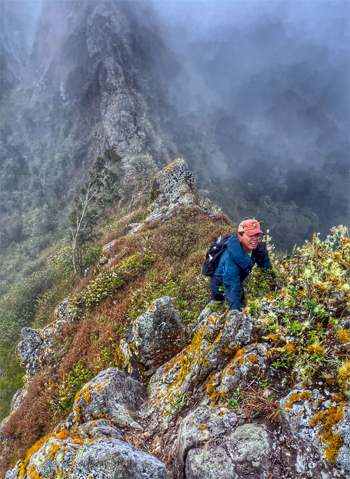
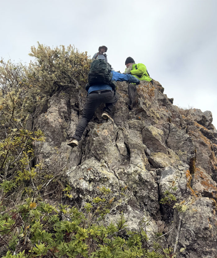
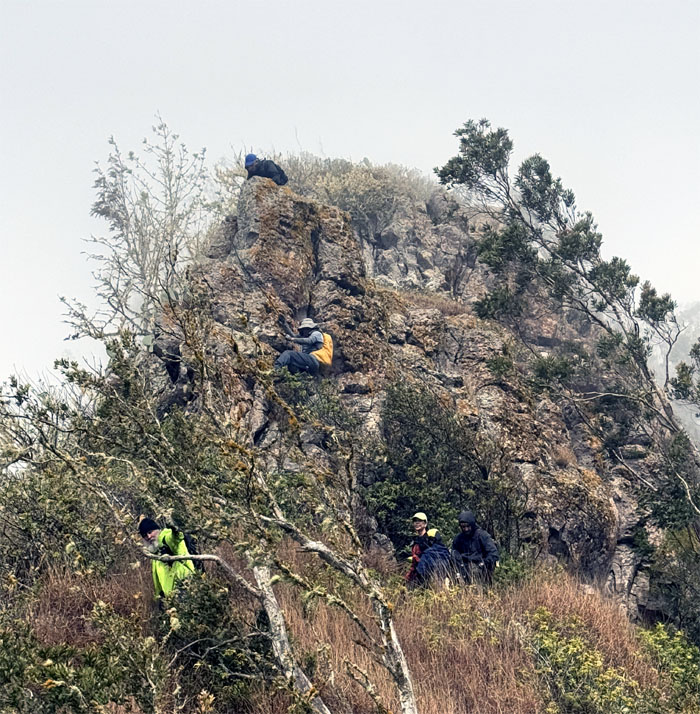
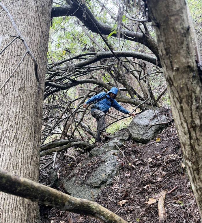
Climbing up the steepest part of the trail.
Kaua Trail
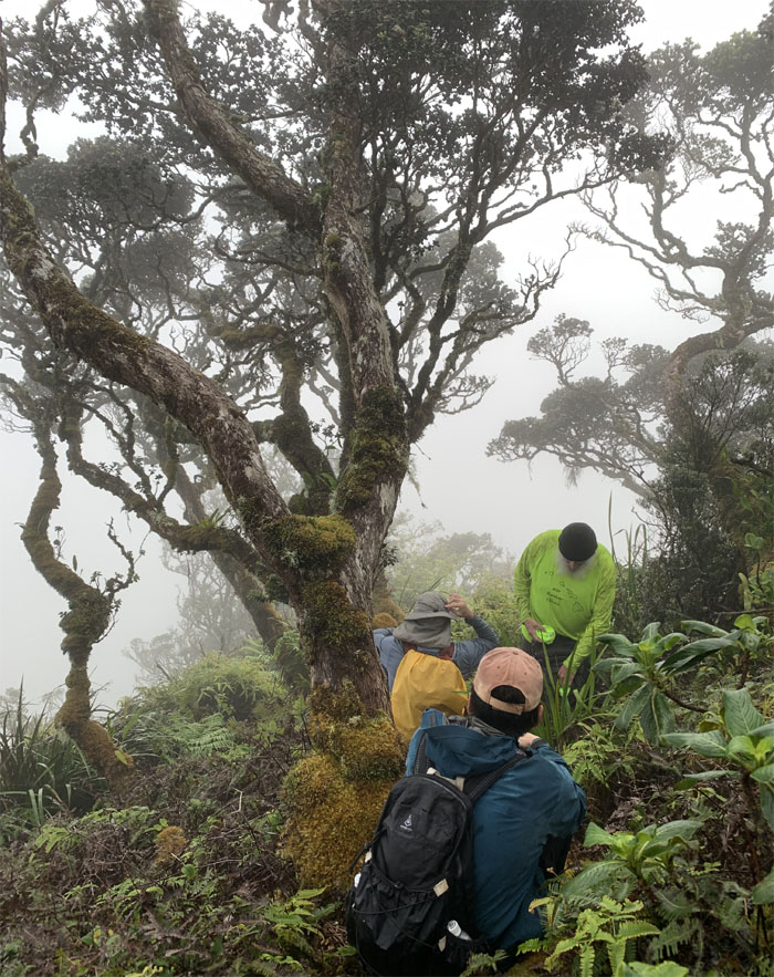
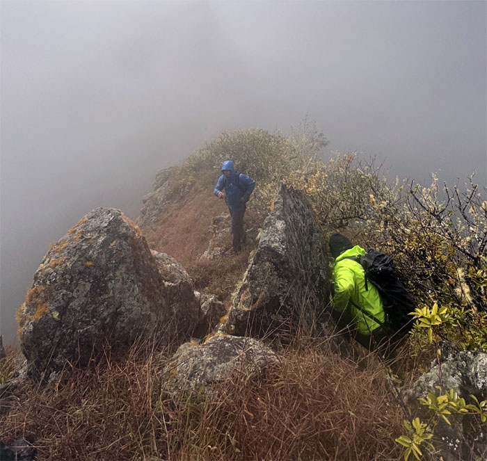
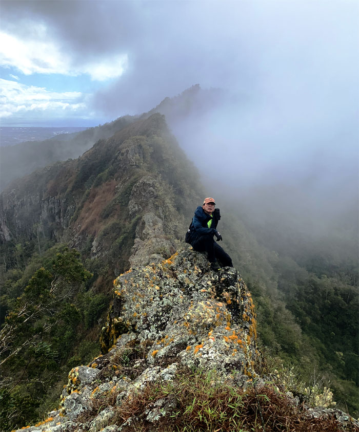
Waiting near the summit as rain showers started to pelt the mountains. So much for sunny skies today.
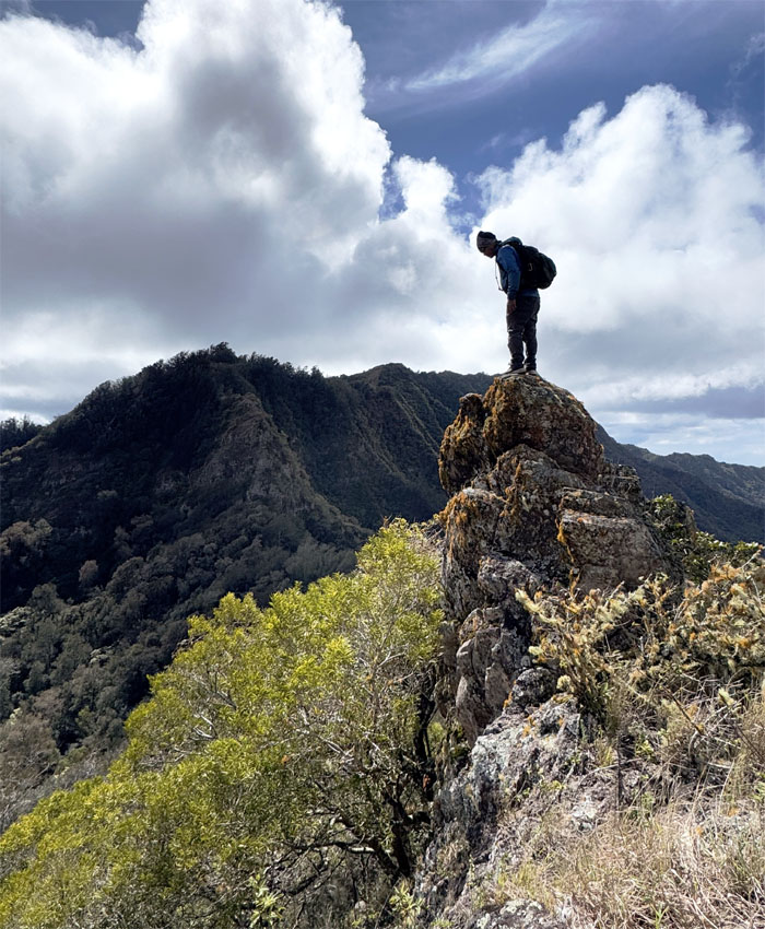
Kaua Summit
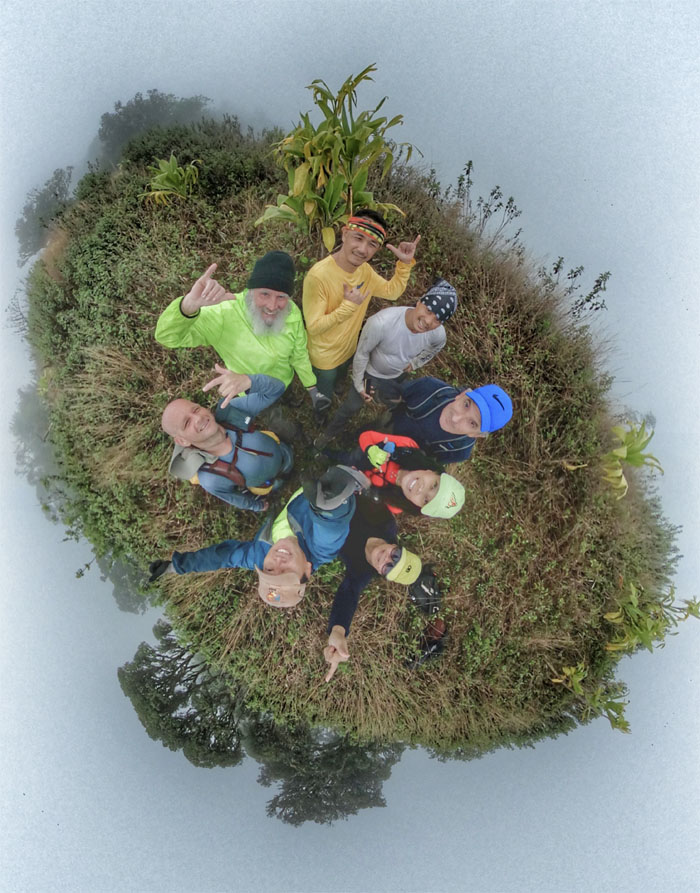
Group photo at the third highest peak on Oahu.
Kaua Summit
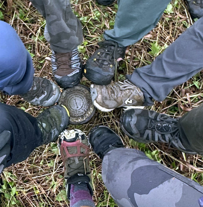
We found out that there is no room for eight shoes to comfortably fit on a geodetic marker.

Waianae Summit Trail (WST)
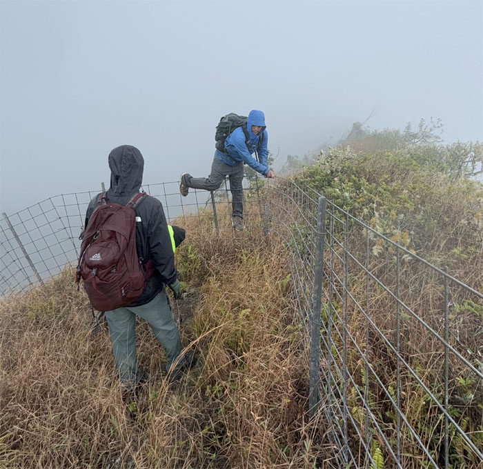
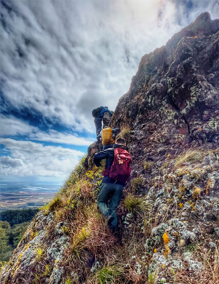
Pushing our way through the dense overgrowth that choked the fenced trail.
WST
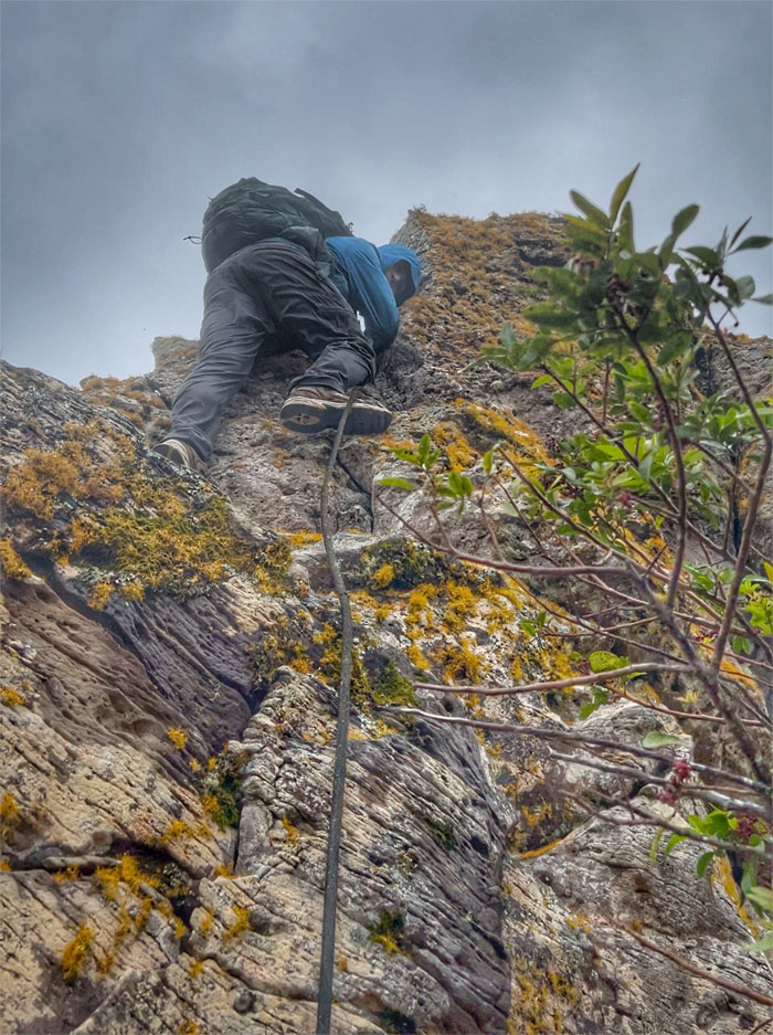
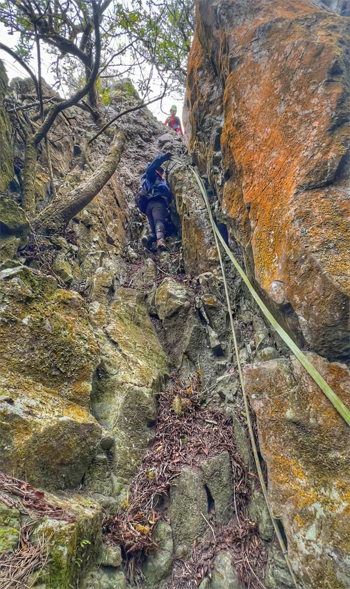
Jeremy climbing his way down over boulders that periodically punctuated the trail.
WST
The boys trying to get some rhythm in the mountains.
WST
CB crossing over the fence line that we left behind us.

WST
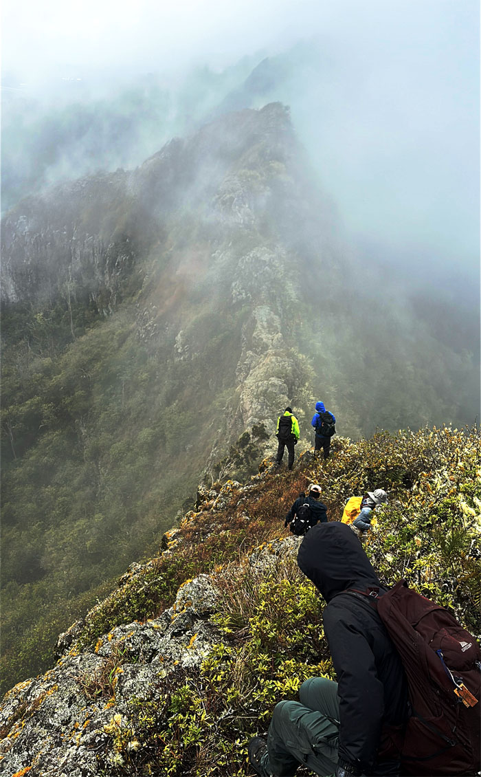
Scattered clouds and rain made for a surreal hiking experience.
WST
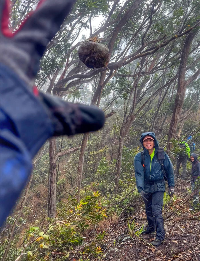
Playing hot potato or in this case, cold potato in the mountains.
WST
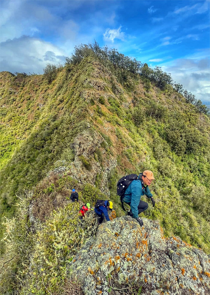
Threading our way down through what CB called the mini-Pohakea Pass.
WST
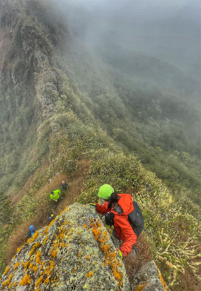
The rest of the group contouring their way around the rocks.
WST
Where do we go?
WST
We go this way.
WST
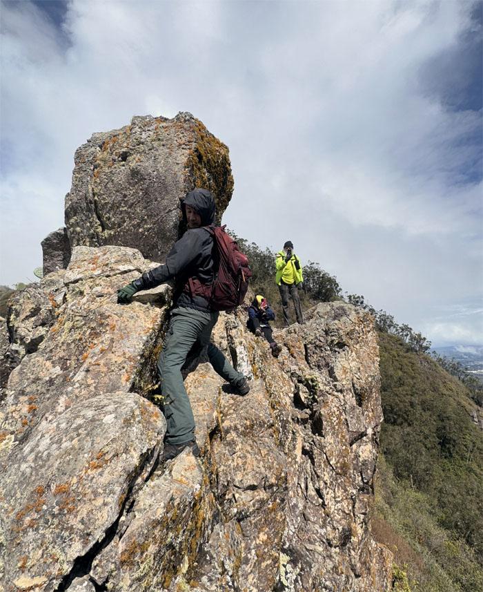
CB climbing his way down as the rest of the group waited their turn.
WST
Watching everybody from my perch.
WST
CB dropping down the next rock climb.
WST
Aida making her way down as the rest of the group watched her progress.
WST
Looking behind as Roger and Jeremy were the last ones making their way down, as the rain clouds stopped watering the mountains. Thank you very much.
WST
It’s been awhile.
WST
It’s this way guys!
WST
I think, no need webbing.
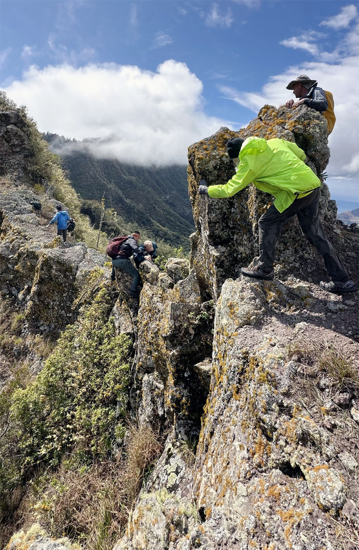
WST
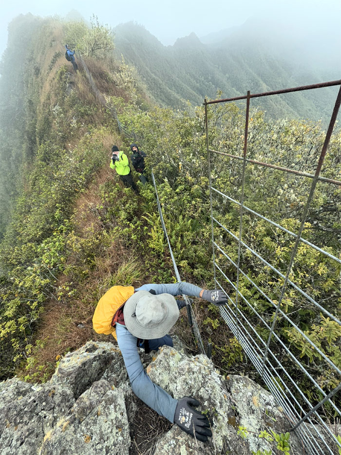
Somebody accidentally almost bumped me off the ridge, as I think he was trying to give me a natural high.
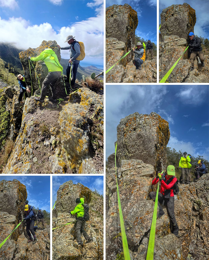
WST
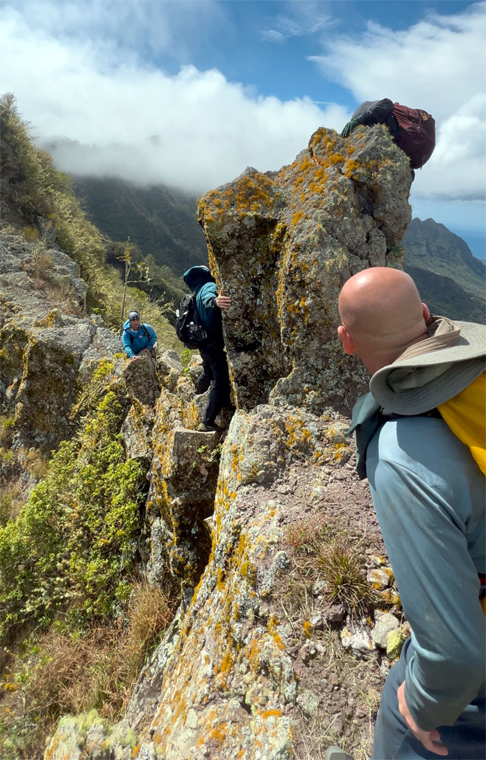
The rest of the group making their way across the short ledge. Wait, why is the marine using the webbing?
WST
Resuming our hike.
WST
Making our way on the rocky trail that was mostly populated with low lying trees, cacti and dry grass.
WST
CB taking the higher “road.”
WST
Tessa climbing her way down the narrow crumbly slot.
WST
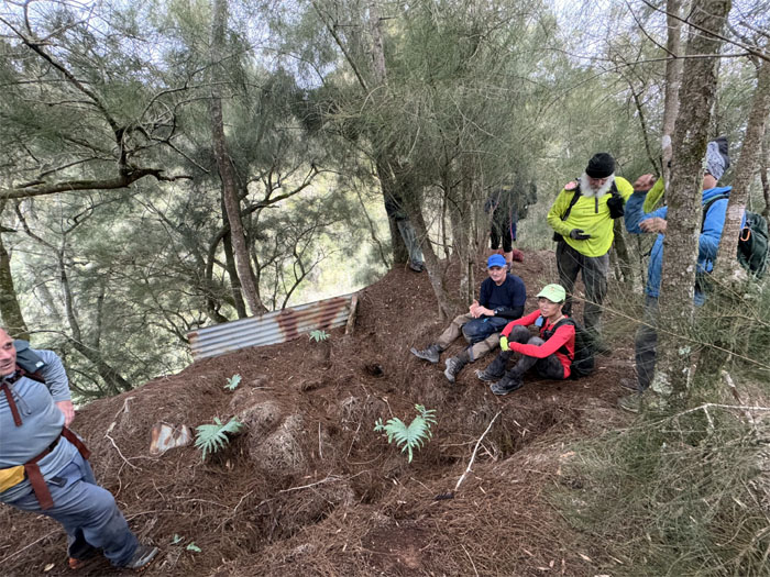
Taking a break at our former camp site as we waited for Chico who decided to take a detour to get in more cardio time.
WST
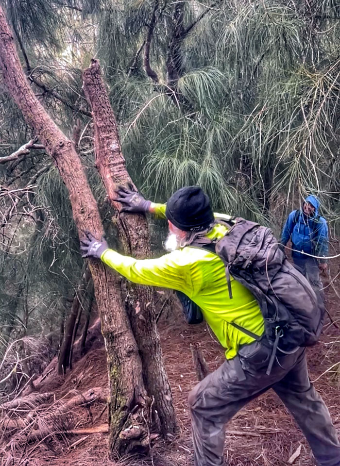
Chico clearing dead trees from the forest. I think he was vying to get a spot on the HTMC trail clearing team.
Pohakea Pass Junction
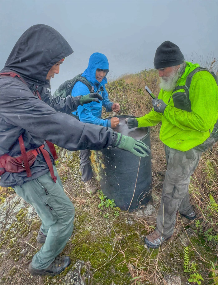
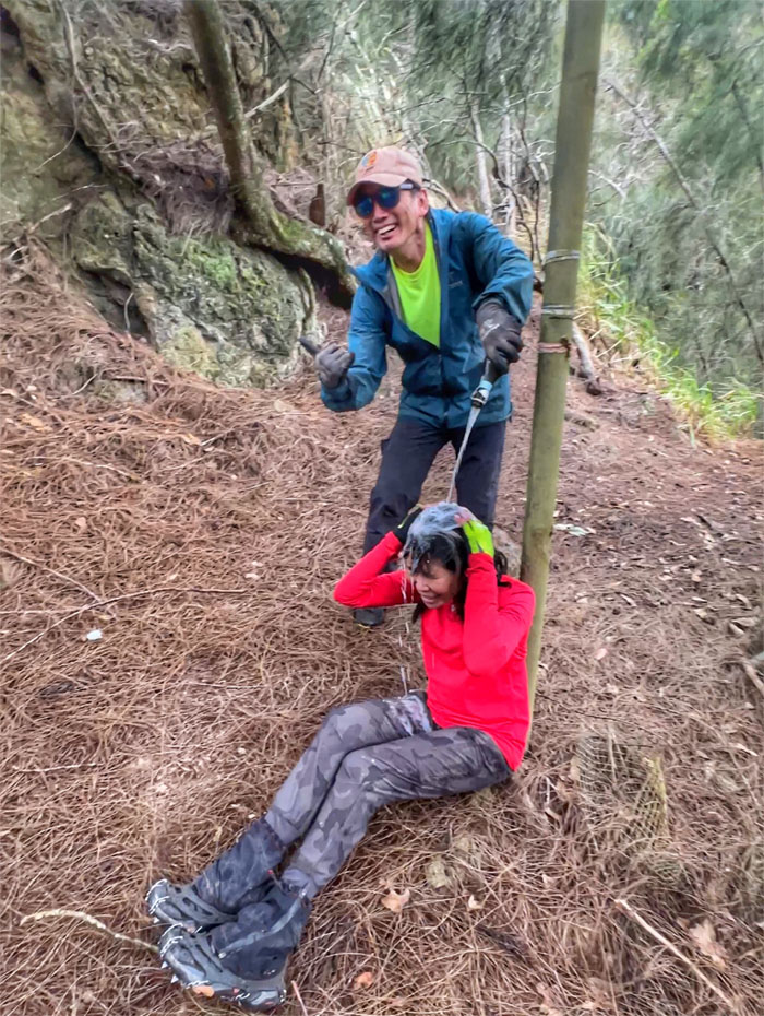
#24 – My customary champagne celebration as we congratulated Aida for completing her last segment needed to finish the 26 mile Waianae Summit Trail. Two feathers in her cap now.
Pohakea Pass Junction
This also marked my #11 finish of the trail that was carved out of this ancient shield volcano that forms the Western half of the island. When am I going to Disneyland?
Pohakea Pass Junction
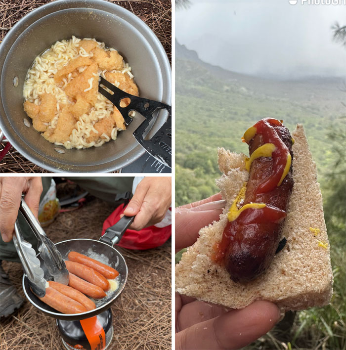
Our sausage sandwich lunch courtesy of Chef Suzuki. Arigatou Gozaimasu.
Pohakea Pass Junction
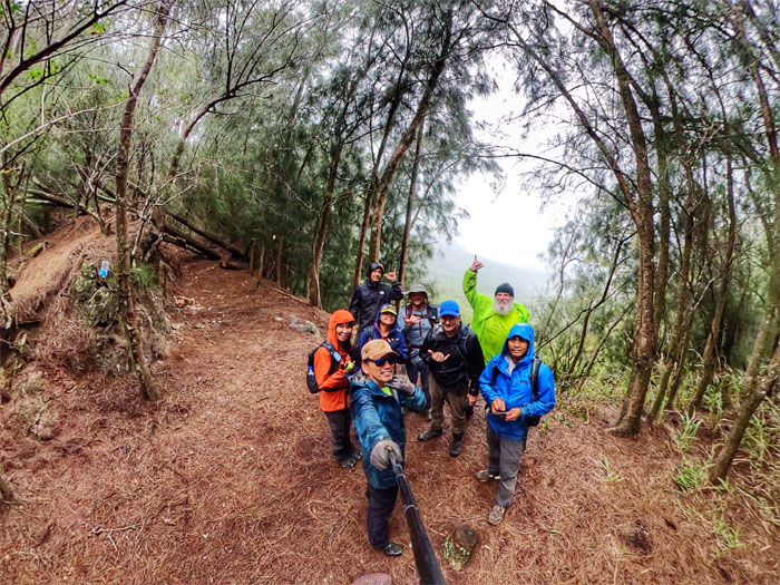
Our last group photo of the day as the rain came back to water the mountains.
Kunia
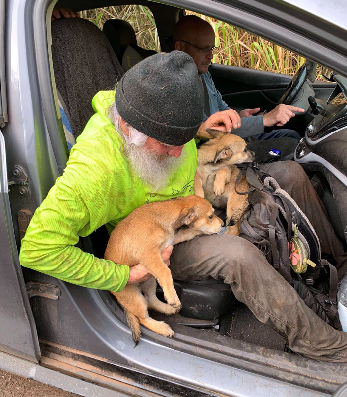
We all scampered and slid down the rain soaked hill as we soon connected to the Honouliuli Contour Trail and back to our staged cars, where we met some hunters and their dogs going up the trail in search of game.
All pau
This is not the satellite branch of the Hawaiian Humane Society, please return the puppies.
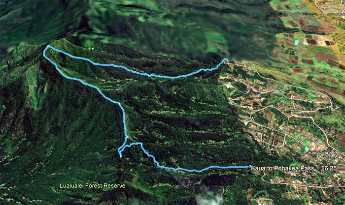
GPS Tracks
Our double finish hike barely scratched four miles with a solid, fun group. Congrats again to Aida for finishing the WST. Post hike meal at Denny’s as the voice calling for Thai food was lost in the rain showers.
Postscript
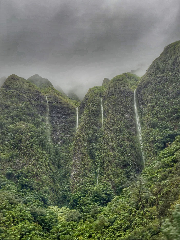
On our ride home, we got to witness the multiple waterfalls pouring off the Ko’olau mountains due to the torrential rain. Great ending for a great day.
Photos taken by Aida Gordon, Akira Suzuki, Chico Cantu, Chris Bautista, Jeremy Cannone, Roger Schiffman, Tessa Bugay and yours truly. Not necessarily in order.
Note: I have been made aware that some hikers have been using my blog as a hiking guide and getting lost on the trails. Please note that this blog was made to document the hike for the crew(s) that did it. That is why some of my comments will seem to have no relevance or meaning to anybody outside of the crew(s) that hiked that trail. My blog was never meant as a hiking guide, so please do not treat it as such. If you find inspiration and entertainment from these hikes, that is more than enough. If you plan on replicating these hikes, do so in the knowledge that you should do your own research accordingly as trail conditions, access, legalities and so forth are constantly in flux. What was current today is most likely yesterdays news. Please be prepared to accept any risks and responsibilities on your own as you should know your own limitations, experience and abilities before you even set foot on a trail, as even the “simplest” or “easiest” of trails can present potential pitfalls for even the most “experienced” hikers. One should also always let somebody know of your hiking plans in case something doesn’t go as planned, better safe than sorry.
{ 6 comments… read them below or add one }
Finally! Tha k you, Kenji, dor making it possible for me to finish the WST. Retirement never felt sweeter lol.
Aloha Aida,
Yep, retirement and WST finish. Sweet.
Mahalo
A big congratulations to you and Aida. Your presence really matters helping others to succeed. You are truly a legend ??
Aloha Ferlino,
Thanks. It takes teamwork.
Mahalo
Aloha Kenji, what is the trail access like in Kunia these days? I have been in contact with the DLNR about the potential development of a full on parking permit to enter and exit the kunialoa ridge farm area for months but they seem to never make any progress. Is it legal to simply park out of their premises and hike in to the trailhead or do you have special permission to park closer to the base of the mountain.
Aloha Evan,
We got access because I have a friend that owns a farm there. There has been a lot of build up of homes and farms back there. Most of the neighbors I ran into were friendly enough. Hope DLNR gets that permit process squared away.
Mahalo