

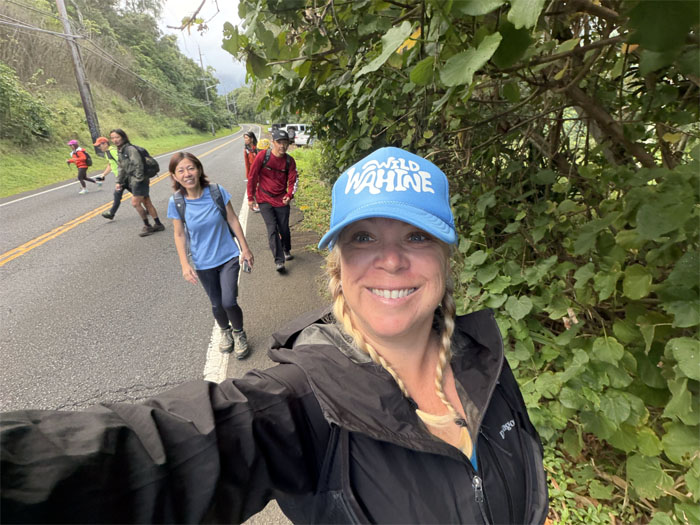
Our sandbar sailing got cancelled due to mechanical and physical breakdowns and so we pulled a magic trick. We turned a two hour hike into a full day. How? Read on impatient ones.
Ka’a’awa
We all met up despite the annoying church slut saying it was raining and perhaps a waterfall hike was in order. What rain? 100000000000%!
Ka’a’awa
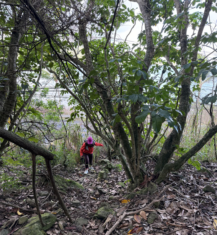
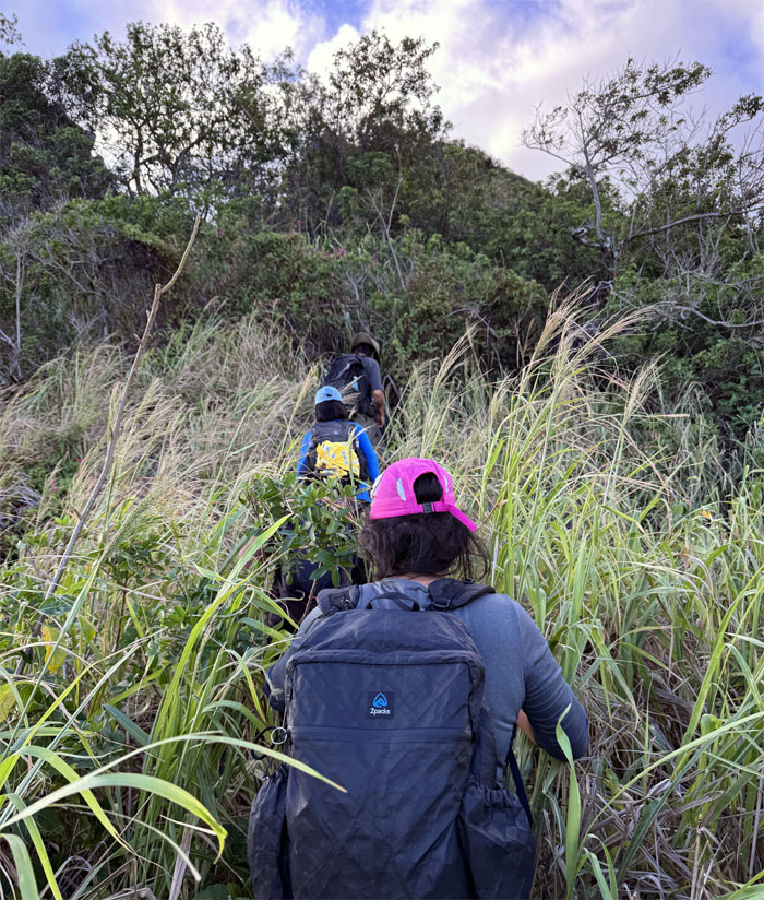
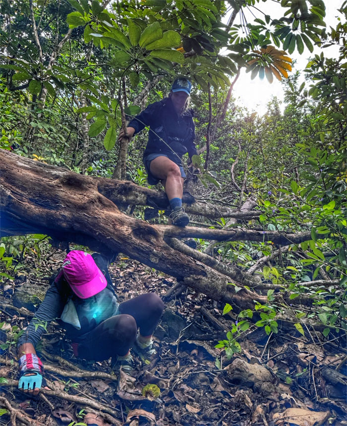
Left the highway and scrambled up a trail less traveled. No signs.
Ka’a’awa
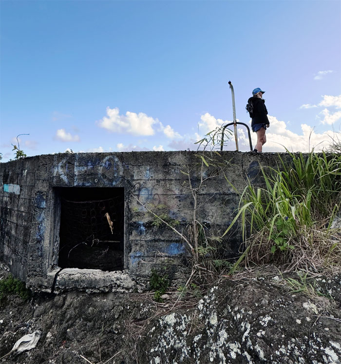
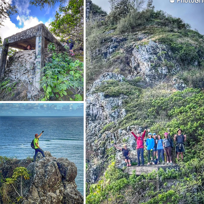
Mere minutes later, we arrived at the first bunker that was currently being occupied. No open bunker today?
Ka’a’awa
Can you see the lion for the bunker? Let me hear your primal roar! Keep it quiet up there, people are trying to sleep!
Ka’a’awa
Sunday Showing was canceled, so we popped over to the next bunker.
Ka’a’awa
The second bunker was open for showing that showcased ocean views and cross ventilation. This was the affordable section of town.
Ka’a’awa
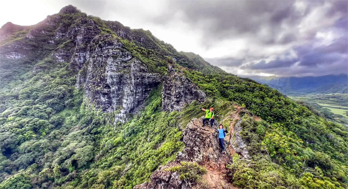
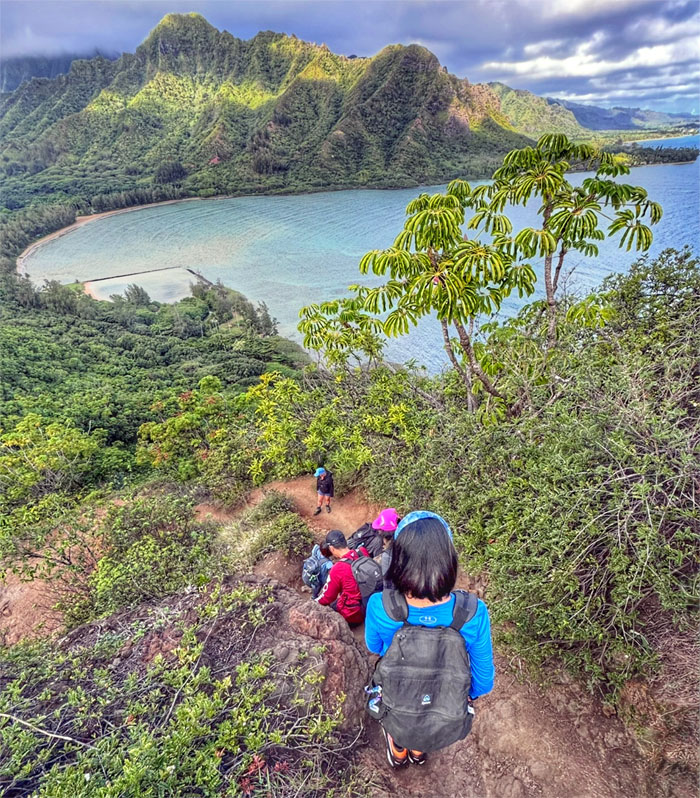
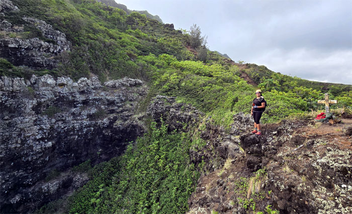
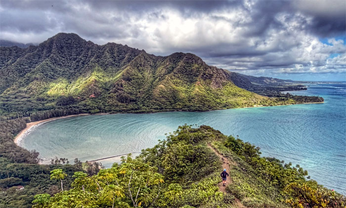
The view from the rock, can you see the group for the distance?
Ka’a’awa
Follow the arrow if you can see it for the group.
Ka’a’awa
View from the studio sized bunker.
Ka’a’awa
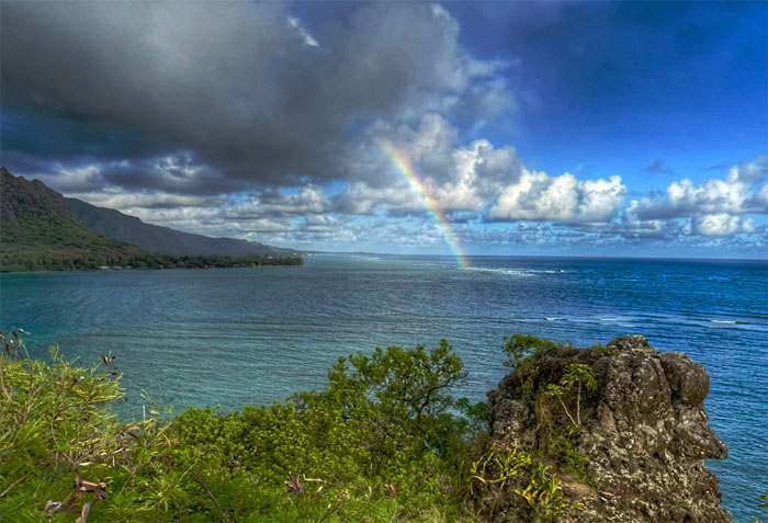
Go back out there and catch the rainbow. Be quick about it.
Ka’a’awa
I couldn’t even taste the Skittles. Let alone that the bag of sugared candy are missing blue and violet colors, so it would have been an incomplete taste test as nonsensical arguments goes.
Ka’a’awa
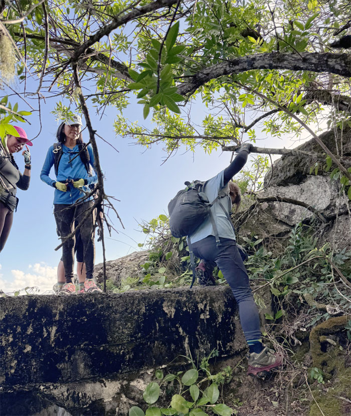
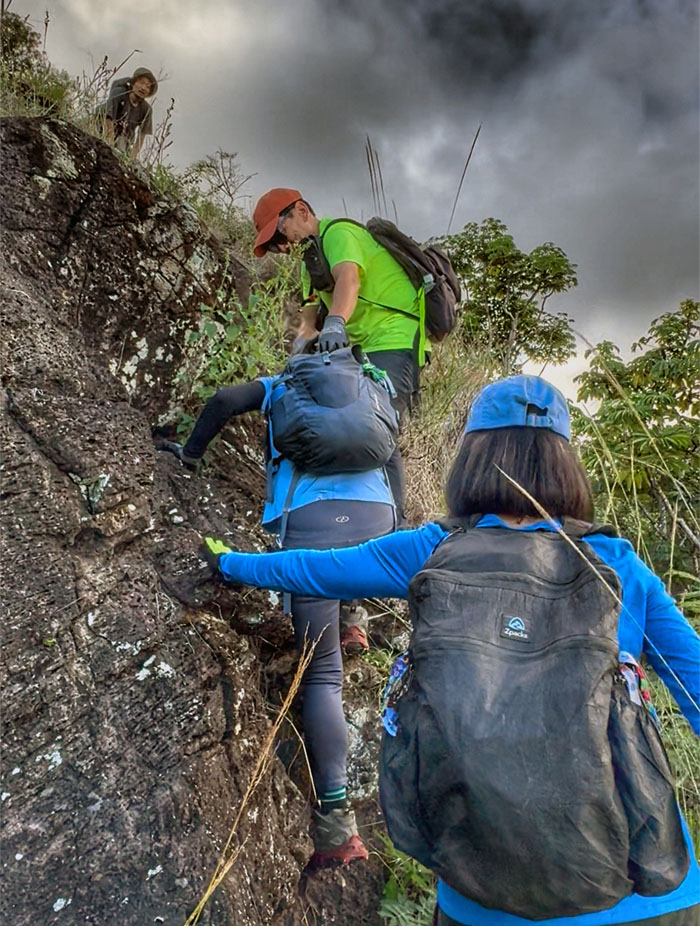
Leaving the man-made structure for natural rock formations.
Ka’a’awa
The hard part was over per Allison. Easy peasy lemon squeezy. Whew.
Ka’a’awa
Looking down at Huilua Fishpond located in Kahana Bay, believed by some to have been built by the legendary menehunes.
Ka’a’awa
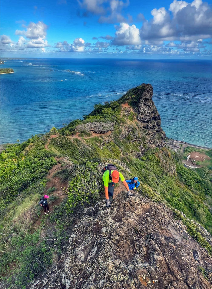
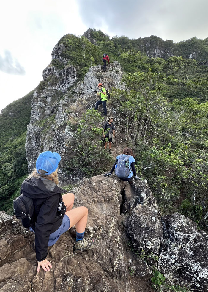
Short climb to the top of the ridge.
Ka’a’awa
Akira should be DJing instead of dancing.
Ka’a’awa
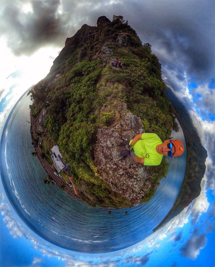
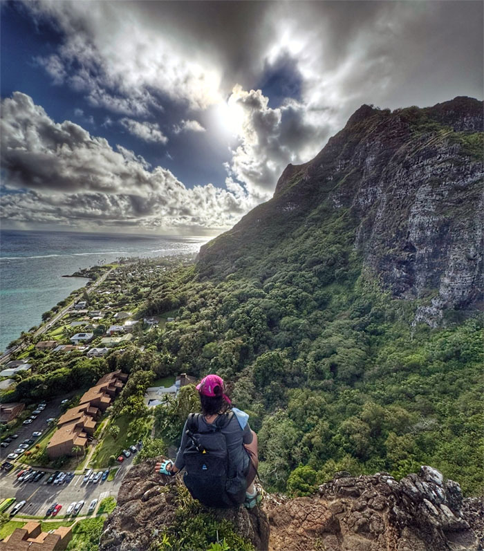
We got the mountain views.
Ka’a’awa
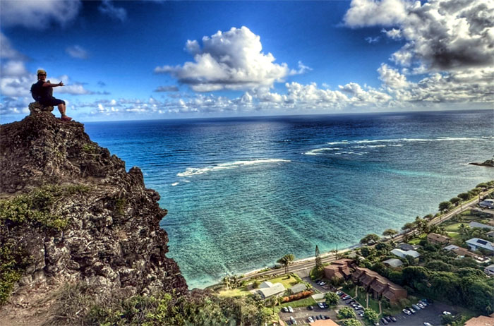
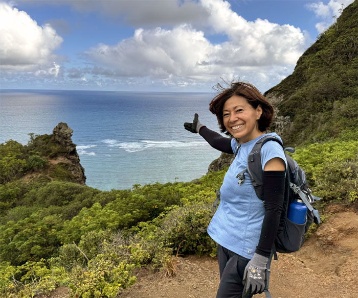
Tessa perched high on the rock with her ocean views.
Ka’a’awa
Cristy with her coastal views.
Ka’a’awa
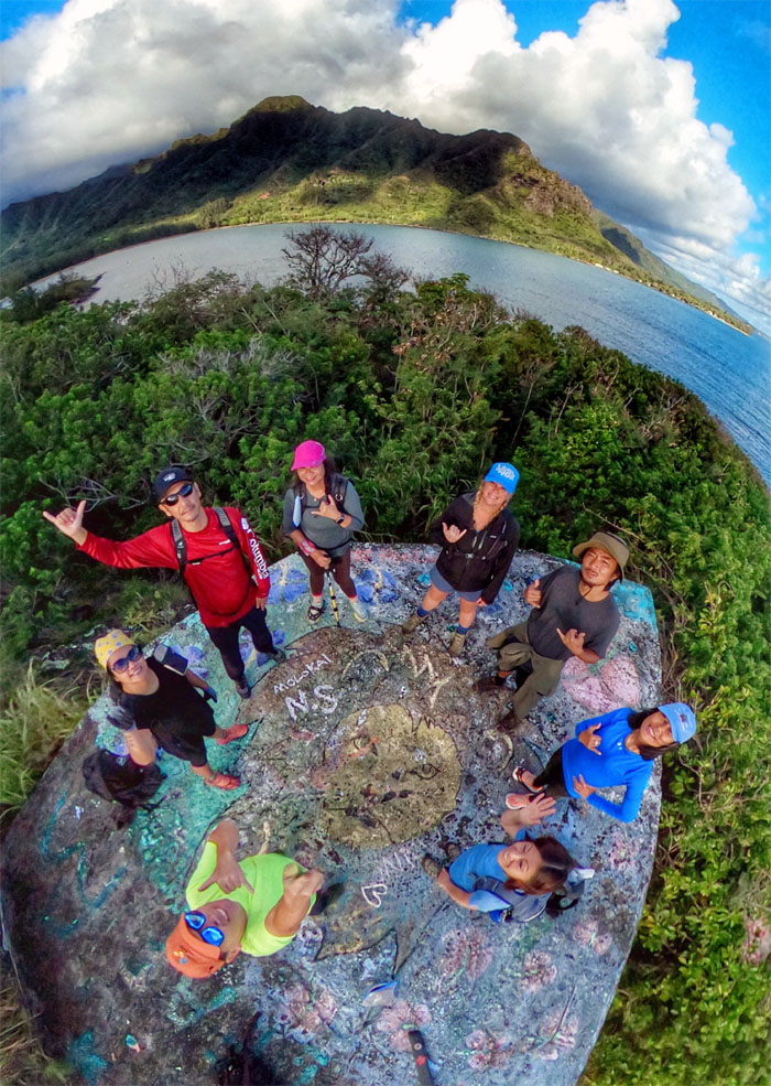
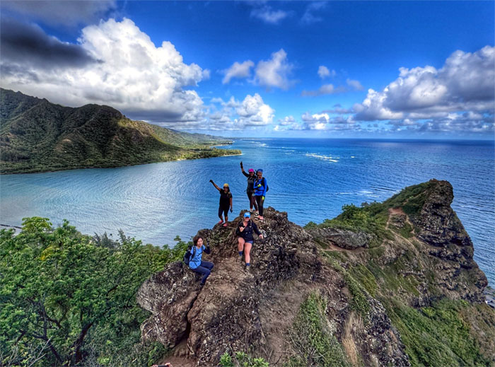
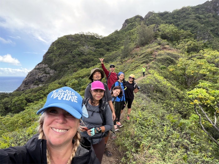
Group photo on the overlook rock. How many people can perch on this spit of a rock, safely?
Ka’a’awa
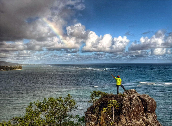
Aida wanted to show off her dance moves too.
Ka’a’awa
Making our way down to the saddle.
Ka’a’awa
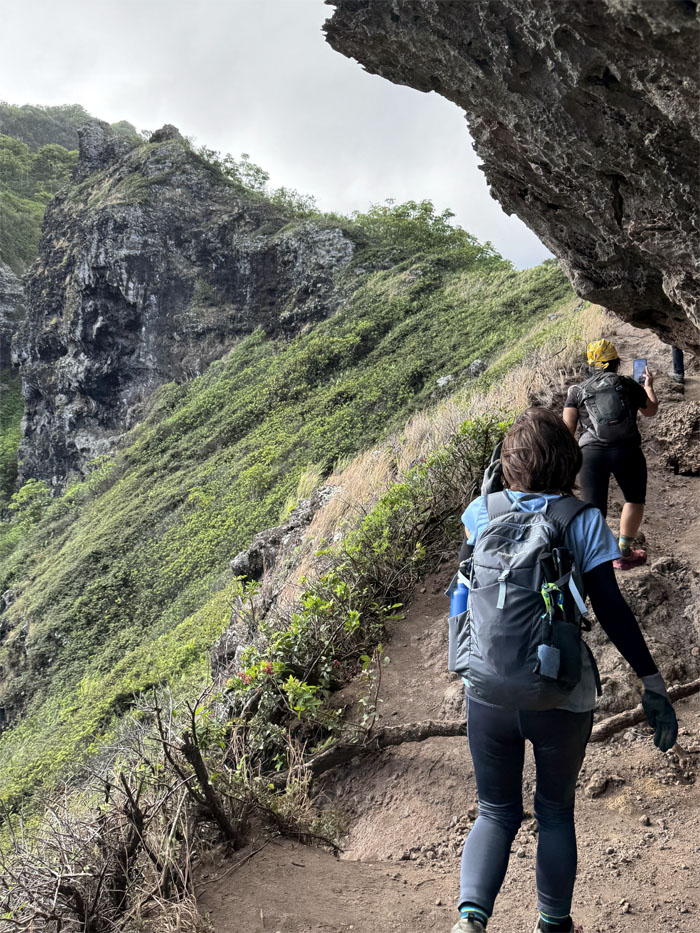
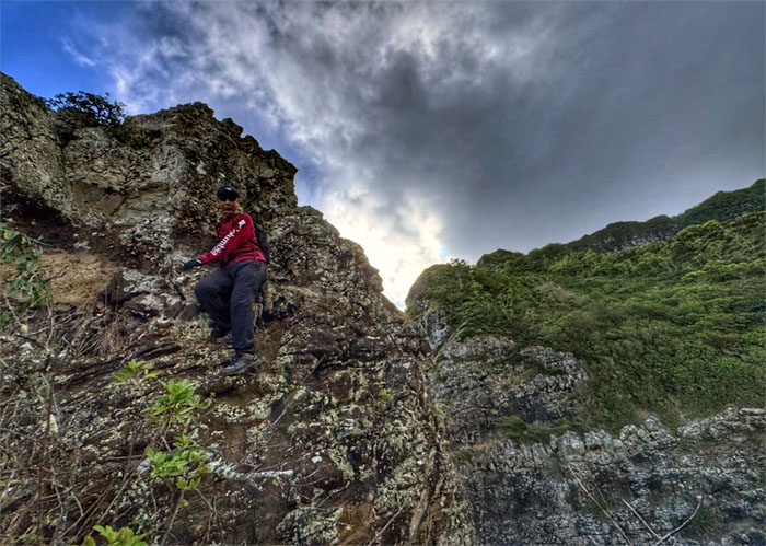
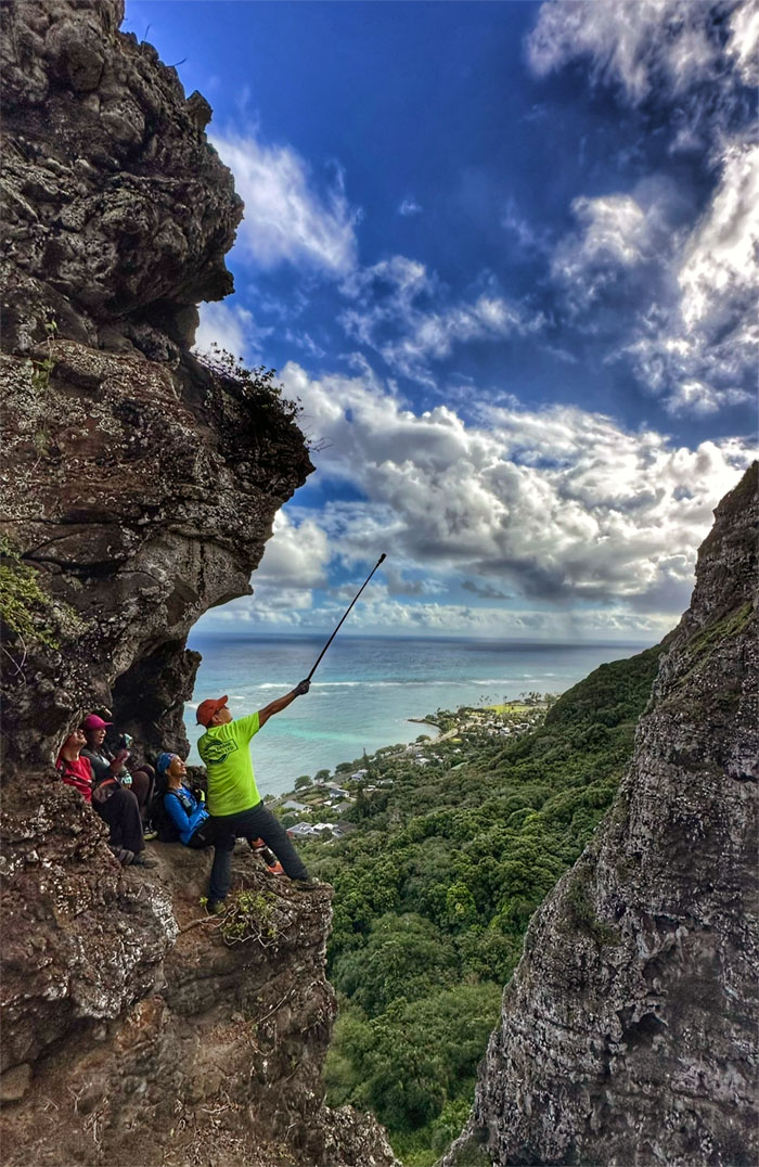
Hugging the cliffs as we made our way to the crouching lion rock formation. Hawaiian legend has it that the formation is actually of the demigod Kauhi’?makaokalani, or large dog that was sent from Tahiti to guard the area. He was trapped by roots and turned into stone when trying to escape the goddess Hiiaka’s siren song.

Ka’a’awa
“What we have here is failure to communicate.” I thought Allison meant we were doing the loop trail to Kahekili, she meant the loop trail back down. Oh well, let’s take a group photo before going up towards the rock formation.
Ka’a’awa
Scrambling up the rear of the “lion.” Or shall we call it a dog now?
Ka’a’awa
The girls were not going any higher.
Ka’a’awa
We coaxed and cajoled Kenny into joining us for the views to no avail. The acrophobia is still strong with this one. Work in progress.
Ka’a’awa
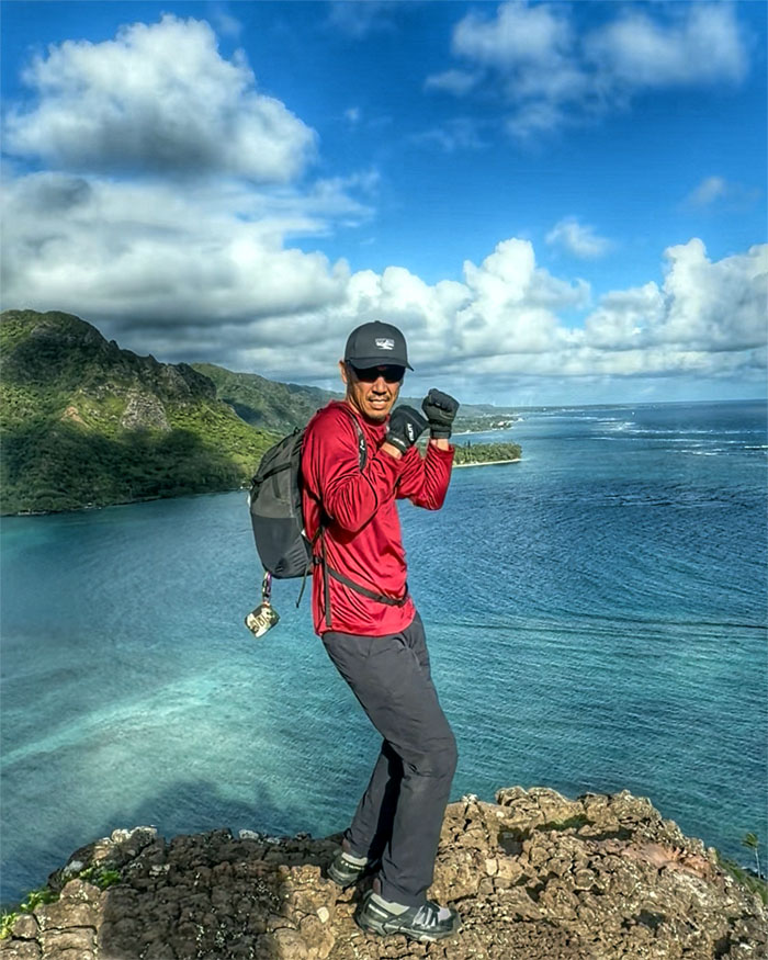
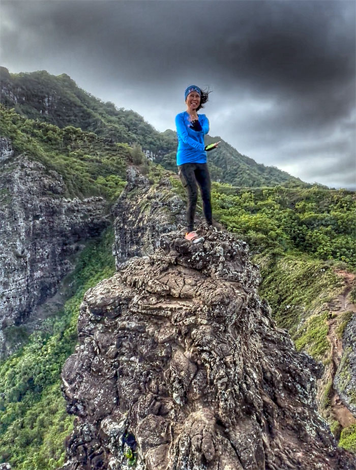
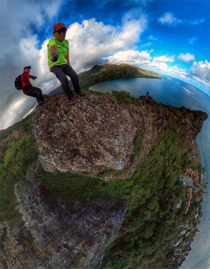
Standing on the head of the “lion.”
Ka’a’awa
Akira climbing down the direct descent. No contouring.
Ka’a’awa
Step back from the edge.
Ka’a’awa
Look who’s talking.
Ka’a’awa
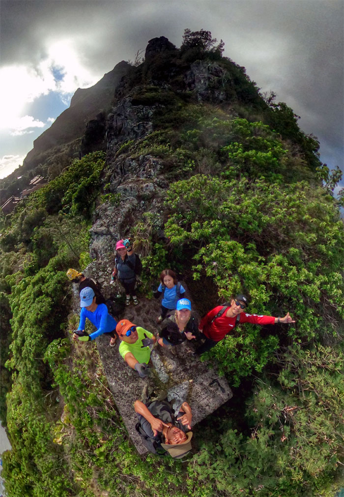
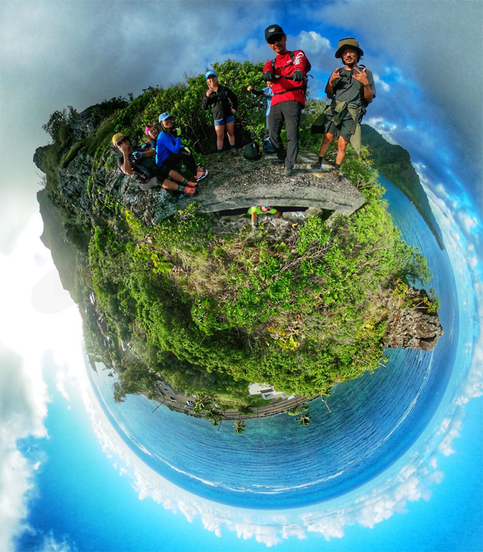
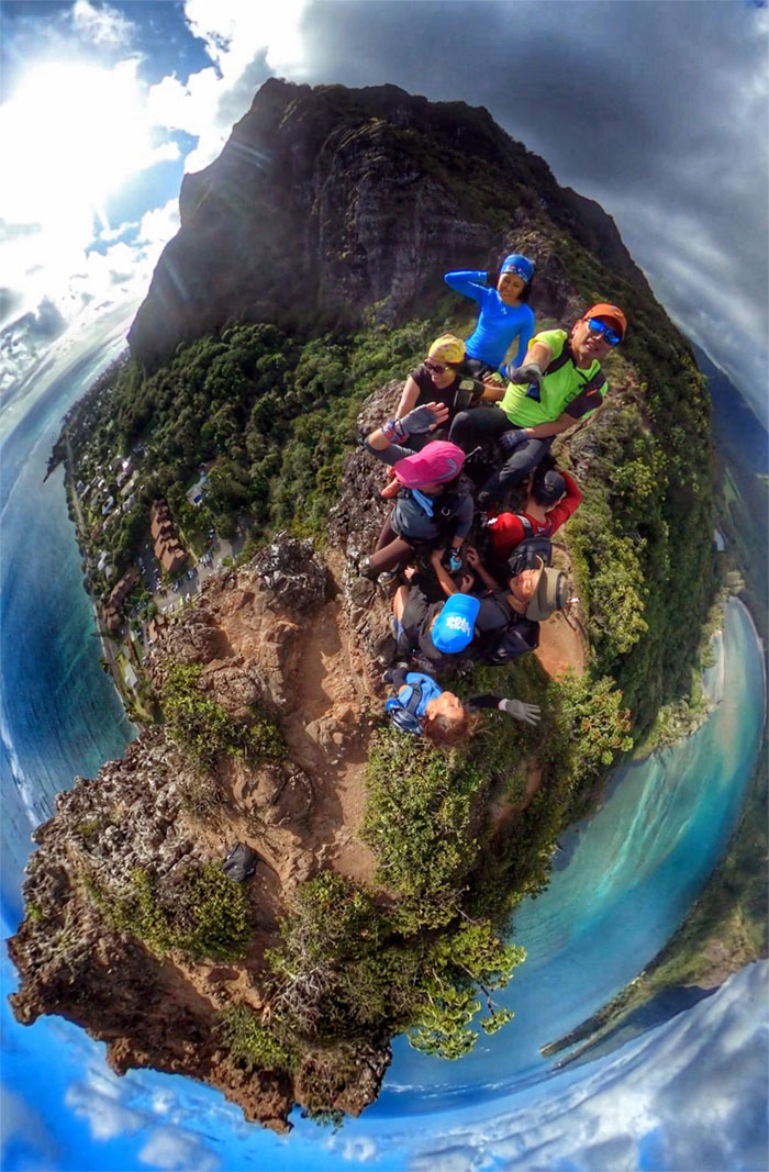
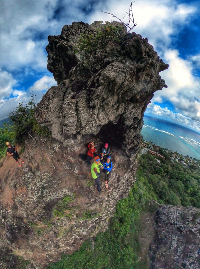
360 views of the four of us shoved into this faint resemblance of a cave.
Ka’a’awa
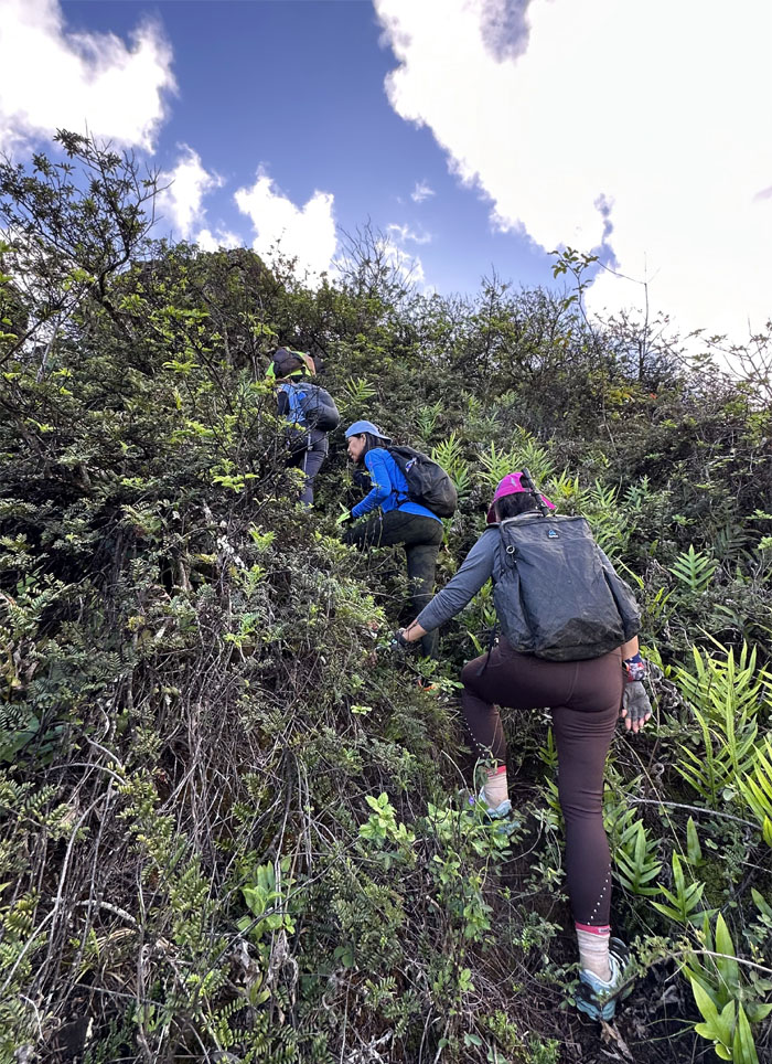
Leaving the eroded section for greener pastures.
Ka’a’awa
Allison walking down the “runway.”
Ka’a’awa
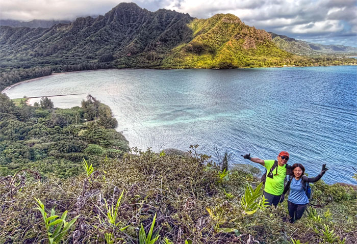
Fond farewell to the “large dog” or “crouching lion”, however historically accurate or not you want to be.
Ka’a’awa
Somebody was making the most of their anniversary gifted IPhone 17 Max. Tessa’s birthday is coming up.
Ka’a’awa
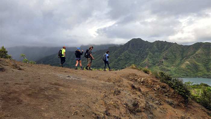
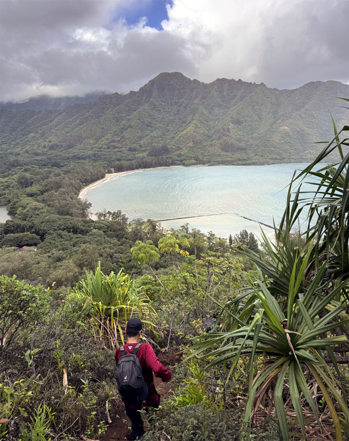
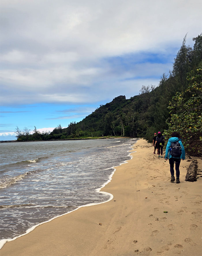
Descending back down to civilization.
Ka’a’awa
Over and under going down the trail.
Ka’a’awa
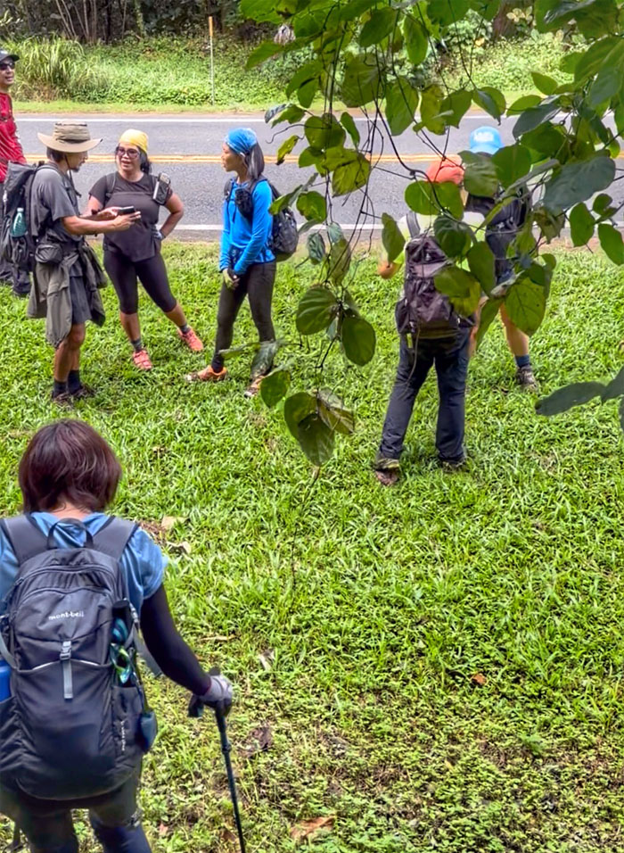
Back on the road again.
Ka’a’awa
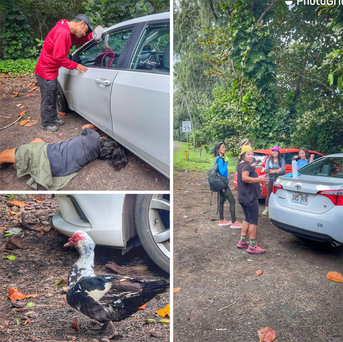
Talks of further explorations and lunch were abruptly cut short when somebody locked their keys in the trunk. Don’t blame the duck either. Googling and YouTubing didn’t help matters much either. Let’s eat. Better to think on a full than empty stomach.
The Crouching Lion
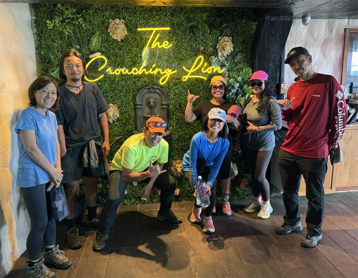
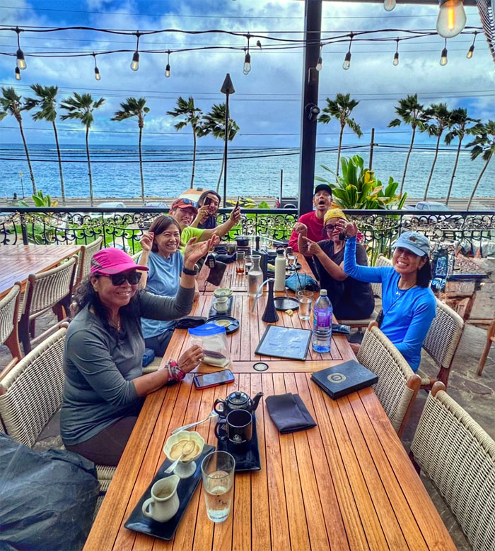
What better place to eat than at a restaurant named after our hike? ‘Nuff said.

The Crouching Lion
Sampling the culinary creations of the restaurant that just reopened last year after a decade of being shuttered. The dishes were small, pricey and tasty. We also had the freshest rice we ever had in our life per our waiter. Say what? We are in Hawaii right? Just had to check.
The Crouching Lion
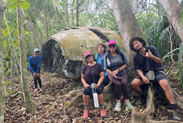
Raise your hands if you have the keys to your car. Tessa, put your hand down! Our bellies full, Akira and I drove to Pearl City to Kalihi and back to Ka’a’awa to get his spare key. Road trip. The rest of the group would go look for that plane wreckage that Allison had told us about.
Ka’a’awa
The group spent over an hour trying to find the plane wreckage. They had a lot of time on their hands.
Ka’a’awa
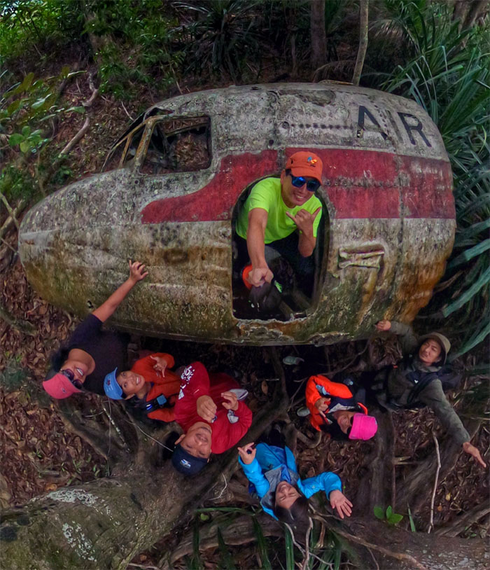
Success!
Ka’a’awa
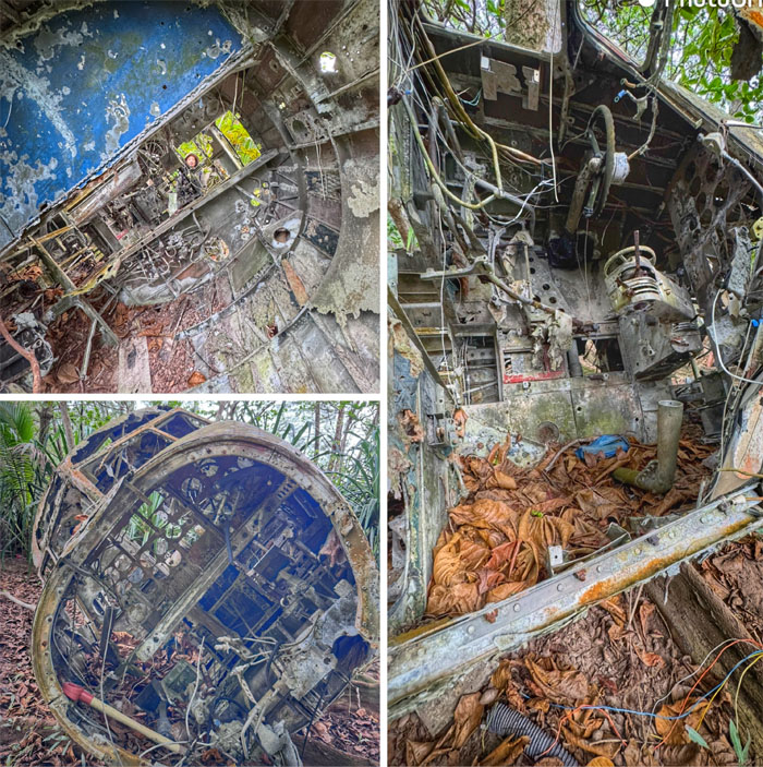
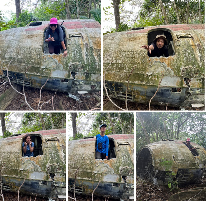
Exploring the wrecked fuselage.
Ka’a’awa
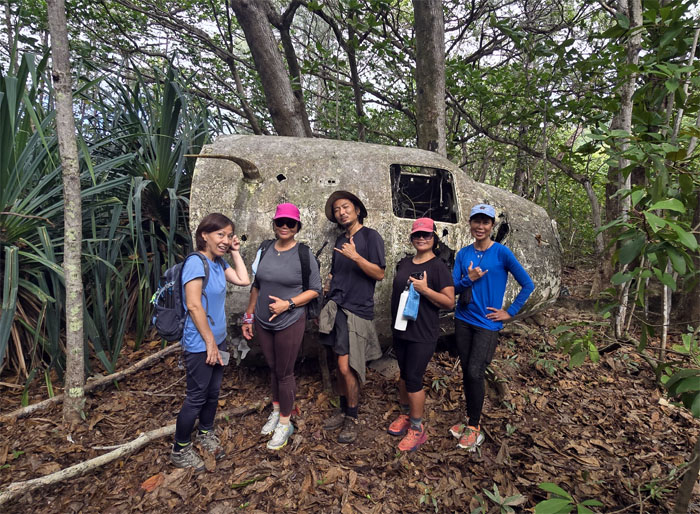
Posing in front of the plane that turned out to be a former movie prop, likely a Bristol Britannia from the 1950s.
Ka’a’awa
Everybody wants to be a pilot until the crash.
Ka’a’awa
Reunited!
All pau
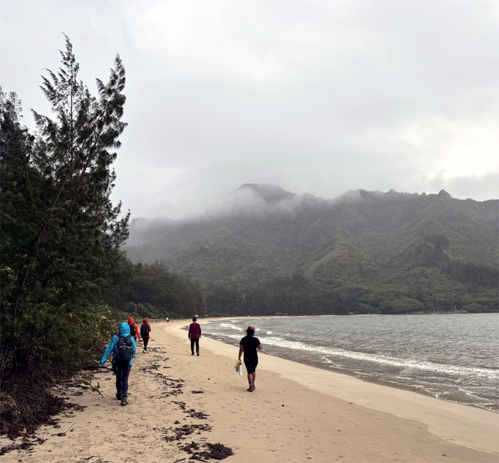
Walking back to our cars, keys in hand, our day was finally over. That is how we turned a two-hour hike into a full day filled with fun, food, and good company that turned a bad situation into a good one. Now you know the rest of the story.
Photos taken by Aida Gordon, Akira Suzuki, Allison Banks, Cristy CM, Kenny Lui, Mari Saito, Tessa Bugay and yours truly. Not necessarily in order.
Note: I have been made aware that some hikers have been using my blog as a hiking guide and getting lost on the trails. Please note that this blog was made to document the hike for the crew(s) that did it. That is why some of my comments will seem to have no relevance or meaning to anybody outside of the crew(s) that hiked that trail. My blog was never meant as a hiking guide, so please do not treat it as such. If you find inspiration and entertainment from these hikes, that is more than enough. If you plan on replicating these hikes, do so in the knowledge that you should do your own research accordingly as trail conditions, access, legalities and so forth are constantly in flux. What was current today is most likely yesterdays news. Please be prepared to accept any risks and responsibilities on your own as you should know your own limitations, experience and abilities before you even set foot on a trail, as even the “simplest” or “easiest” of trails can present potential pitfalls for even the most “experienced” hikers. One should also always let somebody know of your hiking plans in case something doesn’t go as planned, better safe than sorry.
{ 2 comments }


