
I decided to cut today’s hike in half as I didn’t feel like hiking in the dark. Been there. Done that. Thank you very much.
Kolekole Pass
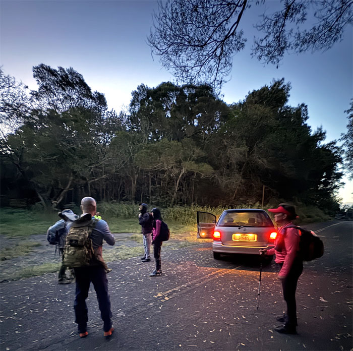
Thanks to Matt for dropping us off despite the gate not being open at the advertised time. Jeremy called Range Control and they came to open the gate for us.
Hapapa Trail
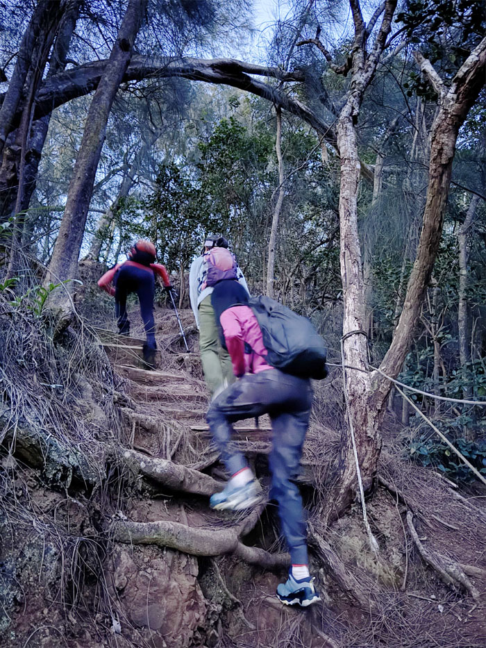
Nothing like early morning cardio to wake one up.
Hapapa Trail
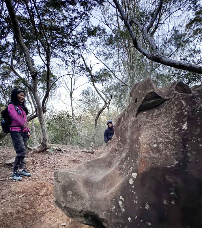
Nobody wanted to be beheaded vicariously.
Hapapa Trail
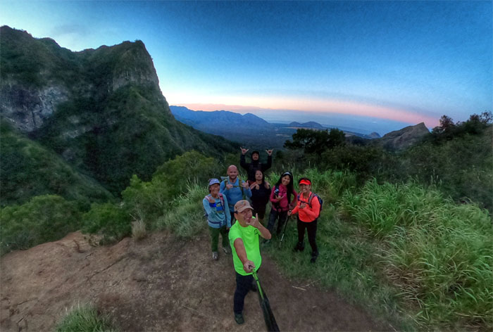
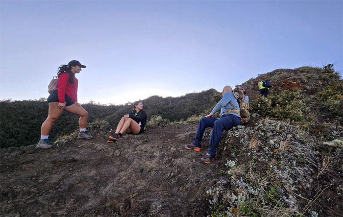
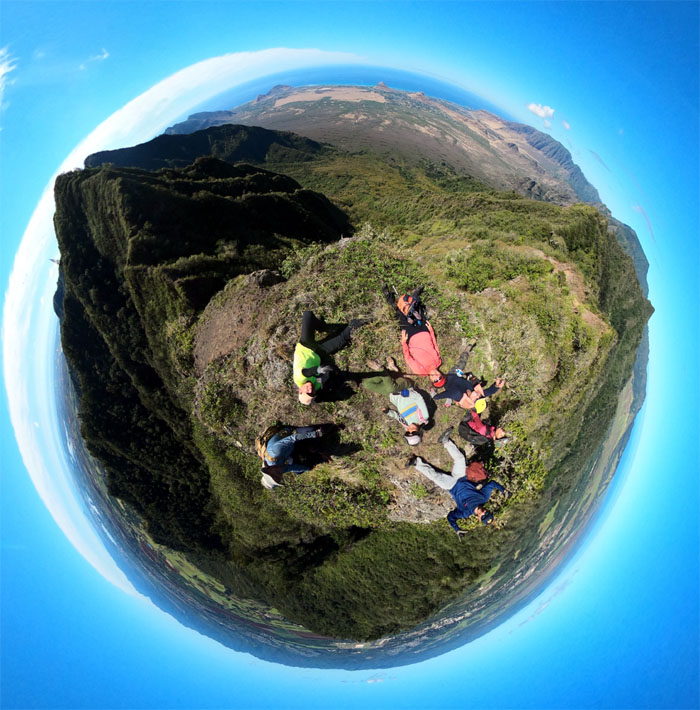
Our first group photo of the day at the bench.
Hapapa Trail
Obviously my directions to take the less direct route fell on deaf ears.
Hapapa Trail
Group photo on the protruding dike where we met Kassaundra and Hannah looking for a group to join. Or maybe they were just waiting for us to move out of the way. I think it was the latter.
Hapapa Trail
Akira, Robin and Tessa standing on top of what I like to call the rock corridor.
Hapapa Trail
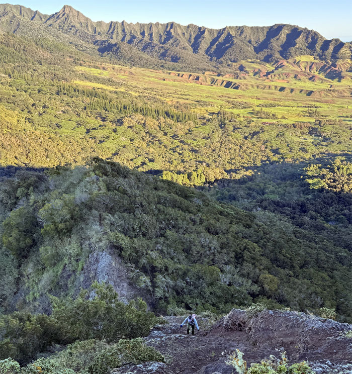
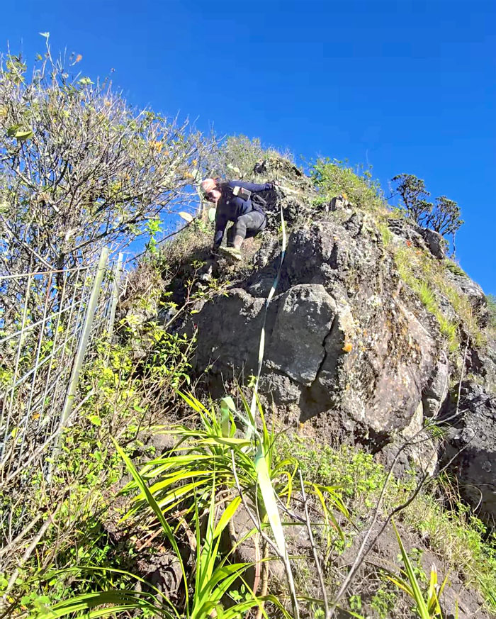
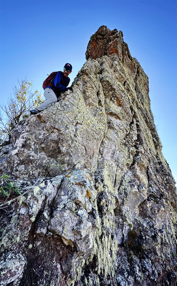
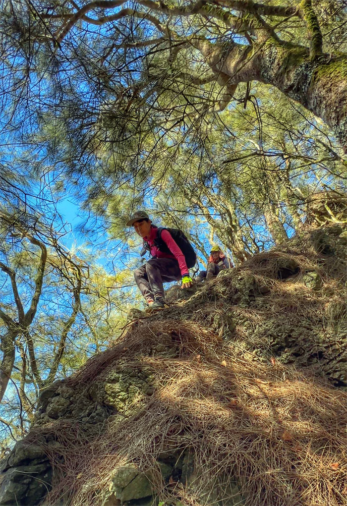
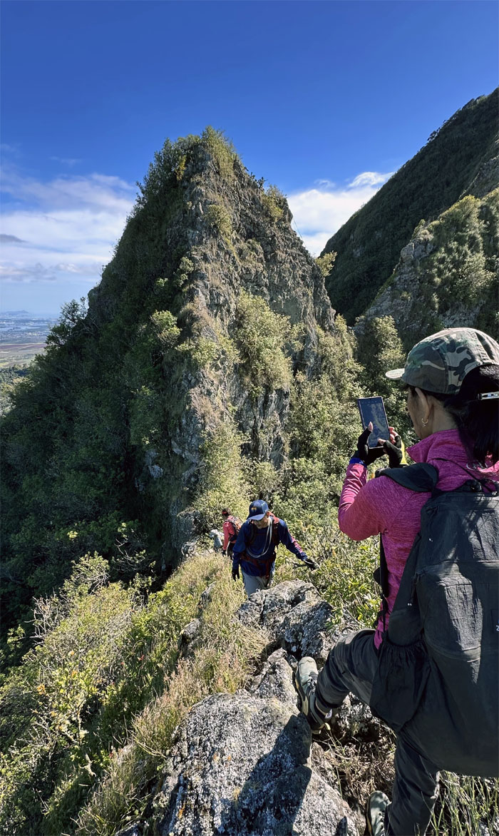
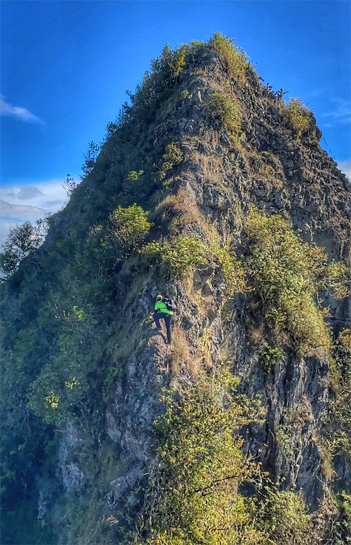
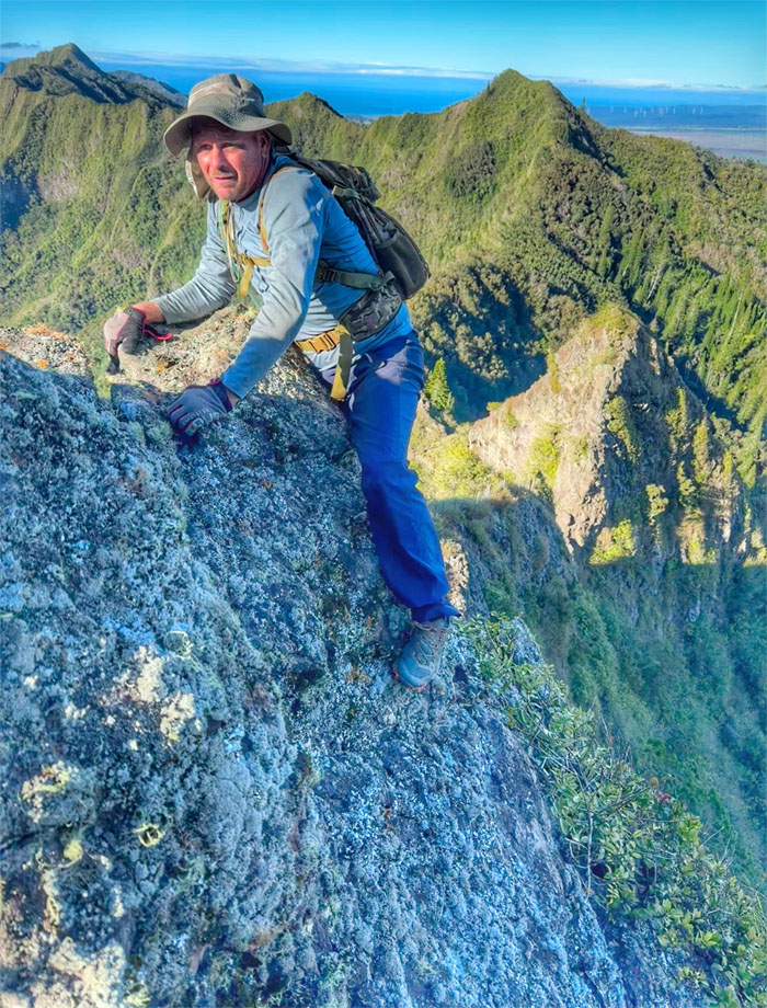
Deborah scrambling up the first notch.
Hapapa Trail
I guess break time is over.
Hapapa Trail
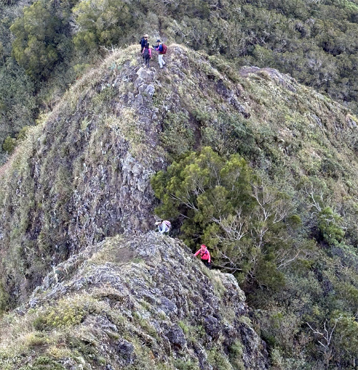
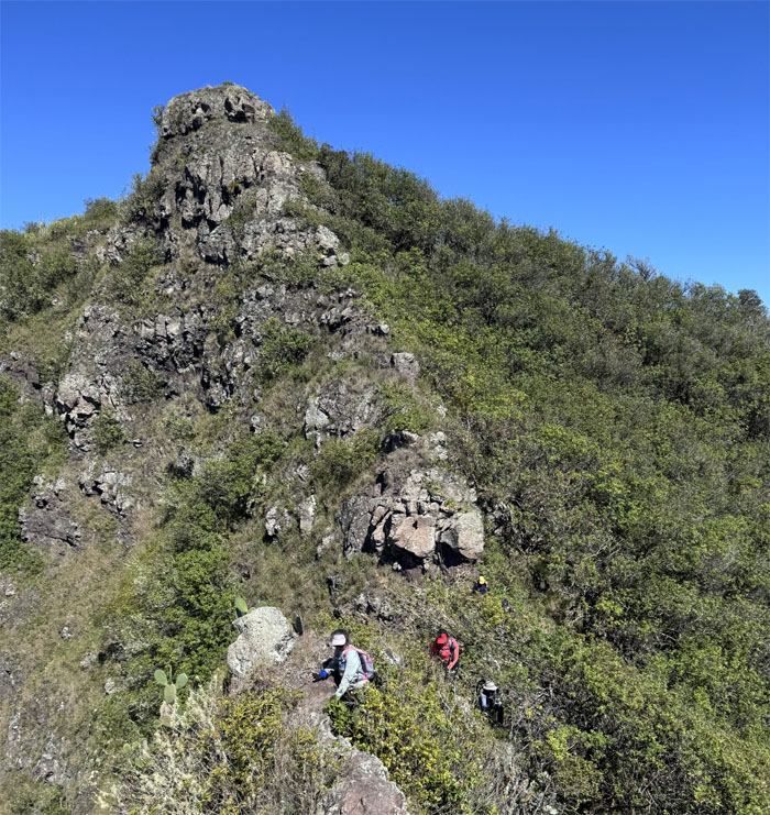
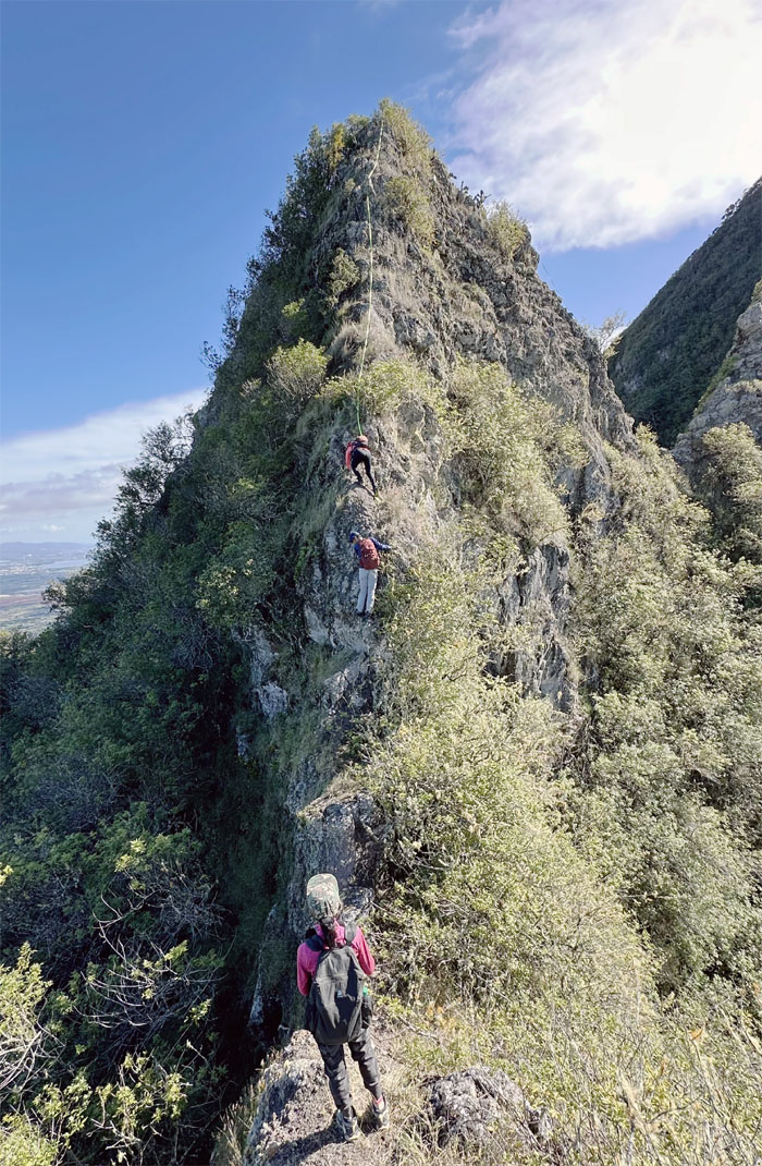
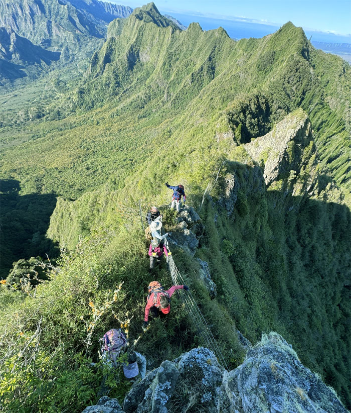
The group scrambling up to the second notch.

Hapapa Trail
Aida and Akira pushing their way up the hill.
Hapapa Trail
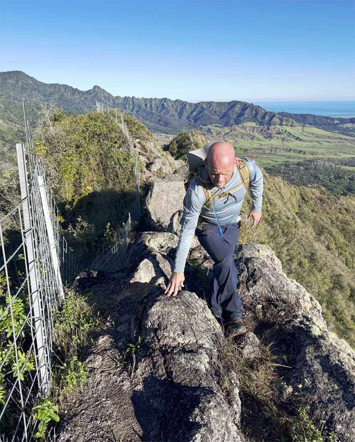
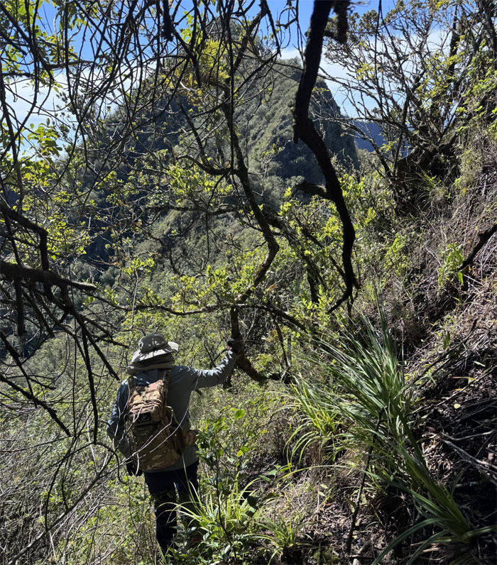
Jeremy meeting up with the inevitable fence line in the mountains.
Hapapa Trail
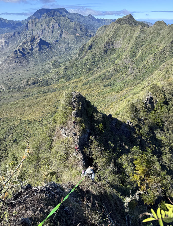
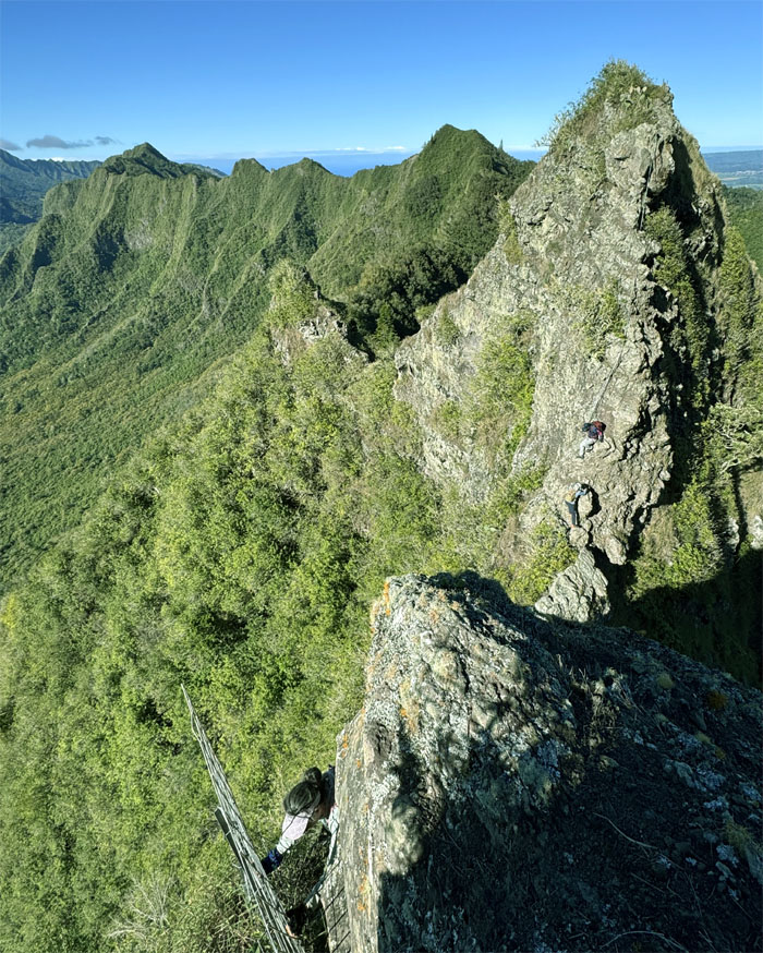
Robin on the creaking catwalk with sweeping valley views below us.
Hapapa Trail
Passing the tent as we approached what I still call the summit while others put it at the hump we had just put behind us.
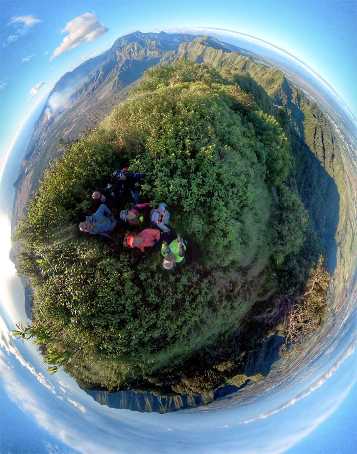
Pu’u Hapapa
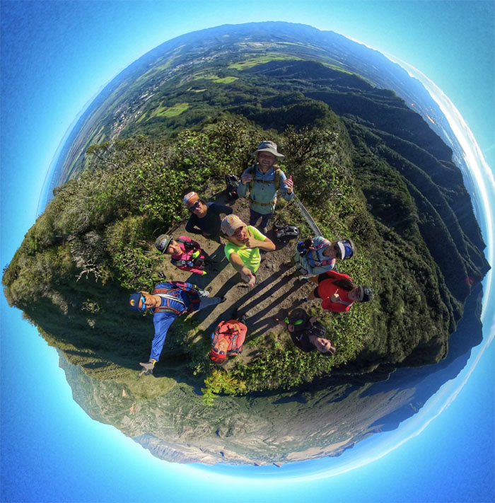
Group photo on the square postage stamp sized of a summit.

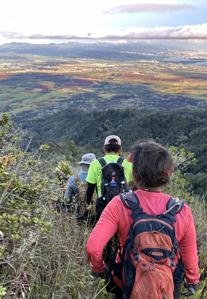
Waianae Summit Trail (WST)
We left the summit as the two girls retraced their steps back to Kolekole Pass.
WST
Tessa climbing her way down one of many boulders interrupting the relatively smooth traverse of the ridge line.
WST
Akira coming down from his natural high.
WST
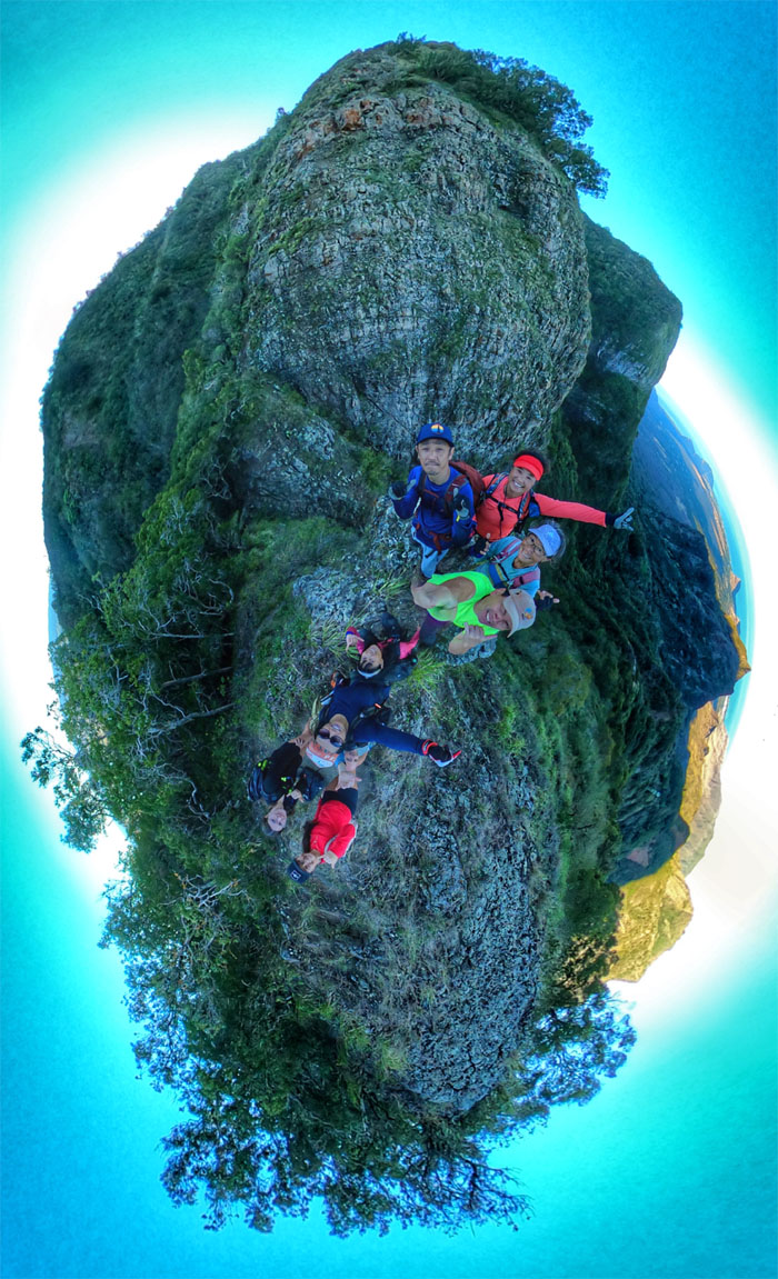
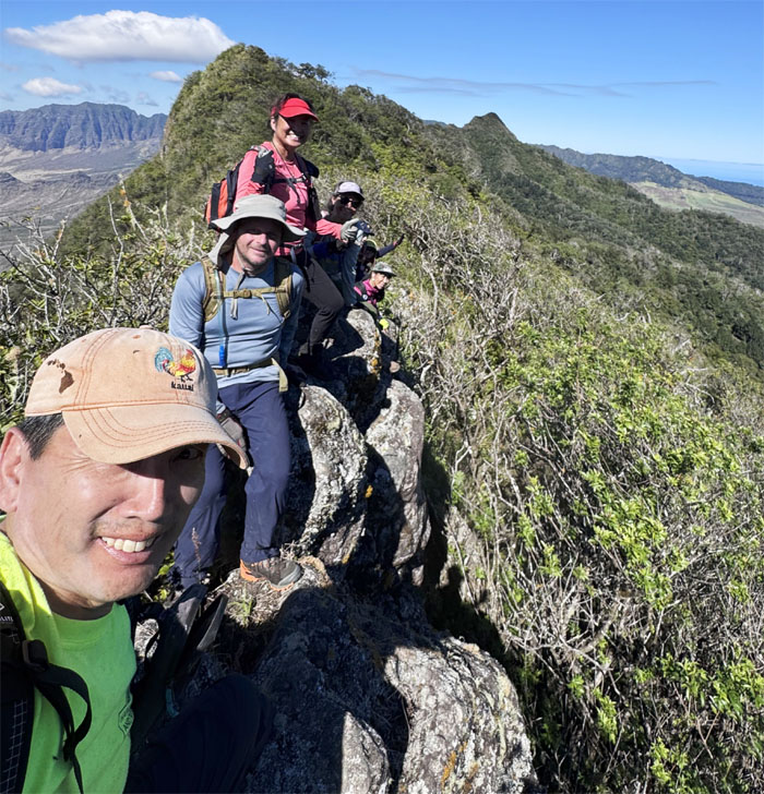
Group selfie on the rocky outcrop protruding from the ridge line.
WST
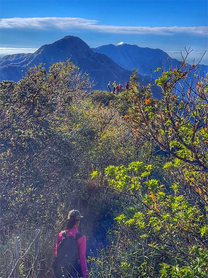
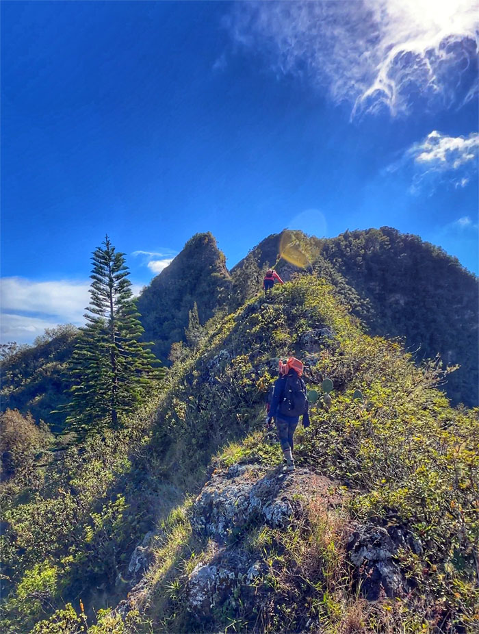
Contouring along the eroded section of the ridge line.
WST
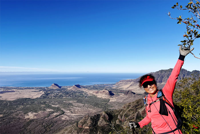
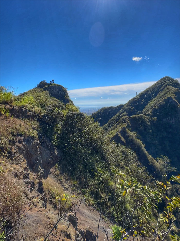
Mount Ka’ala was strikingly clear in the background.
Pu’u Kanehoa
Lying down photo at the 2,778′ knob.
WST
Jeremy contouring along the trail as we made our way back to the ridge line.
WST
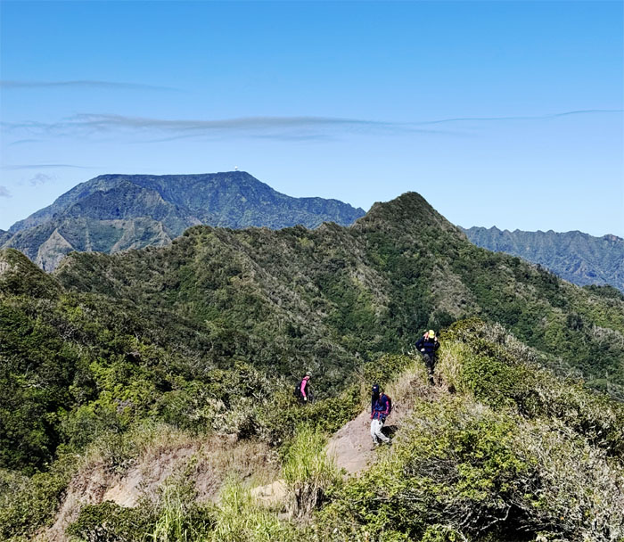
Looking back at the summit of Kanehoa as the group worked their way around the rocks and overgrowth.
WST
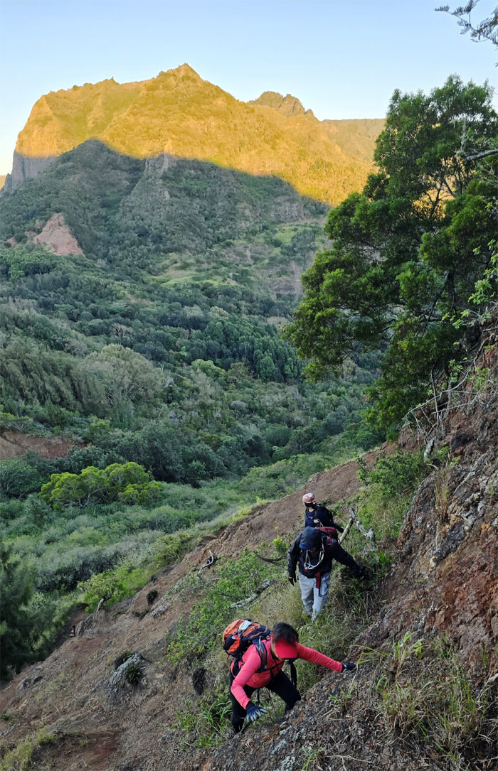
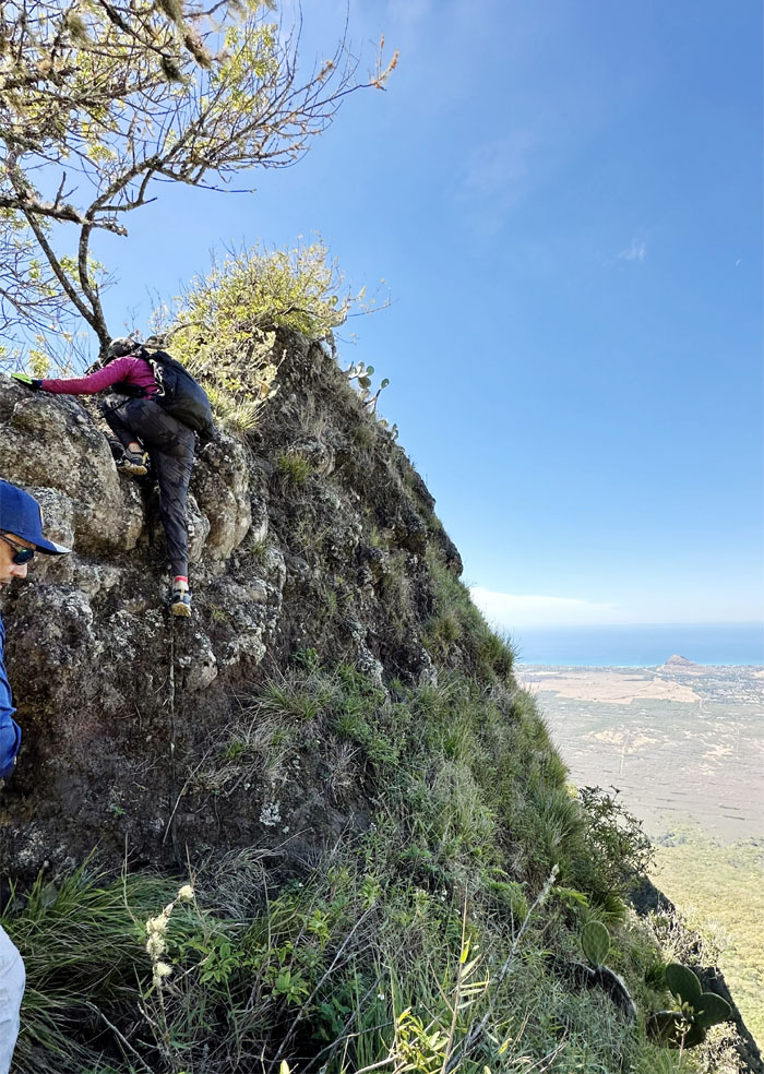
Aida climbing her way up back to the ridge line.
WST
Making our way down the slippery slope of pine needle covered rocks.
WST
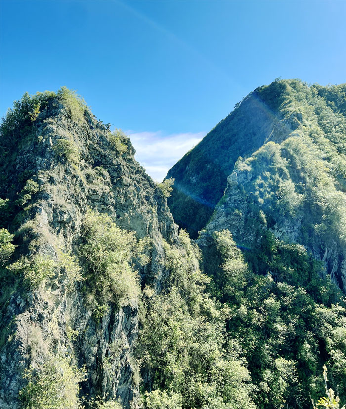
Robin and Tessa approaching the “Christmas Tree” that marks the nearby twin rock formations known as Gorilla Heads.
Gorilla Heads
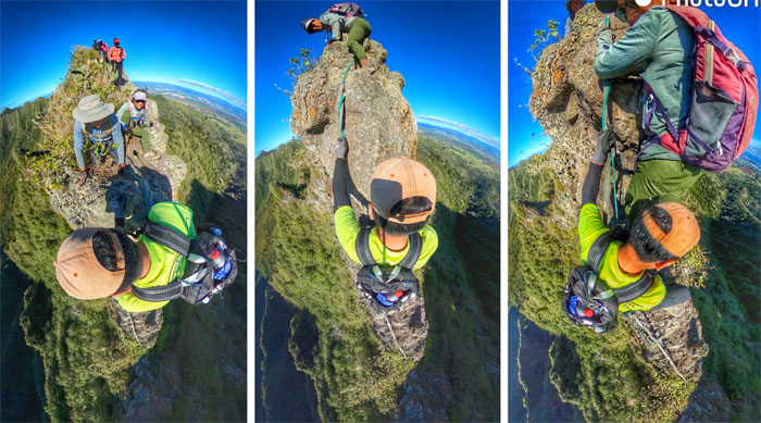
Making our way up the smaller Gorilla Head and the one that actually resembles its name from a certain angle.
Gorilla Heads
The rest of the group climbing up.
Gorilla Heads
Approaching the largest rock formation.
Gorilla Heads
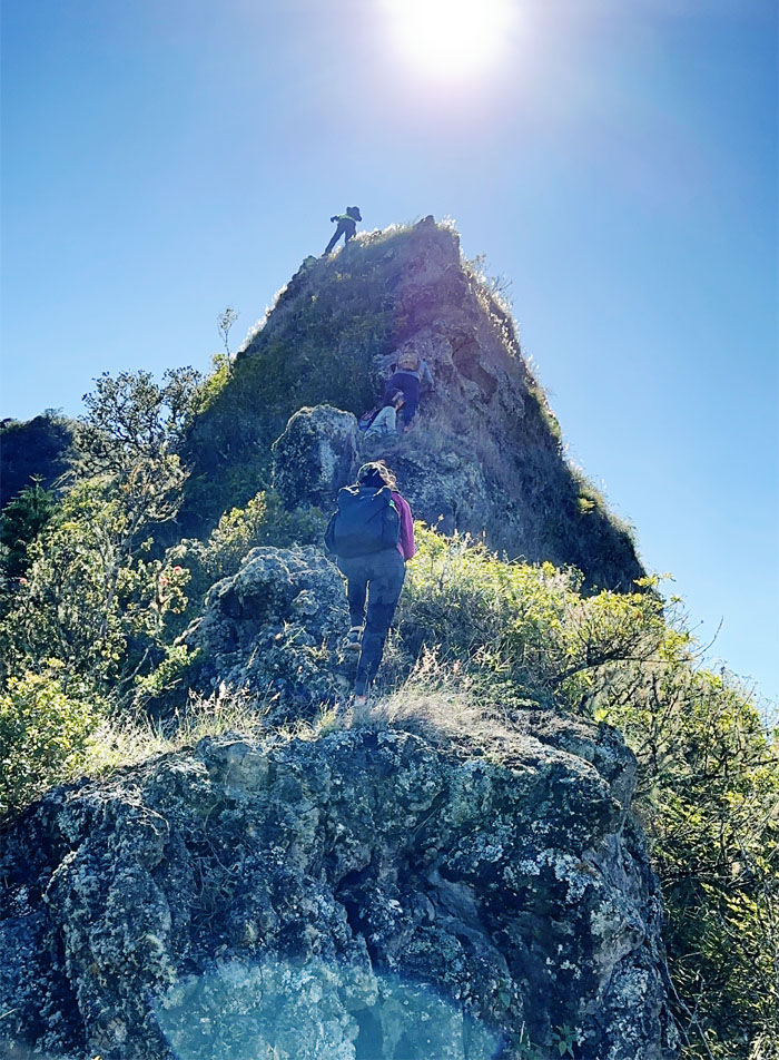
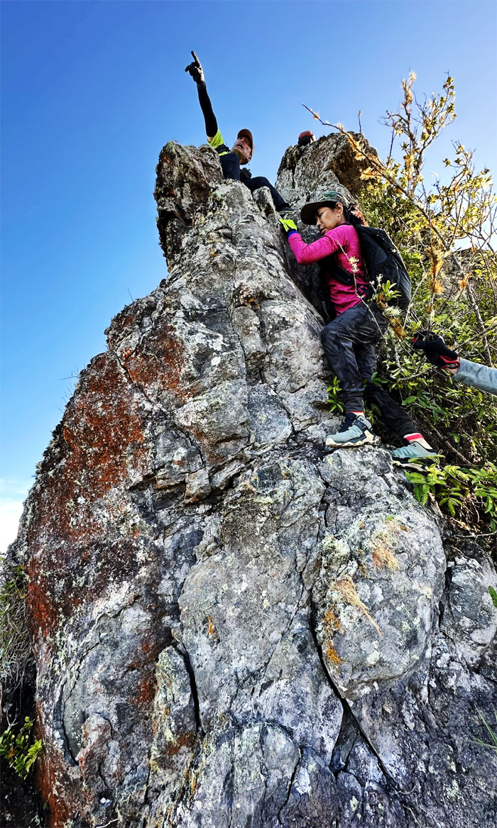
Climbing up the roughly 80′ plus hill.
Gorilla Heads
Jeremy making his way up to the top.
Gorilla Heads
Somebody said they didn’t know if it was harder going first or going last, either you wait at the top or at the bottom.
Gorilla Heads
Climbing down the backside and making our way around the boulder that interrupts a relatively smooth climb down.
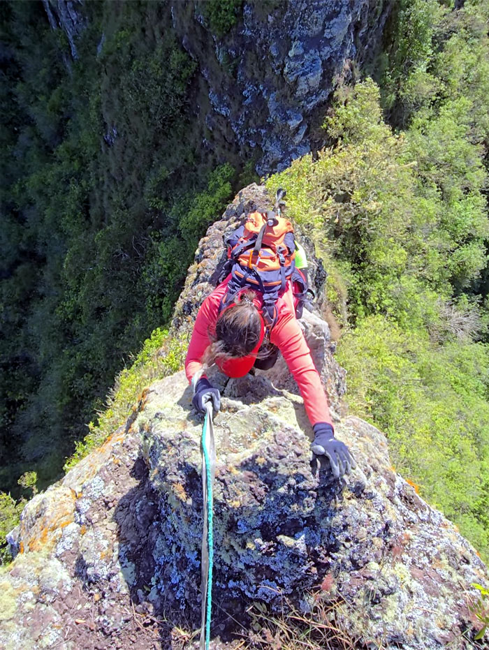
Gorilla Heads
Robin lowering herself down over the boulder.
Gorilla Heads
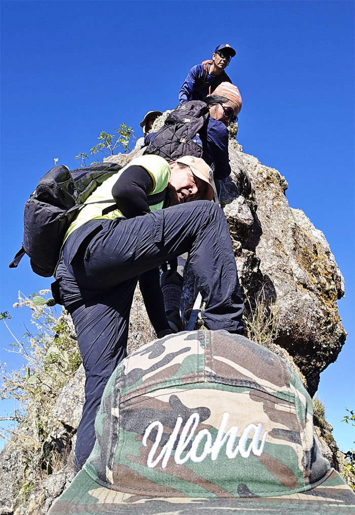
I think it’s spelled Aloha.
WST
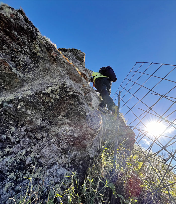
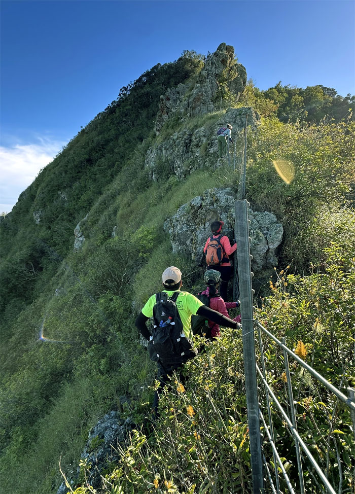
Climbing up and through the wobbly fence line.
WST
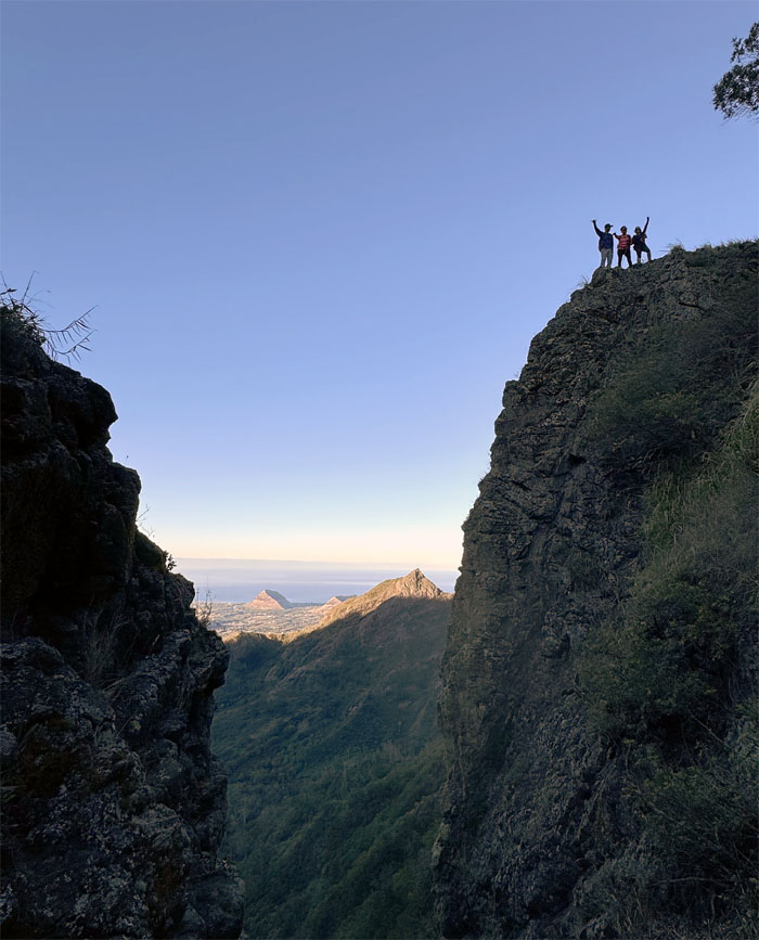
Looking back at the two “toothy” formations of the Gorilla Heads.
WST
Back on the fence line.
WST
The group making their way to the base of the last rock climb of the day.
WST
The bus is over there. Recycled joke.
WST
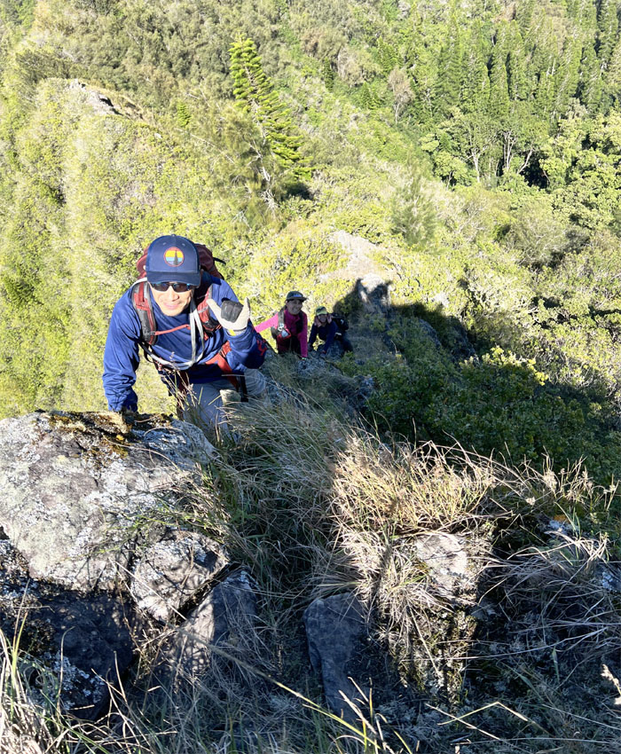
Jeremy scrambling over the top of the rocks.
WST
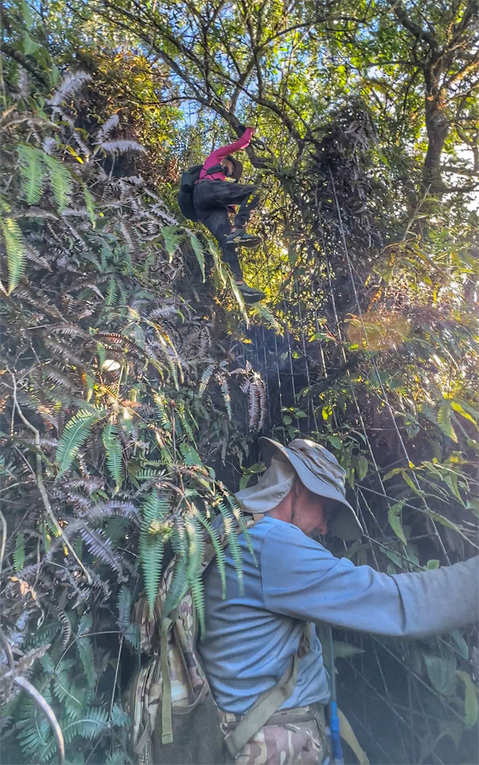
The tangled overgrowth was literally choking the trail as we went up and over the “ladder” fence.
Pu’u Kaua
Group photo at the island’s third highest peak. No time to check out the panoramic views from the overgrown grassy top. We had two hours of daylight left in the mountains.
Kaua Trail
Leaving the 3,127′ summit as we made our way down the trail.
Kaua Trail
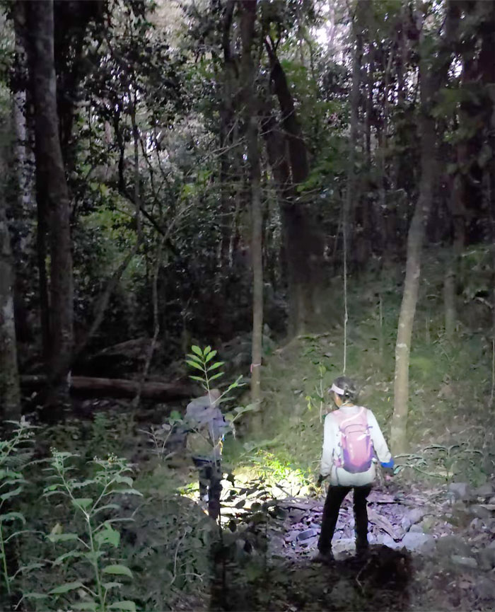
We got to the valley floor as darkness descended upon us.
Kaua Trail
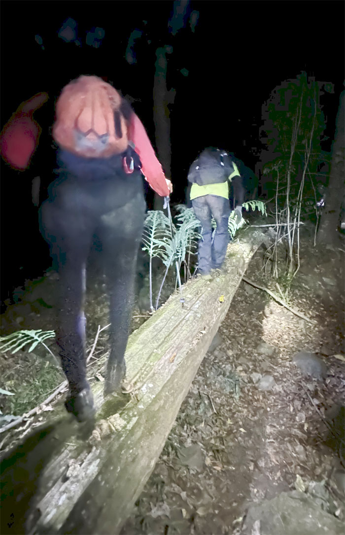
Following the trail out as we had to stumble through chicken cages in the dark and climbed over a makeshift fence. Found out later that the trail corridor had been re-routed.
All pau
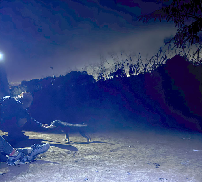
Waiting in the dark for Matt to pick us up as the neighbor’s dog kept us company and the owners even checked in on us and offered us food, water and a ride to the highway. Mahalo! No time to check out the farm today.
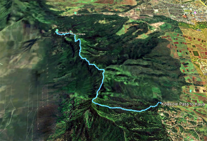
GPS Tracks
Our wild wild west hike covered a little over five miles with a fun group. Post hike meal at Alley Restaurant.
Photos taken by Aida Gordon, Akira Suzuki, Deborah Tom, Jeremy Cannone, Robin Farr, Tessa Bugay and yours truly. Not necessarily in order.
Note: I have been made aware that some hikers have been using my blog as a hiking guide and getting lost on the trails. Please note that this blog was made to document the hike for the crew(s) that did it. That is why some of my comments will seem to have no relevance or meaning to anybody outside of the crew(s) that hiked that trail. My blog was never meant as a hiking guide, so please do not treat it as such. If you find inspiration and entertainment from these hikes, that is more than enough. If you plan on replicating these hikes, do so in the knowledge that you should do your own research accordingly as trail conditions, access, legalities and so forth are constantly in flux. What was current today is most likely yesterdays news. Please be prepared to accept any risks and responsibilities on your own as you should know your own limitations, experience and abilities before you even set foot on a trail, as even the “simplest” or “easiest” of trails can present potential pitfalls for even the most “experienced” hikers. One should also always let somebody know of your hiking plans in case something doesn’t go as planned, better safe than sorry.
{ 2 comments… read them below or add one }
Another fun hike albeit more overgrown than when we did it 2 years ago! I kept hearing Akira say “so annoying ” and he meant the poking branches! Lol. Thanks for guiding is safely up and down Gorilla Heads.
Aloha Aida,
Yep always fun hiking on the west side.
Mahalo