
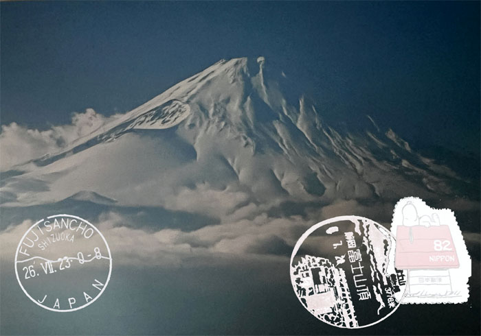
Out of the frying pan into the fire as we The COVID-19 germaphobe storm had settled since 2019, so it was time to hop on a plane and go back to the land of the rising sun to climb a mountain to catch the rising sun.
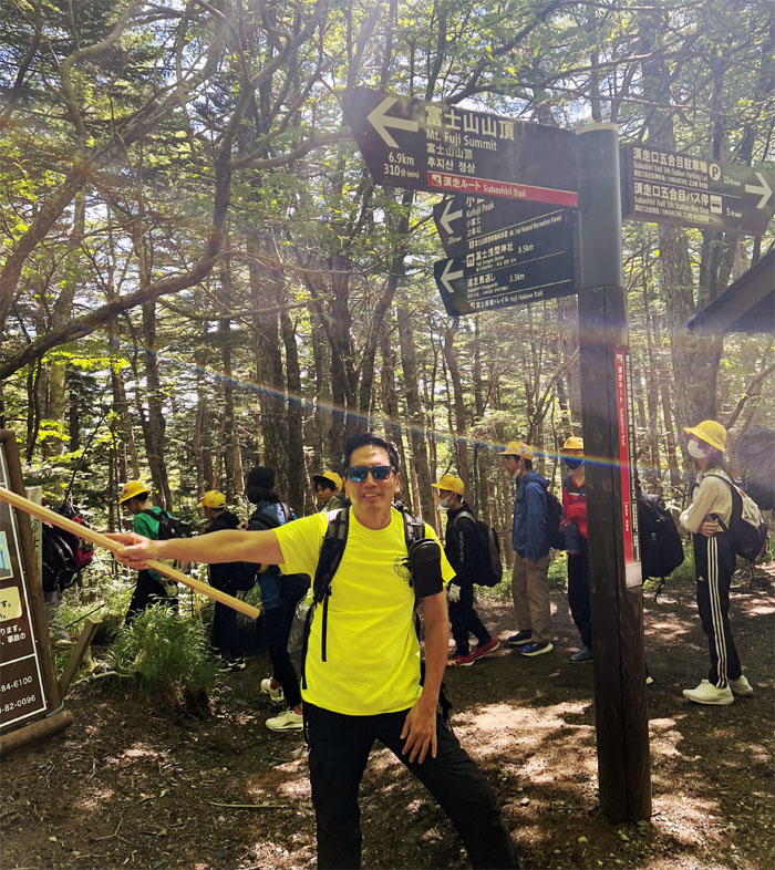
Subashiri Trail
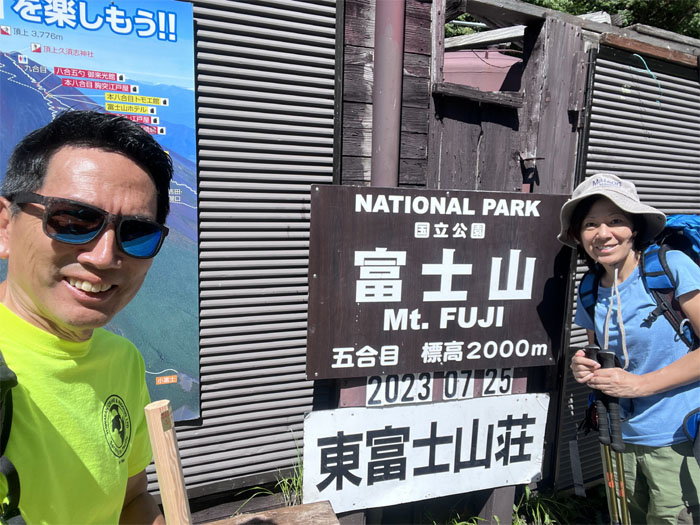
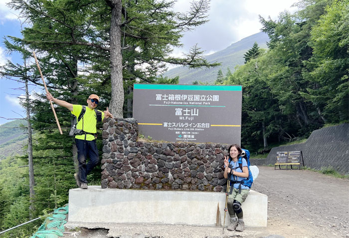
We got up early and left Shinjuku to catch the train to Gotemba where we caught the local bus that dropped us off to the fifth station. This was also the tenth year of Fuji being marked as a world heritage site, fitting as it was 10 years ago that we first stepped foot on this mountain rich in history.
Subashiri Trail
Bought a hiking stick and stuck around for a bit to acclimatize to the higher elevation at 6,561′. Saw a bunch of school kids stretching, somebody joined, from a distance.
Subashiri Trail
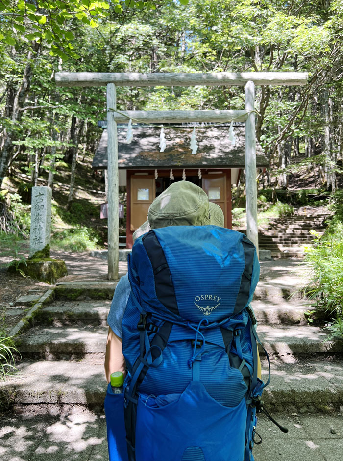
Praying for good fortune and weather on our hike.
Subashiri Trail
The initial part of the trail was nicely shaded, but the trees soon thinned out and the boiling sun blasted us while the lady in the back with the reflective umbrellas started looking smarter with every step.
Subashiri Trail
The trail was well marked with white ropes and gun metal chains.
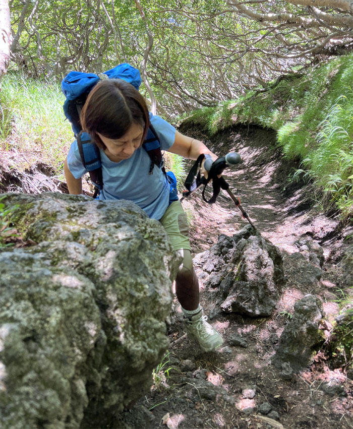
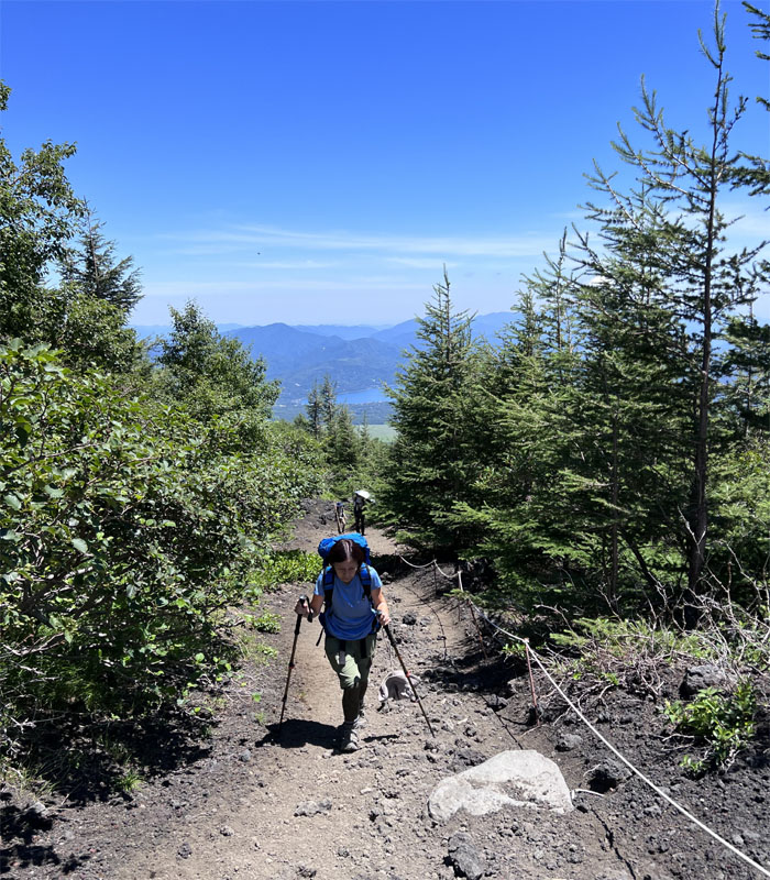
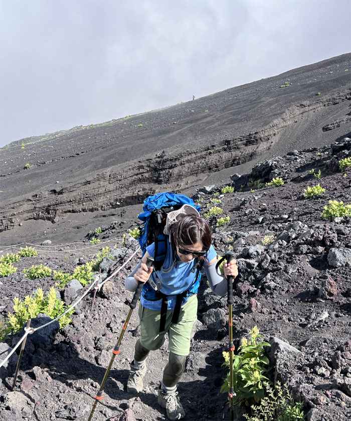
Subashiri Trail
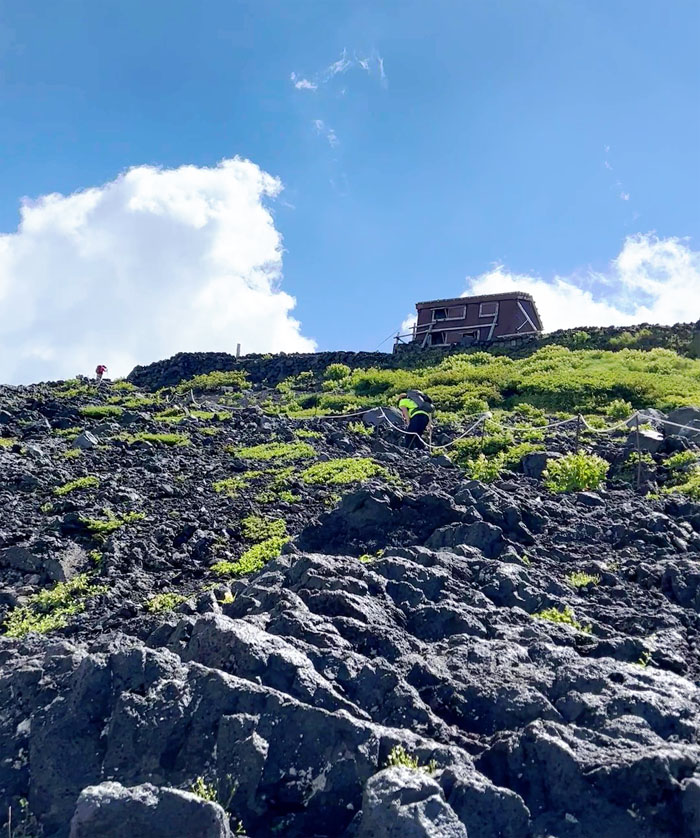
Mari coming up between and a rock and a hard place.
Osada-sanso
Our first hut on the trail and first yakiin (stamp) on my hiking stick. 300 Yen. Inflation.
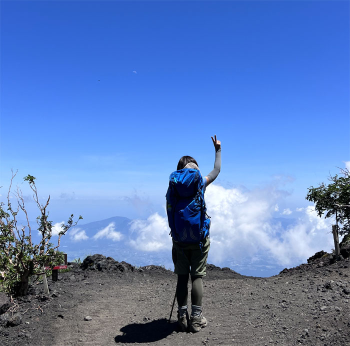
Subashiri Trail
Standing above the clouds.
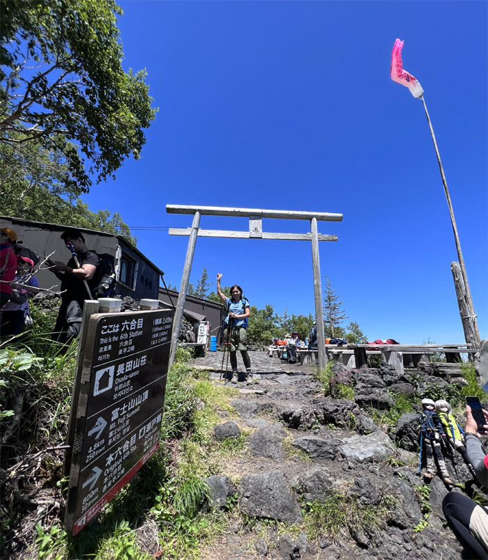
Seto-kan
Brief stop at the original sixth station where another group was staying for the night as the higher huts were already taken. Pays to plan ahead.
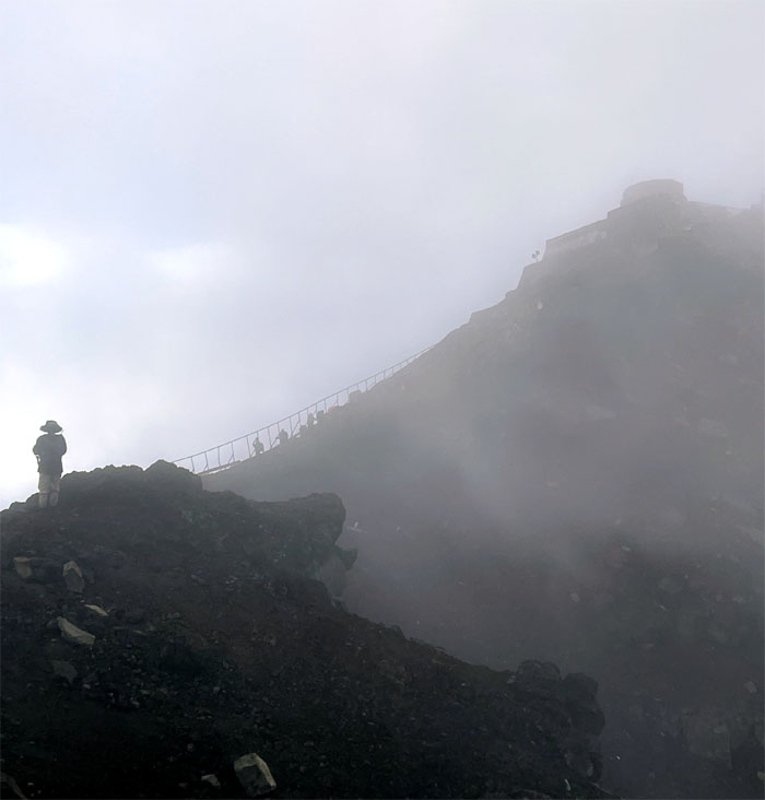
Subashiri Trail
The summit was strikingly clear as we continued on the trail. A good sign.
Subashiri Trail
Spoke too soon, as the clouds started to roll in.
Subashiri Trail
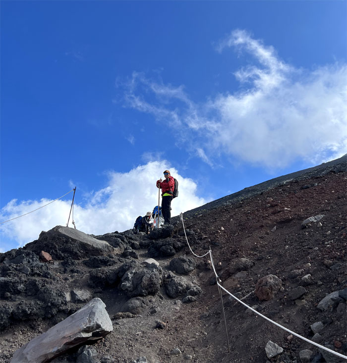
Climbing up to our next hut. No rest for the weary.
Taiyo-kan
Mari pushing her way up to the seventh station.
Taiyo-kan
Eating our anpan brunch at 10,137′ elevation. The outside temperature was still t-shirt wearable. Climate change is not always a bad thing.
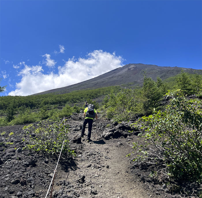
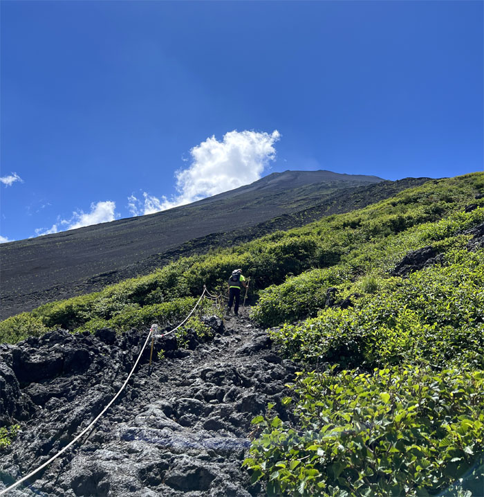
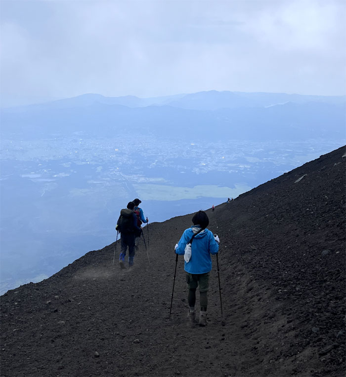
Subashiri Trail
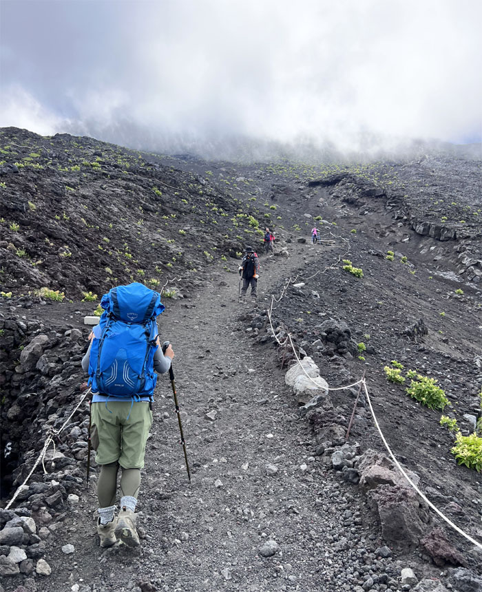
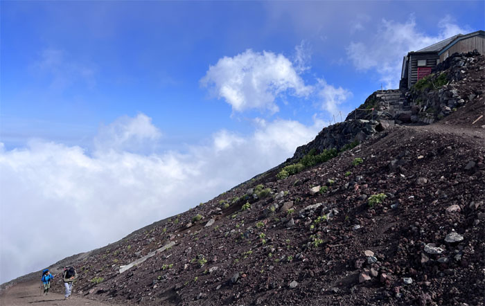
Back on the trail as the clouds rolled across the volcanic landscape.
Subashiri Trail
Going up the trail as another hiker descended down Yoshida trail in the background.
Miharashi-kan
The temperature dropped to 57 degrees as we started to slowly pick up more elevation. Time to add layers.
Subashiri Trail
Constantly playing tag on the trail.
Subashiri Trail
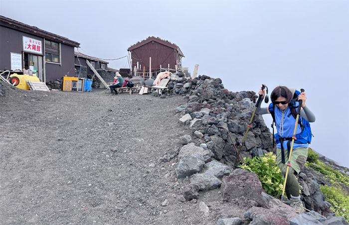
Is that the next hut?
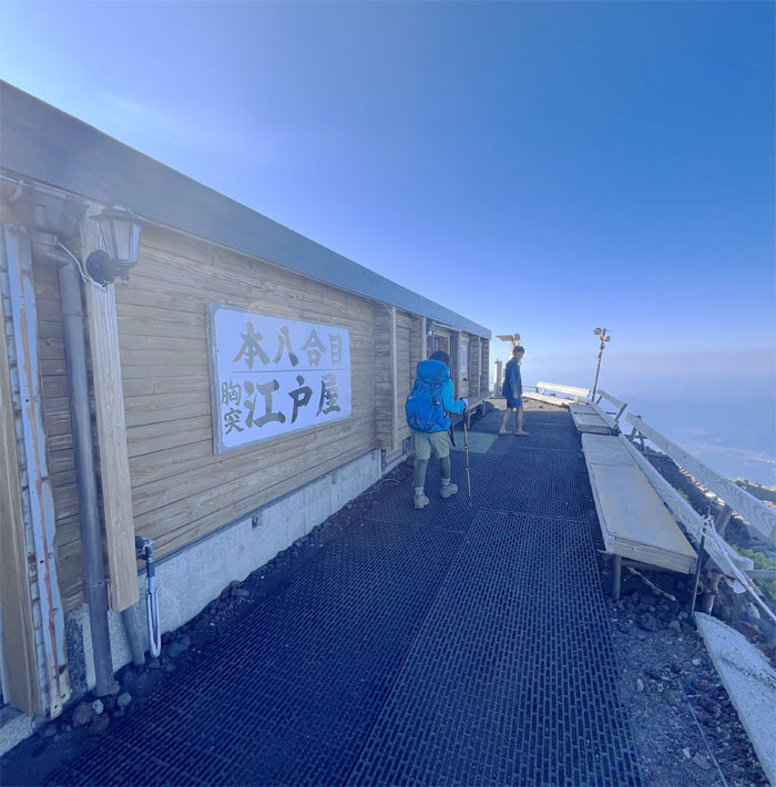
Shimoedoya
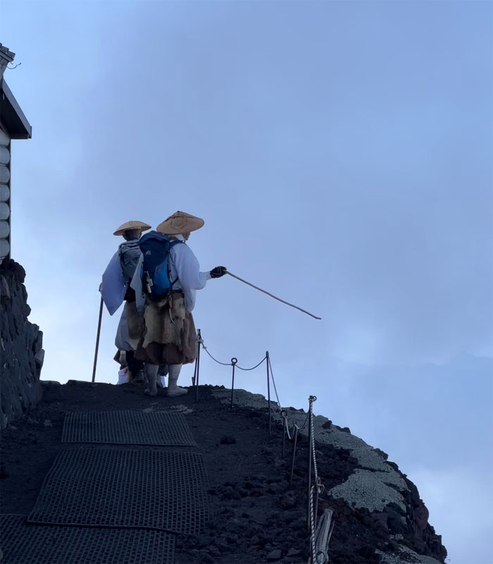
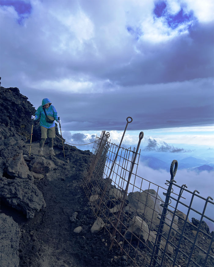
Monks on their way down passing the eighth hut which is all technically private property from the eighth hut up. I did not know that.
Subashiri Trail
Looking back at Lake Yamanaka and the surrounding areas.
Yoshida Trail
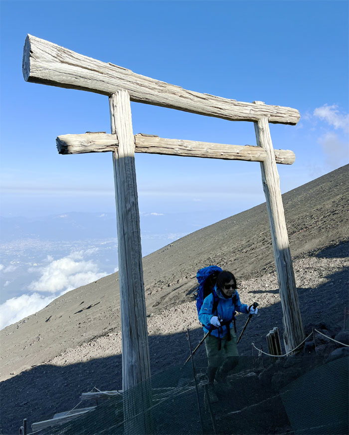
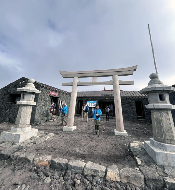
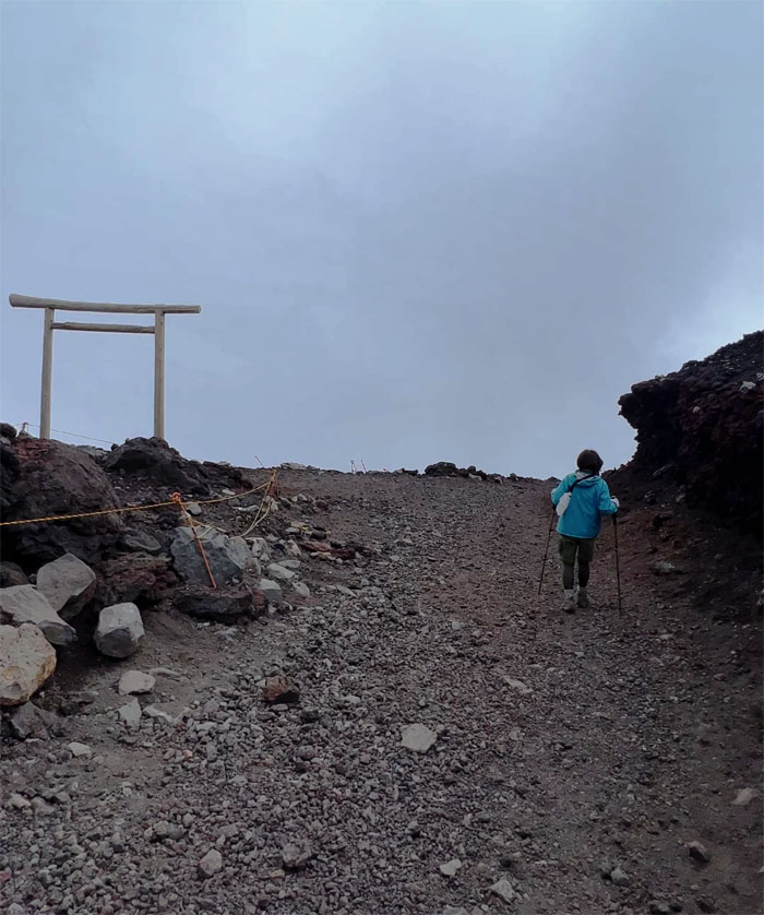
Mari passing through the traditional Shinto gate which marks the transition from the mundane to sacred ground.
Ue-edoya
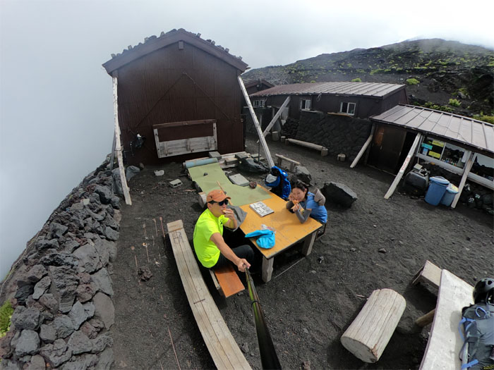
Hut sweet hut for the night. What? No private rooms! False advertising.
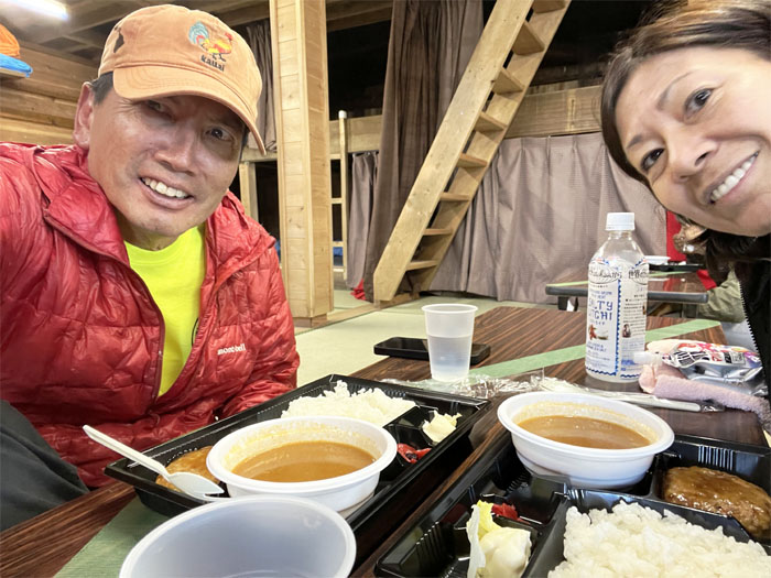
Ue-edoya
Enjoying our 4:30pm dinner of curry, hamburger, vegetables, rice and a cup of water. What? No hot tea?
Ue-edoya
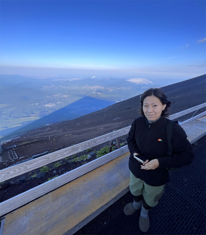
We stepped out in the now cold air to catch a glimpse of kage Fuji, or the shadow of Fuji as the sun passed over the volcanic mountain.
Ue-edoya
Day 2
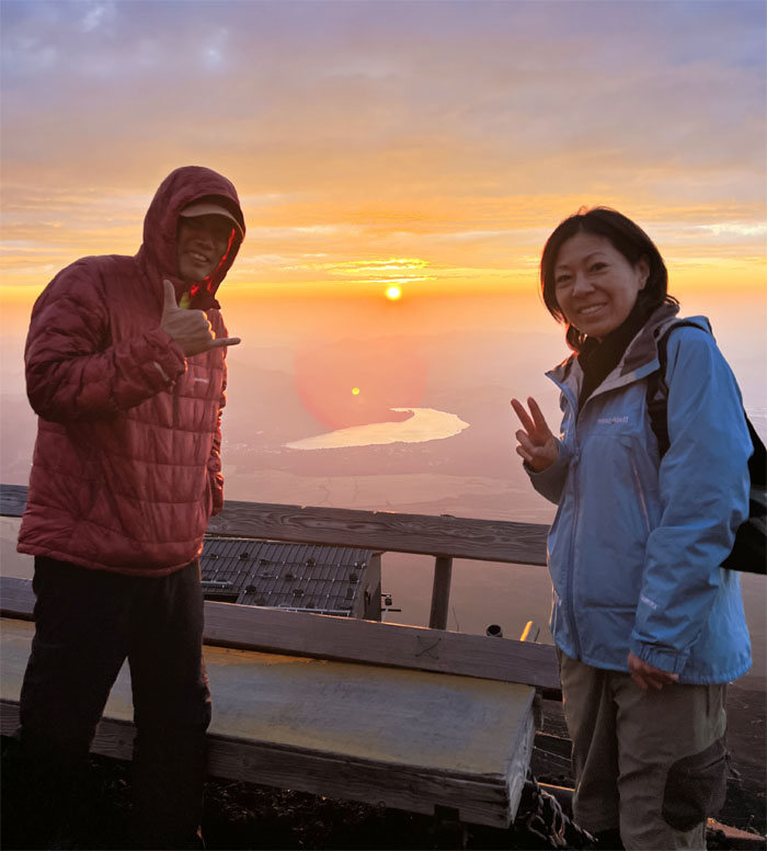
We decided to sleep in and leave the early risers at 1am to get stuck in gridlock traffic going up to the summit. It’s almost like Everest, without the bitter and freezing cold. Instead, we woke up at 4am and still caught the breaking mountain sunrise.
Goraiko-kan
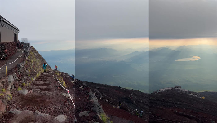
Approaching the 8.5 hut with the breaking sun at our back.
Yoshida Trail
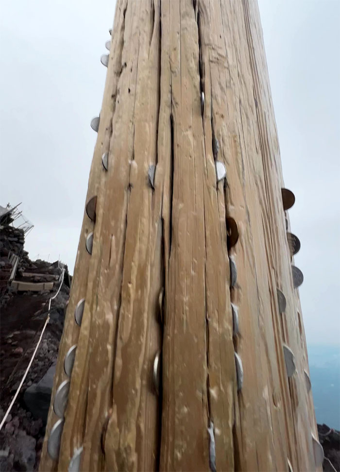
There were no water fountains on the mountain, so let’s stick some coins in the torii base and wish for luck with the views.
Kyugome
Passing through the shuttered 9th hut.
Yoshida Trail
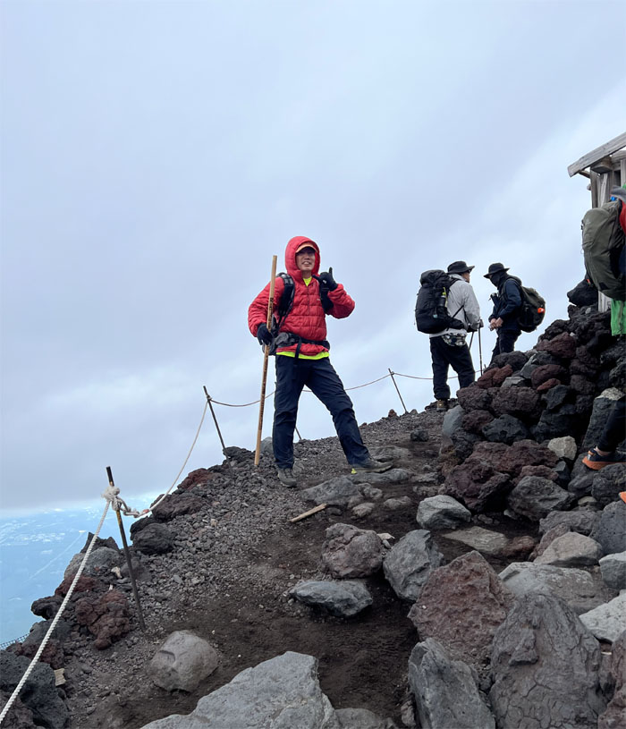
Light sprinkles as we approached the top, didn’t put a damper on our spirits.
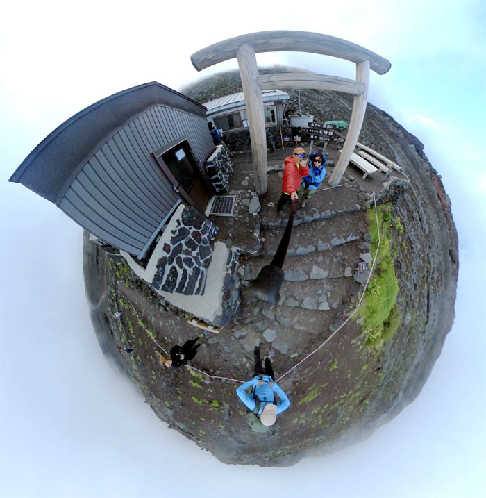
Mt. Fuji Summit
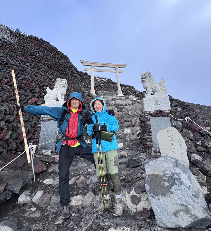
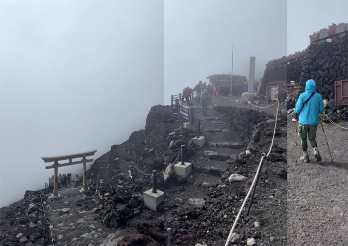
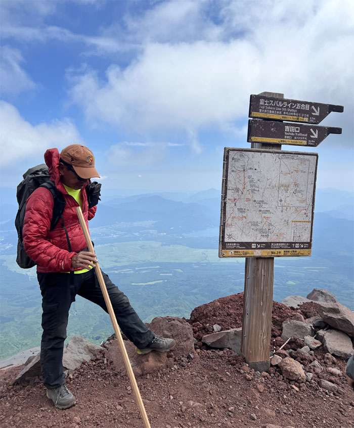
Standing in front of the Kusushi shrine, which is the terminus for the Yoshida, Subashiri, and Kawaguchiko trails.
Ohachimeguri Trail
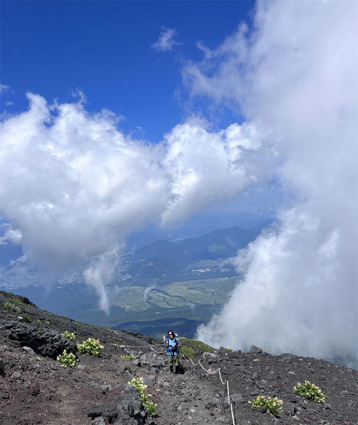
The weather was good so we decided to make the pilgrimage around the crater which is marked by eight sacred peaks known as Ken-ga-mine, Hakusan-dake, Kusushi-ga-take, Johju-dake, Asahi-dake, Koma-ga-take, and Mishima-ga-take.
Ohachimeguri Trail
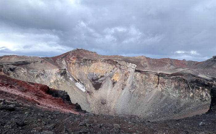
Looking down into the crater of the still active Mount Fuji. The prospect of the volcano erupting has been high on people’s radars due to the Great East Japan Earthquake of March 11, 2011 that resulted in cracks appearing on the roof of the magma reservoir. The last recorded eruption was in 1707, a modern eruption would severely impact the infrastructure of Tokyo and beyond.
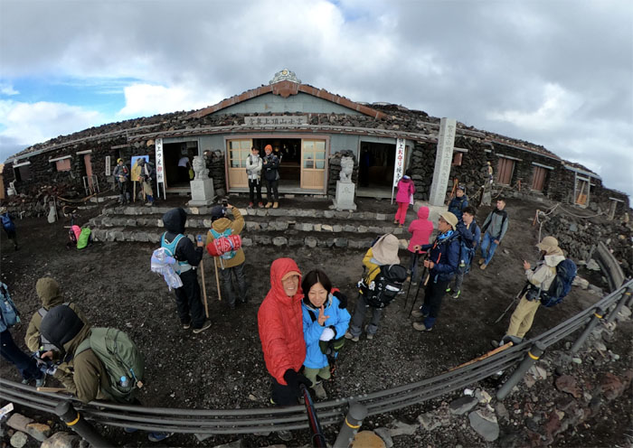
Kusushi Shrine
We dropped off postcards at the highest post office in Japan and paid our respects at the highest shrine in Japan, Okumiya shrine which is the terminus for the Fujinomiya trail.
Kusushi Shrine
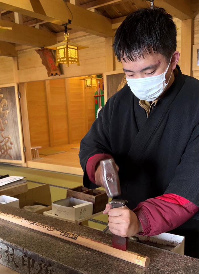
Getting my last stamp on my hiking stick. 500 Yen please. I guess the price rises with the elevation.
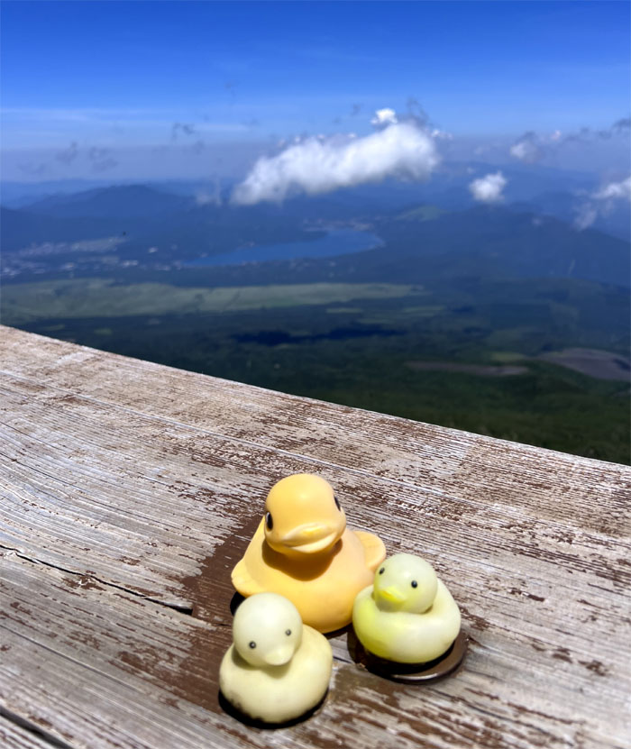
Ohachimeguri Trail
Looking ahead to the cloud wrapped peak known as Ken-ga-mine, which is the highest point on Mount Fuji at 3,776 meters.
Ohachimeguri Trail
Fighting gravity as we went up the slippery slope.
Kengamine Peak
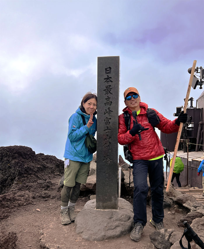
The actual highest peak of Fuji at 12,389′ elevation.
Ohachimeguri Trail
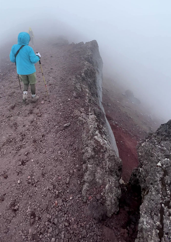
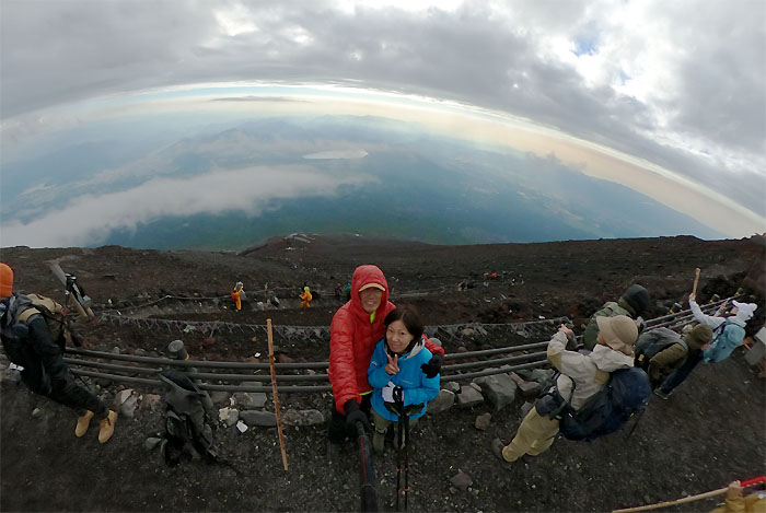
Traversing the Summit Crater Loop that was mostly cloaked in clouds.
Mt. Fuji Summit
Back to where we had started.
Mt. Fuji Summit
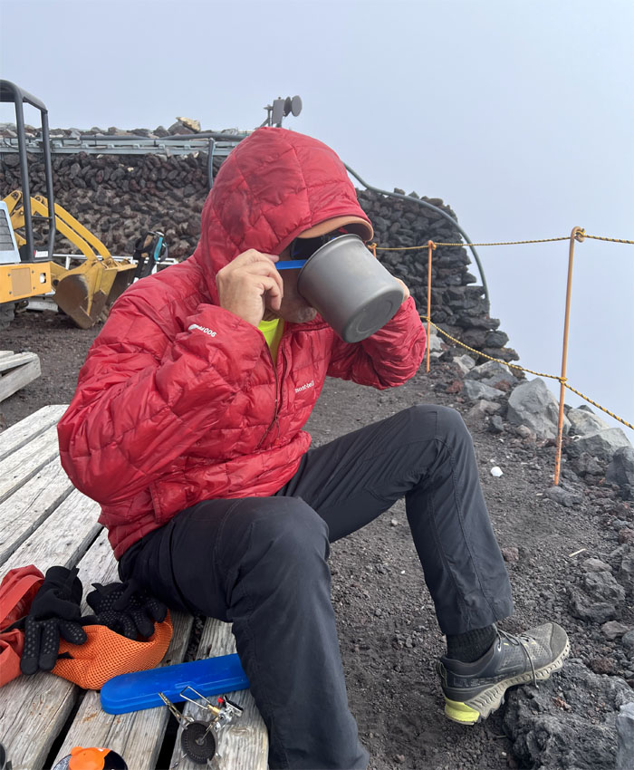
Why pay for overpriced miso soup when you can make your own? Exactly.
Mt. Fuji Summit
Last picture of the picturesque landscape below us as we left the summit.
Yoshida Trail
Passing the torii that marked Fujinomiya trail.
Yoshida Trail
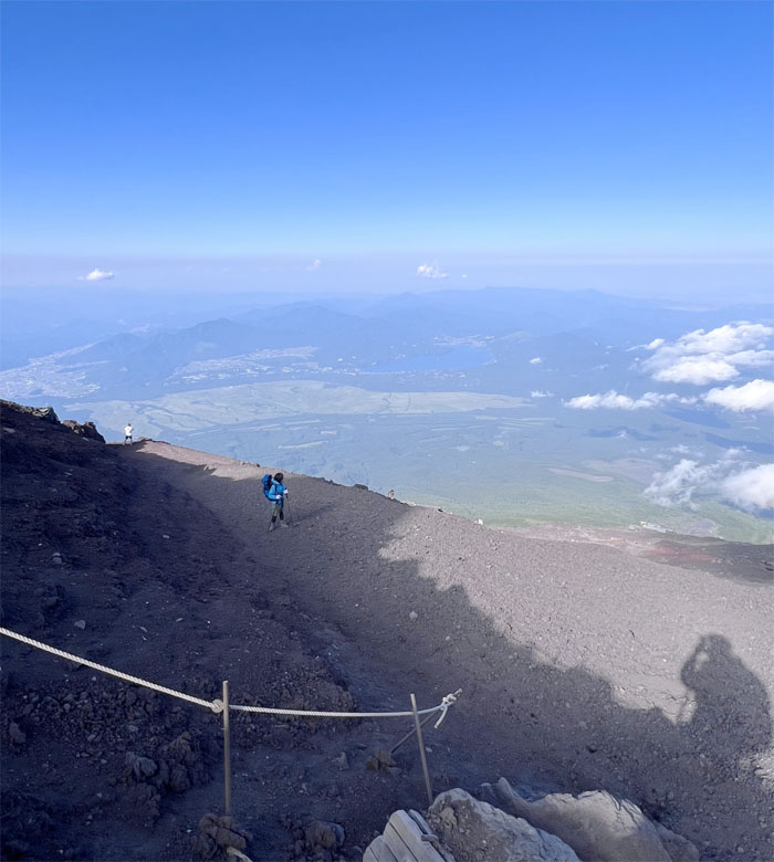
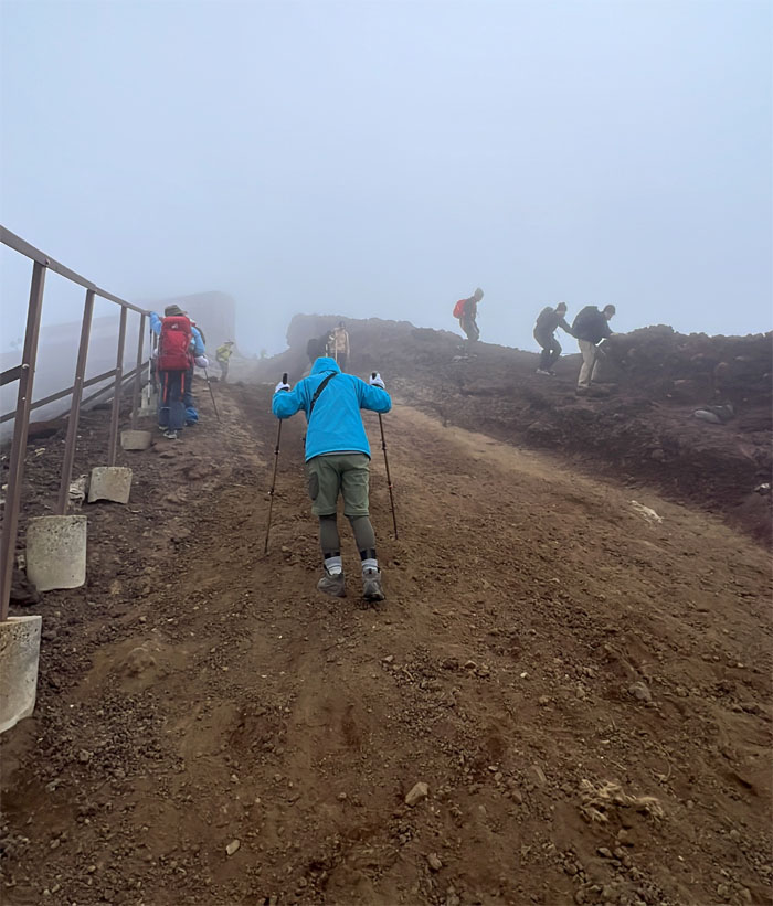
Going down the trail of volcanic rock, gravel and loose dirt.
Yoshida Trail
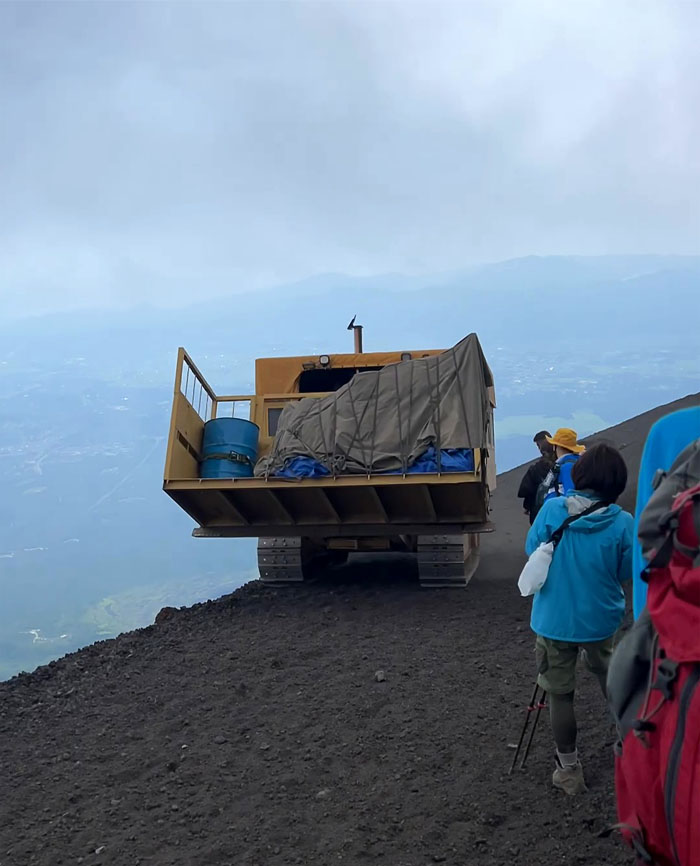
Yielding to tractors going up the trail with supplies for the huts.
Yoshida Trail
How many more switchbacks?
Yoshida Trail
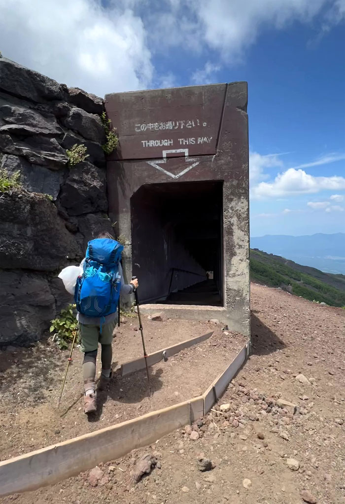
Passing through a series of tunnels designed to make up for the lack of hard hats.
Yoshida Trail
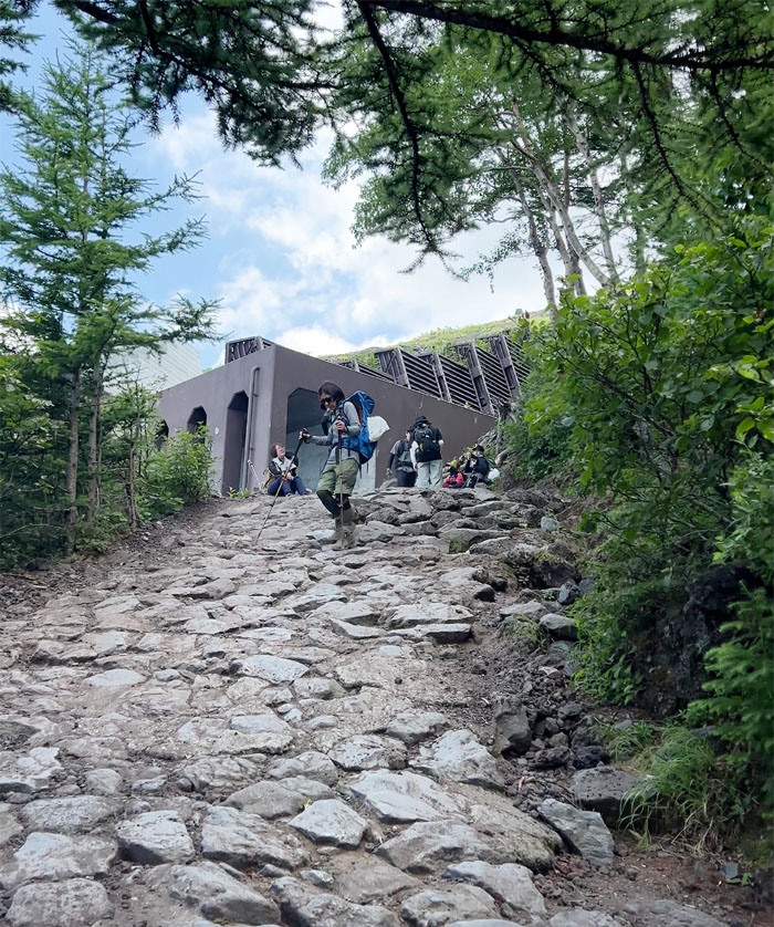
Mari coming down the stone cobbled trail where we soon passed horses waiting for paying passengers and other hikers making their way up.
Yoshida Trail
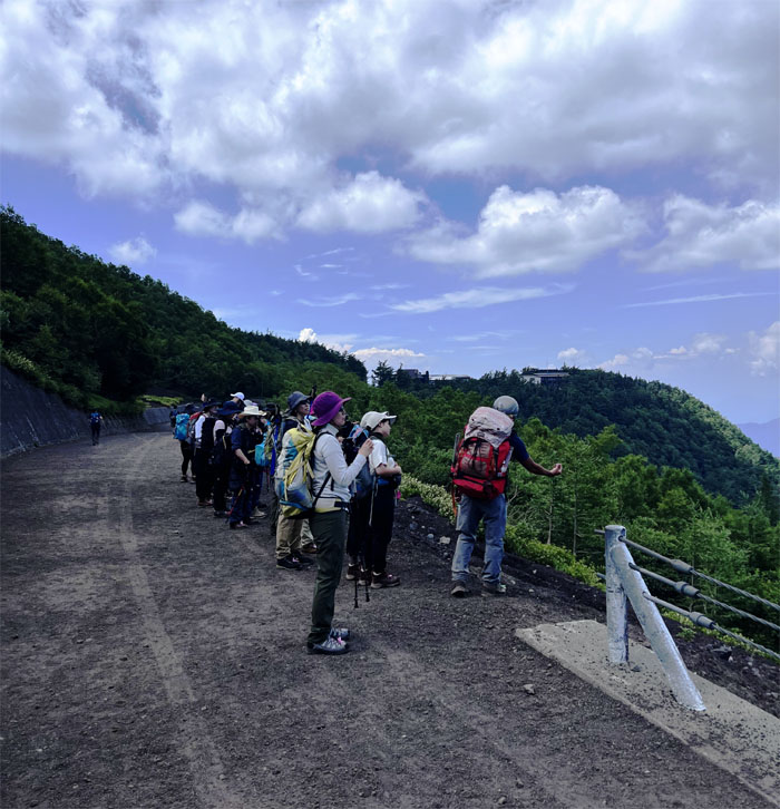
Passing one of multiple tour groups comprised of domestic and international hikers.
Fuji-Subaru 5th Station
Stand or sit at the finish line.
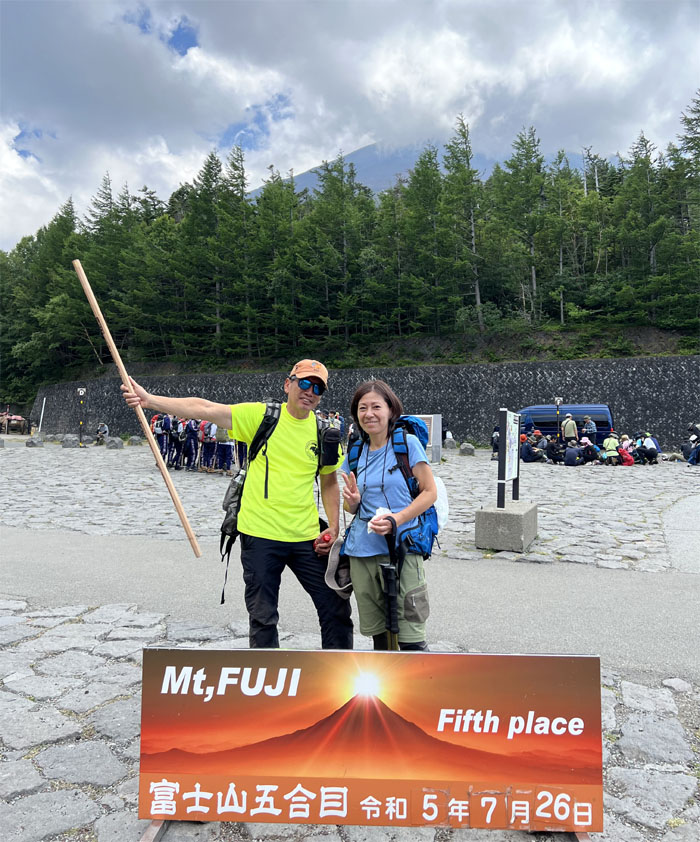
All pau
I guess being in fifth place is better than last place.
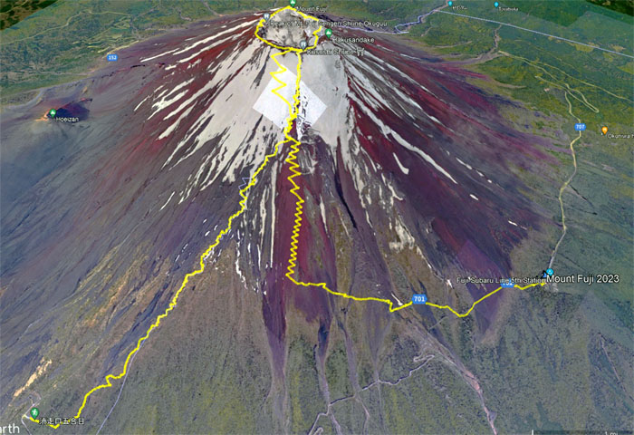
GPS Tracks
Our seventh trek up to Fuji-san covered a little over 11 miles that was blessed for the most part with good weather and spectacular views.
Note: I have been made aware that some hikers have been using my blog as a hiking guide and getting lost on the trails. Please note that this blog was made to document the hike for the crew(s) that did it. That is why some of my comments will seem to have no relevance or meaning to anybody outside of the crew(s) that hiked that trail. My blog was never meant as a hiking guide, so please do not treat it as such. If you find inspiration and entertainment from these hikes, that is more than enough. If you plan on replicating these hikes, do so in the knowledge that you should do your own research accordingly as trail conditions, access, legalities and so forth are constantly in flux. What was current today is most likely yesterdays news. Please be prepared to accept any risks and responsibilities on your own as you should know your own limitations, experience and abilities before you even set foot on a trail, as even the “simplest” or “easiest” of trails can present potential pitfalls for even the most “experienced” hikers. One should also always let somebody know of your hiking plans in case something doesn’t go as planned, better safe than sorry.
{ 0 comments… add one now }