
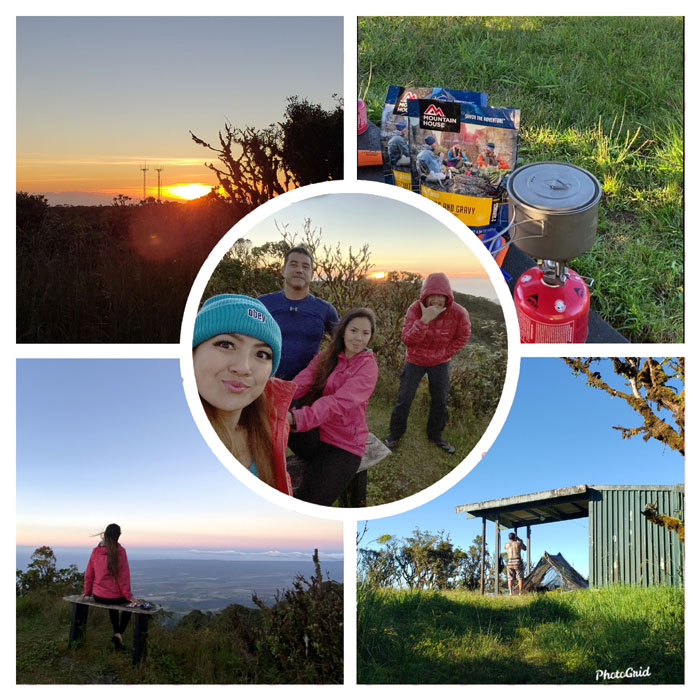
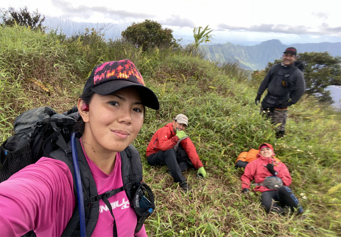
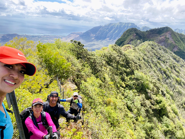
I joined a different team this weekend to tackle the other mountain range on the island, the Waianae Summit Trail. Thanks to Mike for dropping Analyn, Bill, Shirley and myself off under the bright lights of the Kaena Point Satellite Tracking Station to start our late evening hike. Team BASK.
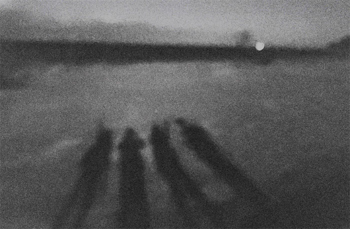
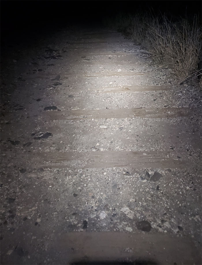
Kaena Point
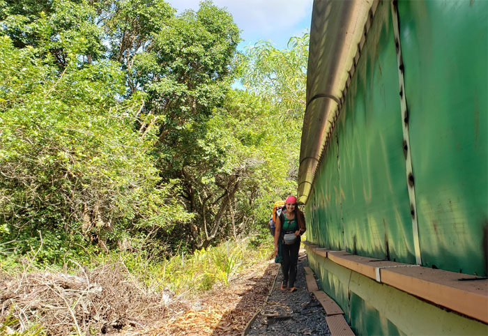
Walking on the remnants of the railroad tracks where only our shadows kept us company.
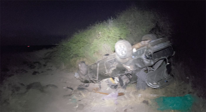
Kaena Point
I guess we should have gotten a 4×4. Whose name was on the rental contract?
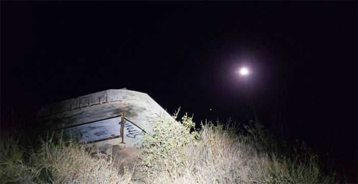
Kaena Point
Passing one of several WW2 pillboxes on our way up the grassy and rocky ridge line that was under lunar illumination.
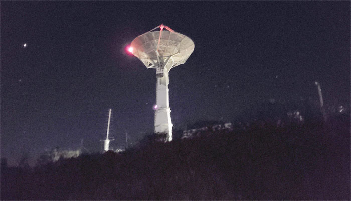
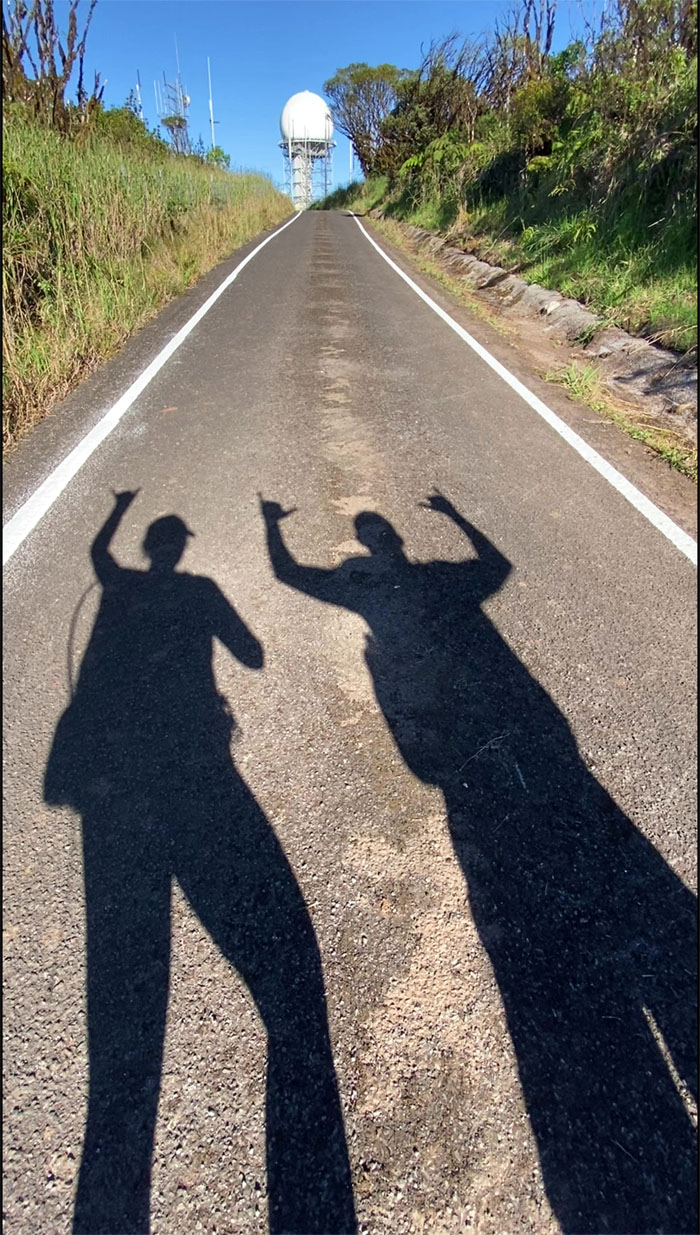
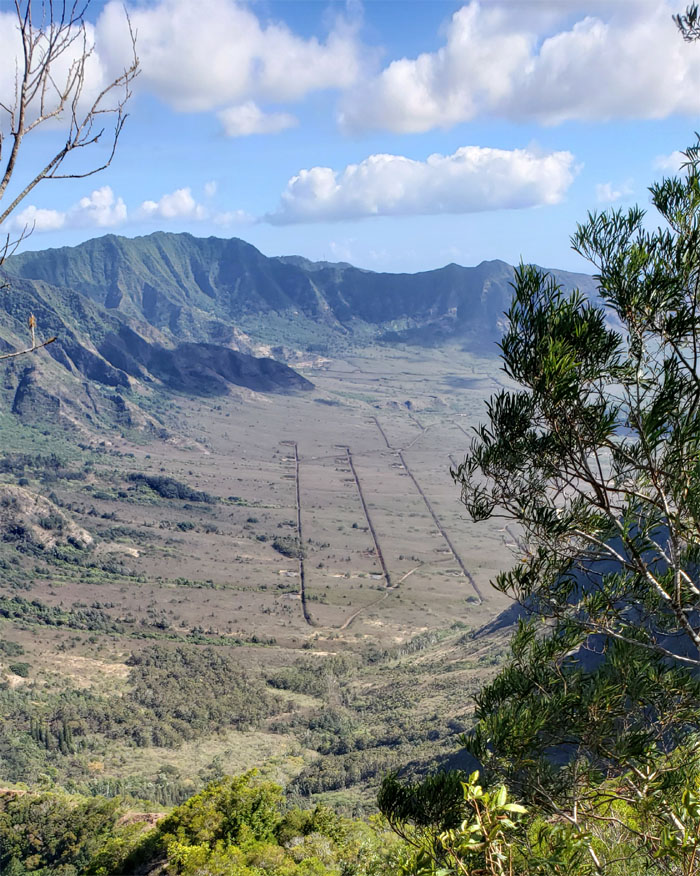
Kaena Point Tracking Station
Approaching the military installation that dominates the landscape of the 1,500′ ridge line.
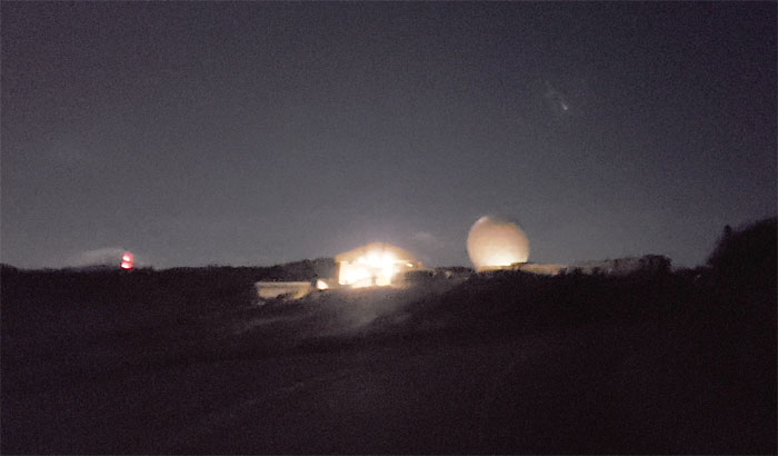
Kaena Point Tracking Station
Somebody wanted to shed more light on themselves and bring unwanted attention to ourselves. Talks of hiking in the dark to our destination soon became a distant memory as we set up camp at the BSA shelter. Bill and Shirley shared a tent, while Analyn and I shared the picnic table.
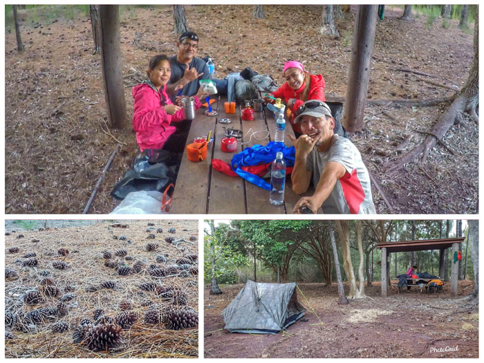
BSA Shelter
We woke up the next day, broke down the tent, cleaned off the table and had breakfast.
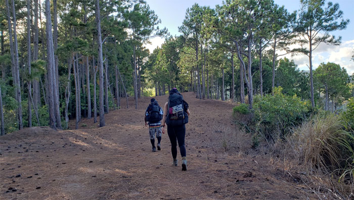
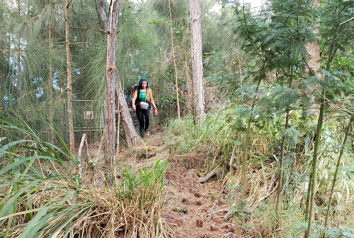
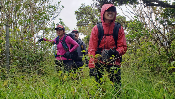
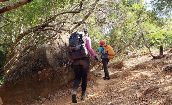
Kuaokala Trail
Hiking the wide tree lined corridor that was strewn with pine cones and needles.
Kuaokala Trail
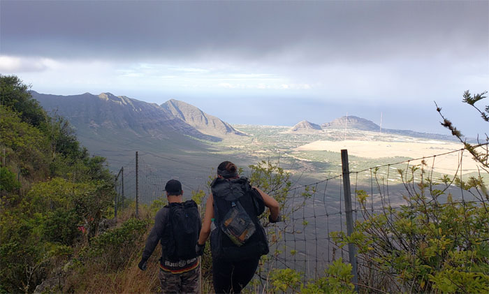
Making our way through the barren and rocky terrain where views of Makua Valley greeted us.
Kuaokala Trail
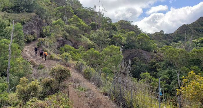
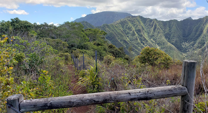
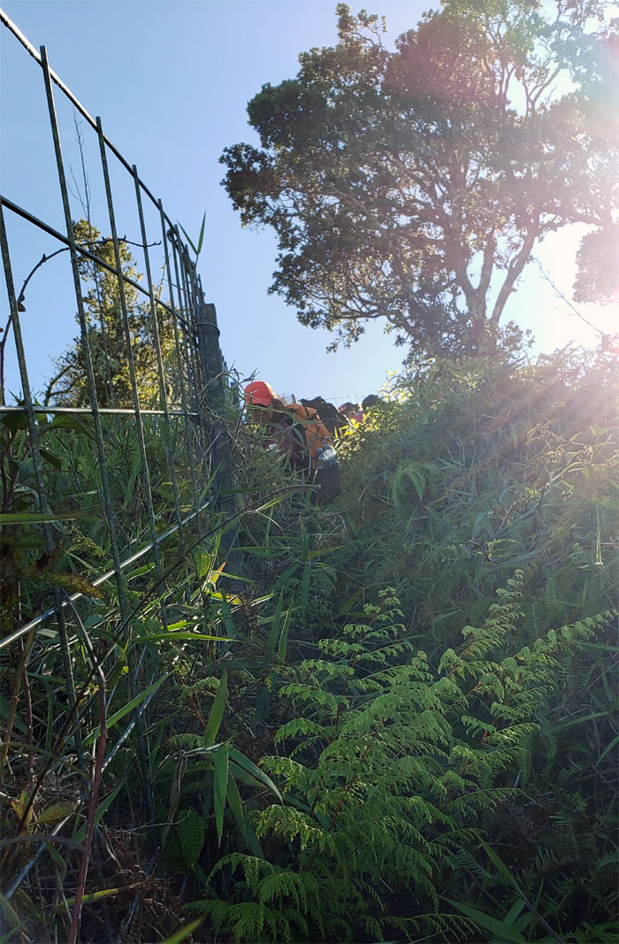
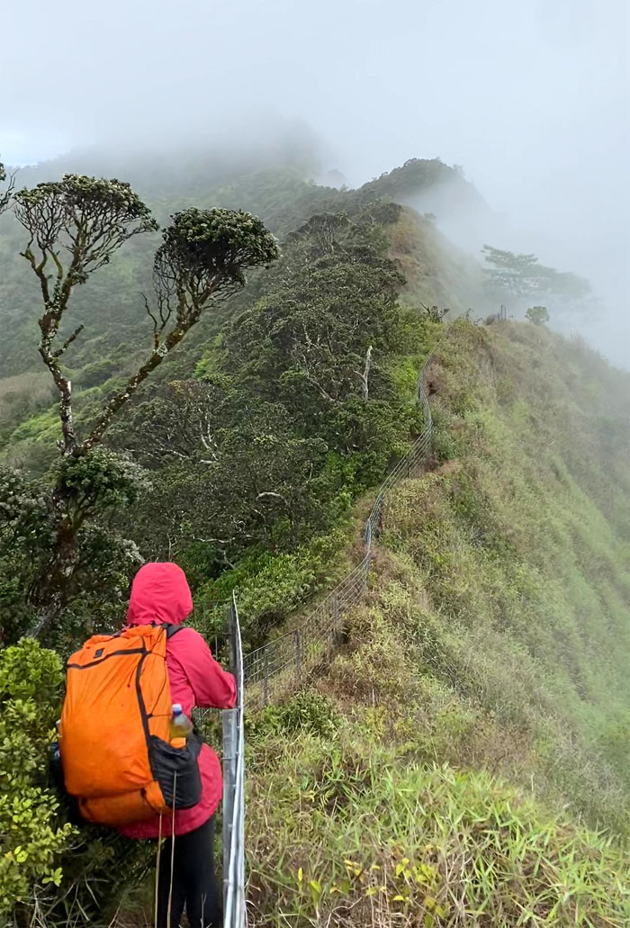
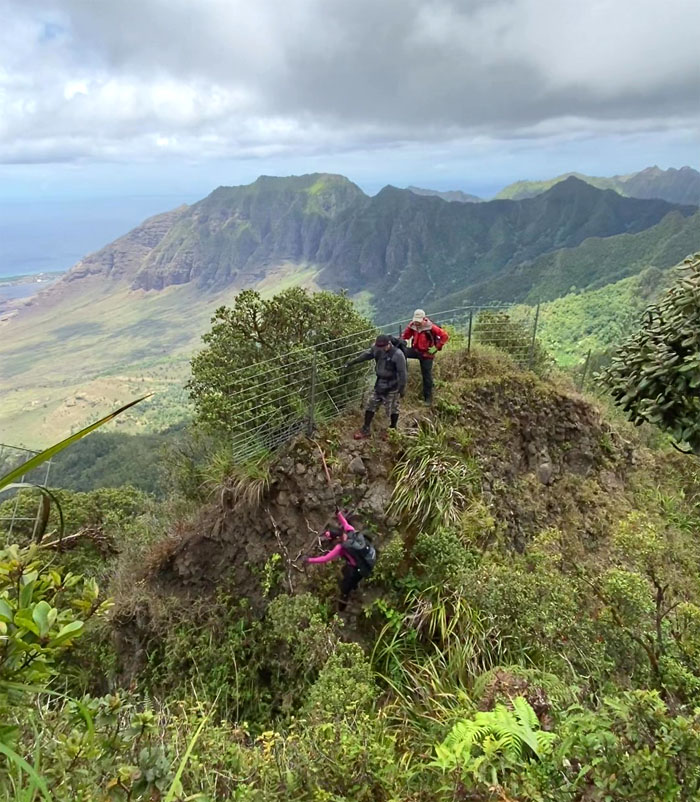
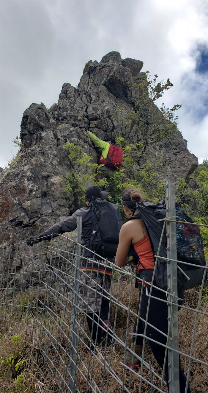
First contact with the fence line that is sprawled over the mountain range.
Kuaokala Trail
We followed the fence line down for a bit before it spit us back onto the trail.
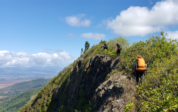
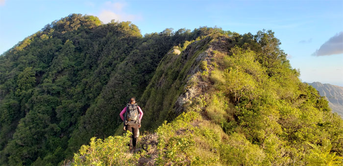
Waianae Summit Trail (WST)
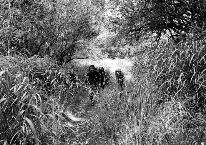
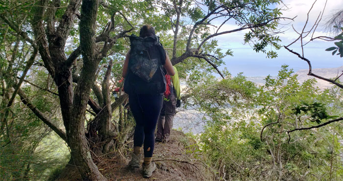
Leaving the well trodden trail for the overgrown one.
WST
We snacked on lilikoi passion fruit before trudging back up the road.
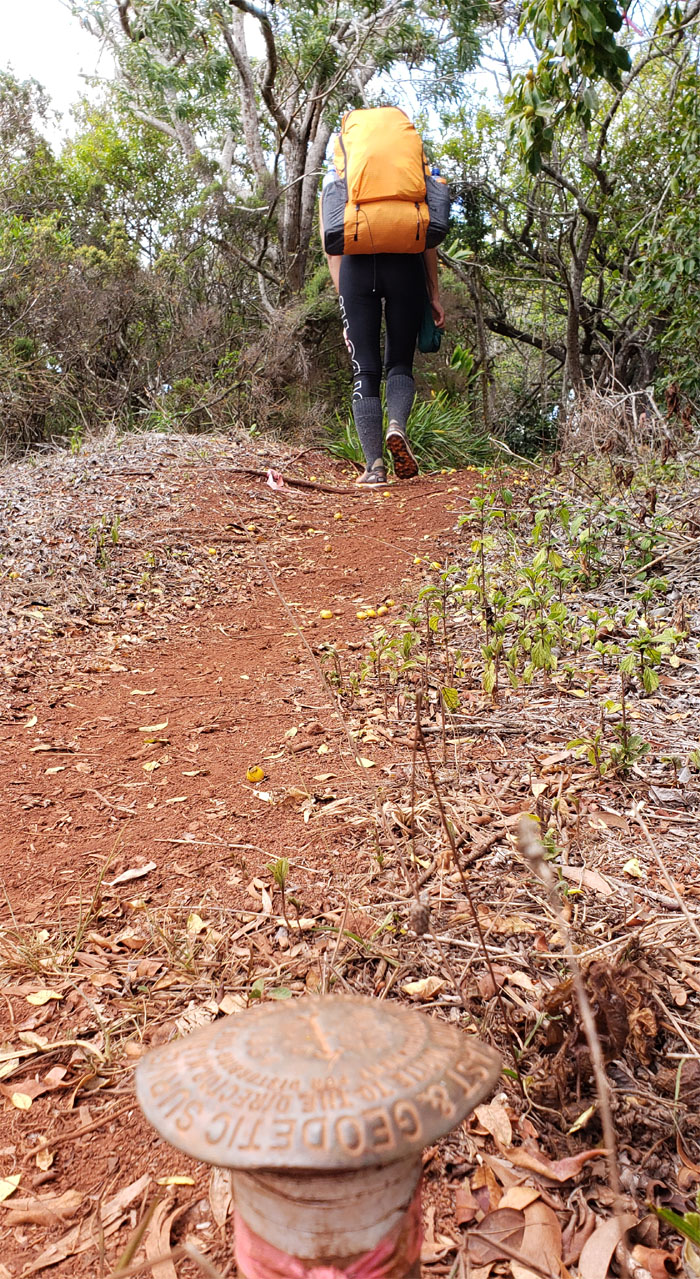
Moku
Turned a right at the geodic marker to pick up the trail.
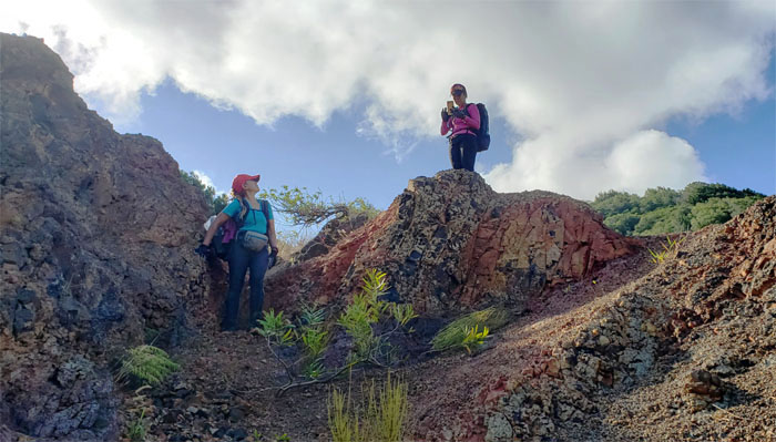
Pahole NAR
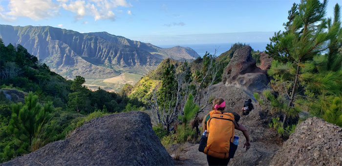
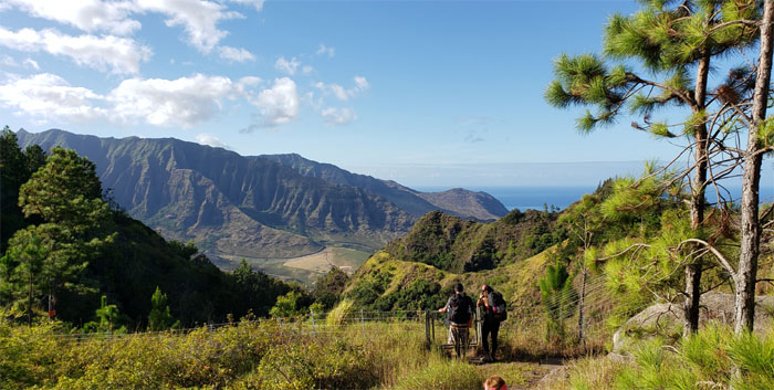
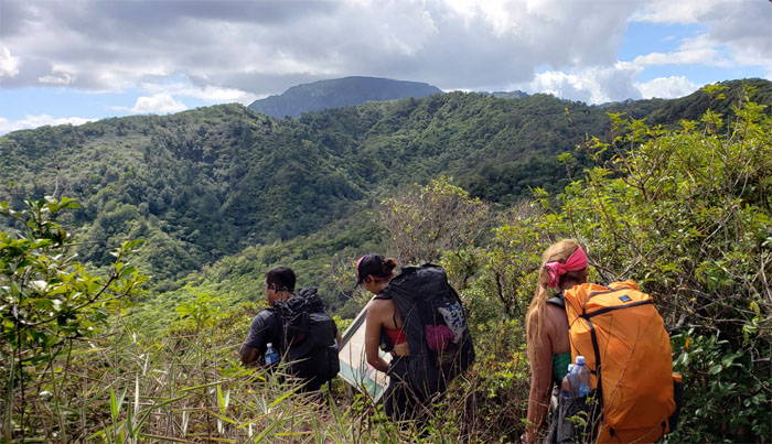
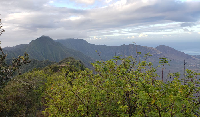
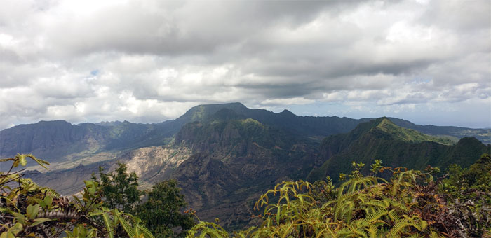
Entering the 685 acres of protected ecosystems that are home to native fauna and flora. Mount Ka’ala looked so close, yet so far.
WST
Seeking scant shade from the blistering sun.
WST
Fences for daze.
Mokuleia Trail
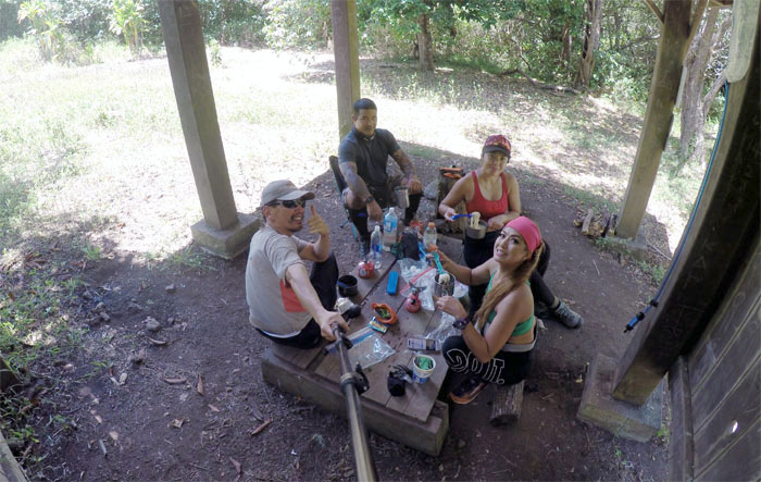
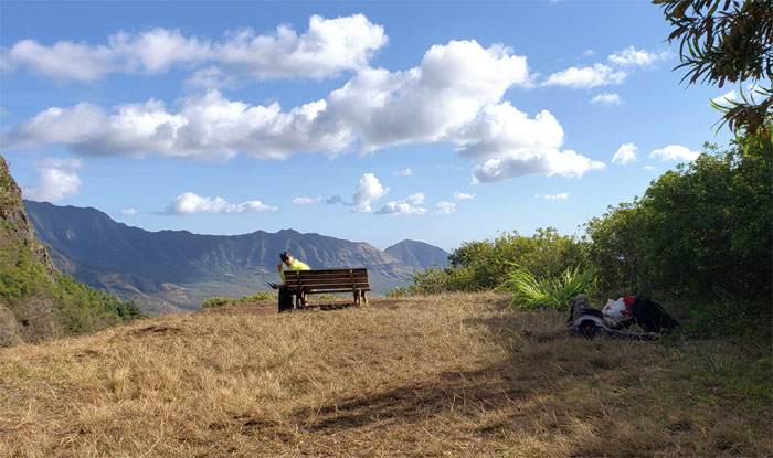
We dropped down to the shelter to have our lunch and top off our water. Slim pickings for the oranges and avocados. Who the hell brings a chair to a hike? A comfortable person that’s who.
WST
Back to hiking under the hot sun.
WST
Giving our hands a workout as we went up and down the fenced hills.
WST
Approaching the summit where a shin high metal stake caught a couple of us on the way up. Ouch!
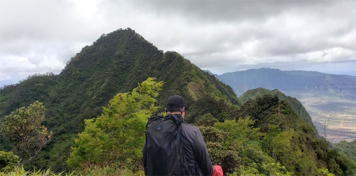
Three Corners
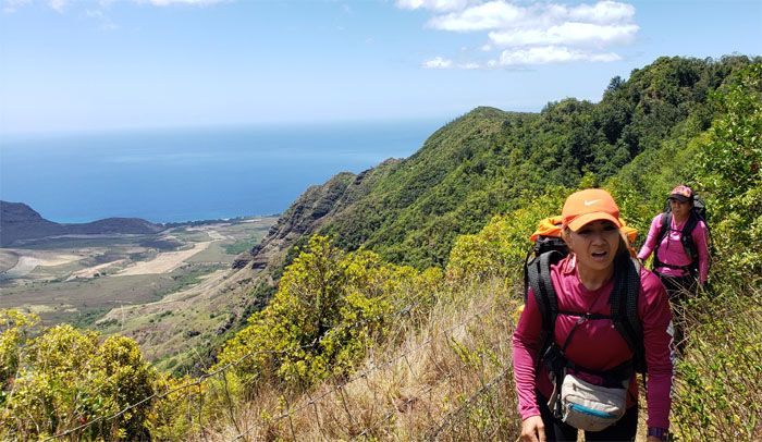
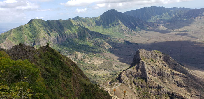
It was a nice day to be enjoying the sweeping views of Makaha, Makua and Mokuleia Valleys.
WST
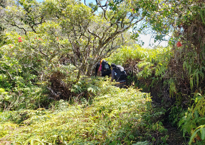
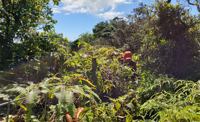
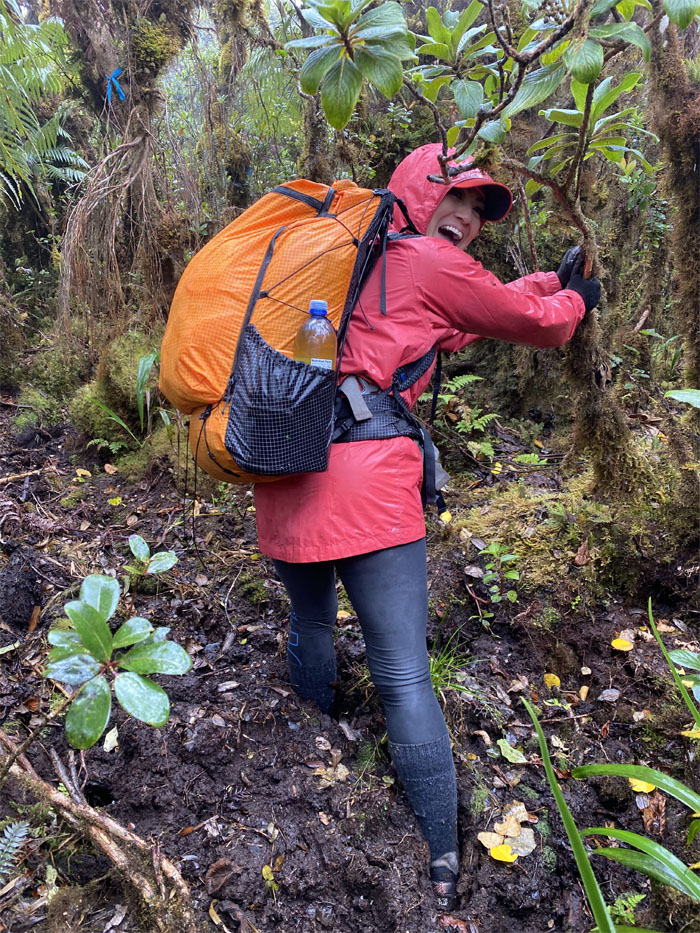
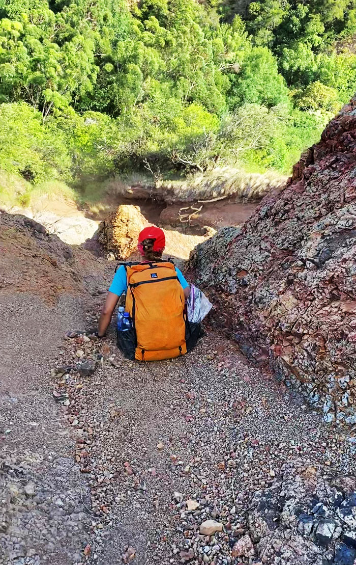
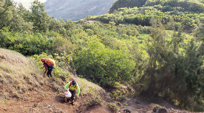
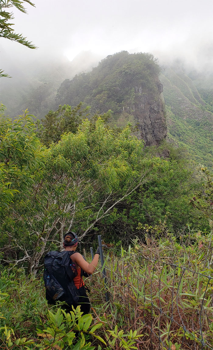
Plunging through the dense uluhe corridor laced with thorny thimbleberry bushes. While hiking has a lot of joys. This was definitely not one of them.
WST
Looking ahead to the road that would take us to the 4,025′ summit.
WST
Coming down the steep hill, Analyn skinned her right hand on the fence coming down. Wear and tear.

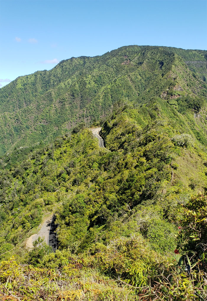
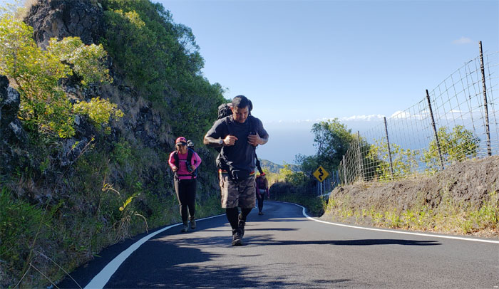
Ka’ala Road
Two bumps on the road otherwise known as potential road kill.
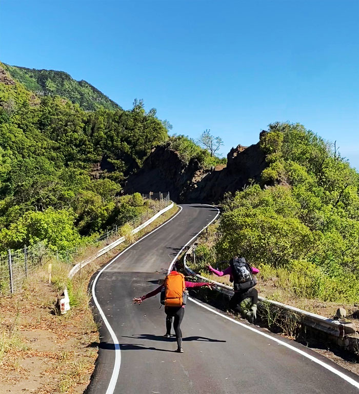
Ka’ala Road
Click your heels together three times and say ‘There’s no place like home’ and you’ll be there. Unfortunately, this is not the movies and you are not Dorothy. This is the Ka’ala Road, hard and unforgiving. Photo by Bill Yogi.
Ka’ala Road
Putting our heads down and putting one foot in front of the other. This road sucks.
Ka’ala Road
End of the road. Thank goodness. Photo by Shirley Gloriani.
Camp Ka’ala
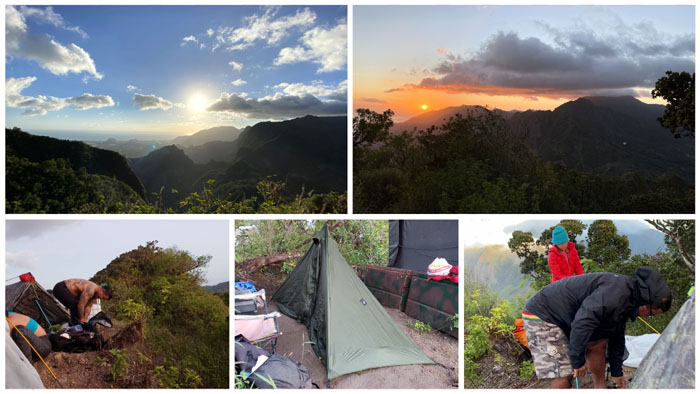
We set up camp; enjoyed a stunning sunset, munched on Godiva Chocolate and somebody got gassed to the point of retching.
Camp Ka’ala
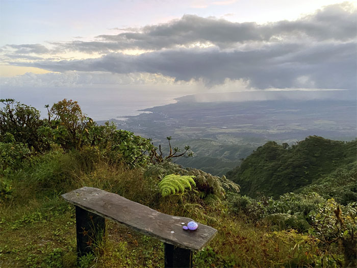
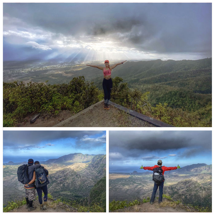
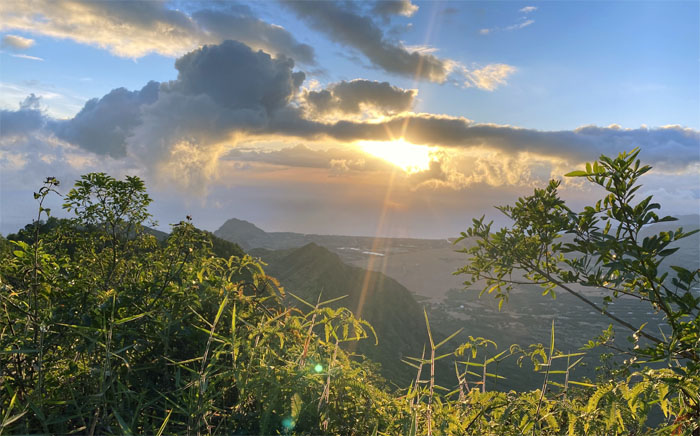
Our morning view from the highest peak on the island, as rain showers slowly marched its way towards us.
Camp Ka’ala
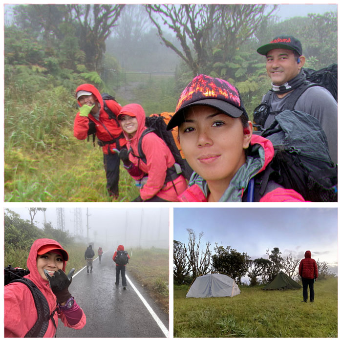
Breaking down camp under a light drizzle of mountain rain.
Ka’ala Bog
On the boardwalk that crosses through 1,100 acres of ancient Hawaiian rain forest home to many native plants and animals. Photo by Shirley Gloriani.
Ka’ala Bog
The Northern KST doesn’t have the exclusive monopoly on deep sole sucking mud. Photo by Shirley Gloriani.
Ka’ala Bog
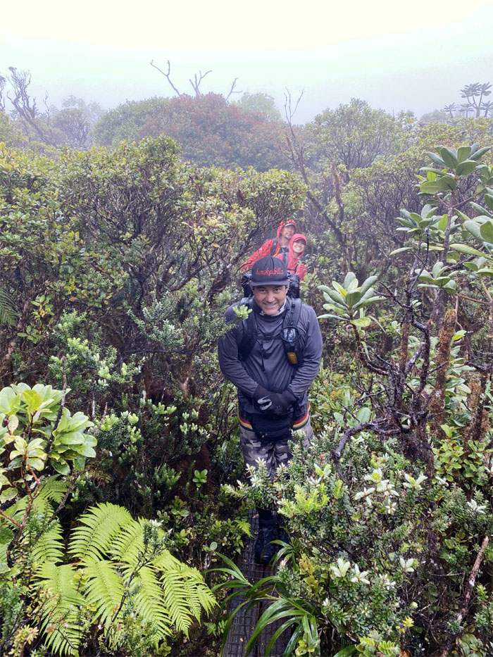
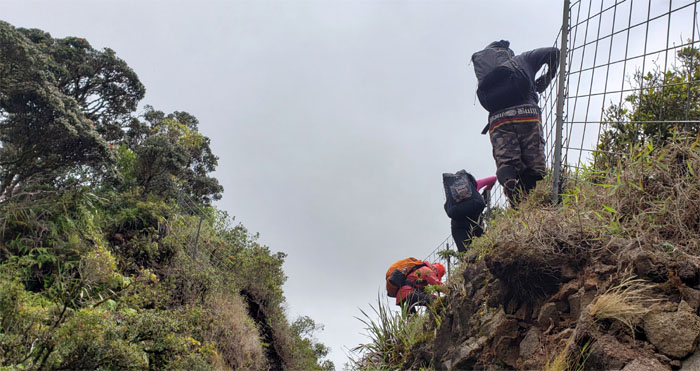
Finding the fence line and following it down to the ridge line.
WST
Going down the slippery slope. Photo by Analyn Baliscao.
WST
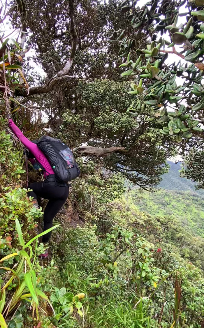
Analyn climbing her way down.
WST
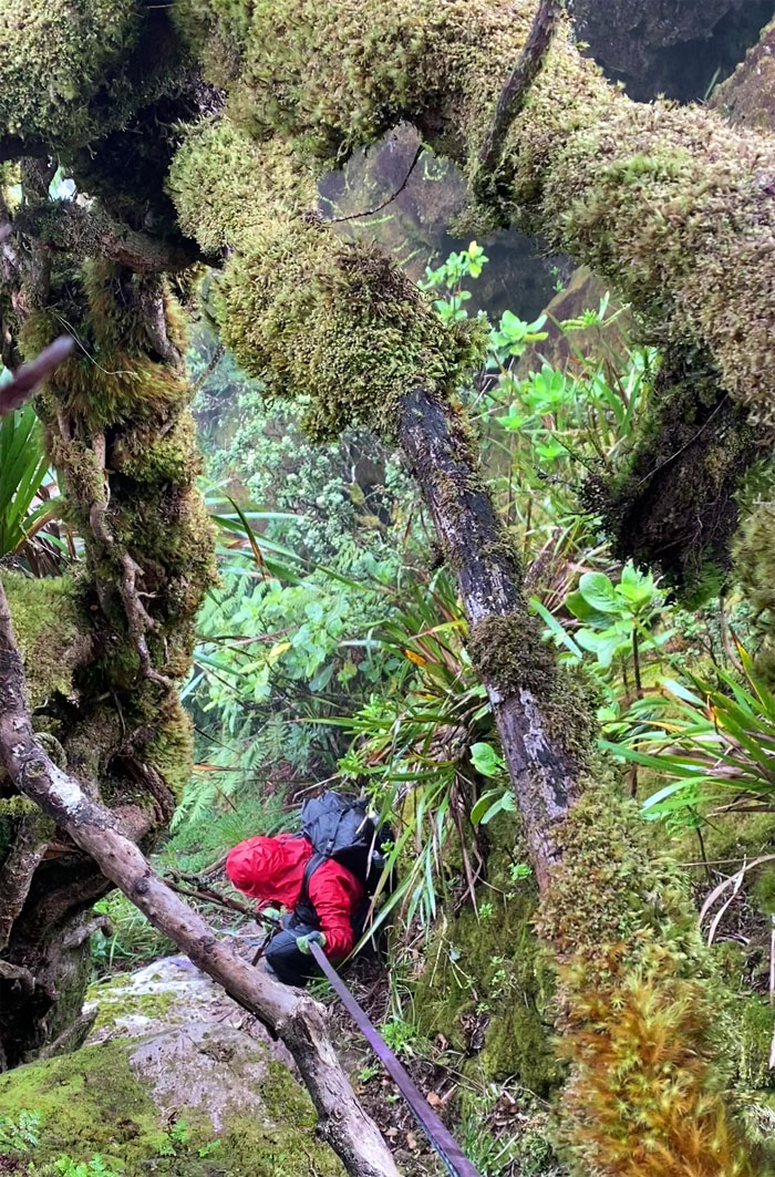
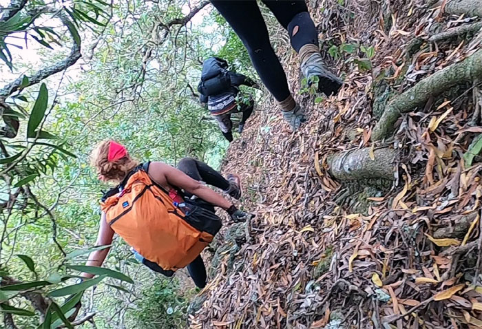
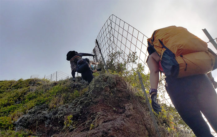
The girls climbing down and out from the moss covered boulder section. Photo by Bill Yogi.
WST
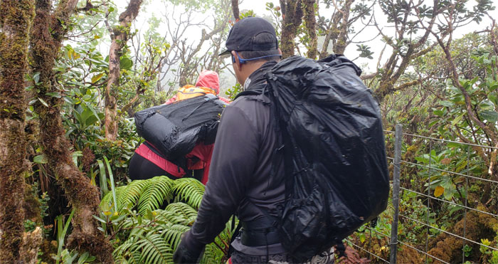
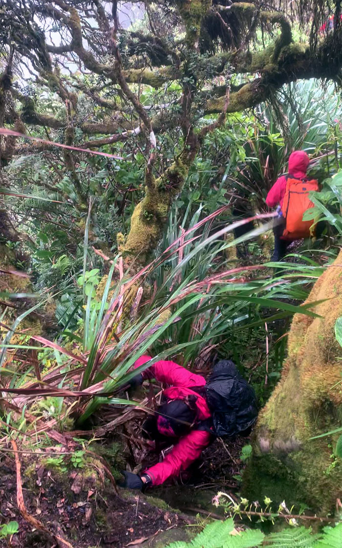
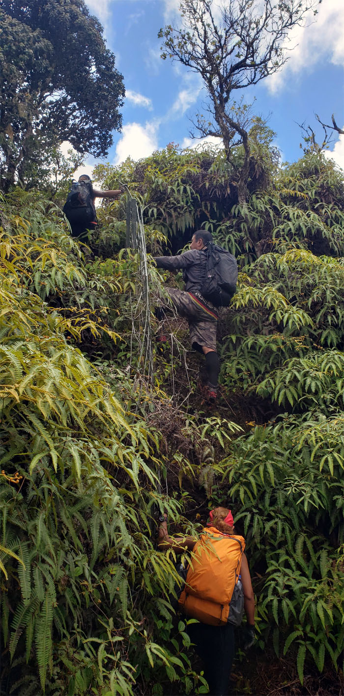
Bushwhacking through the fenced corridor of uluhe ferns and thimbleberry bushes. The overgrowth was too much for Bill’s selfie stick as I cracked the tip while clearing the trail, no fusion videos of the hike. My bad. Photo by Analyn Baliscao.
WST
The last time I saw my selfie stick before the overgrowth snatched it out of my pack. It’s supposed to be used for selfies and not bushwhacking. Photo by Analyn Baliscao.
WST
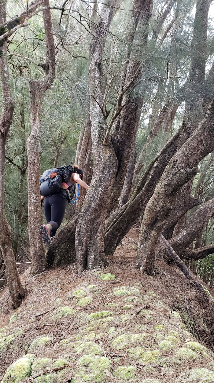
The girls passing through a stand of trees that were thickly padded with green and spongy moss.
WST
The trail overgrowth relented somewhat, but not that much. Photo by Shirley Gloriani.
Hobbs Junction
Taking a break from all that bushwhacking. Agony by a thousand punctures.
WST
Resuming our fenced hike with the second highest peak staring us in our sweaty faces.
WST
Making our way down the split ridge.
WST
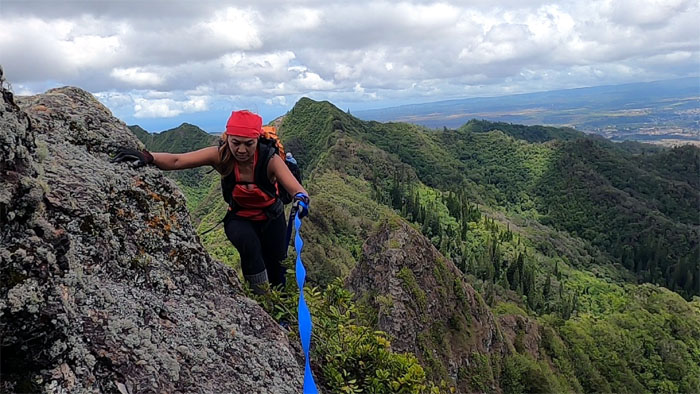
Waiting for our turn to climb down. Photo by Analyn Baliscao.

WST
Shirley contouring the crumbly ridge line. Photo by Bill Yogi.
WST
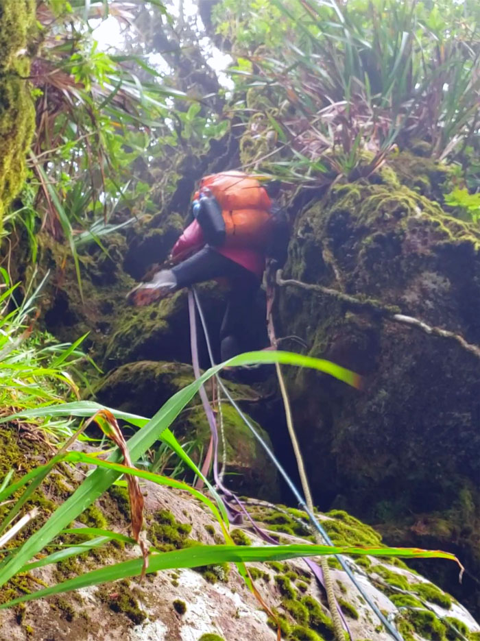
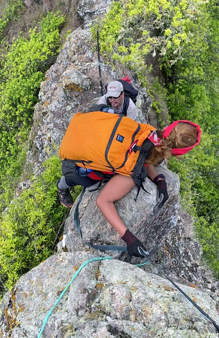
Looking for that ledge to land her size 7.5 shoes on. Photo by Analyn Baliscao.
WST
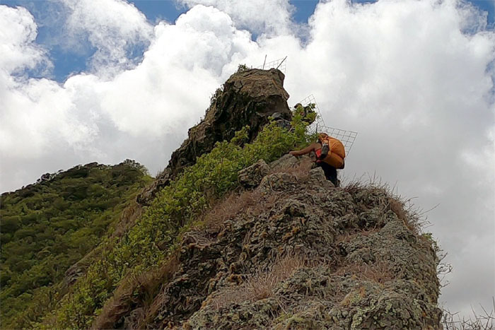
Analyn climbing up one of the last rock faces before the summit.
Pu’u Kalena
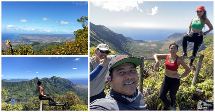
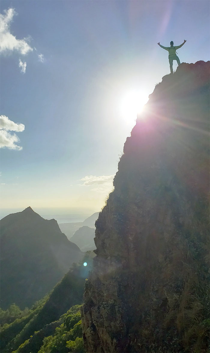
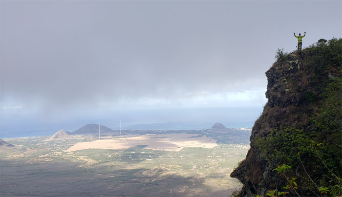
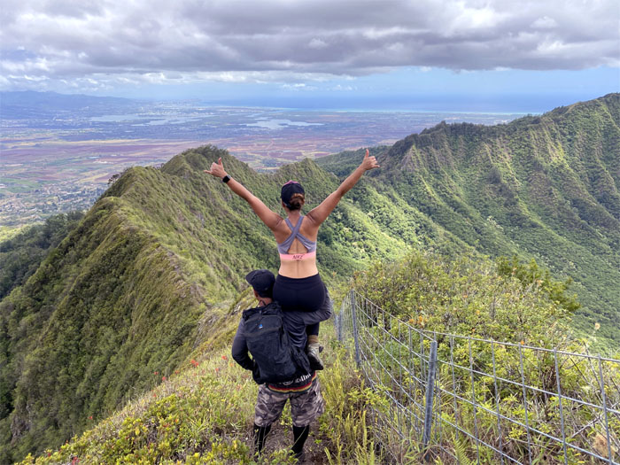
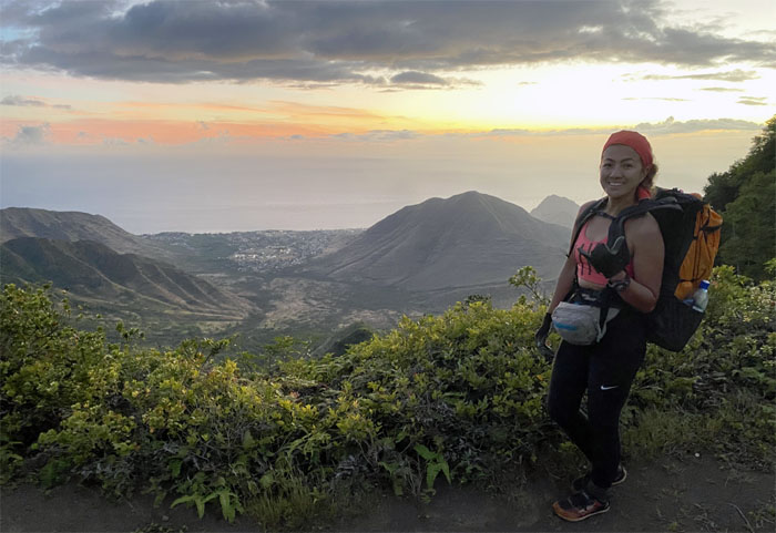
Fabulous views of the West side from the 3,504′ peak.
Pu’u Kalena
What? No lunch break here? Photo by Shirley Gloriani.
WST
Back on the fenced trail to get to the eroded section over on the next hill.
WST
Lunch break and scenic photography spot.
WST
False peak after false peak.
WST
Selfie at one of the step fence sections. Photo by Analyn Baliscao.
WST
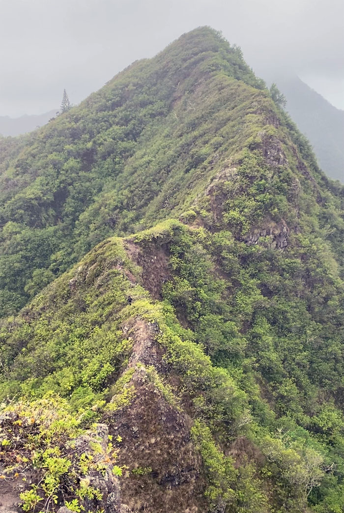
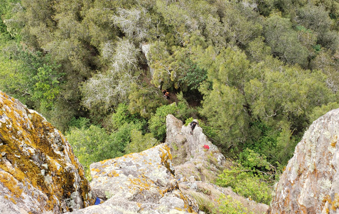
Looking down at the hot mess of crumbly rocks otherwise known as Pu’u Ka’ilio.
WST
West side boy on the West side dike.
WST
Looking back at sexxxy ridge. No opportunity for sexxxy time. Next time. Photo by Analyn Baliscao.
WST
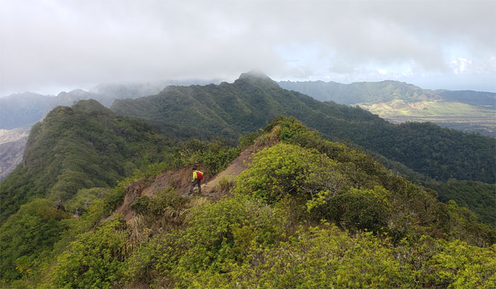
We left the fenced ridge line and made our way down the spur ridge.
WST
Analyn throwing out a shaka before going down another narrow dike section.
WST
There’s always time for another shaka on the dike. Photo by Shirley Gloriani.
WST
Getting off the rocky ridge line as we descended towards the pass, the lowest point in the Waianae Mountain Range.
Lualualei Valley
Looking down into the largest coastal valley on this side of the island.
WST
Can you take a video of me sliding on my butt sis?
WST
Sure thing sis! Photo by Shirley Gloriani.
Kolekole Pass
Why did the hikers cross the road? To get to the other hiking trail.
Pohaku Hupeloa
Everybody try and keep their heads about them.
Kolekole Pass
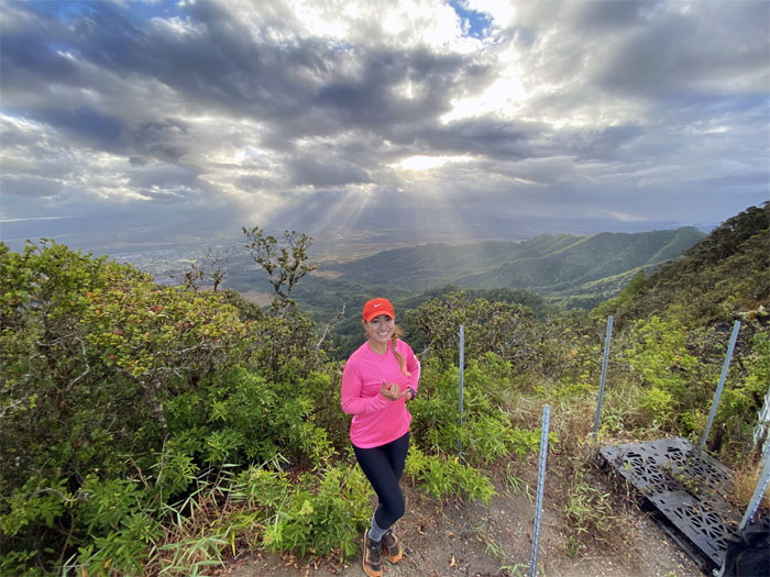
Approaching the clearing with sweeping views and looking for my carbonated beverage. Sorry Analyn.
Kolekole Pass
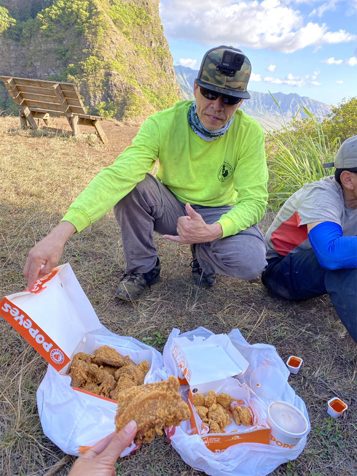
Thanks to Matt for bringing us the fried chicken without an apostrophe. Our group just got bigger by one. Photo by Shirley Gloriani.
WST
Our bellies full, we climbed straight up the crumbly hillside to save 15 minutes. Photo by Matt Vidaurri.
WST
Matt bringing the chicken with him. Leftovers are the best. For some people.
WST
The sun silhouetting Matt as we descended down to the notch.
WST
Bill and Shirley climbing out of the first notch.
WST
Coming over the second notch. Photo by Shirley Gloriani.
WST
Almost there.
Camp Hapapa
We set up camp; enjoyed another spectacular sunset, no dessert this time and no gassing was reported as well.
Camp Hapapa
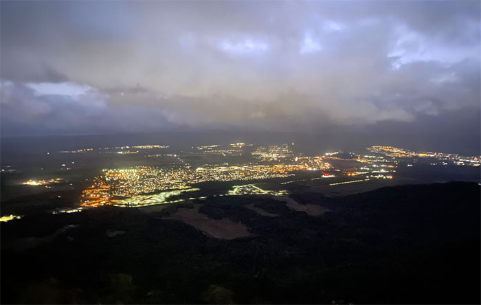
Twinkling city lights. Photo by Analyn Baliscao.
Camp Hapapa
The morning sunbeams spilling over on the central plain. Photo by Shirley Gloriani.
WST
We broke down camp and set out for the square sized summit of Hapapa.
Pu’u Hapapa
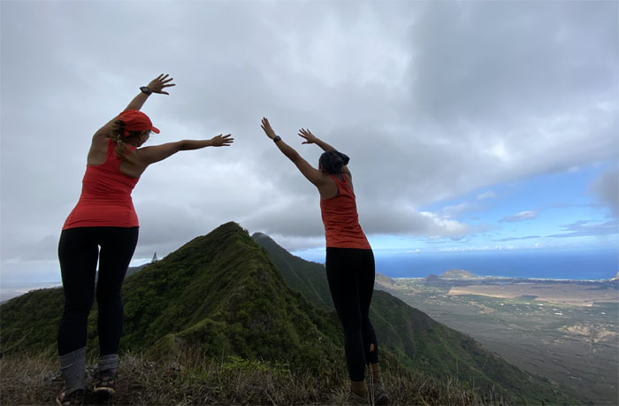
Our collective photographic poses on the 2,883′ peak.
WST
Leaving the summit.
WST
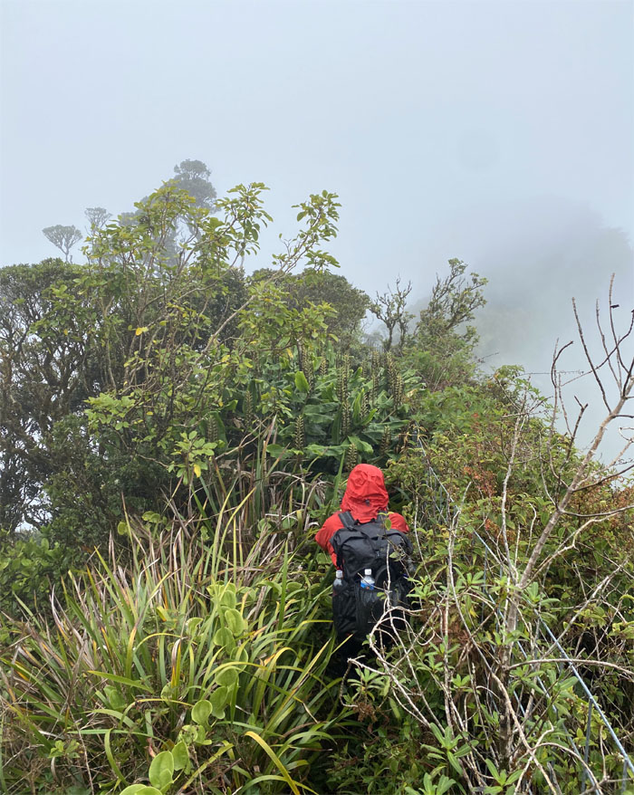
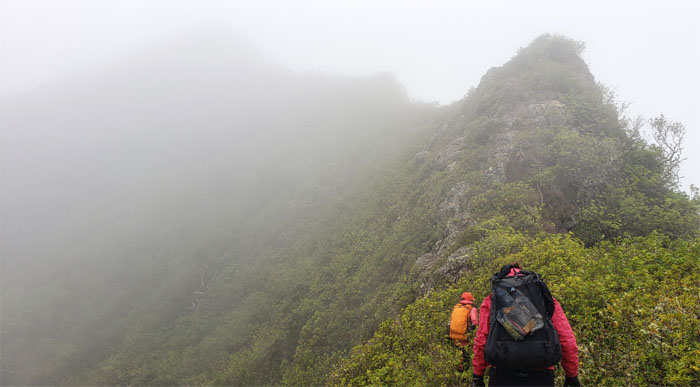
Misty mountains.
WST
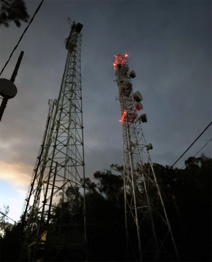
Looking back at Matt and the valley that are home to two of the tallest transmission towers in the Western hemisphere.
WST
Contouring and not climbing. Photo by Shirley Gloriani
WST
Traversing the eroded section of the ridge line.
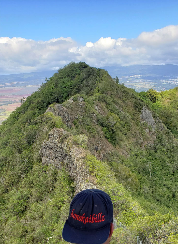
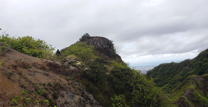
Pu’u Kanehoa
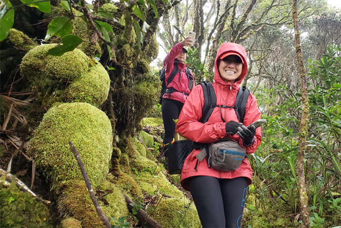
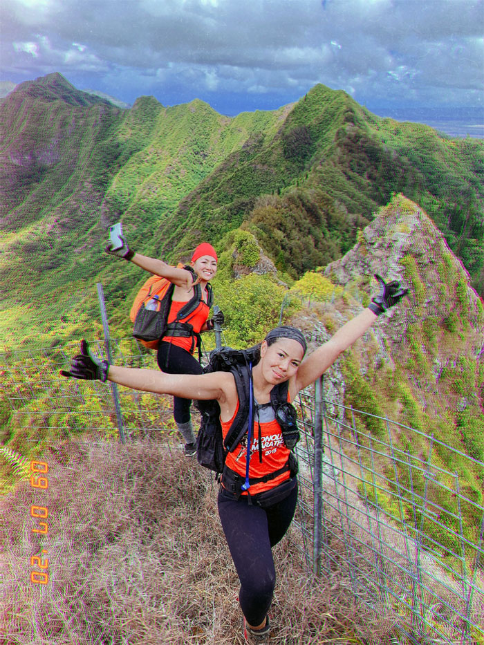
Cheesy pose by the girls at the 2,728′ summit. Not my words. From the cheesy person herself.
Pu’u Kanehoa
Watching Bill “No Breaks” Yogi moving on the ridge line. Photo by Shirley Gloriani.
Pu’u Kanehoa
Matt checking out the views and kicking himself for not bringing his drone.
WST
The clouds drifting over the mountains.
WST
Most of the clouds soon left, but some stayed. Photo by Matt Vidaurri.
WST
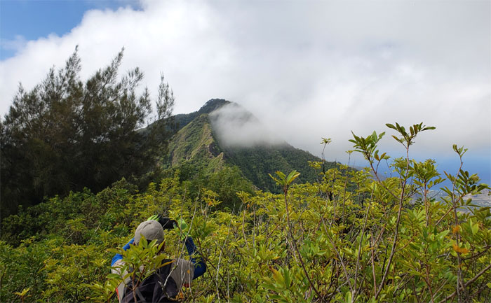
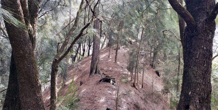
We went through a section of pine forest before getting back onto the exposed ridge.
WST
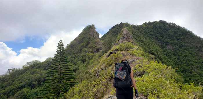
Approaching the “Christmas Tree” that marks the gateway to the first main obstacle.
Gorilla Heads
Climbing up and over the smaller of the primate rocks. Photo by Matt Vidaurri.
Gorilla Heads
Supplemental webbing does a body and mind good. Or so I heard. Photo by Analyn Baliscao.
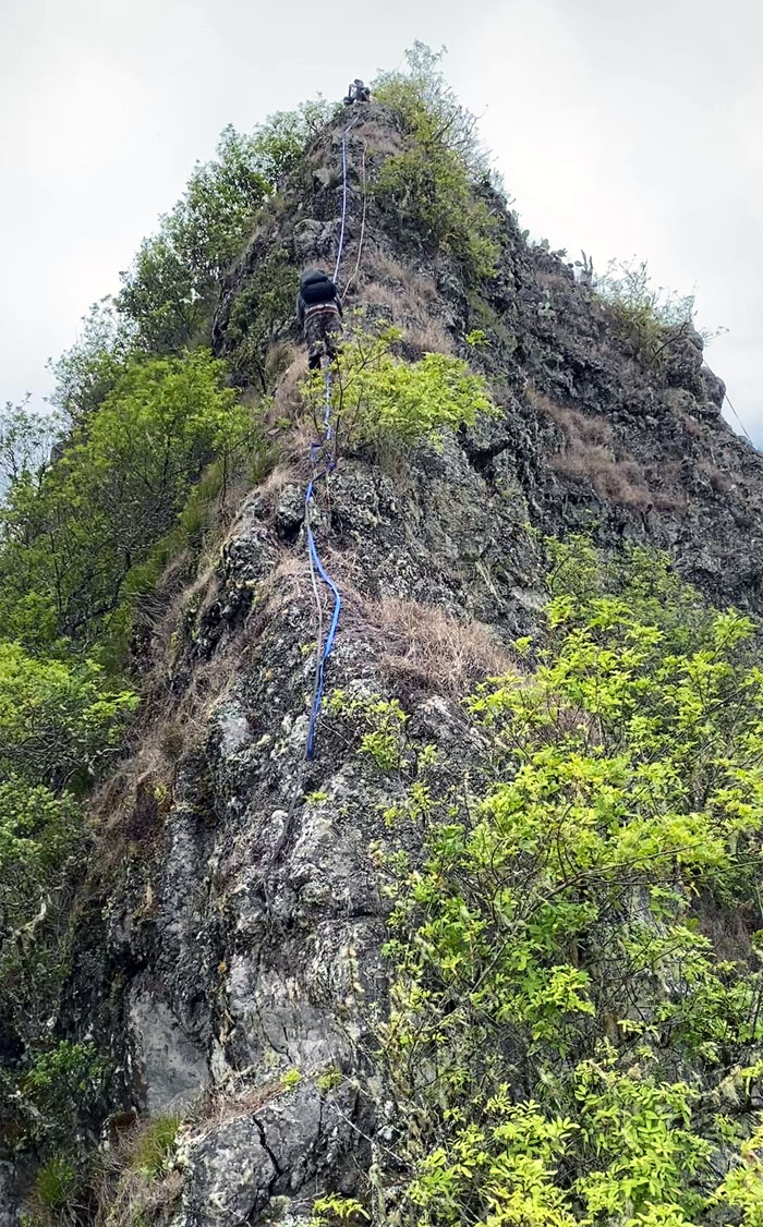
Gorilla Heads
Bill climbing up the biggest of the ape rocks. Photo by Shirley Gloriani.
Gorilla Heads
Shirley’s turn.
Gorilla Heads
Passing resemblance to their Simian namesake. Photo by Shirley Gloriani.
Gorilla Heads
Bill climbing his way down.
Gorilla Heads
Spotting Analyn coming down. Catching services not included. Photo by Matt Vidaurri.

Gorilla Heads
Looking back at the two humps. And it wasn’t even Wednesday yet.
WST
The group going up between a hard rock and a fence. There was only one decision to make. Up.
WST
There’s always a photographic opportunity in the mountains, especially with these two. Photo by Bill Yogi.
WST
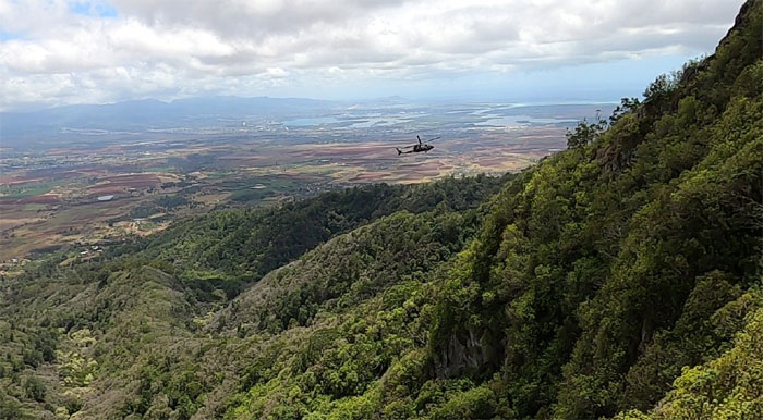
Blackhawk doing a fly by. Photo by Matt Vidaurri.
WST
You go right, I’ll go left. Who wants to follow? Webbing will be provided.
WST
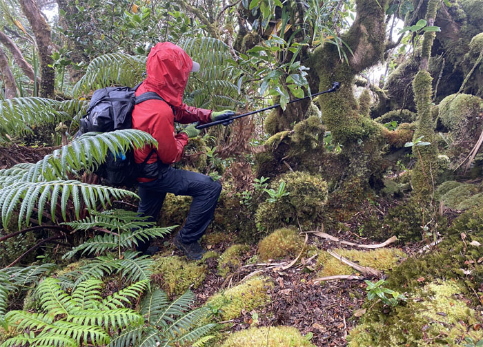
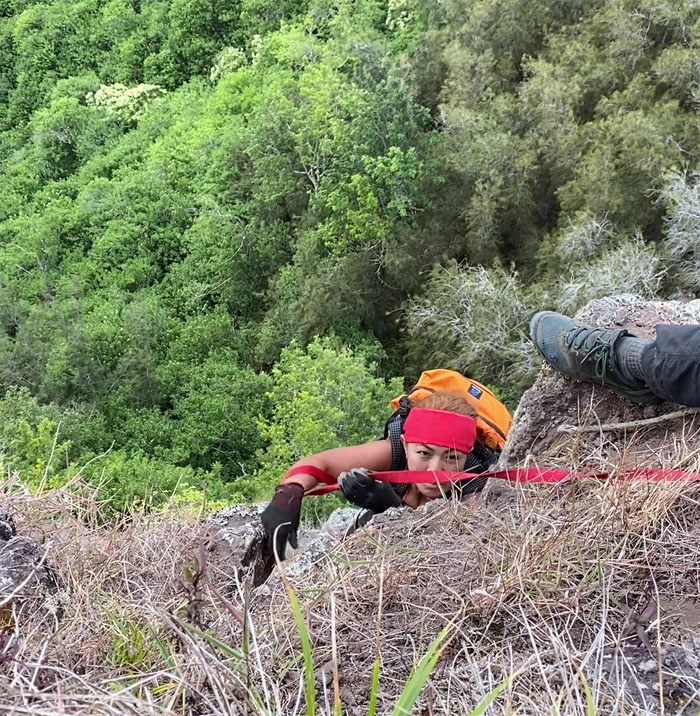
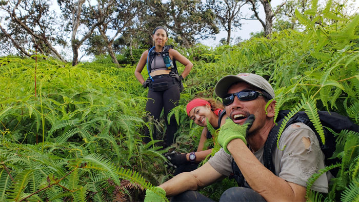
Analyn contouring her way around the crumbly rock. We took a musubi break at this spot. Photo by Matt Vidaurri.
WST
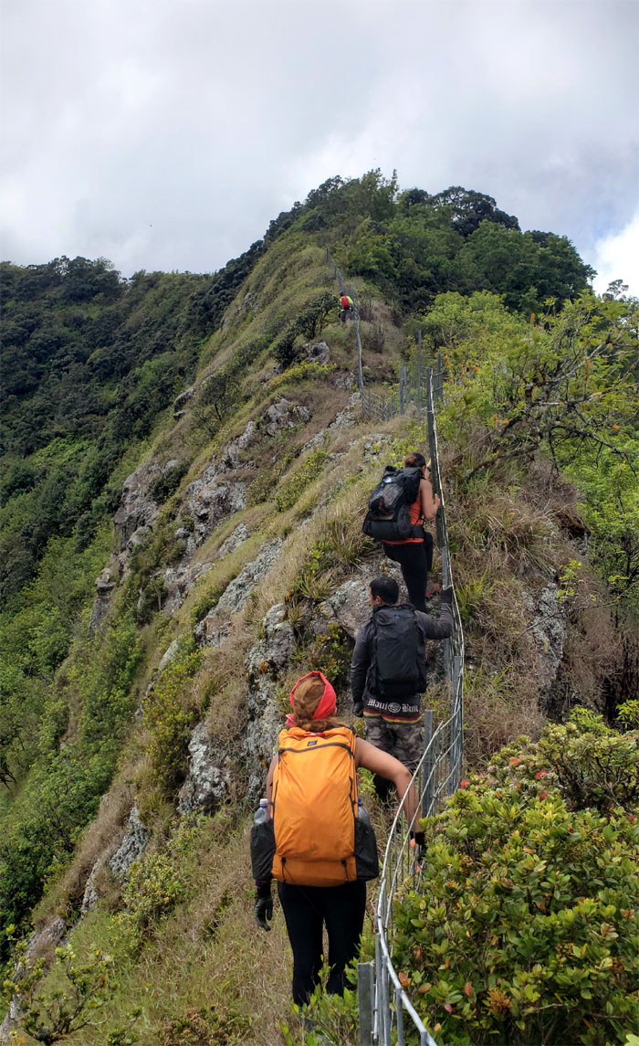
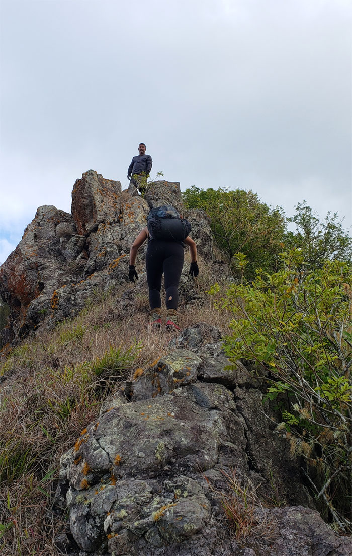
Following the fence line as we climbed up the rocky ridge.
WST
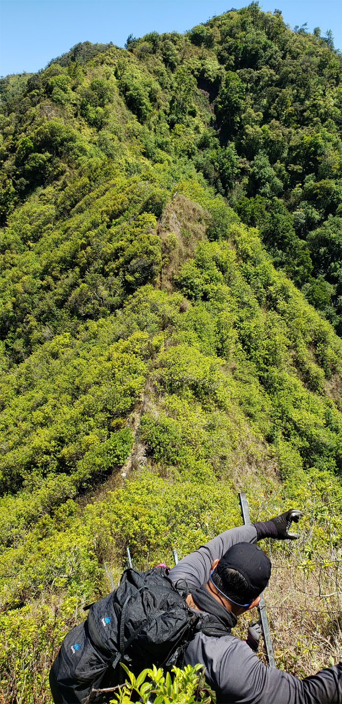
Pushing our way through the insufferable patch of uluhe ferns that was thankfully interrupted by the fence line.
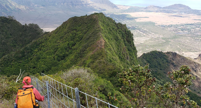
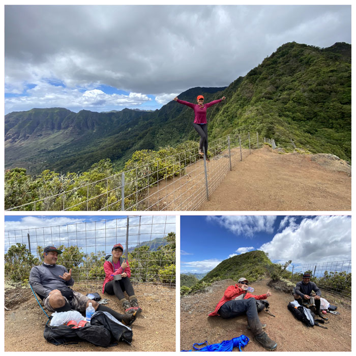
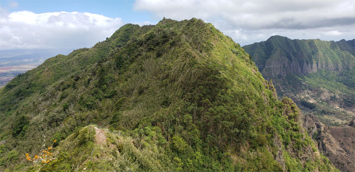
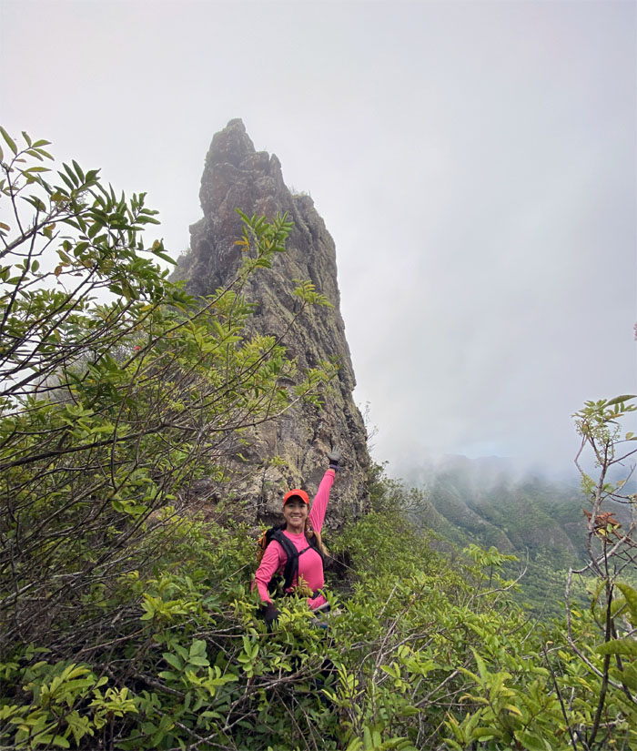
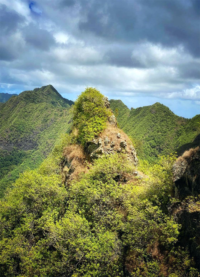
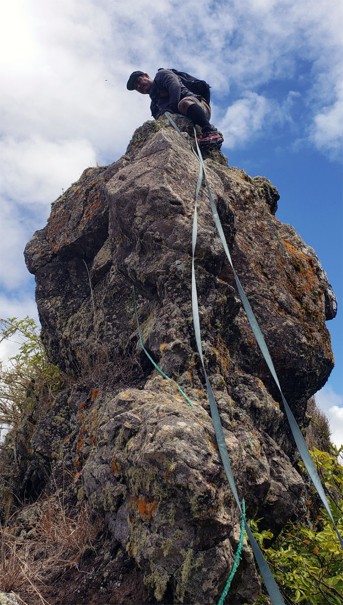
Pu’u Kaua
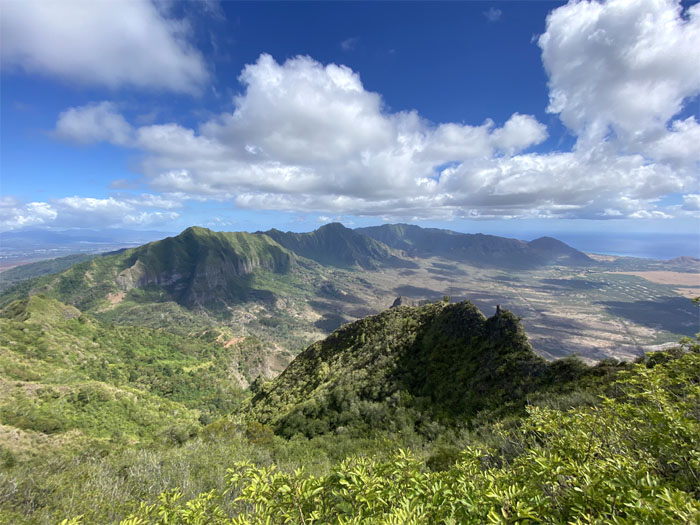
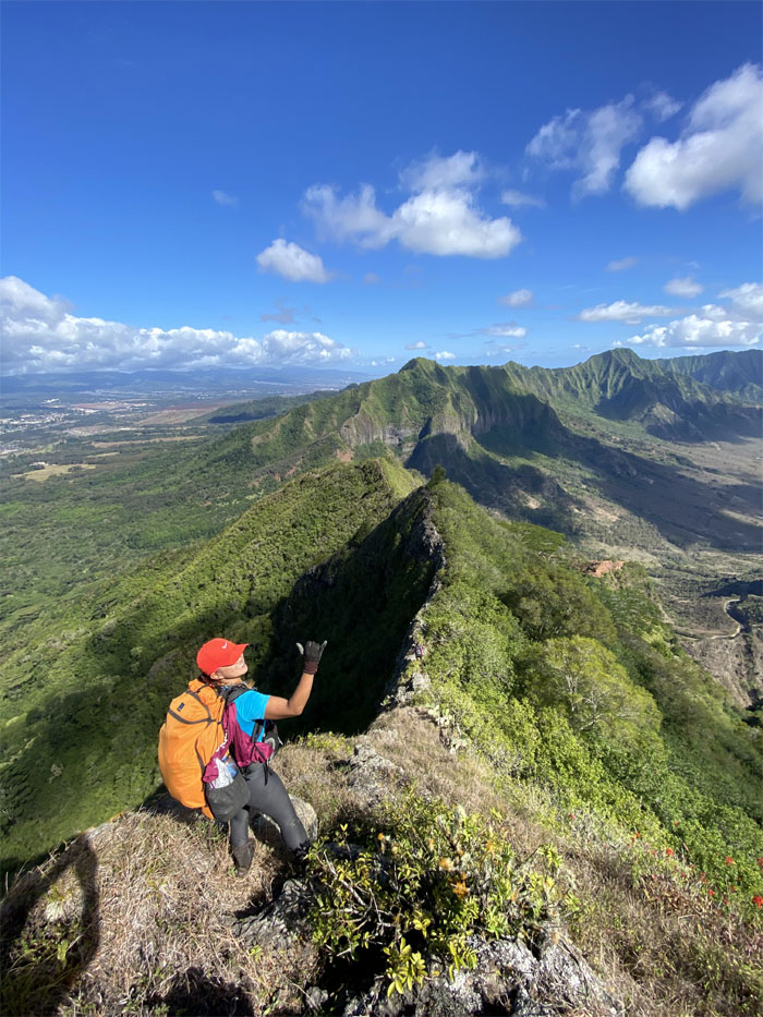
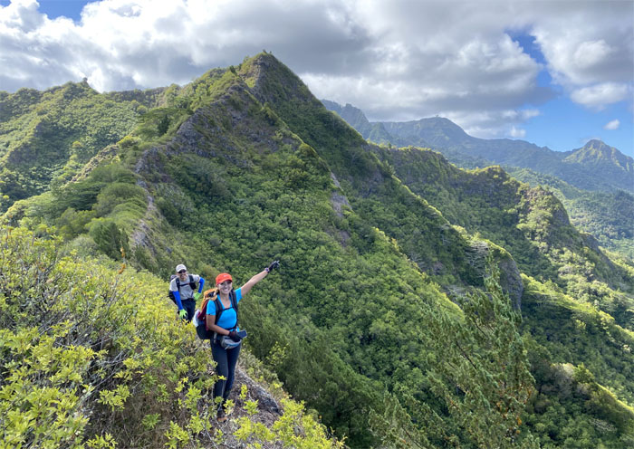
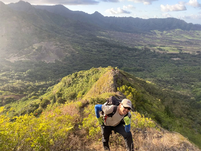
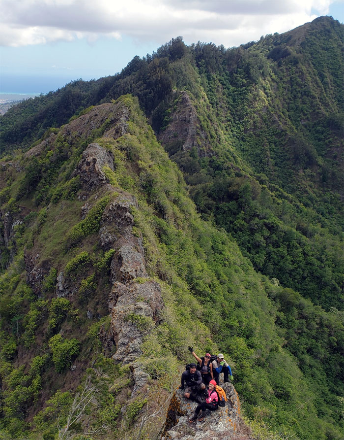
Looking back at the mountains we had traversed from the third highest peak on the island.
Pu’u Kaua
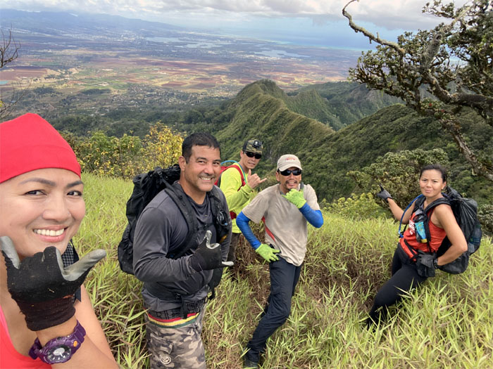
Group photo by Analyn Baliscao, left to right: Analyn, Bill, Matt, myself and Shirley at the 3,127′ peak.
WST
What broad shoulders you have, the better to see the views with. Photo by Analyn Baliscao.
WST
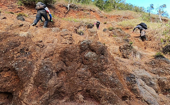
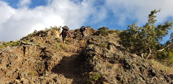
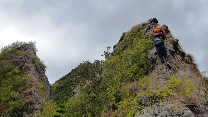
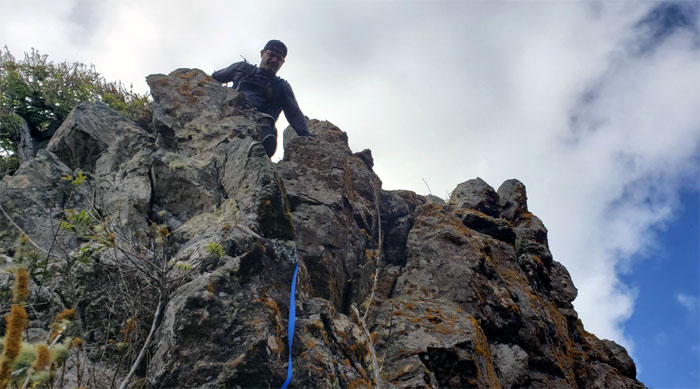
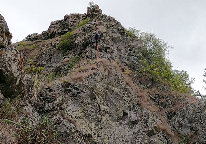
Bill coming down the rock face, the start of the most rock climbing on this section of the WST that you can shake a crumbly rock at.
WST
Team BASK perched on the rocks. Photo by Matt Vidaurri.
WST
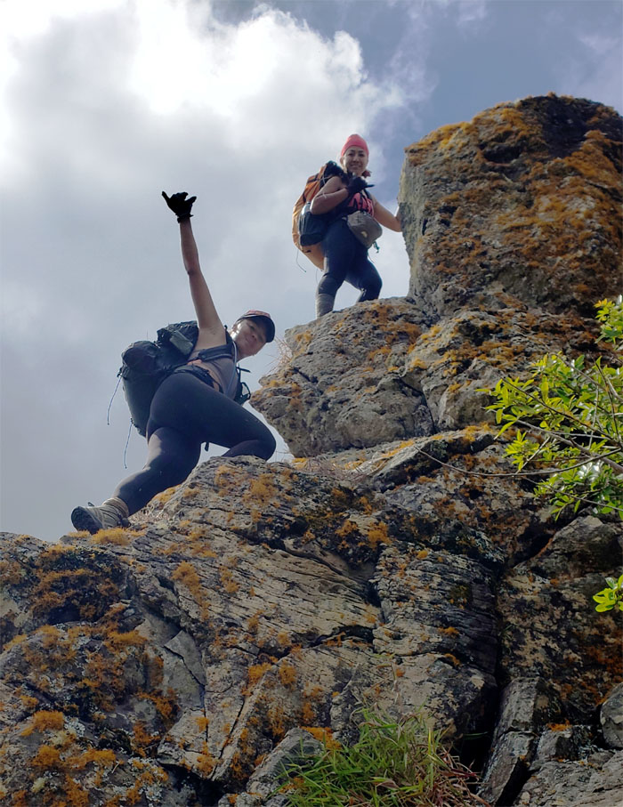
The girls climbing their way down and posing. Multi-tasking at its finest. Photo by Matt Vidaurri.
WST
Follow me. Or maybe not. Some people have to learn the hard way. Photo by Matt Vidaurri.
WST
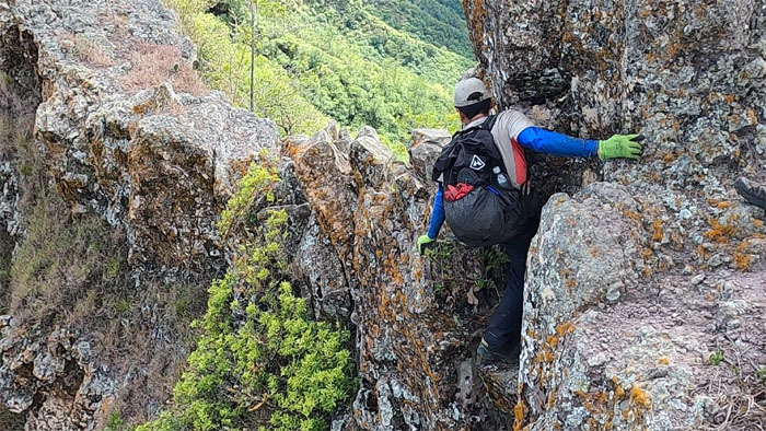
Matt making his way around the rock that was in our way. Photo by Analyn Baliscao.
WST
Contouring our way around the slippery and rooted hill to pick up the trail. Photo by Matt Vidaurri.
WST
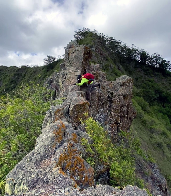
Analyn climbing down the short drop with the overhang. Photo by Matt Vidaurri.
WST
The pine tree corridor that took us to the main obstacle of the day.
Pohakea Pass
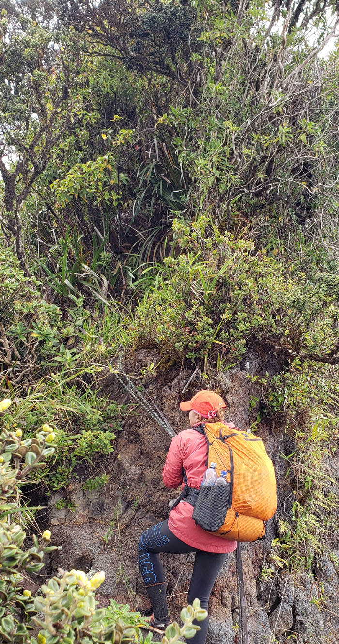
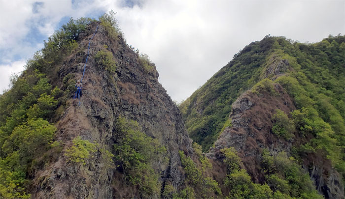
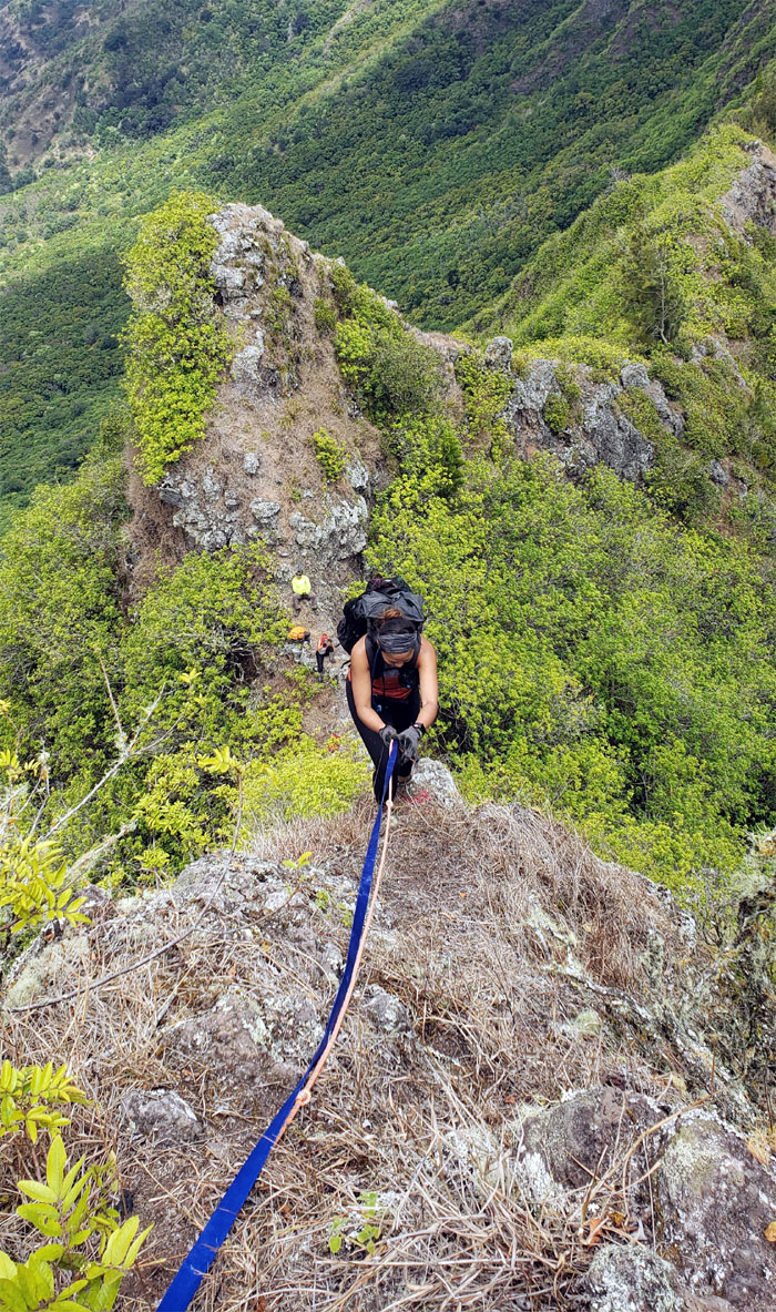
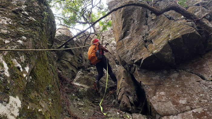
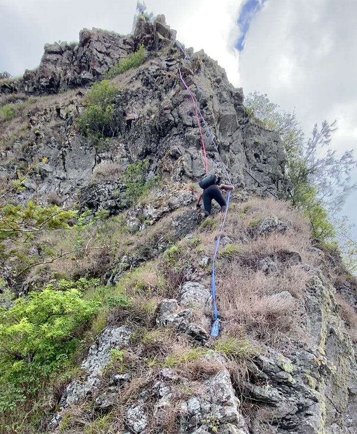
Going up the crumbly 80′ cliff for the fourth time and my stomach still had butterflies. The saving grace was the red webbing that was leftover from another group’s ascent. No free climbing needed this time. Photo by Matt Vidaurri.
Pohakea Pass
Bill climbing his way up.
Pohakea Pass
Shirley using the blue and red webbings to pull herself up. We just had to have a white webbing and it would have been a patriotic climb. Photo by Analyn Baliscao.
Pohakea Pass
Somebody was focused on getting to the top. Need a hand? Photo by Shirley Gloriani.
WST
Scrambling up and away from the sheer cliff.
WST
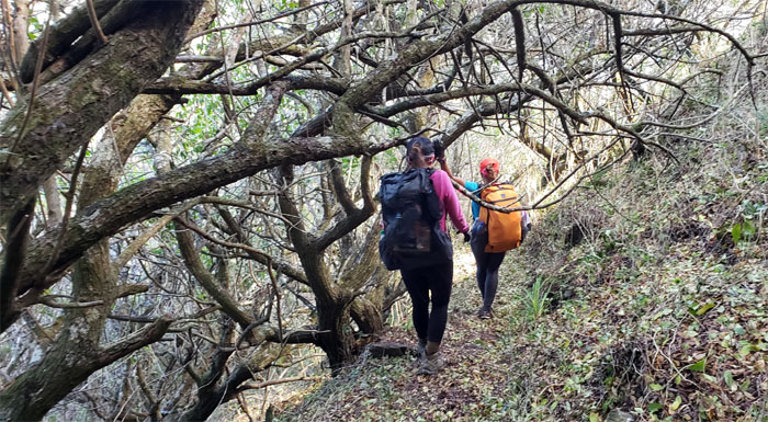
Shirley threading her way between the trees on the mossy ground.
WST
Pulling ourselves up the last major fenced climb.
WST
Pondering the anticipated removal of my facial hair after my self-imposed shaving hiatus that was to be lifted when I finished both mountain ranges in one shot. Photo by Matt Vidaurri.
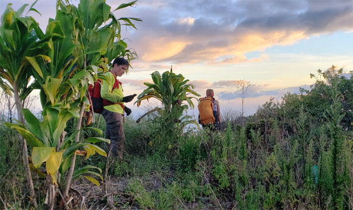
Palikea
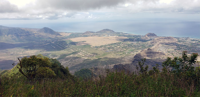
Brief stop at the ti leaf summit that at 3,098′ elevation had panoramic views of the West side. Only an hour left to the end of our hike.
WST
Trying to beat the sun to the bottom. Mother Nature would win.
Palehua
Our last selfie of the day as the daylight slipped away from us.
All pau
Not quite. We still had a roughly five mile road to walk down to Makakilo. We were going to pool our cash together to get a ride back down. But nobody answered the call of opportunity. So we ended up pounding the pavement all the way down to Makakilo. We piled into Matt’s truck and met up with Janell at the nearby shopping center where frozen cokes and bubbly were waiting for us.
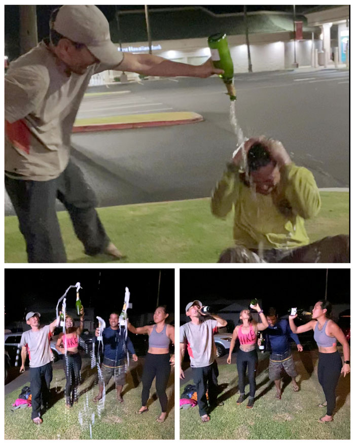
Post hike celebration
Matt was the only one afforded the traditional champagne dousing over the head, as he had to head home. The rest of us retired to Bill and Shirley’s lawn and just sucked it down. I don’t know who got the better deal. Thanks again to Janell for giving us a ride. Photos by Janell Tuttle.
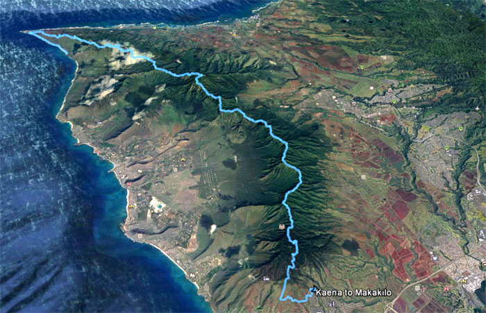
GPS Tracks
Our Labor Day weekend hike over the entire Waianae Mountain Range and then some, covered almost 33 miles through rugged and spectacular terrain that defines the West side. Amazing adventure with awesome friends. Until the next adventure.
Note: I have been made aware that some hikers have been using my blog as a hiking guide and getting lost on the trails. Please note that this blog was made to document the hike for the crew(s) that did it. That is why some of my comments will seem to have no relevance or meaning to anybody outside of the crew(s) that hiked that trail. My blog was never meant as a hiking guide, so please do not treat it as such. If you find inspiration and entertainment from these hikes, that is more than enough. If you plan on replicating these hikes, do so in the knowledge that you should do your own research accordingly as trail conditions, access, legalities and so forth are constantly in flux. What was current today is most likely yesterdays news. Please be prepared to accept any risks and responsibilities on your own as you should know your own limitations, experience and abilities before you even set foot on a trail, as even the “simplest” or “easiest” of trails can present potential pitfalls for even the most “experienced” hikers.
{ 0 comments… add one now }