
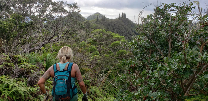
My saddle tour business model continued with Ben, Cisco, Katie and Yoly where Quan and Lonnie were nice enough to drop off us at the trailhead. At a nickel a pop, I have to do a lot of business in order to succeed, which I learned in college. A slow study. Photo by Yoly Bedford.
Powerlines Trail
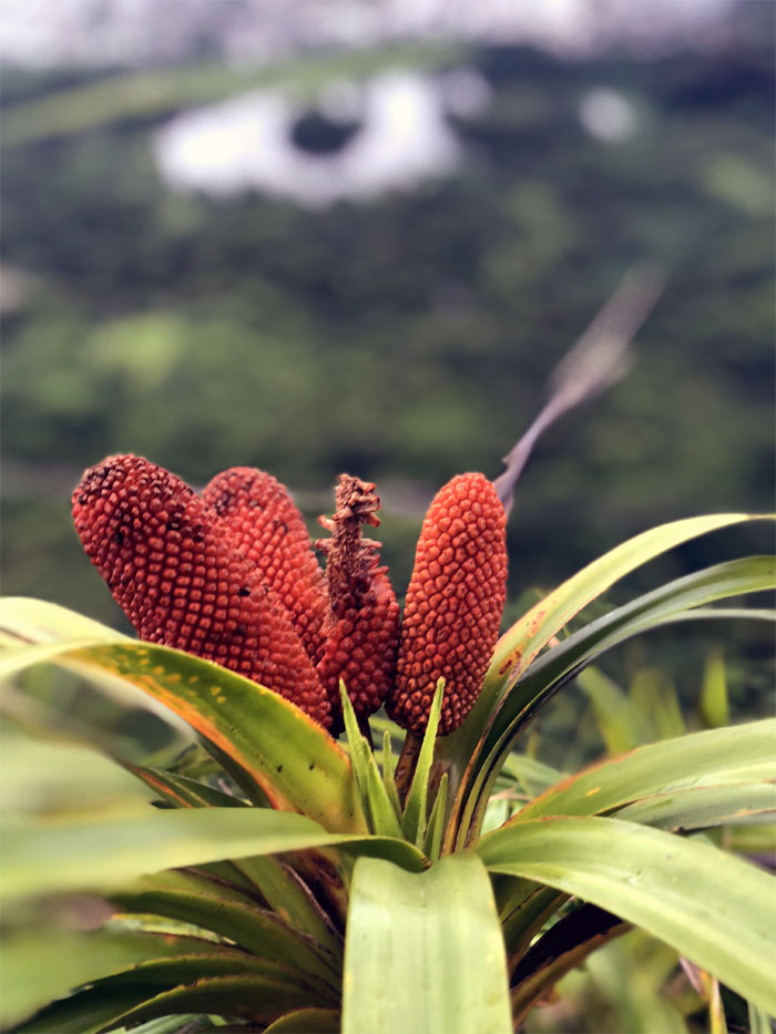
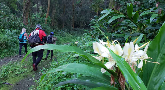
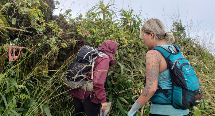
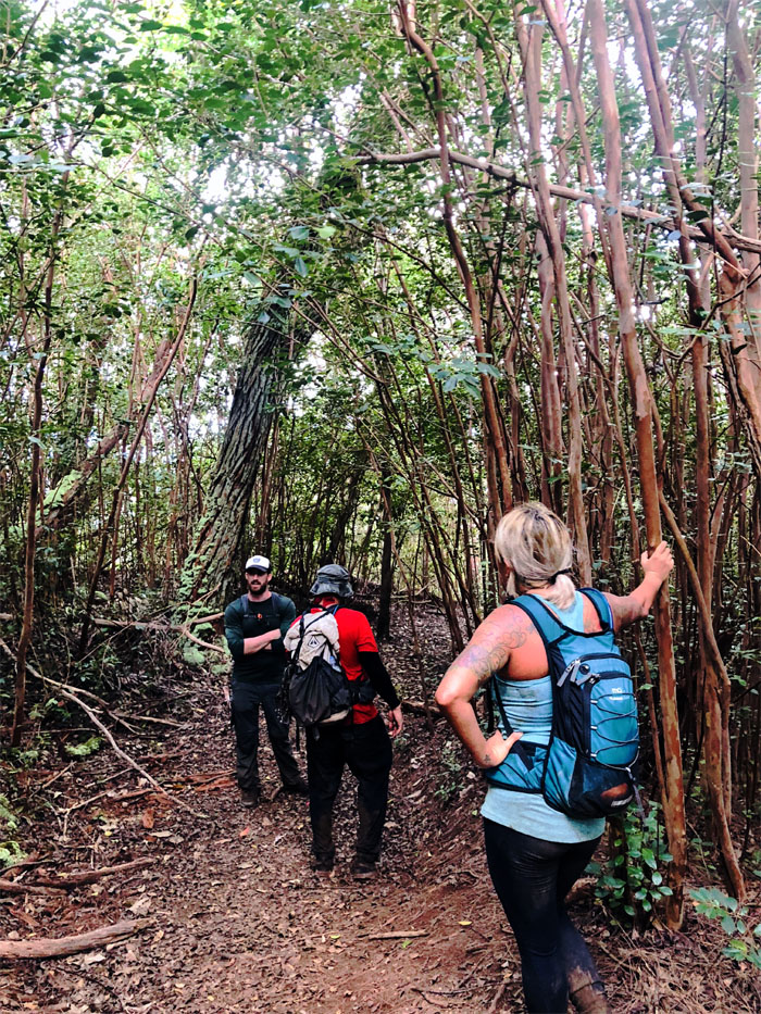
Walking up the mosquito and ginger infested service road.
Powerlines
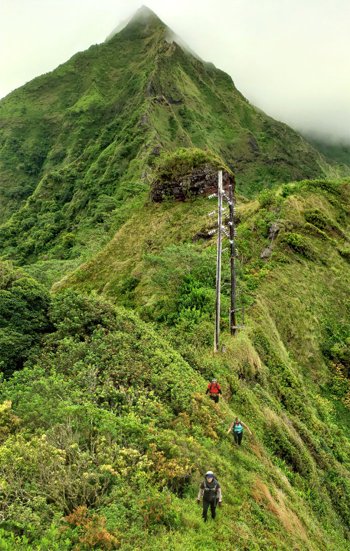
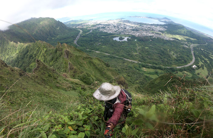
Making our way up to the saddle while watching out for the metal punji stake that was waiting to give somebody a reason for a tetanus shot.
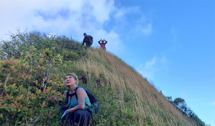
Kalihi Saddle
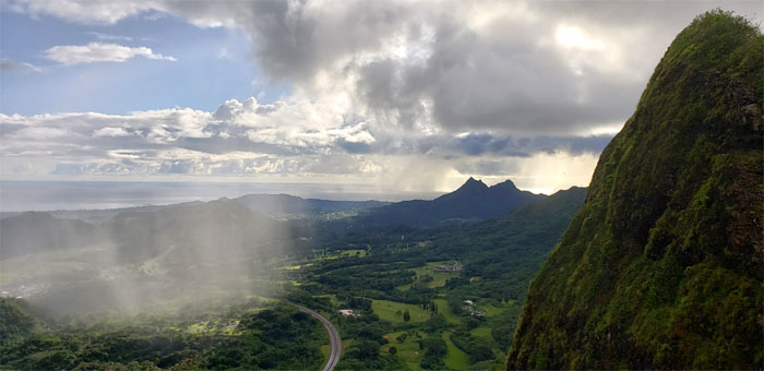
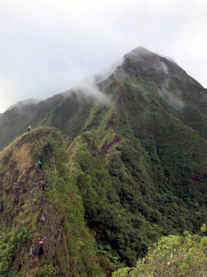
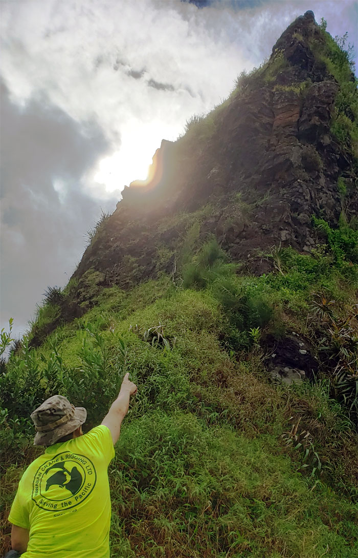
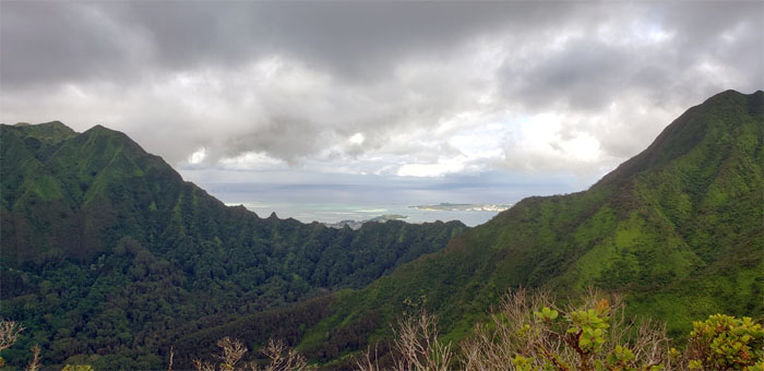
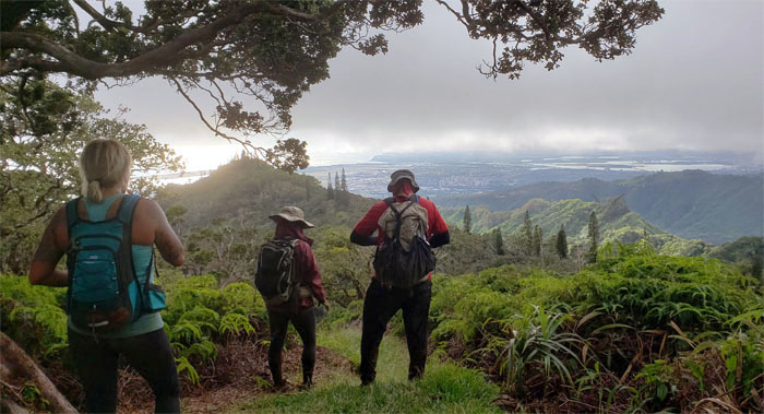
Watching the rain shower as it made its inexorable march from sea to summit.
Kalihi Saddle
The soaking was brief enough to not let us think twice of turning around.
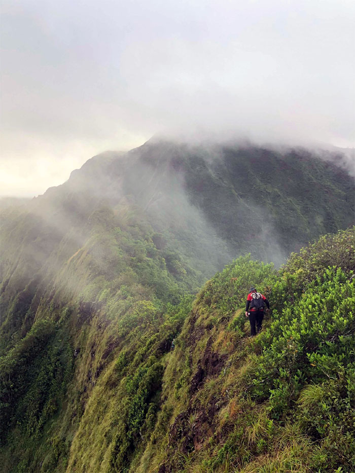
Kalihi Saddle
The drifting clouds muted the mountain landscape. Photo by Ben Hinders.
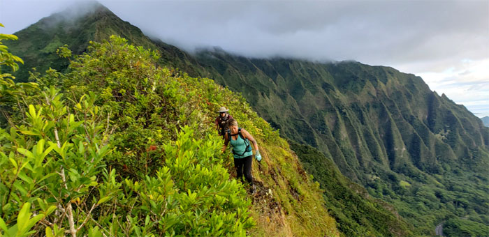
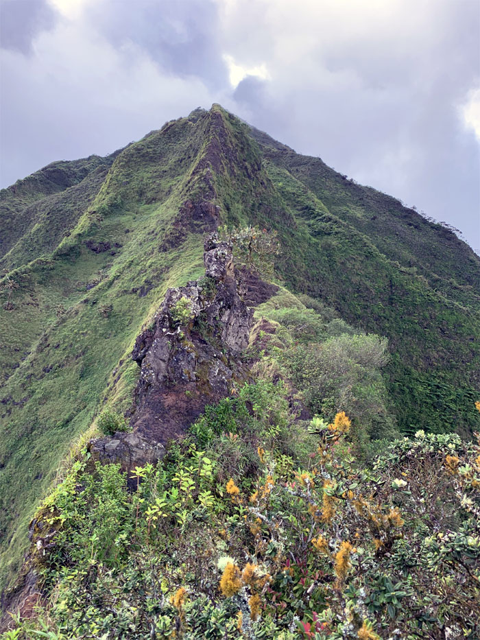
Kalihi Saddle
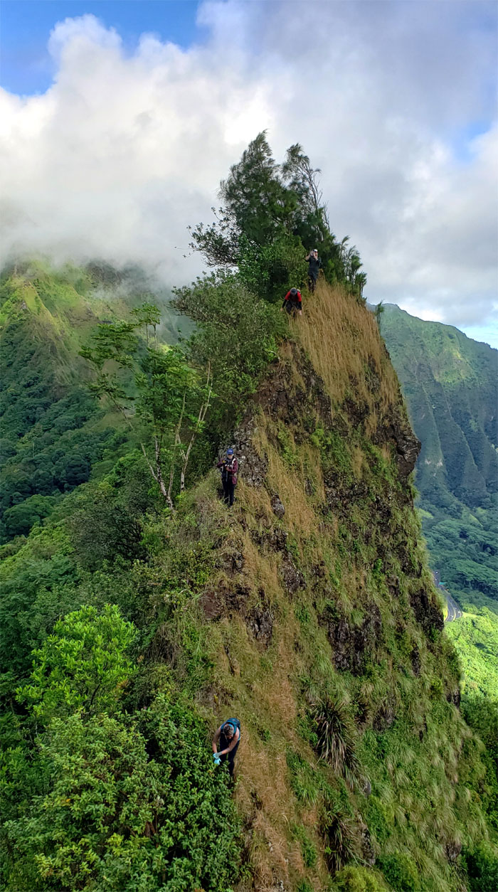
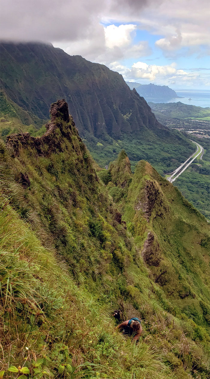
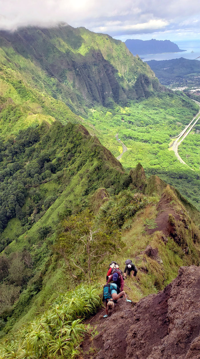
The thick vegetation on the Leeward side and the pushy Windward winds kept us grounded on the edge of the ridge line.
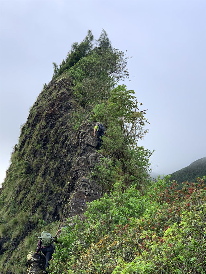
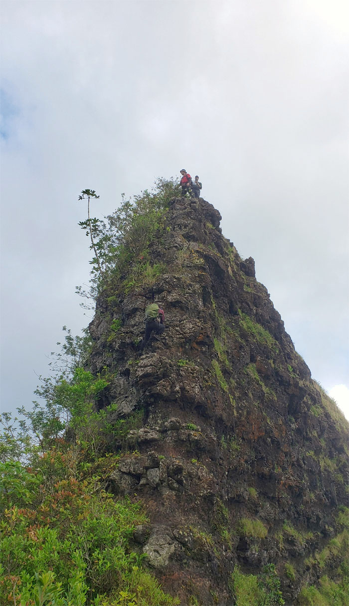
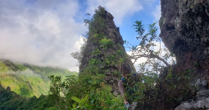
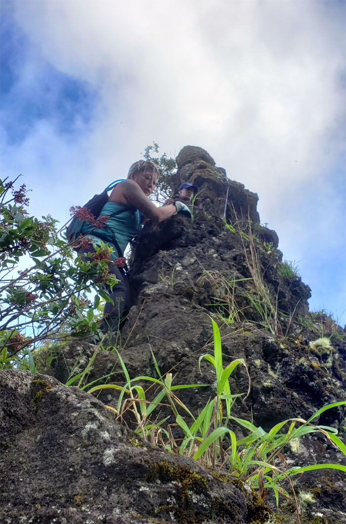
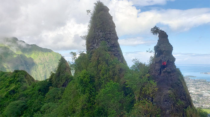
Shark’s Fin
Climbing up to the fifth sequel? Photo by Cisco Quintanilla.
Bunny Ears
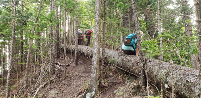
Descending from the stand of pine trees at the top.
Bunny Ears
Ascending to the top of the second ear. Photo by Ben Hinders.
Bunny Ears
Cisco reminding us what obstacle we were currently on.
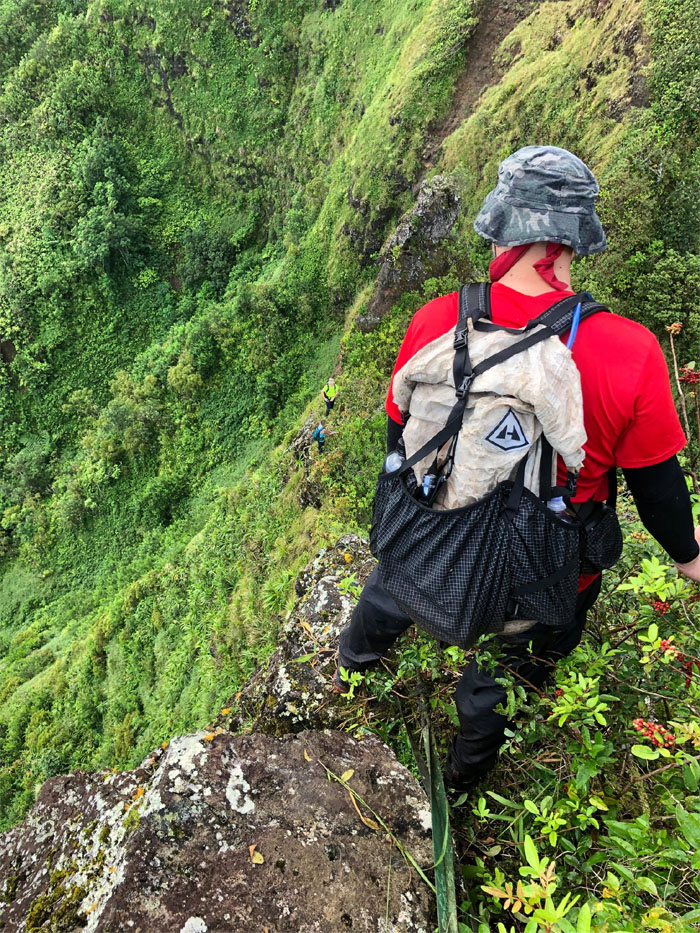
Doorstop
Top down view. Somebody had to be reminded which way the spikes faced on the shoes. Photo by Ben Hinders
Doorstop
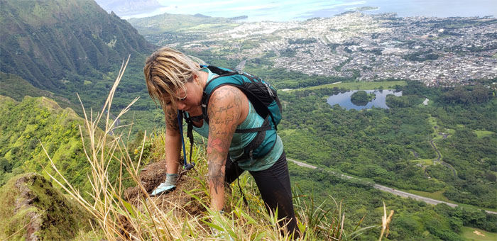
Yoly climbing down to her right. The other right.
Pimple
Looking ahead to the crumbly elevation of shredded rock. Photo by Cisco Quintanilla.
Pimple
We are not climbing up and over this one.
Pimple
Katie doing her best not to pop any of the rocks on her climb down.
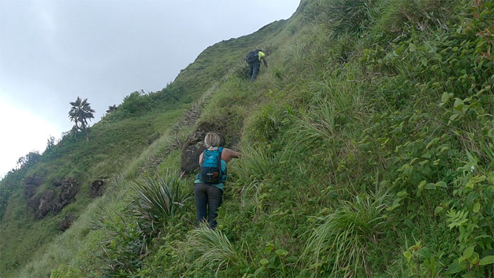
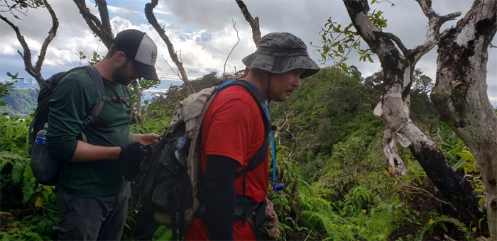
Kalihi Saddle
Ben and Cisco contouring their way around the pimple.
Kalihi Saddle
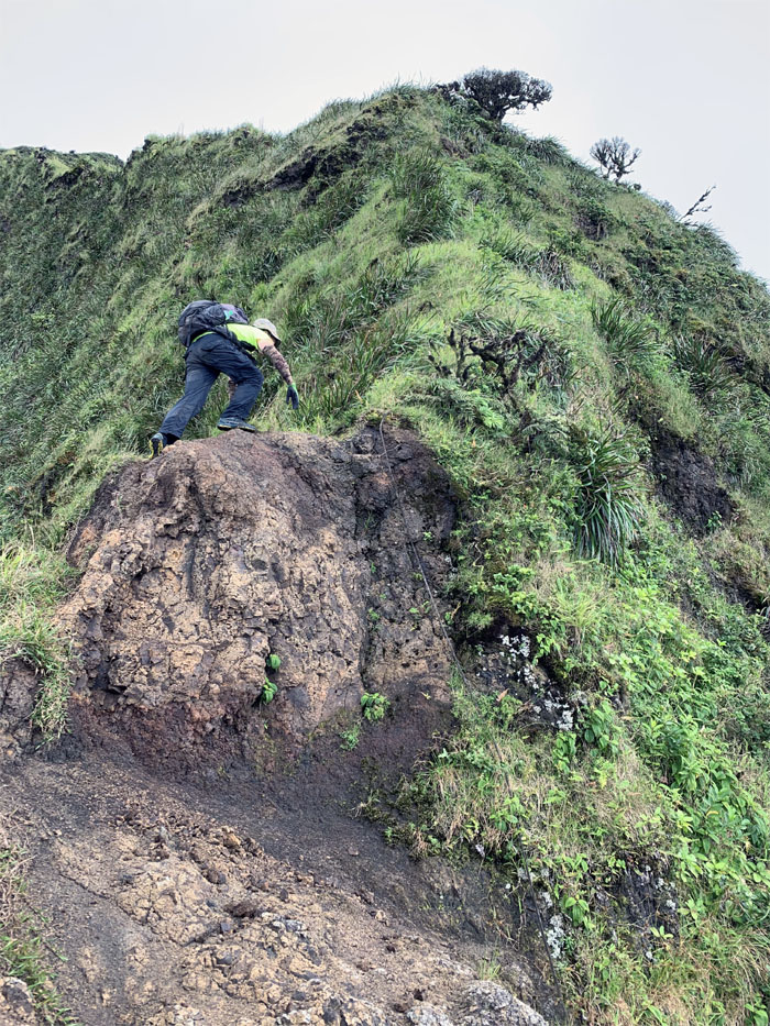
Scrambling our way up to the heavily eroded section below the can opener.
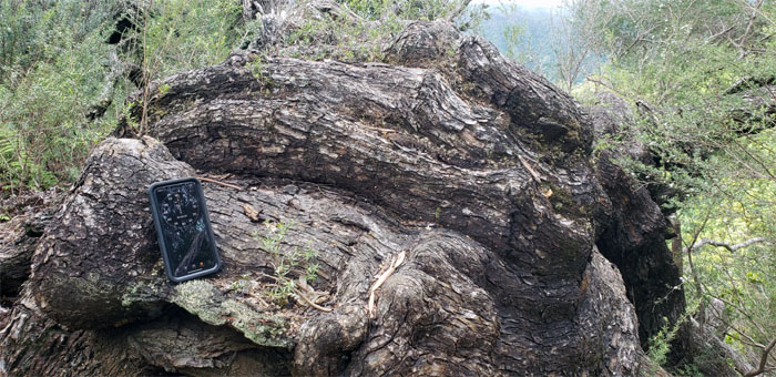
Can Opener
The sofa sized rock that is just waiting to fall out. Don’t want to be around for the clearance sale. Photo by Katie Bingham
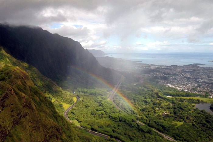
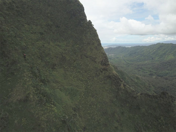
Skittles
Aerial view of our shower soaking reward. Drone photo by Ben Hinders.
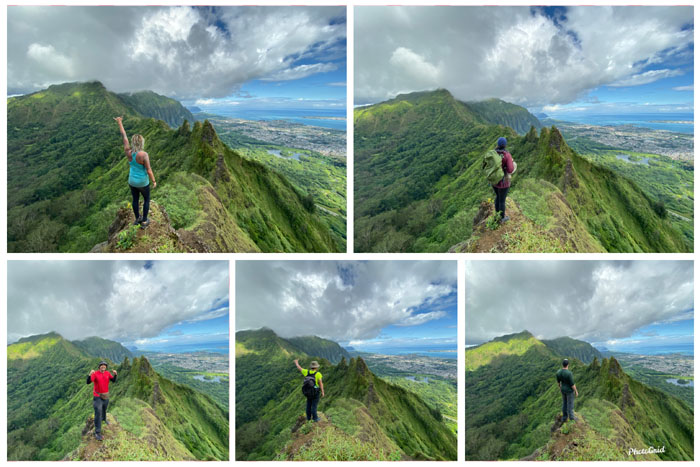
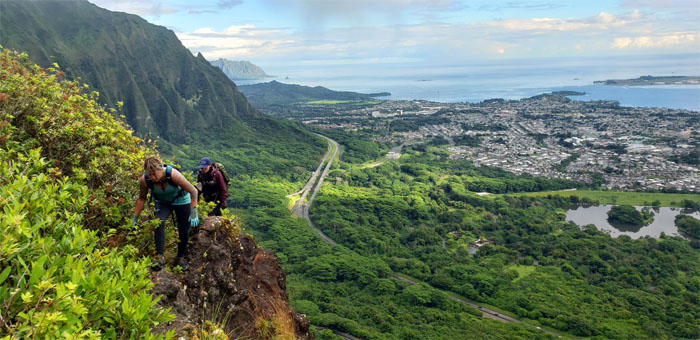
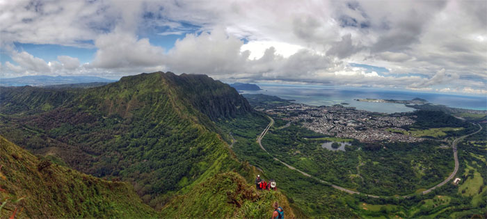
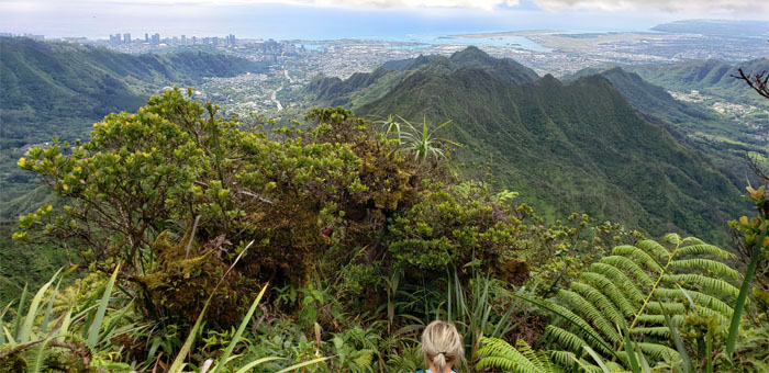
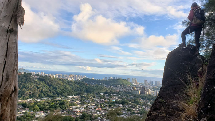
Kalihi Saddle
Wide angle photos of the scenic spot overlooking the saddle, courtesy of the iPhone 11.
Lanihuli Wall
Contouring around the can opener to ascend the grassy flank. Photo by Yoly Bedford.
Lanihuli Wall
Passing the first tier of the wall and going to the next and longer tier.
Lanihuli Wall
Cisco pulling himself up the near vertical flank. Look for the red dot. Drone photo by Ben Hinders.
Lanihuli Wall
Almost there. Photo by Yoly Bedford.
Kalihi Saddle
The face of sheer exhaustion.
Kalihi Saddle
The centipede crawl up the saddle.
Kalihi Saddle
When arms and legs go akimbo as the ridge was too narrow to pass. Photo by Yoly Bedford
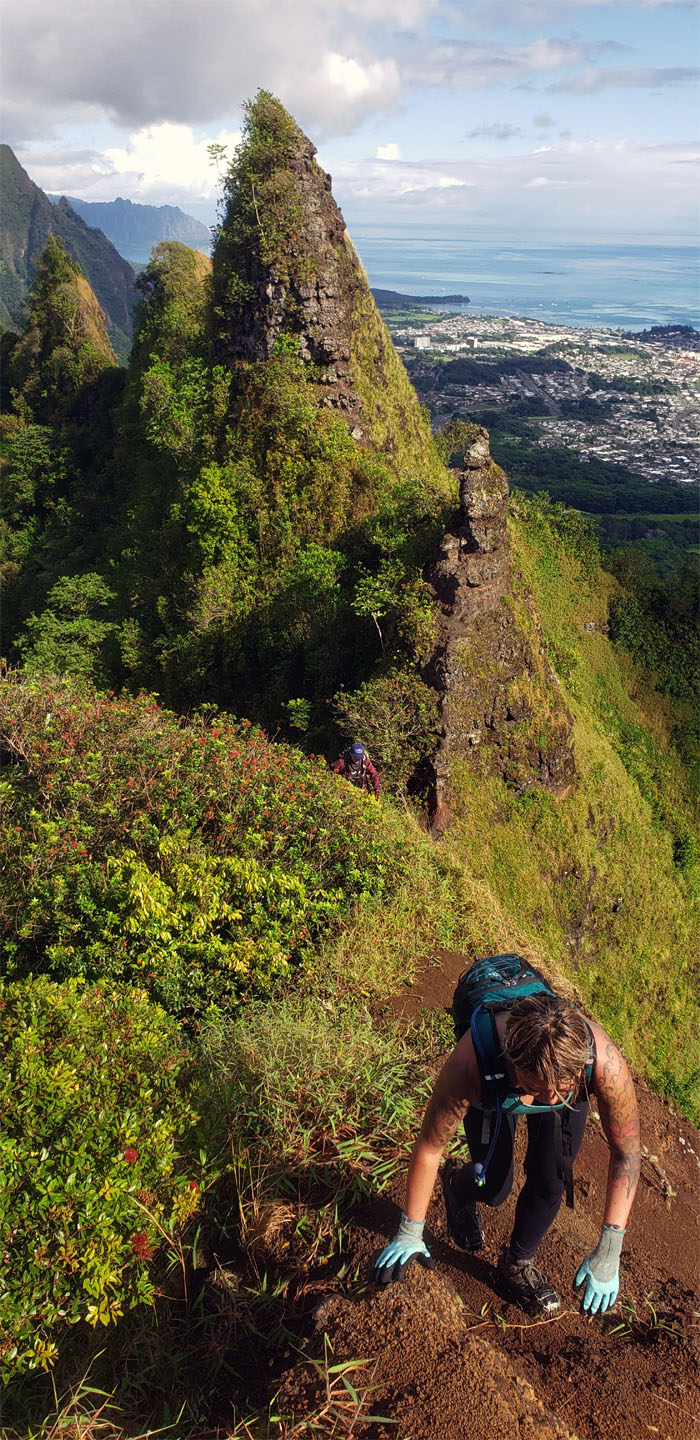
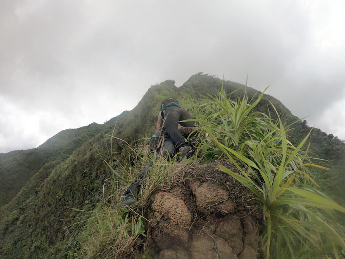
Dirt Dragon
Straddling and standing on the skinny serpentine of a ridge.
Kalihi Saddle
Time to get off the back of the dragon and back on the ridge. Photo by Cisco Quintanilla.
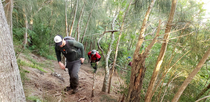
Kalihi Saddle
Pushing ourselves up the slow and exhausting climb.

Kalihi Saddle
Scrambling our way out of the saddle. Photo by Yoly Bedford.
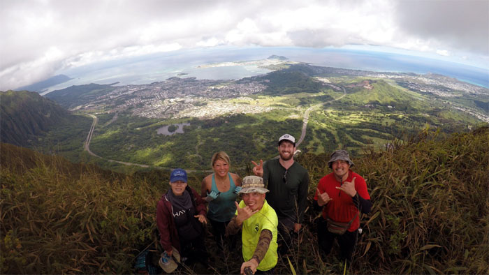
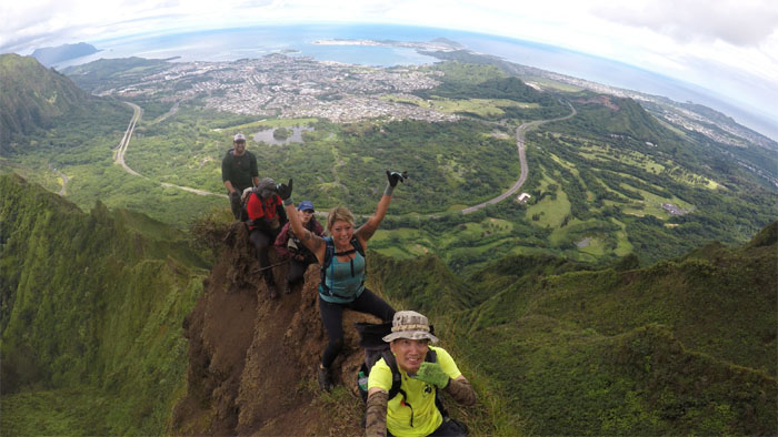
Lanihuli Summit
Group photo at the swirling heavens, left to right: Yoly, Katie, myself, Ben and Cisco.
Lanihuli Summit
Leaving the 2,780′ summit.
Kapalama Trail
Going down the initial steep descent that was clogged with vegetation and muddy underfooting.
Kamanaiki Junction
We briefly considered doing the overgrown loop and then thought better of it.
Kalihi Saddle
Looking back at the spur ridge that we had originally planned to go down, but discovered that the junction fell short of the summit. Lesson learned.
Kapalama Trail
Making our way down the rustic trail.
Kapalama Trail
The tree that time forgot.
Kapalama Trail
The trail soon took on a more manicured and maintained appearance going down.
Kapalama Trail
Where horizontal and vertical intersects outside of mathematical equations and poetry.
Kapalama Trail
Looking for the correct trail to follow amidst the colored ribbons littered on the ground. Photo by Yoly Bedford.
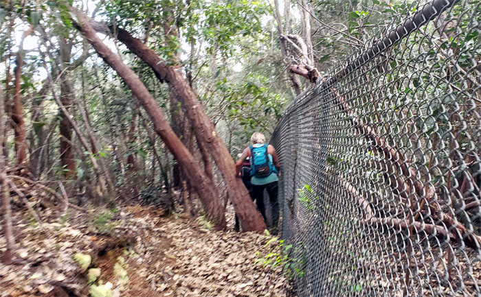
Kapalama Trail
Following the fence line on the outside to avoid being trapped and detoured to another exit.
Kapalama Trail
Yoly overlooking the extinct volcano of Pouwaina surrounded by urban blight.
All pau
Walking up to the postage stamp sized of a park where Quan and Lonnie where waiting to pick us up.
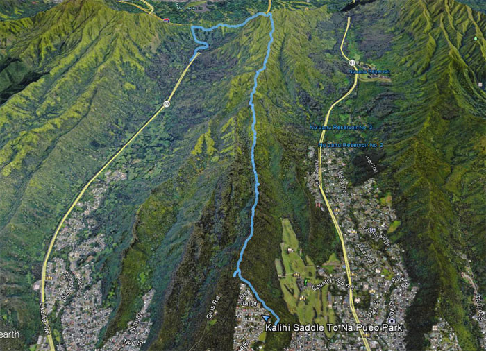
GPS Tracks
Our saddle and ridge hike covered 5.56 miles with a great group. Post hike meal at Lilihia Bakery where the oxtail soup never seems to run out.
Video by Ben Hinders of our saddle hike.
Note: I have been made aware that some hikers have been using my blog as a hiking guide and getting lost on the trails. Please note that this blog was made to document the hike for the crew(s) that did it. That is why some of my comments will seem to have no relevance or meaning to anybody outside of the crew(s) that hiked that trail. My blog was never meant as a hiking guide, so please do not treat it as such. If you find inspiration and entertainment from these hikes, that is more than enough. If you plan on replicating these hikes, do so in the knowledge that you should do your own research accordingly as trail conditions, access, legalities and so forth are constantly in flux. What was current today is most likely yesterdays news. Please be prepared to accept any risks and responsibilities on your own as you should know your own limitations, experience and abilities before you even set foot on a trail, as even the “simplest” or “easiest” of trails can present potential pitfalls for even the most “experienced” hikers.
{ 0 comments… add one now }