
I decided to stay at sea level elevation this week and went waterfall exploring with Chris and Jasmin. My body was still recovering from last week’s extreme hike.

A well traveled trail
We found parking on Nuuanu Pali Drive and entered the opening in the bamboo forest.

Follow the source
Hopping over the water pipe, the upper falls gurgling with fresh water soon greeted us.

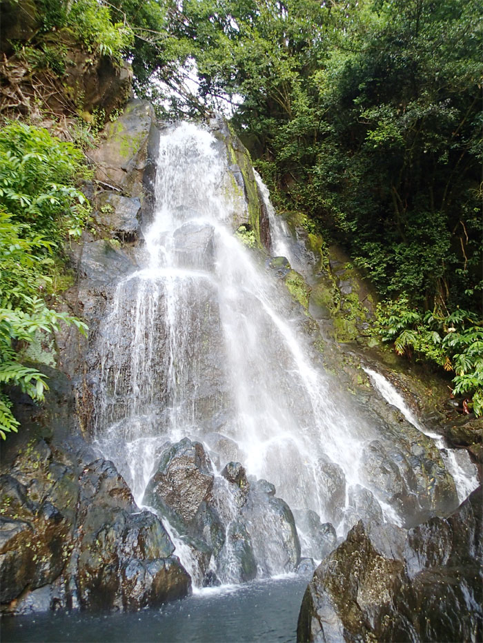
Cascading waterfall
Looking down from the top of the falls. Don’t stand too close!

Going down the hill
Chris picked up the trail to the left of the falls and we made our way down the mosquito infested hill.

Luakaha Falls
The grass surrounding the falls was nicely clipped as it’s supposed to be on private land.

GPS Tracks
The short walk to the falls was only .75 mile round trip. Not enough to make a day of it, we proceeded to the next stop – Likeke Falls.

Trailhead A or B?
Most people start from the Pali Lookout to get to Likeke Falls, Chris knew of a shorter way from the Ko’olau Golf Course. There was a large sign saying no parking for hikers until after 11:30am. Hmmm, I guess that meant us? Luckily Jasmin was able to squeeze her car into the last “open” space in front of the Old Pali Road gate.

Old Pali Road
We walked up the Old Pali Road, passing the golf course’s shop and soon made a right into the forest where Chris and Jasmin are standing. This took us to the top of the golf course’s parking lot where the trailhead starts. Security was there to thwart any hikers that chose to ignore the sign that was posted at the bottom.

Can you see the puka?
A graffitied water tank blocked further progress on the trail, the junction is actually to the left just before the tank. Can you spot Pali Puka?

Big Tree Junction
We picked up the Old Pali Road again, slowly being reclaimed by Mother Nature, and took a right at where Chris is peeking out from.

Calathea lancifolia
Yellow and red rattlesnake plants lined the trail.

Likeke Falls
More mosquitoes greeted our arrival, fresh meat! These falls seemed to have become very popular recently, with more locals and tourists flooding the area. Today, we had the place all to ourselves.

Obligatory group shot
My camera has a 30 second timer, which comes in handy when scrambling up wet, mossy rocks.

Town view
Looking out towards town, one can actually follow the stream all the way back out to civilization.

Costus spicatus
Checking out the Indian Head plants on the way back out.

Walk down memory lane
Hard to imagine, that this used to be the main artery for folks to get to and from the Windward side.

GPS Tracks
The 1.45 mile hike led us to the second and last waterfall of the day.
{ 5 comments… read them below or add one }
Wow great shots of your adventure! Can’t get over the fact that that was the main way across from windward. I heard it took 20 years to build H3.. let’s hope that this rail system will be a success too and cut down some traffic ????
Aloha Drena,
Thanks! Yup H3 took decades due to cost overruns and lawsuits and carried a hefty price tag. I fear the rail will follow in its footsteps, hopefully it will alleviate the traffic, but not much I fear.
Mahalo
Aloha, yes, really unfortunate. And taking its toll with taxes and registrations. We will be moving off this beautiful Aina but I pray that those who are here will get something out of it. Much love and thanks for sharing these beautiful images!!
Hello! I was wondering if you guys could identity a waterfall for me. If you get back to me on email ic a send you an image ive been looking for it forever! thank you!
Aloha Emelia,
Sure, I’ll do what I can to help, but waterfalls are not my fav. lol.
Mahalo