
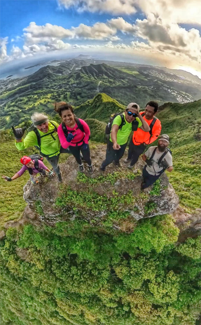
We all gathered to check off a list, not necessarily on everybody’s checklist, but a list nevertheless.
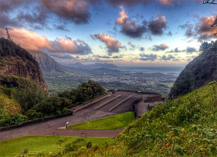
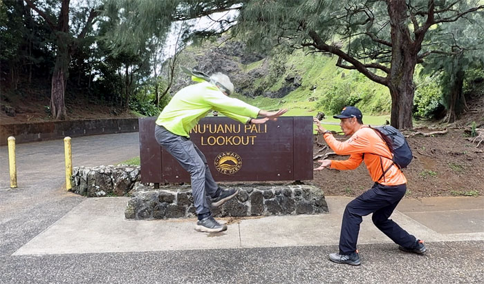
Pali Lookout
Thanks to Lilia and Tessa for dropping us off at the historic vista that was witness to the 1795 Battle of Nu’uanu and was strangely devoid of the usual gawkers but not the whipping winds that caressed and carved the neighboring mountains.
Nu’uanu Pali
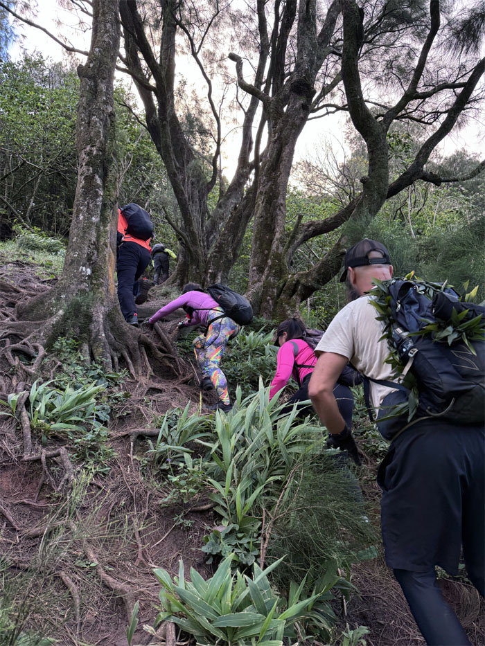
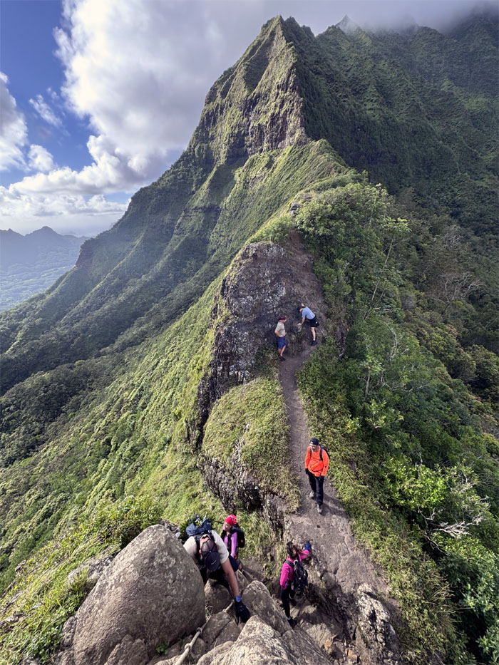
Climbing our way up the rooted and forested landscape.
Nu’uanu Pali
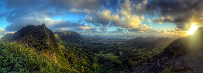
Enjoying the breaking sunrise as our blue marble rotated on its axis.
Nu’uanu Pali
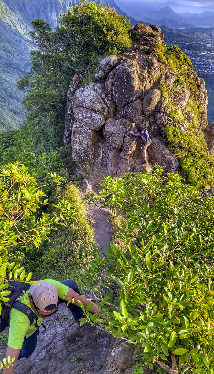
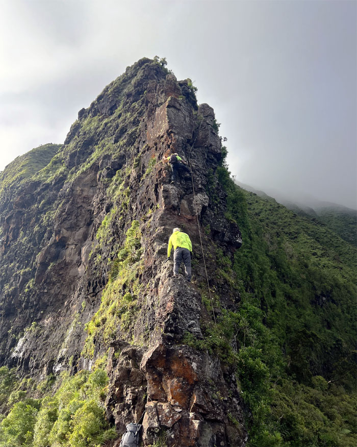
Akira entering the rock corridor as we slowly gained elevation.
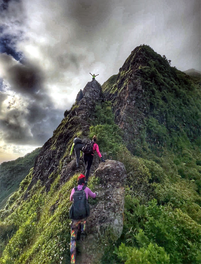
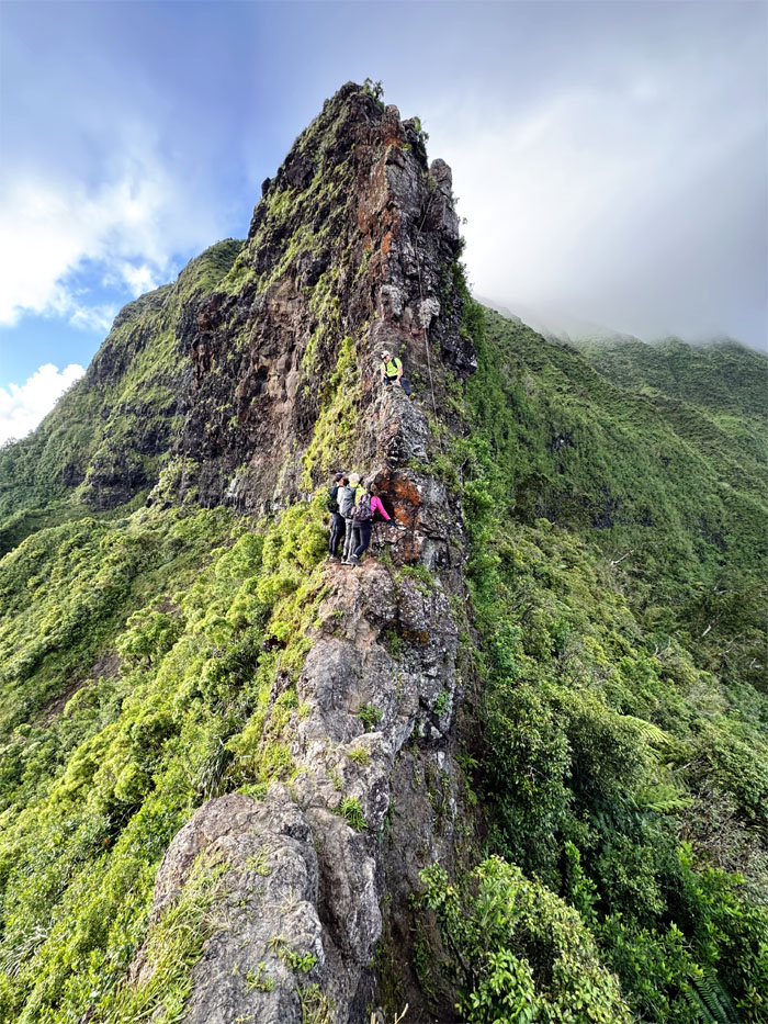
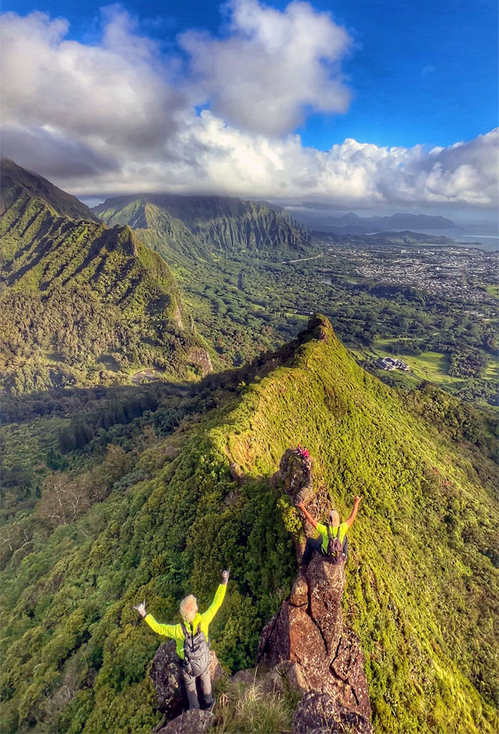
Pali Notches
Chico was not maintaining his three points of contact. Throwing caution to the wind.
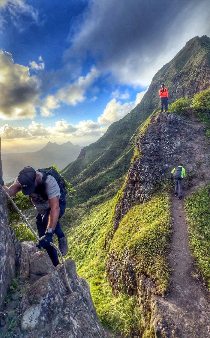
Pali Notches
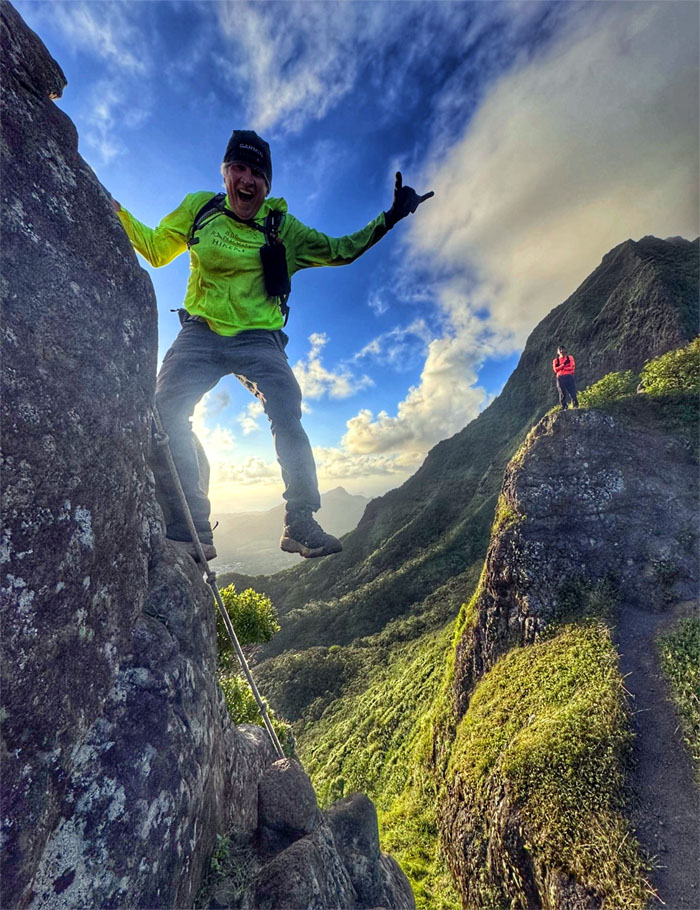
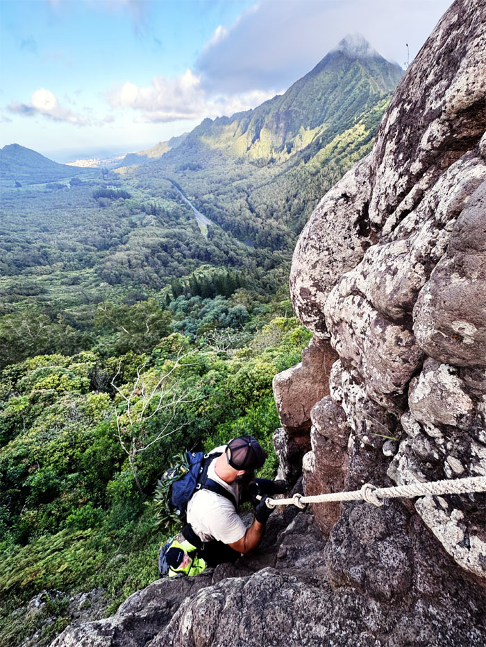
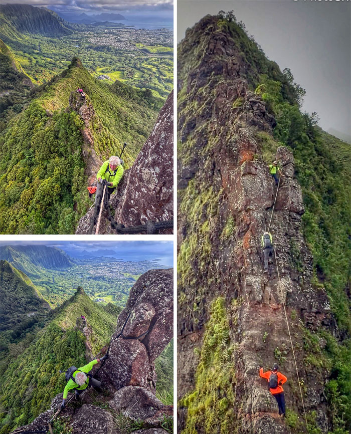
Scotty descending down the first notch on his first visit to this part of the Ko’olau Summit Ridge Trail or Nu’uanu Saddle.
Pali Notches
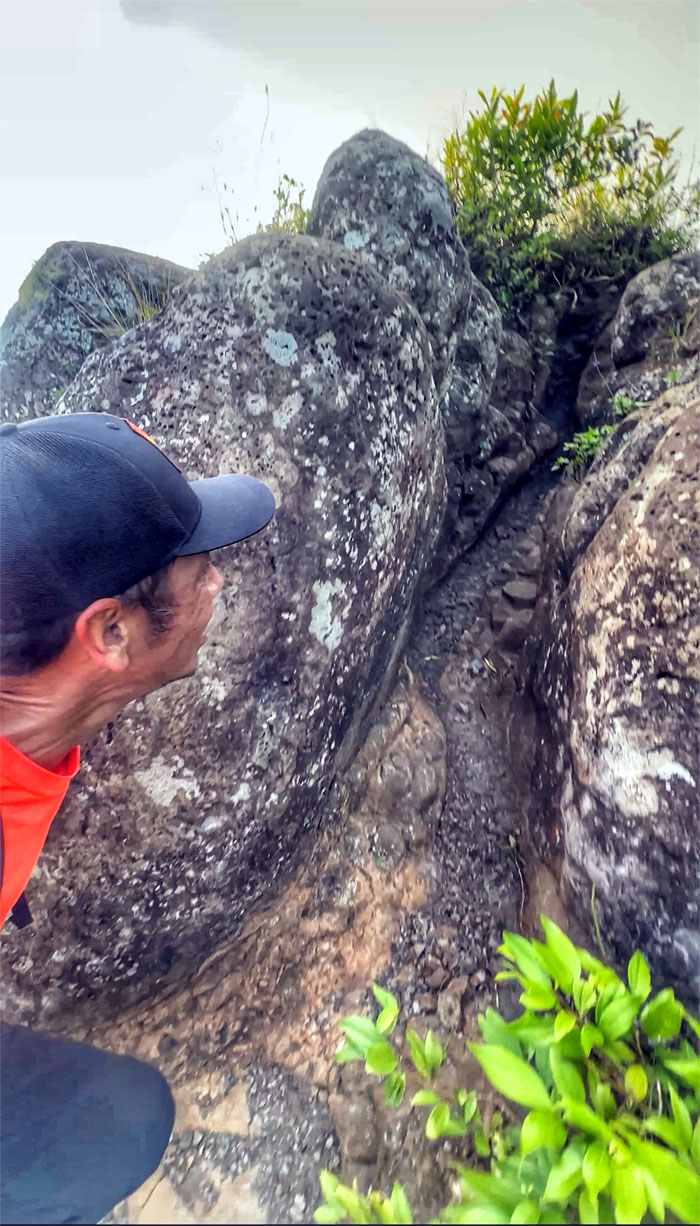
Marilyn climbing down the first of the rectangular gap which folklore states that Hawaiians carved these notches out of solid basaltic rock for canon emplacements to be used against King Kamehameha when he invaded Oahu in 1795.
Pali Notches
Climbing our way out of the first notch that was more likely formed when the dikes fractured over time and erosion.
Pali Notches
Scott going down into the largest of the dike fractures.
Pali Notches
Posing and climbing down into the second canon emplacement or scout lookout used by the defenders of King Kalanikupule against the invading army of King Kamehameha who sent his scouts up the mountain to disable the sentries.
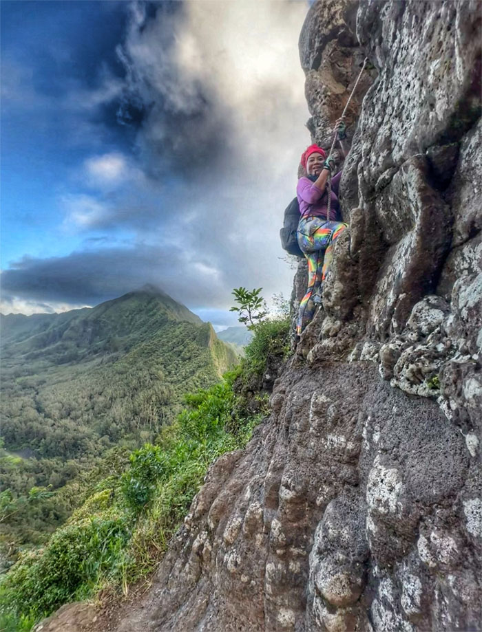
Pali Notches
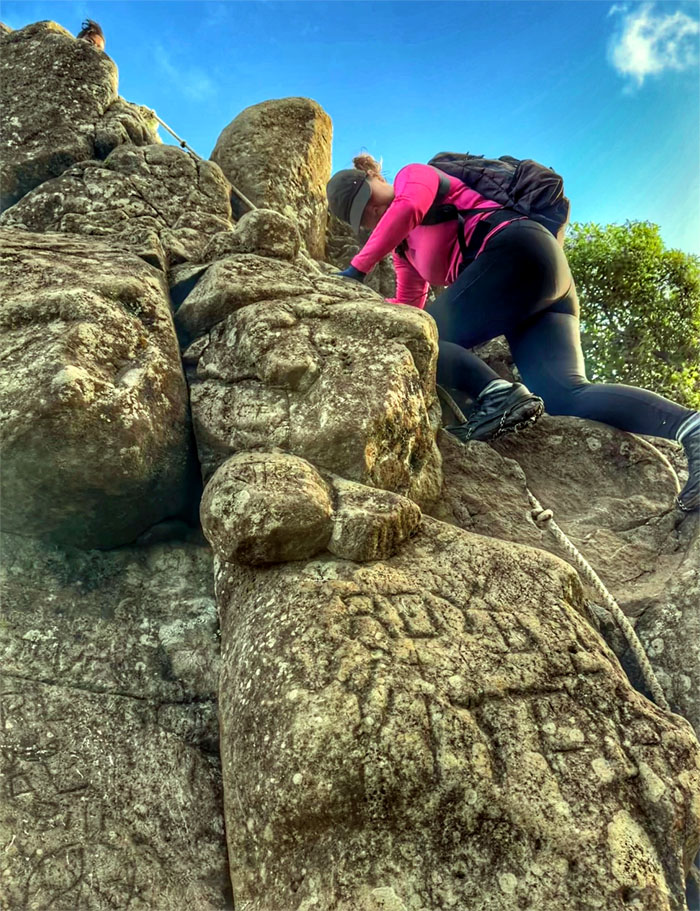
Cristy demonstrating the correct way to climb down and not the exaggerated leaning back look made for dramatic IG shots and potential falls.
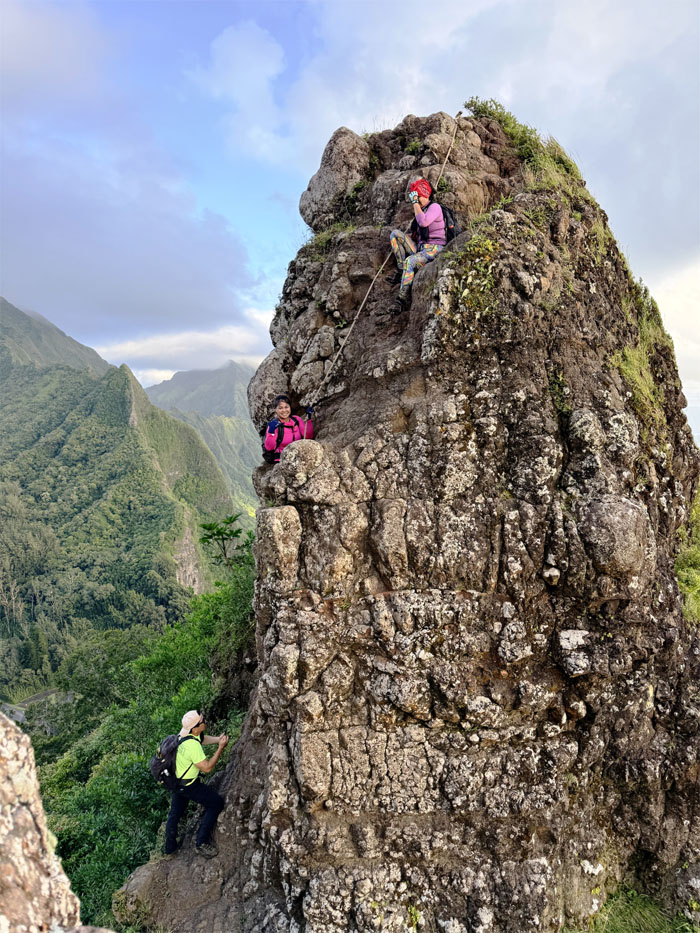
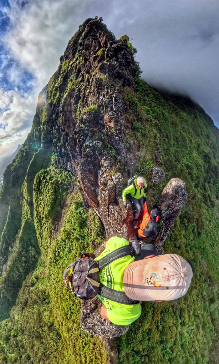
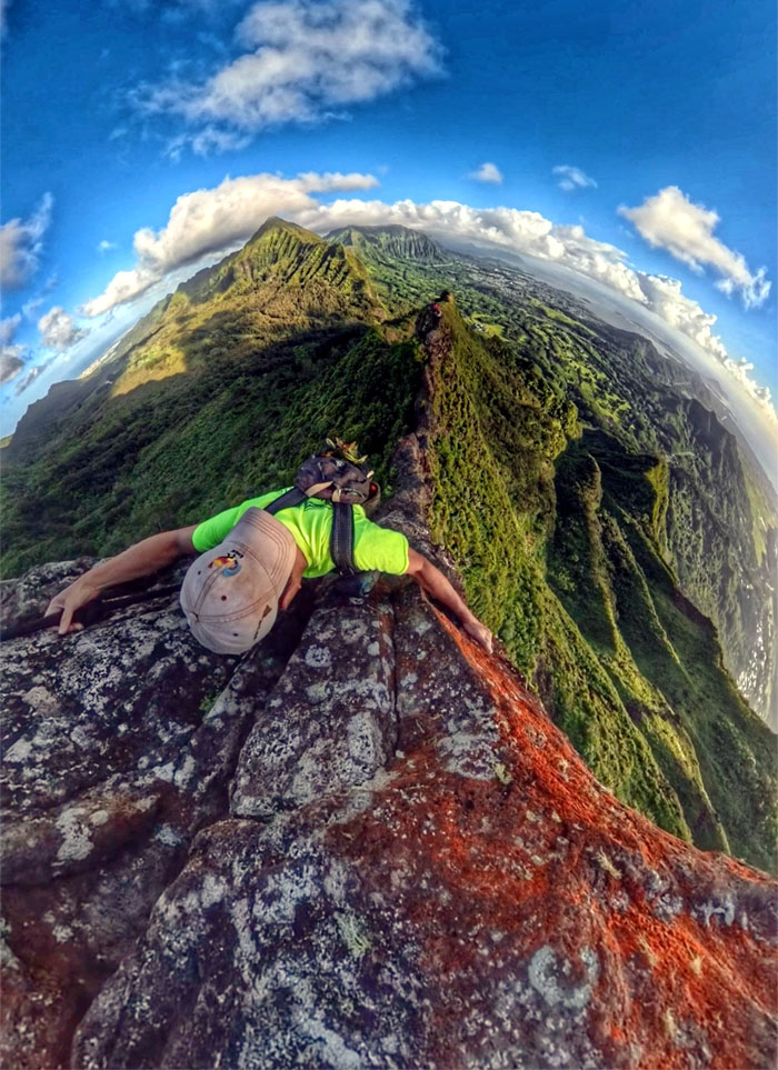
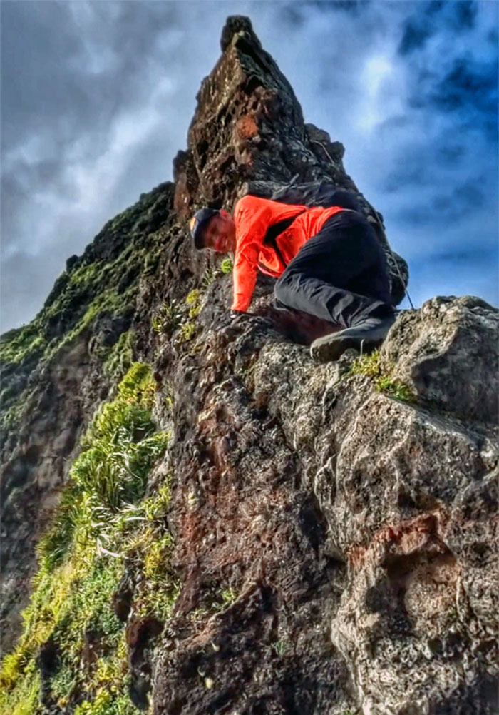
The Nipple
Making our way towards the stubby column of isolated basaltic rock.
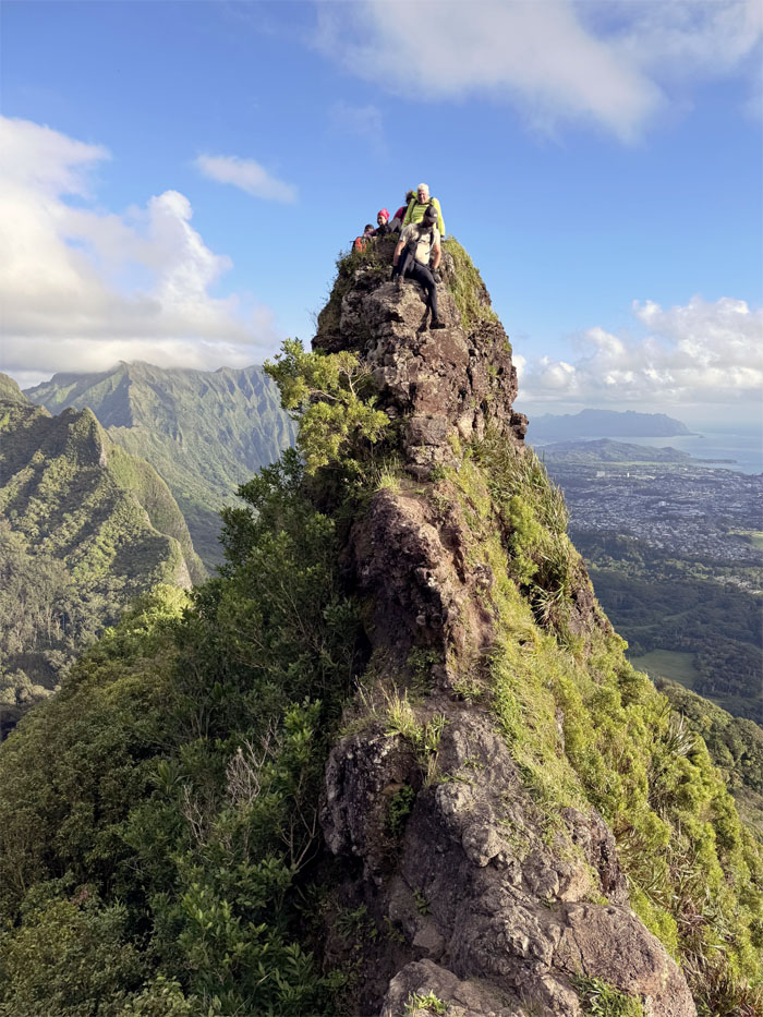
The Nipple
The group climbing down the rock spire.
The Nipple
Make or break time.
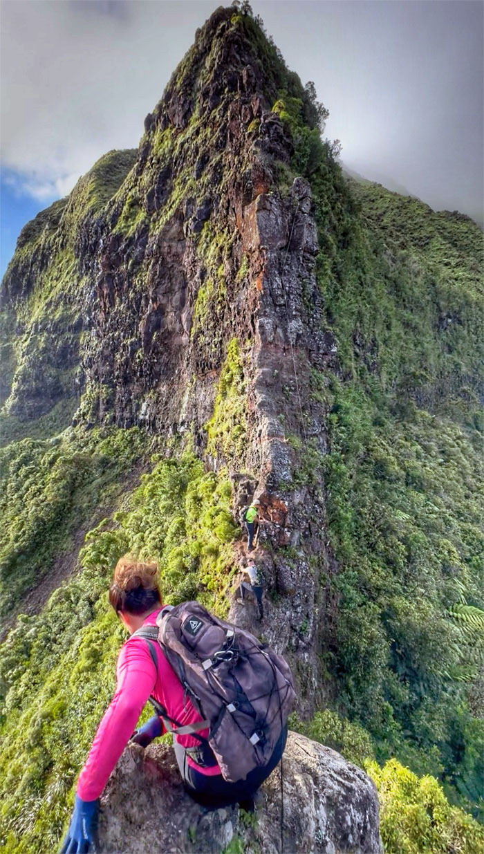
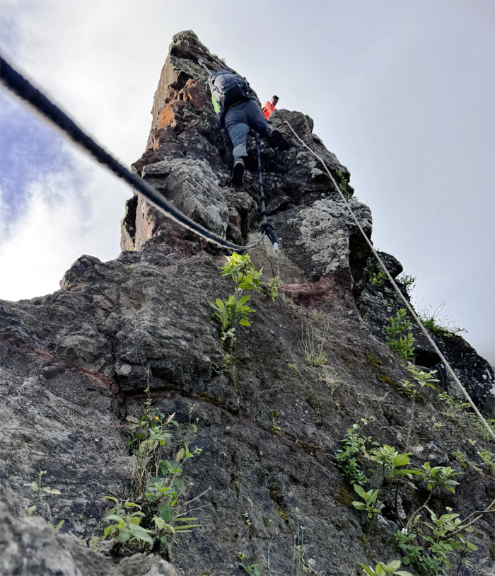
The Chimney
Deep thoughts. Somebody was not ready for prime time. The mountains will always be here.
The Chimney
Somebody still wanted a small taste, so without further aplomb, heigh-ho, heigh-ho, it’s off we go.
The Chimney
If there ever was a personified definition of true grit, it would be this individual right here. Kudos to Chico for completing his second climb up and down the chimney, unassisted.
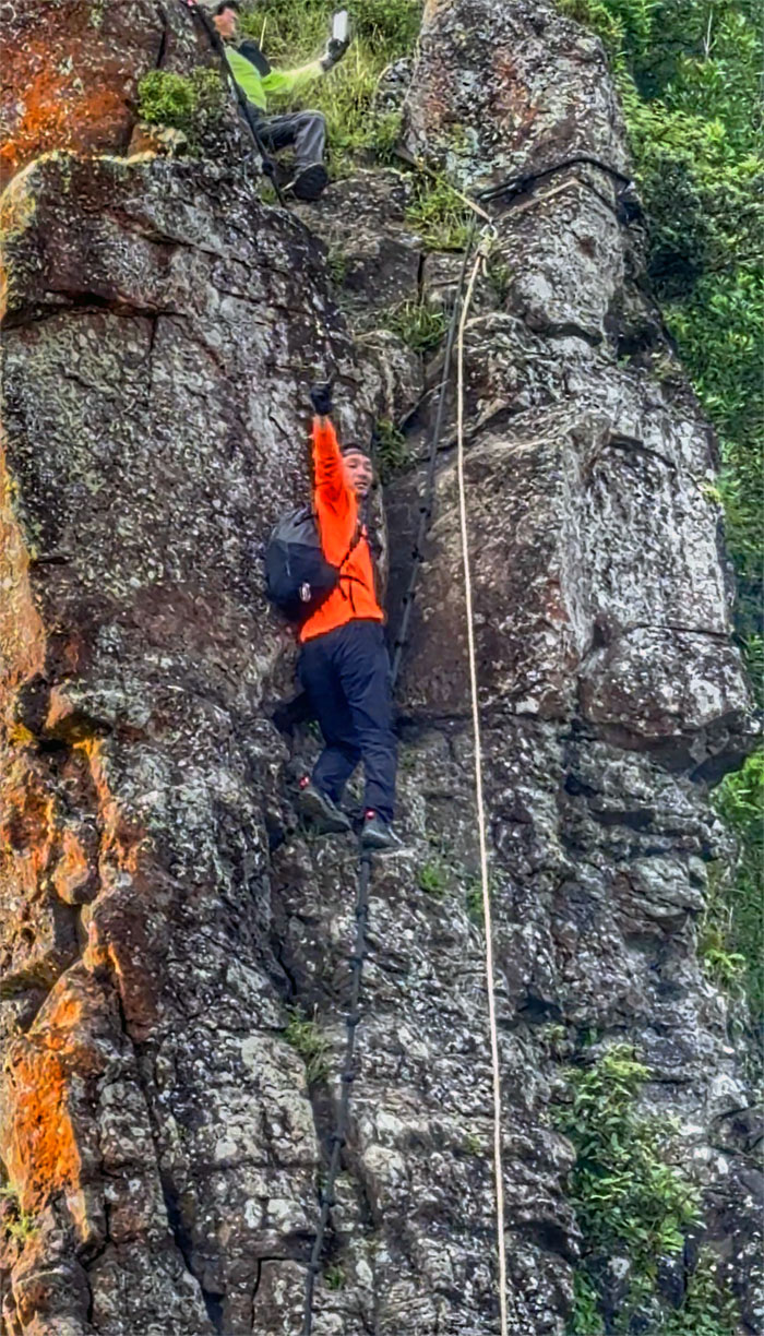
The Chimney
Shout out to my noisy_hawaii fans. Please visit my YouTube channel.
The Chimney
Three’s a crowd. More the merrier.
The Chimney
Seen from the front and the back. Double the viewing pleasure.
The Chimney
Demonstrating the classic rule of gravity as immortalized by Sir Isaac Newton.
The Chimney
POV that makes the grade look not half bad.
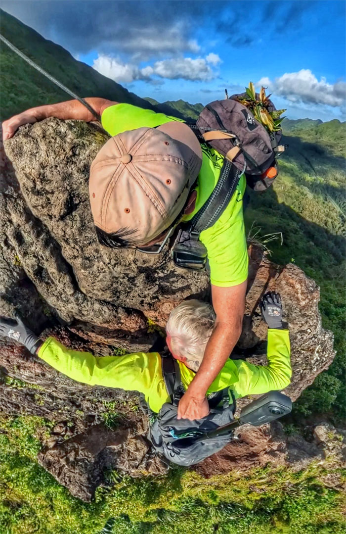
The Chimney
I got you bro. Charge is still only a nickel. Doing my part to keep inflation at bay.
The Chimney
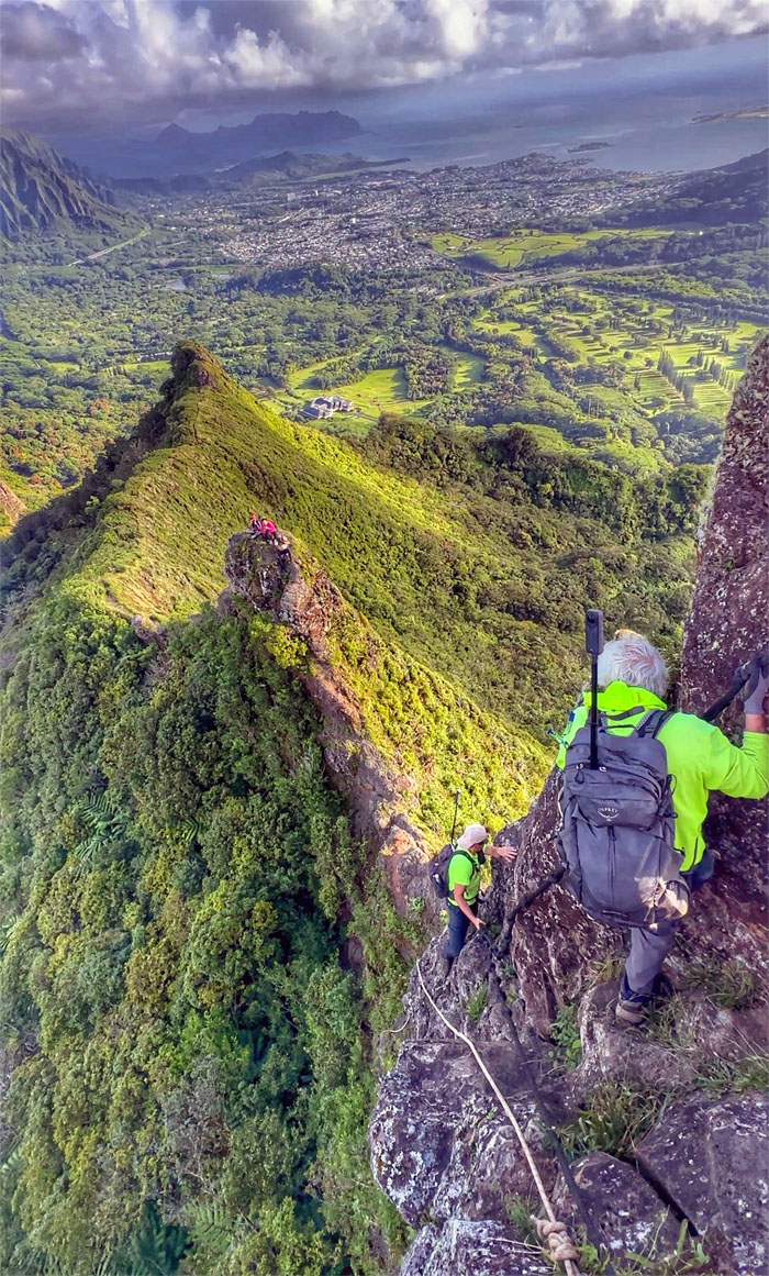
Akira waiting to get off the sliver of a rock to more solid footing.
The Nipple
Reunited back on the windswept rock where Akira lost his cap to the mountains but got it back on the contour trail below us.
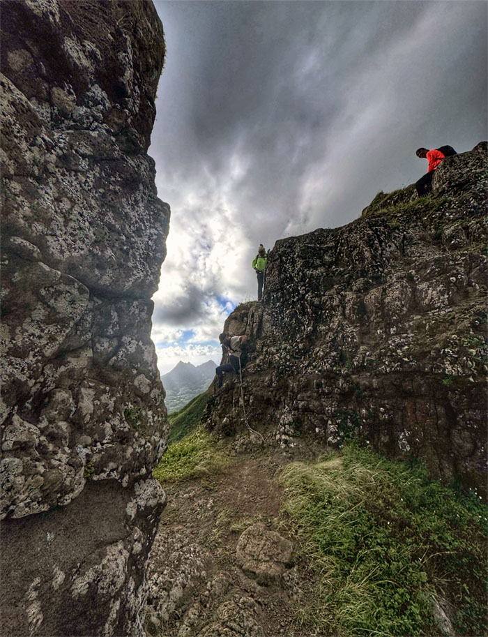
Pali Notches
Olomana framed by the notch walls.
Pali Notches
We crossed paths with two other hikers who were debating going past the first notch, for one, the World Cup showing at 0900 took precedence over setting foot on new ground.
Pali Notches
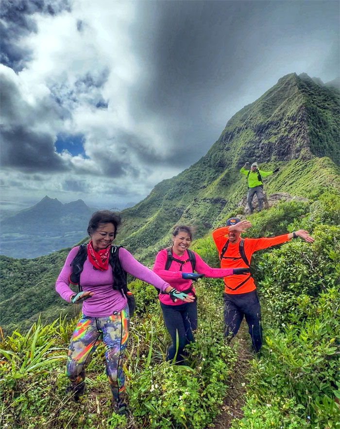
The hike is not complete with dancing in some form or fashion. Participation is welcome.
Nu’uanu Pali
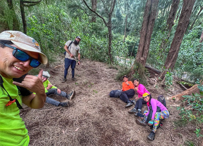
Hanging out at the KST campsite until Lilia and Scott came to collect us. Mahalos!
All pau
Chico being blown away by Akira channeling his inner Dragon Ball energy. Not to be confused with kimatteiru. Our morning hike didn’t even crack a mile let alone beads of sweat. It was still a safe and fun hike with good company. Post hike meal at Koa Pancake House as the wait at Koko Head Cafe exceeded our parking time.
Photos/Crew taken by Akira Suzuki, Chico Cantu, Cristy Meador, Marilyn Bermudez, Scott Peterson, and yours truly. Not necessarily in order.
Note: I have been made aware that some hikers have been using my blog as a hiking guide and getting lost on the trails. Please note that this blog was made to document the hike for the crew(s) that did it. That is why some of my comments will seem to have no relevance or meaning to anybody outside of the crew(s) that hiked that trail. My blog was never meant as a hiking guide, so please do not treat it as such. If you find inspiration and entertainment from these hikes, that is more than enough. If you plan on replicating these hikes, do so in the knowledge that you should do your own research accordingly as trail conditions, access, legalities and so forth are constantly in flux. What was current today is most likely yesterdays news. Please be prepared to accept any risks and responsibilities on your own as you should know your own limitations, experience and abilities before you even set foot on a trail, as even the “simplest” or “easiest” of trails can present potential pitfalls for even the most “experienced” hikers. One should also always let somebody know of your hiking plans in case something doesn’t go as planned, better safe than sorry.
{ 1 comment }


