

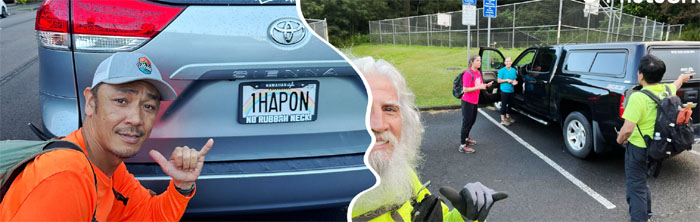
We picked up from almost two months ago when inclement weather forced us to prematurely shorten our destination. Met up with Aida, Akira, Chico, Ferlino and Roger in Moanalua Valley.

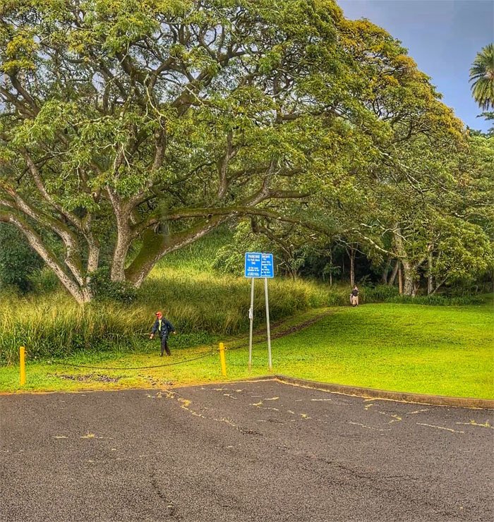
Moanalua Valley
The park is now open for business!
Moanalua Valley
Prior to starting our hike, Akira found a perhaps long distant cousin of his and we informed a couple hikers that it would be best to park outside, contrary to law enforcement advice.
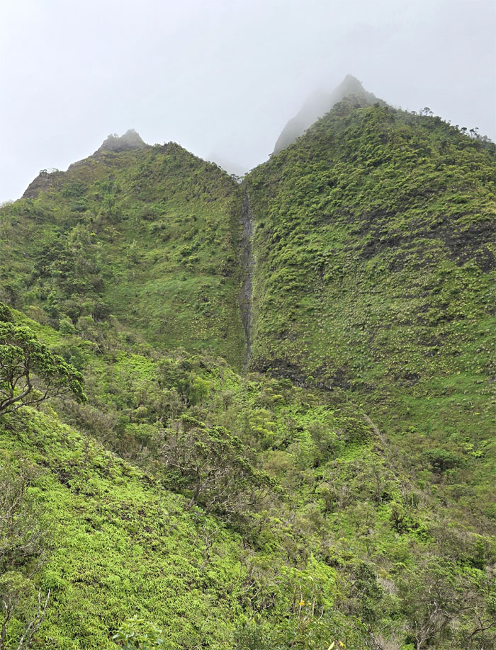
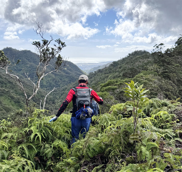
Kamananui Valley Trail,
Walking on the old carriage road that once belonged to the Damon Estate, a storied family that was intertwined in Hawaii’s political and economic history from the 1880s.
Kamananui Valley Trail,
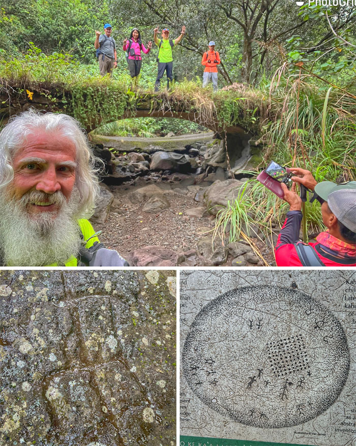
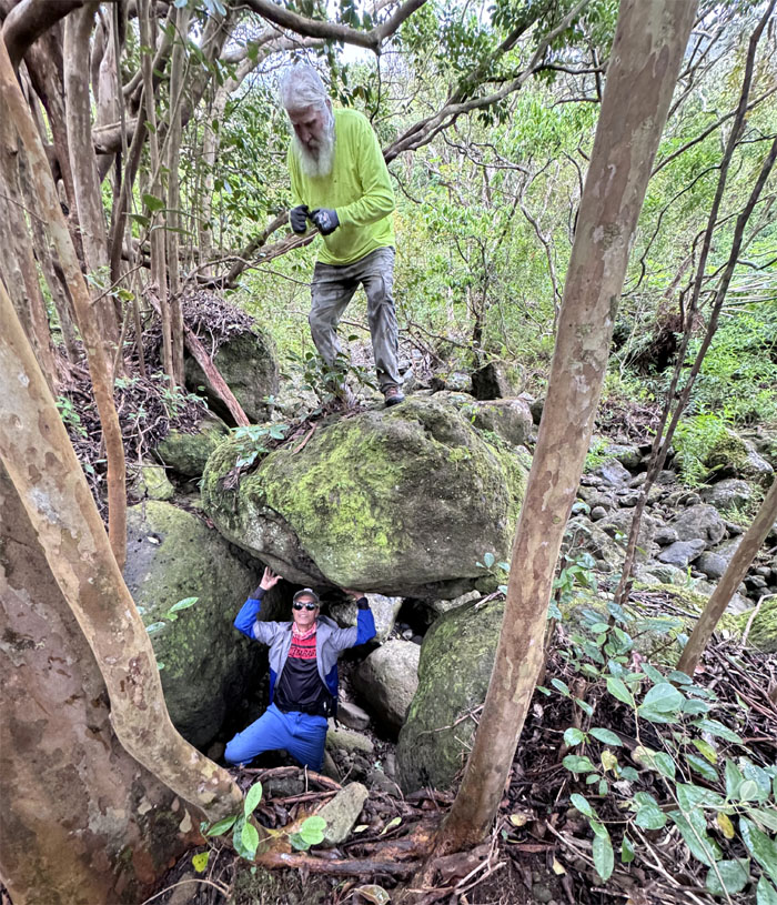
Stopping at the seventh and final bridge on the trail and also the spot where the Pohakukaluahine sits, the stone of the old woman that stopped the construction of the H3 through this valley.
Kulana’ahane Junction
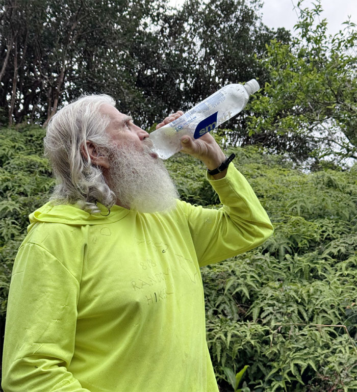
Chico showing us the best way to drink water from a bottle. Now you know. CB also showed up fashionably late.
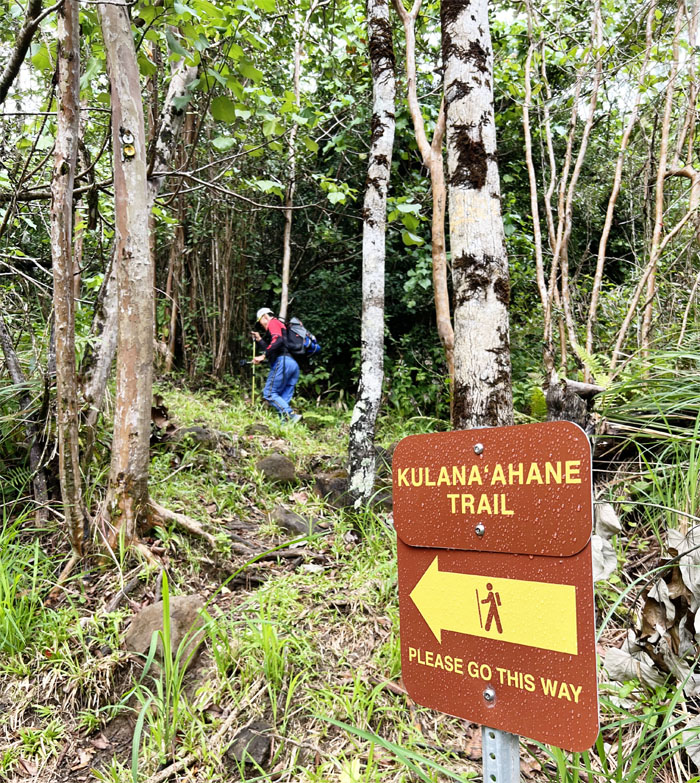
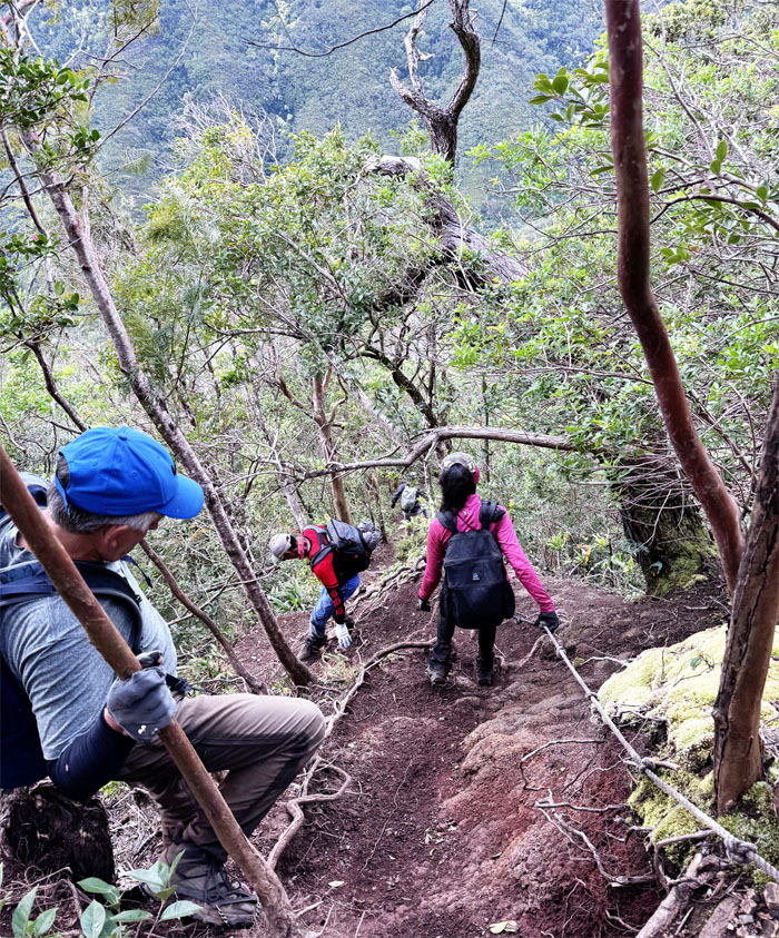
Kulana’ahane Trail
Politely following directions.
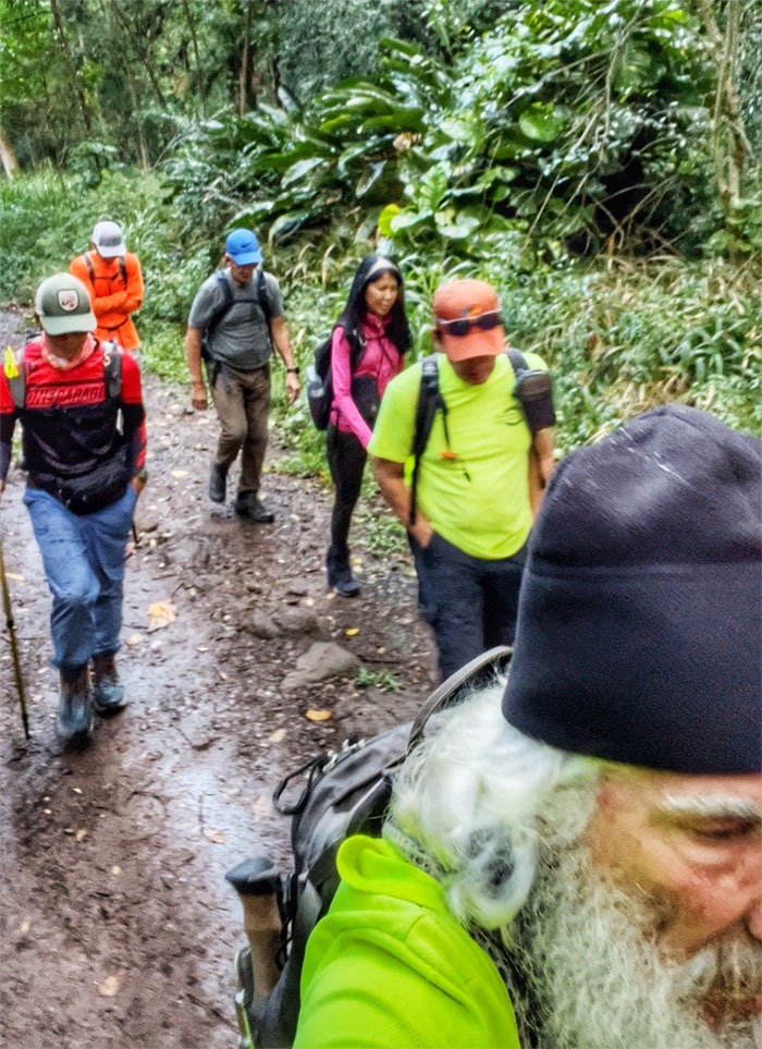
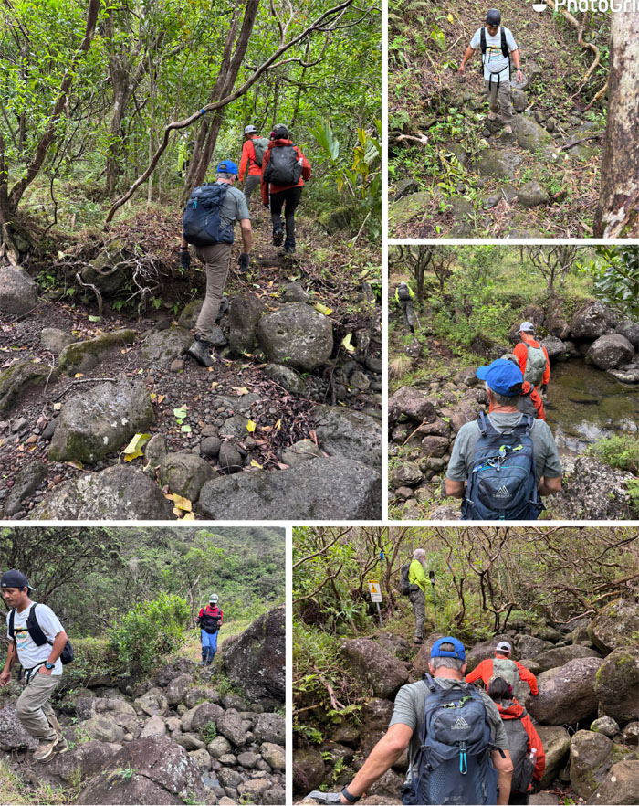
Kulana’ahane Trail
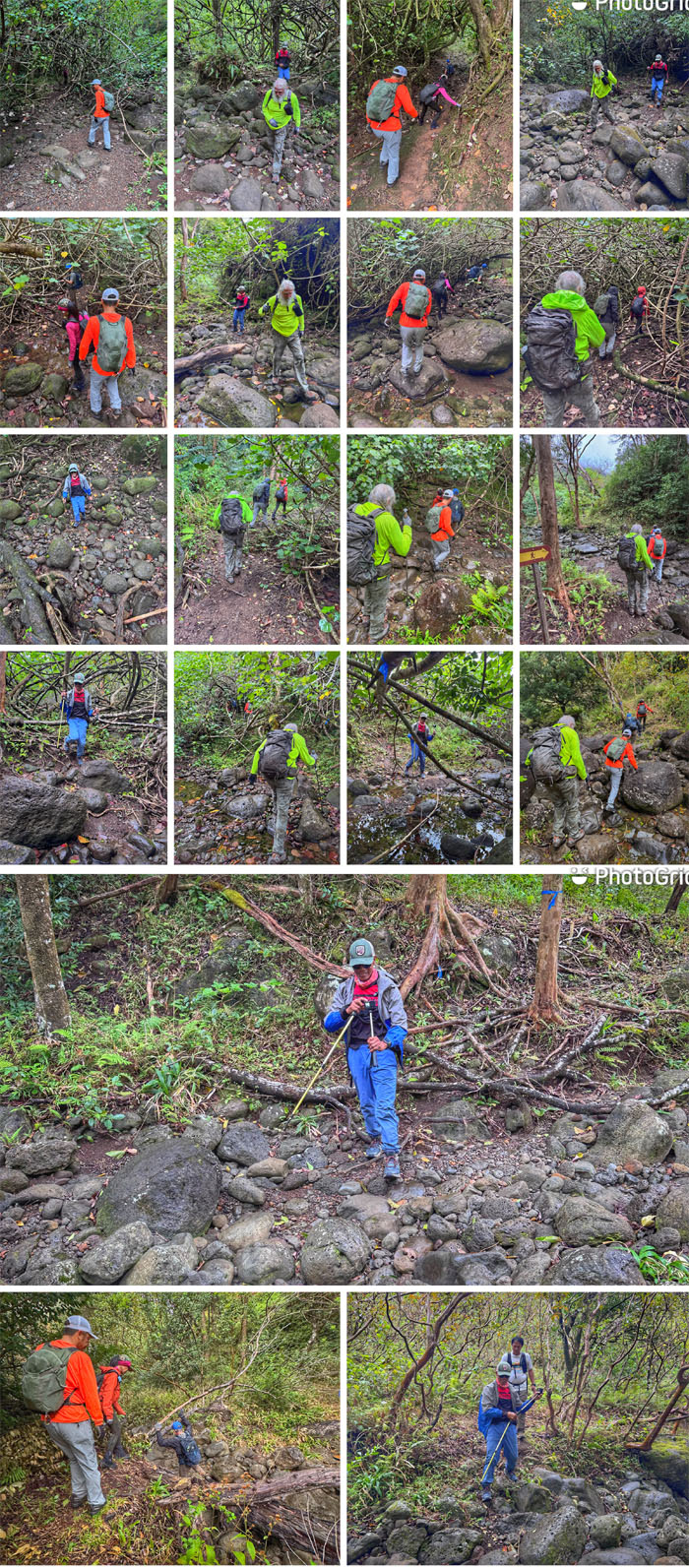
How many stream crossings are on the trail and what constitutes a stream crossing? Let’s apply our interpretation and find out. 19 so far.
Kulana’ahane Trail
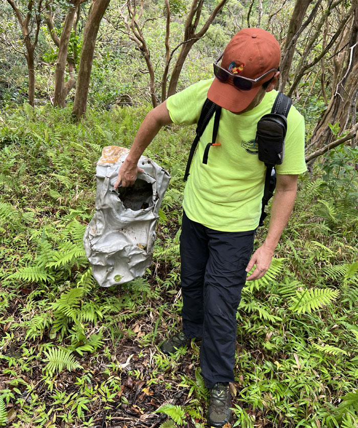
Checking out the wreckage from a P-47 Thunderbolt plane that crashed in the late 1940s. The pilot survived the crash.
Kulana’ahane Trail
Up to 23 now.
Kulana’ahane Trail
Rock detour.
Kulana’ahane Trail
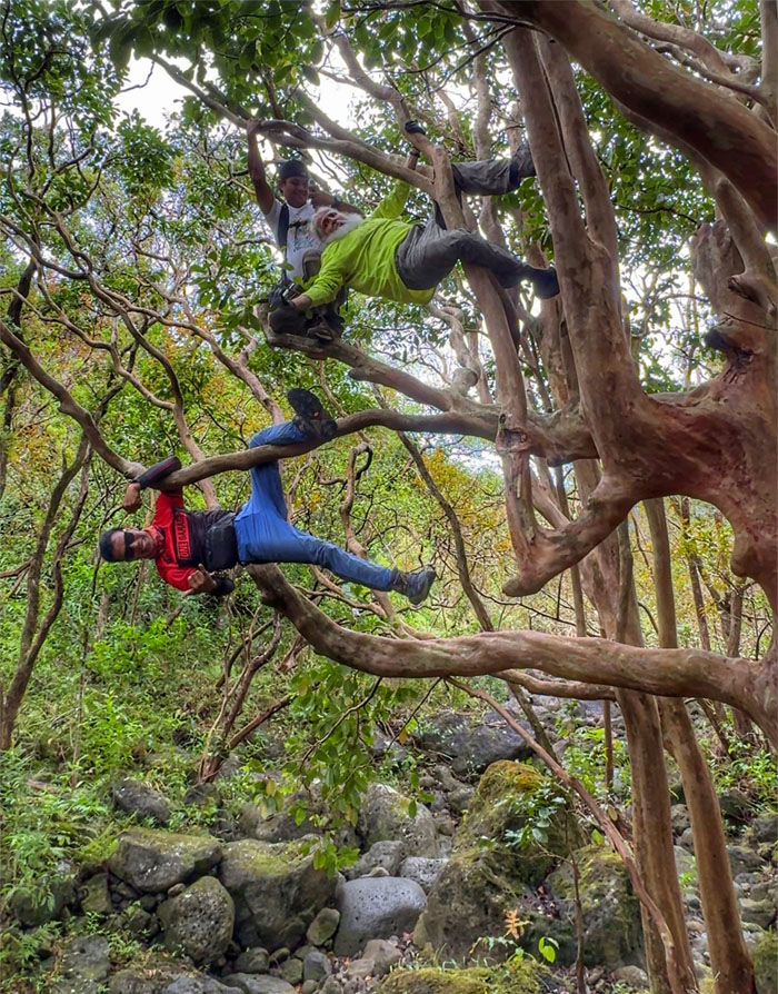
Tree climbing. Somebody was probably thinking if we are even going to do the saddle today.
Kulana’ahane Trail
Right or wrong. 28 is the final count.
Kulana’ahane Trail
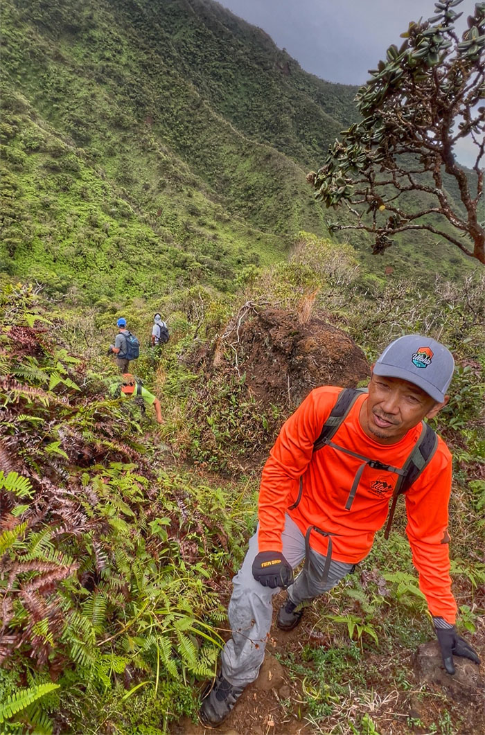
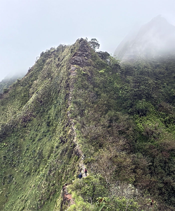
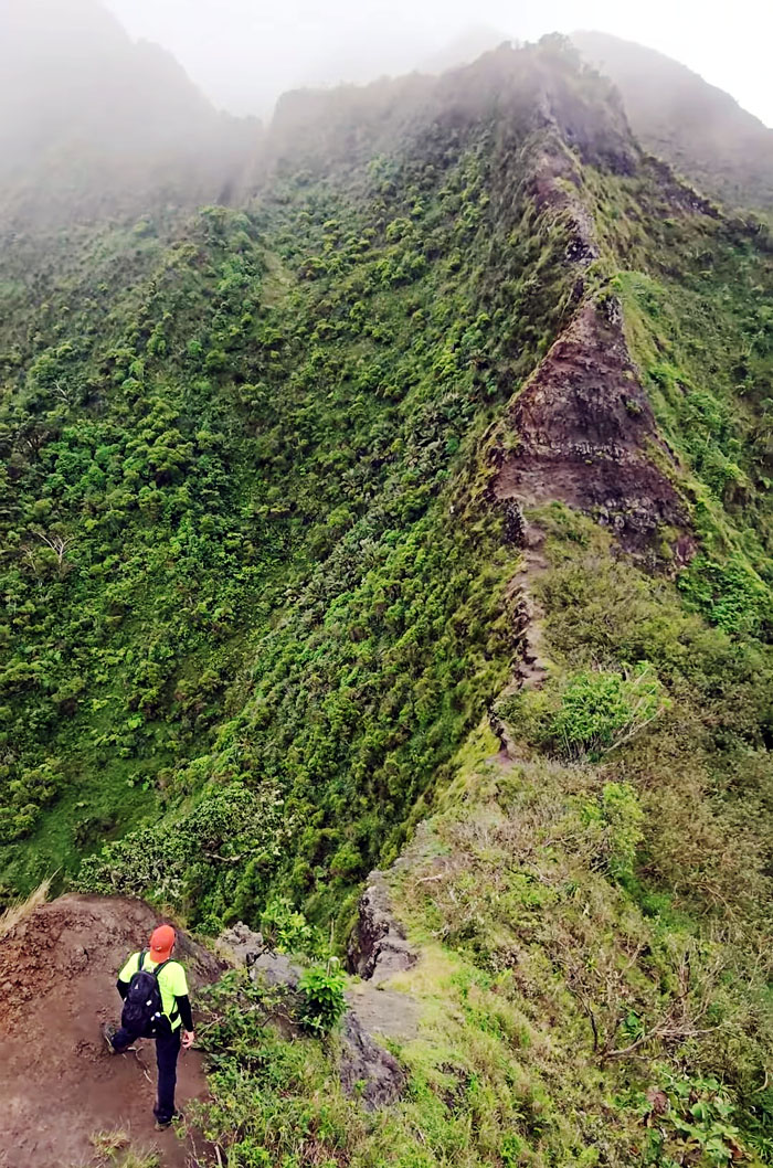
Starting the climb up the short but steep spur ridge.
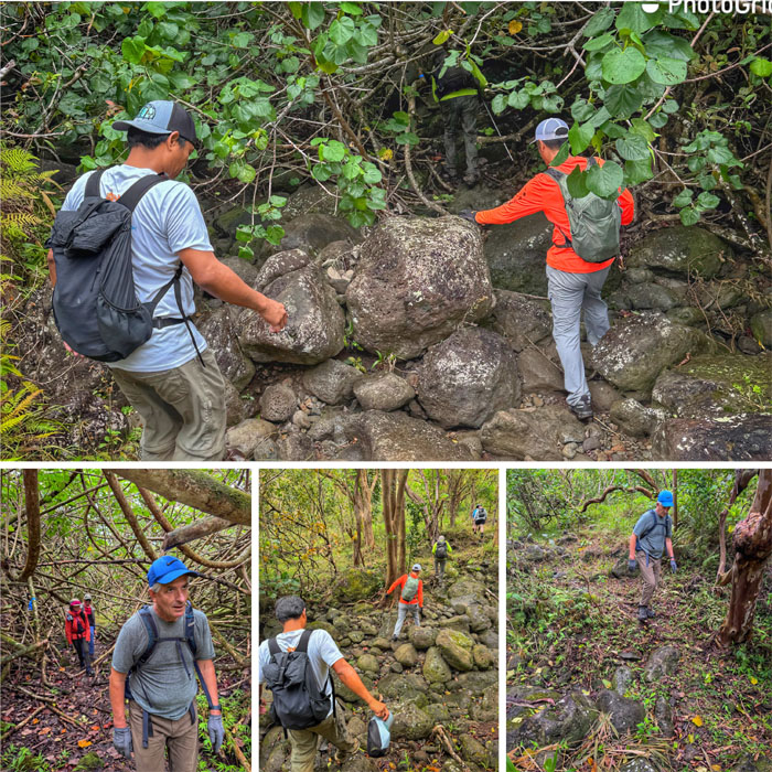
Kulana’ahane Trail
We could see that Moanalua Falls was trickling today.

Kulana’ahane Trail
Pushing our way to the top. Almost there.
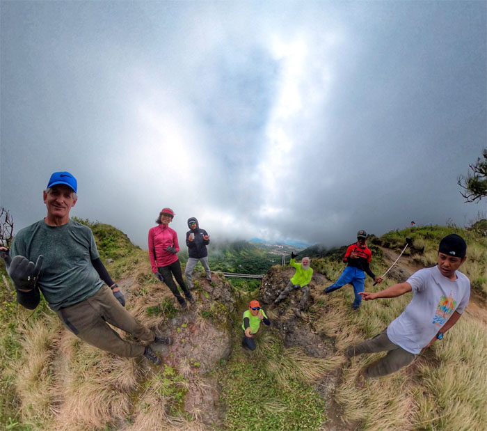
Kulana’ahane Summit
Group photo where soon after CB and Chico took their leave of us and descended back down towards the valley for ambulatory and anxiety reasons.
Moanalua Saddle
Our group now reduced to five set foot on the crumbly ridge line known as the “easiest” of the three saddles. Depends who you ask.
Moanalua Saddle
The group electing to climb on the Windward side and forsake the webbing on the Leeward side.
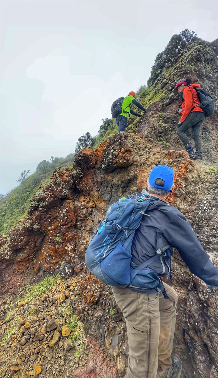
Moanalua Saddle
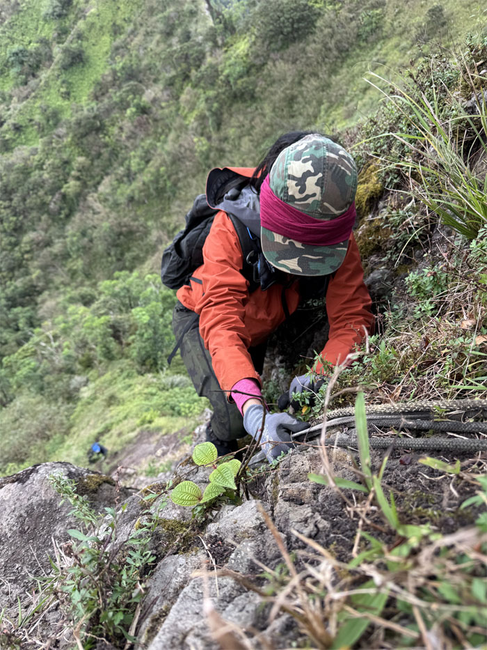
Scrambling up the chossy rocks as it constantly changes the “character” of the ridge line.
Moanalua Saddle
Contouring our way on the Windward side as the rolling clouds blurred the views.
Moanalua Saddle
Roger and Aida working their way back to the ridge line.
Moanalua Saddle
Somebody was enjoying their first outing on this saddle.
Moanalua Saddle
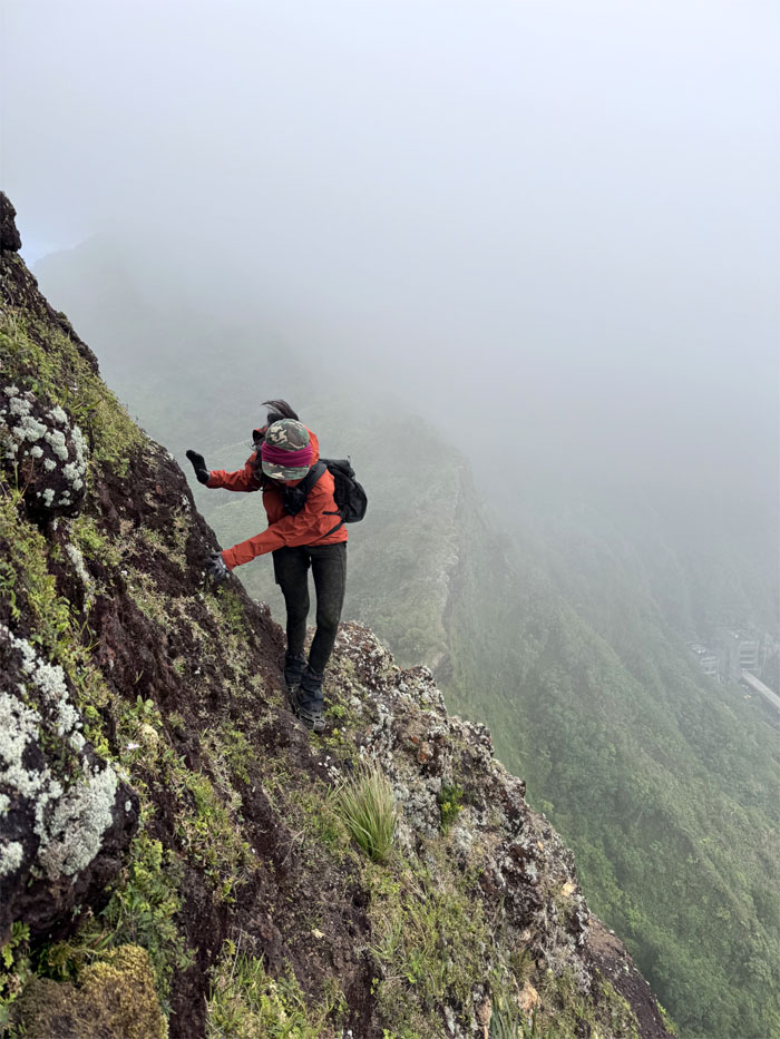
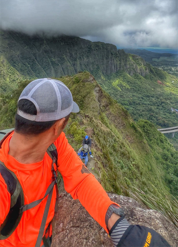
Making our way towards the most famous obstacle on the saddle, the “Dirt Triangle” for obvious reasons.
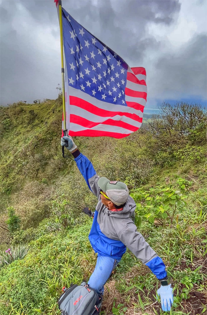
Moanalua Saddle
Ferlino flying the flag as we contoured our way around the triangle where we saw CB and Chico making their way down the spur ridge.
Dirt Triangle
Oh, I get by with a little help from my friends
Mmm, I get high with a little help from my friends
Ooh, I’m gonna try with a little help from my friends
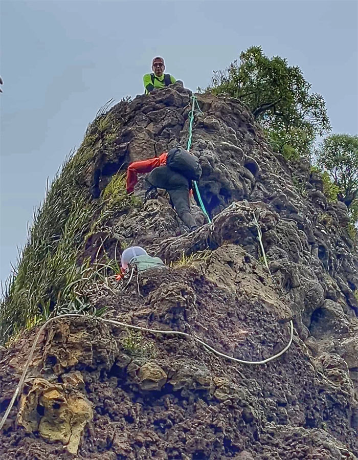
Dirt Triangle
Aida climbing to the top.

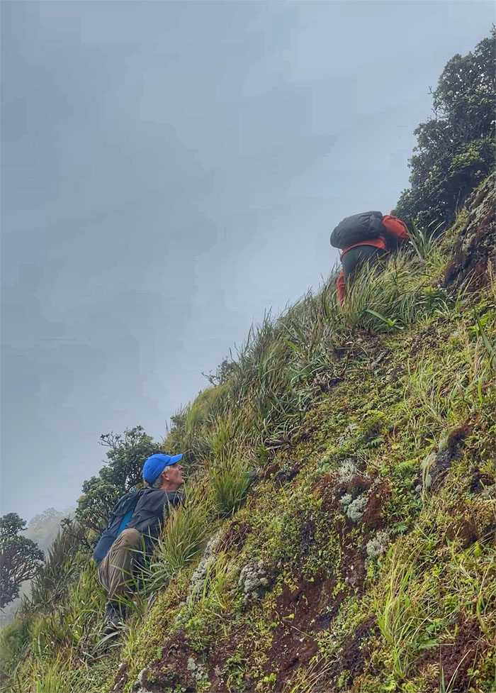
Moanalua Saddle
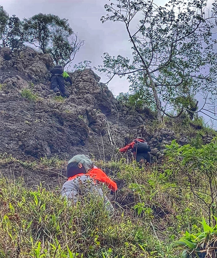
Scrambling our way over the assorted boulders, lucky the wind exposure was not gusting at its normal tempo.
Moanalua Saddle
Akira looking back as the rest of the group were making their way up.
Moanalua Saddle
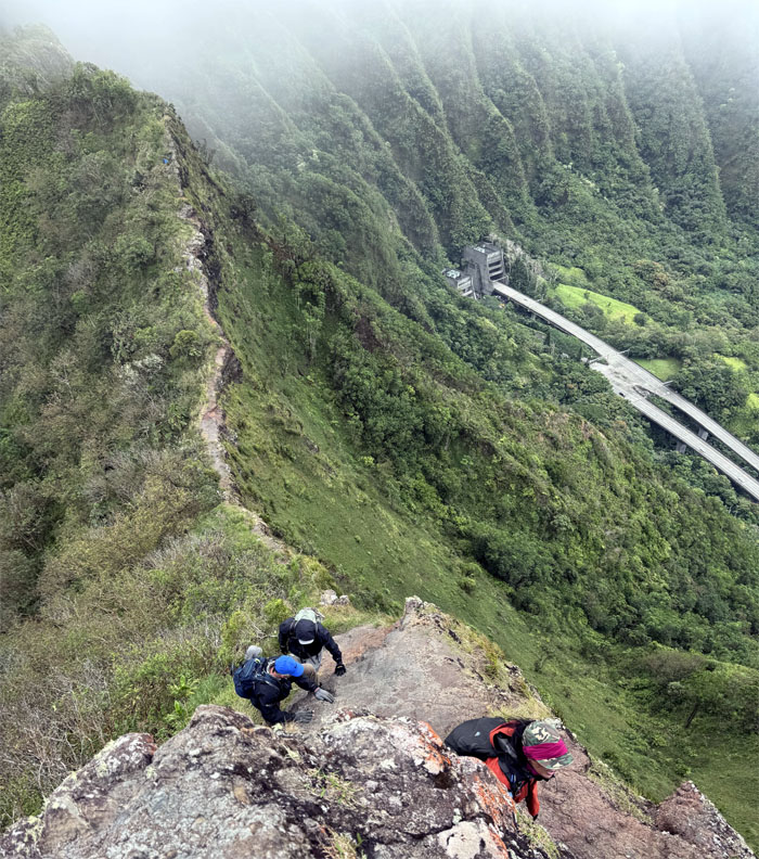
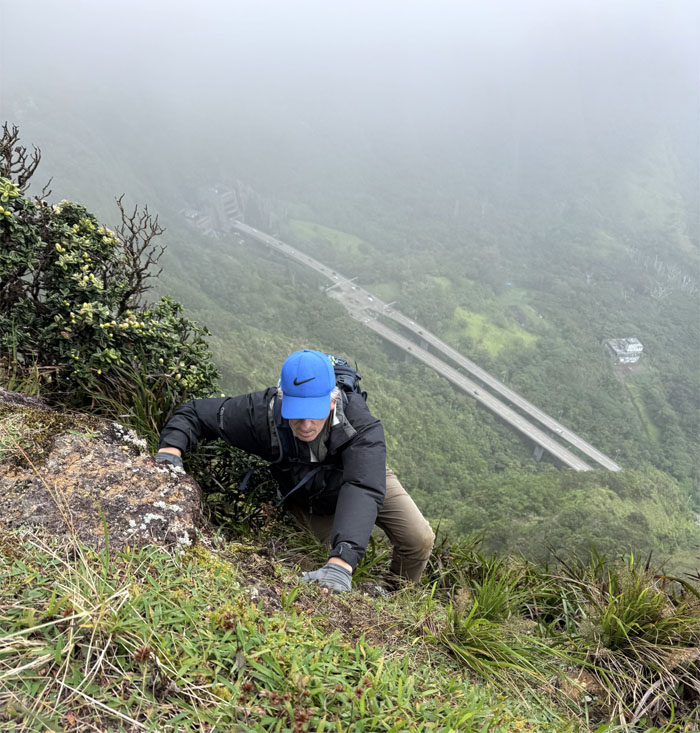
Climbing our way up what is arguably the “hardest” section of the trail due to the exposure factor especially if the winds are gusting and the rope has been blown off. Subjective.
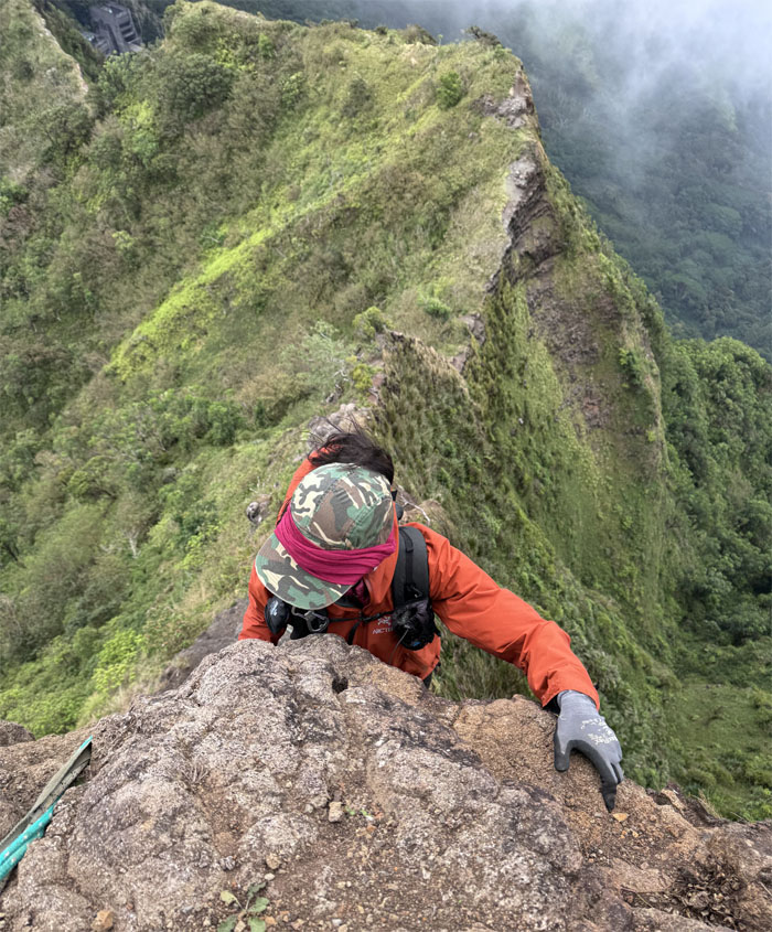
Moanalua Saddle
Aida approaching the top and relatively safety and peace of mind. All the scrambling parts were done for the day.
Moanalua Saddle
What happened to the twine and twig? More of a hindrance than help.

Moanalua Saddle
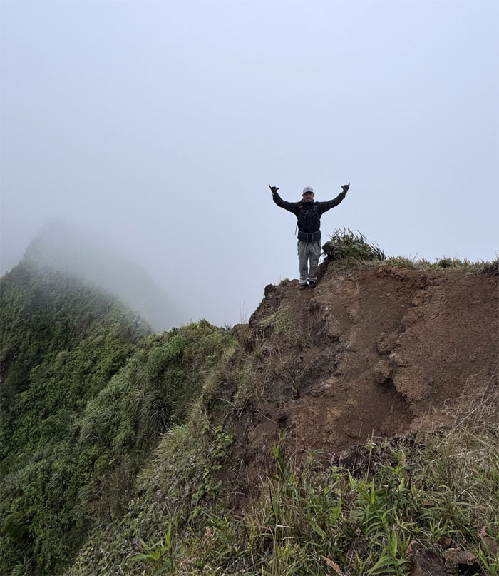
That was fun! Let’s do it again! Something that nobody said.
Moanalua Saddle
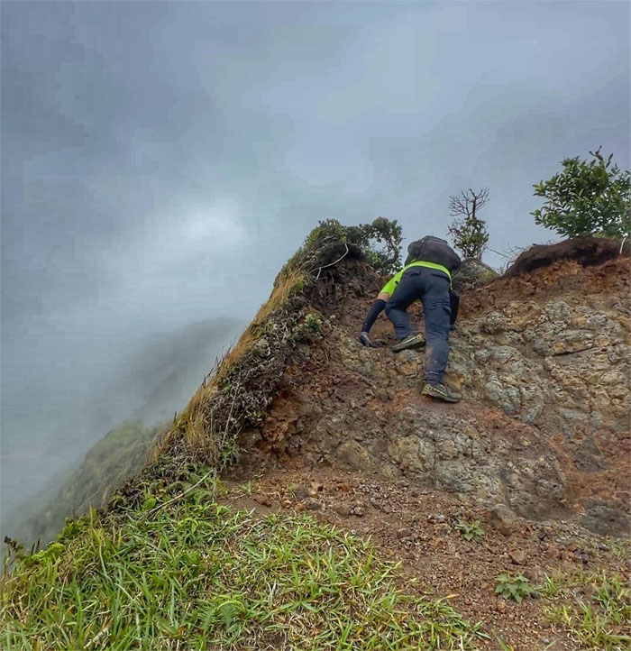
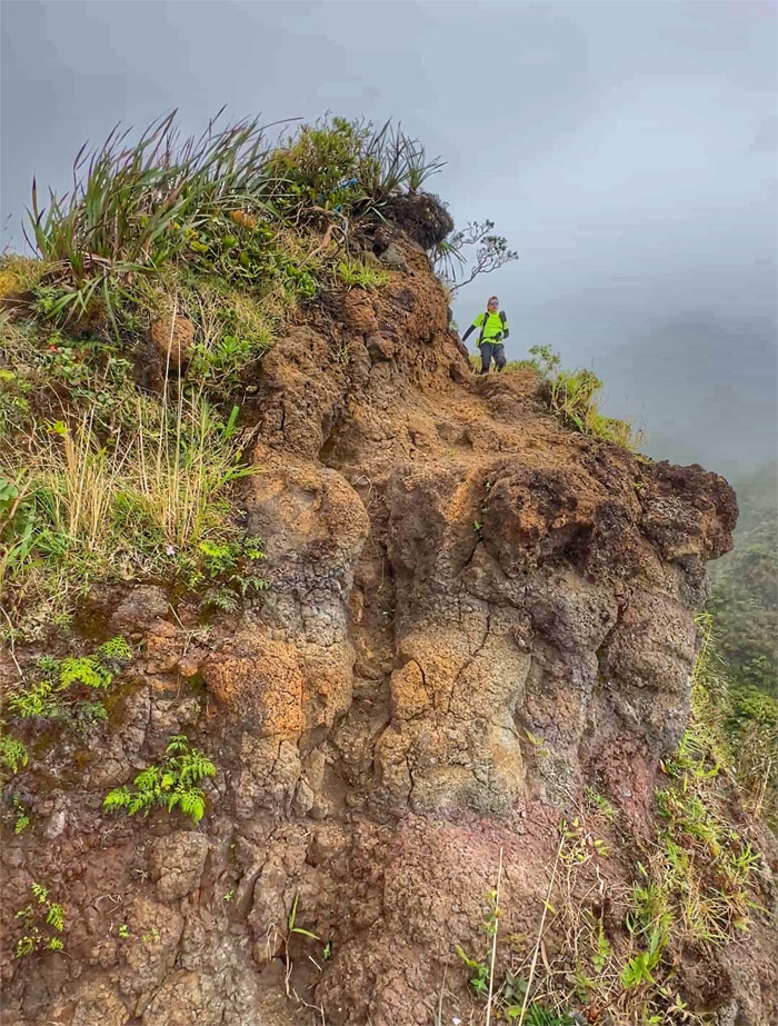
The erosion part was not over yet. Not by a long shot.
Moanalua Saddle
It would’ve looked better if the clouds had cleared in the background. Can’t have everything in life.
Moanalua Saddle
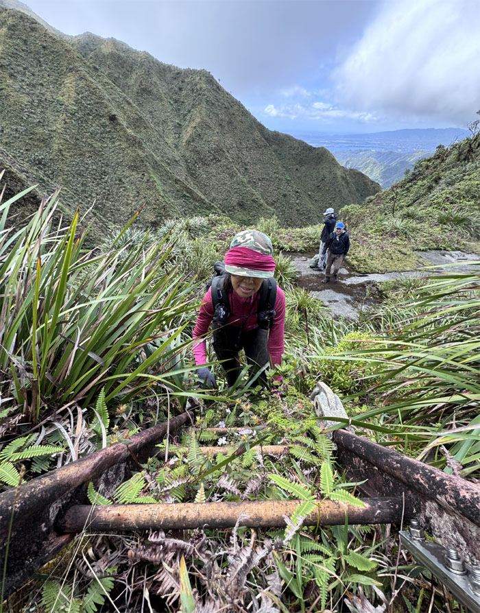
Where does this ladder lead to?
Moanalua Saddle
Greener pastures. The stairs are no more. Stripped by The Nakoa Companies sometime last year or as somebody else eloquently put it, a Brazilian wax that removed the metal from the mountains. It was actually easier to walk on the ridge line without the decaying steps on it.

Moanalua Saddle
It still takes time getting used to the au naturel look.
Moanalua Saddle
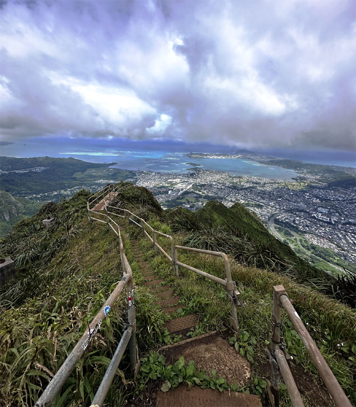
Approaching the CCL building that by all accounts will remain after the stairs have long since gone.
Moanalua Saddle
Aida on the last landing overlooking Haiku Valley which served as a natural amphitheater when the US Navy strung antenna cables across the valley in order to transmit radio signals to ships and submarines in the Pacific in 1942.
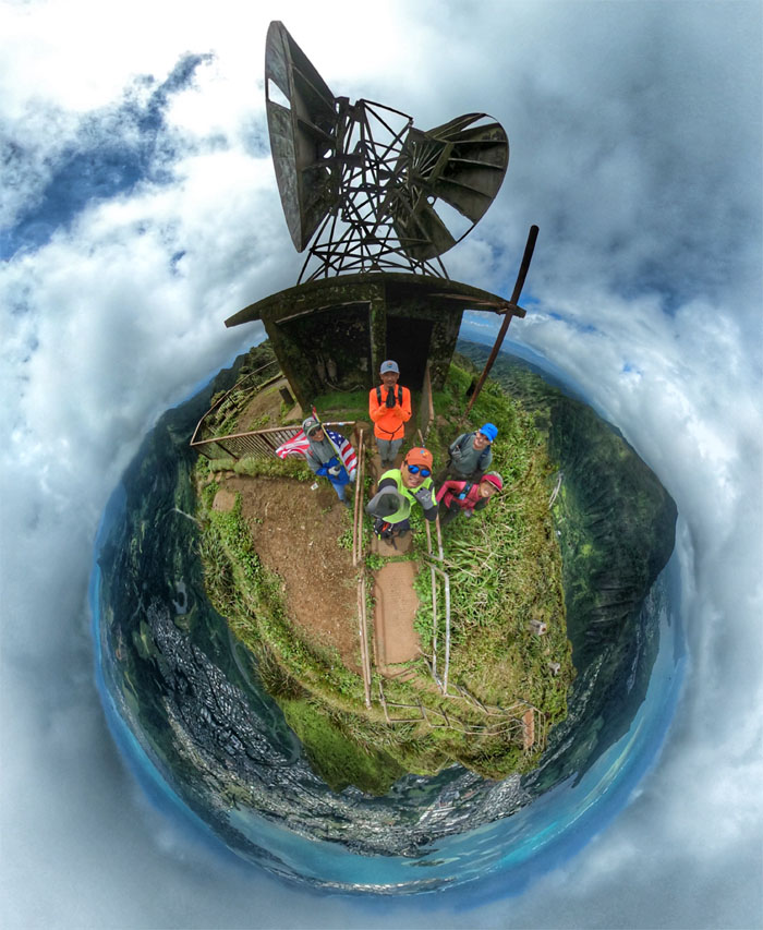
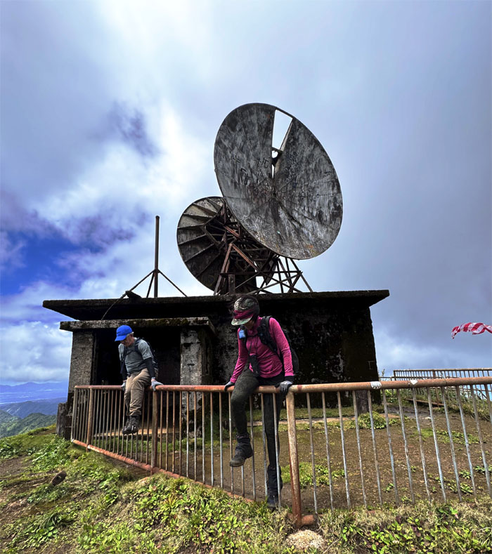
CCL Building
Group photo in front of the bombproof block house that used to house backup UHF communications to communicate between Kaneohe and Wahiawa. I believe the microwave antenna on the top of the bunker was installed later in the 1950s.
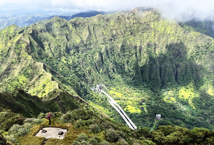
Stairway to Heaven
Looking out at the 3,922 steps that constitute the storied and iconic Stairway to Heaven. The City had awarded the contract in April 2024 to Nakoa Companies to finally tear down the stairs after decades of debates and it looked like the fate of the stairs was sealed. Friends of Haiku Stairs successfully obtained an injunction to halt the dismantling in July 2024 and it has remained there in legal limbo. Either way it will cost taxpayers a lot of money if it stands or gets torn down.
Stairway to Heaven
Synchronized straddling of the fence line.
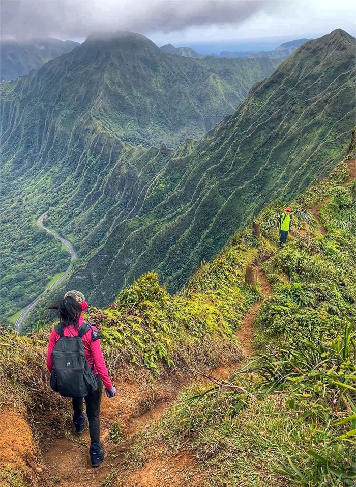
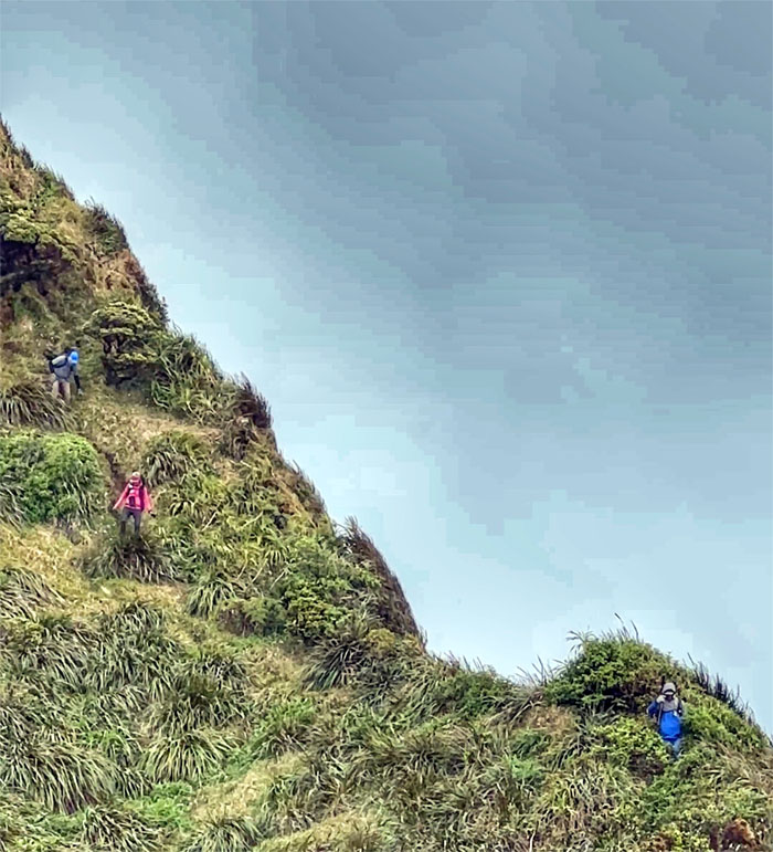
Ko’olau Summit Ridge Trail (KSRT)
Going down the rutted trail with Kalihi Saddle in the background.
KSRT
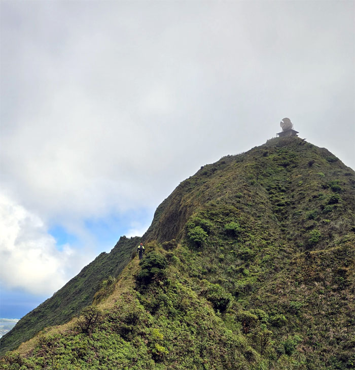
The group descending from the summit of Pu’u Keahi a Kahoe.
KSRT
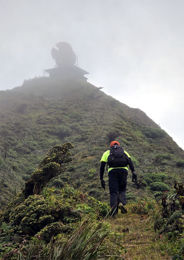
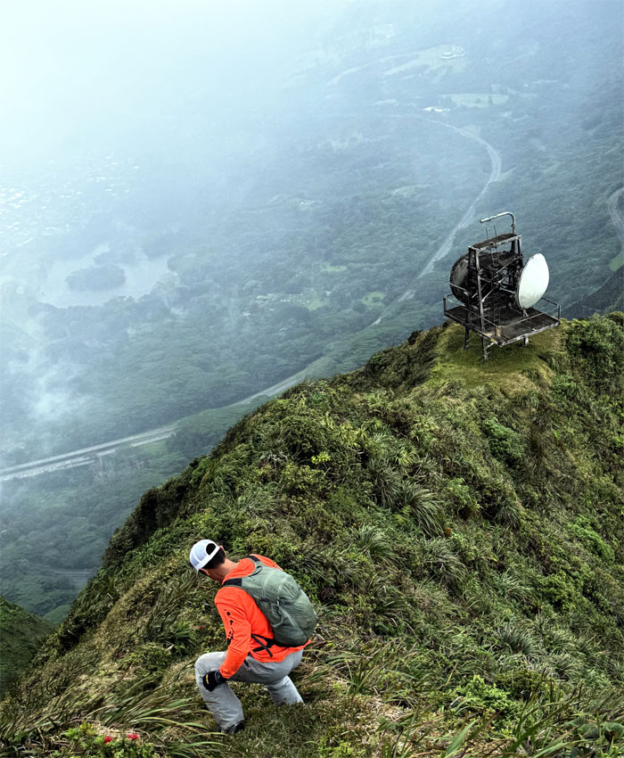
Akira climbing down towards the defunct radar station.
KSRT
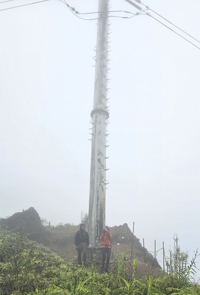
Passing another set of electric power line towers on the ridge line.
Tripler Summit
Thanks to Akira for making a pot of hot ramen noodles. Hit the spot especially when the weather had turned a corner for the worse.
Tripler Summit
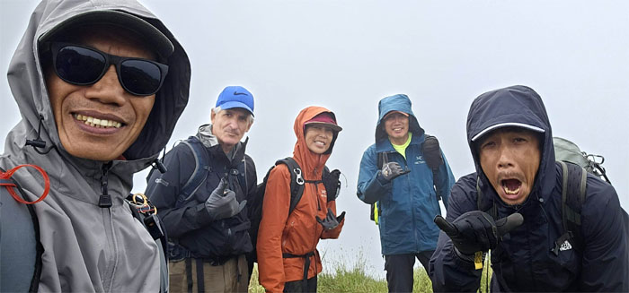
Group photo on our last summit.
Tripler Trail
Leaving the 2,760′ peak.
Tripler Trail
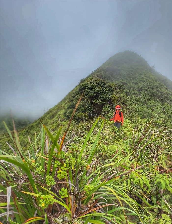
This trail has been described by Stuart Ball as a “classic leeward Ko’olau ridge hike.” The only part I agree with is “It’s long, hard, and somewhat tedious.”

Tripler Trail
Reaching the junction that will take us off the ridge …
Tripler Trail
… to go down a somewhat steep trail …

Kamananui Valley Trail
… and down to the valley floor. The rain showers also came back to cool us off.
All pau
Finishing at the park before the next shift arrives.
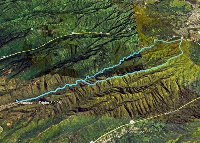
GPS Tracks
Our 10.3 mile hike covered a crumbly saddle, new scenery and a long ridge hike down with a fun group. Post hike meal at Alley Restaurant. Done with the oxtail soup, too much fat and overpriced.
Photos taken by Aida Gordon, Akira Suzuki, Chris Bautista, Chico Cantu, Ferlino Carinio, Roger Schiffman, and yours truly. Not necessarily in order.
Note: I have been made aware that some hikers have been using my blog as a hiking guide and getting lost on the trails. Please note that this blog was made to document the hike for the crew(s) that did it. That is why some of my comments will seem to have no relevance or meaning to anybody outside of the crew(s) that hiked that trail. My blog was never meant as a hiking guide, so please do not treat it as such. If you find inspiration and entertainment from these hikes, that is more than enough. If you plan on replicating these hikes, do so in the knowledge that you should do your own research accordingly as trail conditions, access, legalities and so forth are constantly in flux. What was current today is most likely yesterdays news. Please be prepared to accept any risks and responsibilities on your own as you should know your own limitations, experience and abilities before you even set foot on a trail, as even the “simplest” or “easiest” of trails can present potential pitfalls for even the most “experienced” hikers. One should also always let somebody know of your hiking plans in case something doesn’t go as planned, better safe than sorry.
{ 4 comments… read them below or add one }
Thanks Kenji, for great blog and for helping me through another section of the saddles!
Aloha Roger,
Thanks, it was all you!
Mahalo
Fun and memorable hike always! Thanks for giving me a hand up on that triangle bypass. That section always gives me anxiety. The rest wasn’t so bad. Going down Tripler was a mistake for me..couldn’t walk the following day lol. Thanks again for leading us safely and for all the pics!
Aloha Aida,
Thanks. Elevator service is still a nickel, holding costs down. lol.
Mahalo