
This was my fourth hike with the Hawaiian Trail and Mountain Club, and my first as a member. Good thing, as this hike was only open to members. We all met at the club’s house in Waimanalo and carpooled to the Makapu’u lookout. We crossed the road and gradually made our way up the rocky slope, basically following the fenceline. If you follow the ridgeline, you can’t go wrong or get lost.

Sea Life Park
We quickly gained elevation at 700+ feet and was looking down at Sea Life Park and the waves crashing down on Makapu’u Beach from a bird’s eye view.

Makapu'u Point
We soon left Makapu’u point and it’s lighthouse in the distance.

Kaulanaaka'iole Puka
At this hilltop of around 900 feet, we came across this puka in the rocks which can be seen from down below. Legend has it that the archer, Pikoiaka’alala, spotted a rat where this puka is and killed it with his arrow. That is why this place is called Kaulanaaka’iole or the “resting place of the rat.”

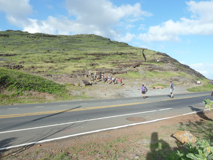
Hang Glider Launch Pad
After climbing another 1,200+ hill, we descended to a flat area that has some former Kamehameha School buildings and this launch pad that is used by hang gliders and para gliders.

Waimanalo coastline
After passing an abandoned Nike missile site, we regained the ridgeline and descended down the ridge which became somewhat steep for about 100 feet or so, but is quite manageable as there is also a rope to help you out. As I was walking down towards the saddle, I tripped on a root and banged my head on a rock. Luckily, I didn’t fall off the ridge, just lost a little blood.

Makapu'u Ridge
After figuring out that the cut wasn’t that serious, I resumed climbing up the ridge to the clump of Ironwood trees where everyone else was hanging out and eating their lunch.

Lunch Spot
Luckily, there was a kind nurse with a handy first aid kit in the hiking group, who cleaned up my cut. No stitches needed.

Koolau Summit Trail
After resting a bit, we eventually left the nice and cool shady tree covered spot and made our way down towards the Kamiloiki ridge, where it dropped to a saddle and then to the powerlines, in the middle of the photo, which marks the start of the TomTom trail.

TomTom Trail
The TomTom trail was named after Tom McGuire and Tom Cadle that “discovered” this old trail used by Hawaiian runners in the past. The trail descends somewhat steeply towards the town of Waimanalo where we popped out into a neighborhood inhabited by a lot of large and hopefully not loose dogs. We walked the rest of the way back to the clubhouse. The hike took approximately four hours and was moderate in difficulty.
{ 2 comments… read them below or add one }
Nice post on the Tom-Tom trail, Kenji. I’m going up Mariner’s on Saturday, then eastward on the KST, then hopefully down Tom-Tom. So the left turn off the KST coming from Mariner’s is at the telephone lines? Are there ribbons there to denote the path downward? Are you on this FB group Oahu hikers’ page? You should join:
http://www.facebook.com/groups/oahuweekendhikers?ap=1
Shoots,
Will
koreambear@yahoo.com
Howzit Will,
Thanks for dropping by. Yup, the turn towards Waimanalo is at the power lines. I don’t remember any ribbons, but just follow the ridge going down, can’t miss it and good hiking! I will definitely check out the FB group.
Mahalo!