
Rain, rain – didn’t go away. The torrential rains that had soaked the Windward side earlier in the week forced us to cancel our planned hike of Ohulehule in Kahana Valley and replace it with a hike on the WST (Waianae Summit Trail). We decided to take a page from DGC and start segment hiking the WST, beginning with Kaena Point.

Christmas came early
Rain showers passed over as we parked at the far end of Dillingham Airfield, putting the hike into question. It cleared quickly, so we piled into Matt’s van to drive to the end of Mokuleia to start our hike. Group photo left to right: Will, Matt “Bah Humbug”, myself and Marvin.

Slip’n’Slide
The long jeep road to the trailhead was mud central, as we some trucks drifting and sliding through the liquid dirt as we slogged our way through.

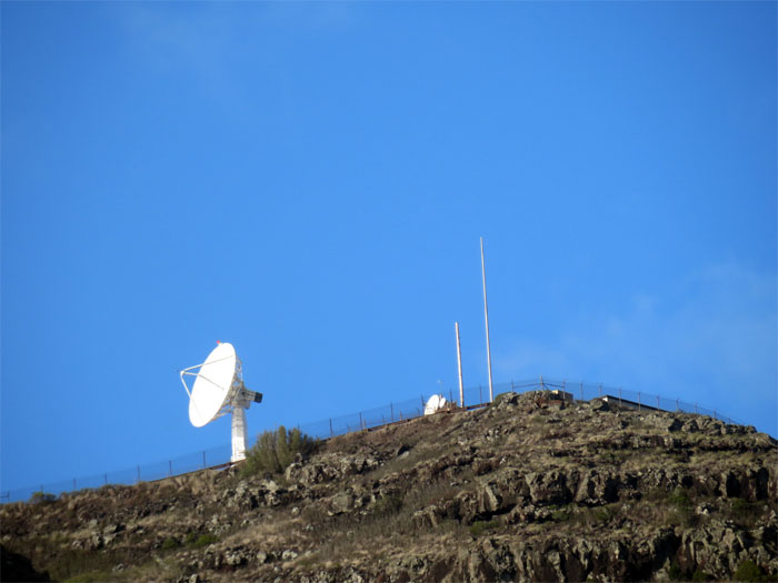
Kaena Point Natural Area Reserve
It was a windy day on the North Shore. Photo by Matt Vidaurri.

Spirit Rock
Passing through the fence that protects the bird populations, we saw a rock known as Leina ka ‘Uhane. Ancient Hawaiians believed departed souls would plunge into the ocean for eternity from this rock.

Up the mountain
The hardest part of the hike was climbing up this hill, made easier by the overcast clouds and cool winds. Photo by Will Lee.

Eye of the hikers
Sitting on top of a graffitied bunker. The striking eye was painted by the Irish artist known as Eoin.

Bunker view
Kaena Point in the background. Didn’t see any monk seals sunbathing.

Last bunker
As we climbed our way up, we could see the Mokuleia and the Waianae coastlines from our vantage point.

Almost there
It was a perfect day to hike as it was heavily overcast and windy as heck, otherwise it would have been a scorcher of a day. Sometimes it pays to hike after a heavy rainstorm.

Looking back
Our last glimpse of Kaena Point as we made our way to the top.

Kaena Point Satellite Tracking Station
After having seen the KPSTS (Kaena Point Satellite Tracking Station) or golf balls from Keawaula or Yokohama Beach so many times, we were going to finally see it in person.

Life imitating art
This sign gave me flashbacks from my last hike. Photo by Marvin Chandra.

Follow the paved road
For a change, I didn’t mind walking on a paved road while hiking. It was a nice paved road. I wish our city streets were like this road. Photo by Matt Vidaurri.

Tee time?
Matt wanted to play with a really big golf ball. His club wasn’t big enough.

Golf Ball
Excuse me, what time do the tours start?

Practicing how to levitate
Will and Matt trying to float above the concrete coated hill.

Everybody come here
Walking past the guard shack, a MP (Military Police) stopped us and questioned us as to where we came from. After hearing our story, he said that we were supposed to be escorted down the Satellite Tracking Station Road to Keawaula or Yokohama Beach on the Waianae side. He let us off with a one time warning. Happy Veteran’s Day!

Approved trail
The MP said to go down this trail and cross the ravine to the last tracking station or golf ball. We happily complied. Otherwise our hike would have been abruptly terminated.

Look both ways before crossing
After bushwhacking in the woods for about half an hour, we found ourselves right back from where we started! So we plunged back into the woods and paralleled the road until we were out of sight from the guard shack.

Back on the road again
The paved road eventually turned into a jeep road.

Goodbye golf balls
Looking back at the last cluster of tracking stations or golf balls.

Scenic point
Group photo with the Waianae coastline in the background.

Kuaokala Access Road
We were now on the Kuaokala Access Road that traverses a public hunting area. Hmm, did we have on bright clothing? Oh yeah, we had Hawaiian Santa with us. We were covered.

How wide?
This section of the trail was wide enough to drive a semi through it and then some!

Picnic table break
We took a short break at this picnic table. Photo by Will Lee.

Hmm, who has the right of way?
This mountain biker was the first person we saw today, besides the MP.

Matt of the hill
The views of the valley were starting to open up, especially if you were standing on top of a rock.

Makua Valley
Group photo looking into Makua Valley. It is believed that this valley was once inhabited by the Olohe, hairless, red-skinned people separate from the Hawaiians. They were skilled in lua or the ancient martial art of bone breaking. A good reason to keep out of their valley.

WST junction
The trail continues until you reach the WST junction to the right. We kept on going straight. Another hike for another day.

Right, right, left
There were three clearly marked junctions indicating which direction to head to Kealia trail.

Falling rocks
I thought it would be a good idea if we photographically illustrated the falling rocks sign at the Kealia trail. A plan not well thought out. Luckily we only picked up small pebbles. As the rocks were thrown up in the air, one hit me on my nose. Lesson learned.

Dillingham airfield
Coming down the 19 switchbacks. I lost count after two.

Beware of falling rocks
The switchback trail was littered and strewn with rocks of various sizes.

Fish farm?
There seemed to be a trail cut into the mountains above this fish pond?

Kealia trail
All pau!

GPS Tracks
The hike was 11.52 miles long. Surprisingly it did not feel like a grinder, as the trail was pretty much flat for the whole distance and the nice cool weather helped as well. After the hike, we drove to Dong Yang in Wahiawa for some good Korean food.
{ 4 comments… read them below or add one }
Very nice and helpful information on getting up there.
Aloha Robin,
Glad the post was of some help in your hiking. Hope you get or got some great views.
Mahalo
Finally was able to do the Ka’ena point hike and was able to get some great views.
Very interesting up hill hike and it looks like they closed up the fence area at the top.
Thanks again
Aloha Robin,
Glad you did the hike and got some views! Nice.
Mahalo