
A filled parking lot and somebody not waking up on time dictated a change of hiking venues today.
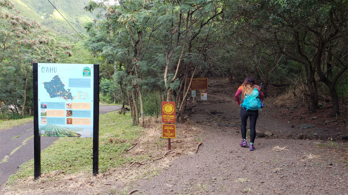
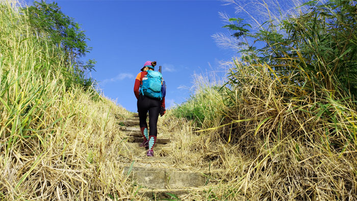
Trailhead
We joined the steady stream of hikers that were going up one of the more popular trails on the East side of the island.
Kuli’ou’ou Ridge Trail
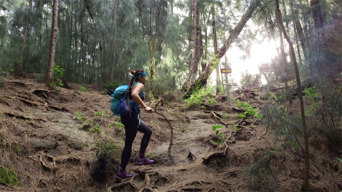
Going up one of multiple switchbacks as we climbed out of the valley.
Kuli’ou’ou Ridge Trail
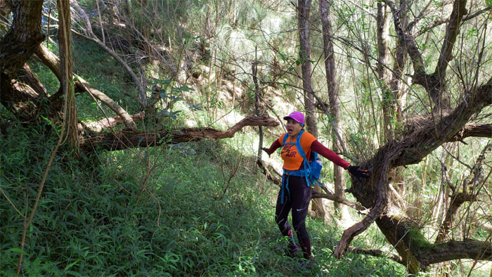
Makahiki in the mountains. Time to lose that seven pounds. Photo by Analyn Baliscao.
Kuli’ou’ou Ridge Trail
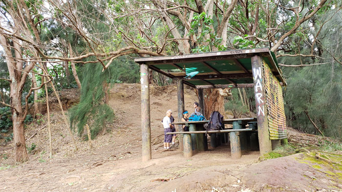
Time to get away from nature and check ones messages and social media. I thought it was the other way around?
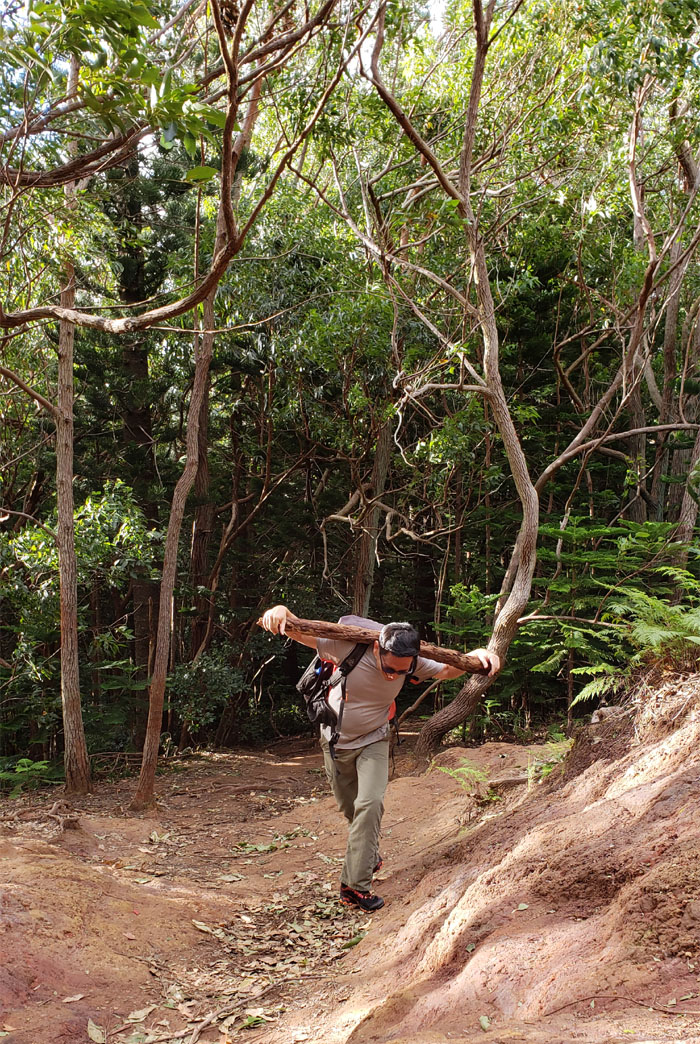
Full Metal Jacket
Do you mean to tell me that you cannot do one single pull up? I’ve been watching too many movies lately.
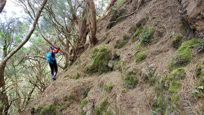
Kuli’ou’ou Ridge Trail
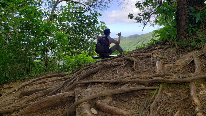
Warming the bench and briefly enjoying the valley views. Photo by Analyn Baliscao.
Kuli’ou’ou Ridge Trail
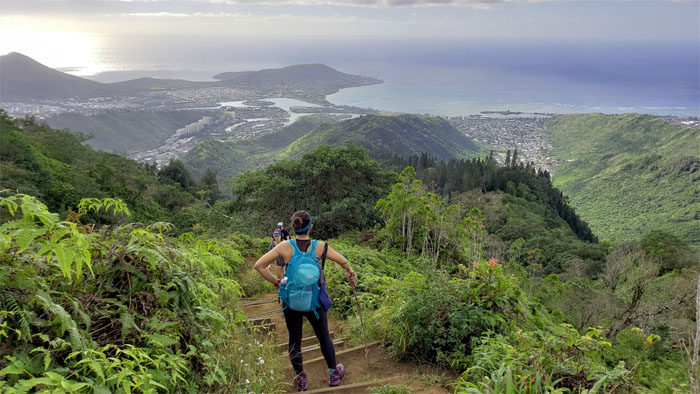
Looking back at how far we had climbed up.
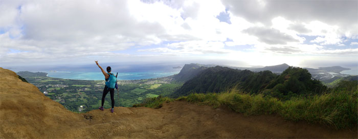
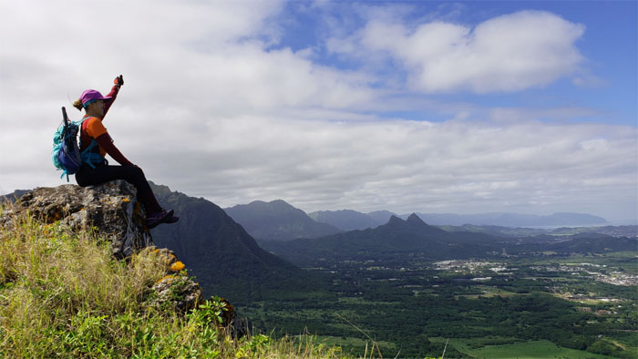
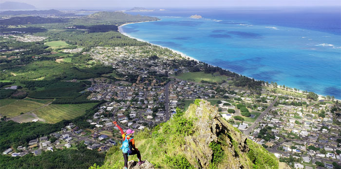
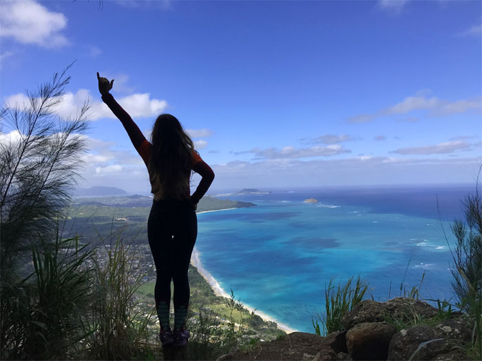
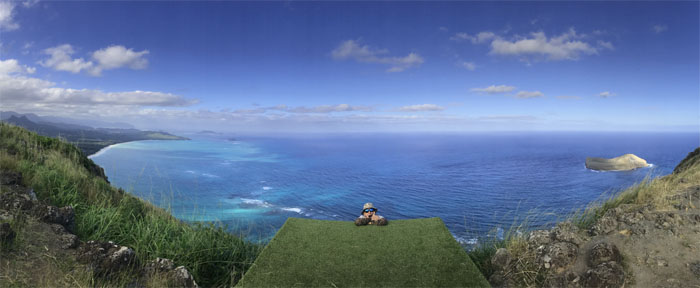
Kuli’ou’ou Summit
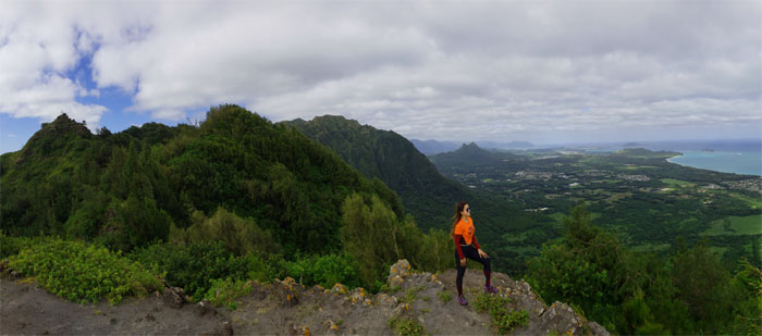
We joined the slowly growing crowd at the 2,028′ eroded hill. The sweeping Windward and Leeward views never gets old from this vantage point.
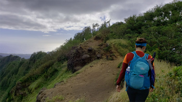
Ko’olau Summit Ridge Trail (KSRT)
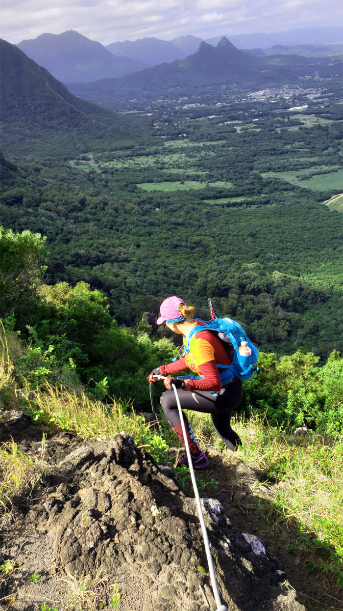
Time to leave the congested summit as we made our way on the exposed ridge line before …
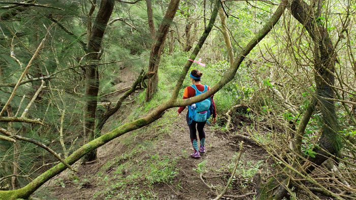
KSRT
… being swallowed up into the iron wood forest.
KSRT
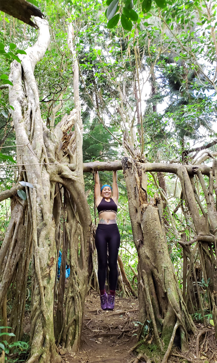
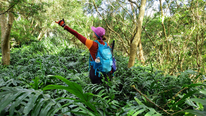
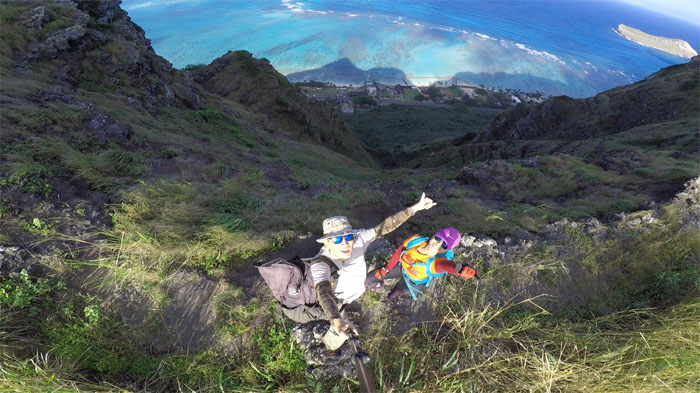
When the student becomes the teacher. Photo by Analyn Baliscao.
KSRT
Skirting the pine needle covered hill side.
KSRT
Analyn on the flat topped hill with Hahaione Pyramid in the background.
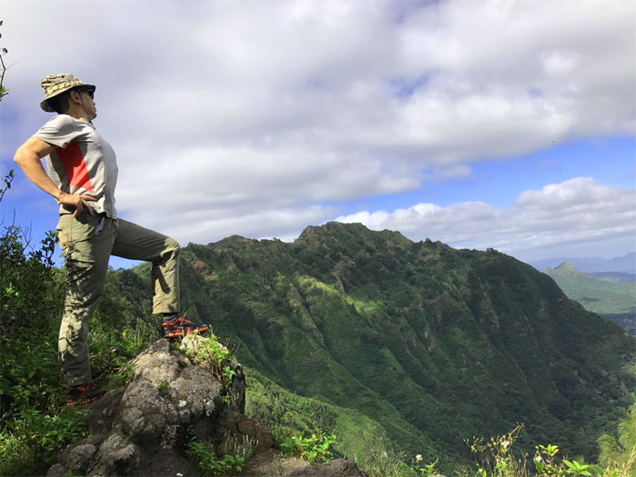
KSRT
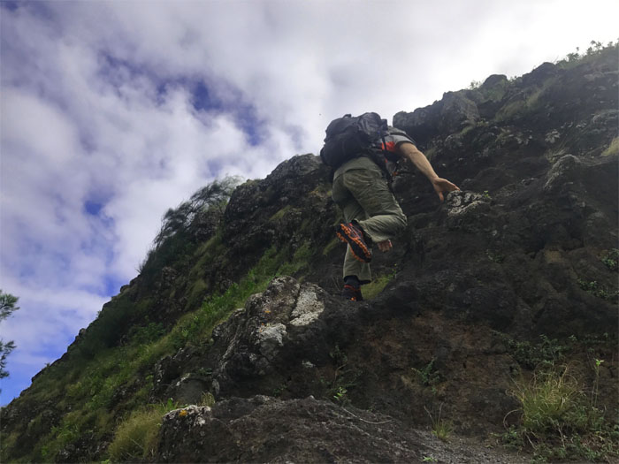
Climbing to the abandoned top of Kaluanui. Photo by Analyn Baliscao.
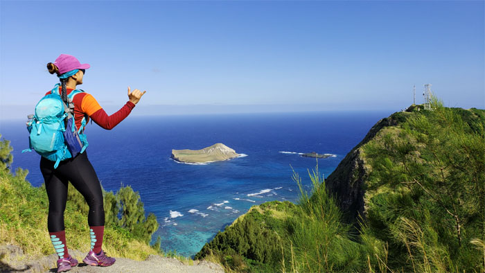
Mariner’s Summit
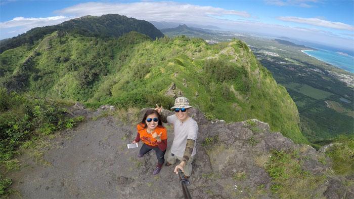
Group photo at the 1,361′ summit, which is one of the lowest summits on the Ko’olau Mountain Range.
KSRT
Who said there aren’t snakes in Hawaii?
KSRT
Passing through a patch of feathery fronds, infinitely preferred than traveling through the clawing and scratching uluhe ferns.
KSRT
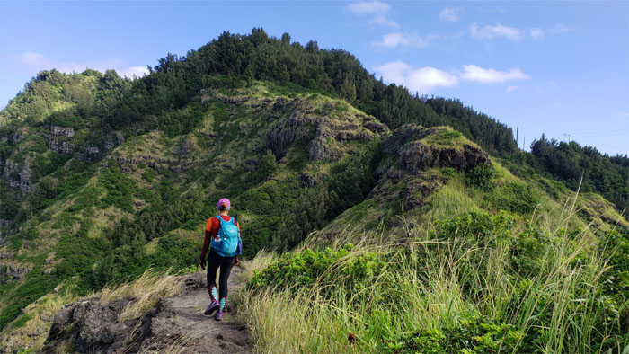
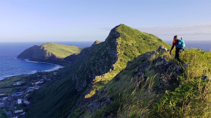
We left the canopy cover as we descended down the flank of the exposed ridge.
KSRT
This scenic spot on the rocky ridge line once took up over two hours of countless photos on a previous trip. Hiking time that was traded for countless photographic memories.
Tom-Tom Trail
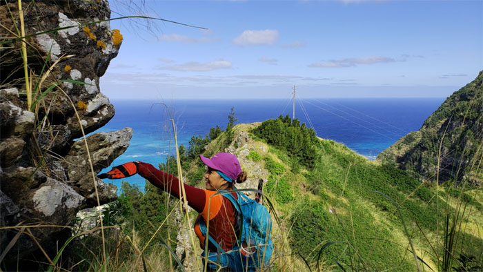
Looking down into the country town of Waimanalo and points beyond.
KSRT
Hand feeding the land shark that lives on the ridge.
KSRT
Crossing the open ridge line pocked with grassy fields as we beelined it to the tree line to gain shade from the sun.
KSRT
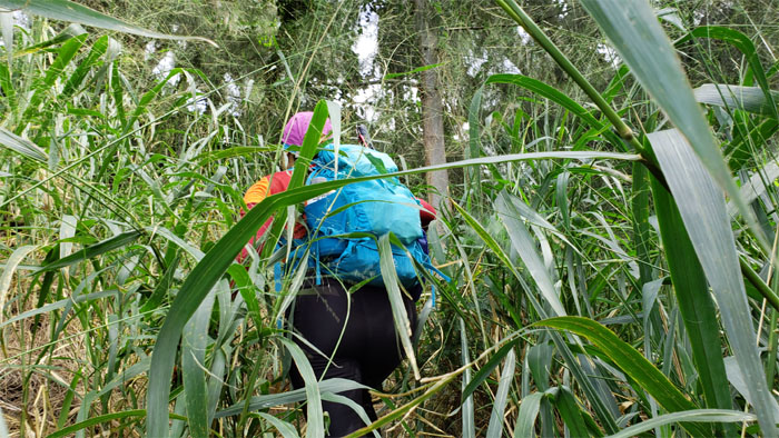
Pushing our way through the hairy California grass.
Kamiloiki Summit
The gap was not wide enough to allow the complete views in.
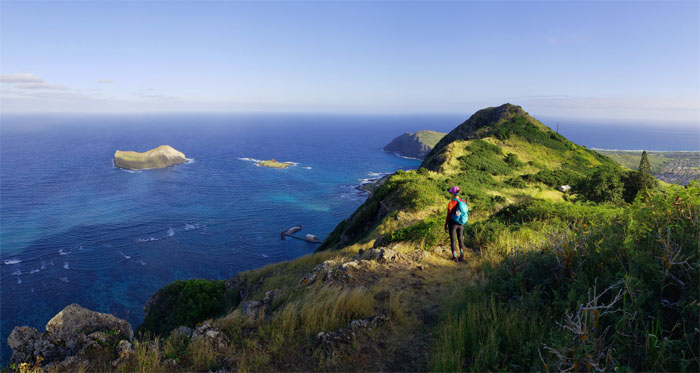
KSRT
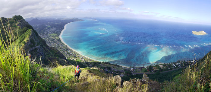
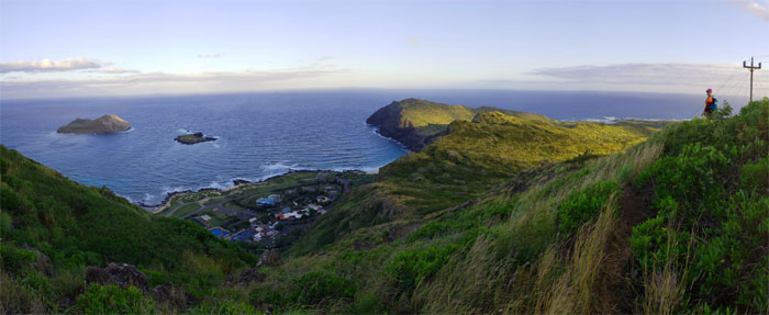
We broke out of the covered ridge line and made our way to the saddle with views of Manana and Kaohikaipu islands.
KSRT
Birds eye view of the saddle as the sheer cliffs dropped down towards the coastline.
KSRT
Analyn climbing out of the saddle.
KSRT
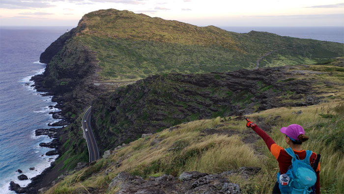
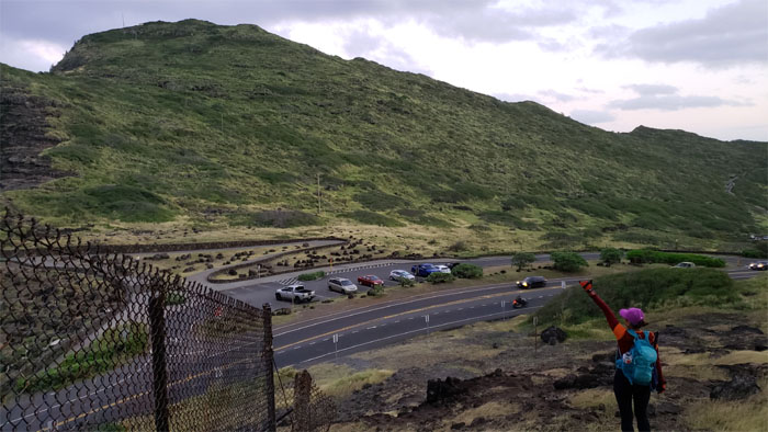
We detoured around the communications tower, skipped what was left of deadman’s cat walk and left the road to regain the ridge line.
KSRT
Just hanging around. Photo by Analyn Baliscao.
KSRT
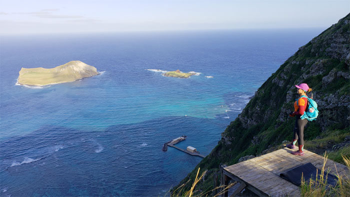
We left the hang gliding platforms to continue our hike on the now tree less ridge line, perfect place to get toasted and tanned.
KSRT
Making our way along the rocky ridge before it dipped down to more rocks of assorted sizes. I call this area the Stonehenge of Makapu’u.
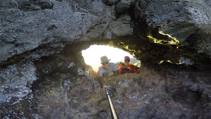
Makapu’u Puka
Hello from the other side.
KSRT
Looking down into Sea Life Park and the seabird sanctuaries offshore.
KSRT
We’re almost there!
All pau
Our hike ended after 7.7 miles on the mountains. Mahalo to Chris for picking us up. Post hike meal at Pieology where you can make a mountain out of a molehill if so desired.
Note: I have been made aware that some hikers have been using my blog as a hiking guide and getting lost on the trails. Please note that this blog was made to document the hike for the crew(s) that did it. That is why some of my comments will seem to have no relevance or meaning to anybody outside of the crew(s) that hiked that trail. My blog was never meant as a hiking guide, so please do not treat it as such. If you find inspiration and entertainment from these hikes, that is more than enough. If you plan on replicating these hikes, do so in the knowledge that you should do your own research accordingly as trail conditions, access, legalities and so forth are constantly in flux. What was current today is most likely yesterdays news. Please be prepared to accept any risks and responsibilities on your own as you should know your own limitations, experience and abilities before you even set foot on a trail, as even the “simplest” or “easiest” of trails can present potential pitfalls for even the most “experienced” hikers.
{ 2 comments… read them below or add one }
Nice! How long did it take you? I’ve gone from Makapu?? to Kamiloiki but going all the way to Kuli?ou?ou seems like it would take all day.
Aloha Eric,
Thanks. It took us about 10 hours, 2 of those being photo breaks. So your pace will vary depending on how many breaks, photos you take and your cardio. For most people, I would say 8 hours would be the average.
Mahalo