
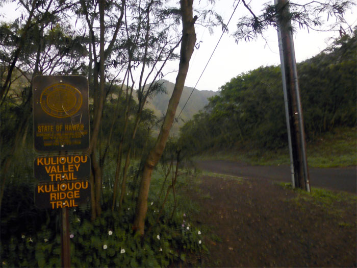
Wanting to catch a quick hike before the projected thunderstorms were set to soak the island, I decided to hike up Kuli’ou’ou West Ridge to Hahaione Trail by myself, as the last hike we did not got a single decent view due to cloudy and rainy conditions.

Koolau Mountains
Going up the still somewhat muddy trail, I could see that it was going to be a beautiful day, albeit with vog conditions thrown in for good measure.

Kuli’ou’ou Valley
Looking back into Kuli’ou’ou Valley, with the sunshine being filtered by vog and hazy sky conditions.

Small kine fun ahead
After working my way through the trail, I finally got to the part where minor scrambling was involved. The fun part. Everything else is a means to the end.

Pu’u O Kona
Pushing ahead to the 2,200′ summit of Pu’u O Kona.

Panoramic view of the Windward side from Pu’u O Kona
Click here for the larger image. The stellar views were a marked change from two weeks ago, when it was nothing but clouds hiding the views.

Eroded section
I always wonder when this section will finally give way. Hope nobody is even near this spot when it happens.

Koolau Spine
Looking back towards the Koolau spine as far as my camera can see. I never get tired of these views.

Bear Claw Ridge
Looking down into Waimanalo from the top of Bear Claw Ridge. Having come up the ridge from both left and right forks, I thought about trying to downclimb this ridge. One day.

Panoramic view from Kuli’ou’ou Summit
Click here for the larger image. Amazingly, when I reached the summit around 9:25am, not a single soul was in sight. Usually this place is teeming with hikers and dogs. As I left the summit, I heard a couple hikers making their way up from the Kuli’ou’ou Ridge Trail.

Power lines
My solitude existence on the trails was soon interrupted by a stream of hikers making their way up from Hahaione Valley, as I was making my way down.

Private property?
As I made my way down into the valley floor, I ran across a large group of paintballers getting ready to do their thing. It seems that this area is a frequent hangout for paintballers. Shortly after I popped out at the end of Hahaione Street, Chris was nice enough to pick me up and deposit me back on Kalaau Place to get my car.

GPS Tracks
The 3.8 mile hike took me a little over 3 hours to complete.
{ 2 comments… read them below or add one }
Hey Kenji! Thanks for keeping up with posting on hikes! We follow your directions religiously when we are out there haha. How do you get to bearclaw ridge? Do you have any pictures or tips?
Aloha Liz,
Thanks for taking the time to read my blog. My directions are deliberately vague, as the conditions ( access and trails change constantly) ,as I hope the posts serve more as entertainment and inspiration than a hiking guide.
That being said, bearclaw has two forks, left and right, with the first being the easiest. Trailhead is deep in Waimanalo near Hilltop Ranch. Please be respectful of the neighbors by not making much noise until you get high in the mountains. The forks themselves are different for everybody. Just make sure you know your limitations and test every hold before committing, as most of the rocks are crumbly/chossy and loose. Don’t trust strange ropes that you haven’t set yourselves. Here are a couple links to Bear Claw:
http://kenjisaito.com/bear-claw-left-fork/
http://kenjisaito.com/bear-claw-right-fork/
Stay safe and happy trails. Mahalo