
This was my second hike to Mount Olympus, a trail that is a town favorite as evidenced by the abundance of hikers on the trail. The first hike was with the HTMC which was marked by rain, clouds and not making the summit. This time I was determined to reach the summit and hoped Mother Nature would cooperate and clear the clouds at the summit.

Trailhead
We drove to the top of St.Louis Heights and parked at the Wa’ahila State Recreation Park which opens their gates at 7am daily. If you get there early, you can park outside and still walk inside.

Trail
The clearly marked trail goes up and down several times that are punctuated with rocky areas and the ever present strawberry guava trees whose fallen fruit had been trampled by countless hikers before us to release their strong, sweet smell.

Manoa Valley
We soon saw views of the city with Manoa valley taking center stage.

Up or down?
This marked the end of the lower trail, so we took the trail to the right to continue our hike to Mt. Olympus. The trail to the left continues down to Manoa Valley.

Palolo Valley
View of Palolo valley with Diamond Head in the background. Looking ahead we saw that the top of Mount Olympus was alternating between clouds and blue skies. We hoped to catch the latter when we made the summit.

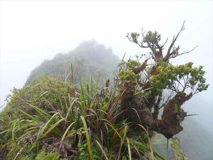
Cloudy Mount Olympus
The last part of the trail is a somewhat steep hill that is mostly dirt, luckily there was a grassy trail to the left that we used to make the final push towards the summit. Clouds greeted us as we made the top of Mount Olympus at 2,486 feet. We stayed at the top for awhile hoping that the clouds would pass, we got several teasing glimpses of the windward side and then rain convinced us to turn back and go home.
{ 0 comments… add one now }