
The twin peaks of Konahuanui (K1 and K2) have beckoned to me for quite some time. All four of our previous attempts to climb them were either derailed by Mother Nature or Human Nature. Today was the day we were going to get to the top of the highest peak on the Koolau Mountains. It would have took a tsunami with hurricane winds to stop Glenn, Chance and myself from making this hike today.

Koolau Mountains
I picked up Glenn from Alani Drive in Manoa, as that was where we were planning on coming out and we met Chance at the Pali Lookout. The climb going up towards the Pali Notches was steep off the bat and then we scrambled through a tangled thicket of hau tree branches. After that, we got to a flat clearing where we saw the sun painted fluted cliffs of the Koolau Mountains.

1st Pali Notch
Scrambling down the first Pali Notch was just a warm up for what lay ahead of us which was the second notch and the Chimney.

2nd Pali Notch
When we got to the second Pali Notch, we were pleasantly surprised to find that somebody had left ropes. The last time we did the notches, there were no ropes. The route we found that works best going down, is starting from the left and working your way to the right with or without ropes.

The Chimney
As we made our way to the nub or nipple right before the Chimney, the wind started to pick up again. This wouldn’t be the Pali Lookout without strong winds pushing you around. We had heard a lot about the Chimney and it’s near vertical face with limited handholds and footholds, so we had bought rock climbing shoes in preparation. Make that Glenn had brought his shoes, while I forgot mine’s in my car and Chance decided he could do without them.

Top of the Chimney
Much has been made about the Chimney, while it was a good climb, it was nowhere near the terrifying experience we were anticipating. It was more a comedy of errors on our part, as the following story illustrates. We had decided it would be easier to climb without our backpacks, so I had brought along 550 parachute cord to haul the backpacks up the Chimney. I volunteered to go first and borrowed Glenn’s rock climbing shoes to scale the Chimney. Once at the top, the 550 cord got tangled and was too short to reach Glenn at the bottom. I wasted a lot of time trying to untangle the cord and then attached Glenn’s rock climbing shoes to the end to provide some weight as the wind was whipping the cord every which way but Glenn’s way. The cord was still too short as it was still partially tangled, so Glenn climbed up from the base of the Chimney and then tried to swing the cord to Chance at the bottom. During one of his swings, one of Glenn’s shoes flew off the cord and tumbled down the windward side. Goodbye $180 shoes. Chance finally snagged the cord and attached two of our backpacks and it was a bear hauling it up as it swung towards the town side where there were more branches and rocks for the cord to catch on. Glenn then made it up and Chance completed the climb with his backpack on. That little exercise probably added an extra hour plus to our hiking time.

Another rockface
After the Chimney, the path ahead lay strewn with narrow ridges and brittle rock. Buoyed by the confidence of completing the Chimney portion and ropes left behind by others, we made short work of the rockfaces.

...and another...
As we started to climb higher, the rocky trail eventually turned into a narrow trail held together by dirt, grass and plants.

Windward view
Taking a break to soak in the bird’s eye view of the Windward side. This is what makes ridge hikes so worthwhile as the views knock it out of the park.

Town view
Looking towards Nuuanu Valley and town. You can see the top of Lanihuli on the right.

Can't see the top for the clouds
As we looked up trying to find the peak of Konahuanui, the clouds kept hiding it from us. More often than not, the top is usually covered in clouds. Today was no exception.

Slippery slope
We came across this section where it was straight going up 25+feet of mud. Luckily there were ropes again, you will need some upper body strength to pull yourselves up using tree branches, grass and ropes. Glenn actually took his shoes off to get a better grip going up.

Cloudy view
Here we are almost at the top. We were so high up, we actually saw an red bi-plane flying below us, which I think is the original Hawaiian Airlines plane. Pretty cool.

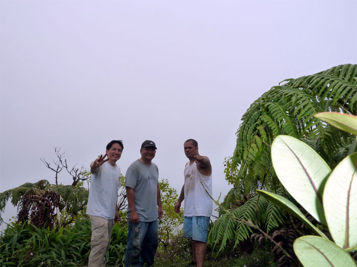
Top of Konahuanui
We arrived at the top of Konahuanui at 3,105 feet to be greeted by whiteout conditions. While it was disappointing not to have clear conditions, Mother Nature teased us every now and then as the clouds would partially open up to show us the Windward and Town views.

Headed to K2
After vainly waiting about 30 minutes hoping that the clouds would clear from the top, we decided to move on to the second highest peak of Konahuanui or K2. Here is where we made our second mistake of the day. Since we could barely see, we started going down the ridge on the town side. When the clouds partially lifted, we realized we were going the wrong way and had to backtrack back to the top and follow the ridge on the Windward side that would take us to K2. Another extra hour tacked on to the hike.

Konahuanui 2 marker
The view from K2 was just as cloudy as K1. A big disappointment. The views were actually better getting to the peaks than when we actually got on top of the peaks.

Panoramic view of Windward and Town
Click here to see the larger image of the just stupendous views of the Windward and Town sides.

Koolau Mountains
The fact that we could see the Koolaus all the way to Makapu’u just made this hike even more breathtaking.

Headed down the Manoa Middle Trail
As we were walking along the spine of the Koolau’s, we were wondering if we had missed the turn to go down the Manoa Middle trail. We thought we were going to have to hike all the way to Mount Olympus and go down the Waahila Trail. Then as Glenn was hiking ahead of us, he came back with a shit eating grin on his face that said he found the clearing and the Manoa Middle pink ribbon. The hike down Manoa Middle is all downhill and the last part before the trail drops you into the Waiakeakua stream is almost vertical with strawberry guava trees and ropes to brake your descent, which reminded me of the Cemetery Ridge coming down Pu’u Manamana. After that, we just followed the stream all the way out until we found ourselve on Waaloa Place, a little off from our intended exit of Alani Drive. It took us over twelve hours to finish this hike, if we hadn’t gotten lost and spent wasted time untangling our cord, we would have completed the hike in a little over nine hours.
{ 0 comments… add one now }