
A former marine joined our saddle hike today who improvised, adapted and overcame with aplomb. Semper Fi.
Pali Lookout
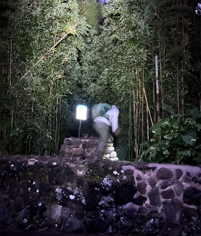
Oh the weather outside looked frightful, but the hikers were so delightful, and since we’ve no place to go, Ferlino took us to the pali’s sheer cliffs which was so dreadful back in 1795 that claimed hundreds if not thousands of lives in the battle that lead to the eventual unification of the Hawaiian islands. We hopped over the rock wall that was thoughtfully repaired so that we wouldn’t trip over it under the cover of twilight.
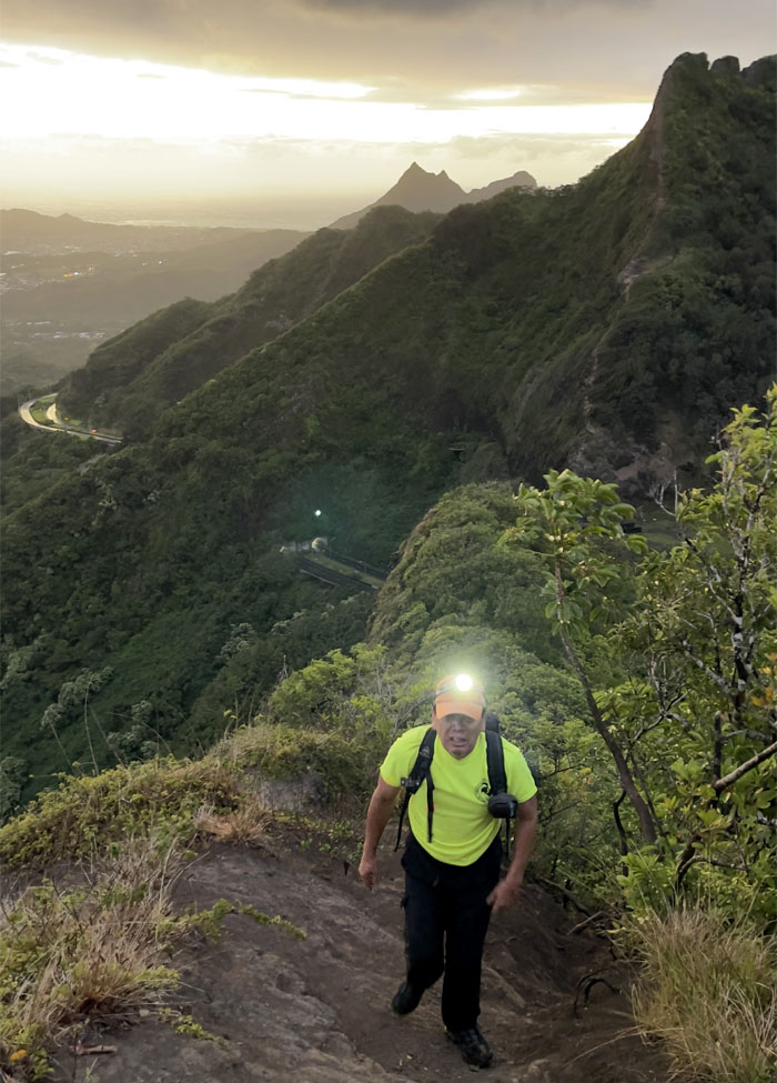
Pali Lookout
Coming up the short and steep trail with the Pali Highway and tunnels behind me that was opened to the public back in 1962. Before that, there were no tunnels, just 22 hairpin turns that allowed people to traverse the narrow road from the Windward side to the town side. And before that, the Pali was just a cliff trail that had to be traversed with ropes and ladders. Times have changed.
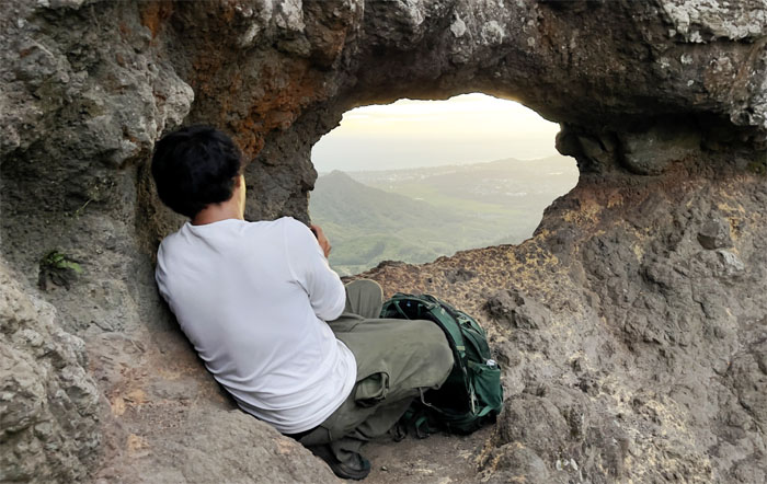
Pali Puka
Chris trying to take the perfect sunrise shot through the puka in the rocks.
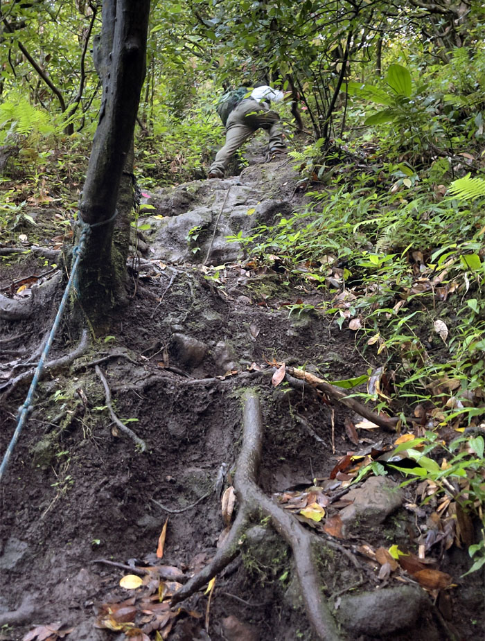
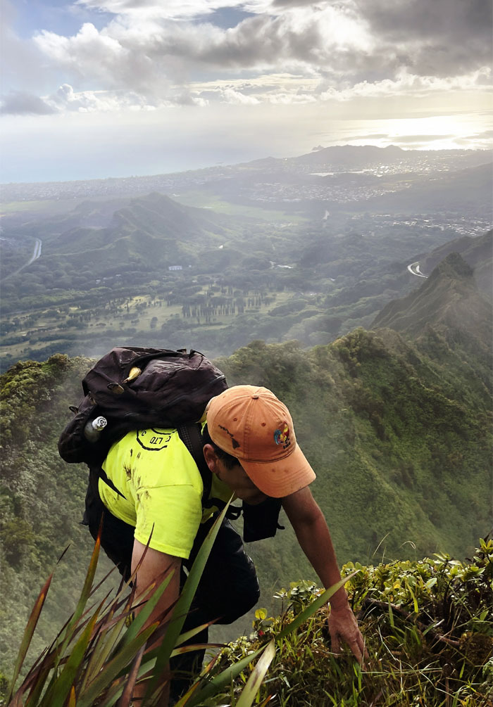
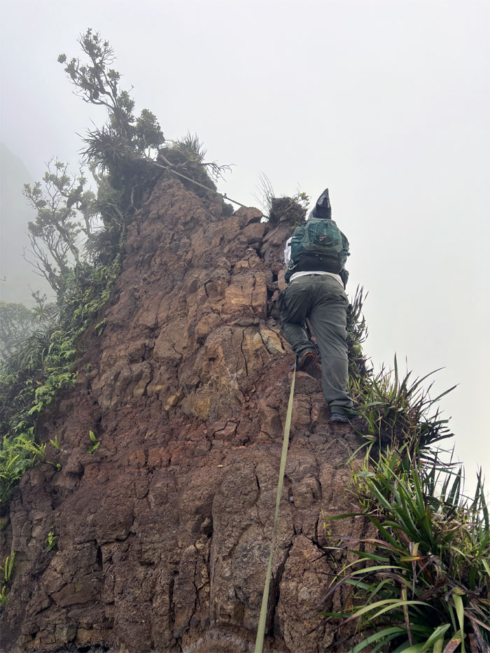
Pali Trail
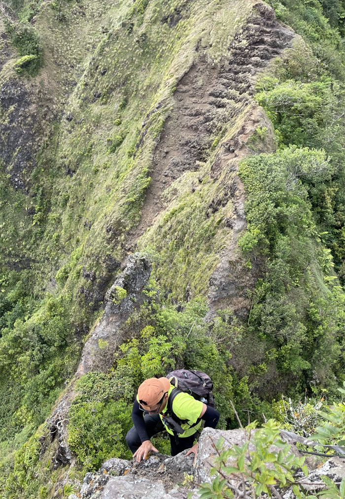
Climbing our way up the steeply rooted and rocked hill laced with ropes for the assist.
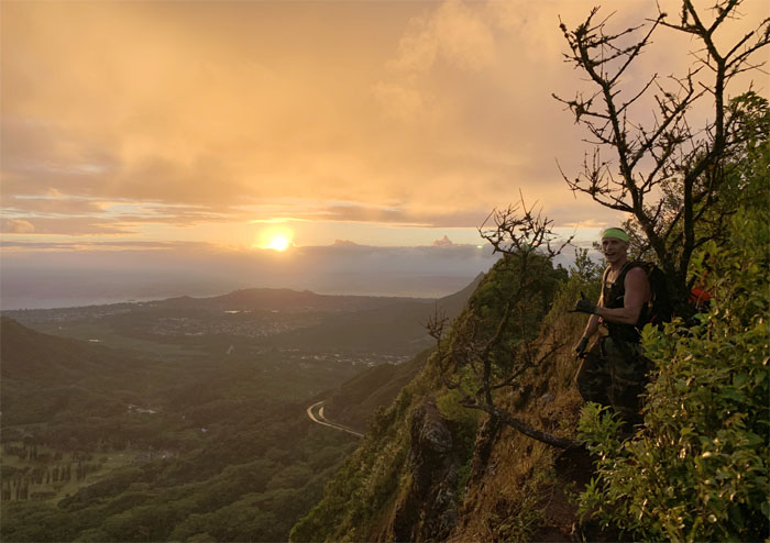
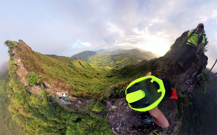
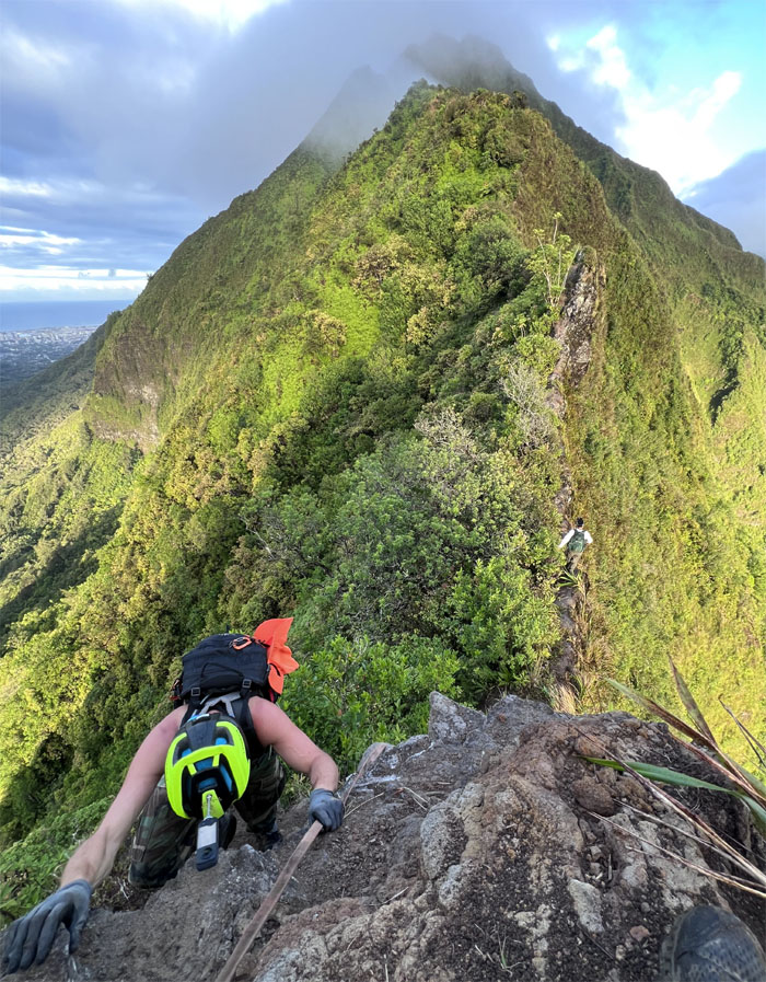
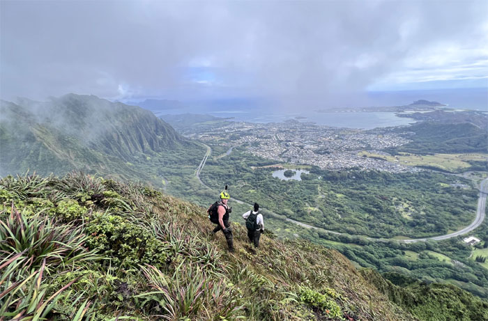
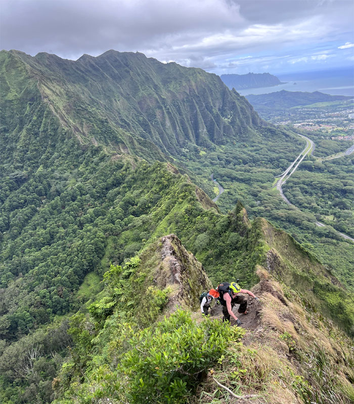
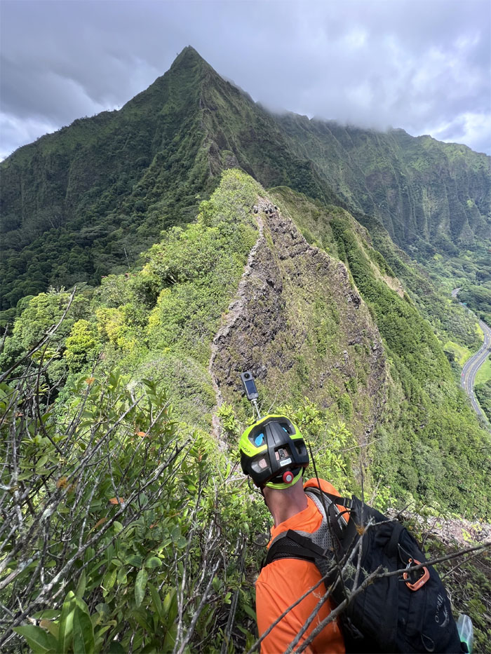
Nu’uanu Saddle
Breaking out onto the narrow ridgeline that afforded a sweeping view of the rising sun as she lit up the landscape below us.
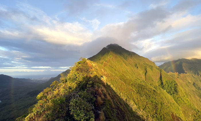
Nu’uanu Saddle
We saw a faint rainbow left over from the rain showers that had washed over the mountains earlier in the morning.
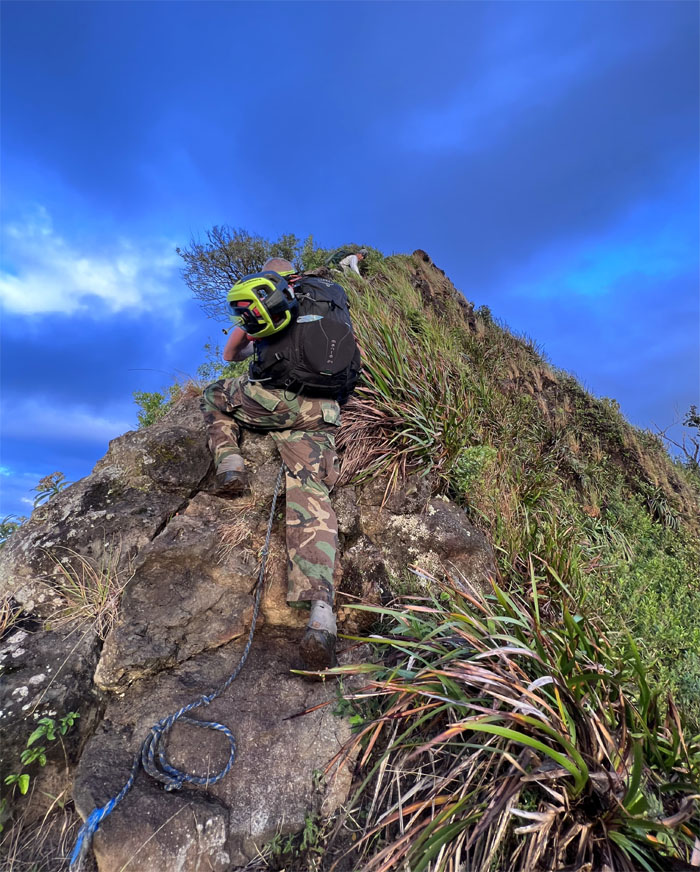
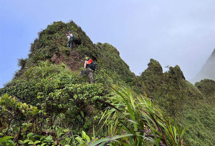
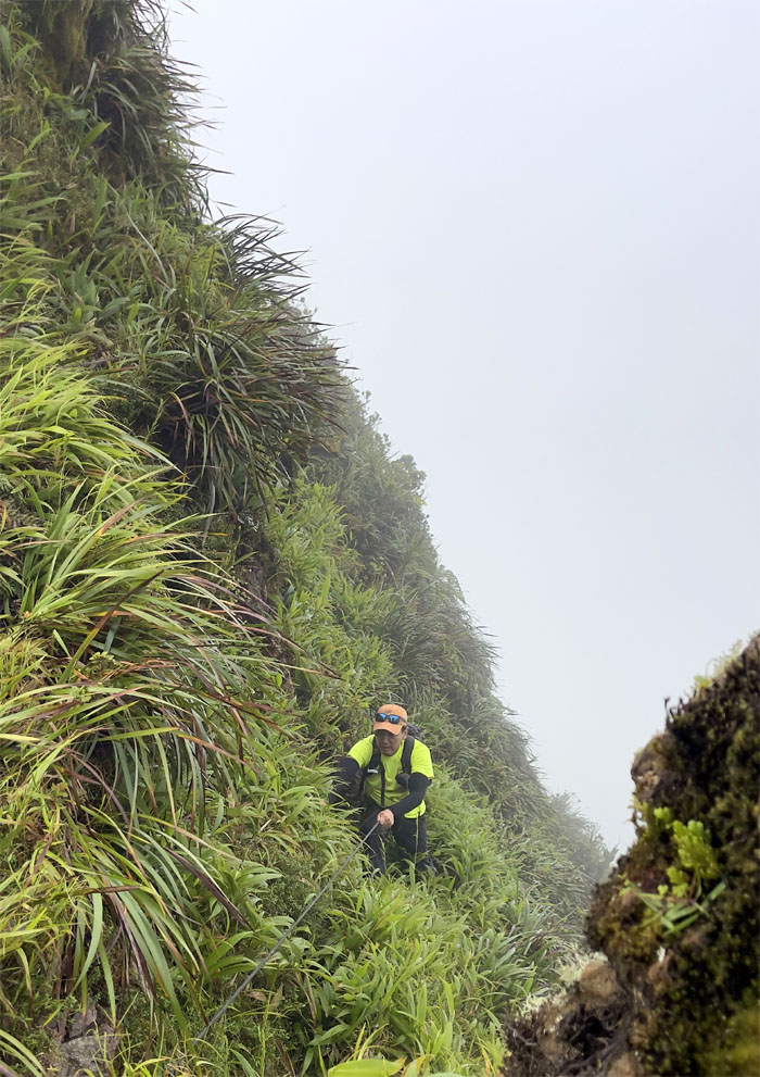
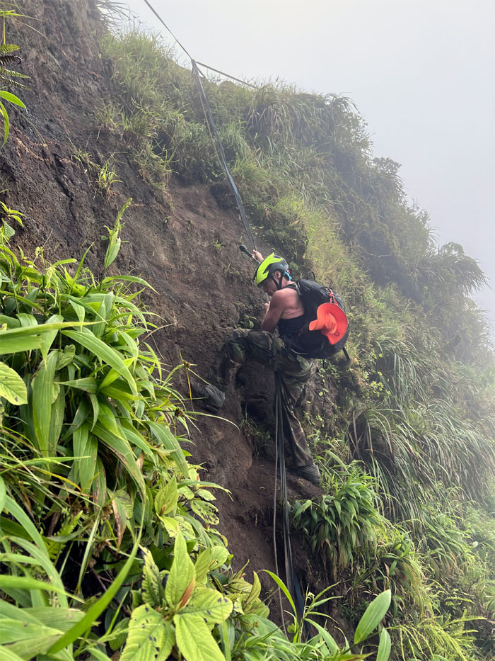
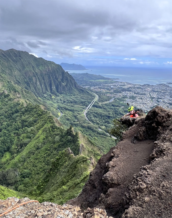
Nu’uanu Saddle
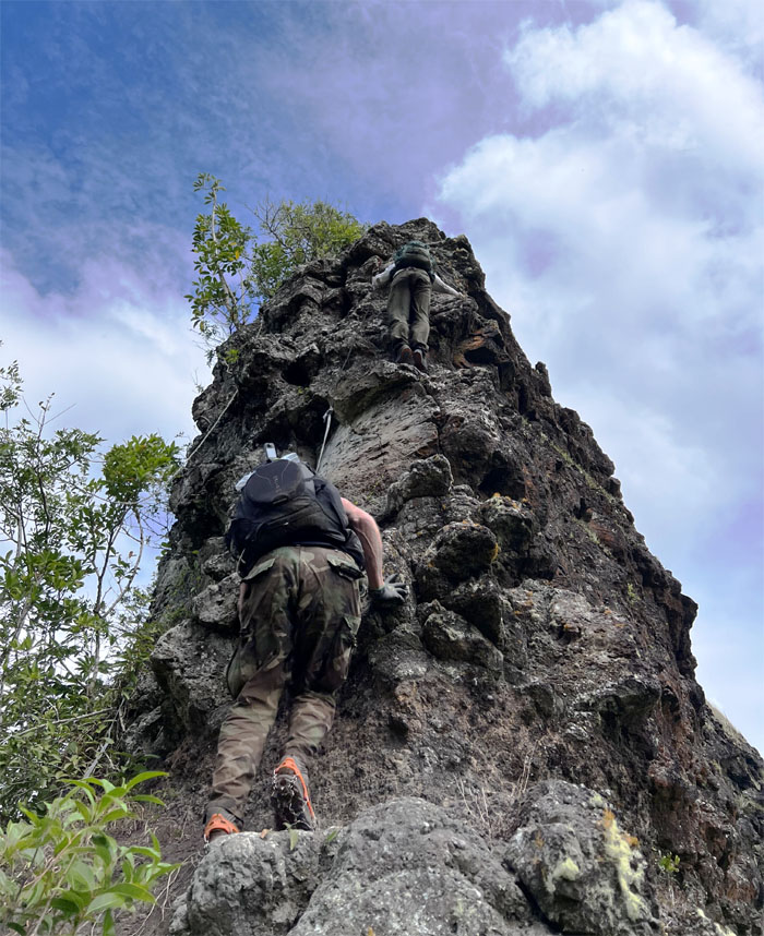
Climbing up the chossy rocks through a combination of hand and footholds, uki grass and questionable ropes. Preferably in that order.
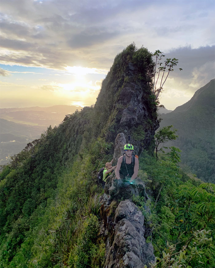
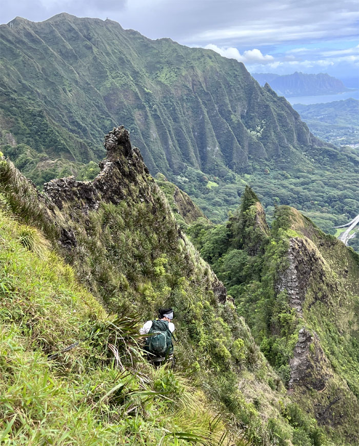
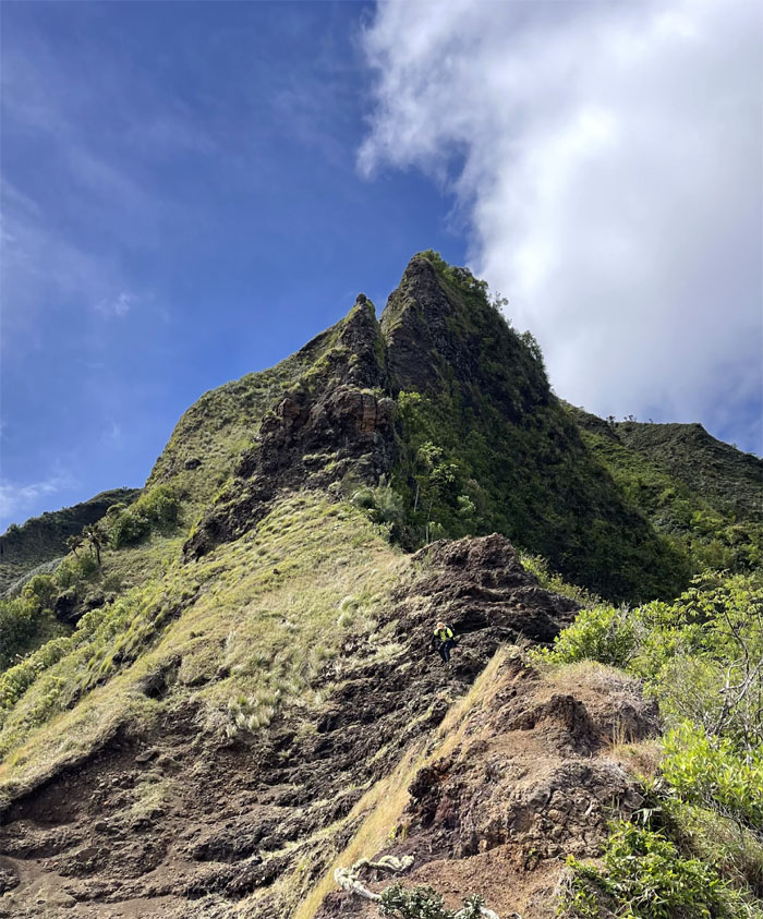
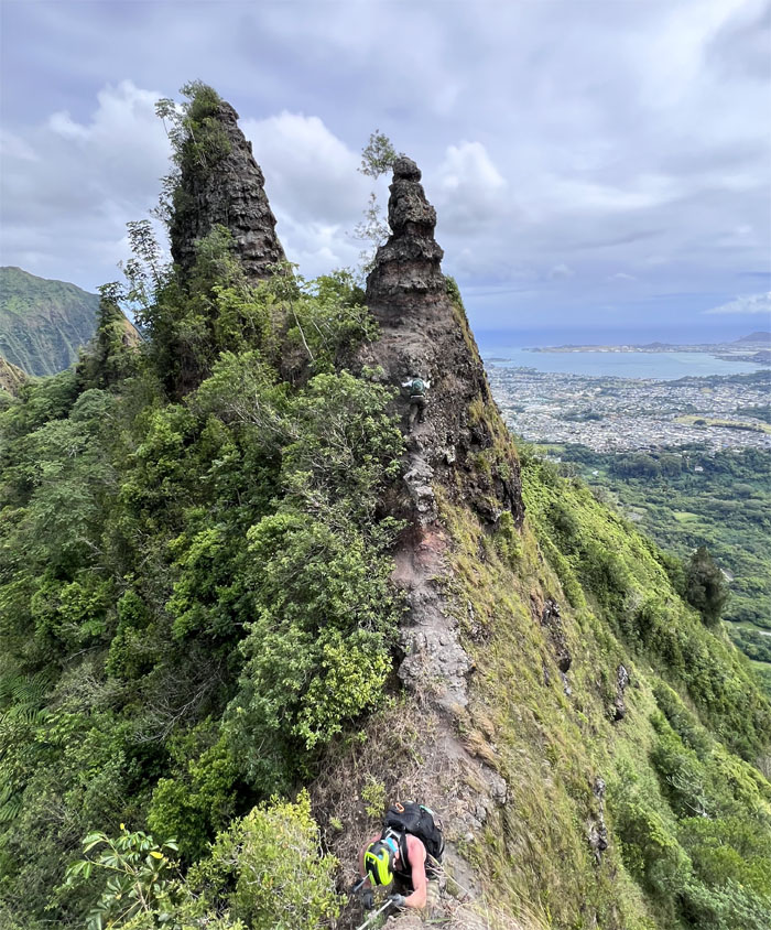
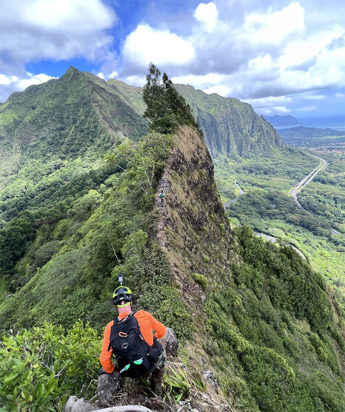
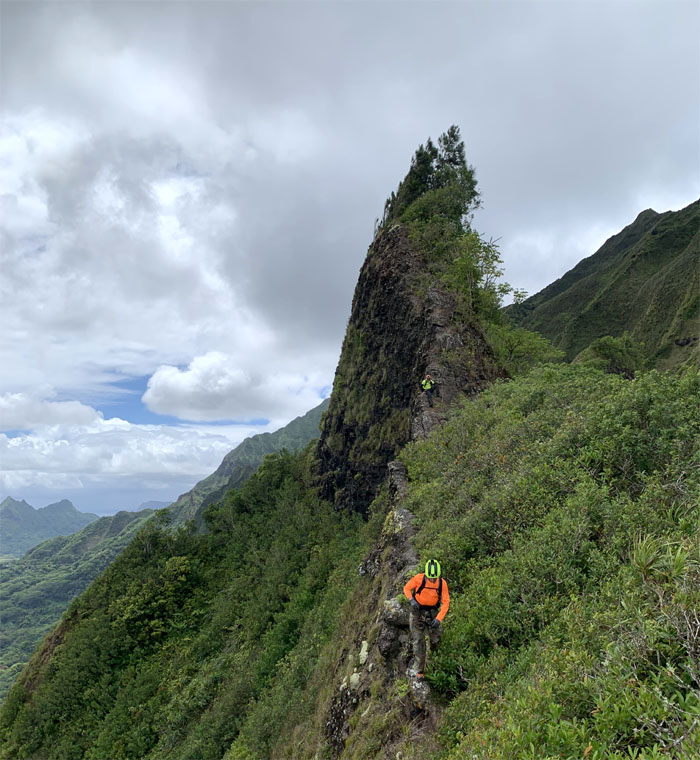
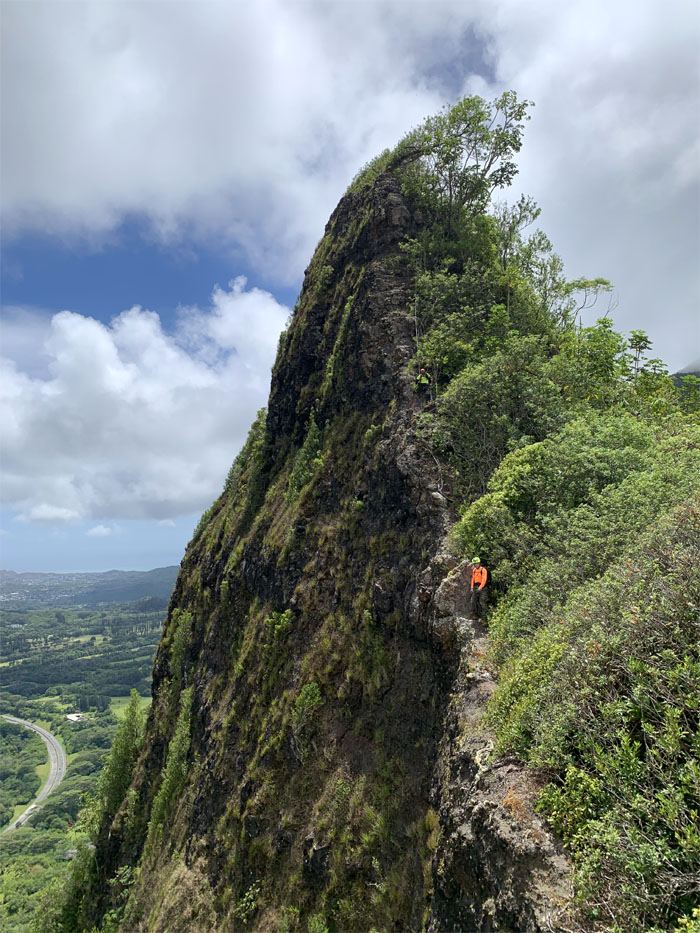
Incisor Rock
Paul straddling the narrow rocks. The ax that was once wedged in these rocks had taken their leave of the mountains. Perhaps by man or nature.
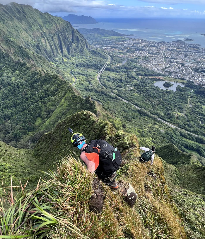
Nu’uanu Saddle
Time waits for no man. That man is Chris Bautista.
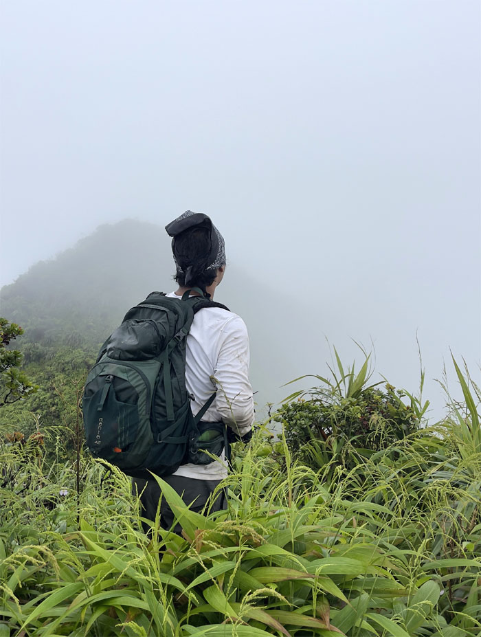
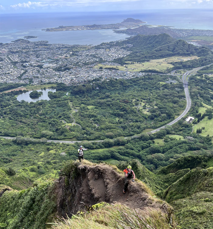
Nu’uanu Saddle
Looking back at the expansive views of the Windward side.
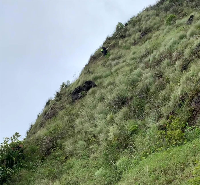
W
Approaching the 23rd letter in the alphabet to discover that the rope had snapped in several places.
W
Cresting the top of the first hill.
W
Descending down the steep flank.
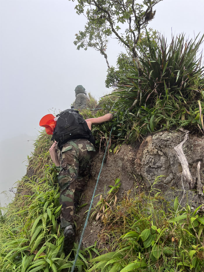
W
Contouring and climbing through the double v shaped rocks using hand and footholds, uki grass, questionable wire and ratchet straps. Preferably in that order.
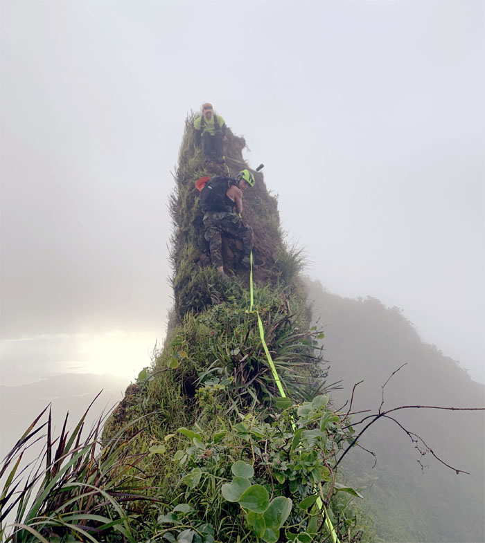
W
We both came down our own ways on that skinny finger of a mountain.
Anvil
Chris wanted to climb the hot mess of rocks, since the shaky anvil rock had finally bit the dust. A decidedly crumbly route. That’s a hard no.
Anvil
We had to trust the ropes coming down as it was now secured to another shaky tree or rock. It was a long roll down if things had gone the wrong way.
Ko’olau Summit Ridge Trail (KSRT)
The hard parts were behind us as we traversed the cloud soaked ridge line. During the hike to the summit, I had clumsily hyperextended my left leg, tenderizing my knee and ankle. The hard parts were now ahead of me.
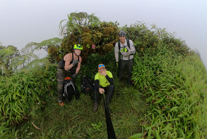
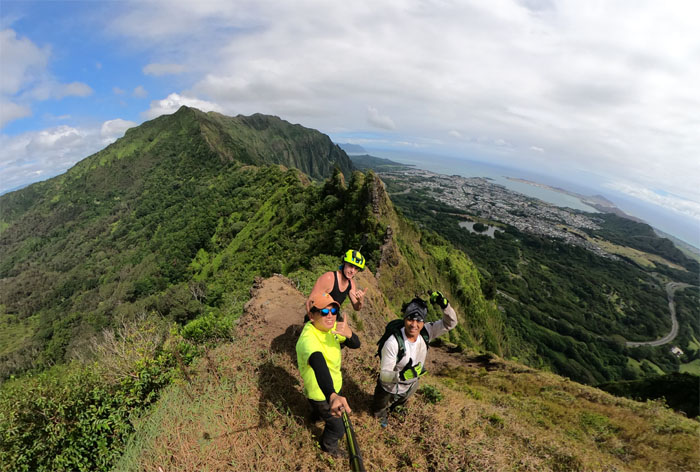
Lanihuli Summit
Group photo at the summit of the massive mountain that is aptly named swirling heavens, more like socked in clouds today.
KSRT
Descending from the 2,700′ summit as we slipped under the cloud cover.
Kalihi Saddle
The wide terrain soon funneled into the classic narrow saddle ridgeline.
Dirt Dragon
Chris and Paul standing and sitting on the shell of its former self.
Dirt Dragon
What exactly is holding this pile of rocks and dirt together? I don’t think we want to know.
Kalihi Saddle
Somebody almost took an unexpected one way ride down to 911 territory.
Lanihuli Wall
Dropping down the steep flank of the ridgeline.
Lanihuli Wall
Contouring our way around the Can Opener and back to the ridgeline.
Kalihi Saddle
Taking our group photo under the shadow of the bulging refrigerator rock.
Kalihi Saddle
Coming down the “rock terrace.”
Pimple
Paul climbing down as Chris couldn’t wait to pop the pimple.
Doorstop
Going up the rockface that always seems to shed rocks every time I see it.
Doorstop
Climbing up the hardest obstacle on this section, everything left was “relatively” tamer.
Bunny Ears
Traversing between the two definitely not fluffy rock faces.
Bunny Ears
Paul hopping over the mushroom rock.
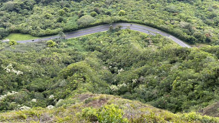
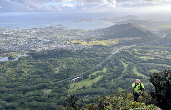
Kalihi Saddle
Looking down at one of the most expensive interstate highways ever constructed that was primarily built to connect Pearl Harbor to the Kaneohe Marine base.
Shark Fin
We dropped off the ridgeline to contour around and popped back out where we couldn’t see the fin for the mountain.
Shark Fin
Looking back at the dorsal shaped rockface.
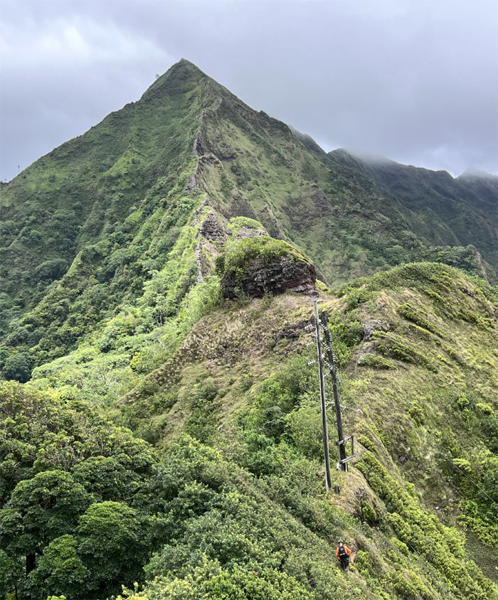
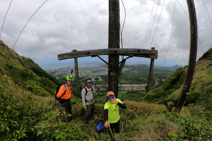
Powerlines
Approaching the powerlines that marked the end of the Lanihuli side of Kalihi Saddle.
Powerlines
My knee and ankle were throbbing at this point, so I threw in the towel while Chris and Paul continued up the Bowman side of Kalihi Saddle and exited out through Tripler ridge.
All pau
Thanks to Ferlino for picking me up on the side of Likelike Highway and taking me back to Kaneohe.
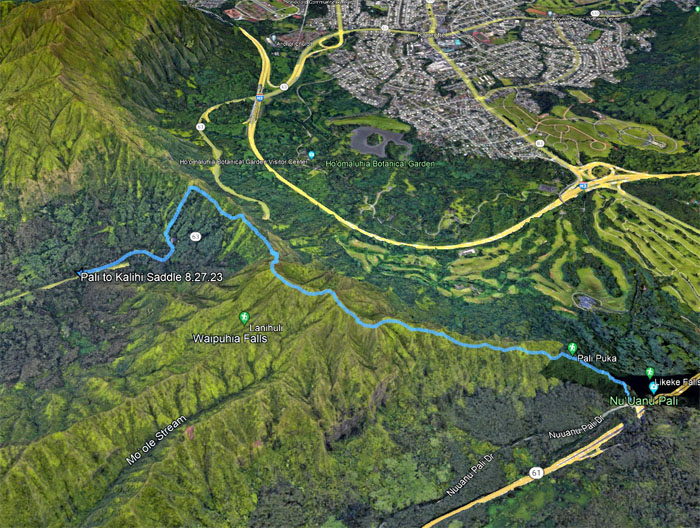
GPS Tracks
Our saddle hike covered 3.09 miles for myself and slightly longer for Chris and Paul who had pushed a little further out to Moanalua Valley. Blessed with great weather and good company. Post hike meal for myself was leftover sinigang soup at Casa Carinio. Mahalo to Ferlino who also picked up Chris and Paul in Moanalua Valley.
Photos taken by Chris Bautista, Paul Smith, and yours truly. Not necessarily in order.
Note: I have been made aware that some hikers have been using my blog as a hiking guide and getting lost on the trails. Please note that this blog was made to document the hike for the crew(s) that did it. That is why some of my comments will seem to have no relevance or meaning to anybody outside of the crew(s) that hiked that trail. My blog was never meant as a hiking guide, so please do not treat it as such. If you find inspiration and entertainment from these hikes, that is more than enough. If you plan on replicating these hikes, do so in the knowledge that you should do your own research accordingly as trail conditions, access, legalities and so forth are constantly in flux. What was current today is most likely yesterdays news. Please be prepared to accept any risks and responsibilities on your own as you should know your own limitations, experience and abilities before you even set foot on a trail, as even the “simplest” or “easiest” of trails can present potential pitfalls for even the most “experienced” hikers. One should also always let somebody know of your hiking plans in case something doesn’t go as planned, better safe than sorry.
{ 0 comments… add one now }