
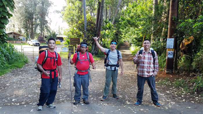
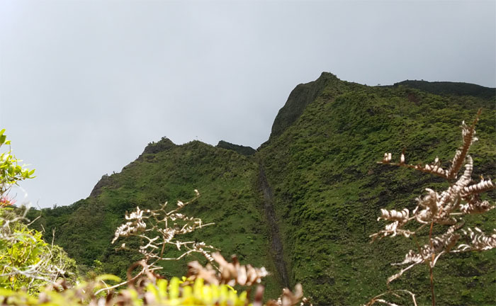
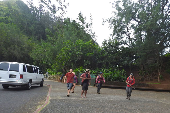
This is a story of one hike that split into two hikes. Ethan picked up Chris, Daryl and myself and drove to the end of the island to begin our journey across the mountain. The Ko’olau Mountain Range.
Pupukea
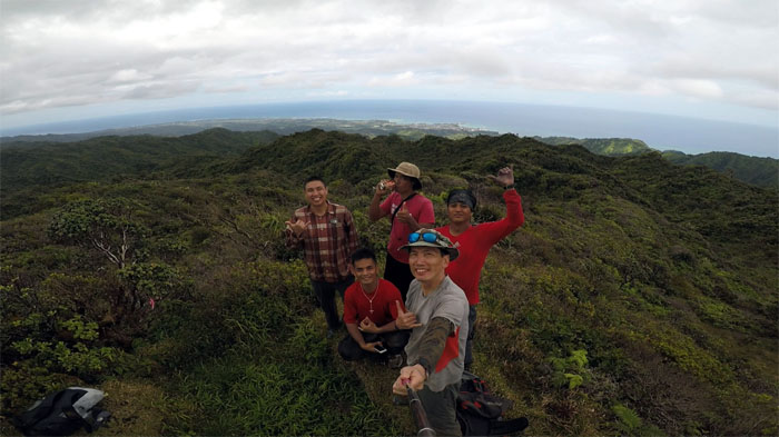
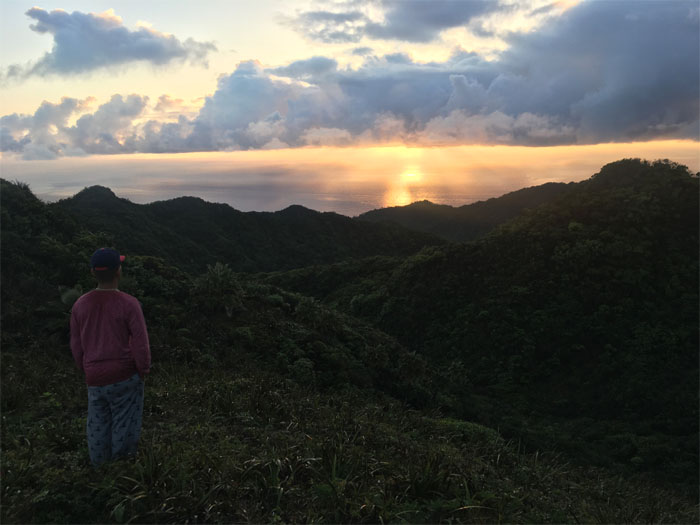
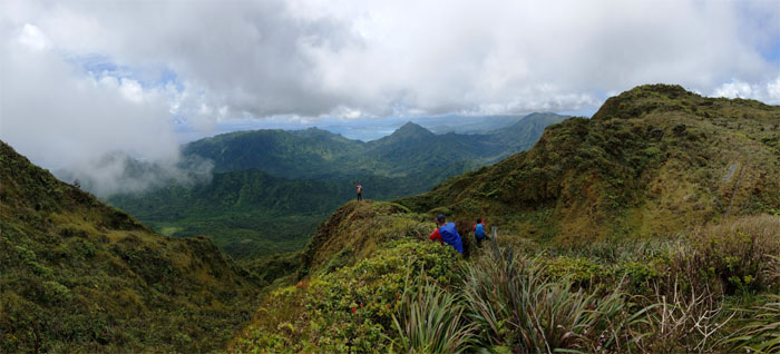
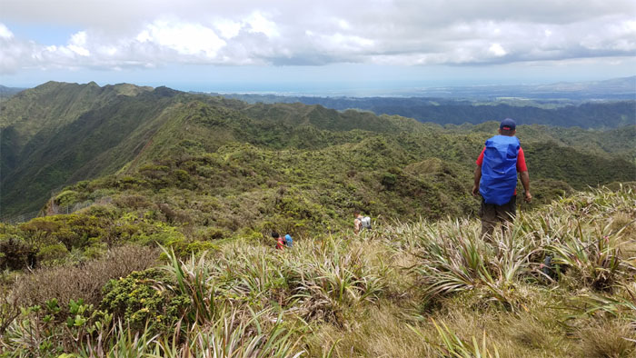
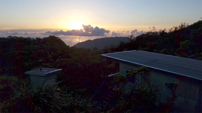
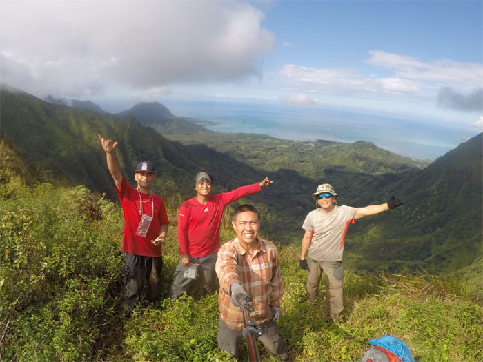
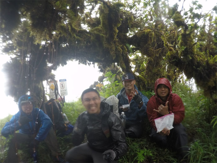
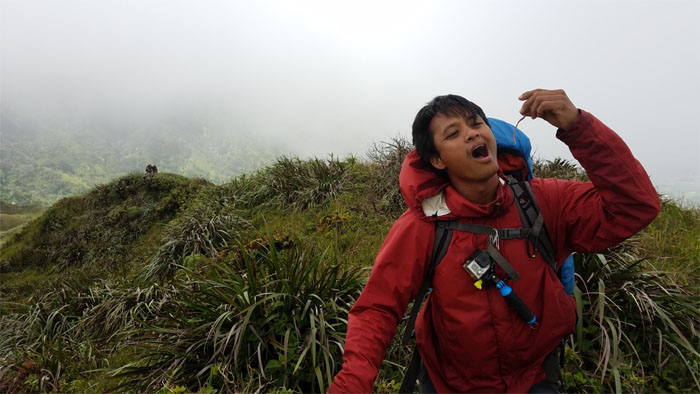
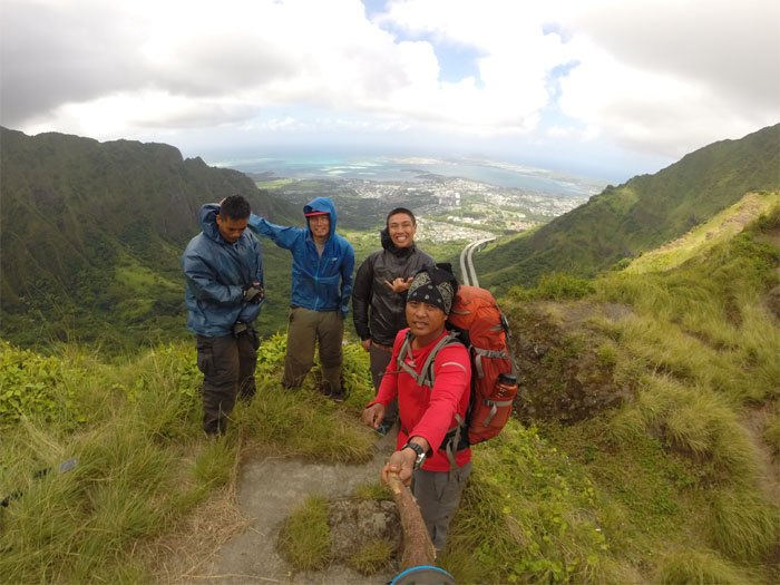
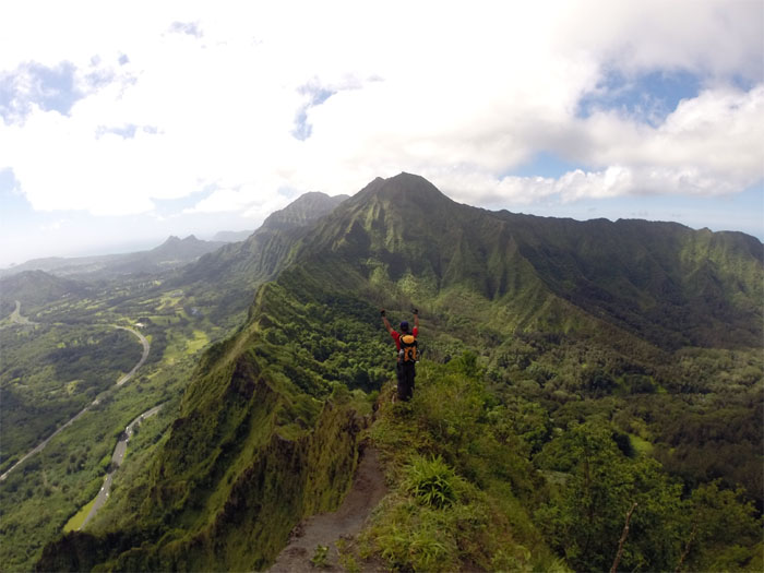
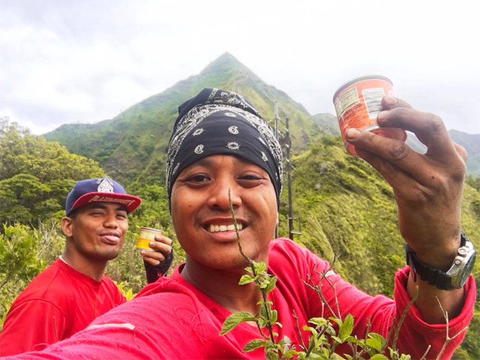
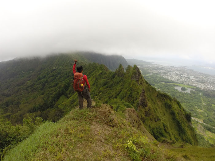
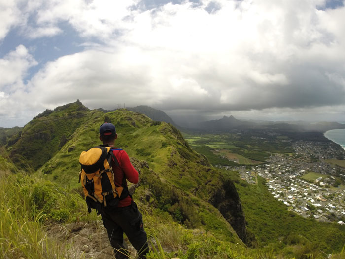
Day 1 – Saturday, May 27. We got off to a late start at a little past 8am, as three of us were sober and one was slightly hung over. The mountains are calling and we are coming. Photo by Kristina Eizenhofer.
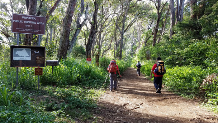
Pupukea
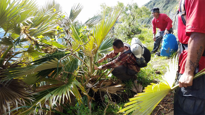
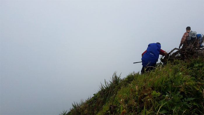
Chris recycling a hiking stick from the forest grounds that would stay with him until the end. The very end.
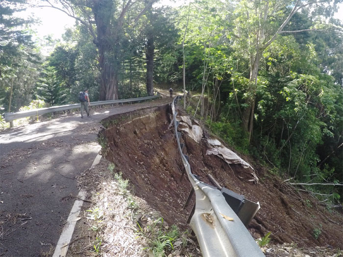
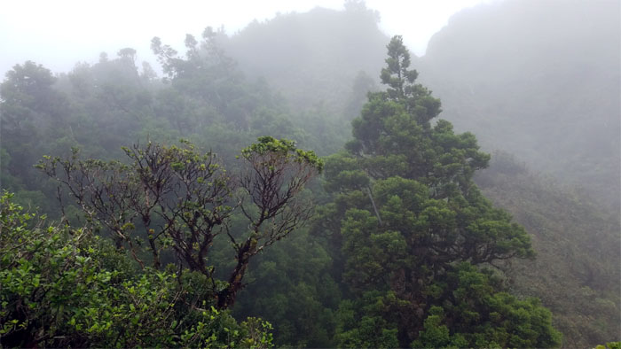
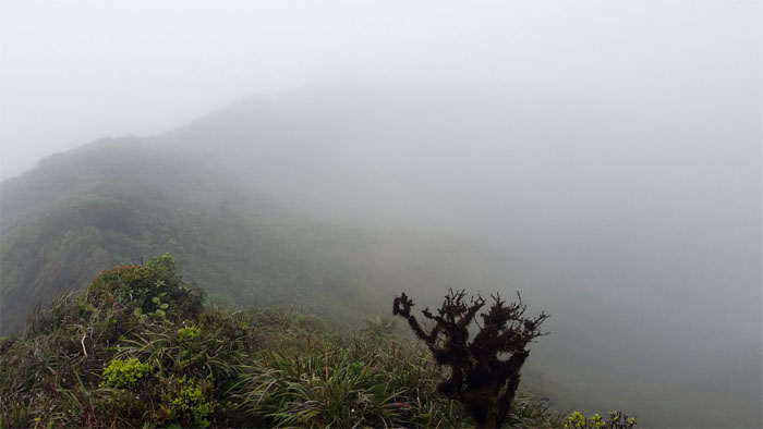
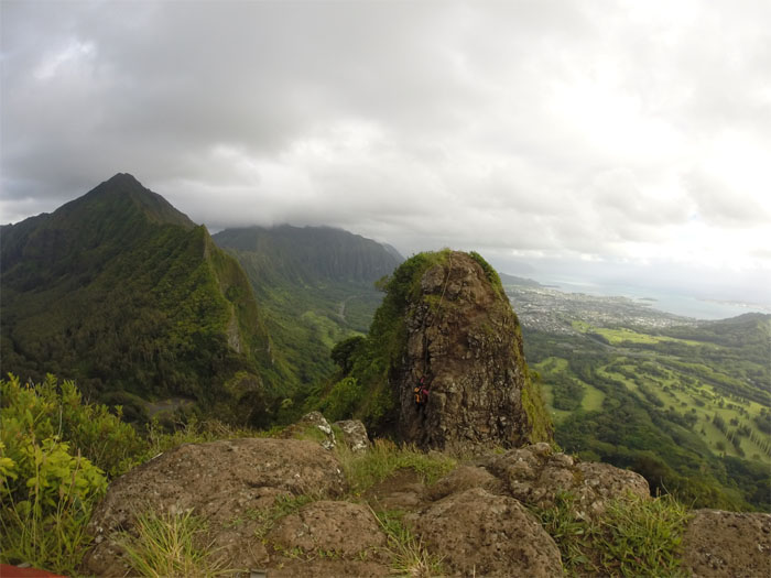
For Sale
Mother Nature is slowly taking her real estate back. Photo by Daryl Cacatian
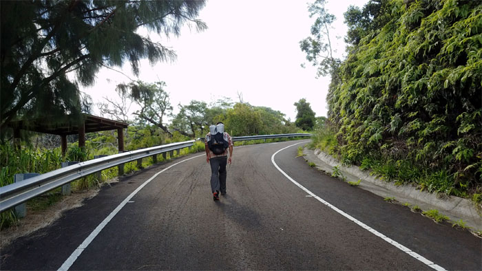
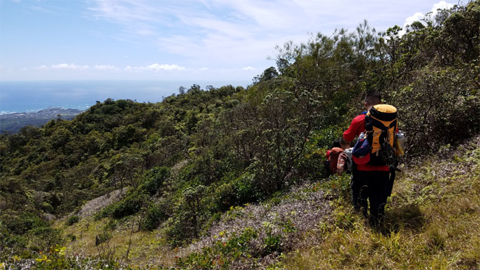
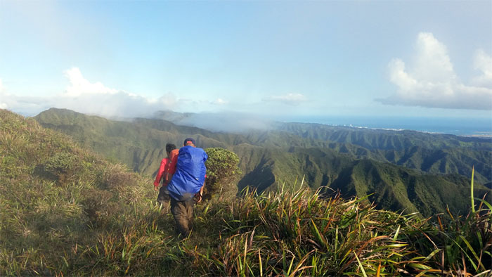
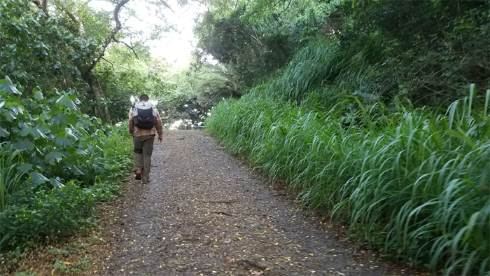
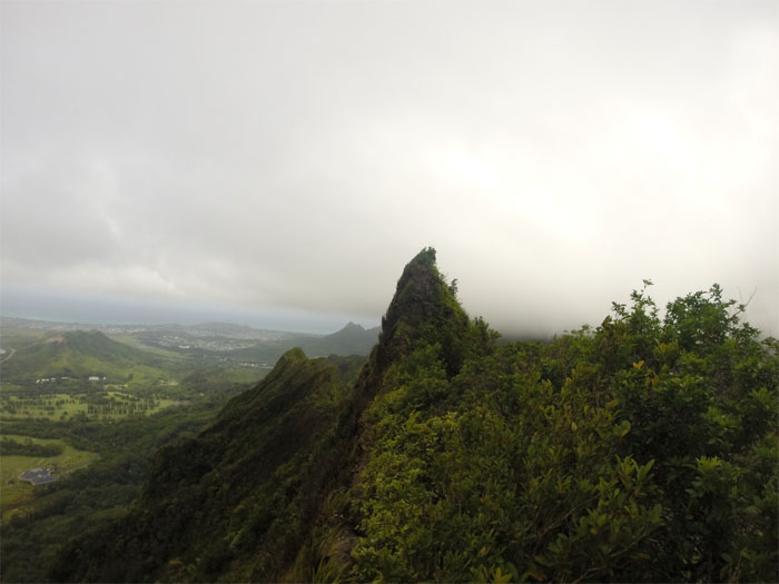
Paalaa Uka Pupukea Road
Ethan passing the picnic shelter.
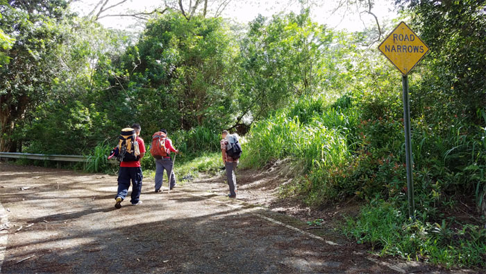
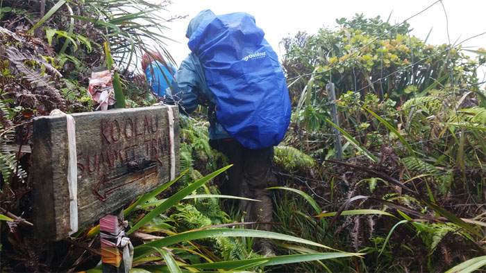
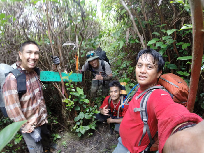
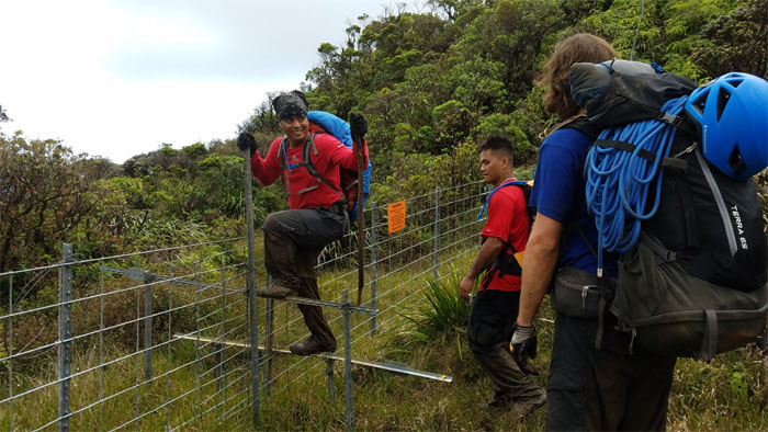
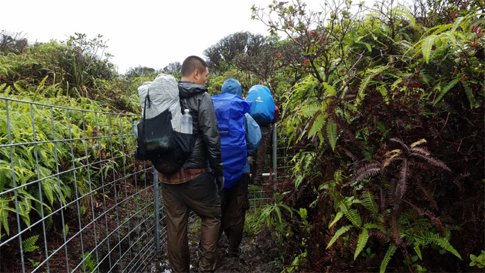
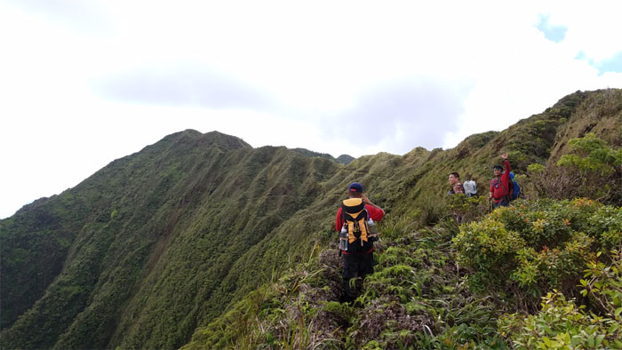
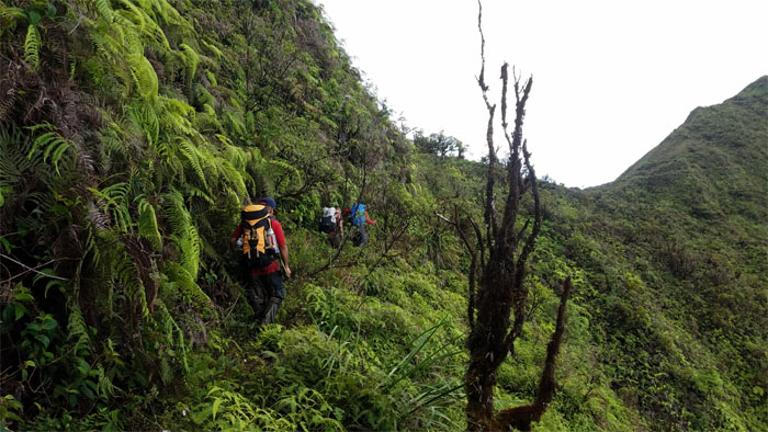
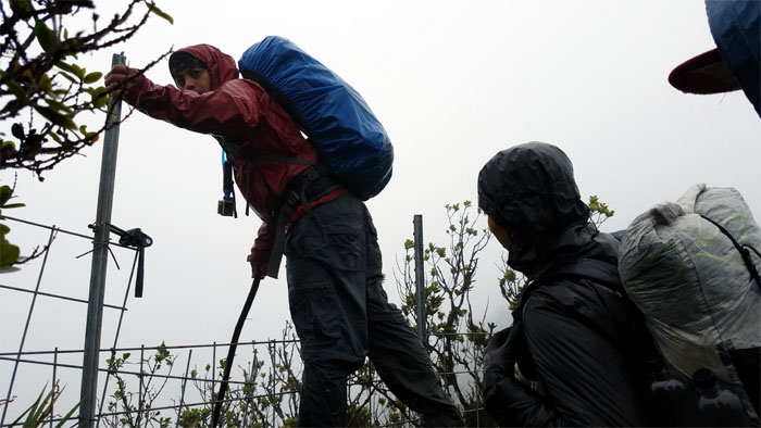
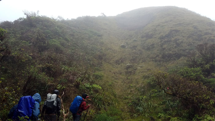
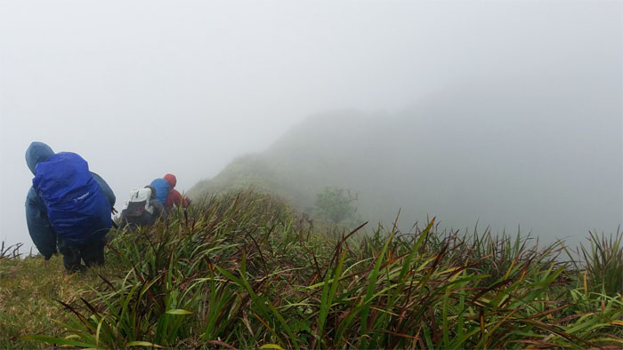
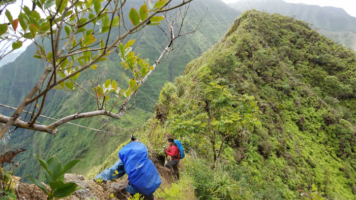
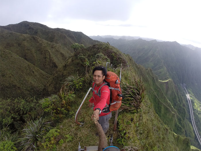
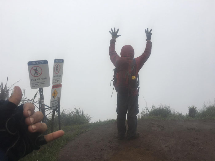
Sign Junction
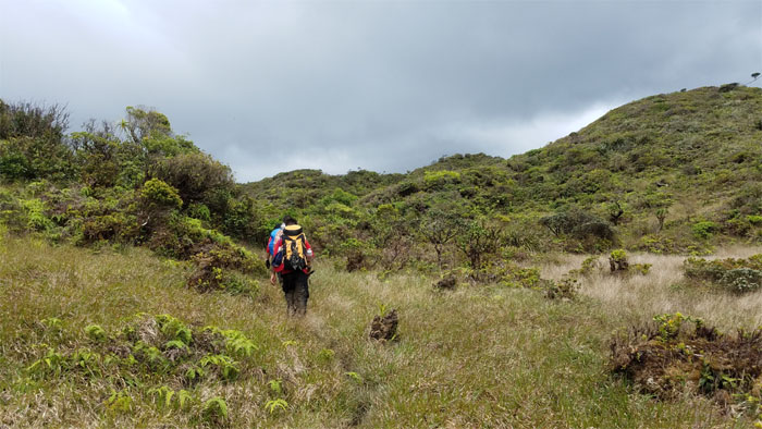
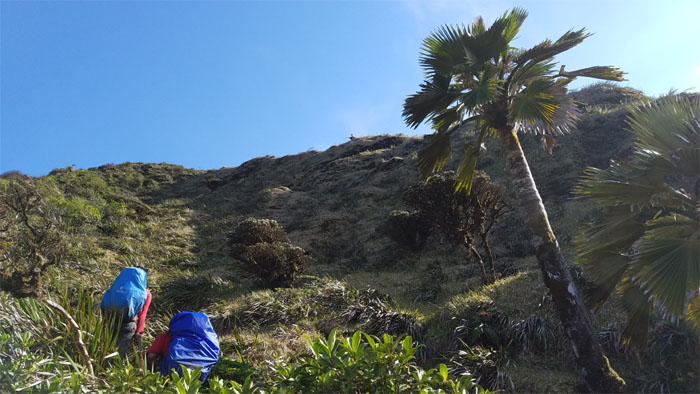
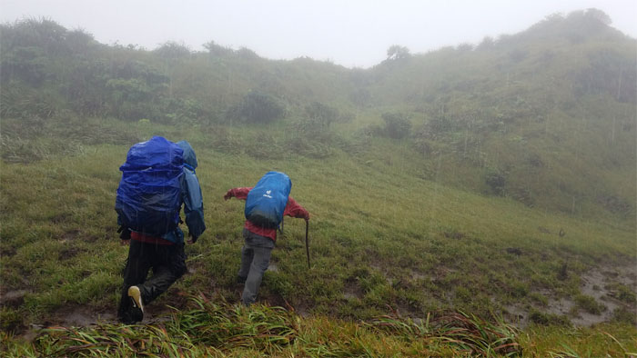
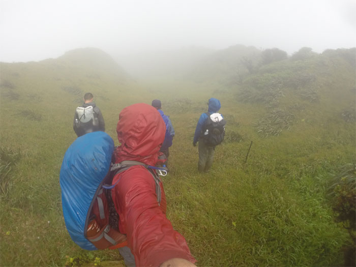
We soon left the road strewn with fallen rocks and trees for a trail strewn with overgrowth, roots, rocks and mud.
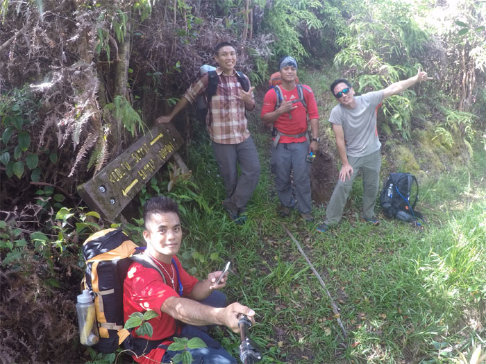
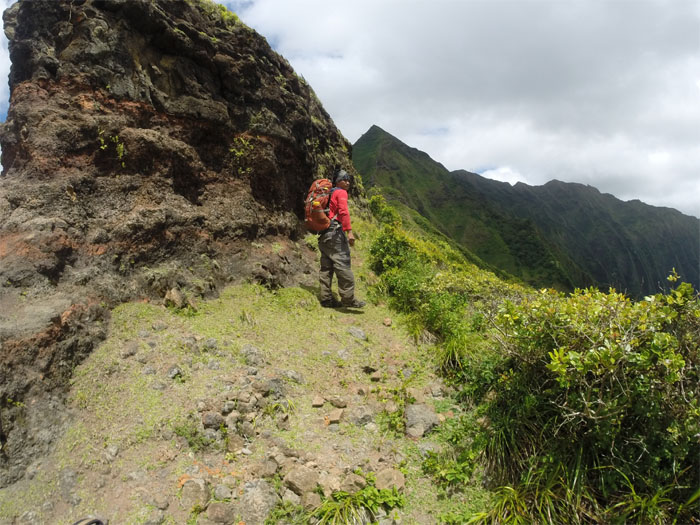
Black Junction
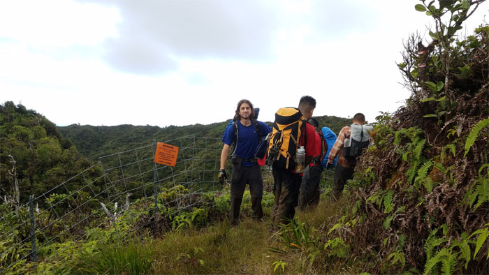
Preparing to plunge into the trail system carved out of the mountains by the Army and Civilian Conservation Corps back in the early 1900s. Photo by Daryl Cacatian.
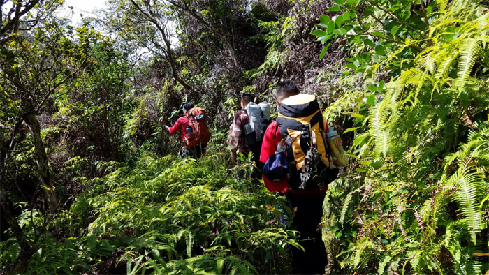
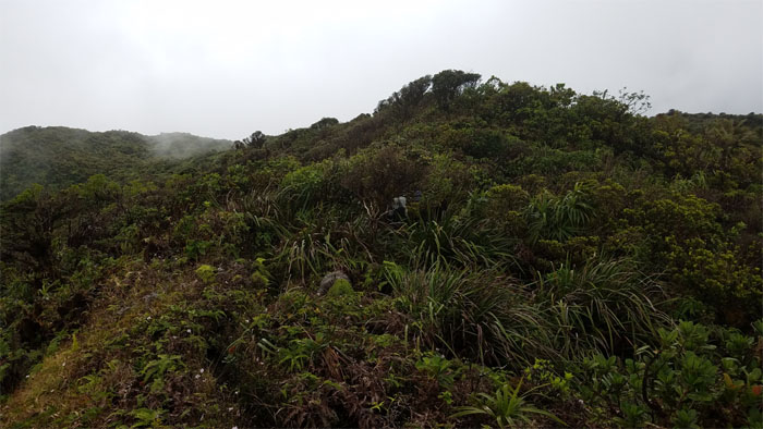
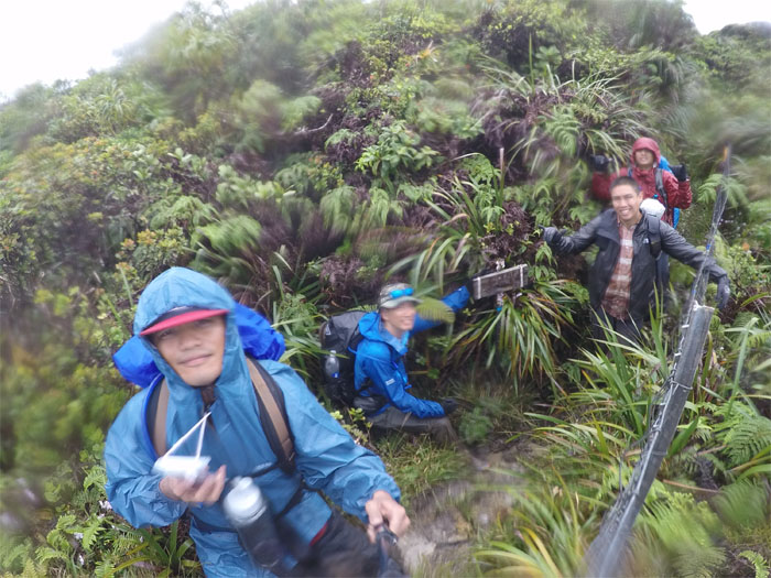
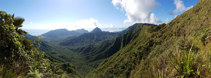
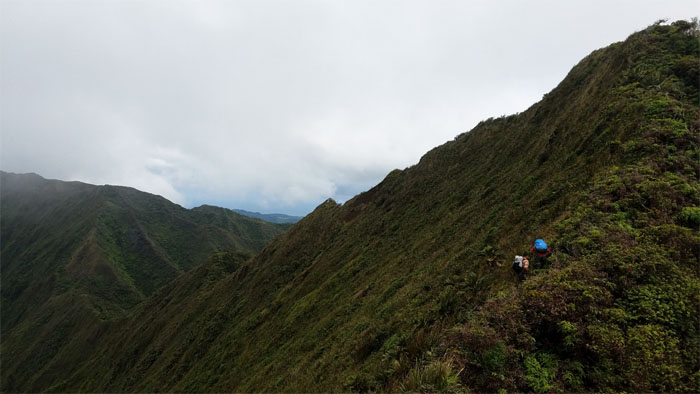
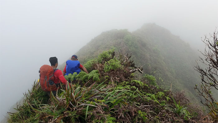
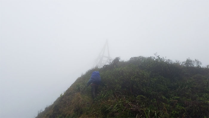
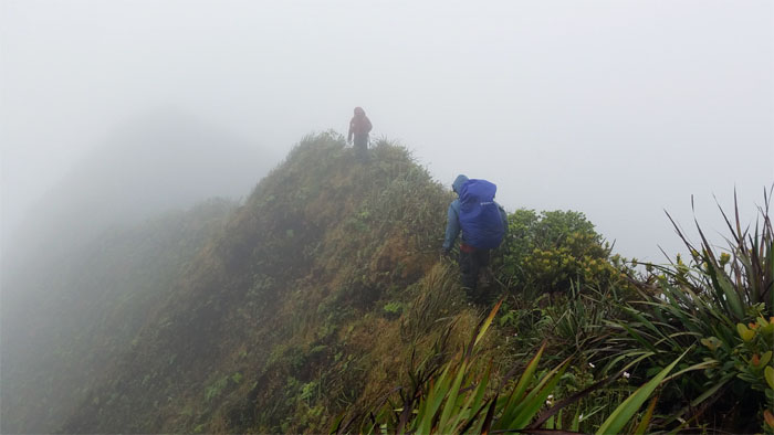
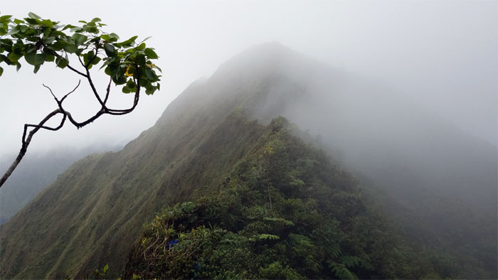
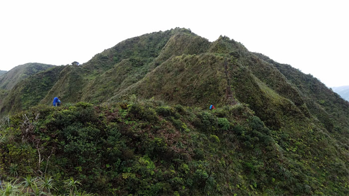
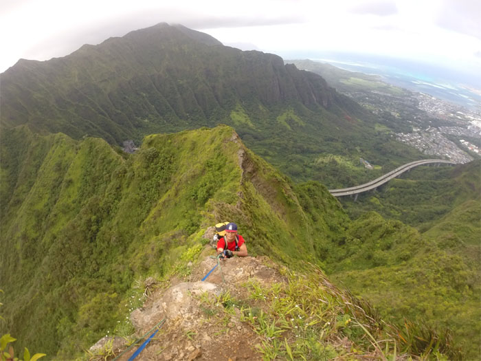
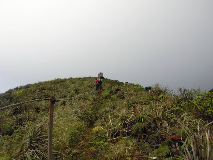
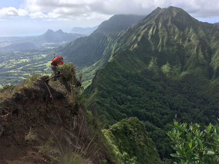
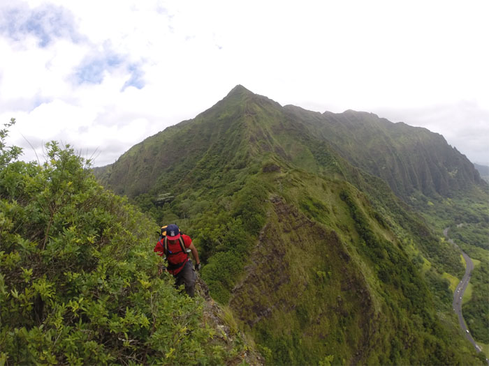
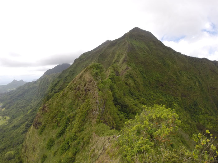
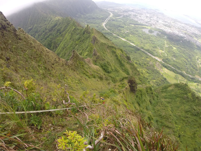
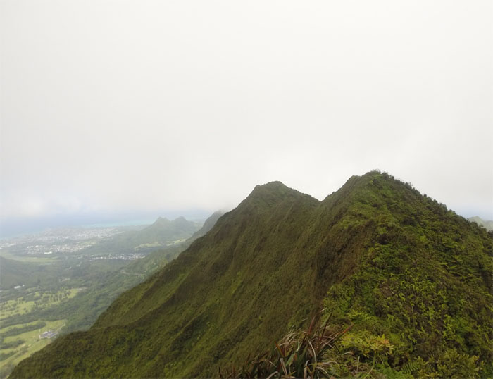
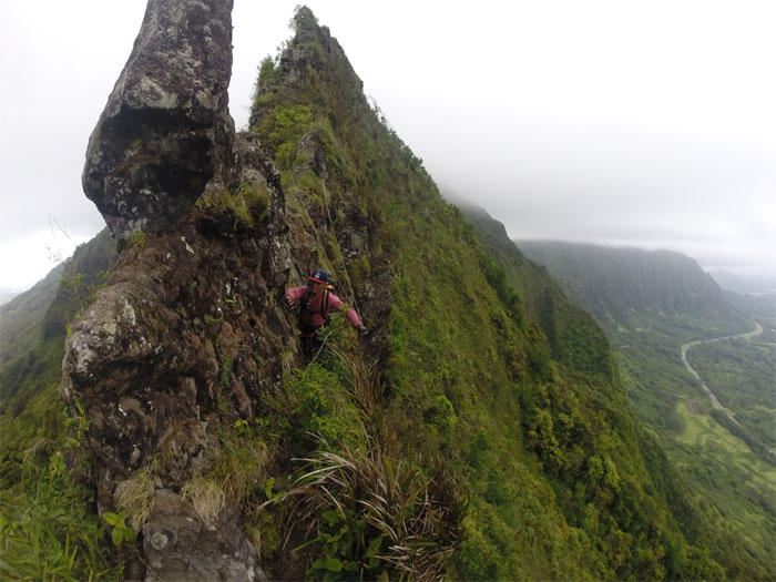
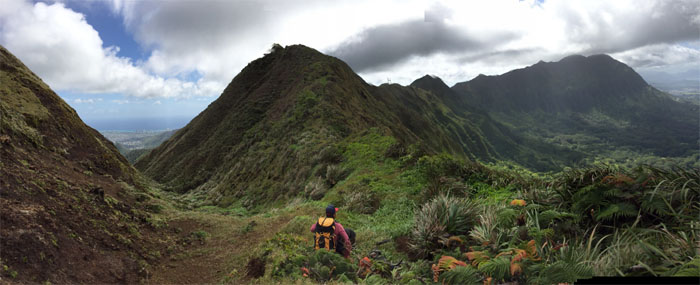
Ko’olau Summit Trail
Walking through waist high uluhe ferns on the trail. Welcome to the jungle, probably the most overgrown section of the KST.
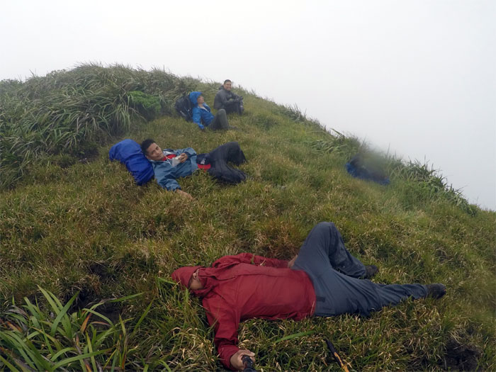
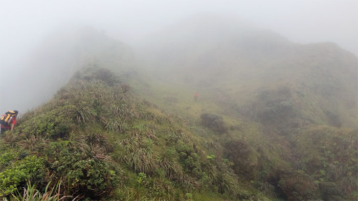
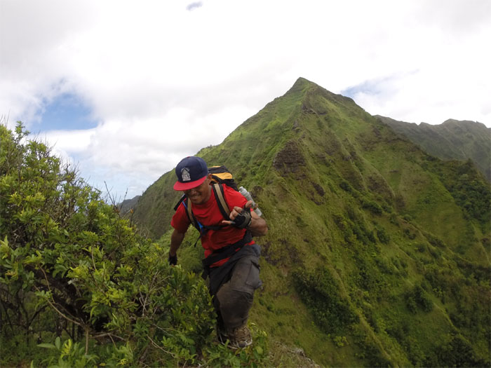
Pu’u Hina
Taking a short break amidst the whistling leaves of grass.
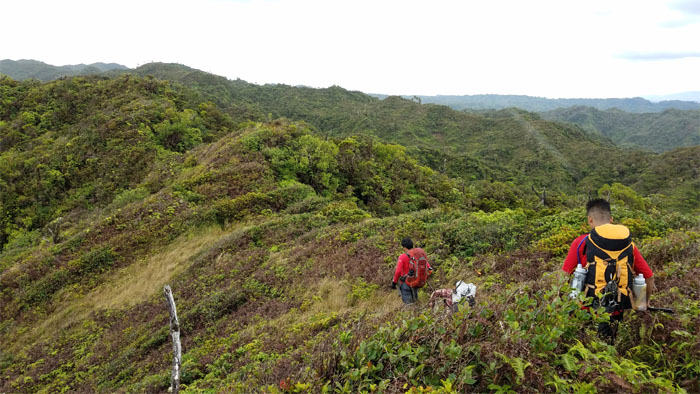
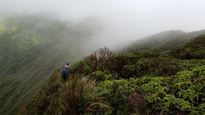
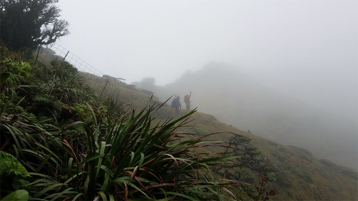
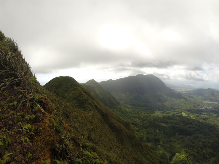
KST
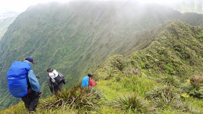
We soon dropped off the ridge to contour on the Windward side.
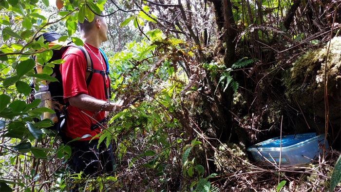
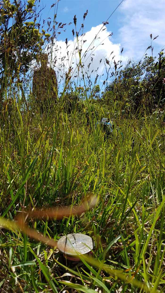
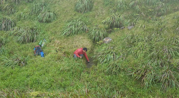
Geocache
Hey, there’s a Tupperware party going on back here. Anybody?
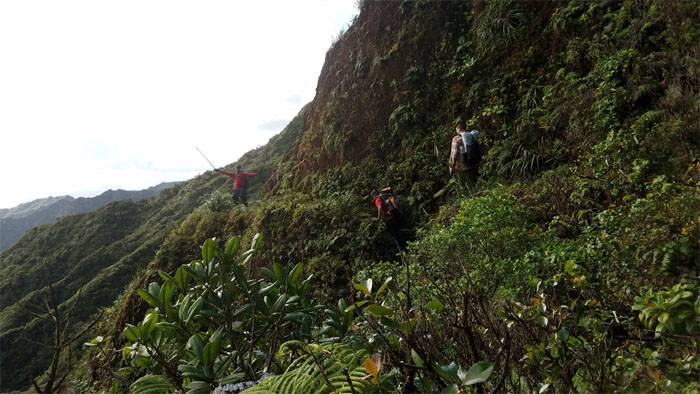
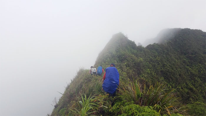
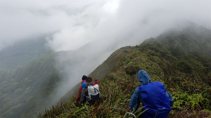
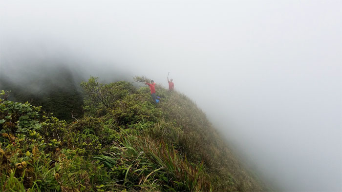
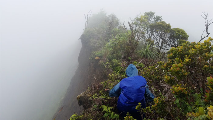
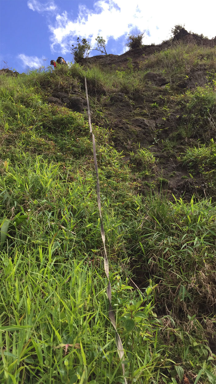
KST
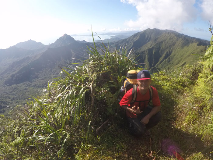
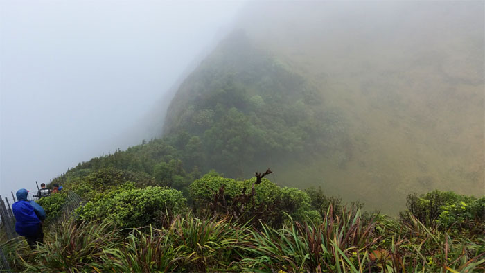
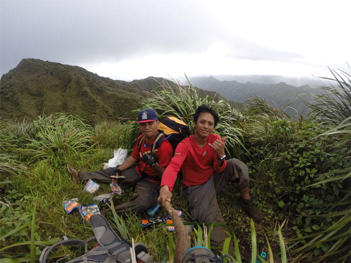
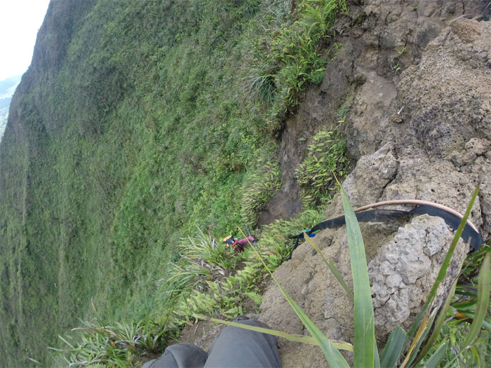
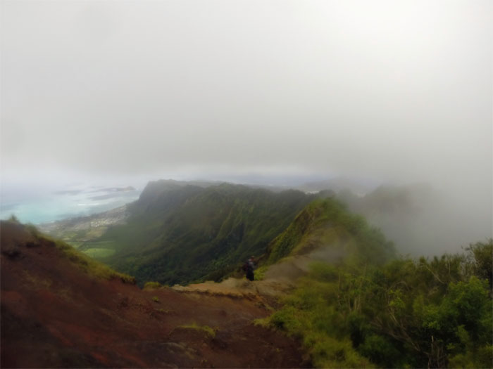
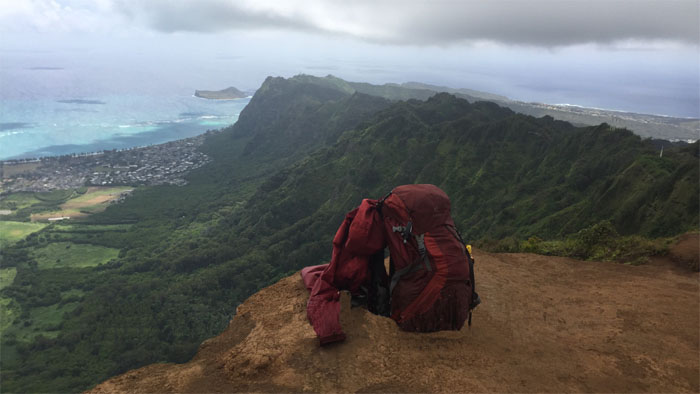
Enjoying a brief respite on the ridge from the claustrophobic and cloying vegetation, which snatched my water bottle and in return, gave up my sunglasses from an earlier hike.
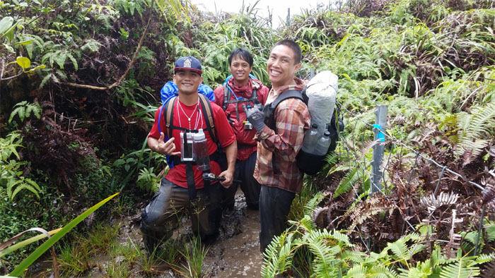
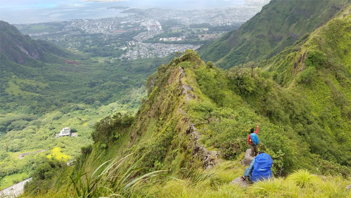
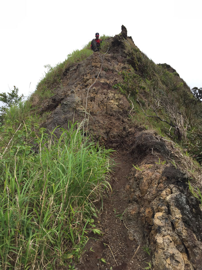
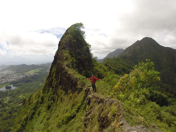
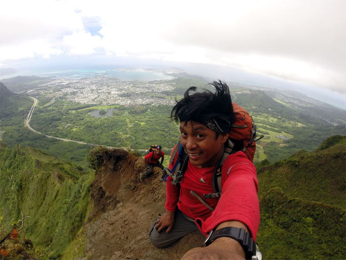
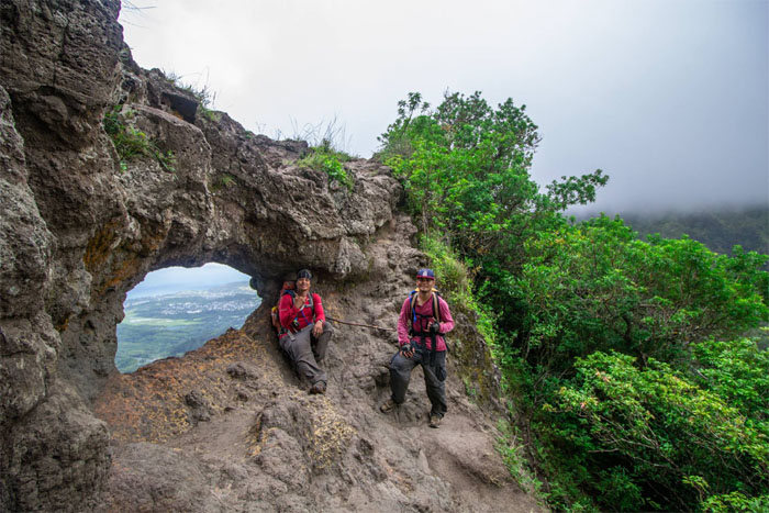
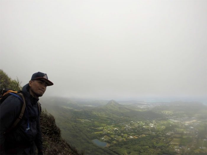
Green Sign Junction
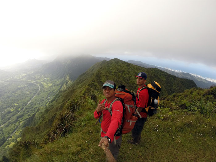
It was around noon when we reached the halfway point to Laie. Photo by Chris Bautista.
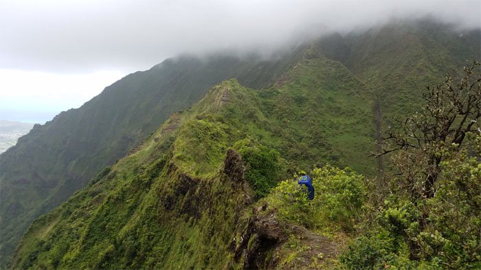
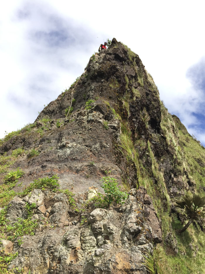
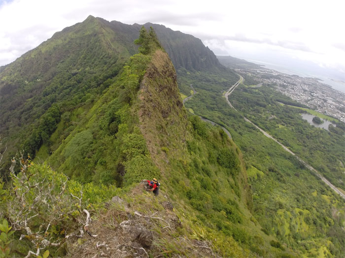
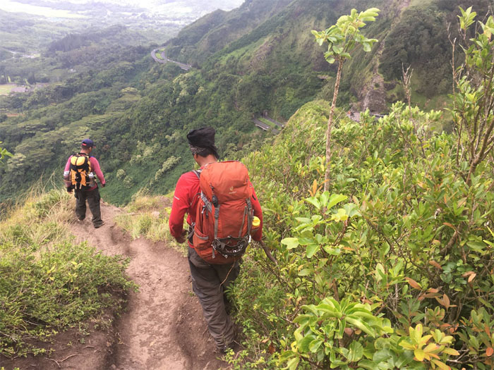
KST
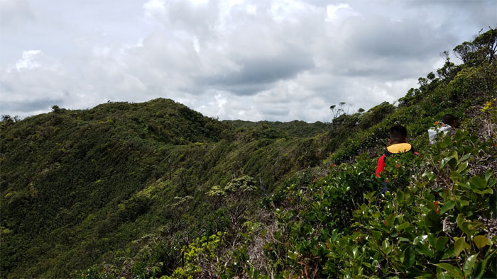
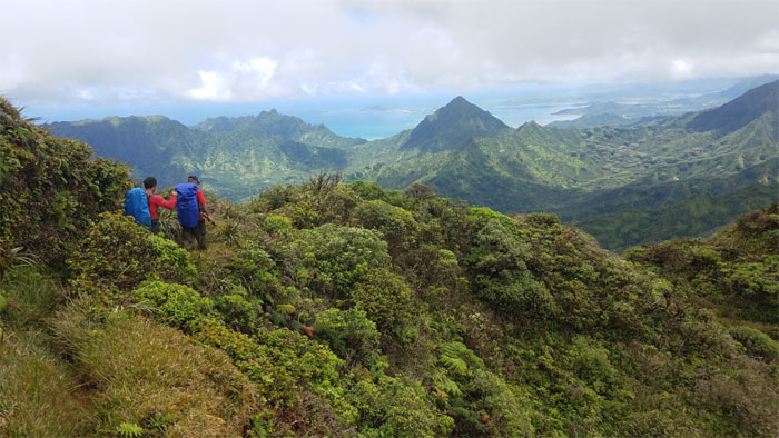
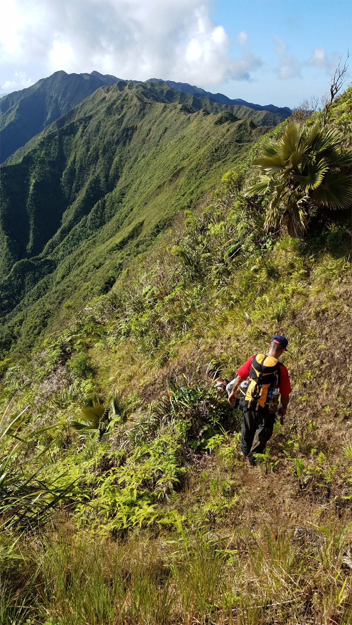
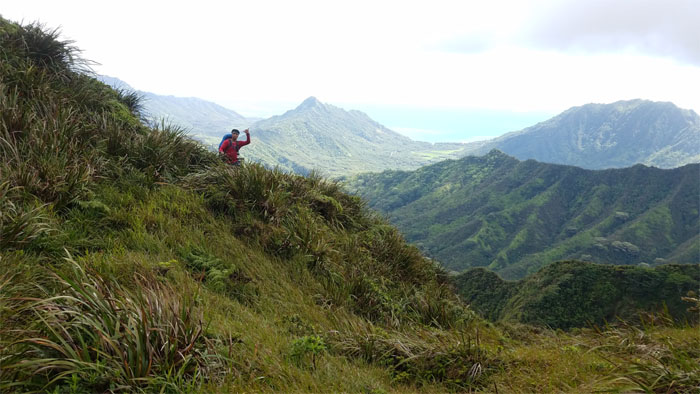
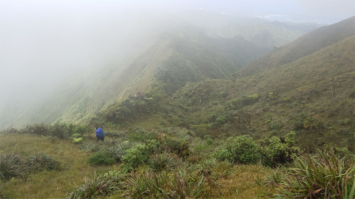
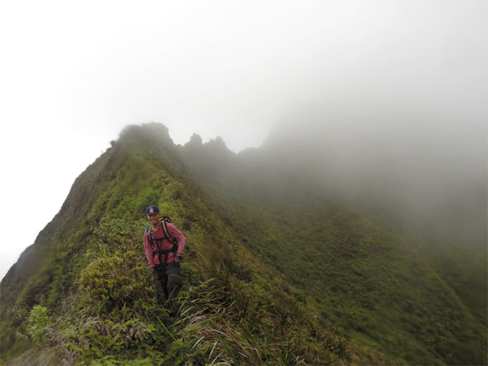
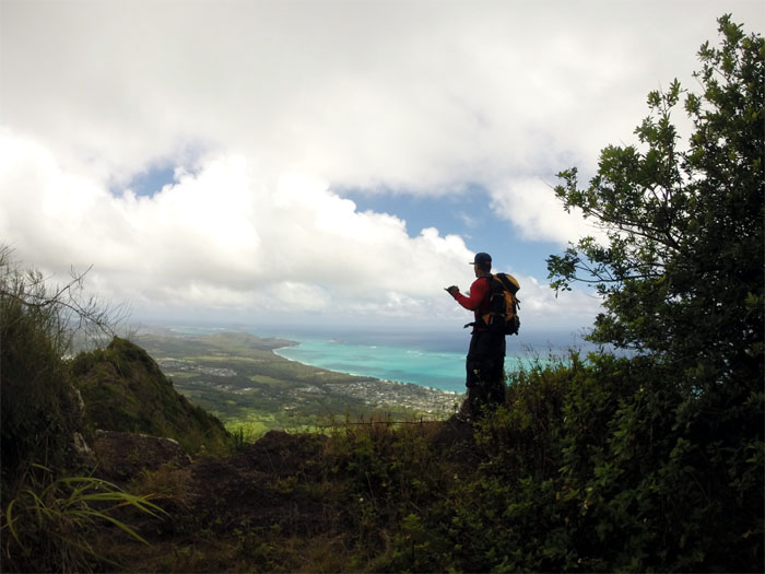
Breaking out into the more exposed section of the ridge and some sorely needed fresh air.
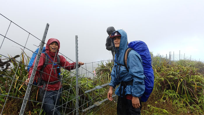
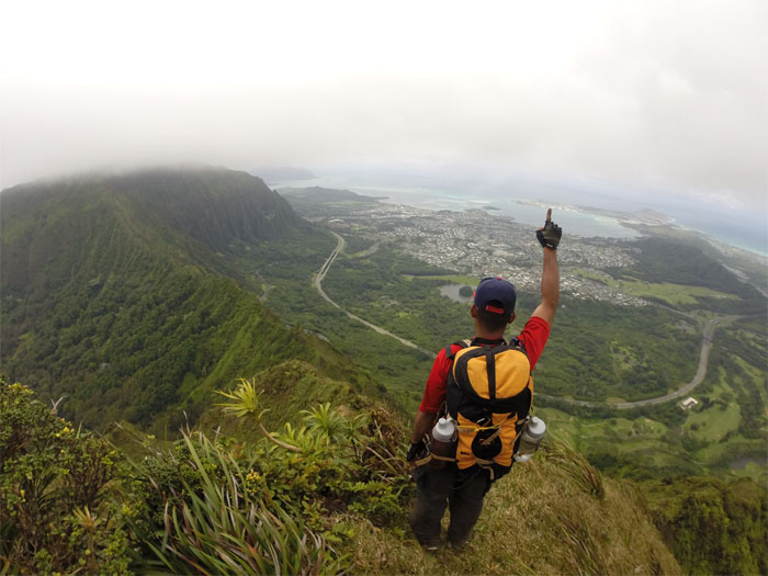
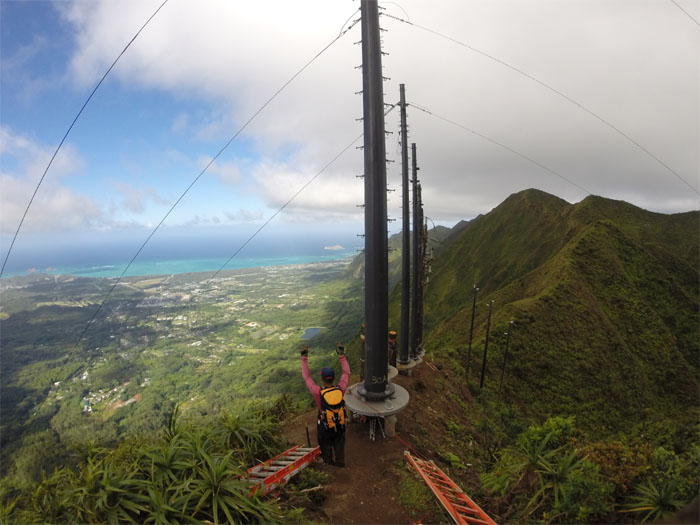
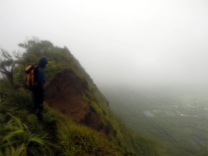
Malaekahana Junction
Covered with condensation and perspiration, we arrived at the gloved junction and dropped down to contour to the Leeward side. Photo by Chris Bautista.
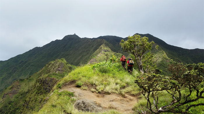
KST
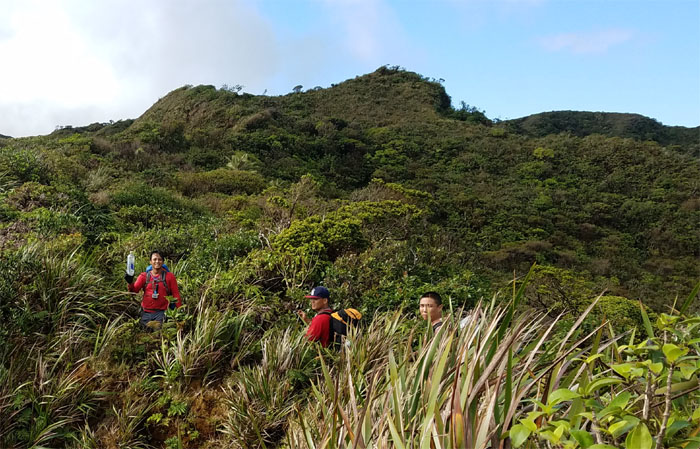
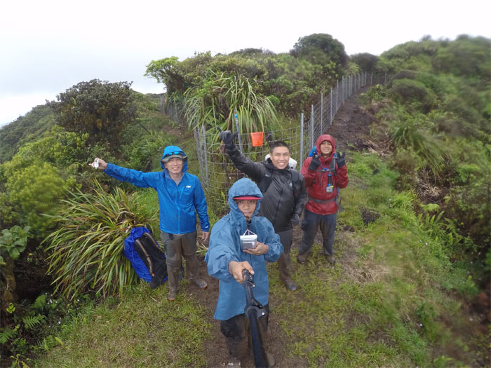
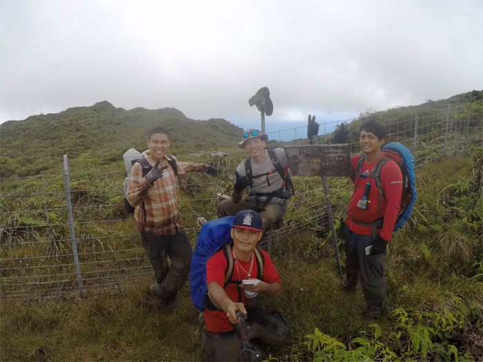
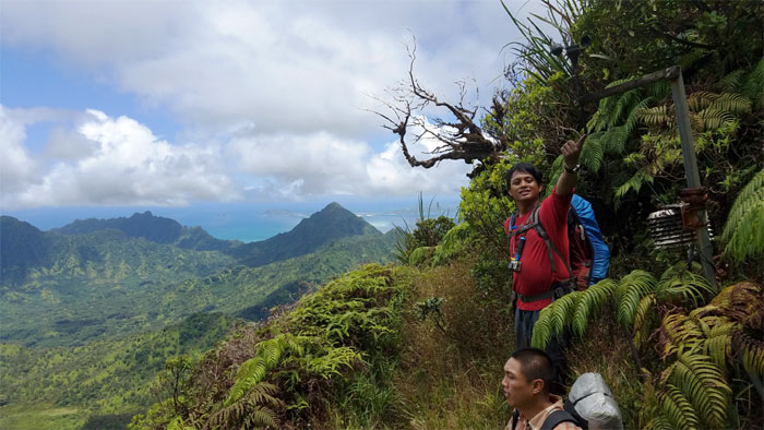
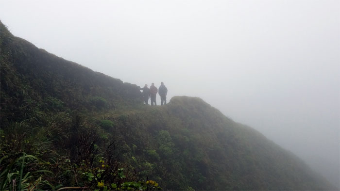
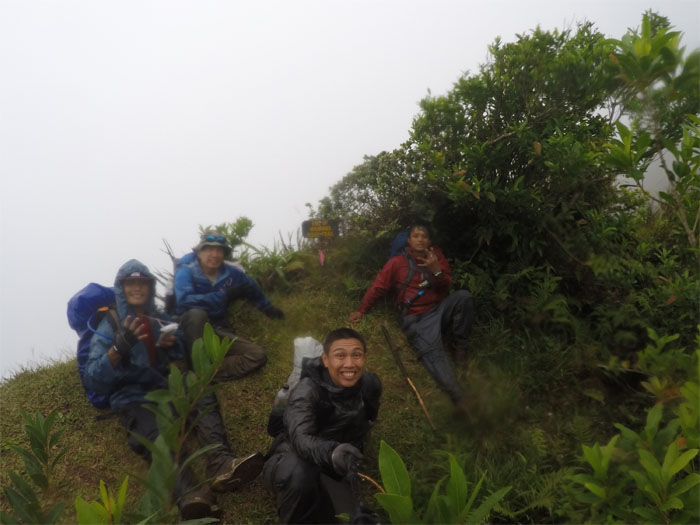
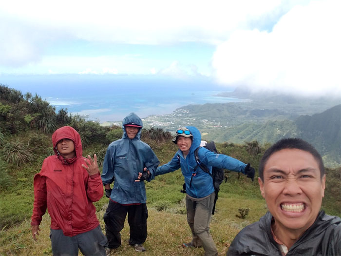
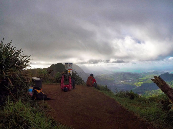
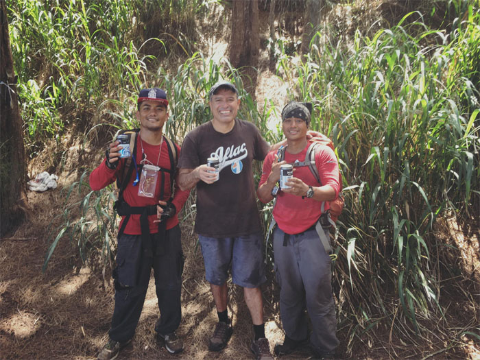
Making our way up to the foxhole that marks the 2,240′ summit, only to discover that we had familiar company sitting at the top.
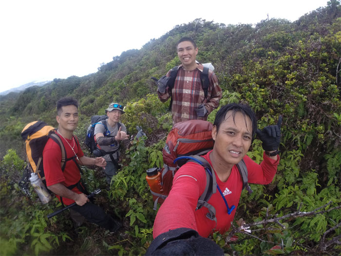
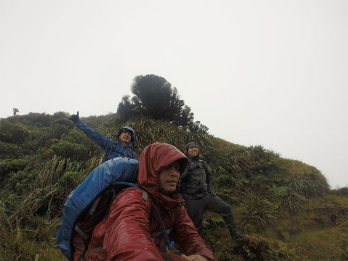
Laie Summit
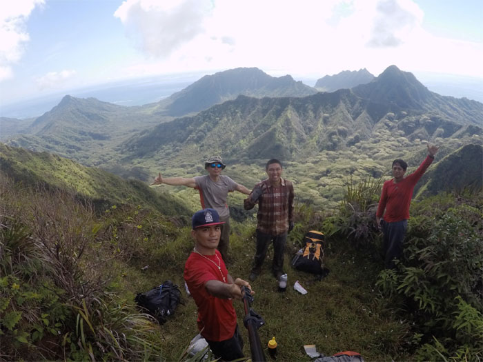
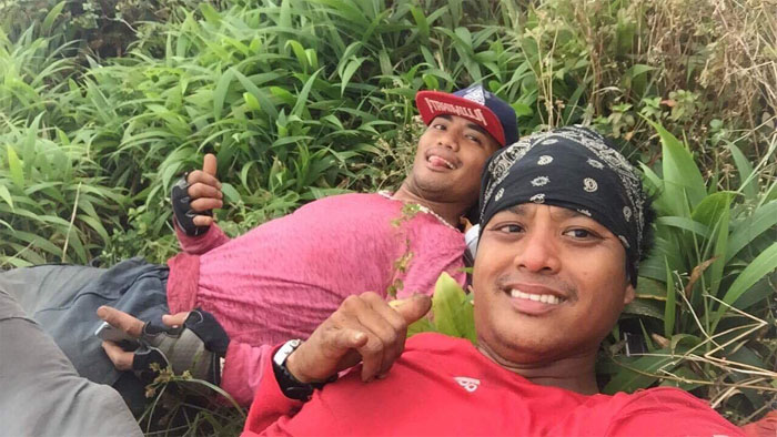
Somebody was drinking beer at the top. Somebody didn’t need another beer. Group photo left to right: Ethan, Daryl, Arnold, myself and Chris.
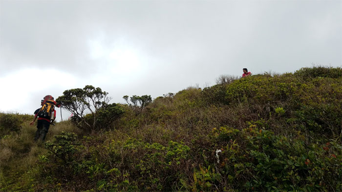
KST
We left Arnold at the summit …
KST
… and soon bumped into the ubiquitous fence line and another familiar face – Rob Johnson.

KST
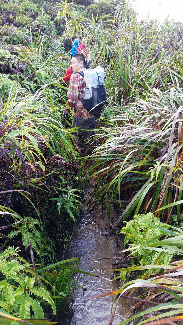
Daryl extricating himself from the ankle deep mud. A taste of what was to come.
KST
The cabin in the distance.
KST
Crossing our mud soaked toes that the cabin would be open.
Koloa Cabin
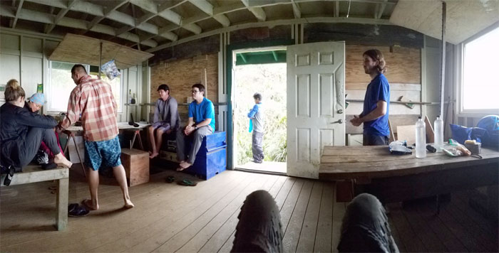
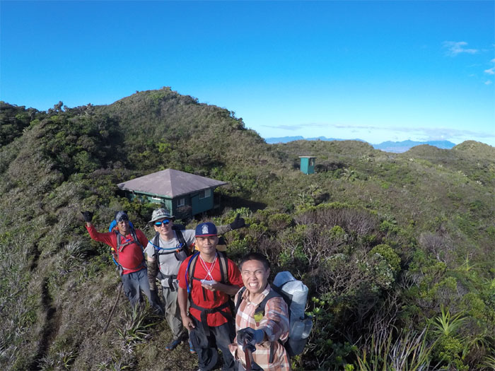
We got to the cabin around 4pm to find out that Rob’s group had already opened the cabin. The largest cabin on the KST was made smaller by nine hikers setting up home for the night. We took turns filling our water and rinsing the mud from our blackened shoes and feet.
Koloa Cabin
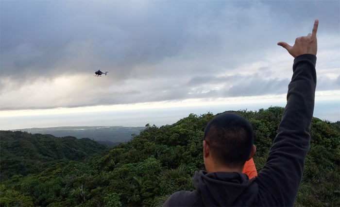
Some of us made our way up to the helipad to catch the evening entertainment that buzzed us on their way to Sacred Falls. Then we trickled back down to the cabin to cook our rice and chicken and beans and rice. Rice dominated the dinner table. Somebody was going to cut their toothbrush in half to save grams of weight, when somebody else pointed out that they still had to carry it back out. Light bulb time.
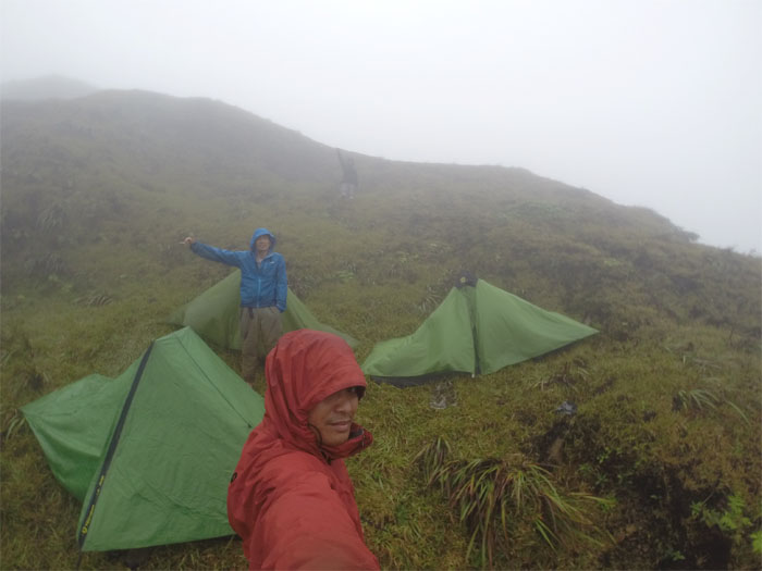
Koloa Cabin
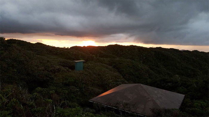
Enjoying the golden hour as we settled in on our first night on the mountains. Earplugs muffled the noise pollution floating around the cabin while air mattresses eased our tired bodies.
Koloa Cabin
Day 2 – Sunday, May 28. Daryl enjoying the glowing sunrise from the helipad, while the rest of us made our bunks and breakfast. Photo by Chris Bautista.
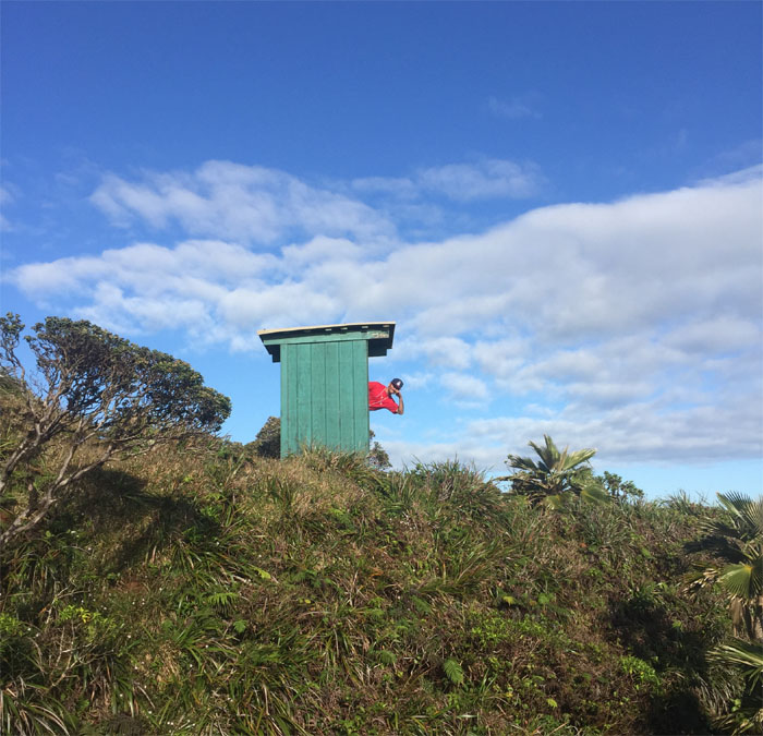
Koloa Outhouse
When you got to go, you got to go. Never mind the smell. Pass the toilet paper. Photo by Chris Bautista.
Koloa Cabin
Rob’s group heading out to rappel Koloa Falls.
Koloa Cabin
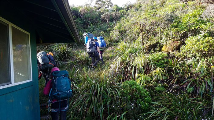
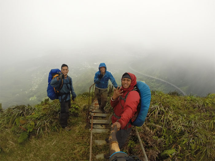
We left the cabin around 8am to start slogging our way through the muddiest section of the KST. Photo by Ethan Clavecillas.
KST
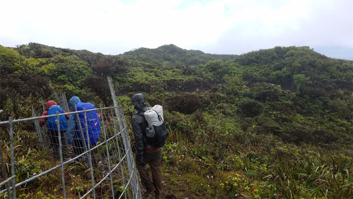
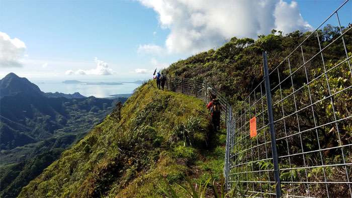
Leaving the fence line and gates behind us as we contoured on the Leeward side of the trail.
KST
Punching through a stream of pungent mud that passed for a trail. No Spartan Mud Race this year.
KST
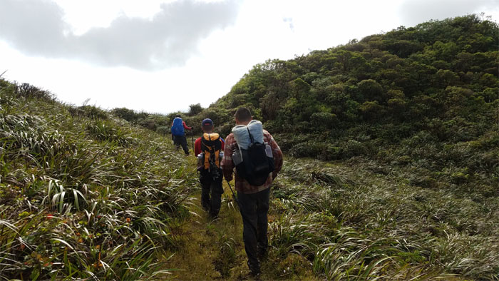
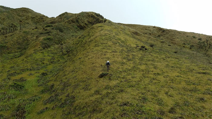
Crossing an open field to regain the ridge.
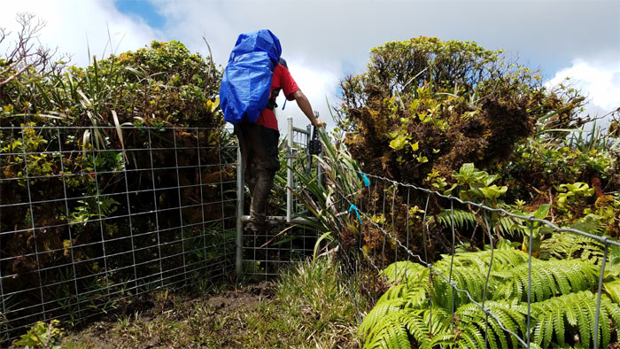
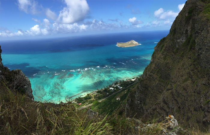
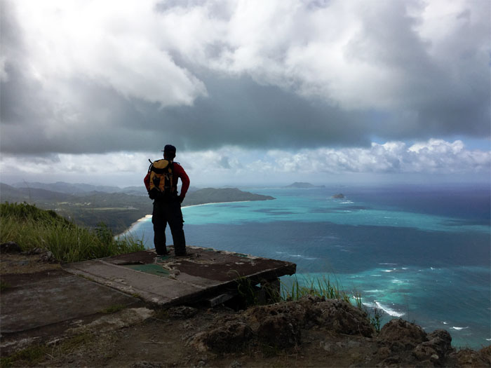
Smartwater Bottle Junction
Look long and hard at this bottle. Let’s not have another deja vu moment.
KST
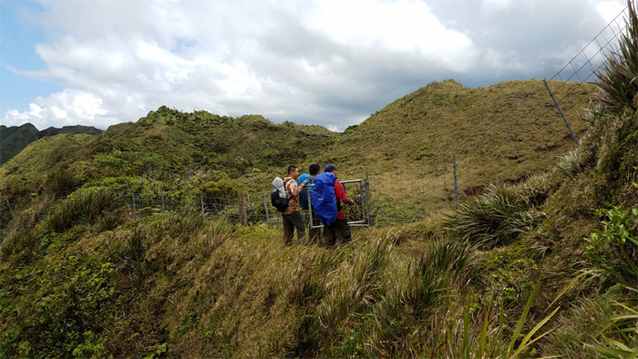
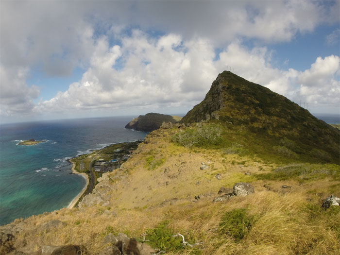
Approaching the fenced Papali summit.
Papali Junction
Rain showers met us at the summit around 10am. No sign of the “King’s Slipper” from an earlier hike. Group photo by Daryl Cacatian.
KST
Rounding the fenced corner to find …
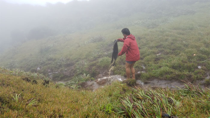
Please do not pet the dead animal
… our lechon lunch? Photo by Daryl Cacatian.
KST
The fence line and gates served as a surrogate firebreak through the uluhell of ferns.
KST Junction
The rain went away shortly after we got to the signed junction around 11am. Time to put away our rain gear. Only to take it out later again. Life in the mountains. Photo by Daryl Cacatian.
KST
Misery aka knee deep mud loves company.
KST gate
Leaving the mud trail behind us.
KST
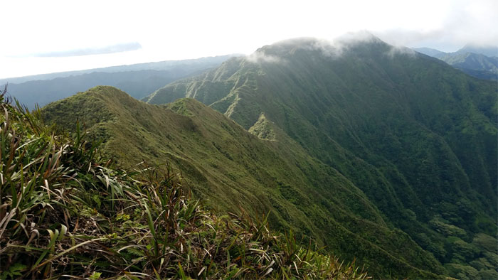
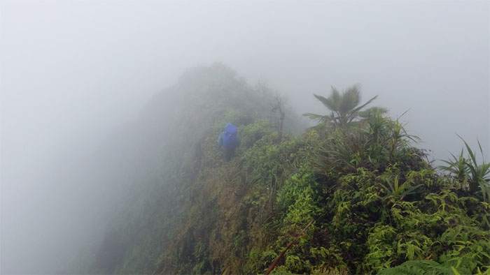
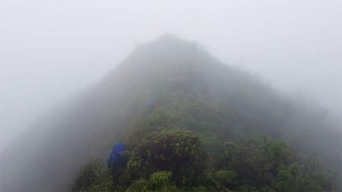
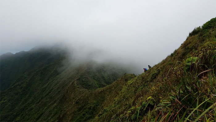
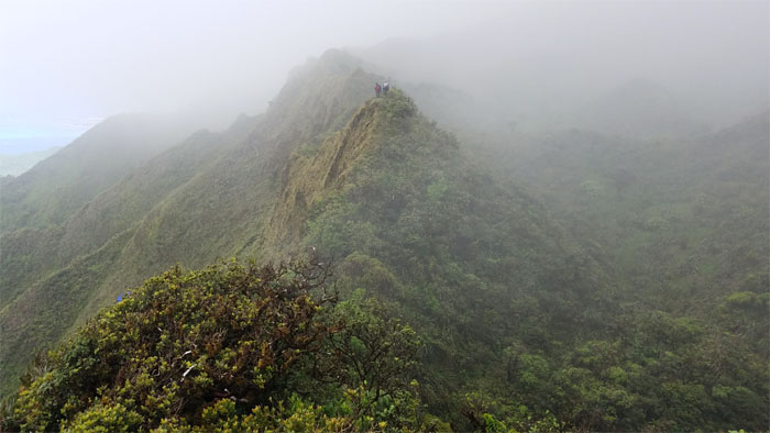
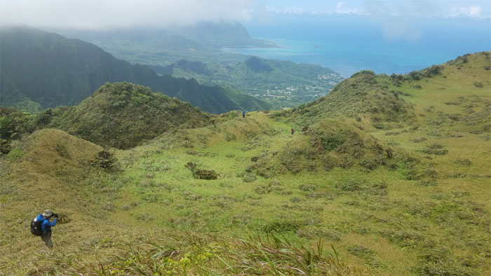
The views were fleeting due to the drifting clouds, but what views they were when we had them.

KST
Chris dropping into the fenced gully, whose streambed was remarkably dry given the wet weather we were experiencing.
KST
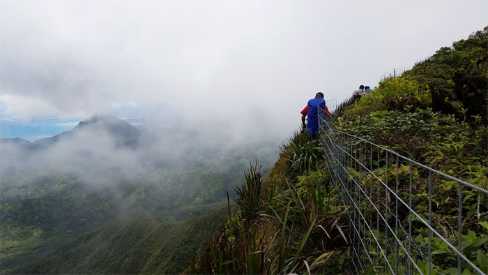
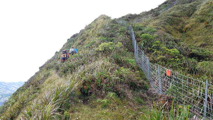
Hanging on the fence line, our constant companion in the mountains, as we contoured on the Windward side with muted valley views.
Fence meadows
Passing through stacks of fences and pallets that provided temporary shelter from the sweeping rain showers that came and went.
Boot Junction
We arrived at the iconic boot junction around noon. Photo by Daryl Cacatian.
KST
Looking out towards the Leeward side as we left the fence line for the ridge line.
KST
Walking on the Windward side of the ridge as we got treated to stunning views of the valleys. Never gets old.
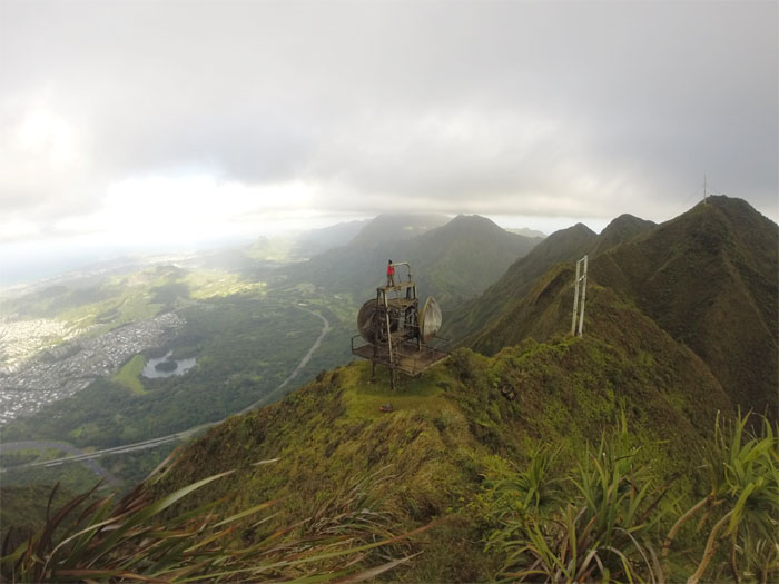
Weather station
Checking the weather forecast. Sunny with splendid views. Guy Hagi was alive and well in the mountains.
KST
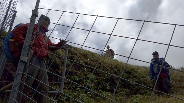
The group queuing around the gate to get off the ridge.
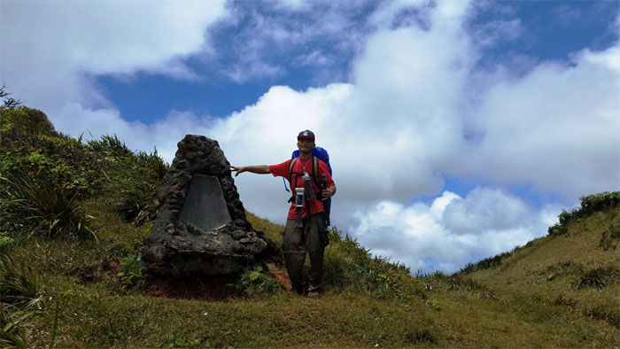
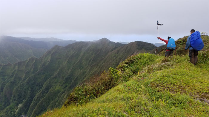
Cline Memorial
Greeting hikers since 1978. Built to honor an avid hiker who particularly loved this spot and whose life was tragically cut short by a car crash.
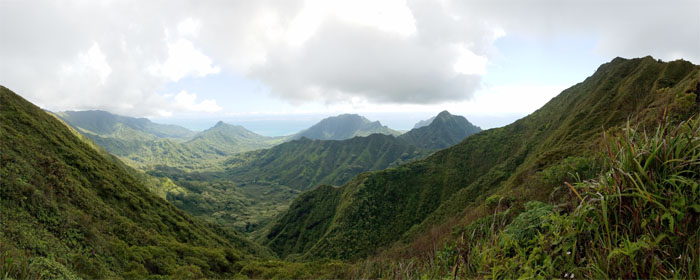
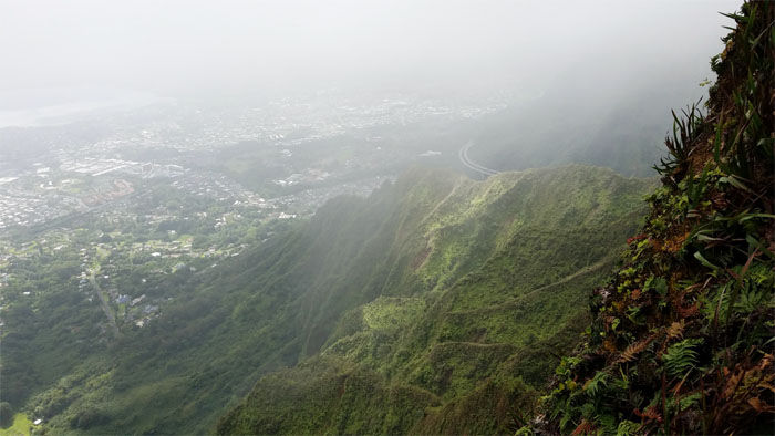
Poamoho Summit
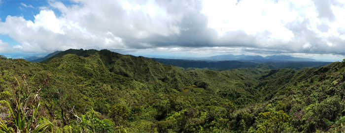
Sweeping views of Punalu’u and Kahana Valleys.
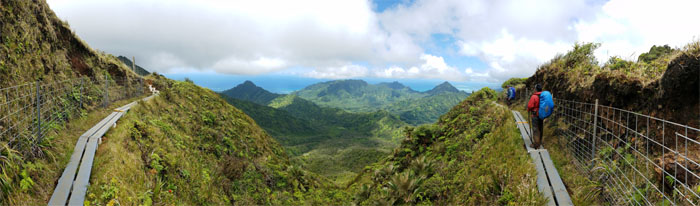
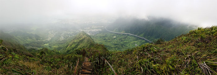
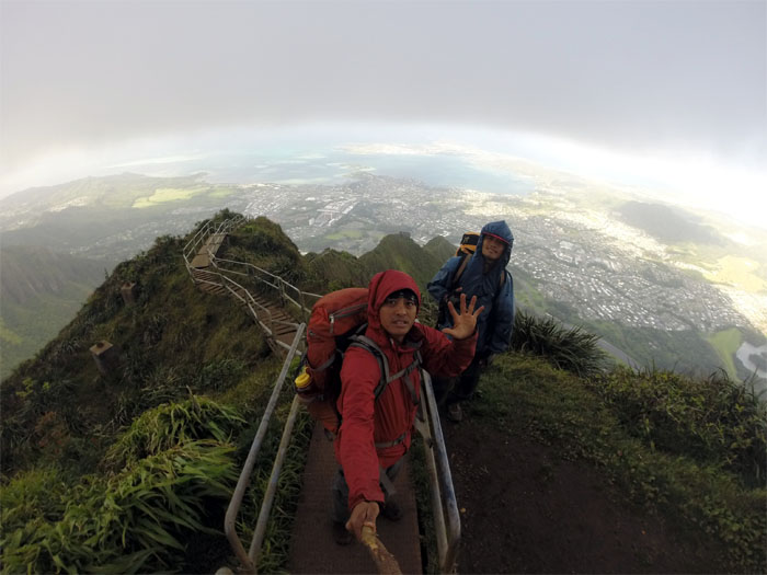
Poamoho Boardwalk
Panoramic view of the recently installed boardwalk and Kahana Valley.
KST
Switch backing our way to the cabin.
KST
Panoramic view of the West side with the cabin, marsh and the WST in the backdrop.
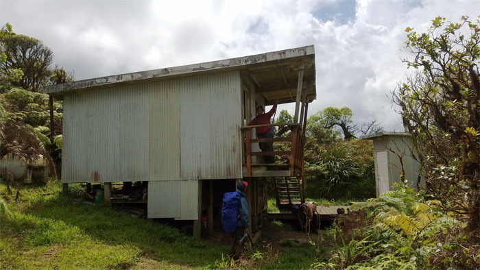
Poamoho Cabin
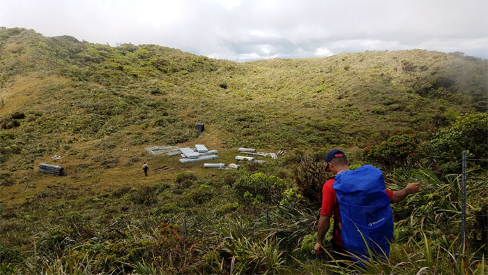
We got to the vacant cabin around 230pm with a lot of time on our hands. Ethan called first dibs on a slowly leaking air mattress that somebody had left behind. We washed off the mud from our shoes, socks and feet.
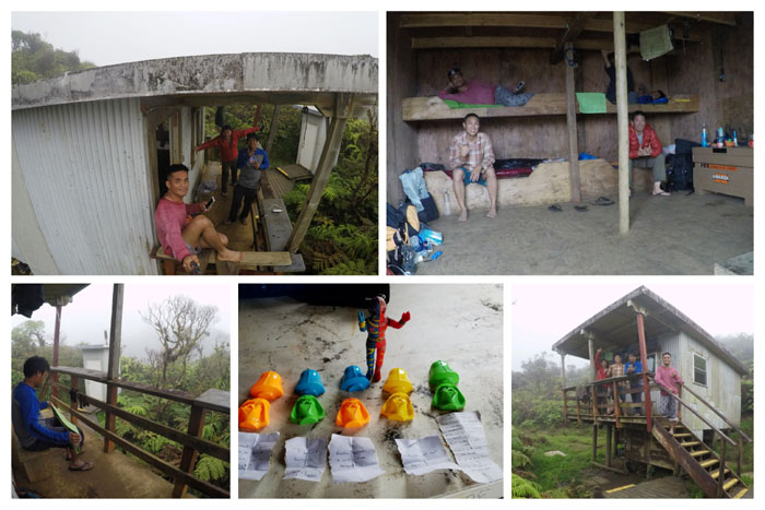
Poamoho Cabin
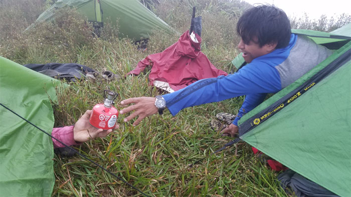
Cabin life. Reading the gems of Darth Vader poems that were trying to pull us to the dark side. We filled up our water and fired up our stoves to cook our dinners. Hot food does a body good.
Poamoho Outhouse
Chris trying to be one with nature or nature was calling.
Poamoho Cabin
Day 3 – Monday Memorial Day, May 29. Sunrise from the cabin.
Poamoho Summit
Chris slippered to the summit to catch a solitary sunrise washing over him, while the rest of us ate our breakfast.
KST
We put on our still wet, but clean shoes and left the last four walled shelter we would see in the mountains.
KST
Daryl enjoying the scenic views of Kahana Valley while munching on the abundant thimble berries that populated the trail.
Pauao Junction
The long and overgrown Windward ridge that goes down into Kahana Valley.
KST
Watching our steps as we made our way down through the false holes and eroded sections of the trail.
KST
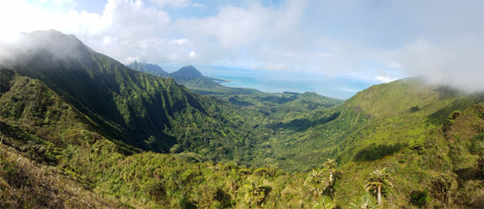
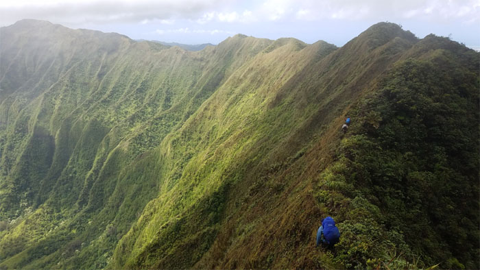
One can’t but be awed and impressed hiking through the most scenic stretch of the KST.
KST
The morning sun was hitting us particularly hard as we made contact with the fence again.
Fresh cut fans
Ethan harvesting fan umbrellas for the crew. Chris’s sickle did come in handy. Ethan would never mock his gardening tool again.
KST
Leaving the fence for the trail.
Schofield-Waikane Junction
We got to the junction with the Leeward trail that leads down to Wahiawa around 9am. Photo by Daryl Cacatian.
KST
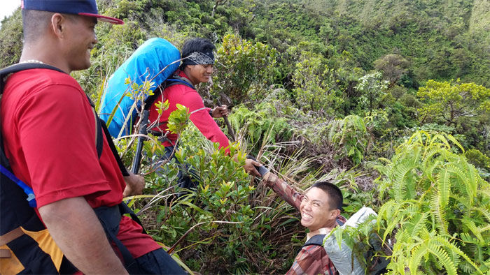
When you fall off the ridge, get right back on, with a helping hand.
KST
The heat was somewhat diffused by overcast clouds, so we disposed of our fan umbrellas.

Waikane-Waiahole Junction
It passed the sniff test. Now for the taste test? It wasn’t even 10am and it was too early to be drinking suspect beverages.
KST
The mass of hikers follow lives of bustling trails, while the minority of hikers enjoy lives of quiet trails. Besides bumping into Arnold and Rob’s group back at Laie, we would not see another soul until Kulana’ahane Summit.
KST
Chris rounding the bend in the trail. Photo by Ethan Clavecillas.
KST
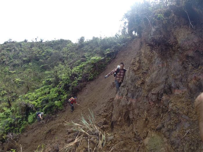
Walking across a relatively fresh landslide that had wiped out part of the constantly evolving trail system. Photo by Chris Bautista.
KST
Contouring on the Leeward side, that for the most part protected us from the elements.
KST
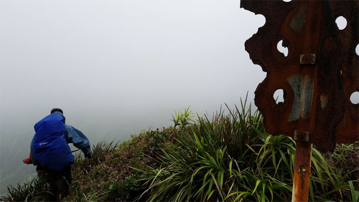
Back on the exposed windswept and cloud covered ridge line.
KST Junction
One does not always follow the fence on the KST, there are certain junctions that must be navigated or one will end up lost and burning precious time getting back on the right trail.
Metrosideros Rugosa
The largest known specimen of Lehua Papa provided scant cover from the rain showers sweeping the mountains.
KST
Following the fenced ridge line, where we soon dropped down and detoured into the tree of life pass.
Tree of Life
Looking at the powerful example of wind at work in the mountains. A horizontally growing sugi pine tree. The views weren’t that bad either. Until the clouds rolled in. Story of our lives in the mountains.
Selfie Stick Junction
Leaving the sprawling fence line behind us at 1230pm. It’s just a matter of time before the necessary eyesore continues its march on the KST, which also seems to be pushing the pigs ahead of the fence.
KST
Passing through the notch in the mountains.
Cryptomeria
Contrary to popular belief, there are several groves of these Japanese Sugi Pine Trees sprinkled throughout the mountains. Besides the ones at your local nursery. ![]()
KST
We skirted the pine trees and crossed the trickling stream to make our way up the hill.
Kipapa Summit
Can we just crash and camp here? It was only 1:30pm, so we decided to change the schedule and push on. Photo by Chris Bautista.
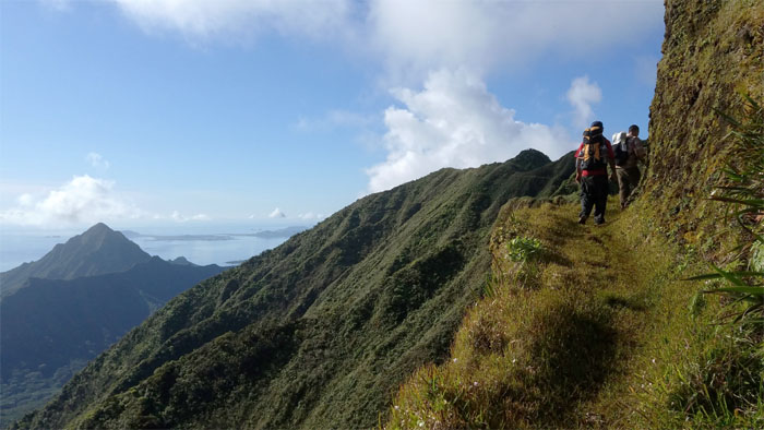
Ko’olau Summit Ridge Trail
Leaving the contours and switchbacks behind us. It was just straight up punishing hills and ridges ahead of us.
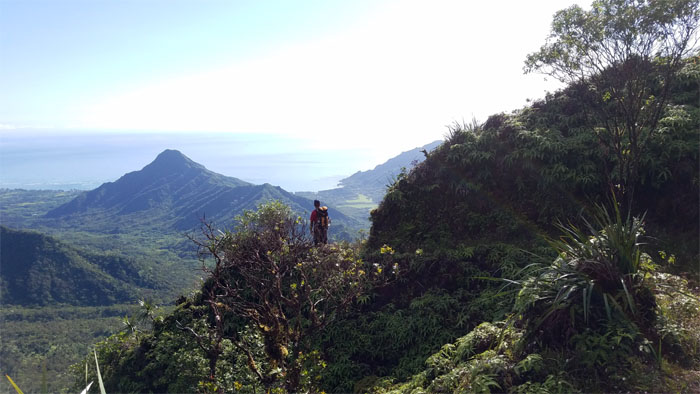
Waiahole Middle Junction
Passing the overgrown Windward ridge from hell that none of us would repeat again under any conditions.
KSRT
The scale of the mountainous terrain was more than equal to the physical exertion needed to traverse the hilly ridges.
Lost & Found
Where is my GoPro? Chris and Daryl backtracked to retrieve Daryl’s GoPro that he had left on an earlier spot on the ridge.
Waiawa Gap
Threading our way down into the heavily vegetated gap.
Waiawa Gap
Minding the buzzing bees in the notch.
Waiawa Gap
Pushing up the short but steep climb out of the notch.
Waiawa Gap
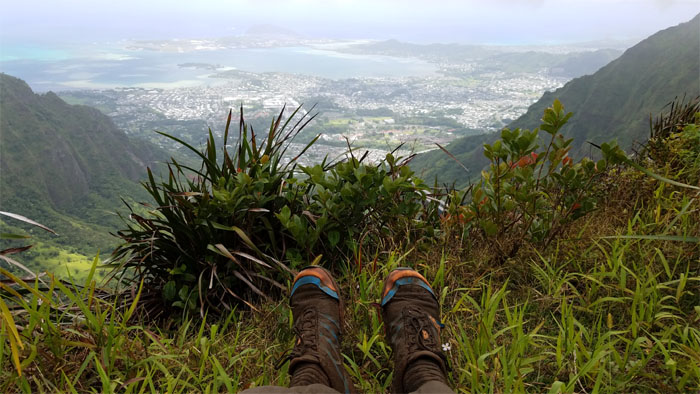
Enjoying the stunning scenery wrapped around us at a little past 4pm.
Waiawa Gap
Looking back at the rollercoaster of a ridge ride. More to come. Keep your feet on the trail and your hands in front of you.
KSRT
Enjoying the short stretch of flat and wide open ridge line. Mountain and ocean views included.
KSRT
Concentrating on wading through the waist high overgrowth on the trail as we had no views to distract us.
The Corner
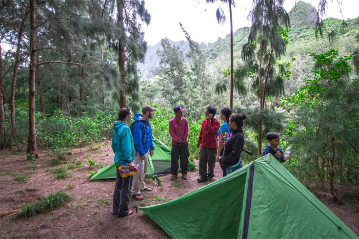
Dropping down to our campsite around 6pm. Ethan had surged ahead to Manana for the night. We noticed a lot of pig rooting activity in the area and checked our water supply and decided not to replenish our water, despite having steripens in stock.
Camp Corner
Goodnight from Camp Corner. Pounding rain kept the grounds wet and air mattresses kept our bodies insulated from the damp grounds.
The Corner
Day 4 – Tuesday, May 30. It was wash day in the mountains. The smell of rain hung in the mountains.
KSRT
Leaving the soggy camp grounds in our squishy shoes a little past 8am.
KSRT
We got disoriented in the clouds and “explored” in the dew dropped tree lined ridge until we found the trail.
KSRT
Approaching the socked in summit of Manana to meet up with Ethan.
Manana Summit
We arrived at the 2,660′ summit around 9am to recover the water bottles that Chris had stashed earlier. Photo by Ethan Clavecillas.
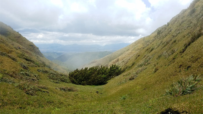
Pu’u Eleao
Dropping down from the rain kissed summit, we walked through the bowl shaped grassy meadows before getting back on the ridge line. Photo by Chris Bautista.
KSRT
Working our way back to the ridge line.
KSRT
The elevating mountainous views kept us grounded on the trail.
KSRT
Passing the constantly eroding and evolving ridge line.
Waimano Summit
Dropping down into the trail terminus around 1130am, experienced cloud blocked views of Waihee Valley, so we pushed on after taking a quick breather. Photo by Ethan Clavecillas.
KSRT
The crew silhouetted against the clouds going down the ridge line.
KSRT
Dropping off the ridge and into the mystical meadows a little past 1pm.
Waimalu Meadows
Chris fishing for water that was sprinkled with floating bugs. Double filtered. Photo by Ethan Clavecillas.
Waimalu Meadows
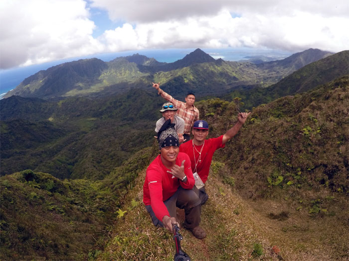
Group photo at the edge of the mythical meadows.
Waimalu Meadows
Ethan heading up to the summit.
Waimalu Meadows
Leaving the meadow oasis in the middle of the mountain range was harder for some than others. Who can blame them? Photo by Ethan Clavecillas.
Whole Foods Market
Why eat gummy worms, when you can have the real thing?
KSRT
Back to our regular programming. The rollercoaster ridge.
KSRT
The sound of huffing and puffing was alive and well in the mountains.
KSRT
The clouds came back to keep us company.
KSRT
It was amazing to hear the cacophony of civilization drifting up to the mountains.
Powerlines
The best views for us after the grueling climbs was the power lines appearing from the clouds. Another couple humps and we could call it a day.

Aiea Summit
I felt every inch of the elevation gains and losses as we made it to the 2,805′ summit around 6pm. The hardest and hilliest section of the KST were behind us.
Aiea Summit
Can you pass the butane please? I need to cook my Rice and Chicken. Photo by Ethan Clavecillas.
Aiea Summit
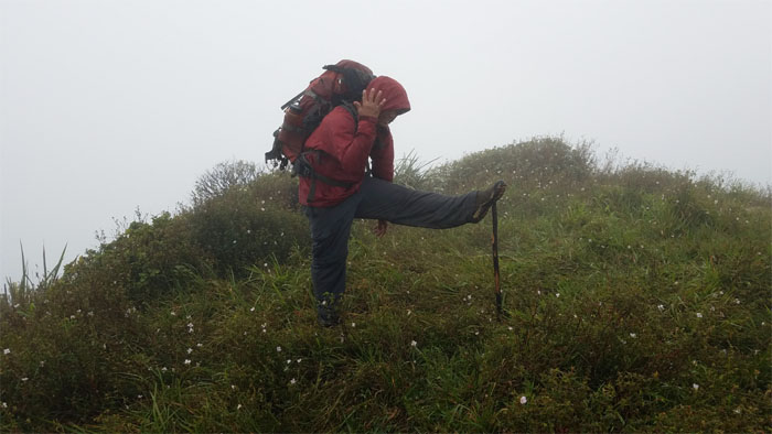
Day 5 – Wednesday, May 31. Hiking stick doubling as a stretching stick for Chris.
KSRT
The gusting winds snatched my boonie hat and sunglasses from my head and sailed them into the great beyond. Daryl lent me his fitted cap to keep my big head warm in the chilly winds.
KSRT
Passing the plant protected enclosure on the way to Hell.
KSRT
It was hump day in the mountains.
KSRT
Rounding the corner to find welcoming Windward views.
KSRT
We dropped off the cloud soaked ridge and made our way towards the rusting stairs of Hell.
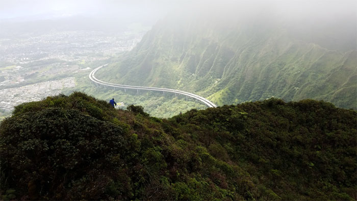
North Haiku Stairs
Panoramic view from Stairway to Hell.
North Haiku Stairs
Our stay in Hell was brief, as it was not as hot as we expected. Photo by Chris Bautista.
KSRT
Following the flag towards Moanalua Saddle.
KSRT
Leaving Hell behind us as we made our way up the dilapidated and rusting stairs.
KSRT
Daryl making his way down the ridge with the backdrop of H3 behind him.
Geodetic Marker
The weathered marker has seen better days.
Red Hill Summit
Taking a shoefie at the summit around 1215. No stashed water from the search years ago was left, but the webbing that Ethan had stashed was still here.
Moanalua Saddle
Making our way down the crumbly and eroded section.
Moanalua Saddle
Stumbling down the saddle, or at least that’s what somebody told me.
Moanalua Saddle
The mountain tops trying to pierce the cloud ceiling.
Moanalua Saddle
The clouds lifted to reveal the CCL building that has been drawing hikers to her since the mid-1950s.
Kulana’ahane Summit
We hit the summit a little past 2pm. I was spent and exhausted from not enough food and water from the past two days. My stomach had shut down. A couple we met at the summit, graciously offered their egg sandwich, which I couldn’t stomach so it was time to end the hike. Parting group photo by Chris Bautista.
Kulana’ahane Trail
Looking back at the guys contouring and climbing the Dirt Triangle.
Kamananui Valley Trail
Mahalo to Ethan for accompanying me down the valley to make sure that I made it down safe and sound. End of the road for us, sorry about that prime rib dinner and cutting the hike short. Thanks to Ben Hinders for picking us up on short notice. More importantly, thanks to my wife who let me take off to the mountains for this hike. I think she was more disappointed that I didn’t finish than I was! I still enjoyed my five days in the mountains with good company and great times. The company always matters more to me than the hikes.
Moanalua Saddle
Meanwhile, back in the mountains … Daryl making his way up the last chossy section. Photo by Chris Bautista
Moanalua Saddle
Chris climbing up the overgrown back stairs to the CCL building.
Moanalua Saddle
Enjoying a brief break with the stashed water and food. Photo by Chris Bautista
Moanalua Saddle
Daryl climbing the steep hill to heaven.
CCL Building
Nobody was around the WW2 building. They had the heavenly view all to themselves.
ET Call Home
Coming down from the Moanalua Middle Ridge Junction, they made their way down to stop briefly at the defunct radar station for a better view. Photo by Daryl Cacatian.

Camp Tripler
Home for the night. Face time gave way to battery time.
Tripler Summit
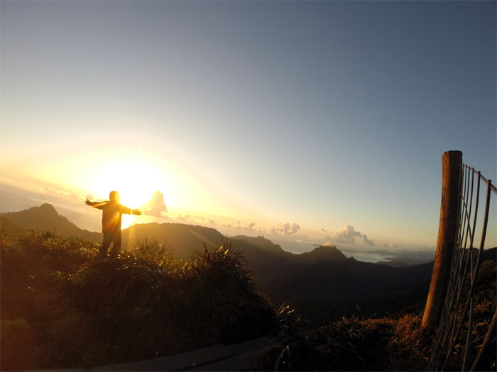
Day 6 – Thursday, June 1. Daryl greeting the morning sun. Photo by Chris Bautista.
Bowman Summit
It was a beautiful but windy day to saddle up again.
Kalihi Saddle
Contouring on the Leeward side of the crumbly ridge. Photo by Daryl Cacatian.
Kalihi Saddle
Chris untangling the webbing from the vegetation. Photo by Daryl Cacatian.
Kalihi Saddle
Daryl about to do the dirty rope slide down. Photo by Chris Bautista
Kalihi Saddle
Scooting down past the broken wave. Photo by Chris Bautista.
Kalihi Saddle
Daryl climbing his way down the first rock triangle. Photo by Chris Bautisa.
Kalihi Saddle
Chris standing above the second rock triangle. Photo by Daryl Cacatian.
Witch’s Hat
Standing on the narrow dike before the last main obstacle on the Bowman side. Photo by Daryl Cacatian.
Witch’s Hat
Daryl cresting the top of Witch’s Hat. Photo by Chris Bautista.
Camp Centipede
Don’t kick over any rocks, lest a creepy crawler goes up your leg. Photo by Daryl Cacatian.
Powerlines
Vienna Sausage break. Just missing the saimin.
Kalihi Saddle
Daryl walking on the narrow ridge fringed by abundant vegetation. Photo by Chris Bautista.
Kalihi Saddle
Looking ahead to the crown jewels of Kalihi Saddle.
Bunny Ears
Daryl making his way up. Photo by Chris Bautista.
Can Opener
The classic photo spot. Photo by Daryl Cacatian.
Lanihuli Wall
Daryl making the steady climb up the flank of the grassy ridge. Photo by Chris Bautista.
Dirt Dragon
It was blowing hard on the saddle today. Just ask Chris’s hair.
Kalihi Saddle
To paraphrase Sir Edmund Hillary, “It is not the saddles we conquer but ourselves.” Photo by Chris Bautista.
KSRT
Almost there.
Lanihuli Summit
Taking a short break. Photo by Chris Bautista.
Anvil
Daryl making good use of all his gym time pulling himself up with the new webbing. Photo by Chris Bautista.
W
Playing Donkey Kong in the mountains. Well played. Photo by Chris Bautista.
Nu’uanu Saddle
Dropping in elevation, they shed the clouds and gained the views back.
Pu’u Suicido
Daryl contouring and climbing his way around the incisor rock. Photo by Chris Bautista.
Pali Puka
Arnold, Ethan and Krissy climbed up to the puka to meet the guys. Photo by Arnold Yago.
Nu’uanu Saddle
Chris and Daryl dropping back down to civilization and more importantly, hot food. Photo by Arnold Yago.
Pali Lookout
Chris and Daryl hitting the pavement around 5pm after a six day hiatus in the mountains. Photo by Dale Yoshizu.
Pali Lookout
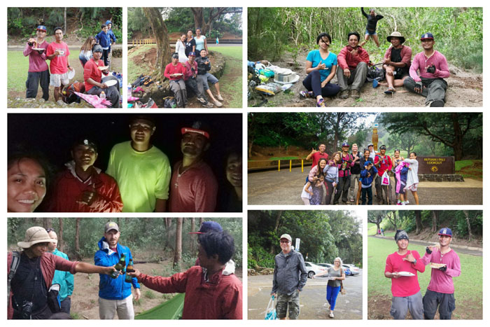
Shout out to Agnes Bryant, Amber John, Arnold Yago, Becca Frager and Justin Brackett, Christine DC, Cynthia De Lafuente Wolarey, Dale Yoshizu, Darlina and Junanita Cacatian, Derek Potter, Ethan Clavecillas and Kristina Eizenhoefer, Harold Viloan, Kathlea Kay Evans, Lee Shreve, Mia Garrison, Nandor Szotak, Scott and Dalia Bowling, and Shirley Hamamura who turned out to show their support for Chris and Daryl and more importantly for bringing assorted foods and drinks. ![]()
Camp Pali
Talking story at the campsite that Derek Potter had found that was relatively protected from the wind and prying eyes. Photo by Arnold Yago.
Camp Pali
Day 7 – Friday, June 2. Early hikers roll up their camp early. Photo by Daryl Cacatian.
Pali Notches
Daryl climbing down the second notch. Photo by Chris Bautista.
Chimney
The wind was blowing hard in the morning and they had discovered the webbing had shifted to the far right. Chris shed his pack and climbed to retrieve the webbing for Daryl. After multiple attempts, the webbing was passed to Daryl and the hike continued. Photo by Chris Bautista.
Nu’uanu Saddle
All the technical were sections behind them as they continued their climb to the highest peak on the Ko’olaus. Photo by Daryl Cacatian.

Awaawaloa Summit
A hippy hiker was their only company along with the cloudy views. Photo by Chris Bautista.
Ka’au Crater
Chris at the top of the crater trail. Photo by Daryl Cacatian.
KSRT
Enjoying a short break before the big climb up to Lanipo. Photo by Chris Bautista.
KSRT
Looking back is always easier than moving forward, but not as rewarding.
KSRT
Passing the powerlines. Almost pau for the day.
Camp Wiliwilinui
They hit the summit around 5pm and promptly gorged on dinner for four. Buffet in the mountains.
Wiliwilinui Summit
Day 8 – Saturday, June 3. Chris greeting their last and rainy day on the mountains. Photo by Daryl Cacatian.
KSRT
Around Wailupe, Chris fell off the ridge and was caught by a tree on the Leeward side. Don’t fall at all, but if one must, veer towards the Leeward side which is generally more forgiving in terms of trees and grade.
Hawaii Loa Summit
Enjoying the Waimanalo views at the 2,520′ top. Photo by Chris Bautista.
KSRT
Passing through a sliver of a trail.
KSRT
Sliding down the eroded section of the trail towards Kuli’ou’ou, where they met a couple of hikers at the Bear Claw summit.
Kuli’ou’ou Summit
The usually crowded summit was eerily empty. Chris decided to dry his tent further down at Hahaione summit.
Mariner’s Ridge Summit
Daryl at the abandoned lookout. Photo by Chris Bautista.
Tom-Tom Trail
Looking out towards Rabbit Island surrounded by the blue-green ocean. It was almost more tempting than the mountains.
KSRT
No photo shoots to delay their progress.
Kamiloiki Summit
Crashing Camp Awesome to enjoy the first beers of the day, courtesy of the Caveman aka Marcus Griego.
KSRT
Enjoying the view before setting off on the exposed and rocky section. Photo by Chris Bautista.
KSRT
Dropping down the rocky ridge to find …
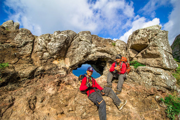
Makapu’u Puka
… Arnold and Mark waiting for them with a couple more beers. Alcohol and hiking go hand in hand, or was that foot to mouth? Photo by Arnold Yago.
KSRT
Nearing the end of a week long journey. Photo by Arnold Yago.
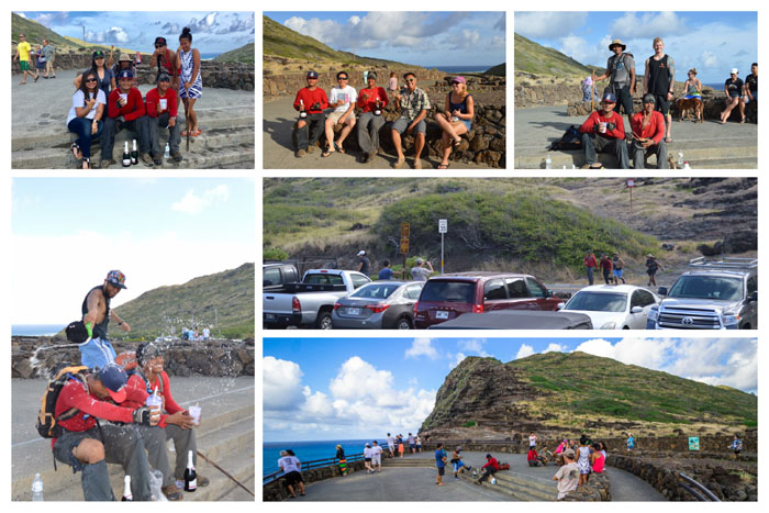
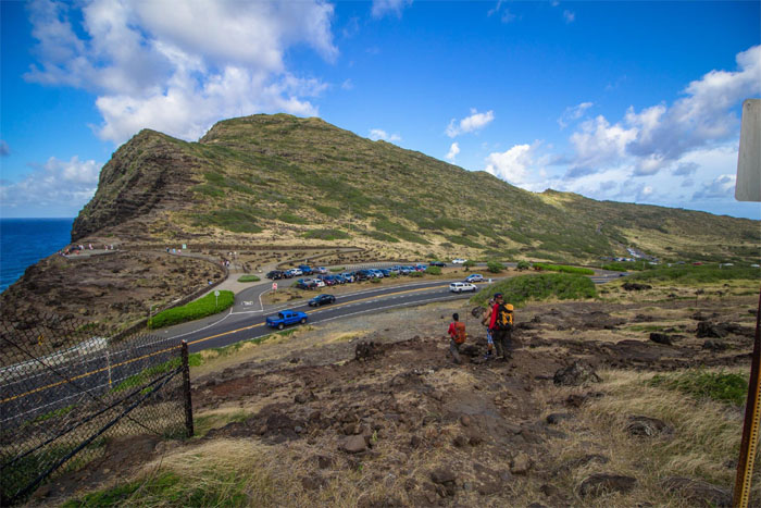
Makapu’u Lookout
A big thanks to Agnes Bryant, Arnold Yago, Christine DC, Derek Potter, Ethan Clavecillas and Kristina Eizenhoefer, Kath Pablo, Lee Shreve, Mae Christine Dizon, Mark Carinoso, Mia Garrison, Rocky Serrano, and Scott Bowling for coming out to see Chris and Daryl crossing the finish line and bringing assorted foods and drinks.
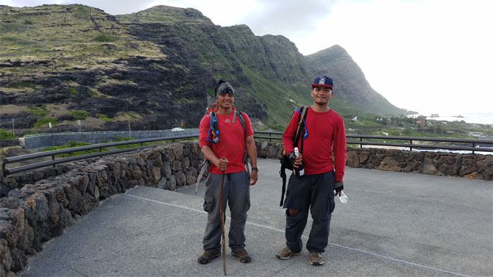
All pau
Celebratory congratulations to Chris Bautista, Daryl Cacatian and the walking stick for hiking the entire Ko’olau Mountains in eight days! Others have done this trek with and without company, with and without assistance; regardless of how it was done, an awesome accomplishment to all that have done it and will do it. Great job guys!!!!
Note: I have been made aware the some hikers have been using my blog as a hiking guide and getting lost on the trails. Please note that this blog was made to document the hike for the crew(s) that did it. That is why some of my comments will seem to have no relevance or meaning to anybody outside of the crew(s) that hiked that trail. My blog was never meant as a hiking guide, so please do not treat it as such. If you find inspiration and entertainment from these hikes, that is more than enough. If you plan on replicating these hikes, do so in the knowledge that you should do your own research accordingly as trail conditions, access, legalities and so forth are constantly in flux. What was current today is most likely yesterdays news. Please be prepared to accept any risks and responsibilities on your own as you should know your own limitations, experience and abilities before you even set foot on a trail, as even the “simplest” or “easiest” of trails can present potential pitfalls for even the most “experienced” hikers.
{ 2 comments… read them below or add one }
This is such a great site! Thanks.
Aloha Ann,
Thanks, glad you enjoyed it.
Mahalo