
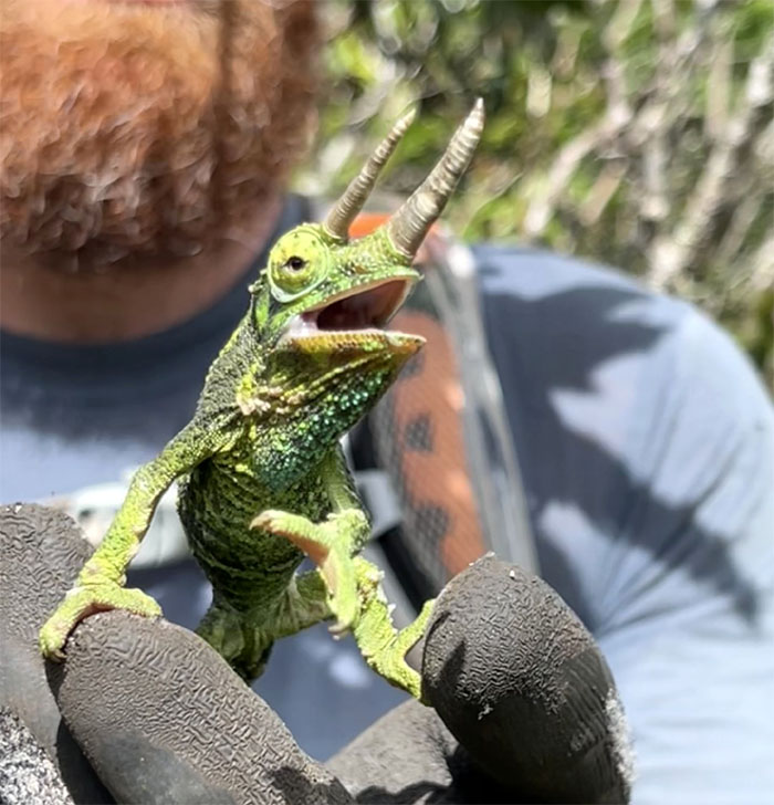
Back to the West side to tie up some loose ends. We even got to see a Achatinella mustelina, an air-breathing land snail that is endemic to the Waianae Range.
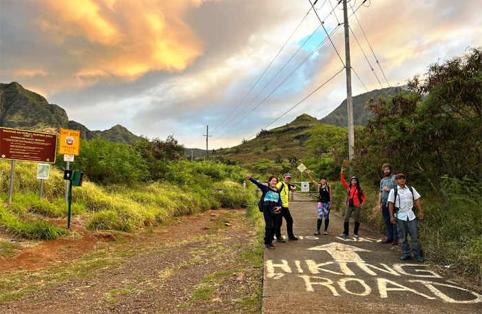
Waianae Valley
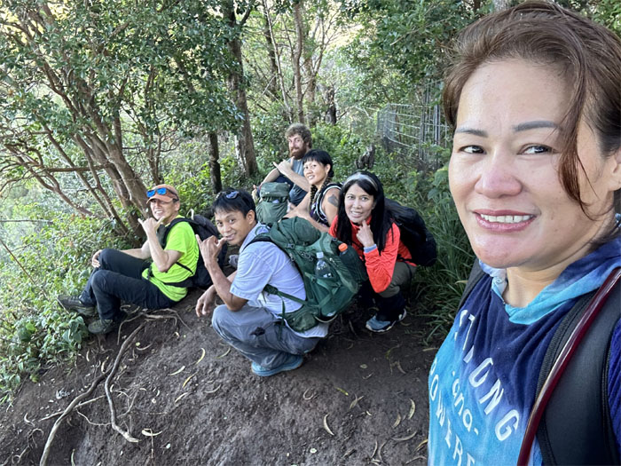
Mahalo to Daryl for coming out of hiking hibernation and dropping Aida, Aileen, Chris, CJ, Thomas and myself off in the remote valley.
Waianae Valley
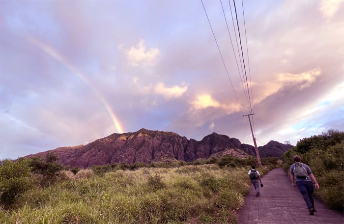
Chasing the rainbow on our walk up the oft-maligned concrete and asphalt road. Somebody had a bag of skittles in their pack.
Waianae Kaala Trail
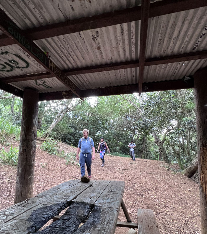
Shaking off the hunting dogs before we traded the road for the trail.
Waianae Kaala Trail
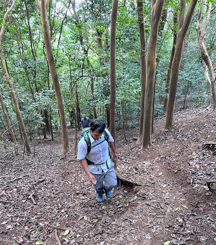
Cardio climb up the leaf covered hill.
Waianae Kaala Trail
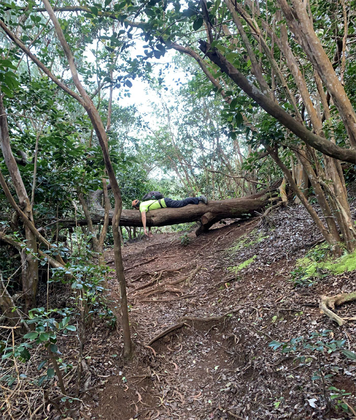
Cardio collapse.
Three Poles
Taking a quick breather.
Waianae Kaala Trail
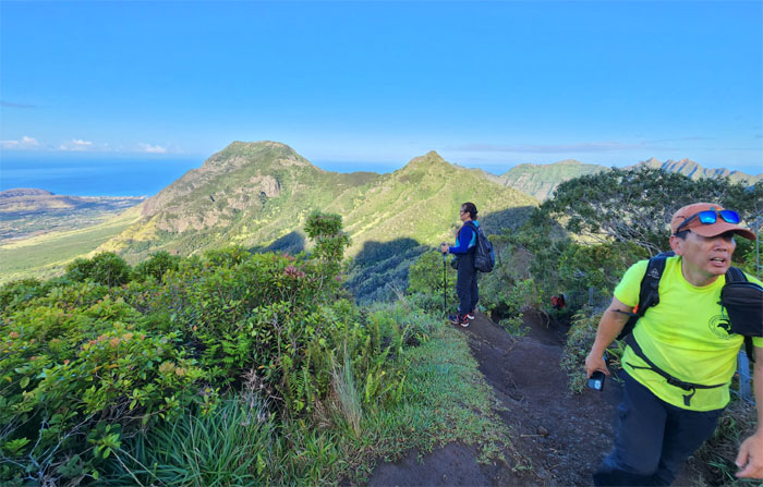
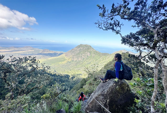
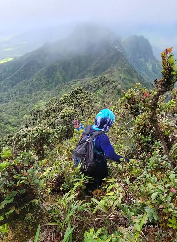
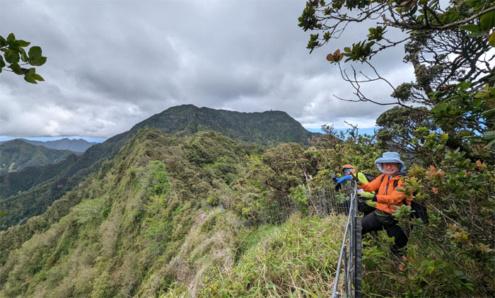
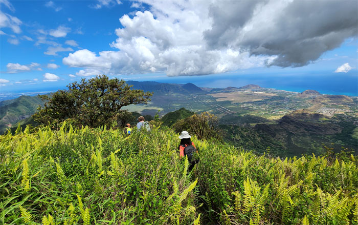
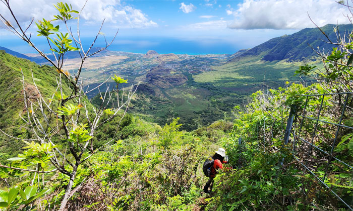
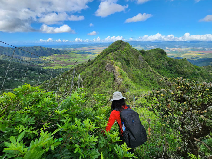
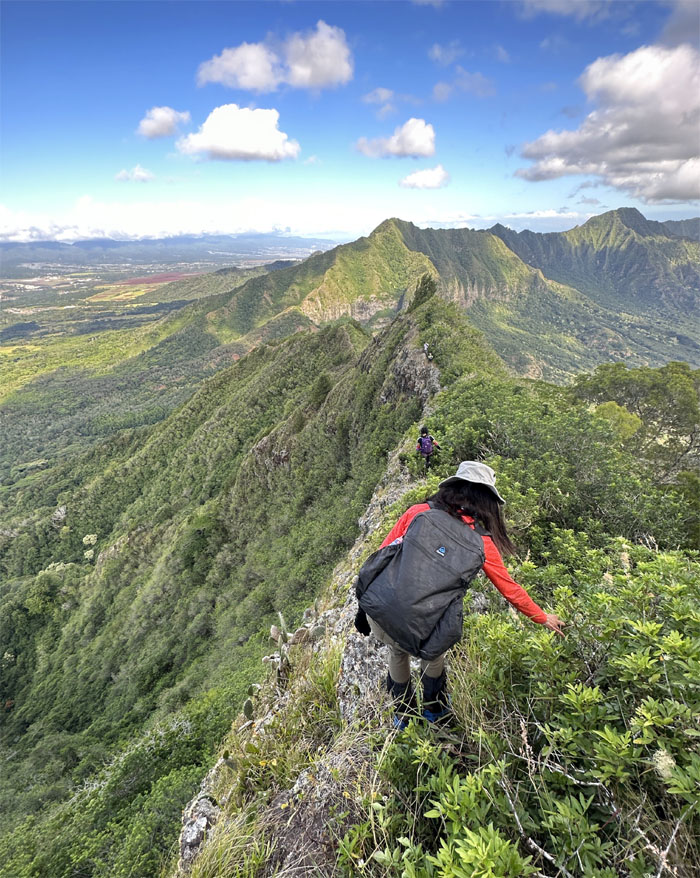
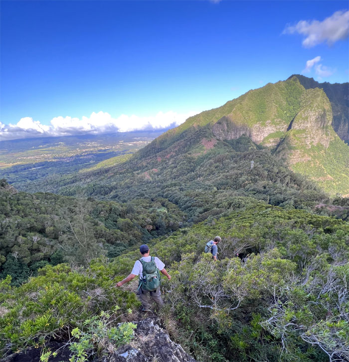
Soaking in the West side views.
Waianae Kaala Trail
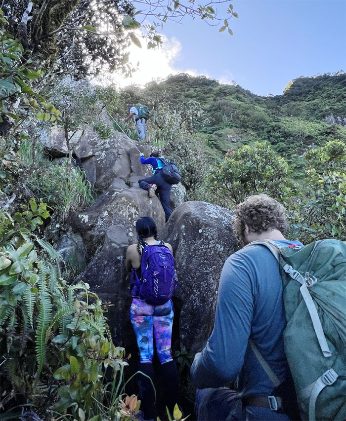
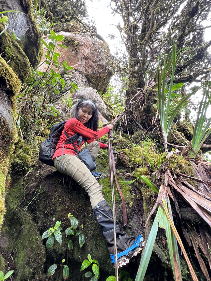
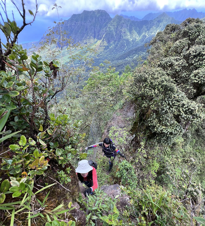
Going up the first set of boulders.
Waianae Kaala Trail
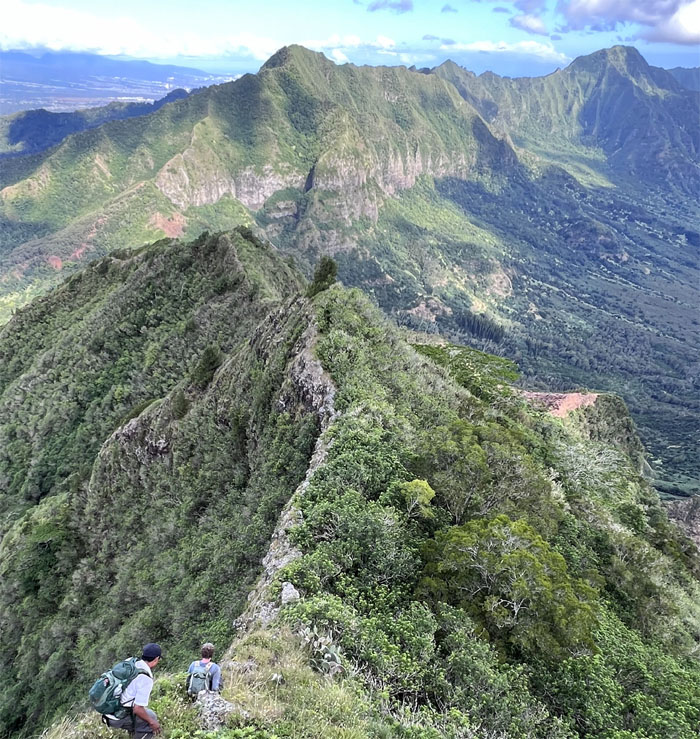
The views were not half bad coming up.
Waianae Kaala Trail
Bolted steps made quick work of the second boulder set.
Waianae Kaala Trail
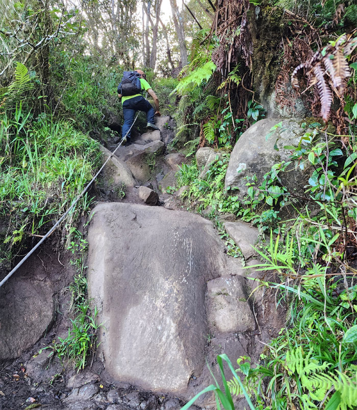
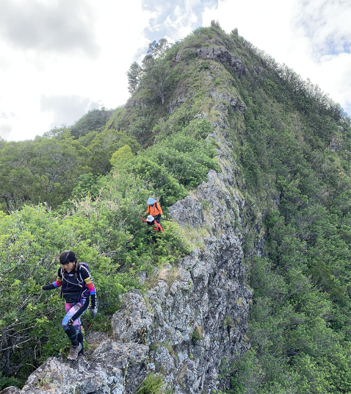
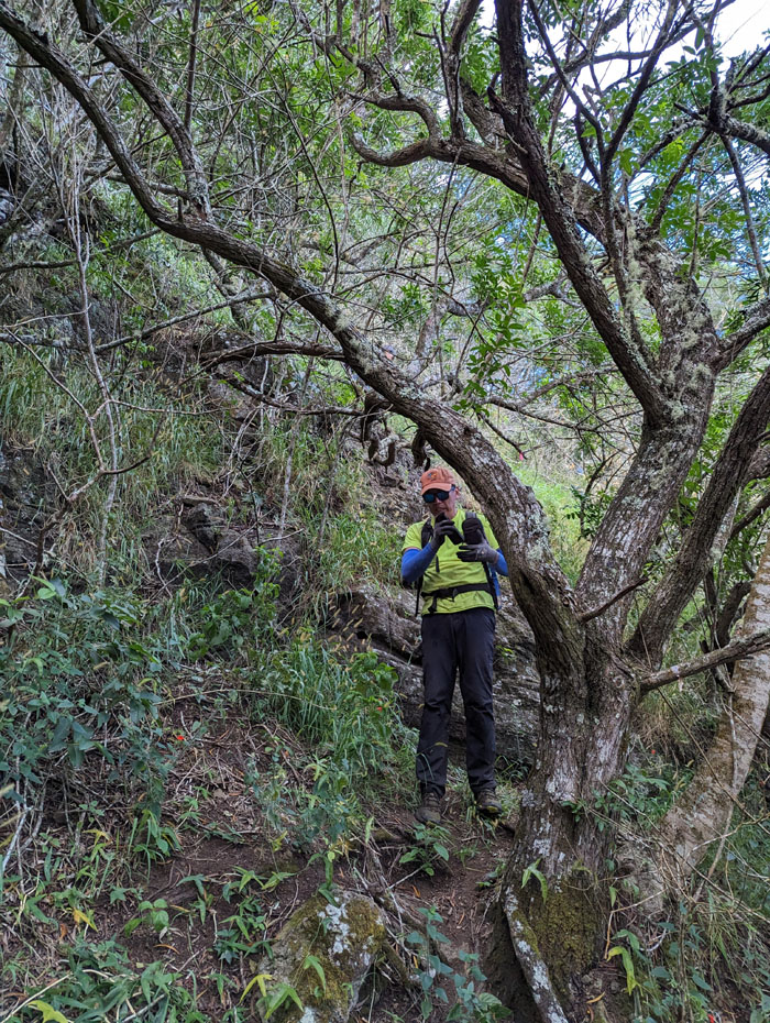
Scrambling up the steep rock studded section.
Waianae Kaala Trail
Gaining roughly 3,500′ in elevation as we approached the highest peak on the island.
Ka’ala Bog
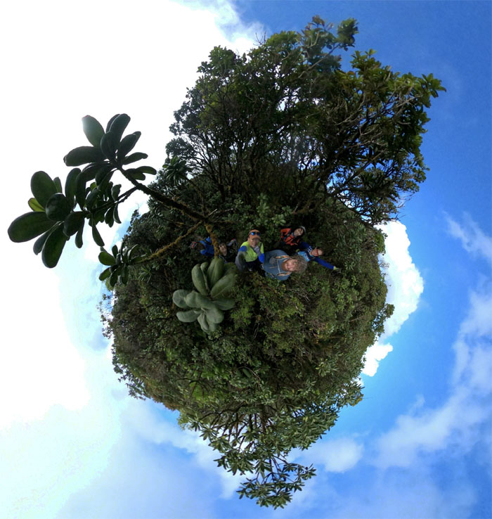
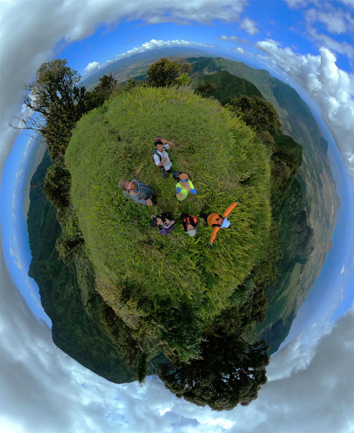
360 degree view of the boardwalk that straddles the native cloud forest.
Ka’ala Bog
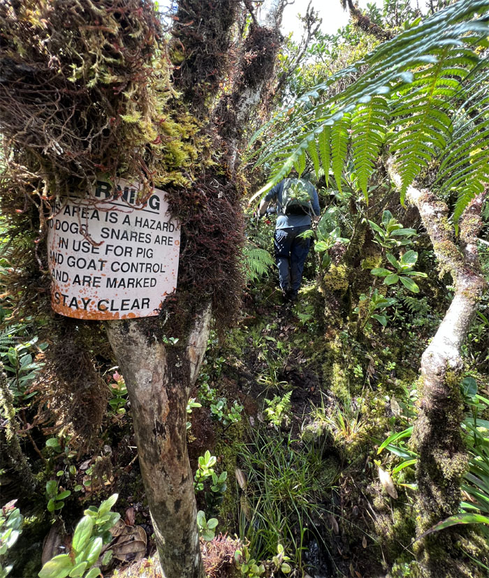
Lucky that we didn’t bring any dogs with us today.
Ka’ala Bog
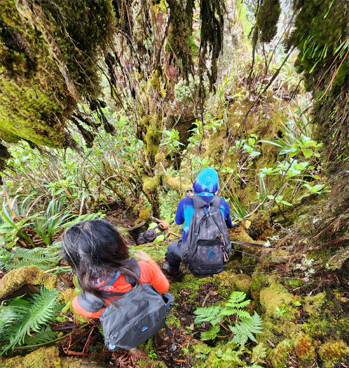
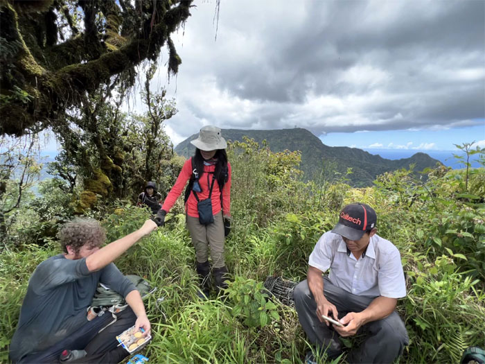
Finding our way through the wet forest.
Ka’ala Bog
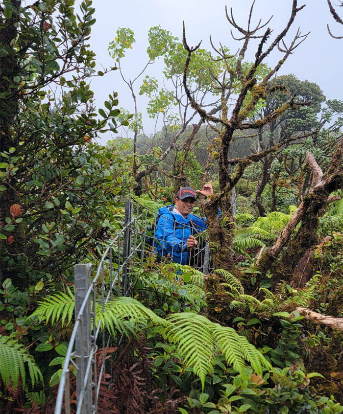
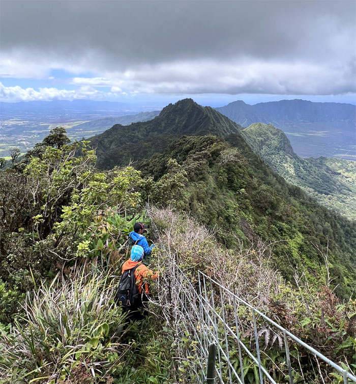
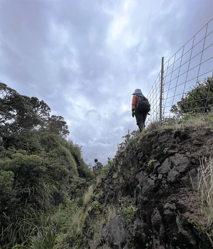
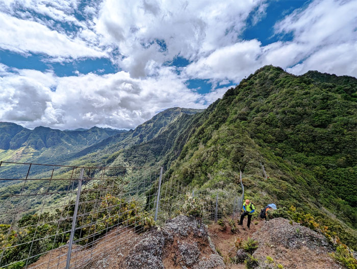
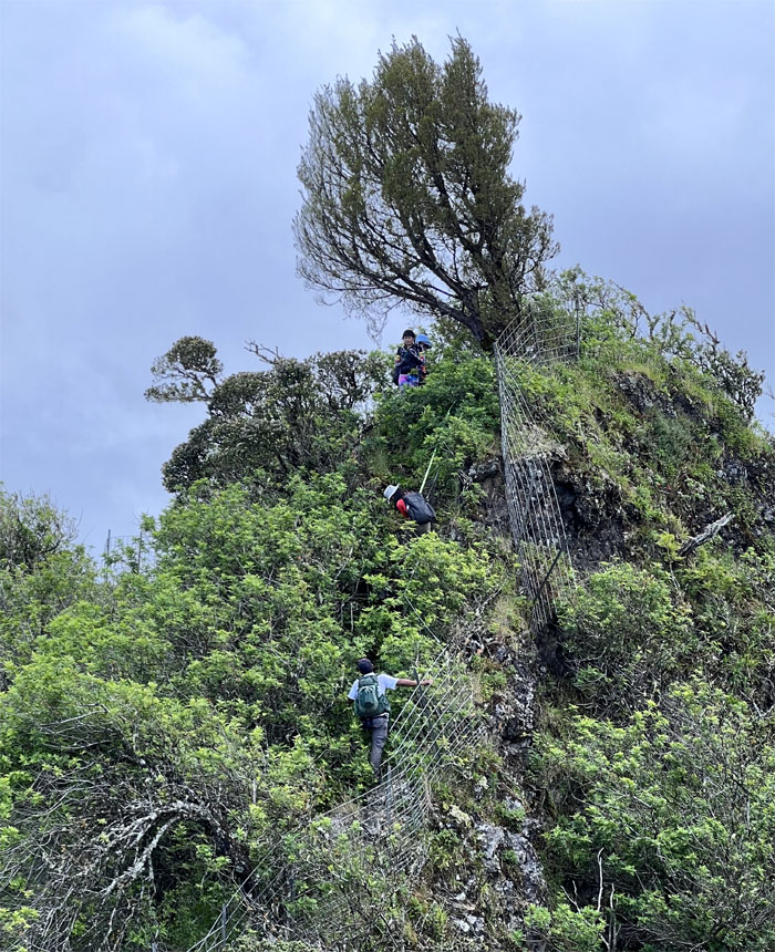
Made it to the fence line.
Waianae Summit Trail (WST)
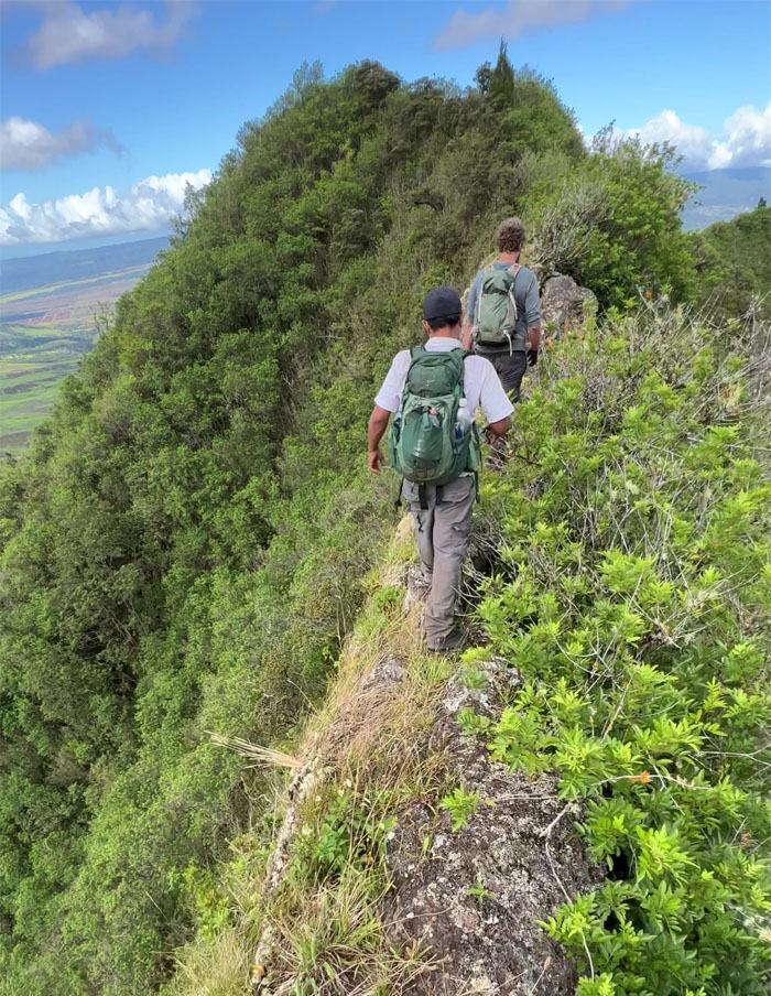
Going down the ridge line.
WST
Standing underneath the hanging moss grotto.
WST
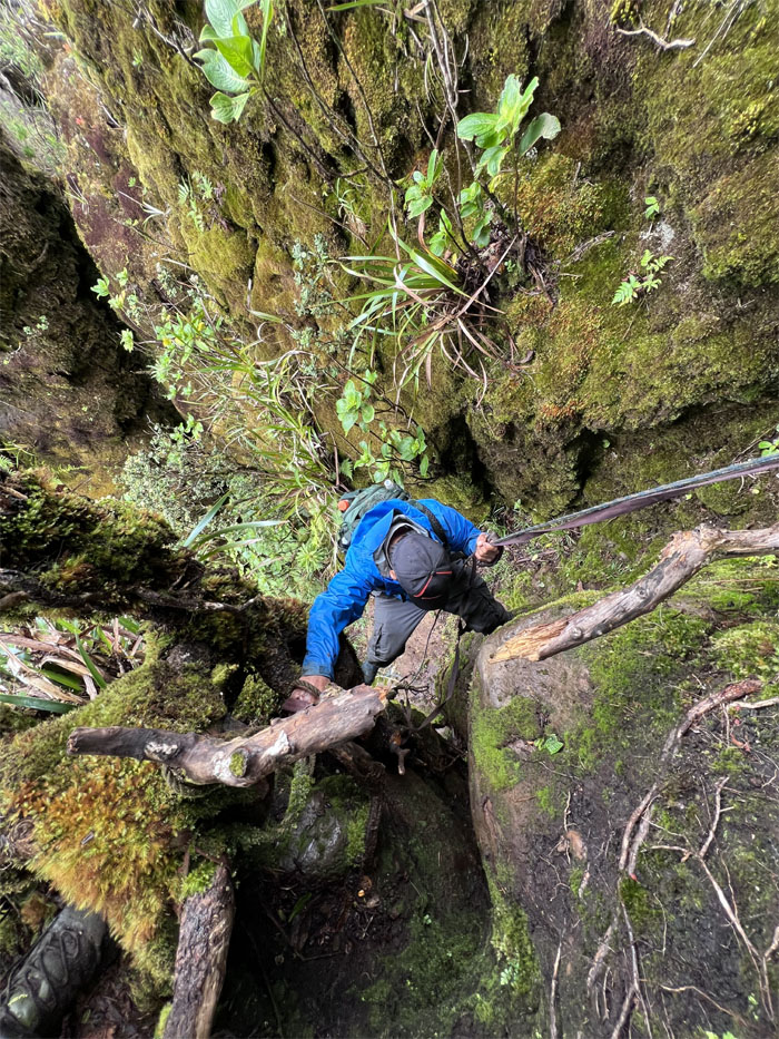
First one down the slippery boulders.

WST
Last one down.
WST
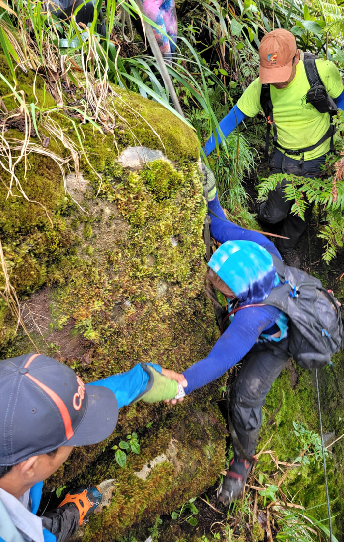
Sometimes the leap of faith requires a helping hand.
WST
Aida looking where to land her foot.
WST
Some of us bypassed the contour and took the direct way up.
WST
All that gym time finally paid off.
WST
Carrying the weight of the world consumes a lot of calories. Time to replenish them.
WST
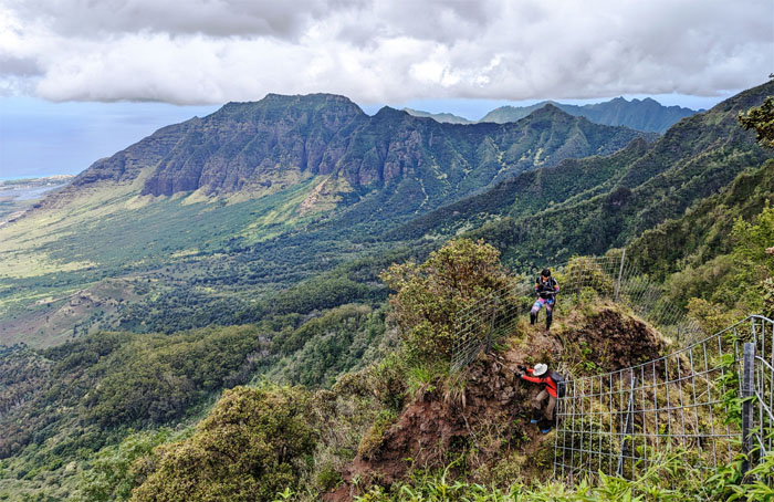
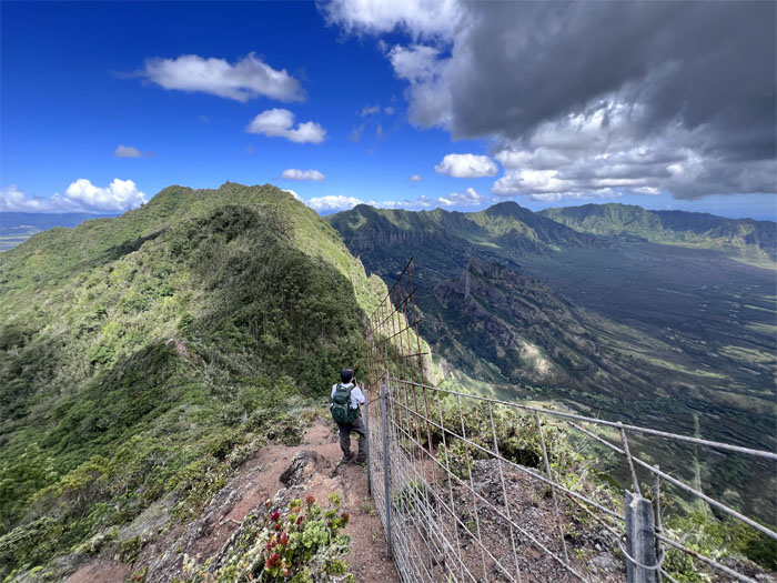
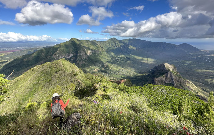
Following the fence line down as we could see the summit of the second highest peak on the island in the distance, so close yet so far.
WST
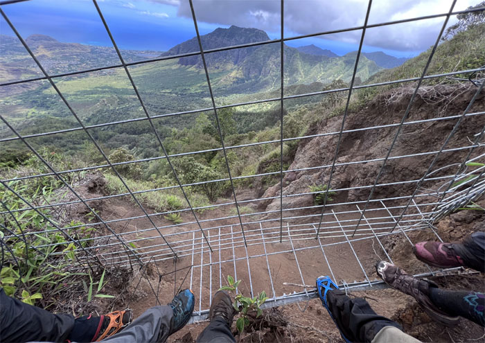
Somebody didn’t get today’s memo to not to put their full weight on the fence.
Hobbs Junction
Group photo at the terminus of the steeply graded ridge that takes one down back into Waianae Valley.
WST
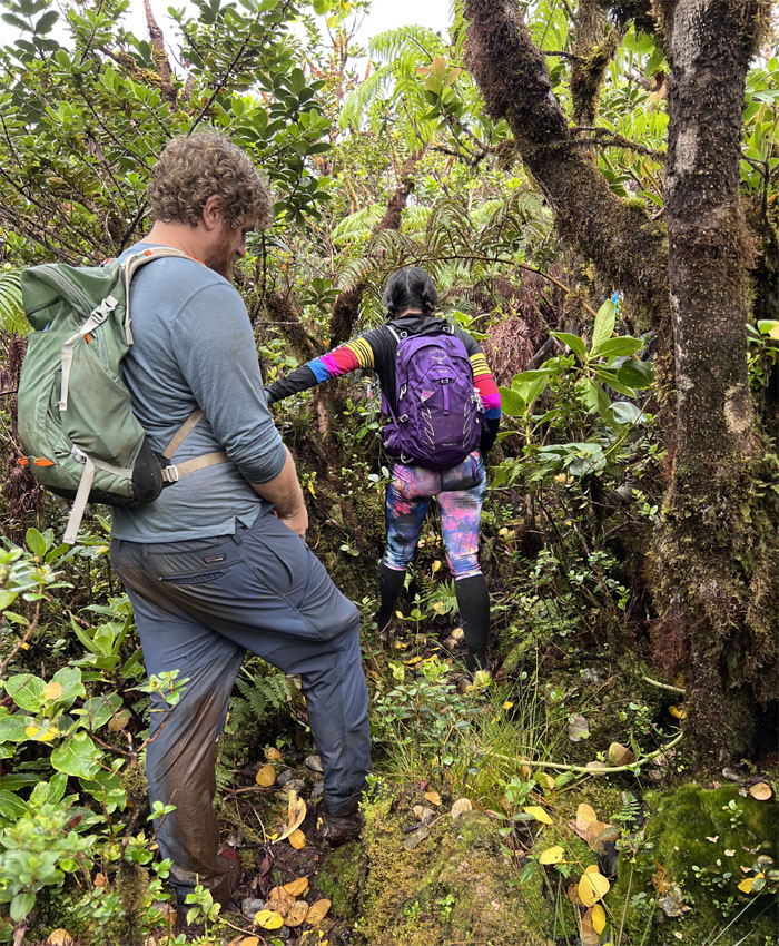
Resuming our hike on the fenced trail that cut through the thorny blackberry bushes and itchy grass.
WST
Looking back at the flat topped summit of Mount Ka’ala.
WST
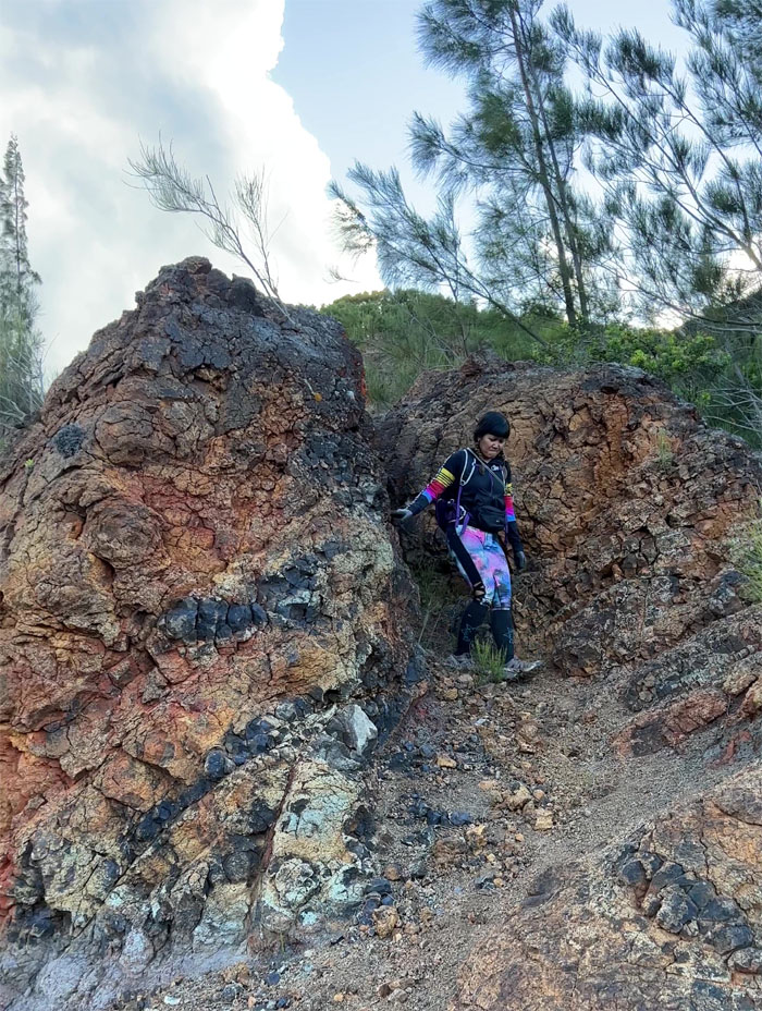
Traversing the crack.
WST
Aida and Aileen climbing down and back up.
WST
Dropping down to contour around the ridge line.
WST
Climbing up the last rockface.
WST
Fist bump followed by lunch.
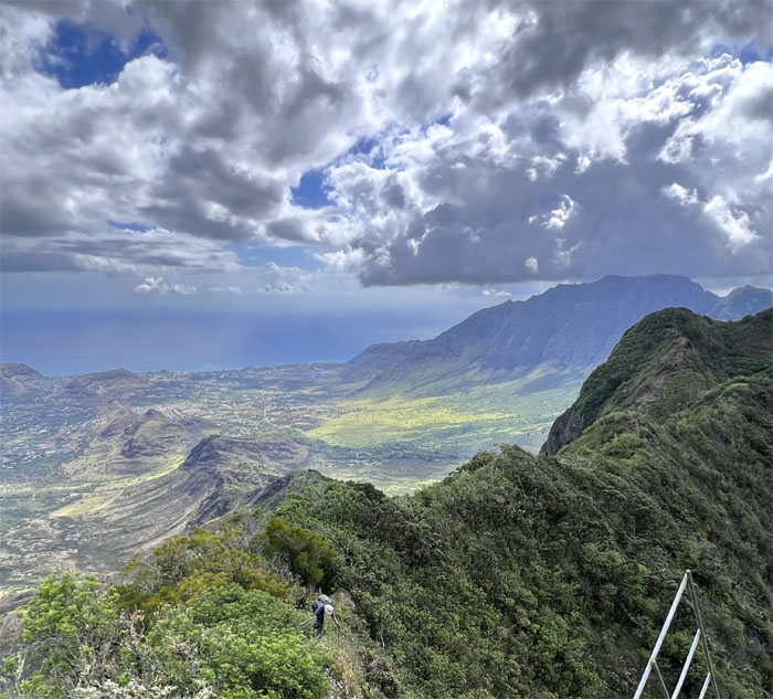
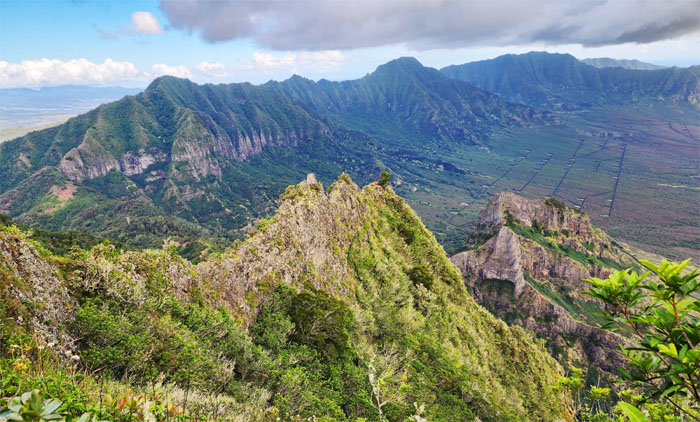
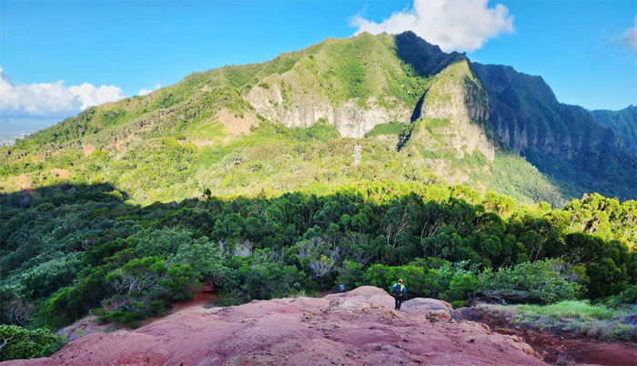
Pu’u Kalena
360 degree view of the 3,504′ peak with clear and commanding views of Lualualei and Waianae Valleys, Wahiawa Plain, cloud capped Ko’olau Mountains, and the prominent peaks of Ka’ala, Hapapa, Kanehoa and Kaua.
WST
Leaving the fern saturated summit.
WST
Descending down the steep fenced line.
WST
Climbing up the eroded hill section.
Star Trek Junction
Giving the Vulcan salute that was created by Leonard Nimoy who drew upon his Jewish roots to create the iconic gesture.
WST
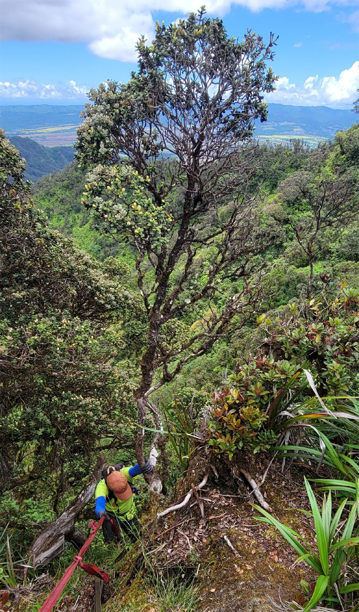
Chris enjoying the views and brief respite from the overgrowth.
WST
Taking the invasive critter from the wilds of Waianae …
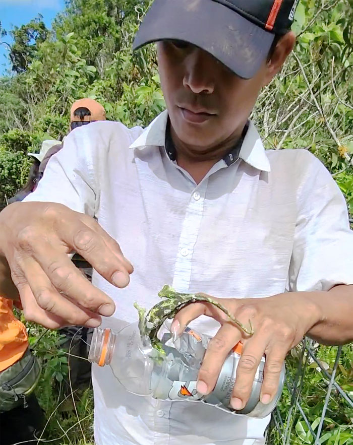
WST
… to the tangerine tree in Ewa.
WST
Thomas carefully crossing over the slipper fence, as he didn’t want to hit a high note.
SeXXXy Ridge
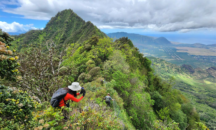
Looking out towards the skinny ridge that drops down into the valley and the crumbly hot mess known as Pu’u Ka’ilio in the background.
WST
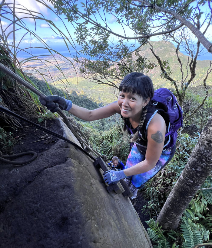
Aida approaching the beginning of the dike section.
WST
Chris watching the girls climb their way down.
WST
Somebody asked what is a dike? Not to be confused with a dyke. Same sound. Different meanings.
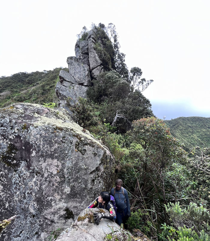
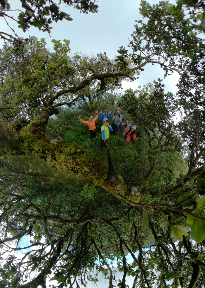
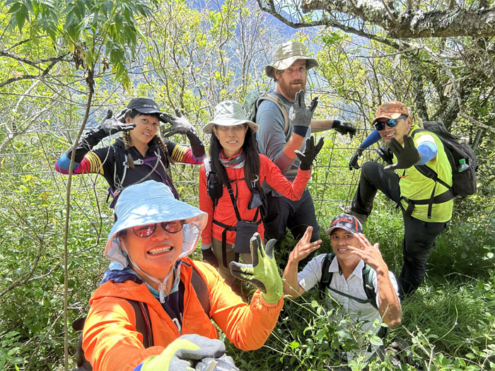
Pu’u Kumakalii
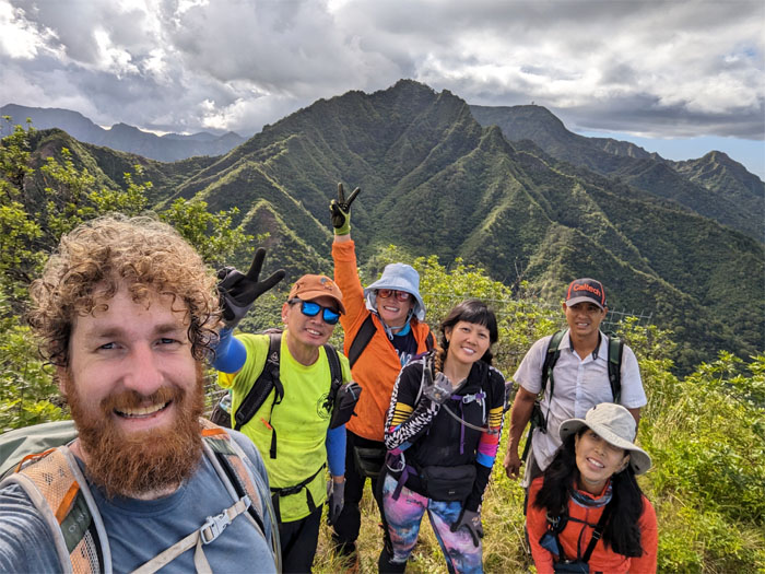
Group photo at the 2,881′ peak. We have a name.
WST
Chris and Thomas descending down the narrow dike with steep drop offs on one side and vegetation on the other side.
WST
Aida keeping her balance on the narrow sheet of rock.
WST
The girls coming off the dike to more stable ground.
WST
Looking into the heart of the largest coastal valley on the island which used to be the center of volcanic activity of the Waianae Volcano.
WST
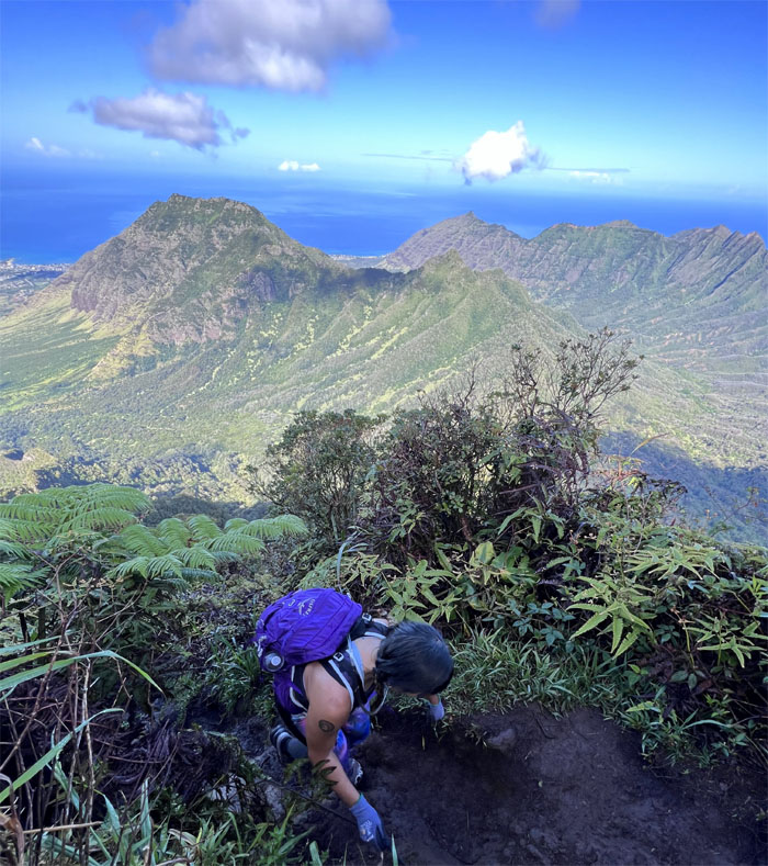
Getting off the exposed ridge line.
WST
Making our way down to the lowest point in the Waianae Mountains.
WST
Aileen coming down the sliding sands section.
WST
Leaving the Martian like dune landscape for the emerald forest.
Kolekole Pass
The group emerging from the valley of head high grass and UXOs.
Kolekole Pass
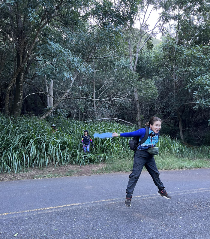
#19. Congratulations to Thomas for completing the entire Waianae Summit Trail that totals roughly 26 miles.
Kolekole Pass
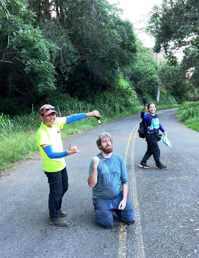
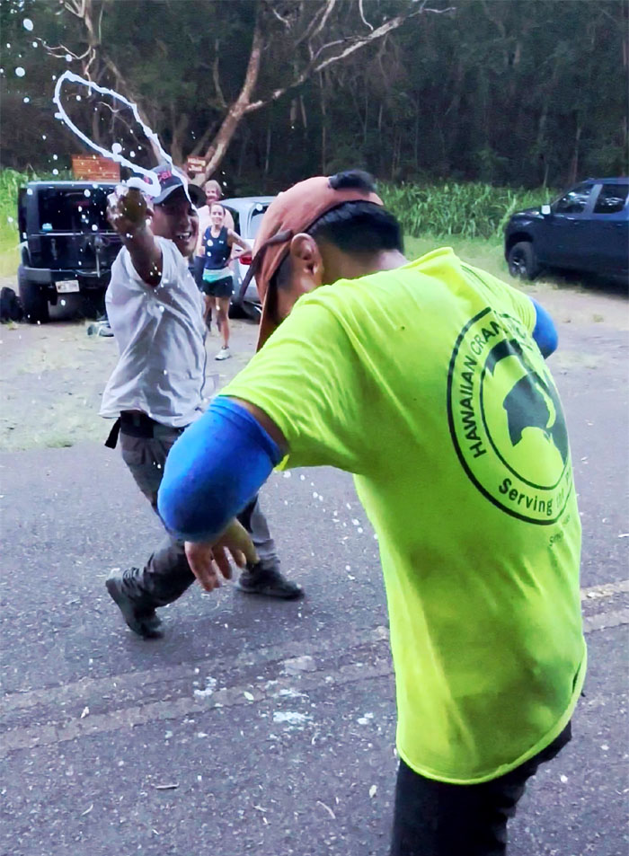
I declined the champagne dousing as best as I could for my #10. I don’t drink alcohol. Only in the worst of times.
All pau
A big thanks to Amber, Cary and Doug who picked up our collective group and dropped us off to our parked cars in Kapolei. Somebody drove back to Schofield Barracks to search for her missing phone, despite being in the car that she was picked up in. I guess she needed extra driving time, much unlike extra cardio time.
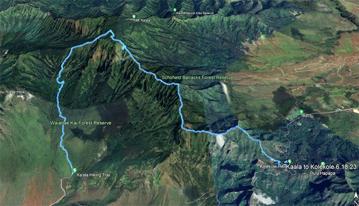
GPS Tracks
Our double finish of the WST covered 7.45 miles that covered the two highest peaks on the island with a great group. Post hike meal was supposed to have been at Outback Steakhouse. Father’s Day reservations made the wait intolerable. Ono Steak & Shrimp closed early. El Mariachi didn’t want to seat us due to the time. Hot Spot was confused with Hot Pot. We finally settled on nearby L & L, which stands for Lee & Lee, the original owners. We should’ve waited for Outback Steakhouse.
Photos taken by Aida Gordon, Aileen Agustin, Chris Bautista, CJ Mendiola, Thomas Barrett, and yours truly. Not necessarily in order.
Note: I have been made aware that some hikers have been using my blog as a hiking guide and getting lost on the trails. Please note that this blog was made to document the hike for the crew(s) that did it. That is why some of my comments will seem to have no relevance or meaning to anybody outside of the crew(s) that hiked that trail. My blog was never meant as a hiking guide, so please do not treat it as such. If you find inspiration and entertainment from these hikes, that is more than enough. If you plan on replicating these hikes, do so in the knowledge that you should do your own research accordingly as trail conditions, access, legalities and so forth are constantly in flux. What was current today is most likely yesterdays news. Please be prepared to accept any risks and responsibilities on your own as you should know your own limitations, experience and abilities before you even set foot on a trail, as even the “simplest” or “easiest” of trails can present potential pitfalls for even the most “experienced” hikers. One should also always let somebody know of your hiking plans in case something doesn’t go as planned, better safe than sorry.
{ 0 comments… add one now }