
Aida, Lilyn, Quan and myself flew to Phoenix, Arizona to hike into one of Nature’s vast works carved by weathering and erosion. Daily visits to the Backcountry office resulted in us getting closer to our goal, but we still had time on our hands. Photo by Lilyn Avendano.
Grand Canyon National Park
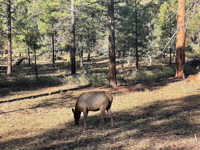
What do you think of when you see elk grazing? Burgers? Photo by Lilyn Avendano.
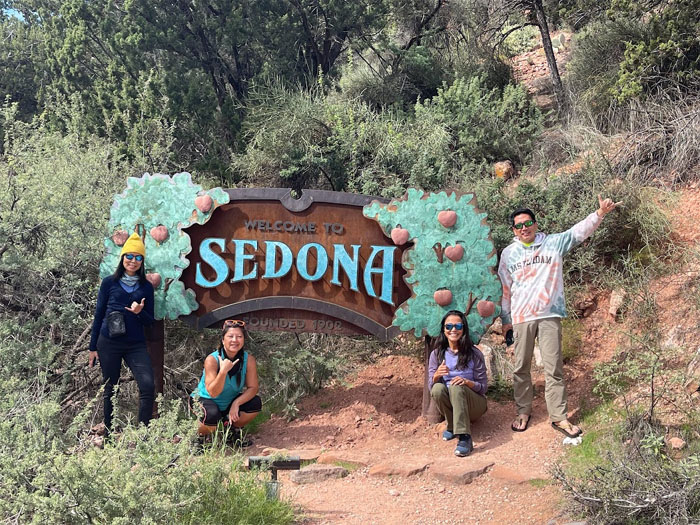
Sedona
Entering the city of Sedona, noted for its apple and peach orchards and new age spiritual vortexes. Didn’t sample or experience any of those things.
Sedona
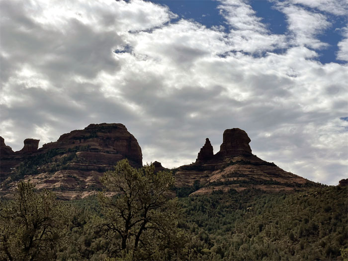
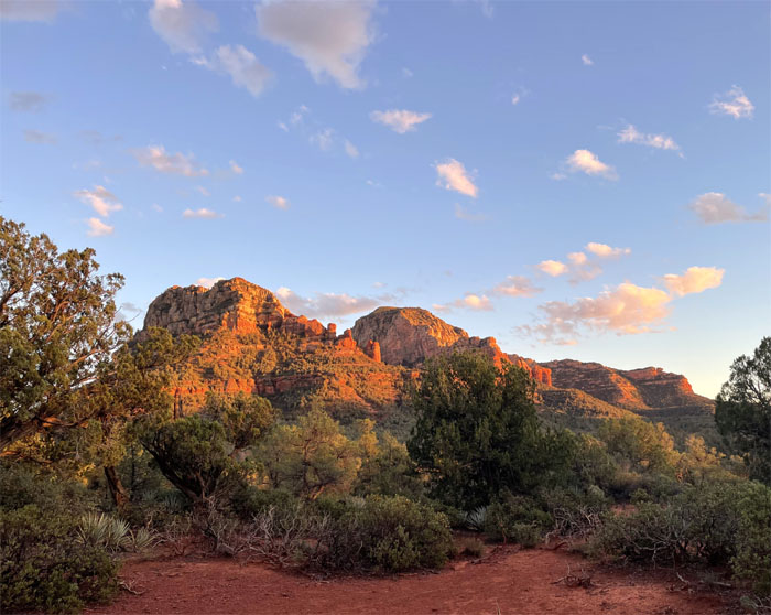
What we came for. The main attraction of red sandstone formations that are a boon to hikers, bikers, hippies and the film industry.
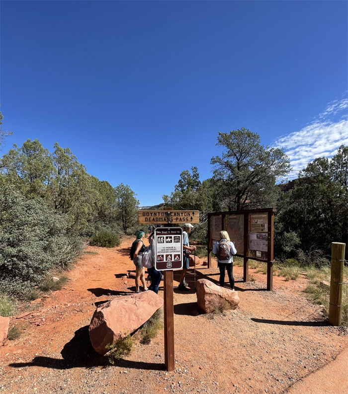
Boynton Canyon
We were able to snag a parking spot at our first hike of the day and found out that the bathrooms are closer than they appear.
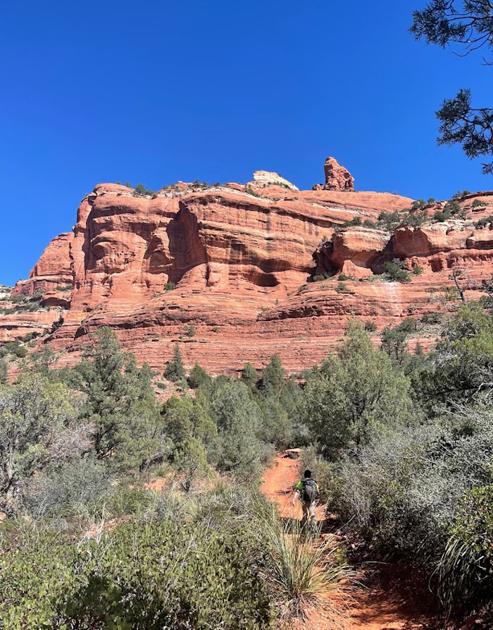
Boynton Canyon
Going down the dirt trail. Photo by Lilyn Avendano.
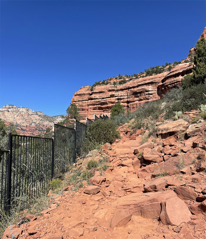
Enchantment Resort
Walking past the gated resort that took away from being out in the “wilderness.”
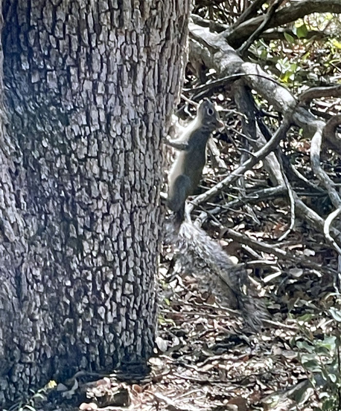
Rodent identification
Some people see nature’s gardeners. Others see bubonic plague carriers.
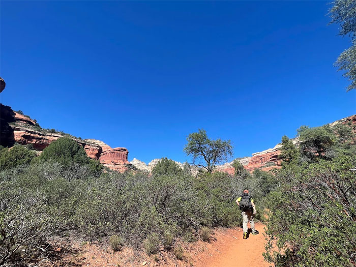
Boynton Canyon
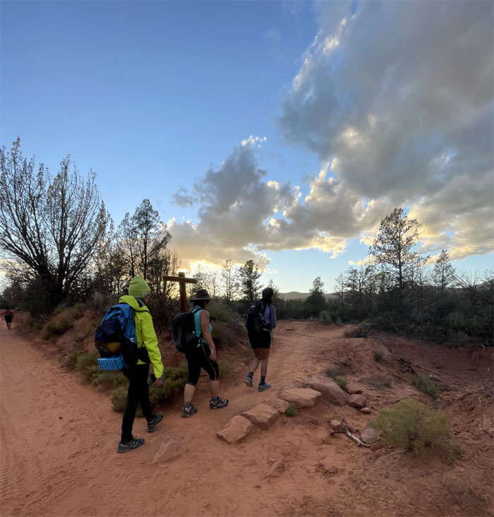
Following the well marked trail, until we had to find the Subway Cave. Photo by Lilyn Avendano.
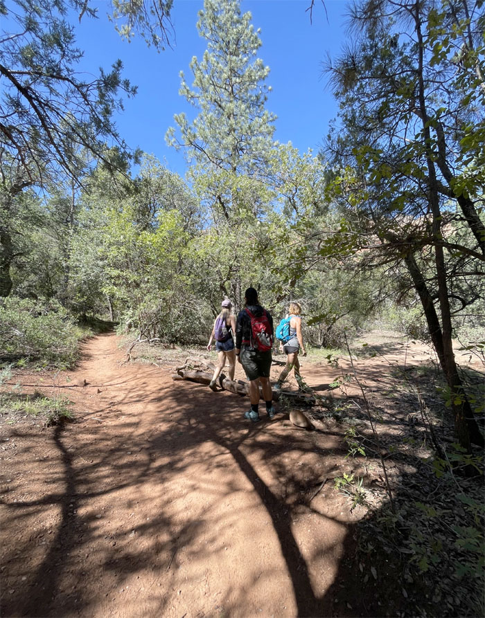
Boynton Canyon
Detouring off the beaten track thanks to the arrow constructed out of branches by fellow hikers, we still got turned around in the creek bed until we found the tree stump and went up the hill.
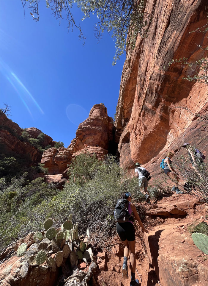
Boynton Canyon
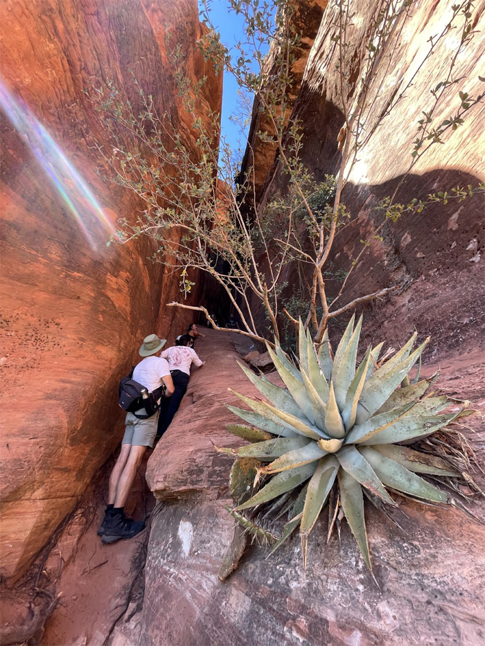
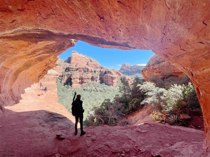
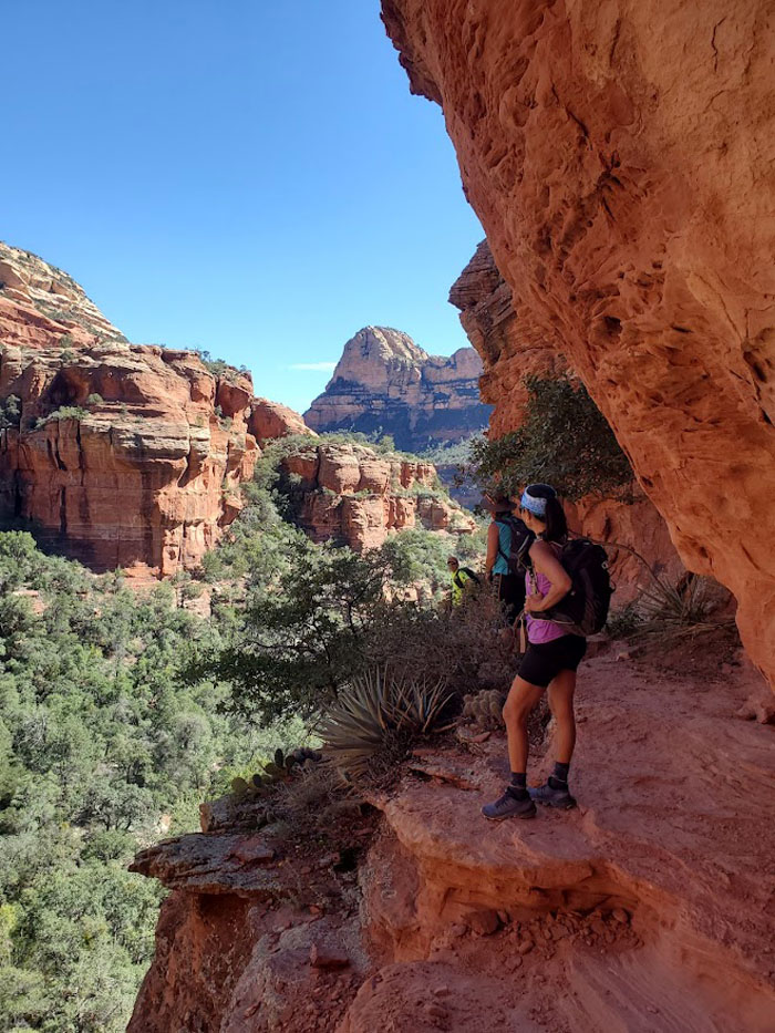
Arriving at the entrance to the cave where we learned the waiting time was north of 40 minutes.
Subway Cave
Traffic on the left.
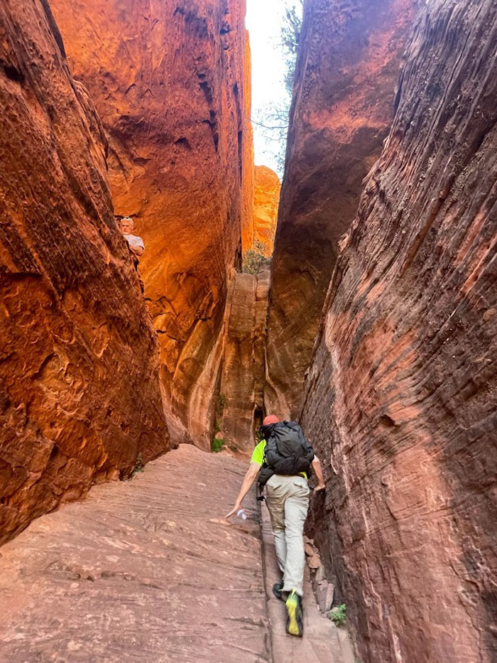
Subway Cave
Passing on the right. Photo by Lilyn Avendano.
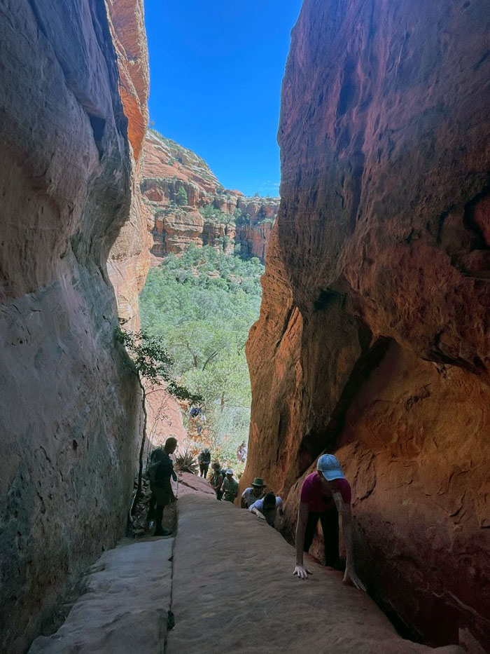
Subway Cave
Somebody yelled to the people coming up that there was no room on top. I believe the voice had an island accent. I could be mistaken. Photo by Lilyn Avendano.
Subway Cave
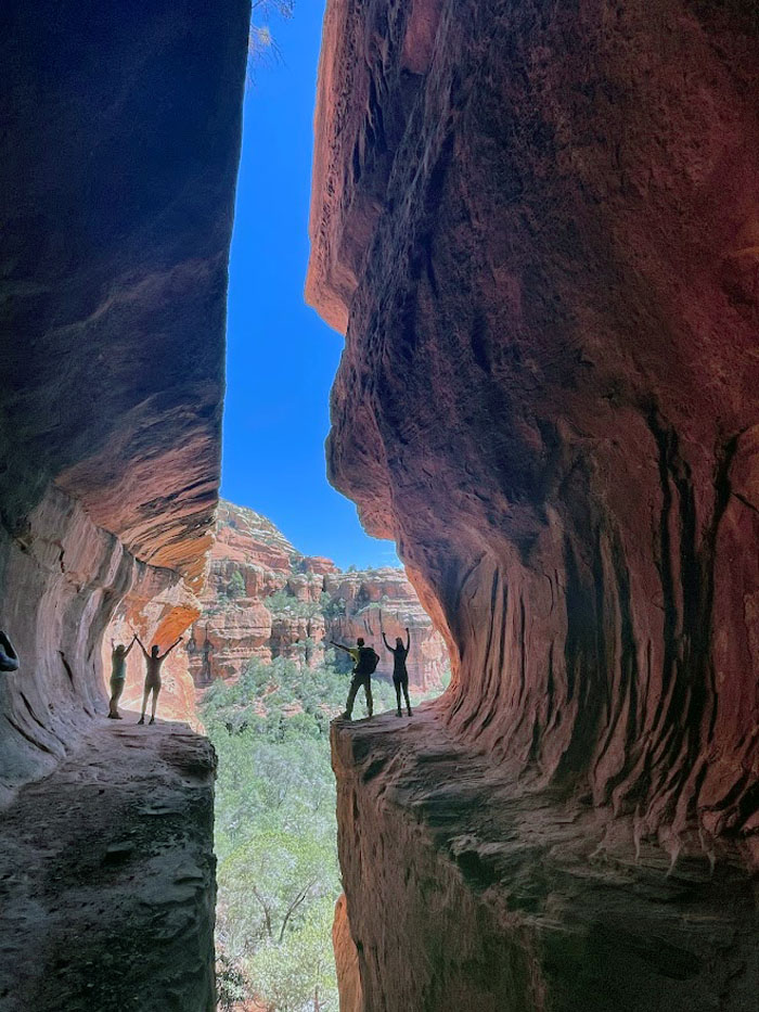
After waiting patiently for everybody to have their 15 minutes of fame and interrupting somebody’s lunch, we finally got our group photo.
Subway Cave
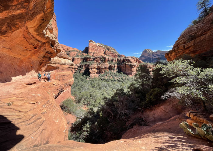
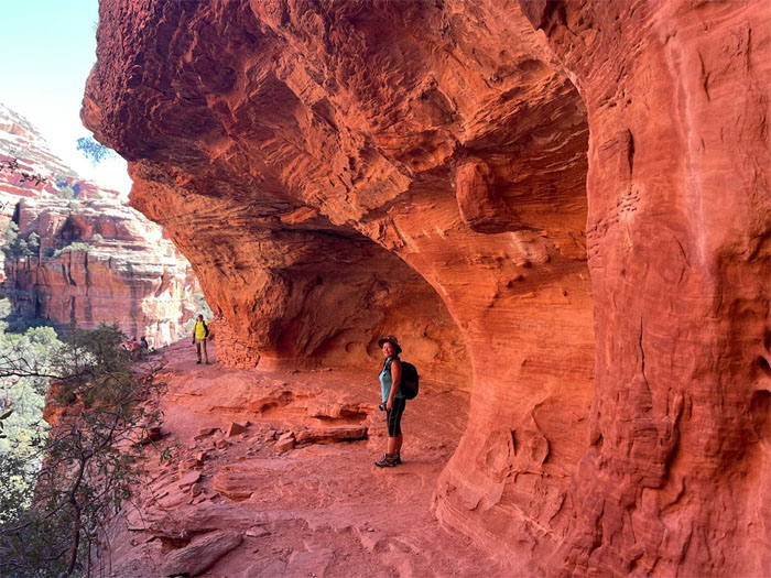
We followed the ledge around the bend and hugged the canyon wall to make our way to the ruins.
Subway Cave
Looking out to the opposite cliff with the walled ruins. Photo by Lilyn Avendano.
Subway Cave
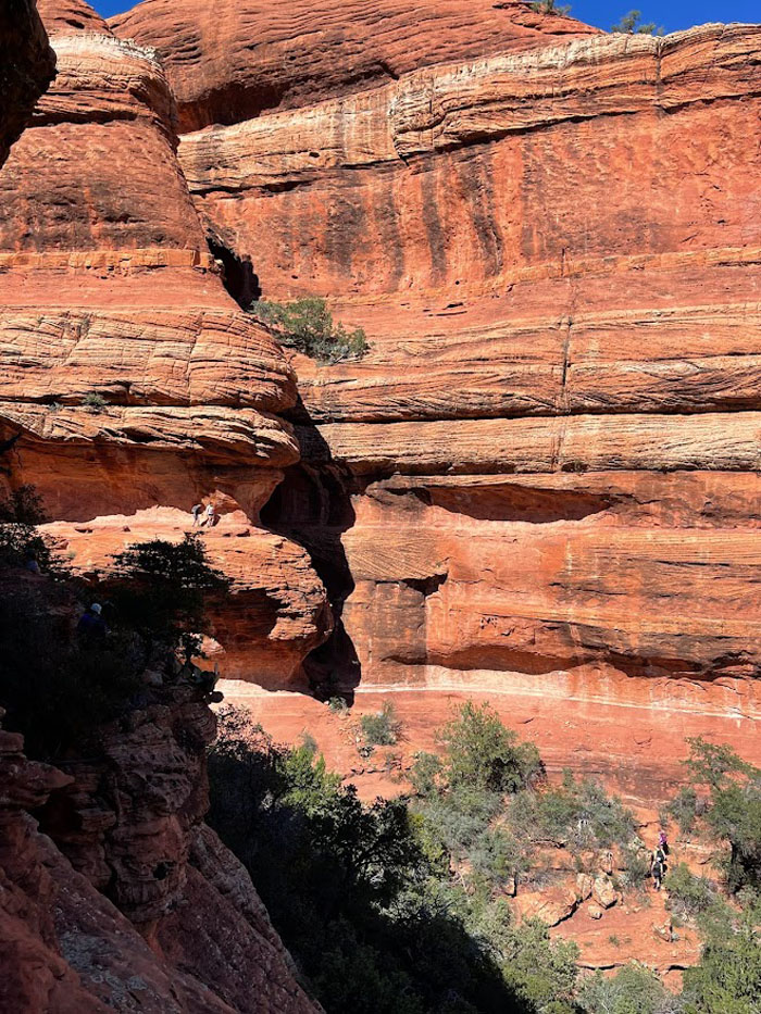
Cave view of the canyon. Photo by Lilyn Avendano.
Subway Cave
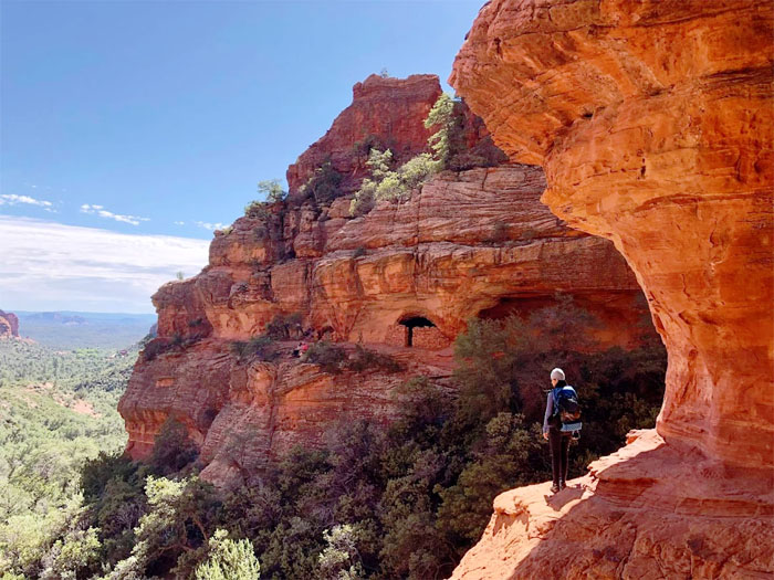
One of several natural caves that made for natural dwellings. Photo by Lilyn Avendano.
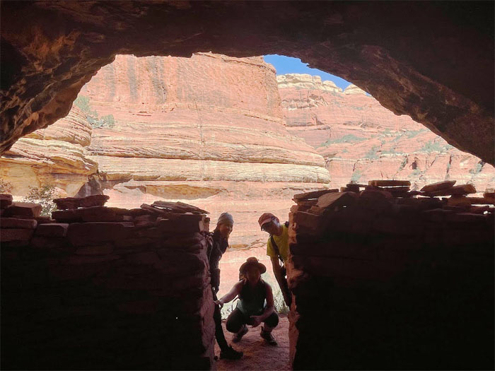
Sinagua ruins
Interior of one of the pit homes. Photo by Lilyn Avendano.
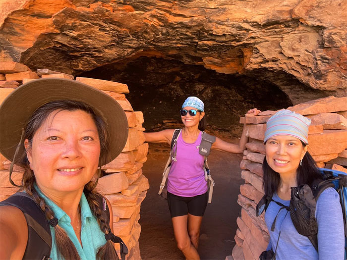
Sinagua ruins
Exterior of the stacked rocks that the Sinagua people made back in the day and mysteriously left without any known reason.
Subway Cave
End of the trail as we must have also missed the petroglyphs that are nearby the ruins. Photo by Aida Gordon.
Subway Cave
Looking back at the mouth of the cave. Photo by Lilyn Avendano.
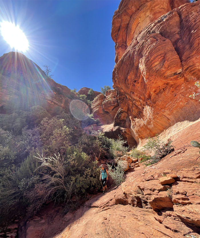
Boynton Canyon
We took a side trail down to avoid the crowds at the cave.
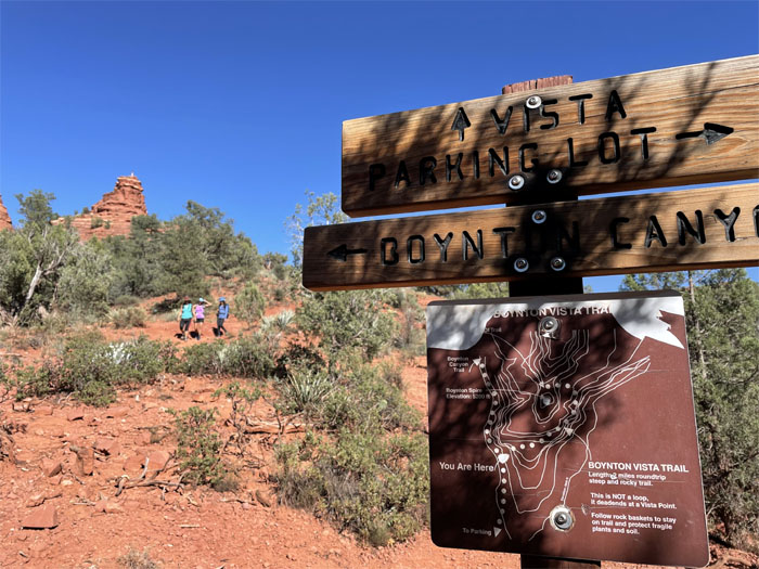
Boynton Canyon
Waiting for the group before we took the trail to the vista. Photo by Lilyn Avendano.
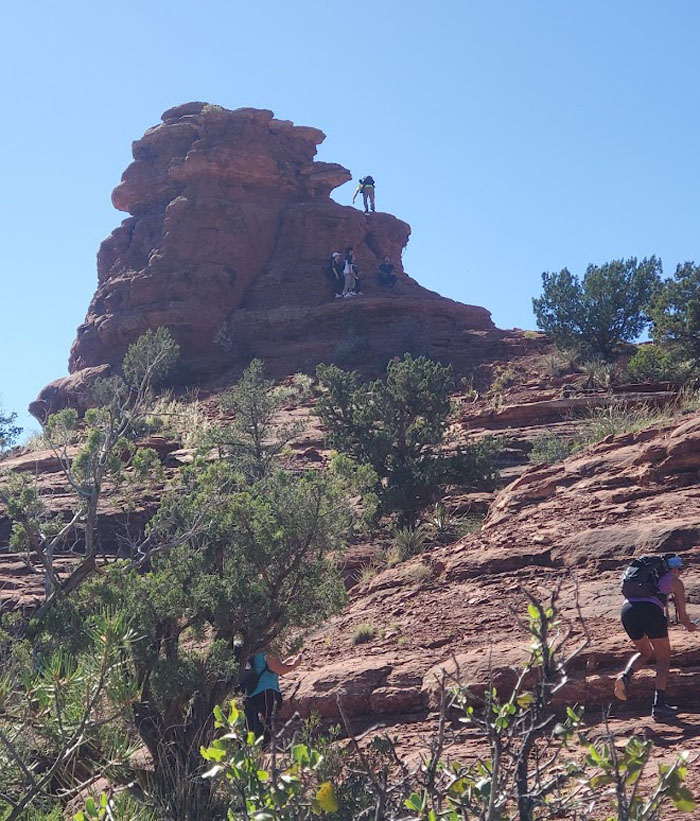
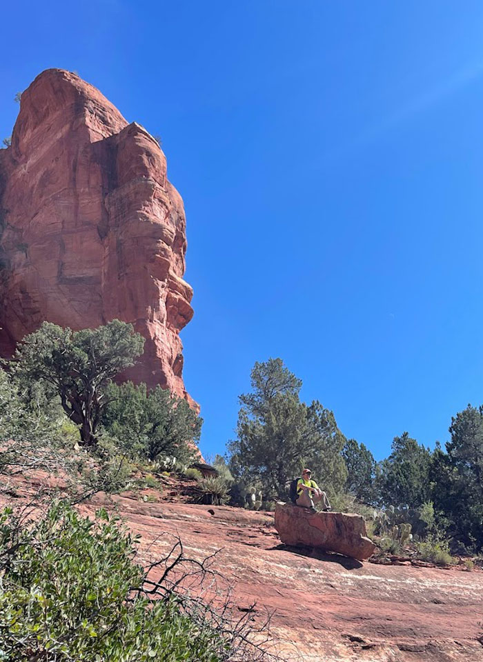
Vista
Climbing up the vista rock. Photo by Aida Gordon.
Vista
Quan reaching the top. Photo by Lilyn Avendano.
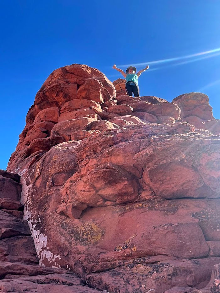
Vista
The Boynton Vortex, which are swirling centers of positive energy, is supposed to be located in this area. I didn’t get all tingly. So I must have missed it by that much. Photo by Lilyn Avendano.
Vista
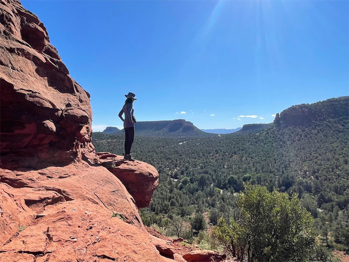
Enjoying the panoramic views. Photo by Lilyn Avendano.
Vista
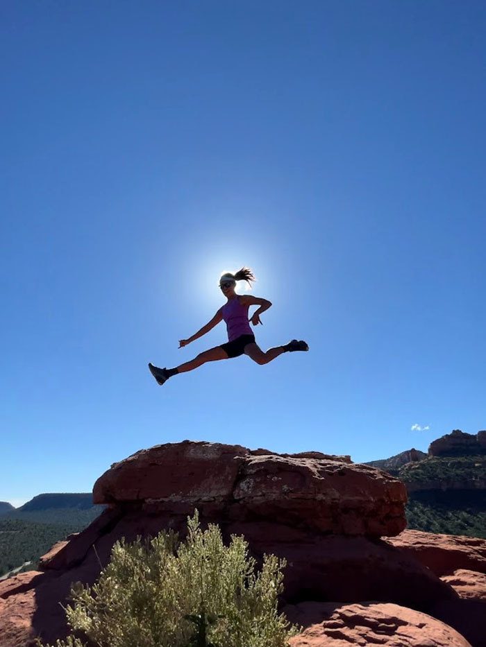
Running with the sun.
Vista
Aida perched on a rock. Photo by Lilyn Avendano.
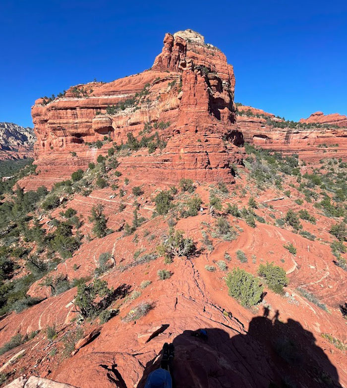
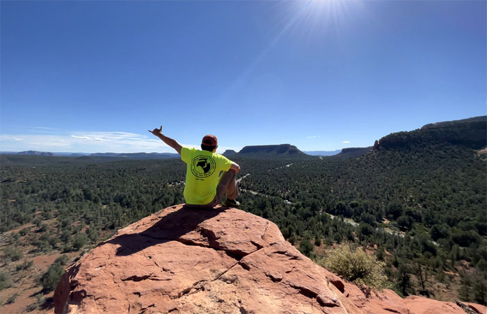
Vista
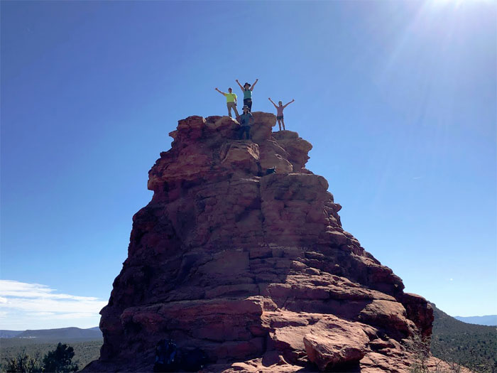
Group photo at the top. Photo by Paul Leurs.
Vista
Making our way down the vista trail.
All pau
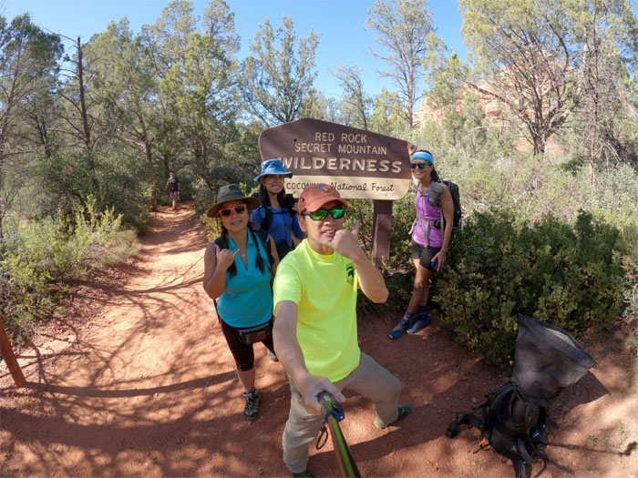
Group photo at the Red Rock Secret Mountain Wilderness that includes over 40,000 acres of Nature’s eye candy.
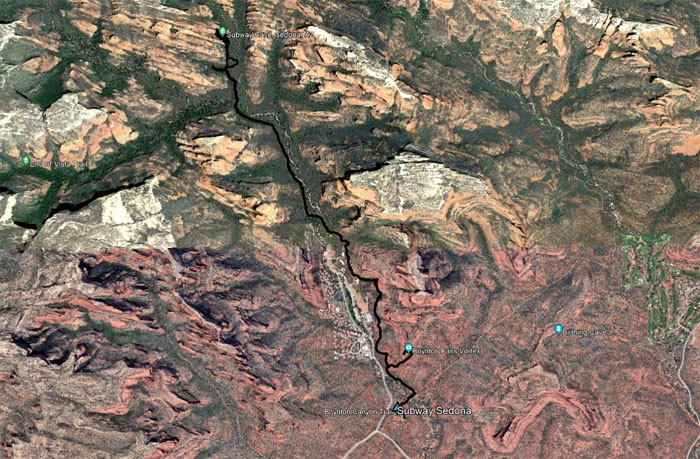
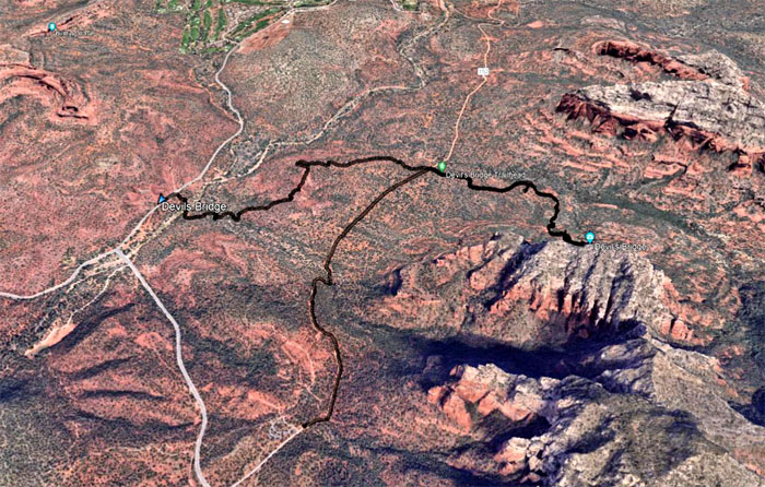
GPS Tracks
Our hike covered 6.05 miles through the orange and red hued buttes, canyons and cliffs.
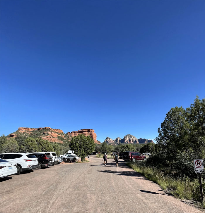
Dry Creek Road
We drove to another nearby hiking trail, but being as it was already late in the day, the cars were parked on the road like breadcrumbs leading to the full parking lot.
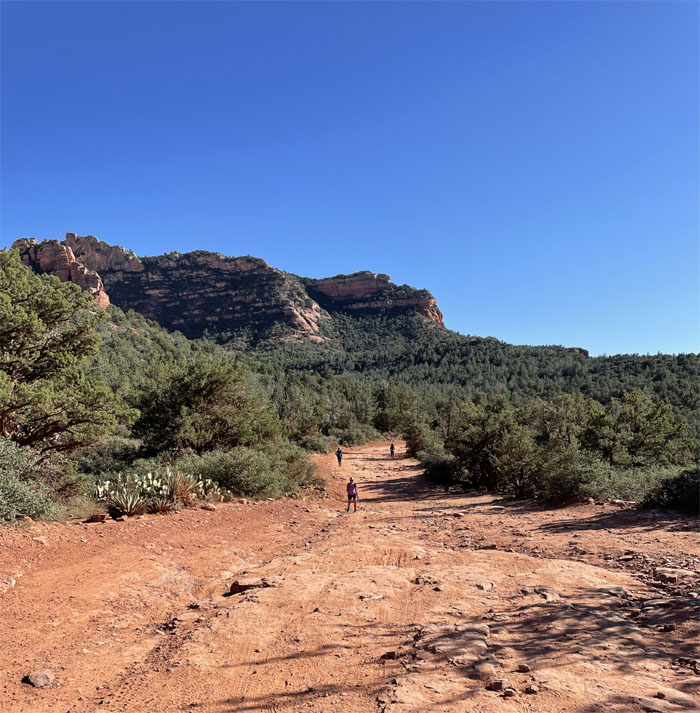
Dry Creek Road
Sharing the dusty dirt road with other hikers, 4×4 vehicles and the Pink Jeep tours that kicked clouds of dust into the air.
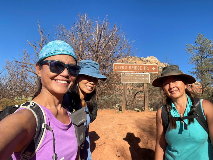
Devils Bridge Trail
Only one mile left to go!
Devils Bridge Trail
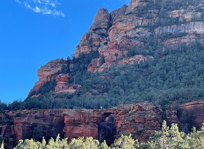
Looking ahead to the largest natural sandstone arch in the Sedona area.
Devils Bridge Trail
Welcome to another 40 plus minute wait. Make yourself comfortable.
Devils Bridge
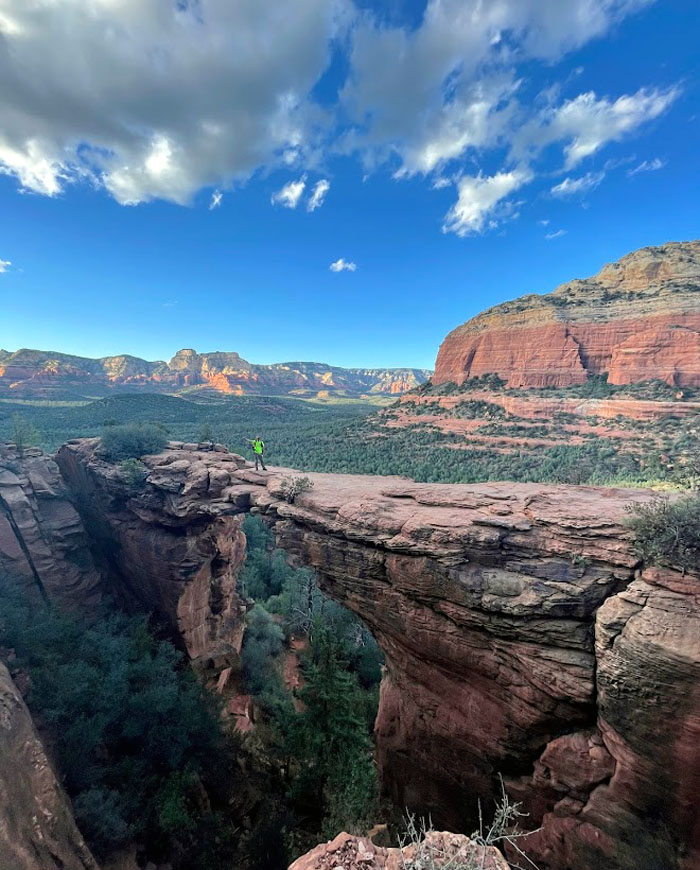
We all got our solo shots on the arch that spans 45′ long and close to 60′ tall.
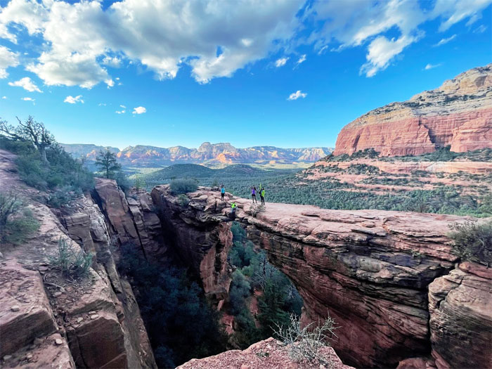
Devils Bridge
After everybody had their 15 minutes of fame, a fellow gawker was kind enough to take our group photo.
Devils Bridge
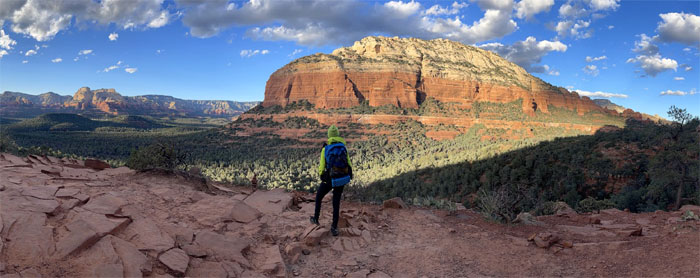
Aida looking out into the Coconino National Forest. Photo by Lilyn Avendano.

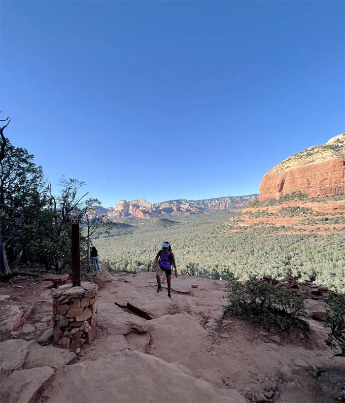
Devils Bridge Trail
Standing on the rock platform surrounded by a sea of green verdant forest. Photo by Lilyn Avendano.

Devils Bridge Trail
Coming down the uneven rock stairs. Photo by Quan Haberstroh.
Devils Bridge Trail
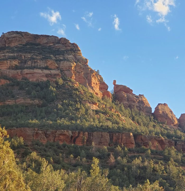
Looking at the balanced rock seemingly tottering on the edge. Photo by Aida Gordon.
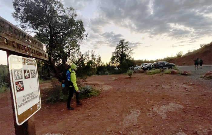
Chuckwagon Trail
We decided to take a “real” trail instead of the dusty jeep road back to our car.
Chuckwagon Trail
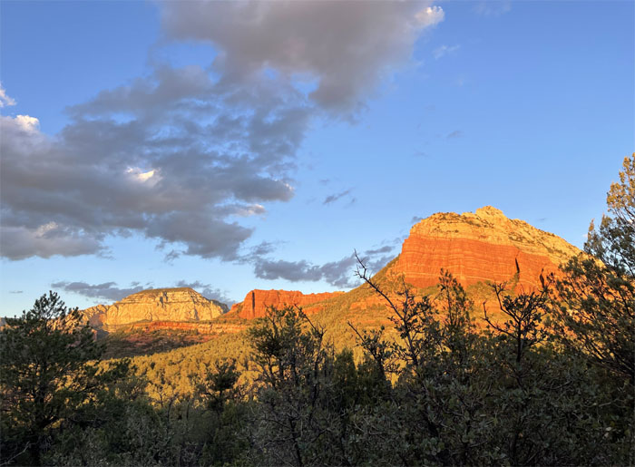
Catching the views as the sun lit up the red rock mountains.
Chuckwagon Trail
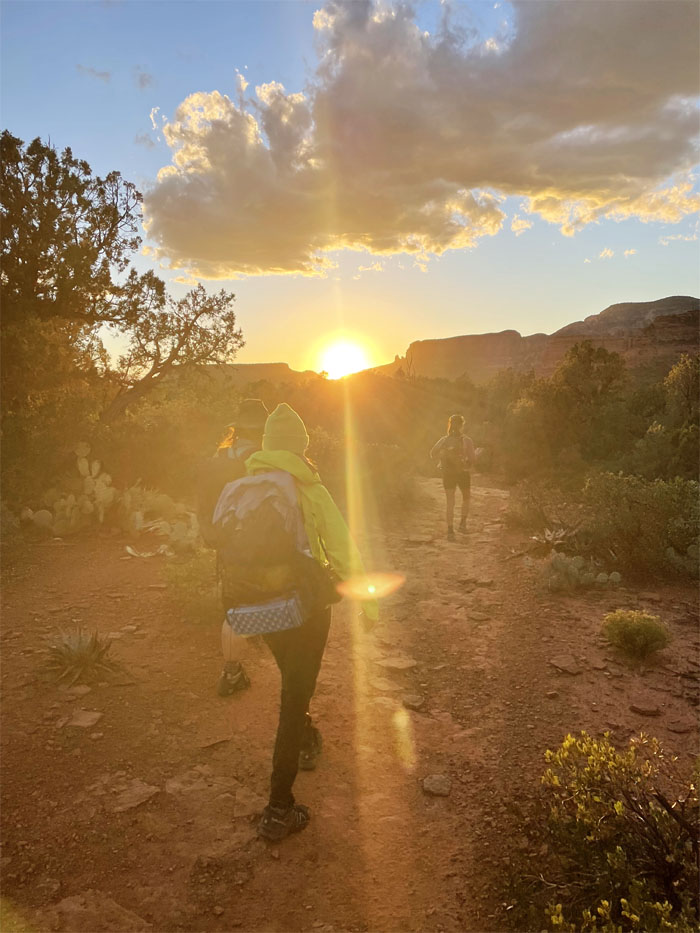
Chasing the setting sun on the trail used by mountain bikers as well.
Chuckwagon Trail
Everywhere we looked, we could see the unique red rock formations being illuminated from different angles.
Mescal Trailhead
We exited the trailhead, not exactly where we wanted to come out, so we had to walk over a mile on the road back to our car.
All pau
Made it back to our car just as darkness fell over the area.
GPS Tracks
Our hike covered 4.29 miles through another collection of Nature’s handiwork.
Post hike meal at Cowboy Club where Elk Burgers were not on the menu today. We had to settle for bison steak which is lower in cholestrol and fat. Balanced that with a hot fudge sundae rich in carbs and fat.
Note: I have been made aware that some hikers have been using my blog as a hiking guide and getting lost on the trails. Please note that this blog was made to document the hike for the crew(s) that did it. That is why some of my comments will seem to have no relevance or meaning to anybody outside of the crew(s) that hiked that trail. My blog was never meant as a hiking guide, so please do not treat it as such. If you find inspiration and entertainment from these hikes, that is more than enough. If you plan on replicating these hikes, do so in the knowledge that you should do your own research accordingly as trail conditions, access, legalities and so forth are constantly in flux. What was current today is most likely yesterdays news. Please be prepared to accept any risks and responsibilities on your own as you should know your own limitations, experience and abilities before you even set foot on a trail, as even the “simplest” or “easiest” of trails can present potential pitfalls for even the most “experienced” hikers.
{ 2 comments… read them below or add one }
Very cool and witty writing, Kenji! I enjoyed the sarcasm lol. Great first day in Arizona!
Aloha Aida,
Thanks, yep it was a great day to kick off our hiking in arizona!
Mahalo