
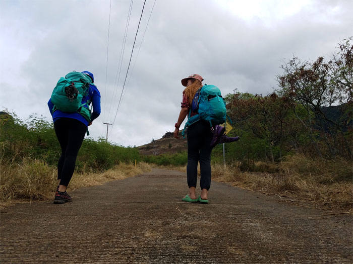
We hiked to the highest point on the island today to visit a post-WW2 wreckage as gloomy weather derailed the original plan to saddle up. Thanks to Jasmin for dropping us off deep in Waianae Valley.
Trailhead
Is this a slipper optional hike?
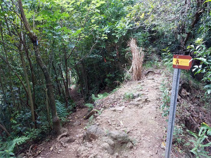
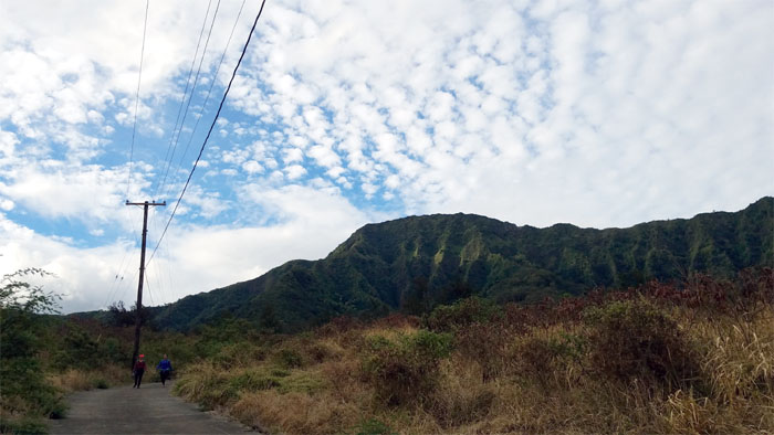
Waianae Ka’ala Trail
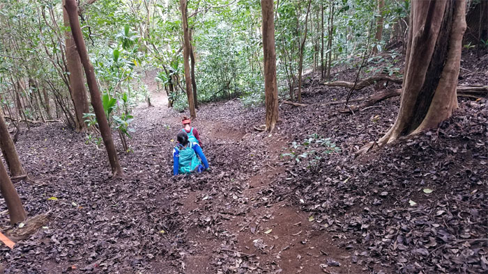
Heading deep into the valley, streambed was bone dry. No waterfalls today.

Waianae Ka’ala Trail
Rooting up the trail. Photo by Ferlino Carinio.
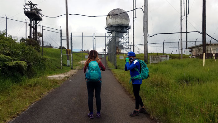
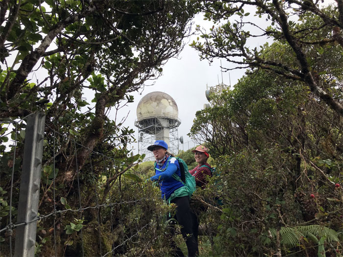
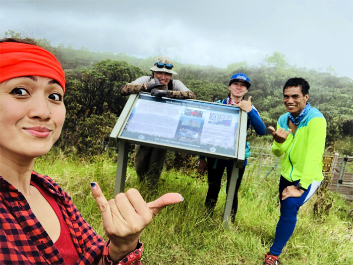
Three Poles Junction
Is it time to shed the slippers yet?
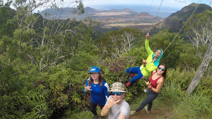
Three Poles Junction
Group photo left to right: Anne, myself, Ferlino and Analyn.
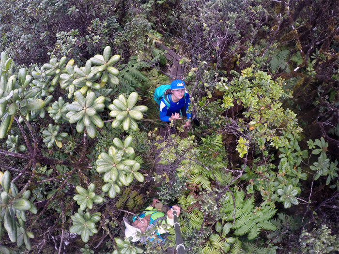
Waianae Ka’ala Trail
Who said you can’t be in two places at the same time? Photo by Analyn Baliscao.
Waianae Ka’ala Trail
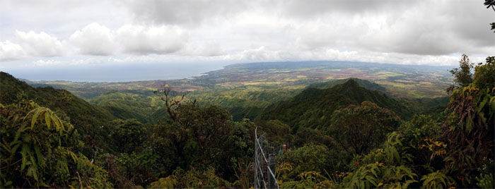
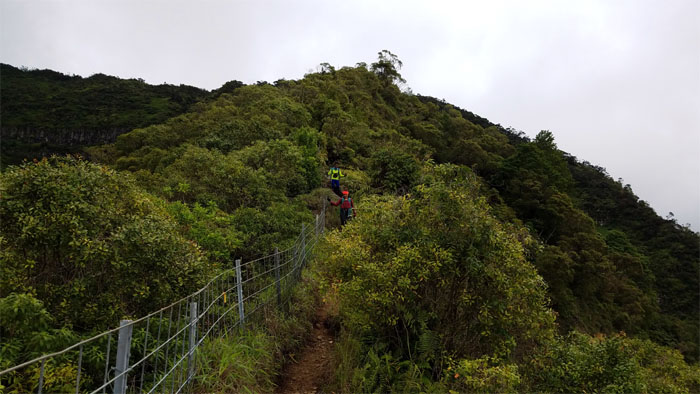
Looking ahead to the steep climb ahead of us to the top. We only had to climb up roughly 1,425′ more of mountain to make it to the top.
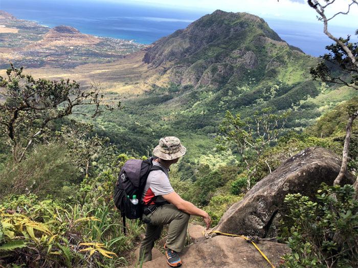
Waianae Ka’ala Trail
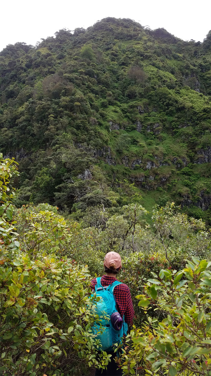
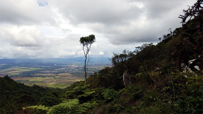
Reflecting towards Waianae Valley on the first boulder section.
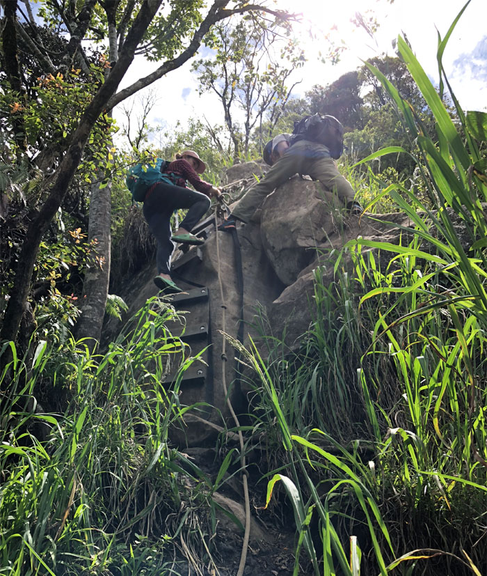
Waianae Ka’ala Trail
Taking the ladder and ladder-less way up on the second boulder section. Photo by Anne Fai.
Waianae Ka’ala Trail
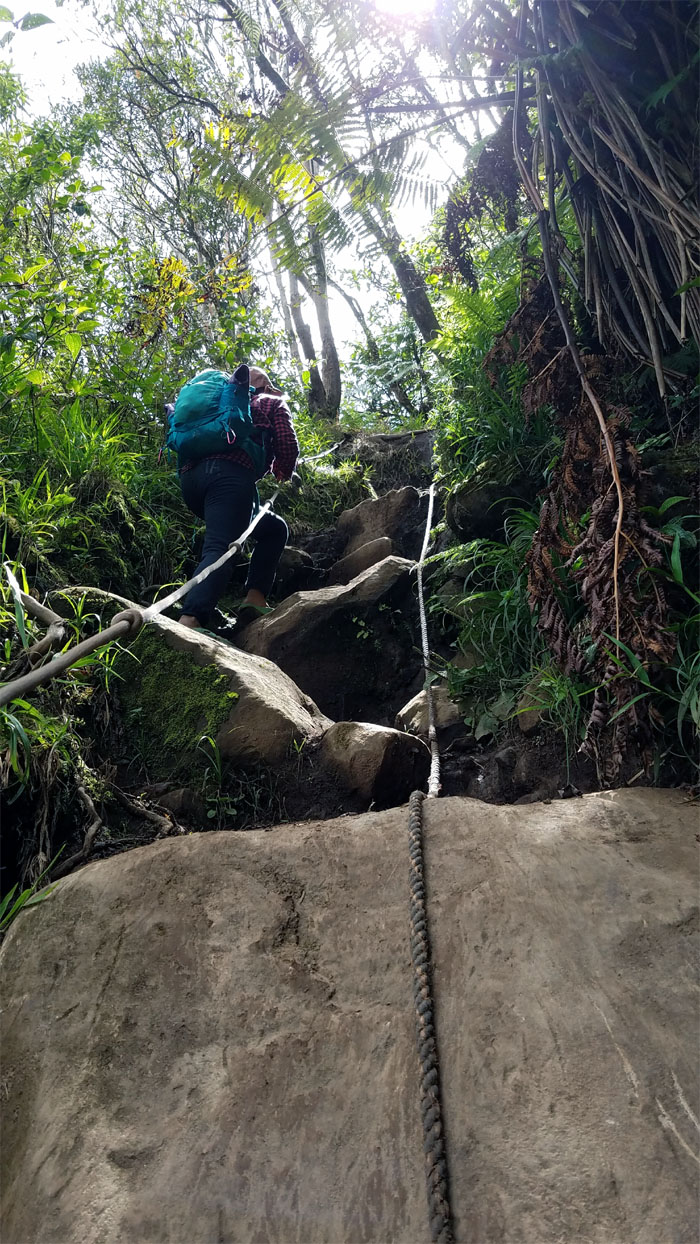
Pitching up the steep rocky climb to the summit.
Waianae Ka’ala Trail
Who needs hiking shoes? Not Analyn.
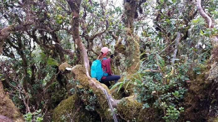
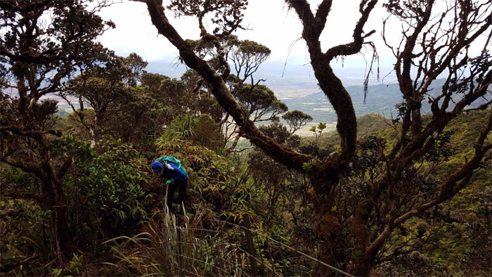
Mount Ka’ala
Hikers in the bog. Photo by Ferlino Carinio.
No hat, no salute
Somebody is not getting a salute today.

Lunch break
Most people get leg cramps, a few get mouth cramps. I heard they can be pretty painful. Photo by Ferlino Carinio.
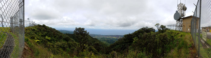
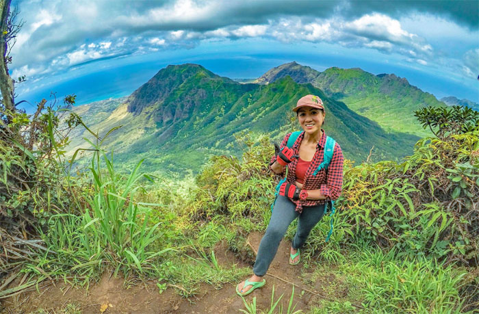
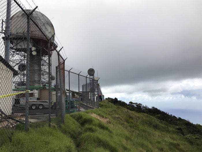
Mount Ka’ala
After lunch, we skirted the barbed wire fence surrounding the FAA tracking station to go exploring down a ridge.
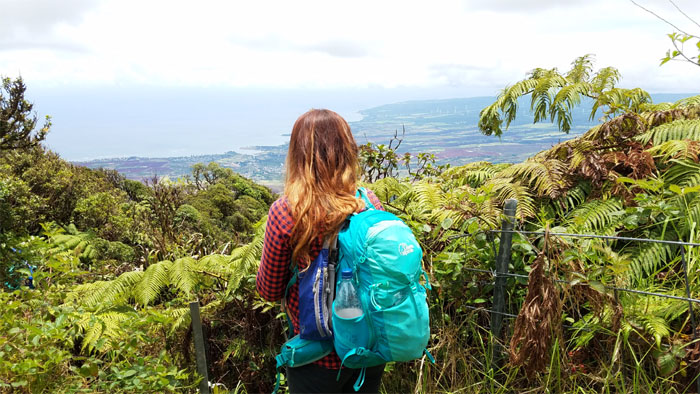
Mount Ka’ala
Descending from the 4,025′ flat topped mountain towards Waialua.
Ridge
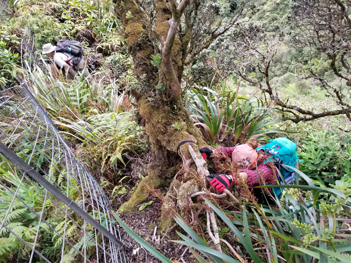
Making our way through the moss encrusted ohia trees as we followed the fence line down.
Ridge
Looking out towards the North Shore.
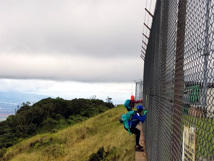
Ridge
Anne hopping over the fence.
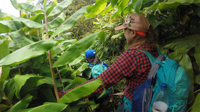
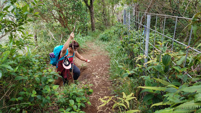
Trail
Bushwhacking our way through suffocating ginger plants and prickly thimbleberry bushes as we tried to pick up the trail.
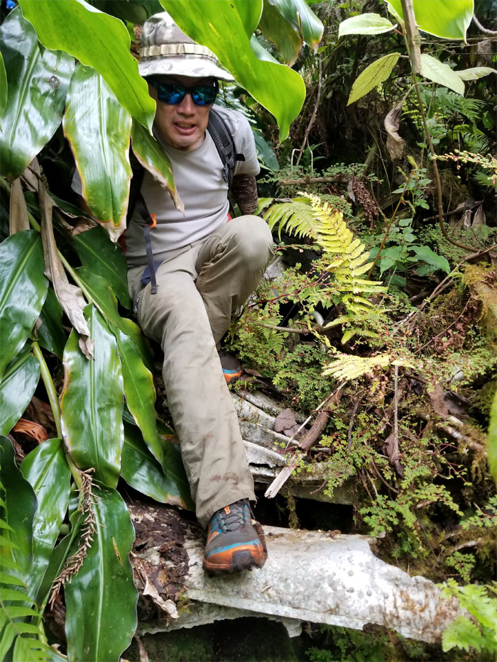
Trail
Stepping on history as we followed the trail of wreckage that soon lead us … Photo by Ferlino Carinio.
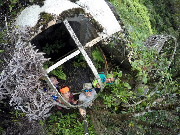
B-24
… to the crashed remains of the B-24 bomber “Evelyn.”
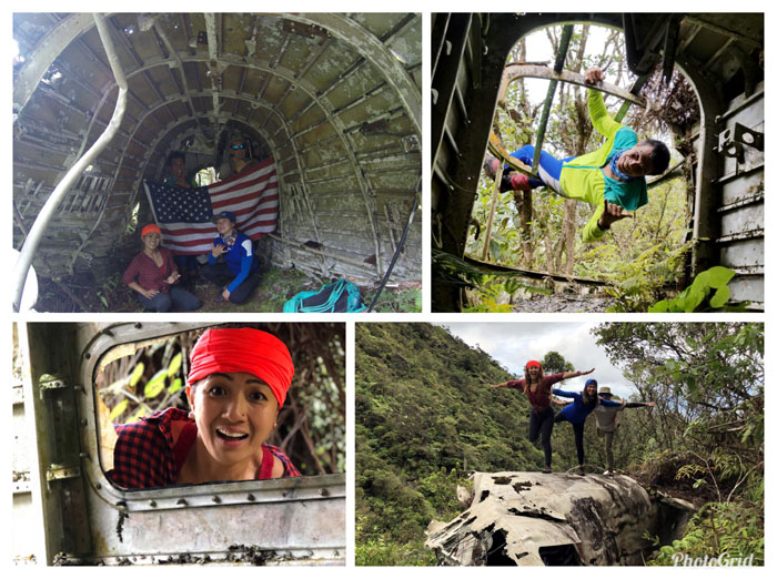
B-24
Exploring what remains of the plane that crashed on July 30, 1945 at 0910. Unfortunately, the eleven crew members did not survive the impact and were retrieved the next day and buried with full military honors.
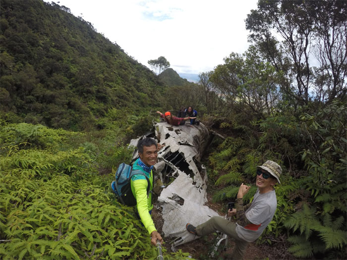
B-24
Leaving the crash scene. Photo by Ferlino Carinio.
Trail
You go that way and I’ll go this way. Photo by Ferlino Carinio.
Ridge
Pausing after the short, steep and humid climb back up to the summit.
Mount Ka’ala
Up. Down. Across. Repeat. Photo by Ferlino Carinio.
Mount Ka’ala
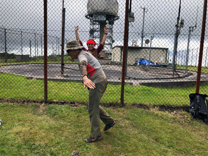
A poorly coordinated dragonfly interrupting somebody’s photo session. Photo by Ferlino Carinio.
Mount Ka’ala
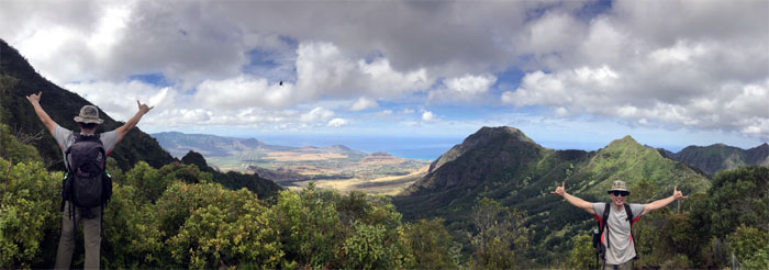
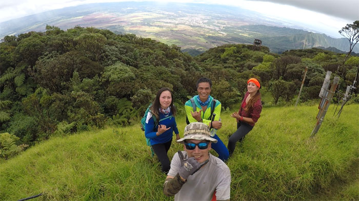
Group photo overlooking the central plain of Wahiawa and points beyond.
Mount Ka’ala
Circling our way around the tracking station.
Mount Ka’ala
Our last group photo at the top before taking our leave of the summit of “the awakening.” Photo by Analyn Baliscao
Waianae Ka’ala Trail
Coming down from the highest mountain on the island.
Slip’n’Slide
Where are those cardboard boxes when you need them?
All pau
Slipper in. Shoe out. Mahalo to Jasmin for coming back to get us, despite Makaha not being Waianae. Fun group hike that explored a different side of the tallest peak on the island. Post hike meal at Pho My Vi, the best phocking rice noodles on the Windward side. Or that’s what I was told. Can’t believe everything you eat.
Note: I have been made aware that some hikers have been using my blog as a hiking guide and getting lost on the trails. Please note that this blog was made to document the hike for the crew(s) that did it. That is why some of my comments will seem to have no relevance or meaning to anybody outside of the crew(s) that hiked that trail. My blog was never meant as a hiking guide, so please do not treat it as such. If you find inspiration and entertainment from these hikes, that is more than enough. If you plan on replicating these hikes, do so in the knowledge that you should do your own research accordingly as trail conditions, access, legalities and so forth are constantly in flux. What was current today is most likely yesterdays news. Please be prepared to accept any risks and responsibilities on your own as you should know your own limitations, experience and abilities before you even set foot on a trail, as even the “simplest” or “easiest” of trails can present potential pitfalls for even the most “experienced” hikers.
{ 38 comments… read them below or add one }
Hey you’re trek looks amazing. I’ve been to Mt Kaala but never found the plane wreck. Can you give me tips on how to get there please?
Aloha Loretta,
I’ll shoot over an email. Hope it helps.
Mahalo
Hi Kenji,
Great pictures of one of my favorite hikes! Would you mind sending any tips on how to get to the plane wreck to me as well? I would like to pay my respects.
Mahalo,
Kevin
Aloha Kevin,
I’ll send an email your way shortly.
Mahalo
Aloha! Loved your blog! Would definitely love help finding Evelyn as well! Mahalo!
Aloha Justin,
I sent you directions a couple days ago.
Mahalo
This hike looks spectacular! Is there any chance that you could mark out where the wreck is? I’ve been trying to find it by satellite photos but can’t seem to find it. Any help/recommendations would be awesome????
Aloha Jacob,
I sent you some directions via email. Hope it helps.
Mahalo
Could I receive the directions or coordinates to this?
I have been multiple times, and have never found Evelyn. Great post, it looks like a lot of fun for y’all!
Aloha Dallas,
I will email you the general directions. I just had some friends that paid a visit to the plane, they said it was heavily overgrown with the thorny bushes. Not a walk in the park for sure.
Mahalo
This hike looks fantastic! I loved reading about your trip. Can you give any tips for finding Evelyn? Any help would be so appreciated.
Aloha Brandy,
Thanks. After gaining the summit of Ka’ala, you go to the left of the radar tower compound until you will eventually run into a fence that goes down a spur ridge towards Waialua. Follow the fence line down and the last time we did it, we could see the plane as we descended down the ridge and then you will basically have to hop over the fence and bushwhack your way to the plane. Hope this helps.
Mahalo
I have lived on the island for about 2 1/2 years now and have done many hikes. This one is on my bucket list. Would you be so kind to send me any information you could on the “Evelyn”.
Mahalo
Aloha Toni,
Please see above.
Mahalo
Hi can you share the maps for direction going to the plane wreck pls? Thank u
Aloha Candace,
I sent it to you. Hope it helps.
mahalo
Hey,
I’m hiking Mt. Ka’ala monday. I was wondering if you can provide a little more detail about the route to the plane? I’ve seen lots of your posts on Oahu hiking Community.
Thanks,
Aloha Chandra,
Sent you some directions. Hope it helps.
Mahalo
Hey Kenji, Love following your posts, I’m heading to Mt. Ka’ala on sunday and would love to try to find Evelyn, any tips or maps you ca give me would be super helpful!
Aloha Thomas,
Emailed you some directions, hope it helps.
Happy New Year!
Hi Kenji,
Thanks so much for documenting this! Really interesting hike. I plan to summit Mt. Ka’ala in a couple days, if all goes well. Would be amazing to visit “Evelyn” while up there–if you see this in time and you’re willing to share coordinates or any navigational tips, it would be a huge help.
Mahalo,
Nick
Aloha Nick,
Thanks. I emailed you the general directions yesterday. Hope it helps.
Mahalo
I love the hike and its history, thank you for sharing this. I really want to find the plane wreckage. Can you give me tips and direction on how to find the plane please?
Aloha Ryan,
I will email you tonight.
Mahalo
Can you email me too please!!!!???
Thank you
Aloha Clay,
I will email you the directions tonight. Stay safe and have fun.
Mahalo
Hey guys is there any chance I could be sent the directions to the plane wreck j plan on hiking the mountain this weekend and hope to be able to get to the plane it would be highly appreciated.
Aloha Dan,
Sorry only saw this now. Did you find it okay this weekend? If not and you still need directions, LMK.
Mahalo
Hello, I think your directions are pretty clear but if you have GPS or map routes you can share I would appreciate it! Thanks, –Ernie
Aloha Ernie,
Sent it your way. Have fun.
Mahalo
Aloha Kenji,
I have been researching instructions on how to get to “Evelyn”, can you please share them with me?
Mahalo! Maybe I will see you on the trail one of these days!
Aloha Sean,
It’s been awhile, but basically once you reach the top of ka’ala, you go clockwise around the fence that surrounds the radar installation until you hit another fence that is going down towards the central plain. follow it down for about 30-45 mins, if the overgrowth is not too bad, you should be able to spot the plane as you make your descent, if not, you might have to do some bushwhacking. hope this helps. Hope to see you on the trails one day!
mahalo
Amazing photos brah!!! Do you have GPS coordinates of the plane wreck! Been up Ka’ala before never knew bout da bomber!
Aloha,
I will email you the directions under separate cover.
Mahalo
Aloha Kenji! Could not find the email, could you send it again by any chance! Mahalo nui!
Aloha,
I sent it over. Hope it helps.
Mahalo
Aloha Kenji!
I know this post is a few years old but is there any chance you could also email me the directions to Evelyn? I plan to hike Kaala sometime soon and would love to visit the wreck. Mahalo!
Aloha Jack,
I’ll email you later.
Thanks