
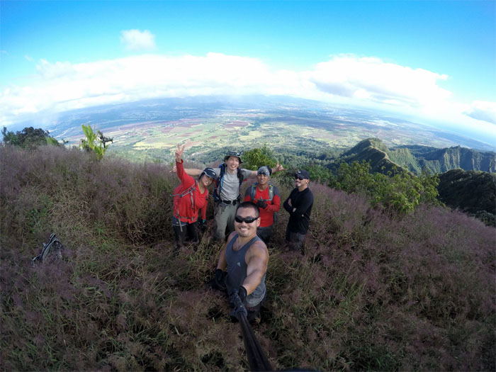
Today was the day to polish off the last chunk of the Waianae Summit Trail (WST) for the second time around. Joining me today were Chris, Justin, Ryan and Thessa. Mahalo to Matt for dropping us off at the crack of dawn at Schofield Barracks. Photo by Thessa Bugay.
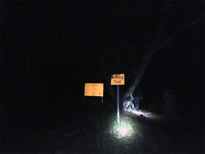
Trailhead
Nobody but us early hikers on the trail. Photo by Justin Hirako.
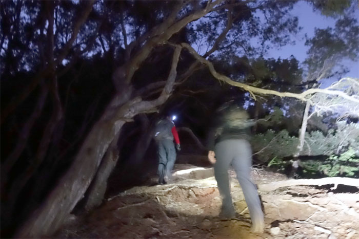
Trail
The trail has been considerably cleared and marked from the last time I was here. It’s like Disneyland. Without the lines. Well, if you come early.
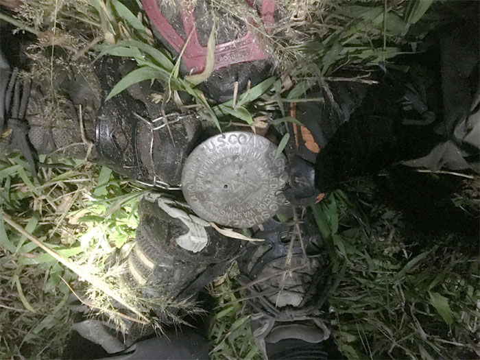
Kolekole Pass Rock
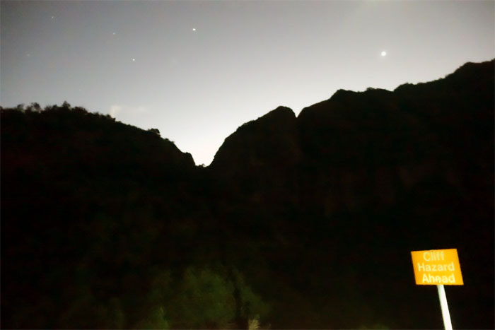
Hiking infractions are dealt with harshly on military bases. You have been warned.
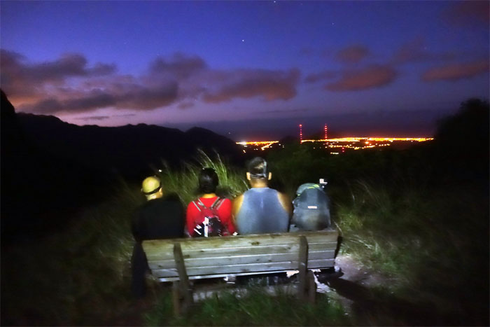
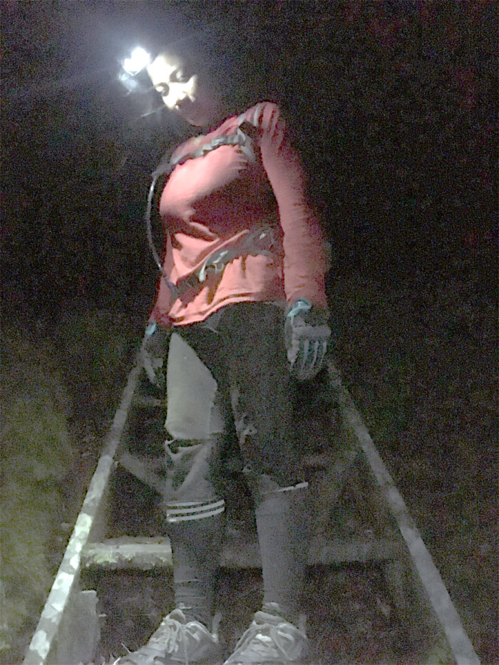
Bench
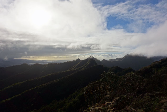
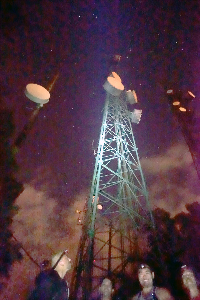
We stopped at the meadow and looked out towards Lualualei Valley and the blinking antenna lights.
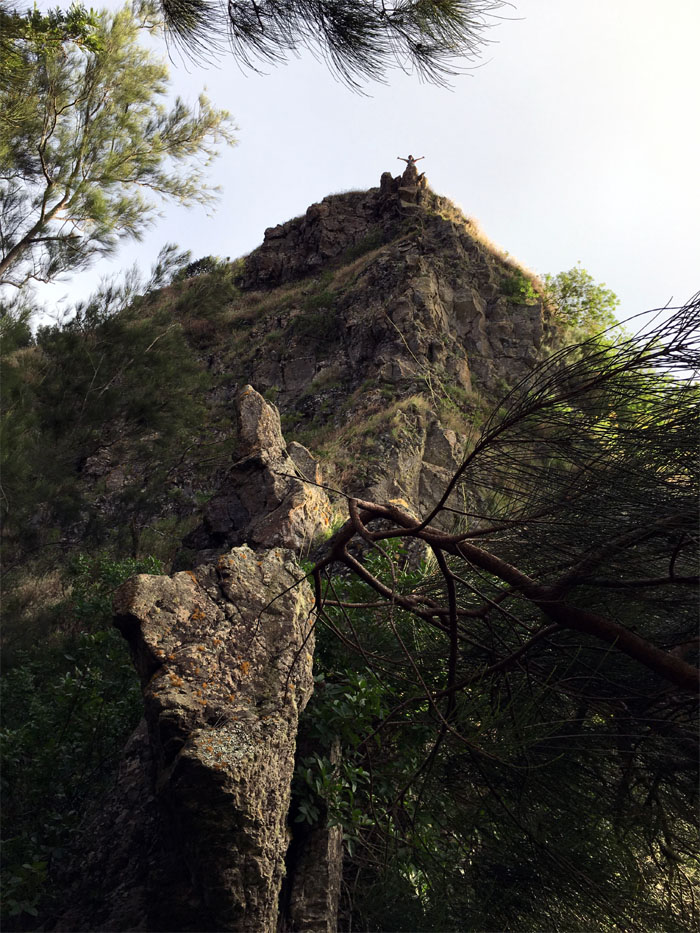
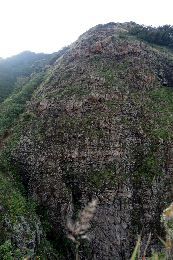
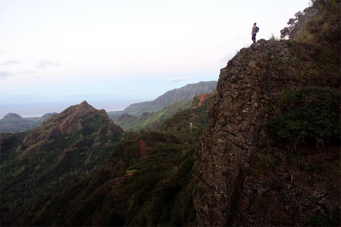
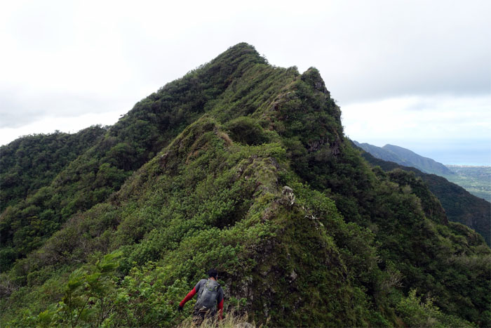
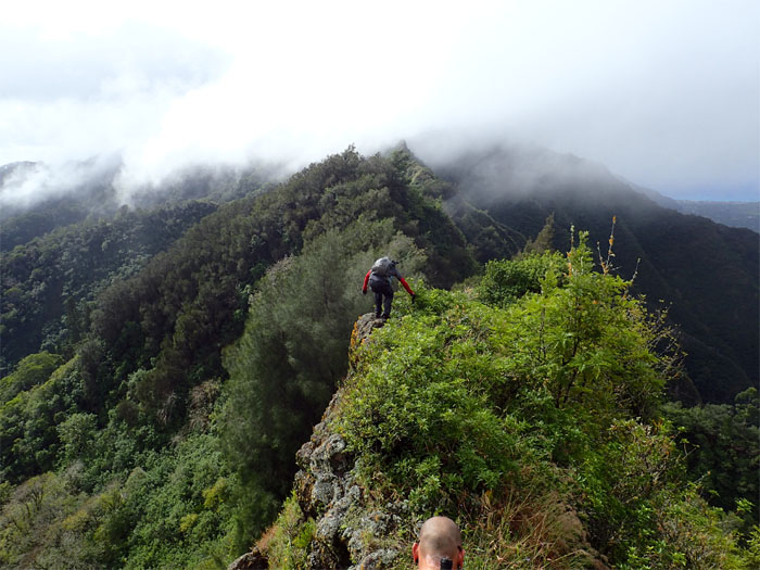
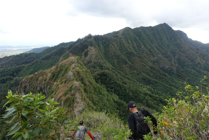
Notches
Looking up at the notched ridge silhouetted against the twilight sky.
Trail
Chris and Ryan making their way up the paperbark tree lined hill.
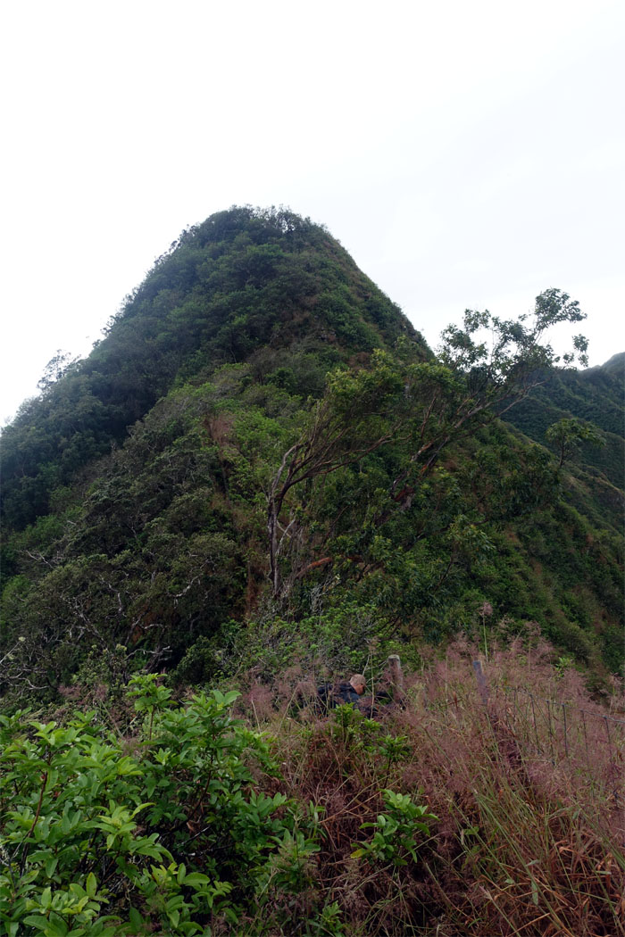
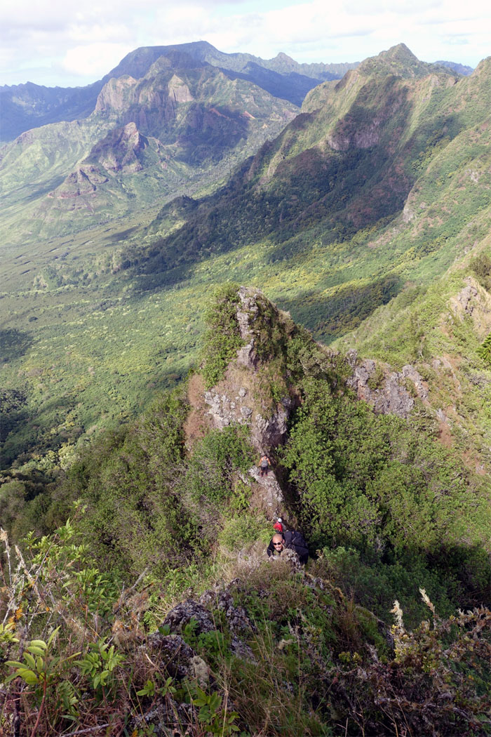
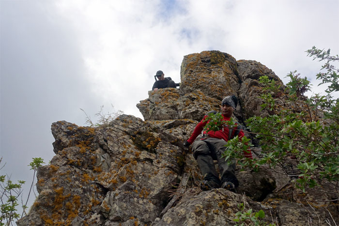
Notch
Maybe this was the cliff hazard the sign had warned us about earlier?
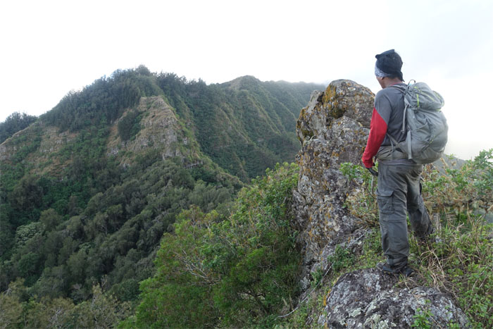
Notch
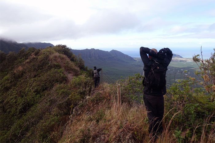
Justin looking out at Pu’u Ka’ilio and Lualualei Valley.
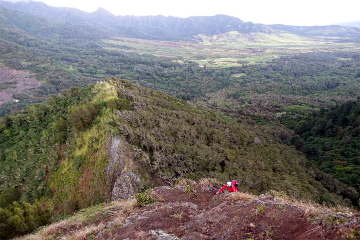
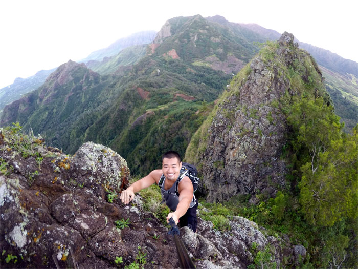
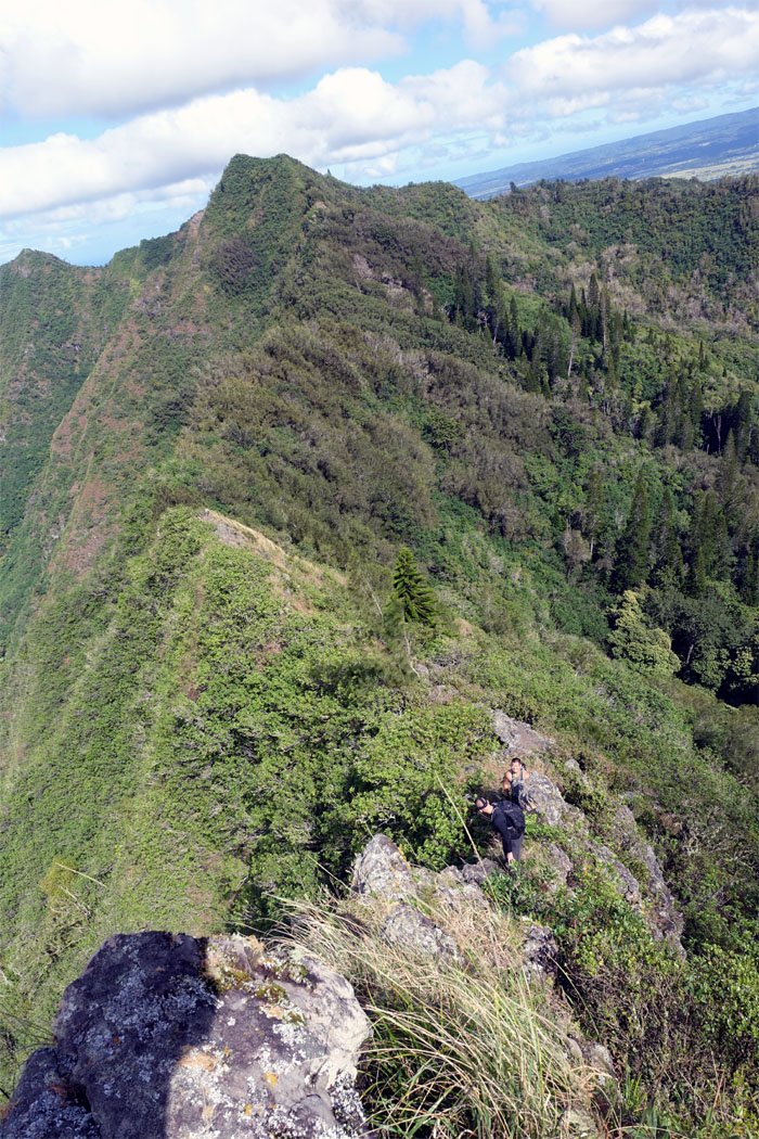
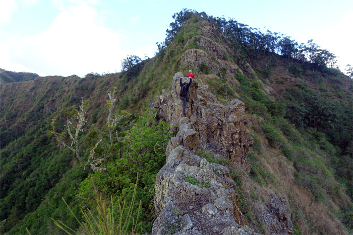
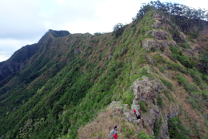
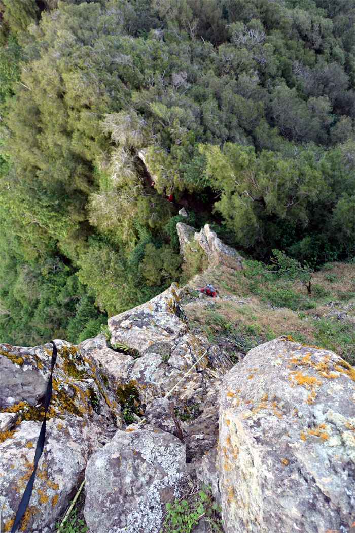
Notch
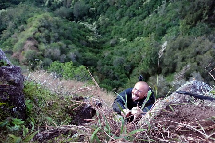
Thessa climbing her way out of the big notch.
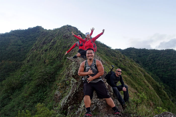
Trail
Impromptu group photo.
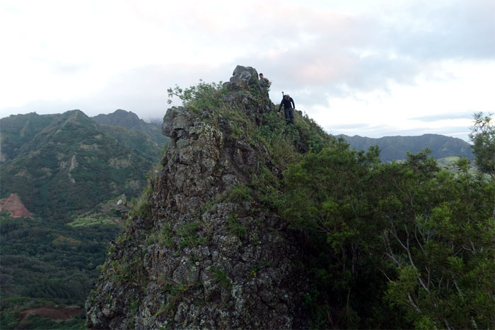
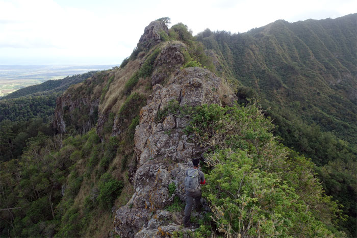
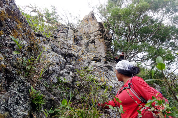
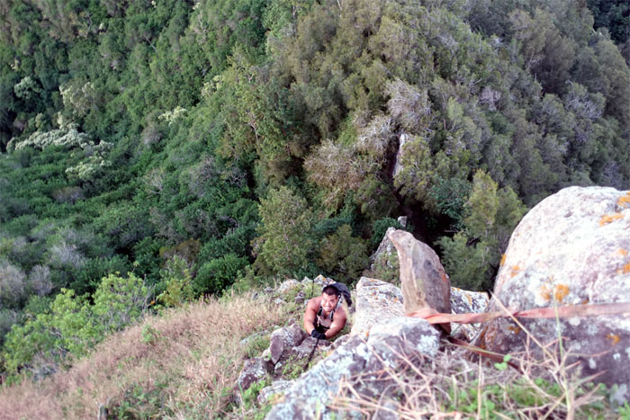
Notch
Ryan making his way over the notch.
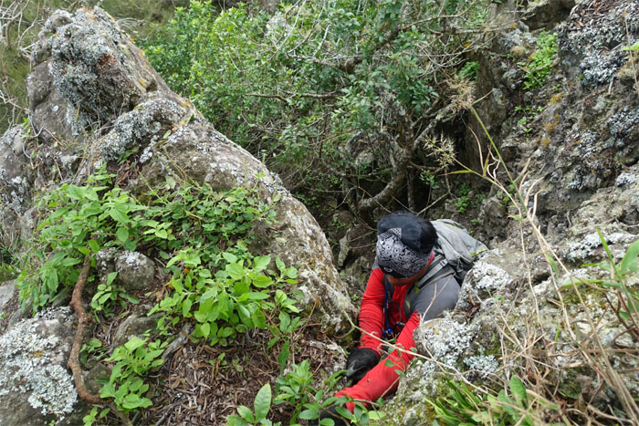
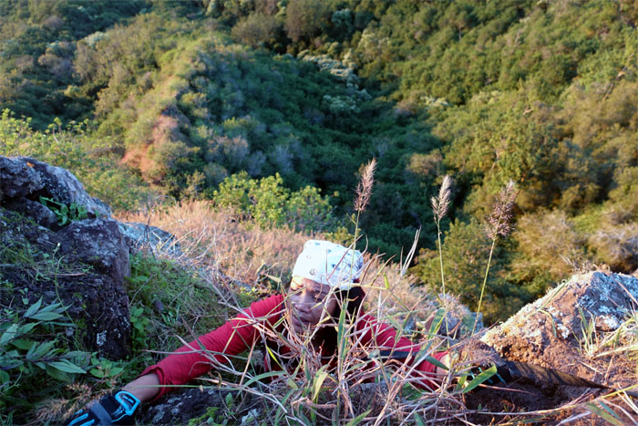
Notch
Justin climbing his way out of the smaller notch. Photo by Justin Hirako.
Looking back
Leaving Kolekole Pass, the lowest point in the Waianae Mountain Range, behind us.
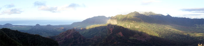
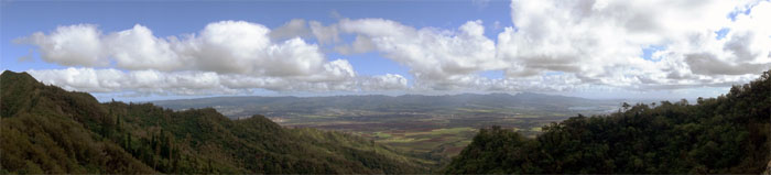
Panoramic view
Click here for the larger image.
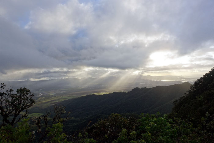
Sun beams
The sun poking through the thick clouds over the Wahiawa plain and Pearl Harbor.
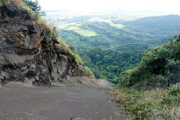
Slide trail
The fastest way to get down to the valley. Not recommended.
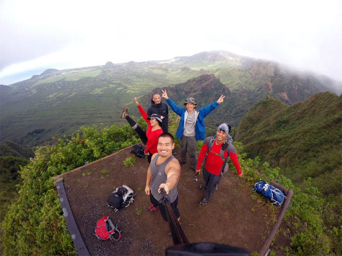
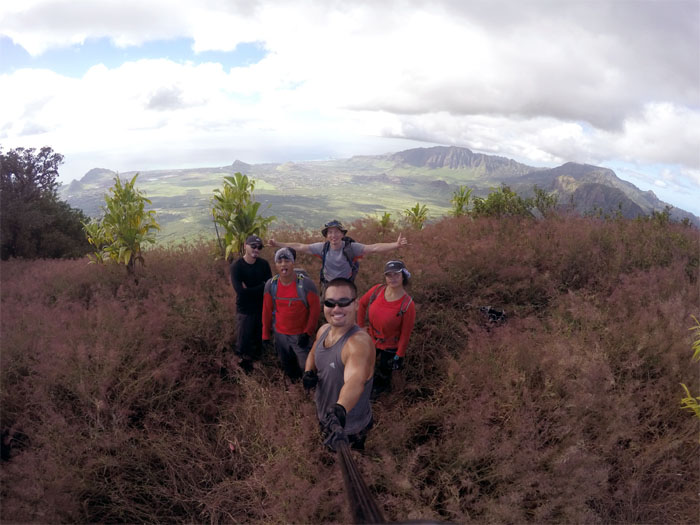
Puu Hapapa
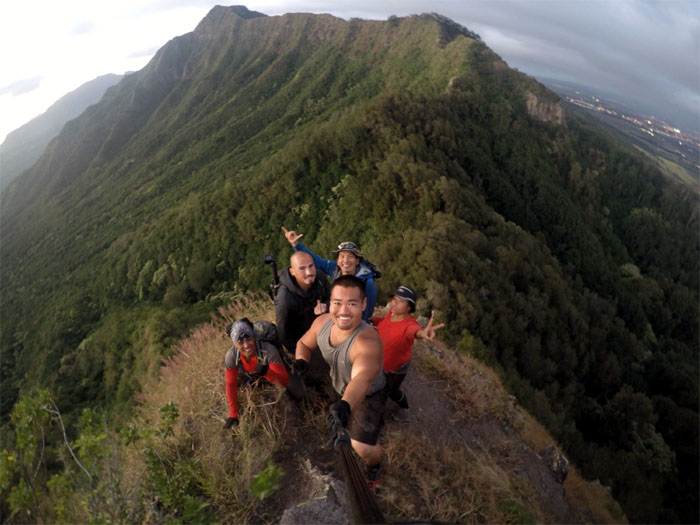
Group photo by Justin Hirako at the 2,883′ flat topped summit, left to right: Ryan, Thessa, Justin, myself and Chris.
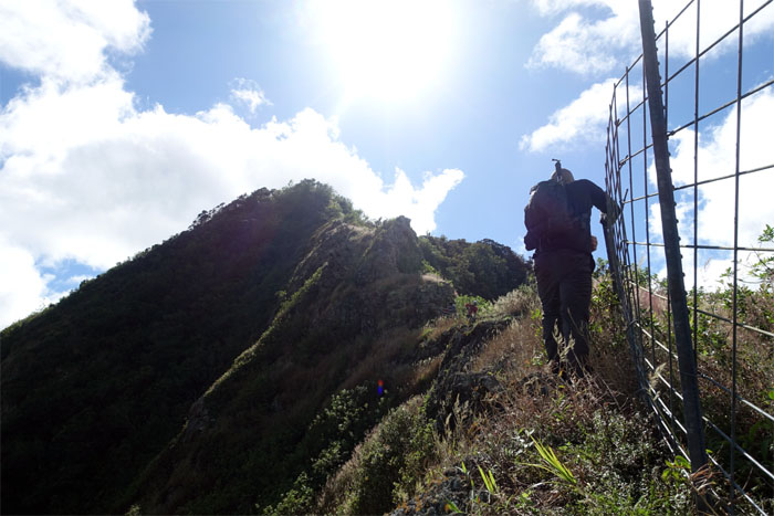
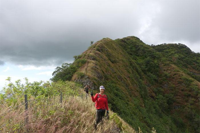
Trail
After a short break, we resumed our hike by following the fenced ridgeline.
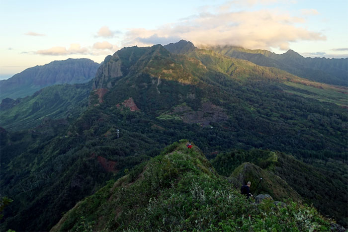
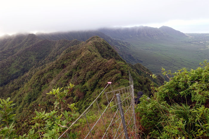
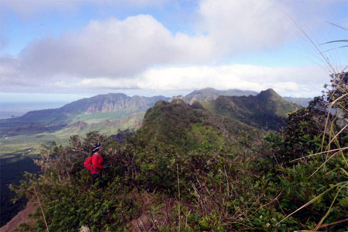
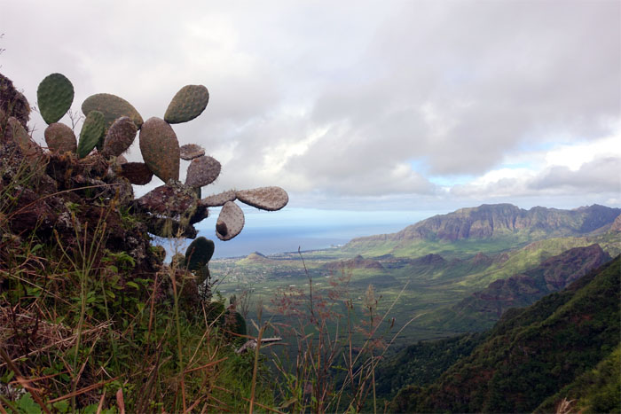
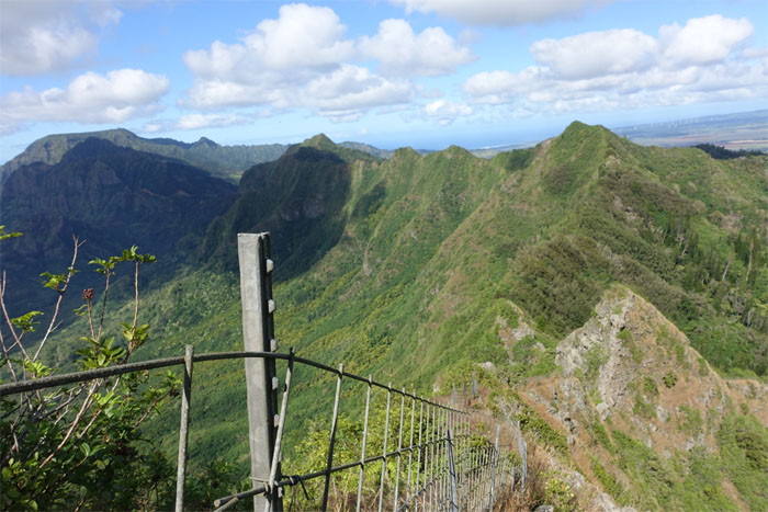
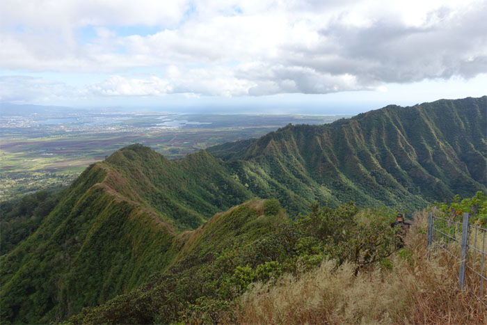
Leeward view
Looking back towards the rest of the rugged Waianae Mountain Range. Spectacular scenery all around.
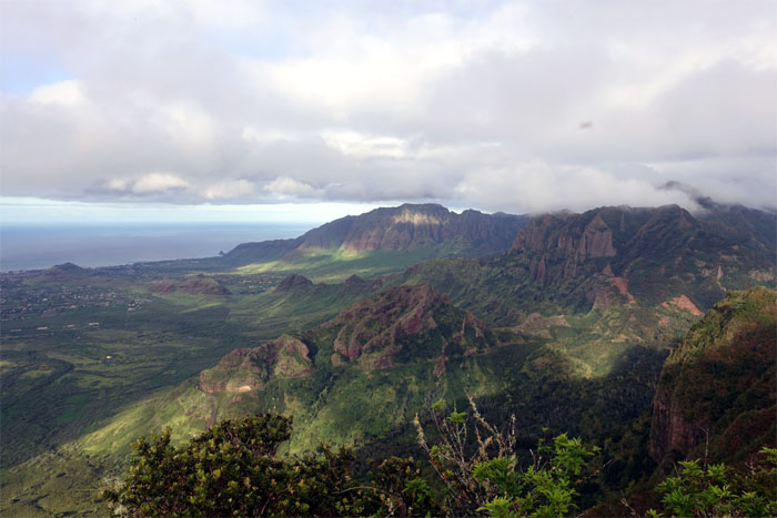
Central view
Despite the heavy cloud cover, we could see all the way out to Diamond Head. I’ll say it again. Spectacular scenery.
Trail
Multiple choice: Is Ryan a) stretching b) scratching his back or c) reaching for his gopro.
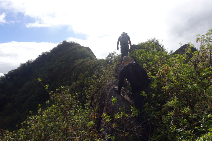
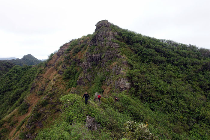
Trail
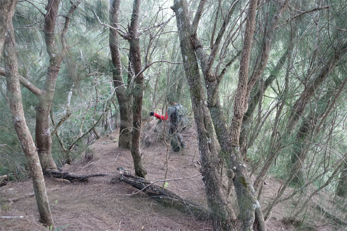
The ridge overgrowth started to get out of hand.
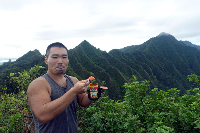
Chef Boyardee time
Who brings canned food on a hike? Justin. That’s who.
Trail
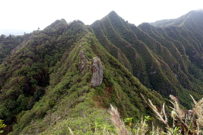
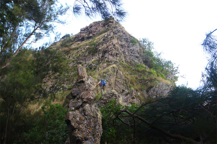
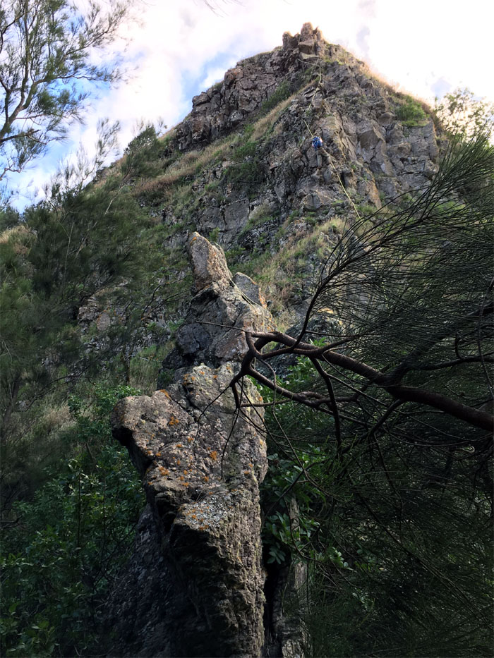
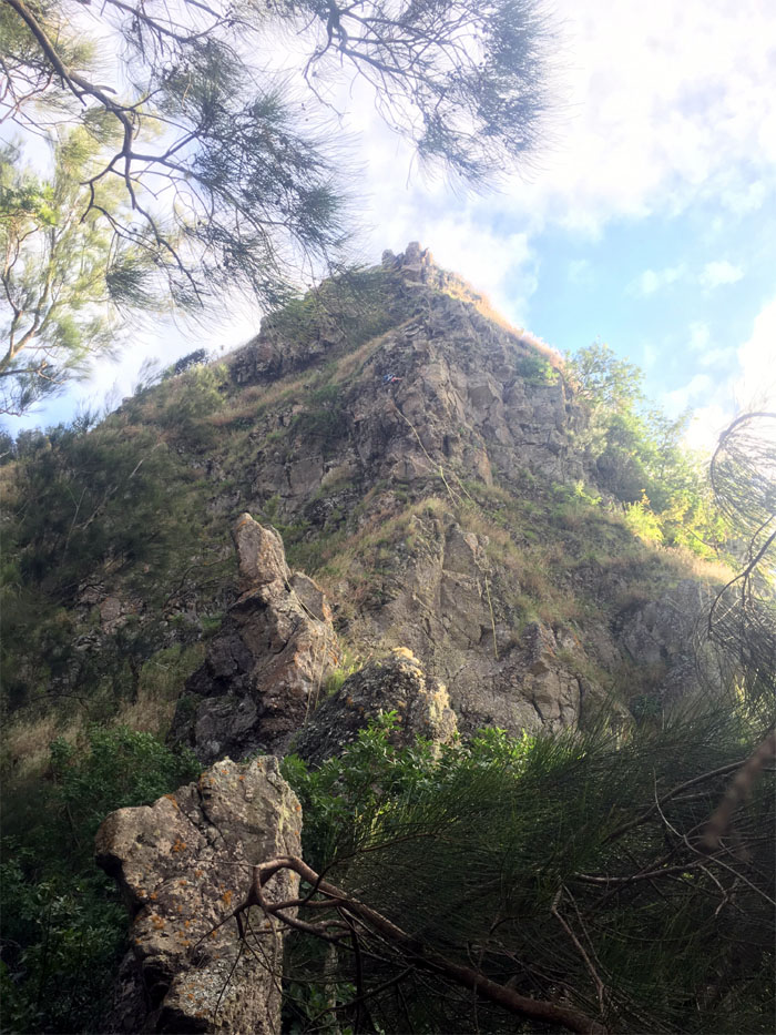
Looking down at the large rock formation straddling the ridge.
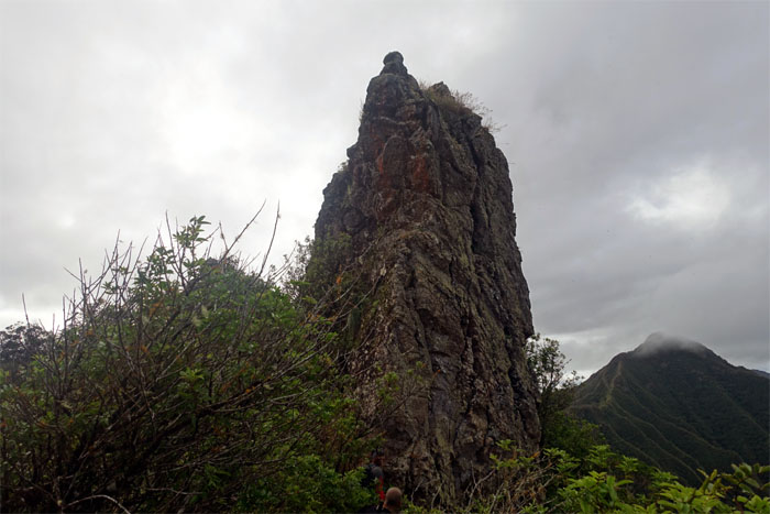
Trail
We contoured to the right of the towering rock edifice.
Trail
The jumbled and scattered boulders helped to break up the overgrowth.
Pu’u Kanehoa
Thessa enjoying the view from the 2,778′ summit.
Trail
Chris hiking through the overgrowth.
Central view
Looking out towards Lualualei Valley, the birthplace of the island of Oahu.
Looking back
Typical ridge hike composed of short ups and downs.
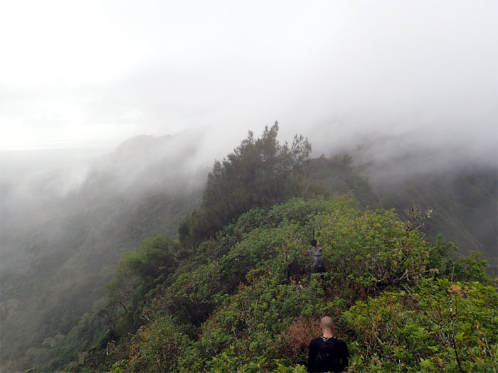
Trail
Scattered rain and rolling clouds helped to cool us down on the overgrown ridge.
Trail
The cool weather soon evaporated. At least we got our views back.

Ladybug
A seven-spotted lady beetle looking for lunch.
Panoramic view
Click here for the larger image.
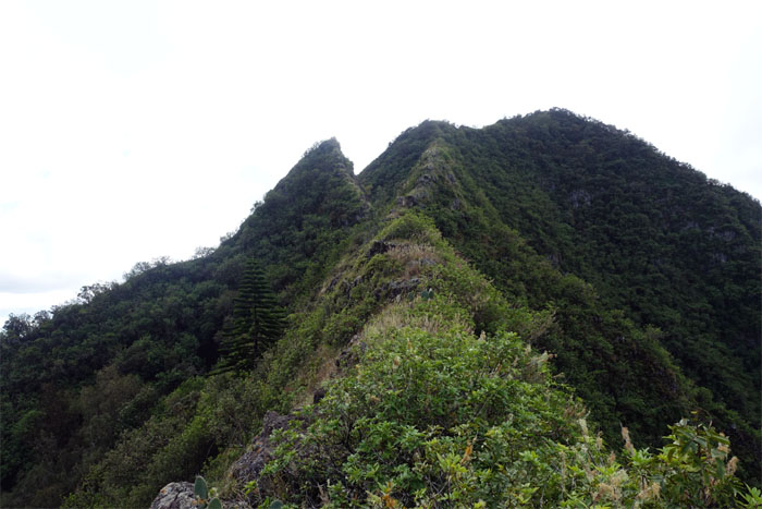
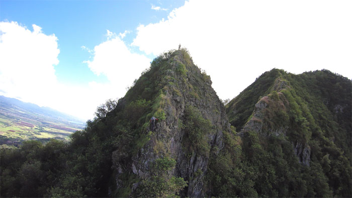
Gorilla Heads
We soon came across the rock formations known as “Gorilla Heads” or “Kriangles.”
Gorilla Heads
Looking back at Pu’u Kanehoa.
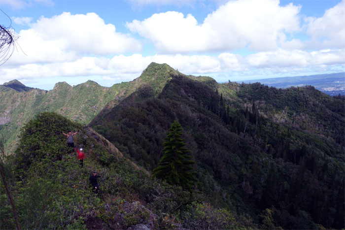
Gorilla Heads
Ryan, Thessa and Justin making their way up the first and smaller gorilla head.
Gorilla Heads
Chris climbing up to join me at the top of the second and larger gorilla head. Photo by Ryan Leano.
Gorilla Heads
Ryan and Thessa making their way up. When it was Justin’s turn, he dislodged a good sized boulder coming up. Stuck. Nothing that webbing can’t fix.
Gorilla Heads
Climbing down the backside of the larger gorilla head. Photo by Chris Bautista.
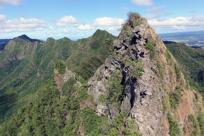
Gorilla Heads
Justin and Ryan making their way down.
Gorilla Heads
What goes down… Photo by Justin Hirako.
Trail
…must go back up.
Looking back
Leaving the Gorilla Heads behind us. It was fun.
Pu’u Kaua
Group photo by Justin Hirako at the 3,127′ summit.
Pu’u Kaua
Another group photo by Justin Hirako at the third highest peak on the island.
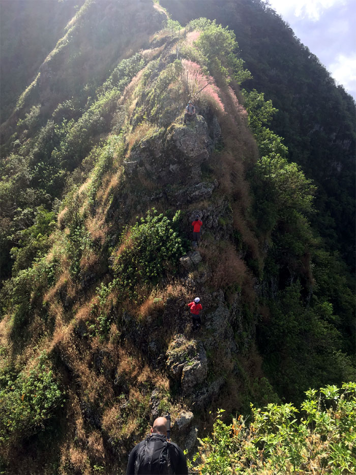
Trail
Back on the fence line. We could see Pohakea Pass in the distance.
Looking back
Leaving Pu’u Kaua behind us.
Trail
Chris and Ryan making their way down the ridge.
Trail
We didn’t have to worry about overgrowth from this point. It was going to be climbing up, over and around small and big rocks.
Trail
Up and …
Trail
… over.
Trail
Scrambling out of the small saddle.
Trail
Climb or contour?
Trail
Thessa looking back at Ryan and Justin making their way around a tree. Tight squeeze.
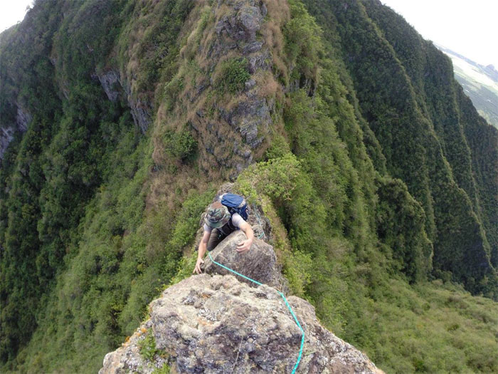
Trail
Chris climbing down the roughly 20′ rock face.
Trail
A short stretch of pine trees separated us from the pass.
Pohakea Pass
We meet again. Somebody had left their yellow rope at the pass. What the heck? Photo by Ryan Leano
Pohakea Pass
I climbed up from the base and tugged on the rope to check out the condition. Photo by Thessa Bugay.
Pohakea Pass
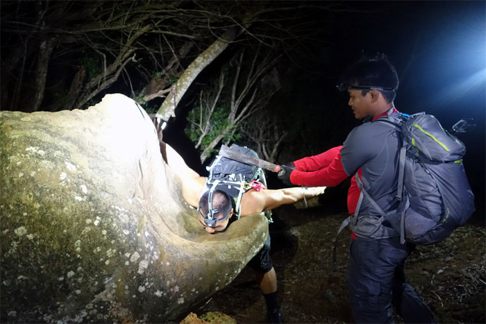
The rope quickly jerked and snapped, leaving me with a dangling rope. Luckily I didn’t have my weight on that rope. Rope left behind by others may look comforting as a form of assistance, but they are exposed to the elements 24/7 and intermittent abrasion. Conversations heard at the base “It’s not worth it mann.” Back and forth shuffling. “Let’s take the snapped rope and go back down the valley.” Photo by Justin Hirako.
Pohakea Pass
I secured my webbing at the top and threw it down to the waiting crew. NEXT!
Pohakea Pass
Looking for a helping hand. The top of the pass was crumbly. Dirt crumbly.
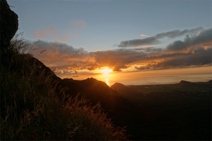
Sunset
I alternated between watching the sunset and the crew making their way up the pass. Two great views.
Pohakea Pass
Conversations from the bottom to the top of the pass. “Who’s watching the webbing?” “I am! Your life is in my hands. HAHAHA” I always like to punctuate my replies with a hearty and reassuring laugh to build confidence in people climbing up a crumbly cliff. Hanging by a webbing. Literally. At one point.
Pohakea Pass
The sound of music.
Pohakea Pass
The hardest part of the WST behind us. Group photo by Justin Hirako.
Trail
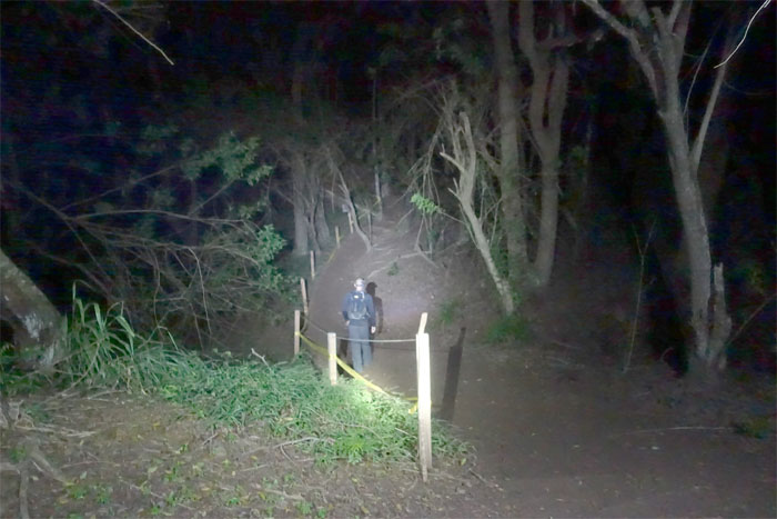
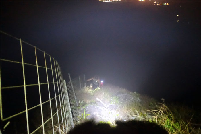
Hiking by head lamps.
City lights
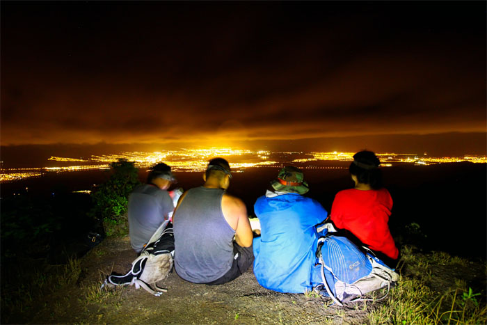
Taking a well deserved break. Loads of bushwhacking through knee to waist high uluhe ferns lay ahead of us. In the dark. Photo by Ryan Leano.
Palikea
We reached the 3,098′ summit marked by ti leaf plants. One hour left to the road. Photo by Justin Hirako.
Palehua
Too dark to look for native snails and happy face spiders. Photo by Justin Hirako
All pau
Trail meets the road. The long five mile Palehua road. Luckily we had a ride.
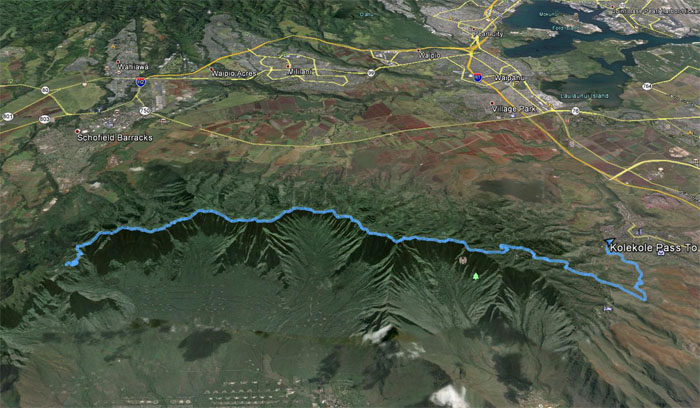
GPS Tracks
The hardest segment of the WST covered 13.03 miles of bushwhacking, rocky ridges and cliffs and spectacular scenery. Fun hike with a great crew that didn’t bail. Cough. Almost. Post hike meal at Zippys. Eat then sleep.
{ 6 comments… read them below or add one }
Thank you for another awesome adrenaline rush hike Kenji! Great write up as always!
Aloha Thessa,
Thanks for the company and joining me on our second climb up the pass. Up for a third time? Haha.
Mahalo
I was thinking about it and I’d actually do it again! I was hella tired, didn’t even know how you guys had the energy to go eat after. And who thought about bailing? Wasn’t me ????????????????????????????…. ***Bails Out***
Aloha Ryan,
Thanks for coming and not bailing out! haha. You want to do it again? Going to do the WST in one shot in May. LMK!
Mahalo
Awesome write up! I gotta start traversing the WST someday. Hard to find people that would wanna tag along with me.
Aloha Arnold,
Thanks! Yup, the WST offers stunning scenery and challenging terrain that’s a tad different from the ones you find on the KST. You also got access issues at certain points. Let me know if you need info.
Mahalo