
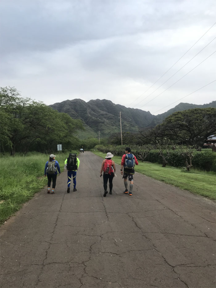
Decided to take a break from the last stormy hike and visit the nice and dry West side. Mahalo to Jasmin for dropping Chris, Ferlino, Jasmin, Lopaka, Matt and myself off at the trailhead where Janell was already waiting for us. Photo by Janell Tuttle.
Mr. and Mrs. Ed
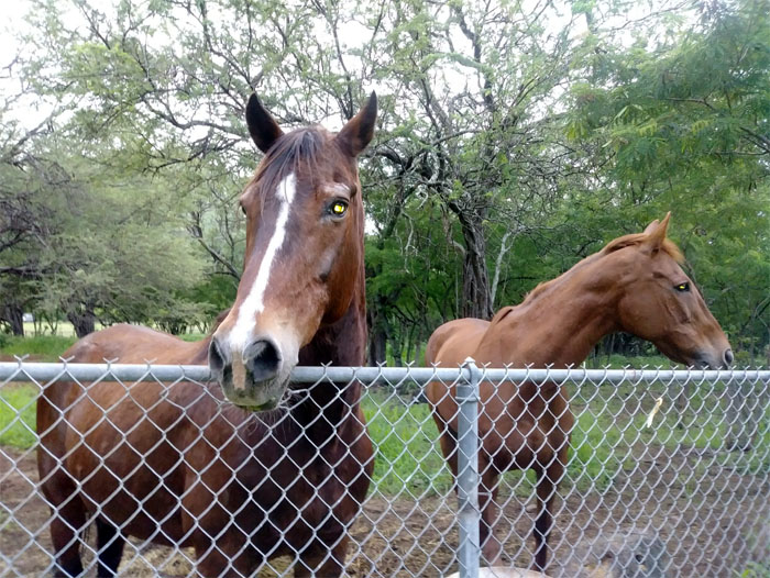
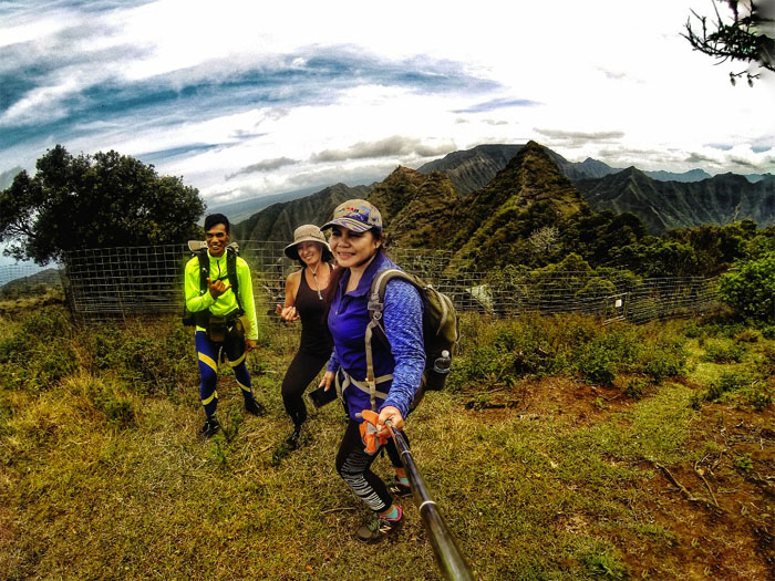
Getting friendly with the locals. Photo by Jasmin Nepomuceno.
Trail
Walking the road to the uplands. Photo by Chris Bautista.
Trail
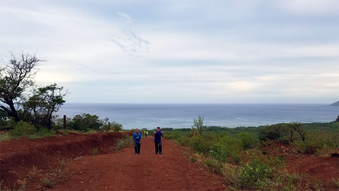
Leaving the sea behind us.
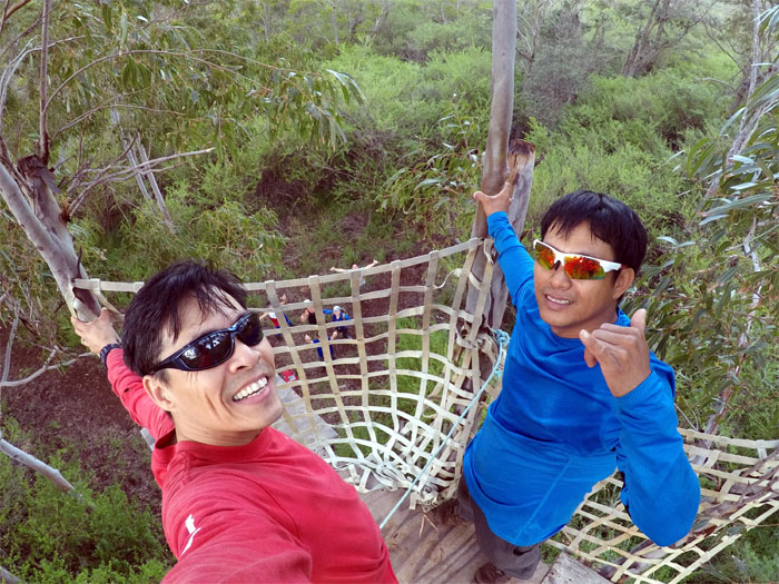
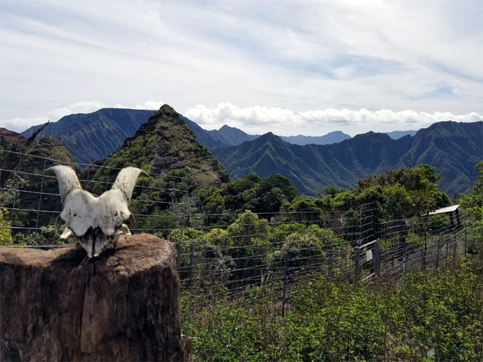
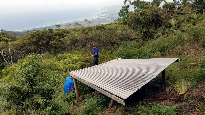
Hunter’s Stand
Chris and Matt enjoying the elevated vantage point. See any goats? Photo by Matt Vidaurri.
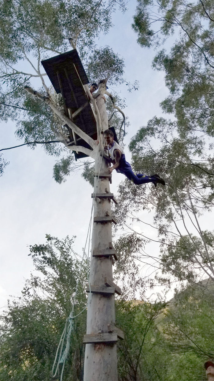
Hunter’s Stand
Ferlino planking on the tree. Who needs the stand?
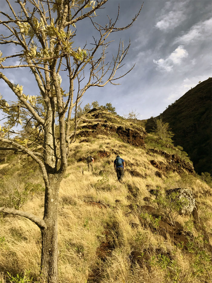
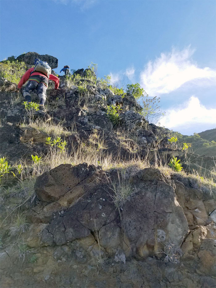
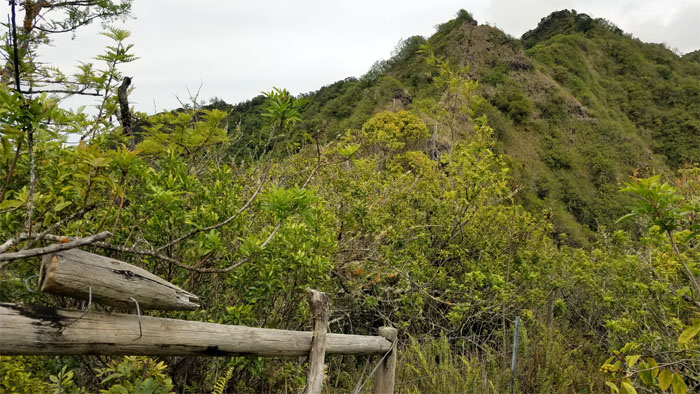
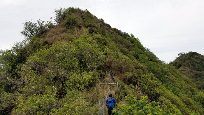
Spur Ridge
Heading up the dry grassy rocky ridge. Photo by Chris Bautista.
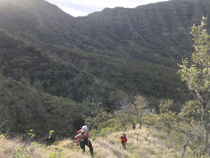
Spur Ridge
Leaving the shaded valley as we made our way up the sun bleached ridge. Photo by Chris Bautista.
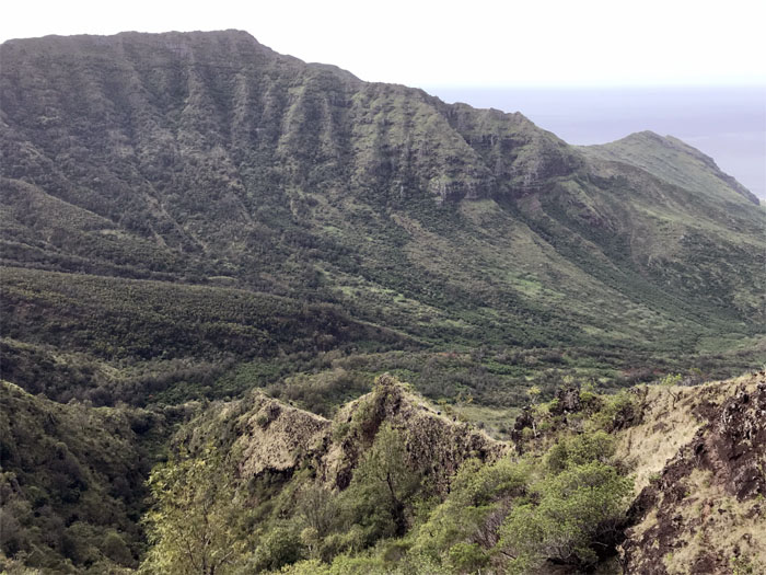
Ohikilolo Valley
Coming up the ridge, we were surrounded by goat bleatings bouncing off the valley.
Spur Ridge
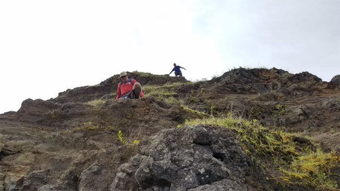
Lopaka playing King of the Hill. Photo by Chris Bautista.
Spur Ridge
Our final push to the top of the ridge. Photo by Janell Tuttle.
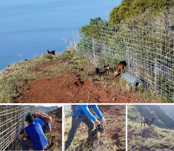
PETA
Chris’s bathroom break startled a goat who ran head first into the fence and promptly got stuck much to his dismay. His buddies scampered off when they saw us approaching, thinking it was nice knowing you. Chris and Lopaka freed the goat who immediately took off down the ridge.
Spur Ridge
Ferlino decided to keep Jasmin company on the journey to the cabin, so we split into two groups. Photo by Chris Bautista.
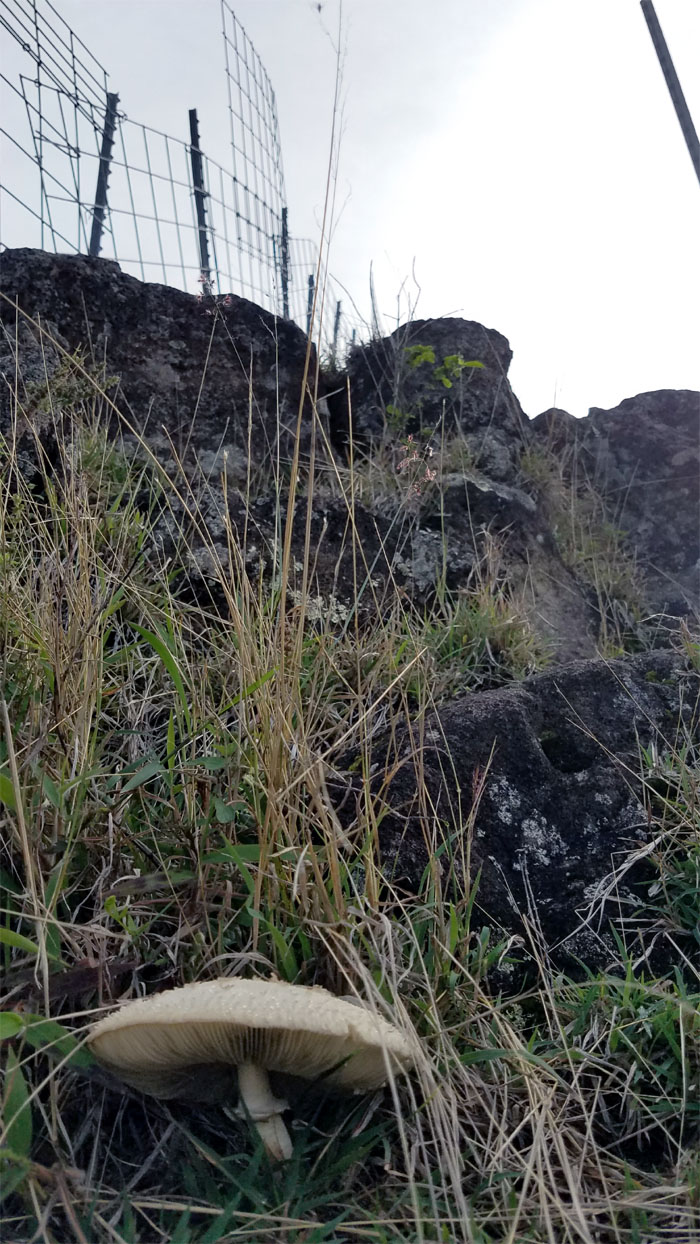
Morning Mushroom
Recreational fungus for recreational hiking?
Makua Valley
Looking back into the valley where landscapers fear to tread.
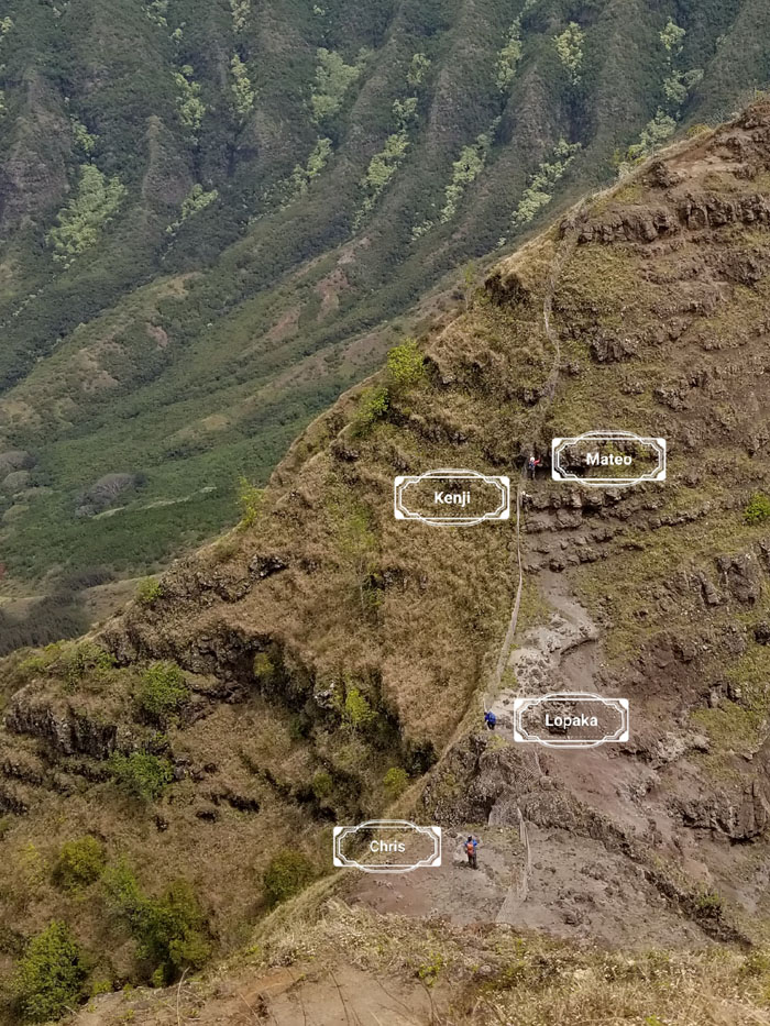
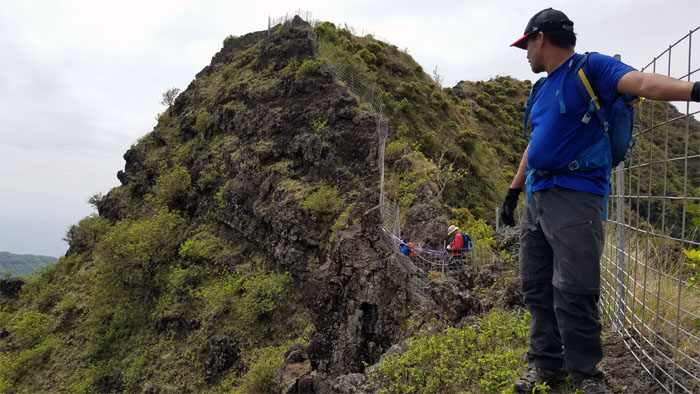
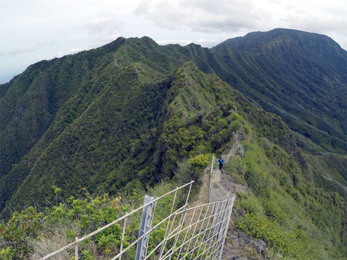
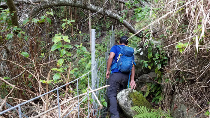
Ohikilolo Ridge
Tube man on the ridge.
Ohikilolo Ridge
Chris and Lopaka detouring around a wrecked fence section due to a rock slide. It was around this section that a bunch of bees were pollinating flowers on the other side of the fence, when some of them decided to bombard me with their suicidal stinging. My flailing around was unfortunately not caught on camera.
Helipad
Cleared to land.
Helipad
Pick me up too!
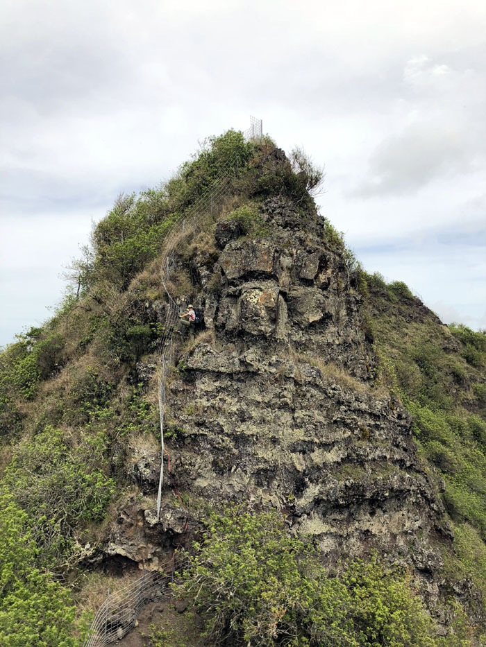
Ohikilolo Ridge
The ridge started to turn from red brown to dark green, a sign that we were getting near the summit.
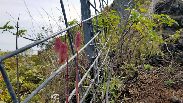
Balloon Flowers
I remember these from small kid time, at least that’s what we used to call them.
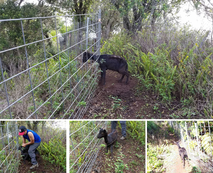
PETA
Not another one? This one actually pissed itself before being freed by Lopaka.
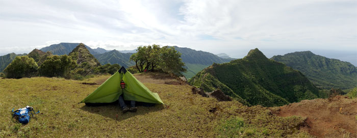
Ohikilolo
Lopaka test tenting my camping shelter. Sold!
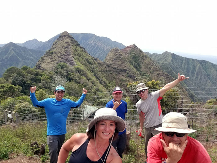
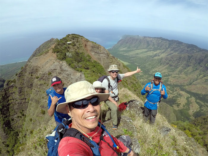
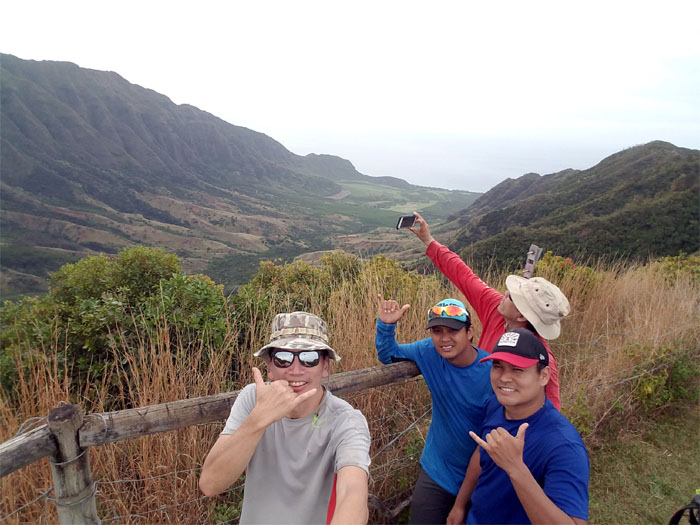
Ohikilolo
Group photo above the cabin left to right: Chris, Janell, Lopaka, myself and Matt.

Ohikilolo
One was closed and the other open for business.
Ohikilolo
Janell decided to wait at the cabin for Ferlino and Jasmin.
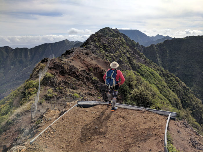
Ohikilolo Summit
I guess somebody changed their mind. Photo by Matt Vidaurri.
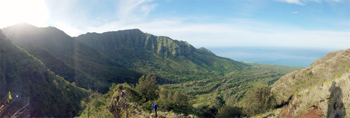
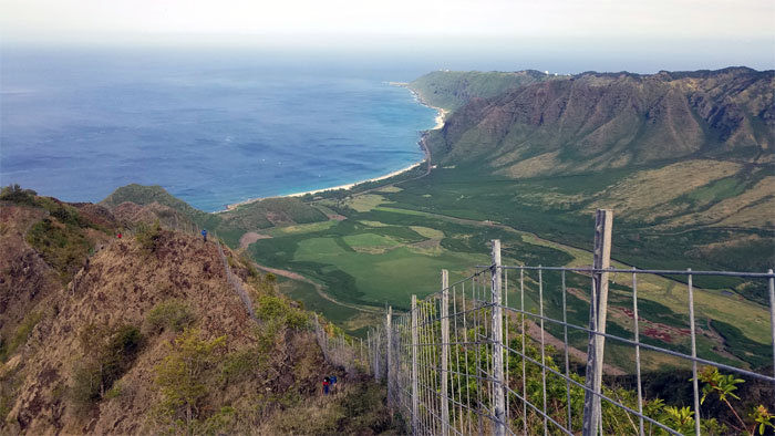
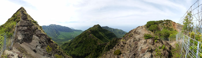
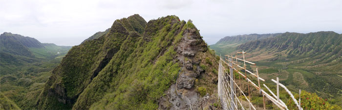
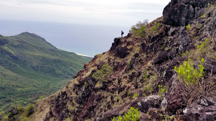
Ohikilolo Summit
Panoramic view of Makaha, Ohikilolo and Makua Valleys from the top.
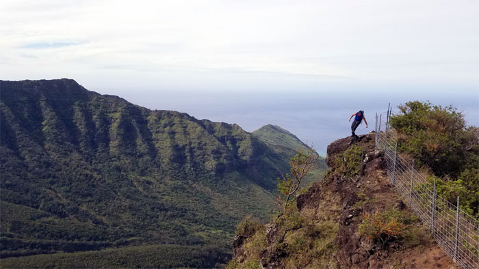
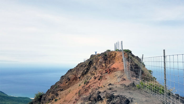
Ohikilolo Summit
We took our leave of the 3,052′ summit and Janell. Photo by Chris Bautista.
Ohikilolo Summit
Matt and Lopaka coming down the crumbly backside.
Ohikilolo Summit
Name tagging on the ridge. Photo by Janell Tuttle.

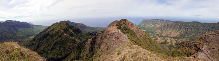
Ohikilolo Valley
Looking into the depression that separates Makua and Makaha Valleys. Photo by Chris Bautista.
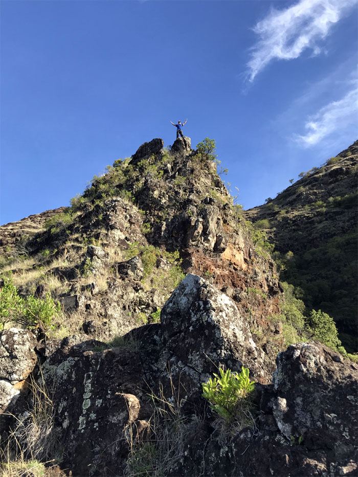
Ohikilolo Ridge
Leaving the peak with our brains intact. Photo by Matt Vidaurri.
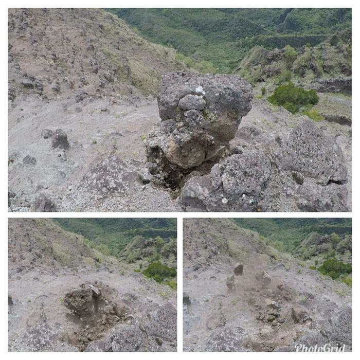
Geology 101
How big rocks are made into little rocks. Photos by Matt Vidaurri.
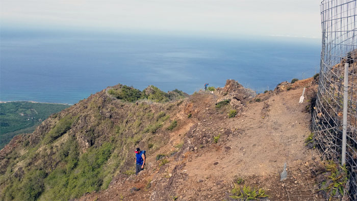
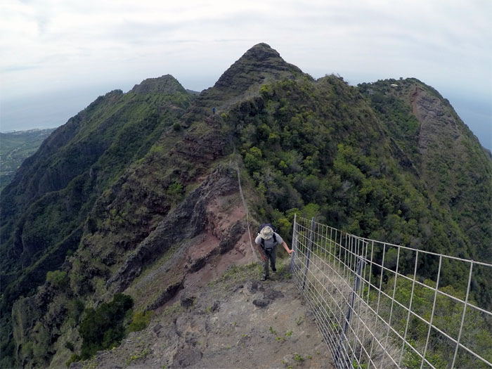
Ohikilolo Ridge
Peering over the crumbly wall of Ohikilolo. Photo by Chris Bautista.
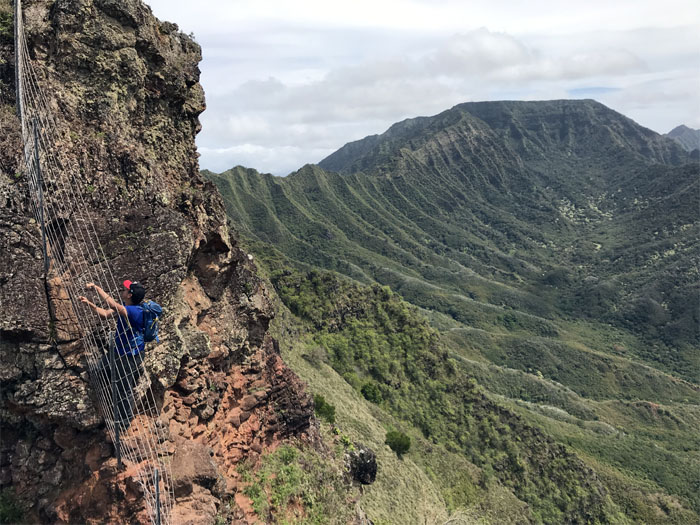
Ohikilolo Ridge
Riding the rock dragon with the sweeping vista of Ka’ala in the background.
Ohikilolo Ridge
Lopaka climbing the fence or the ridge down?
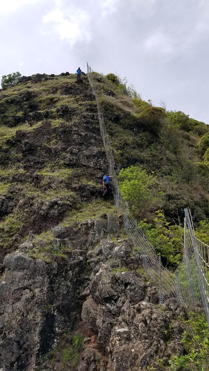
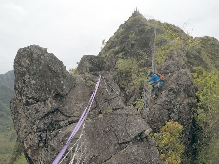
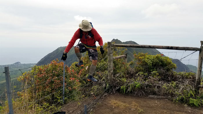
Ohikilolo Ridge
Hindrance … Photo by Chris Bautista.
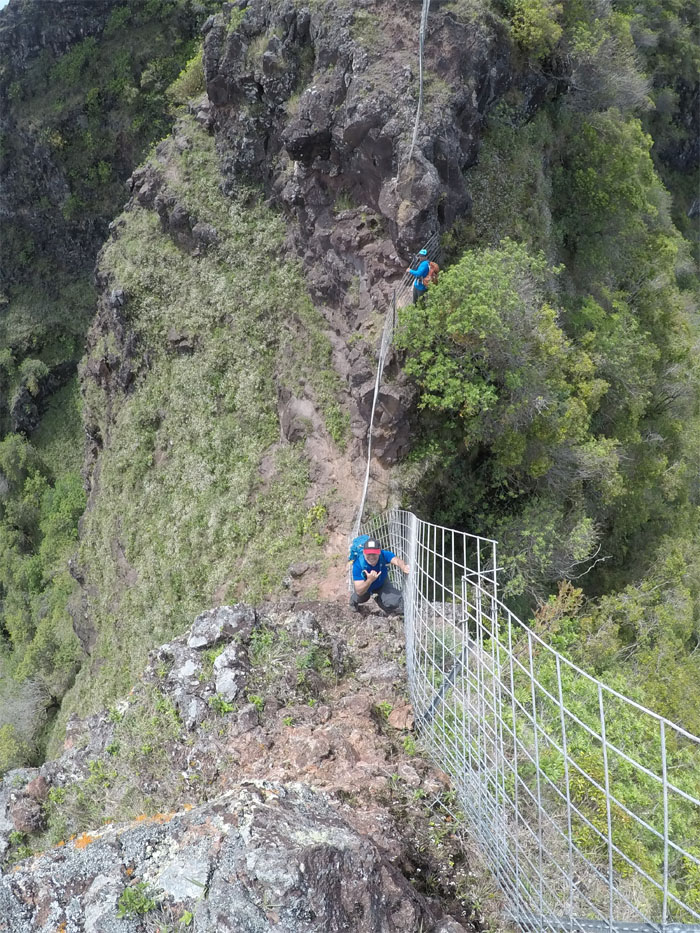
Ohikilolo Ridge
… or help? Jury is still out in my book. Photo by Matt Vidaurri.
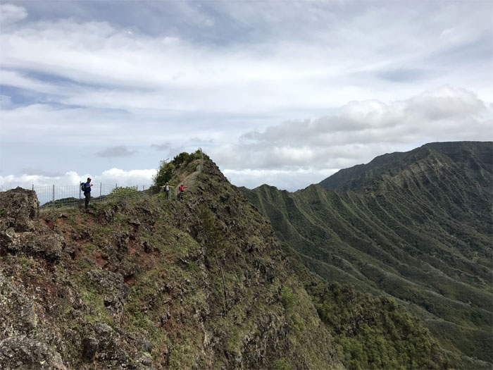
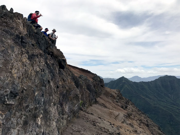
Ohikilolo Ridge
Standing on a sliver of a ridge. Photo by Chris Bautista.
Ohikilolo
Meanwhile, Ferlino and Jasmin caught up to Janell at the hill above the cabin.
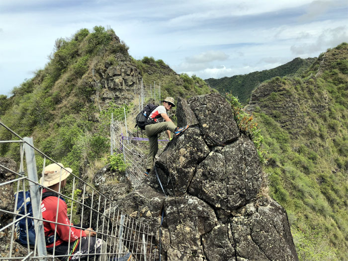
Ohikilolo Ridge
Contouring around the boulder. Photo by Lopaka Hipperson.
Ohikilolo Ridge
What does that look like? Two ears? Photo by Matt Vidaurri.
Ohikilolo Ridge
Can you see the ape for the rocks?
Ohikilolo Ridge
Climbing up the steepest rock section. Photo by Lopaka Hipperson.
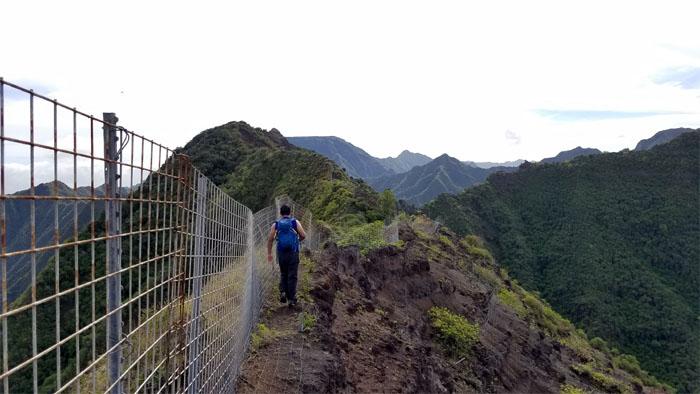
Ohikilolo Ridge
Looking back. Fences for daze.
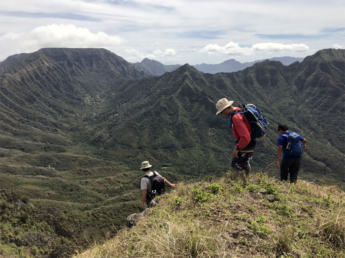
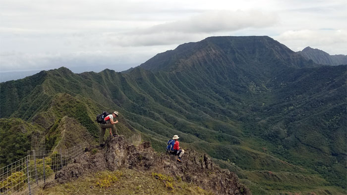
Ohikilolo Ridge
Heading to greener ridges. Photo by Matt Vidaurri.
Ohikilolo Ridge
Rodent country.
Three Corners
Matt climbing over the fence to the spot that provides triple valley views.
Spur Ridge
Meanwhile, Janell and Jasmin were making their way down the ridge into the valley. Photo by Ferlino Carinio.
H20
Filling up our water bottles for the last leg home.
Waianae Summit Trail (WST)
The fence turned from a necessary handhold to more of a navigational and invasive barrier on this trail section.
WST
Lopaka making his way around the many assorted boulders that littered the fenced side of the ridge.
Mokuleia Lookout
I guess somebody wanted their own selfie.
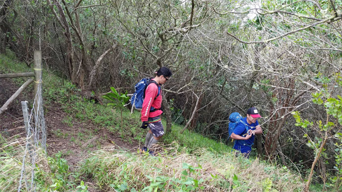
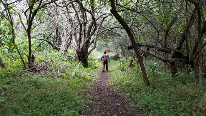
Mokuleia Trail
Getting off the WST.
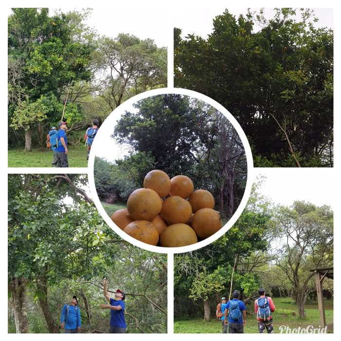
Whole Foods
Oranges. Tangerines. Tangelos. Whatever it was, this tree was brimming with the coldest, juiciest and sweetest citrus fruits I’ve tasted in awhile. Hiking all day may have had something to do with my taste buds interpretation.
Mokuleia Trail
Our packs, some more than others, weighed down with our fruit bounty as we made our way down the trail.
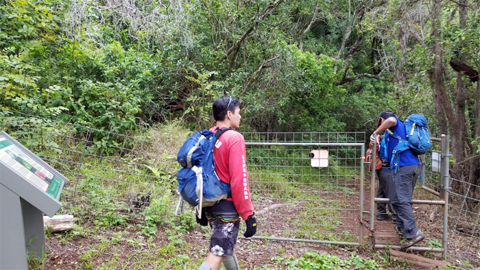
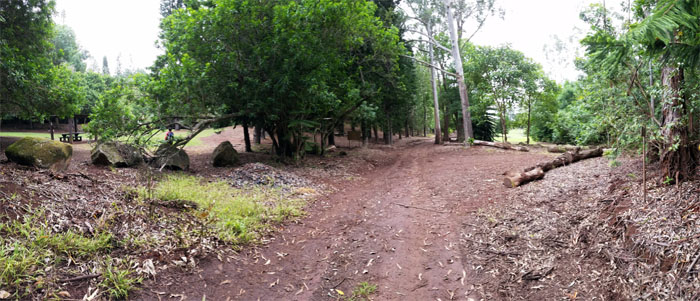
Pahole Natural Area Reserve
Leaving the sprawling 658 acres that are home to endemic fauna and flora.
Peacock Flats
Nobody around to give us a ride down.
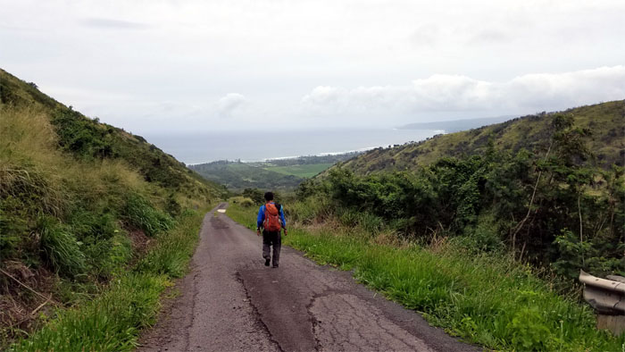
Farrington Hwy
The long walk down the 3.5 mile road.
All pau
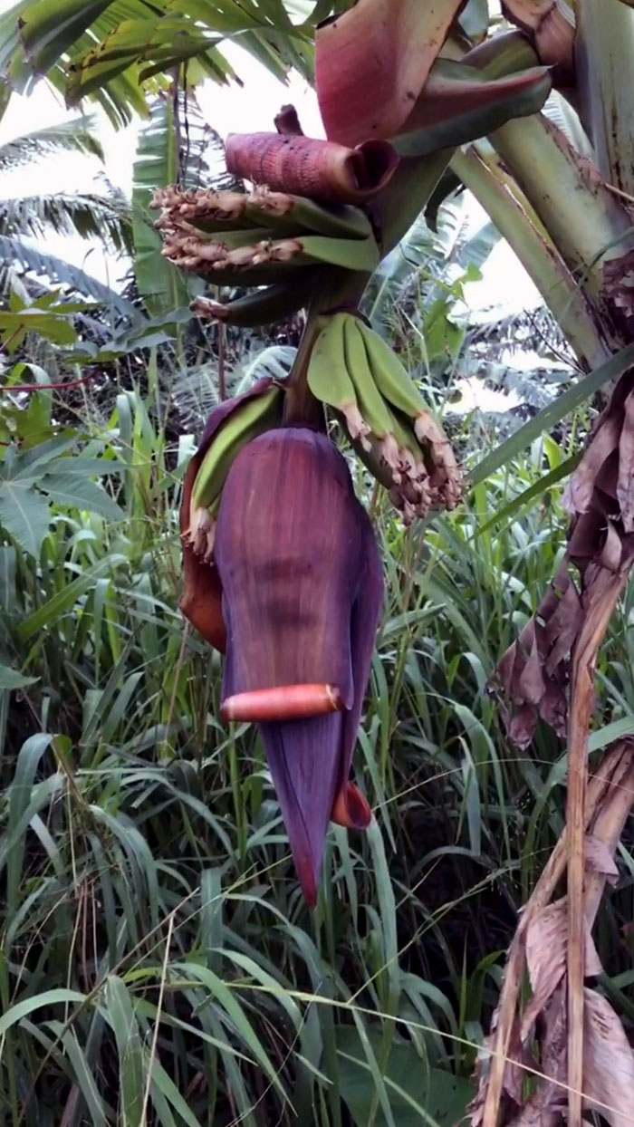
Banana, Coconut and Papaya trees lined the road as we exited to Chris’s staged van. Free range chickens also roamed the road. We had all the fixings of a hearty meal.
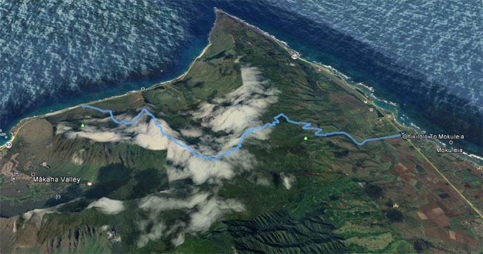
GPS Tracks
Our coast to coast hike covered a little over 11 miles complete with undomesticated ungulates, organic fruits and the company of good friends. Post hike meal at Restaurant Kunio. The wait was too long, but too tired to go elsewhere.
Note: I have been made aware that some hikers have been using my blog as a hiking guide and getting lost on the trails. Please note that this blog was made to document the hike for the crew(s) that did it. That is why some of my comments will seem to have no relevance or meaning to anybody outside of the crew(s) that hiked that trail. My blog was never meant as a hiking guide, so please do not treat it as such. If you find inspiration and entertainment from these hikes, that is more than enough. If you plan on replicating these hikes, do so in the knowledge that you should do your own research accordingly as trail conditions, access, legalities and so forth are constantly in flux. What was current today is most likely yesterdays news. Please be prepared to accept any risks and responsibilities on your own as you should know your own limitations, experience and abilities before you even set foot on a trail, as even the “simplest” or “easiest” of trails can present potential pitfalls for even the most “experienced” hikers.
{ 0 comments… add one now }