
Permits in our phone, Quan and I left our Airbnb a little early to get a jump on Yosemite’s most iconic hike. Jasmin and Mari stayed behind to relax and recuperate and enjoy the wildlife from the living room window.
Mist Trail
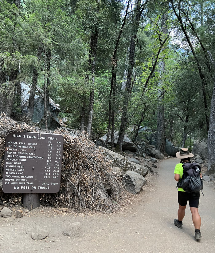
We parked in the backpackers lot nearby Curry Village and walked to the trailhead to begin our hike. Only 8.2 miles to our destination!
Mist Trail
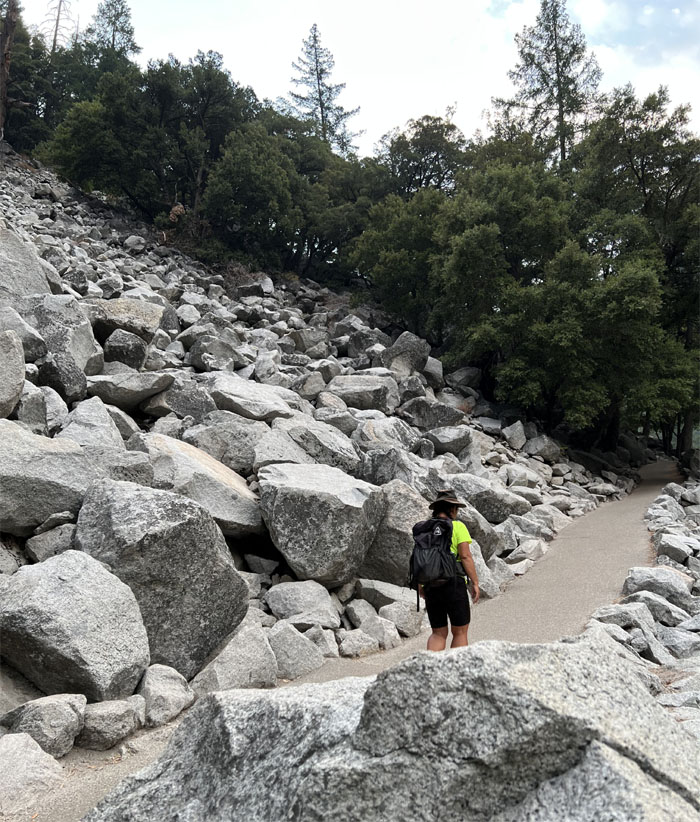
Passing through the avalanche field.
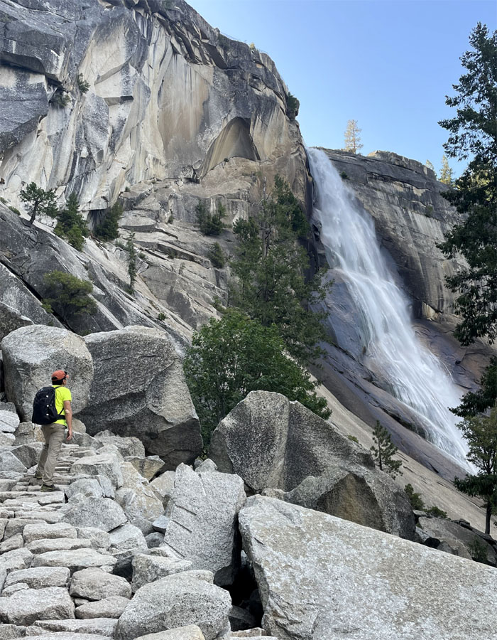
Mist Trail
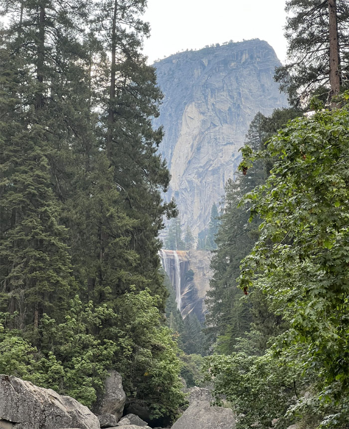
Catching a glimpse of one of the few waterfalls in the park that can’t be seen from the valley floor by car. You have to hike to the base of the falls to experience the flowing waters going over the cliff.
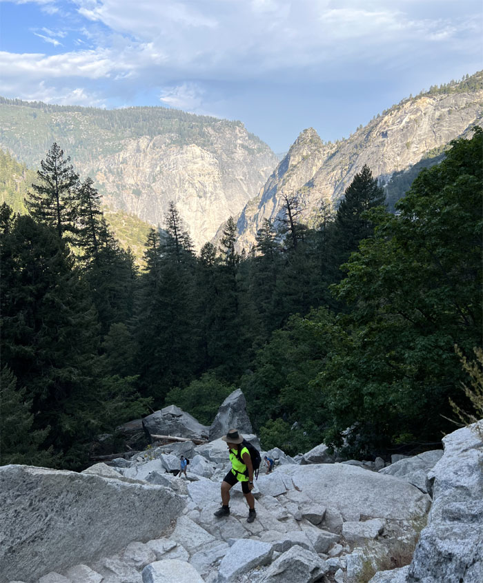
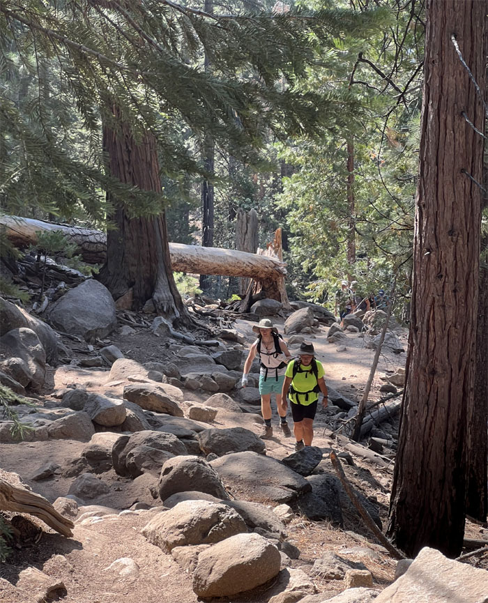
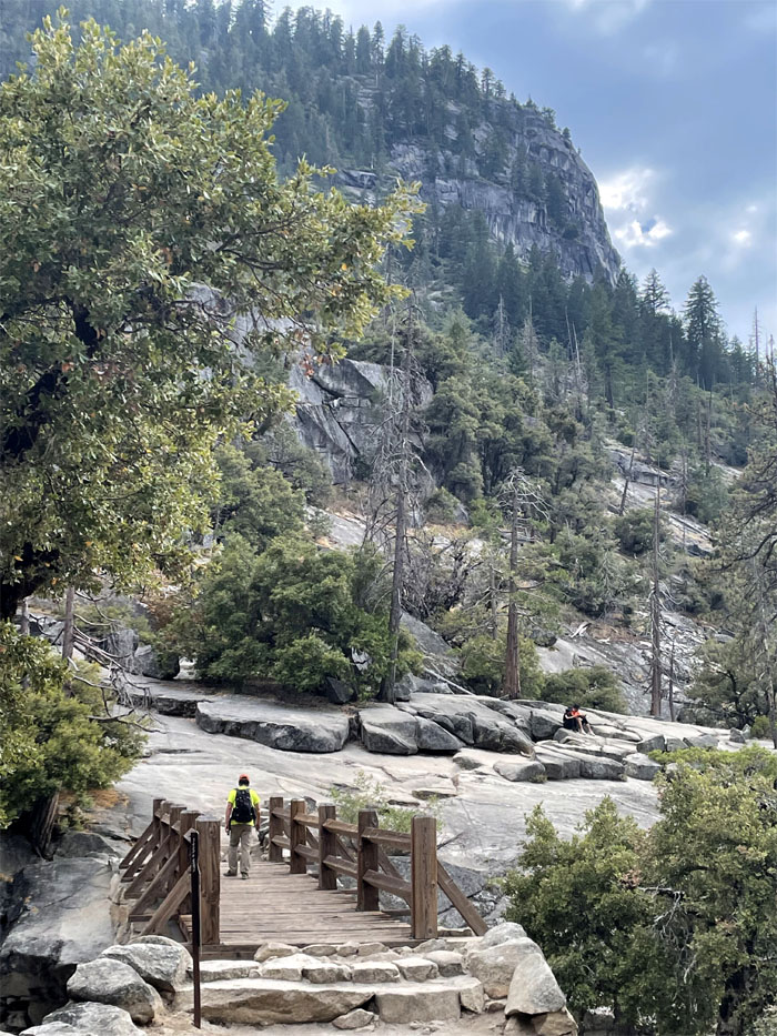
Mist Trail
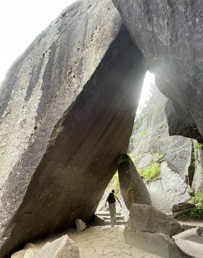
Going through a passageway in the massive granite boulders.
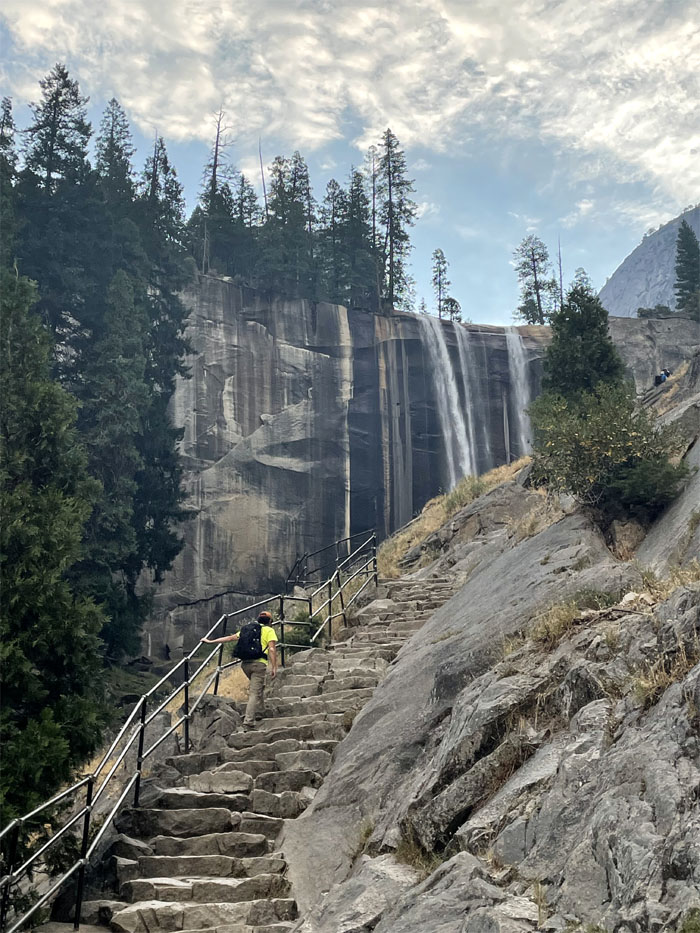
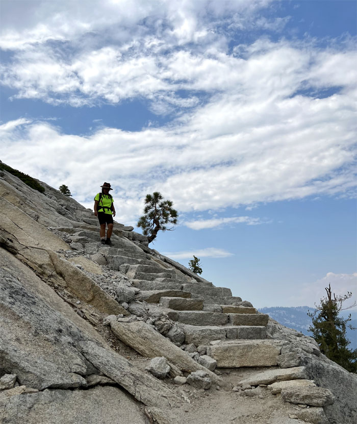
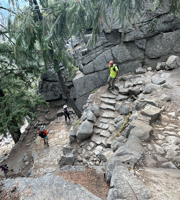
Vernal Fall
Walking up the “grand staircase” to the fall.
Vernal Fall
Quan soaking in the views of the waterfall without getting misted, as the volume of water was substantially reduced from spring time and the usual curtain of water was split into several strands.
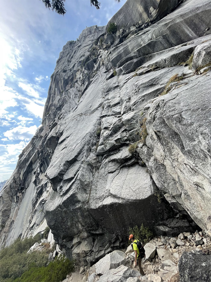
Vernal Fall
Standing on the uneven trail cut into the side of the mountain.
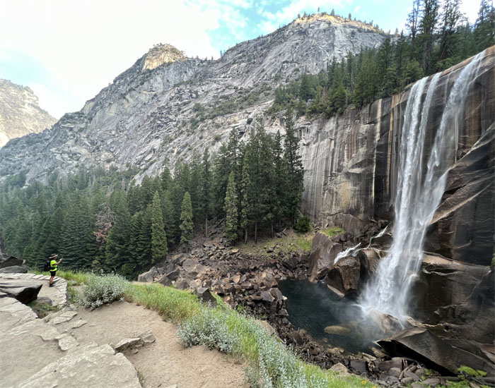
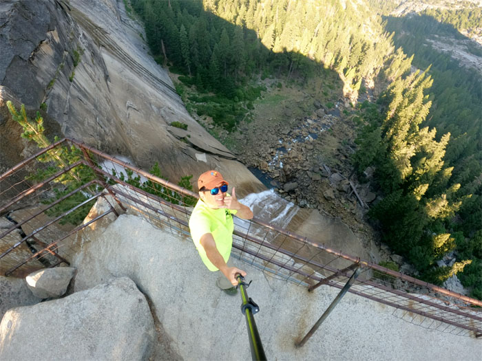
Vernal Fall
Top of the 317′ waterfall plunging down into Merced River.
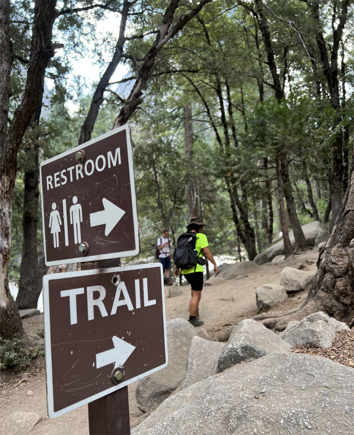
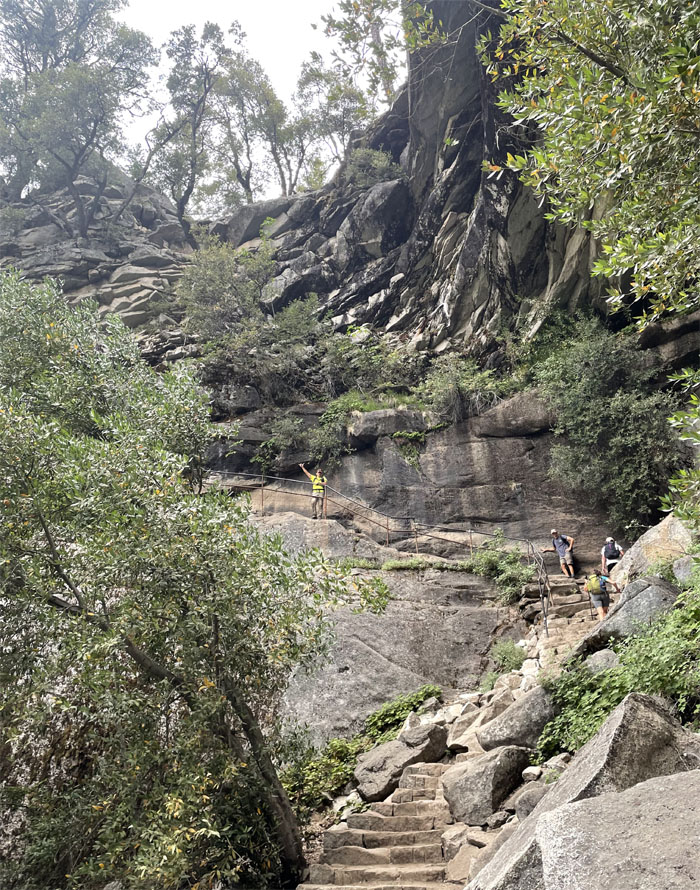
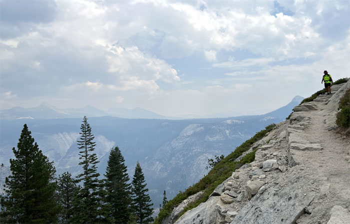
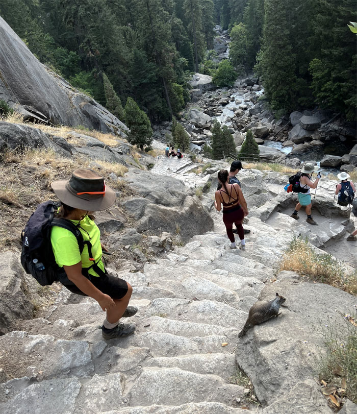
Mist Trail
Passing Emerald Pools on our left and bathrooms on our right.
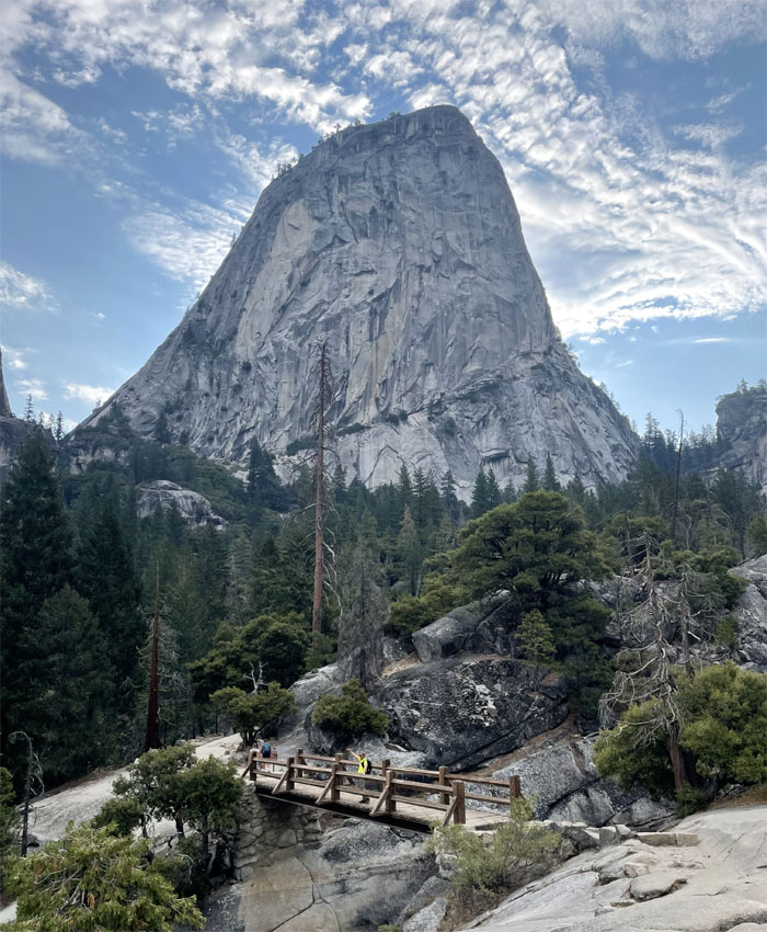
Mist Trail
Crossing the Silver Apron Bridge with Liberty Cap in the background.
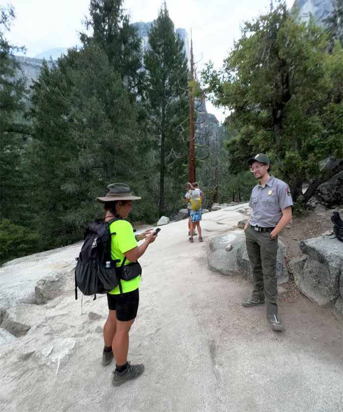
Mist Trail
Quan talking about her imaginary friends to the park ranger. The people I meet on this job.
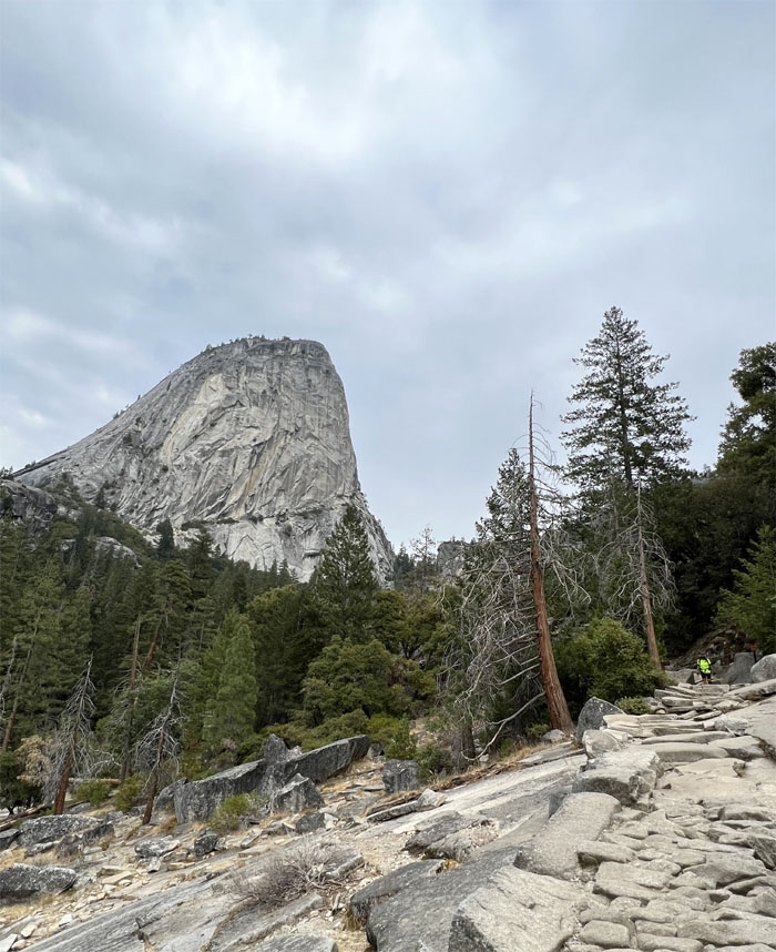
Nevada Fall
Hiked in the tree line for a bit before breaking out to the canyon and approaching the falls that the natives originally called Yo-wy-we, which refers to the twisting of the falling water.
Mist Trail
Quan making her way up and over the granite steps and boulders.
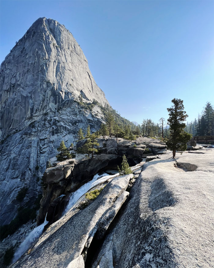
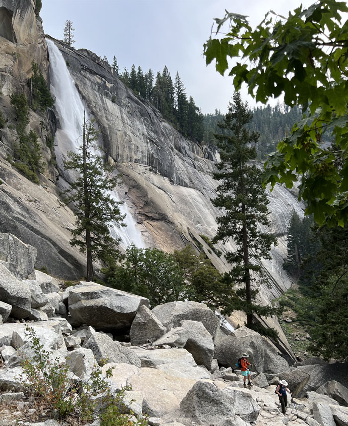
Nevada Fall
Top of the 594′ waterfall. It was named “Nevada” by a member of the Mariposa Battalion as they were in close proximity to the Sierra Nevada and the turbulent whitewater crashing down on the rocks resembled an avalanche of snow.
Nevada Fall
It soon dawned on me after waiting for over 30 minutes, as I’m a slow learner, that Quan was not coming to the falls and must have continued on the trail. A phone call that finally connected, confirmed the obvious.
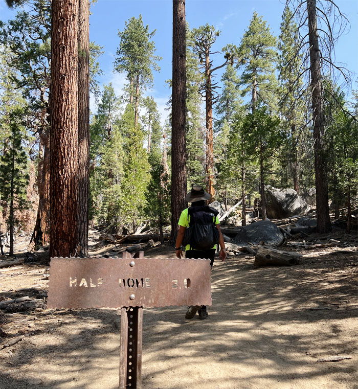
John Muir Trail
I rushed as fast as my slow legs would take me on the trail to catch up with Quan and her three new college friends from Kentucky she had met on the trail; Jack, Mia and Faith. They decided to tag along with us as they didn’t have permits for the cable half dome. Lucky for them, we had three extra permits.
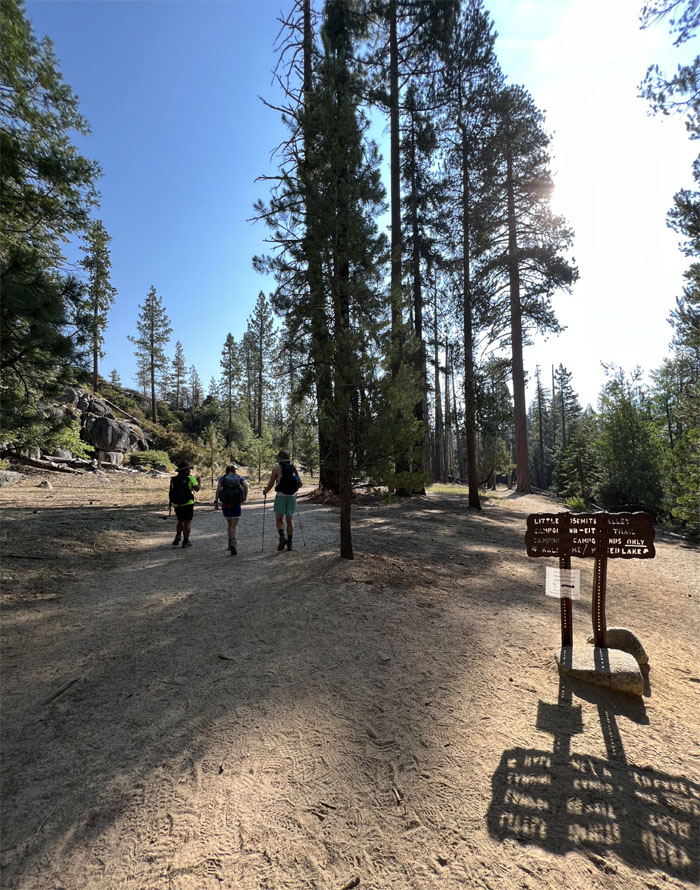
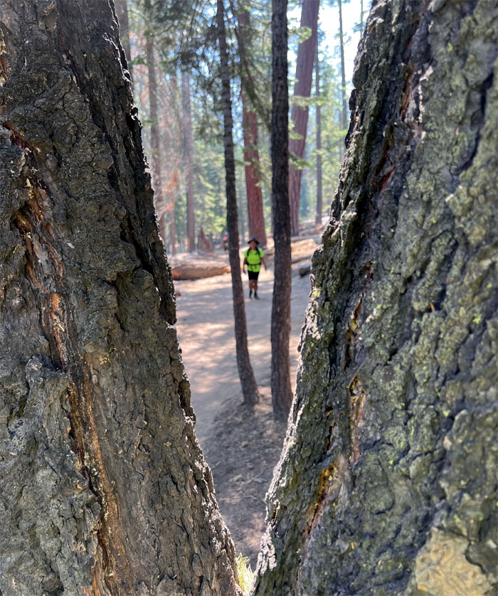
John Muir Trail
The walk through the valley was mostly flat, which soon changed as we started to gain elevation through the forest of Sequoia trees.
John Muir Trail
The high elevation had eventually taken its toll on Faith who elected to stay behind and wait for our return trip.
John Muir Trail
The rooted dirt trail soon gave way to the unyielding granite ground.
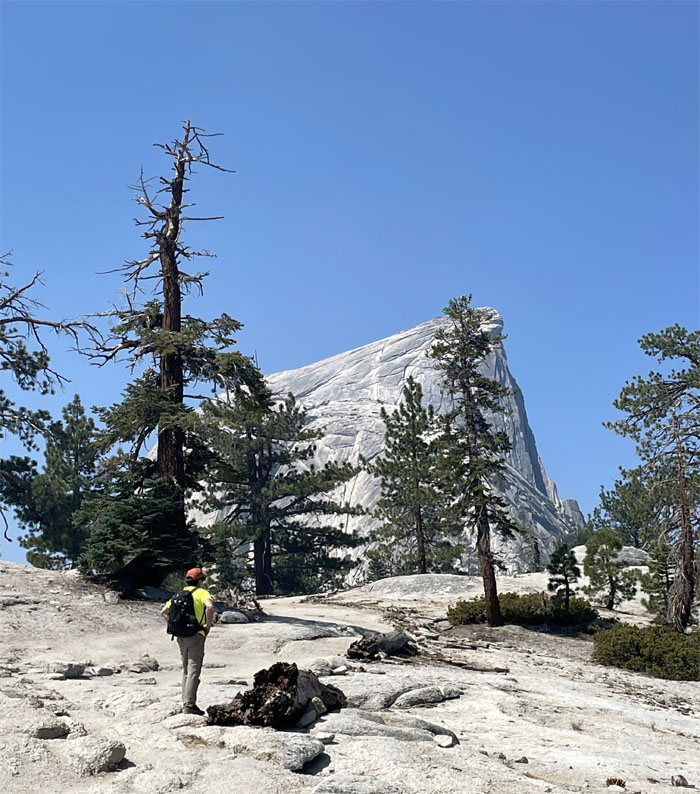
John Muir Trail
Approaching the granite dome that was deemed “perfectly inaccessible” until it was ascended in 1875 by George Anderson who took days on end drilling holes into the granite rock to place eyebolts to assist with his climb up the dome.
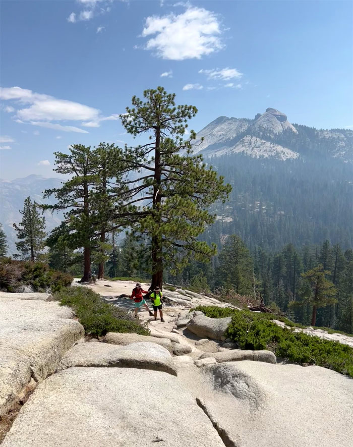
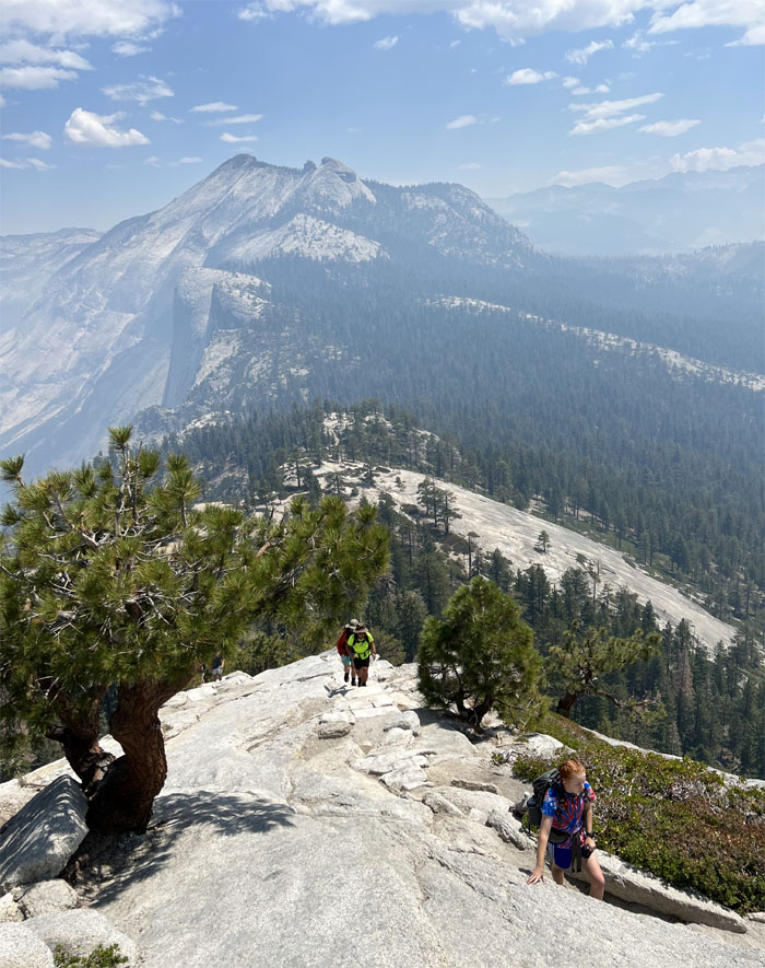
John Muir Trail
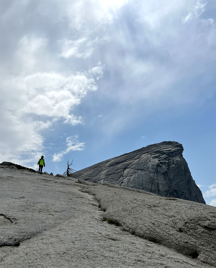
Leaving the treeline in the distance as we advanced towards our objective.
Subdome
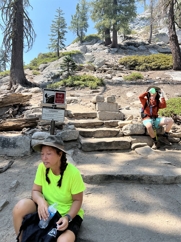
We took a small break at the base of the subdome. Is this where we show our permits?
Subdome
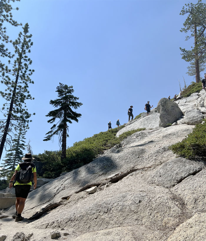
Starting off on our 600′ climb towards Half Dome.
Subdome
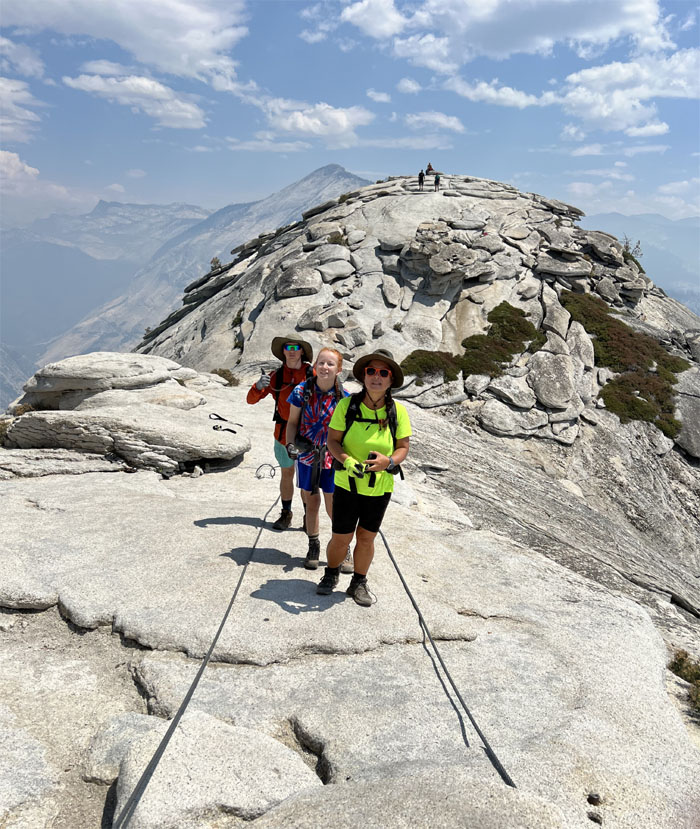
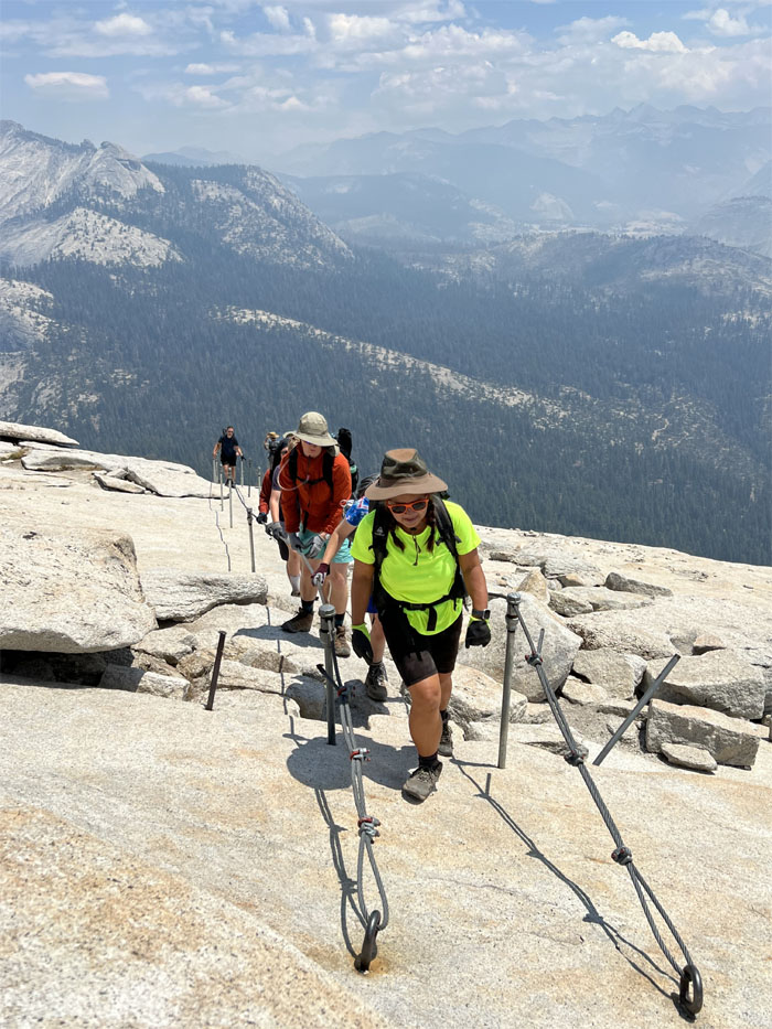
Quan and Jack making their way on the granite steps that switch backed their way up the subdome.

Subdome
Are we there yet?
Subdome
The stairs soon gave way to a somewhat steep grade of granite.
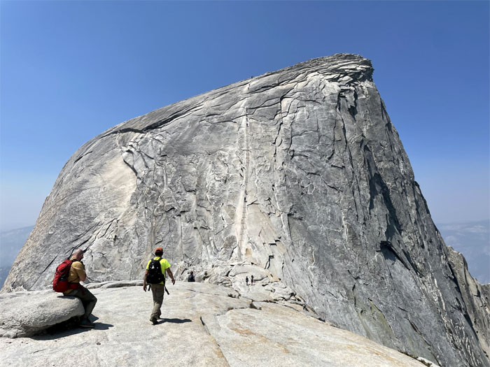
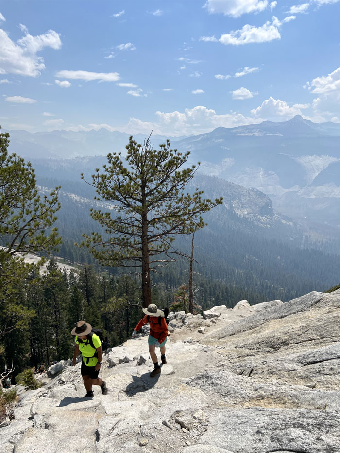
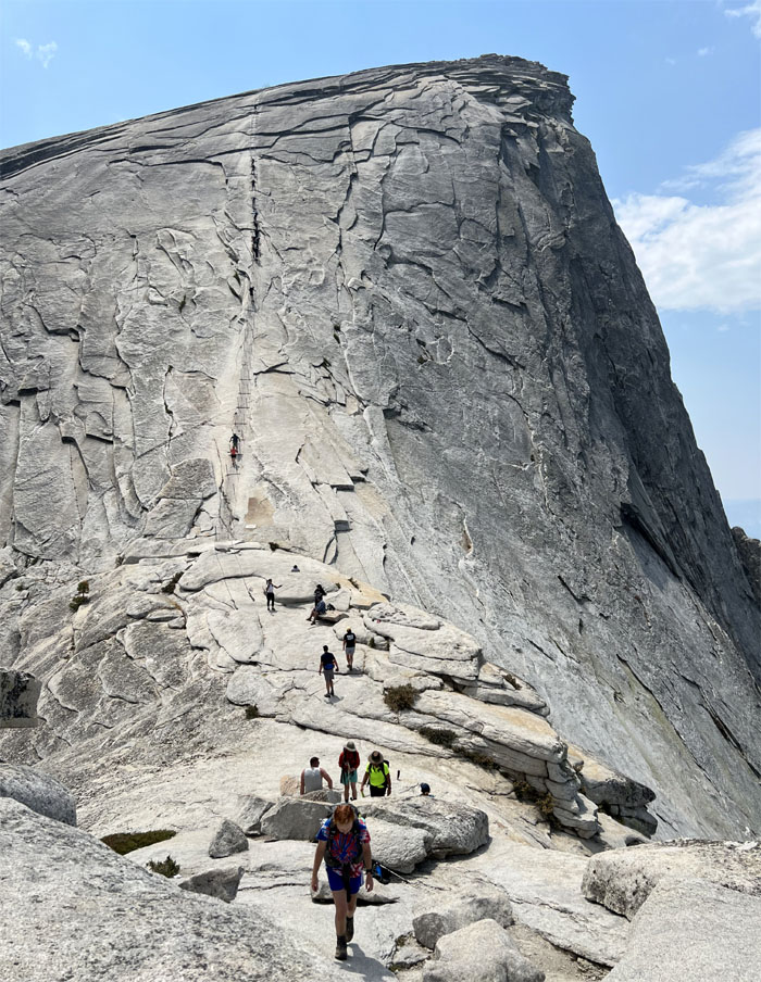
Half Dome
Heading into the saddle as we got closer to what was originally called Tis-sa-ack or Cleft Rock by the native Ahwahnechee people.
Half Dome
Starting our climb up the 400′ steep granite dome.
Half Dome
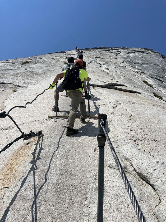
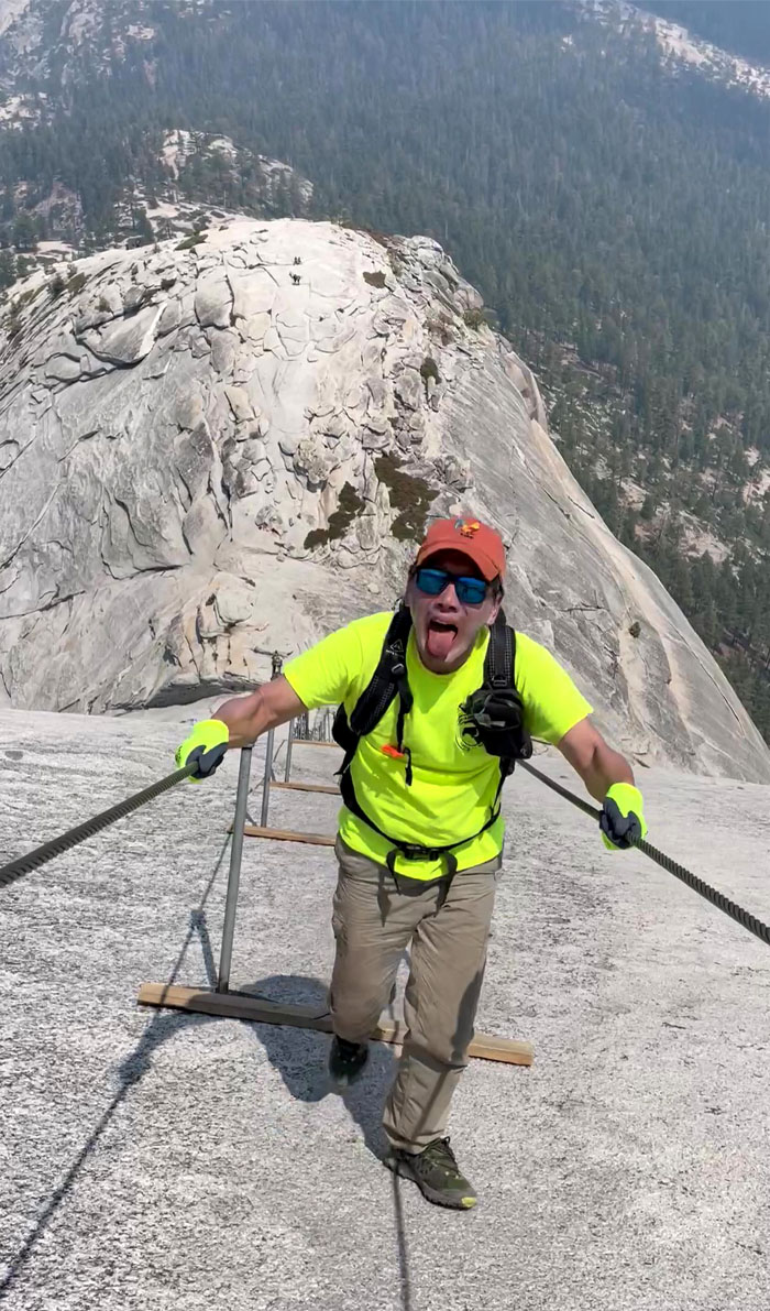
Traffic jam going up the cable route. The climb starts gradually, gets steeper in the middle and tapers off towards the top. The smooth granite surface translated into less traction for your shoes and using mostly upper body strength to pull yourself up the ropes.
Half Dome
Somebody got up with lots of mental and physical support and gloves turned the other way around. Good job.
Half Dome
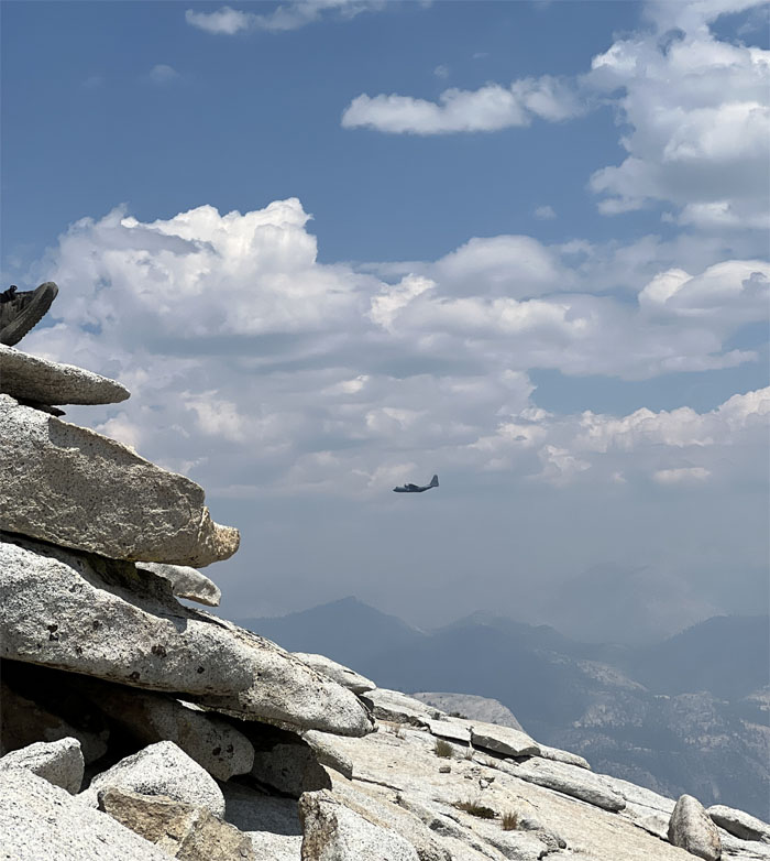
Watched a C-130 Hercules making several passes in the mountains.
Half Dome
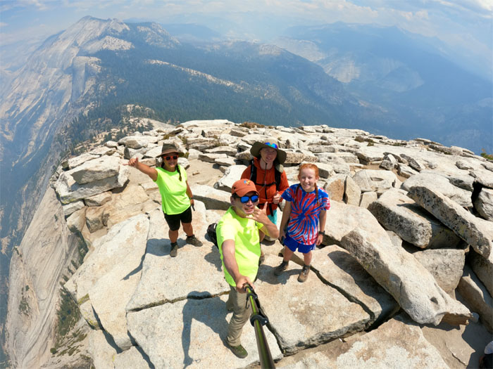
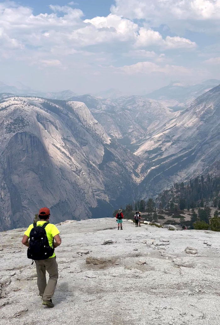
The rest of the group arriving at the 8,846′ summit.
Half Dome
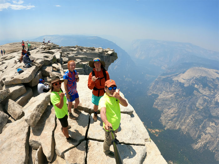
Group photo with Yosemite Valley below us.
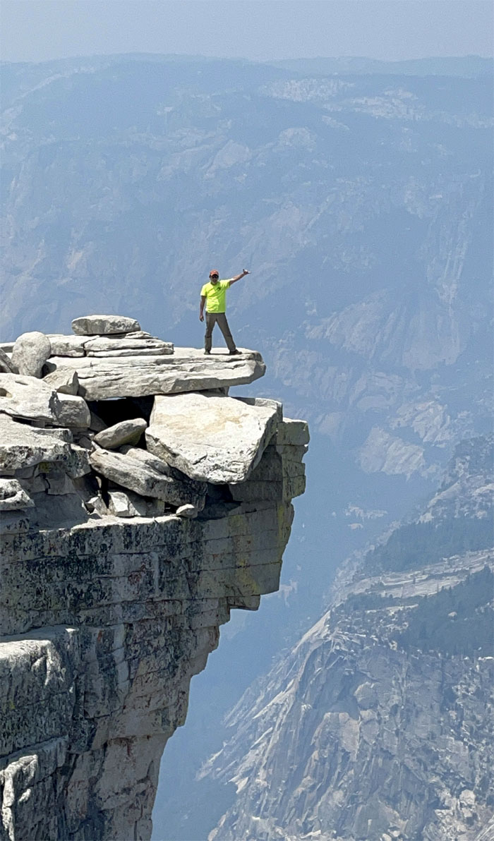
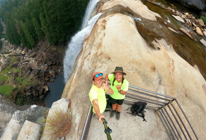
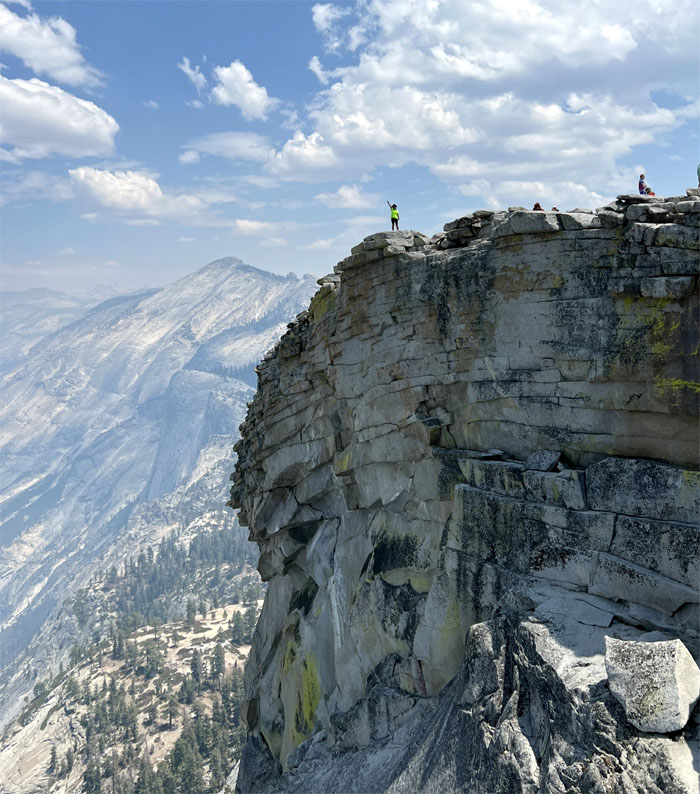
Half Dome
Standing on “the visor.” Not to be confused with the “diving board.”
Half Dome
Another group photo on the 7th tallest peak in Yosemite Valley. Tenaya Peak at 10,301′ is the highest mountain in the valley.
Half Dome
Quan standing on the highest point of Half Dome.
Half Dome
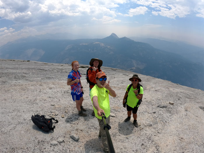
Our last group photo on the deserted side of the dome.
Half Dome
Going back down the cables was infinitely easier than climbing up them.
Half Dome
The group making their way out of the saddle, where Jack also scooped up and scored two expensive harnesses that somebody had left behind.
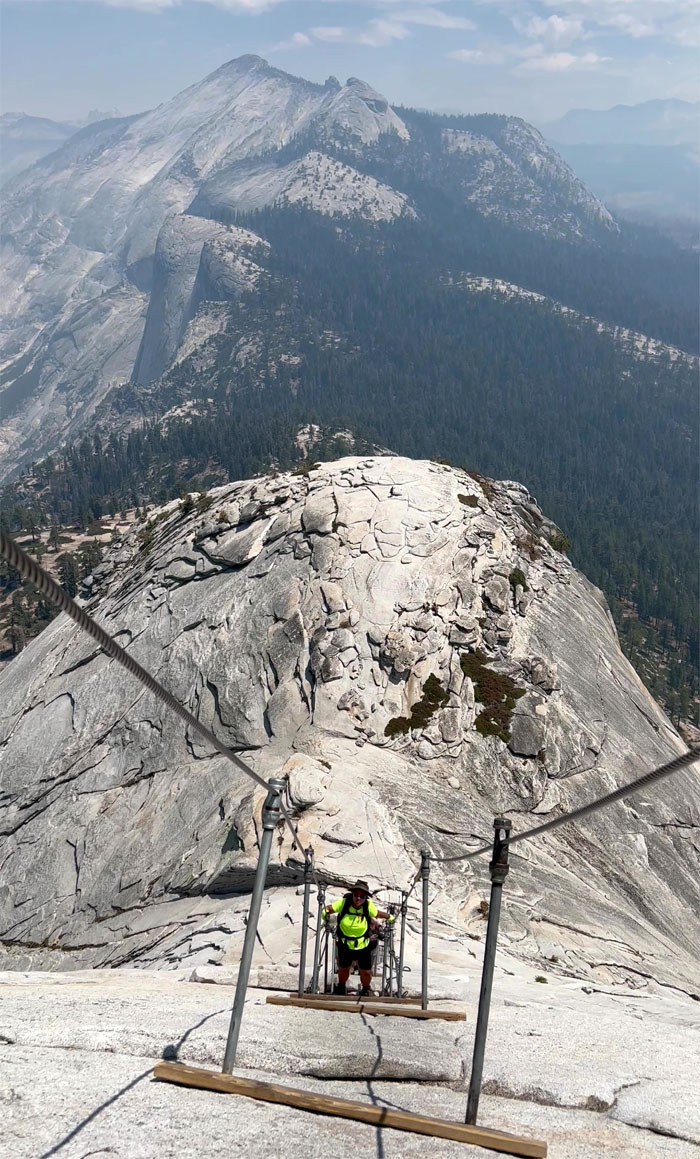
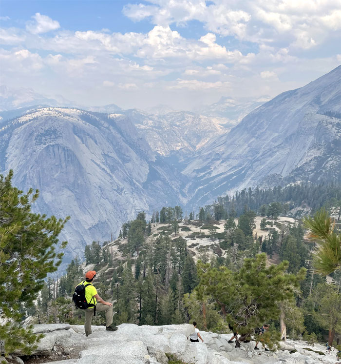
Subdome
Quan leaving the cables and climbing behind her.
Subdome
I heard chatter from other hikers that considered the subdome harder than the half dome while jogging down the granite shelf. Perspective. Subjective.
Subdome
Quan coming down the granite steps.
Subdome
Soaking in the scenery that seemed straight out of a Albert Bierstadt painting.
Subdome
Quan making her way down to the base of the subdome where Faith was waiting for us.
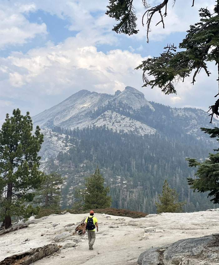
John Muir Trail
Looking towards Clouds Rest, which was Plan B if we didn’t get permits, as we made our way back down the trail.
John Muir Trail
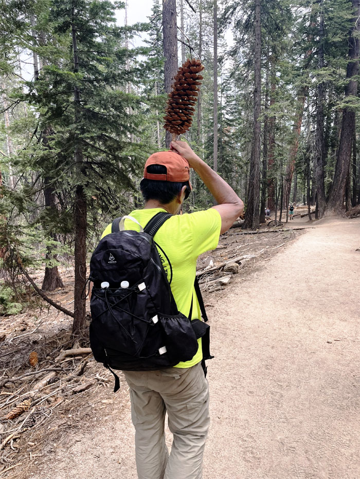
If I collected a pound of these sugarpine pinecones, I could get anywhere from 37 to 52 cents a pound. Time to quit my day job.
John Muir Trail
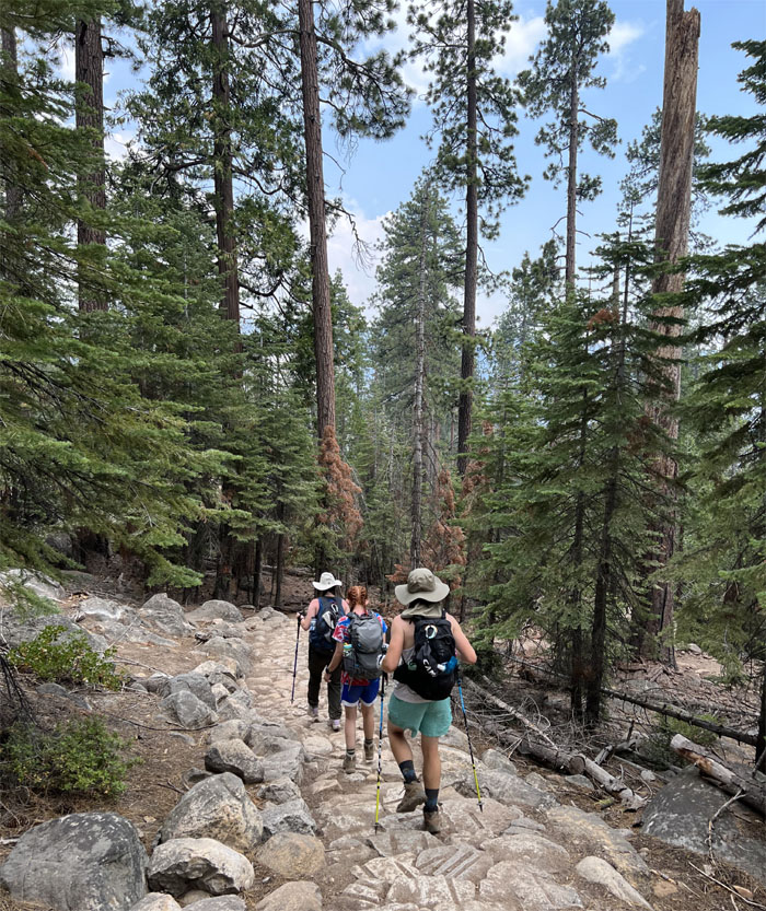
The group going down the steps that would take us back into the valley.
John Muir Trail
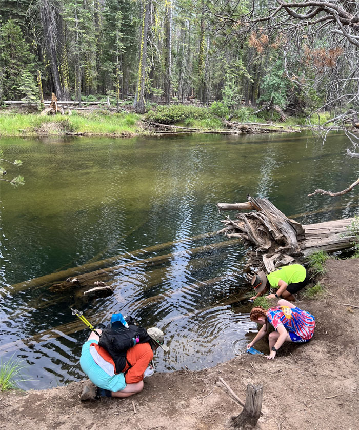
Filtering water from the Merced River to replenish our bottles. Got Leptospirosis?
John Muir Trail
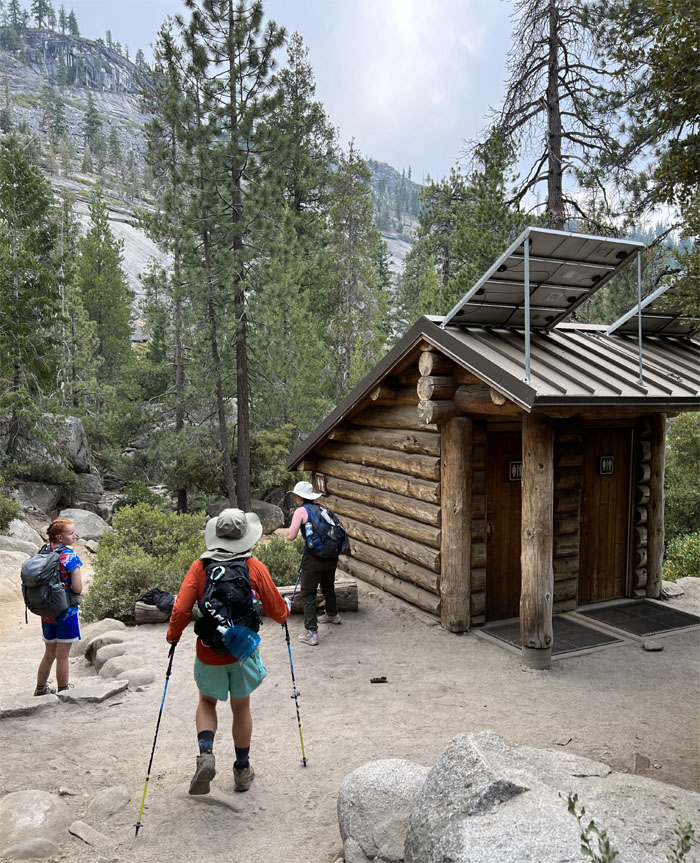
Some of the group took advantage of the now open bathrooms. Upon hindsight, we should have gone down the John Muir Trail to get a different perspective of the valley and mountains.
John Muir Trail
Going down the stairs constructed out of a mix of granite and boulders.
John Muir Trail
Walking underneath these sheer massive cliffs.
Nevada Fall
Leaving behind the “giant staircase.”
John Muir Trail
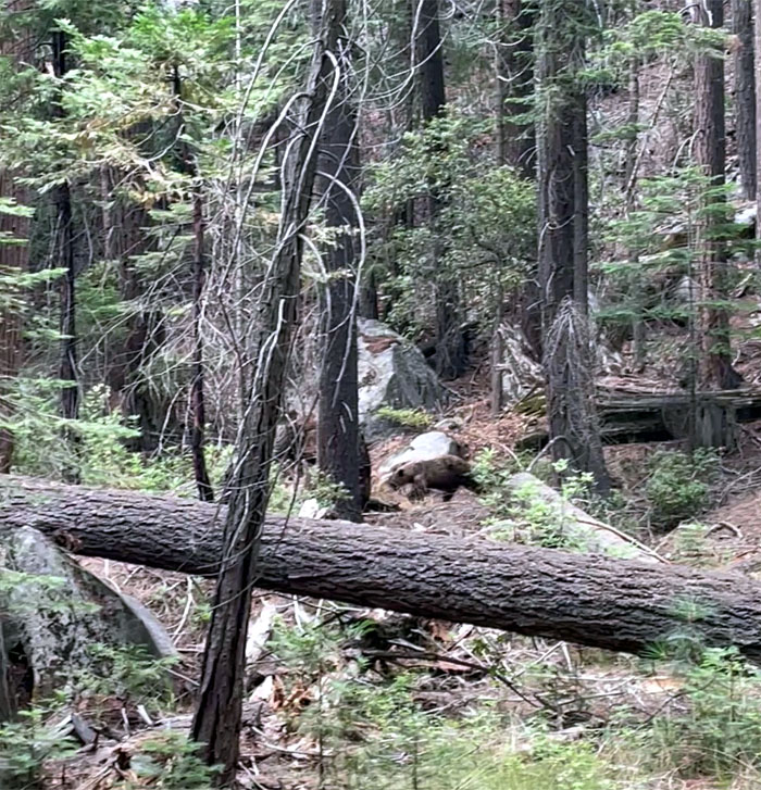
We saw a bear foraging in the forest next to the trail. He was minding his own business, so we minded ours.
John Muir Trail
The park ranger had long packed up and gone home when we got back to the bridge. We wanted to show somebody our permits!
Mist Trail
Quan making her way on the stone trail with the 7,080′ Liberty Cap in the background.
Mist Trail
A California ground squirrel yielding to hikers making their way down from Vernal Fall.
Mist Trail
Waiting for the shuttle, which is supposed to arrive every 12 to 22 minutes. Make that on the higher end. Much higher. Can’t complain. It’s a free service.
All pau
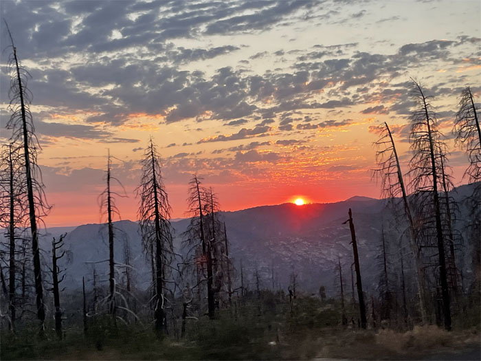
We caught a fiery sunset on our way out of the park, capping our epic 16.05 mile hike up to the well-known landmark of Yosemite National Park.
Post hike meal at 40571 Road 425A, where another fresh pot of chicken chayote awaited us. Thanks to Jasmin for bringing a small taste of Hawaii to California.
Photos taken by Quan Haberstroh and yours truly. Not necessarily in order.
Note: I have been made aware that some hikers have been using my blog as a hiking guide and getting lost on the trails. Please note that this blog was made to document the hike for the crew(s) that did it. That is why some of my comments will seem to have no relevance or meaning to anybody outside of the crew(s) that hiked that trail. My blog was never meant as a hiking guide, so please do not treat it as such. If you find inspiration and entertainment from these hikes, that is more than enough. If you plan on replicating these hikes, do so in the knowledge that you should do your own research accordingly as trail conditions, access, legalities and so forth are constantly in flux. What was current today is most likely yesterdays news. Please be prepared to accept any risks and responsibilities on your own as you should know your own limitations, experience and abilities before you even set foot on a trail, as even the “simplest” or “easiest” of trails can present potential pitfalls for even the most “experienced” hikers. One should also always let somebody know of your hiking plans in case something doesn’t go as planned, better safe than sorry.
{ 0 comments… add one now }