
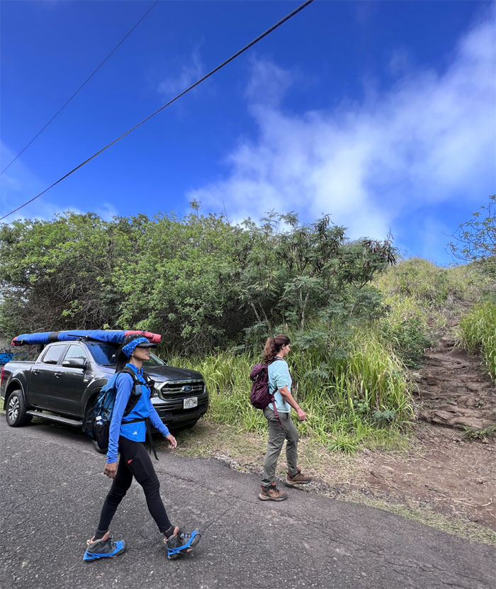
Despite predictions of gloomy weather, the naysayers were pushed aside so that today’s hike that was two weeks in the making could happen.
Hahaione Valley
Met up with the group in the valley of shifting sands that was once underwater and walked quietly into the mixed forest.
Hahaione Valley
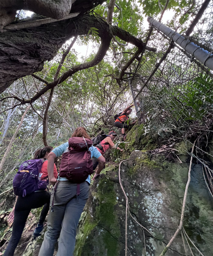
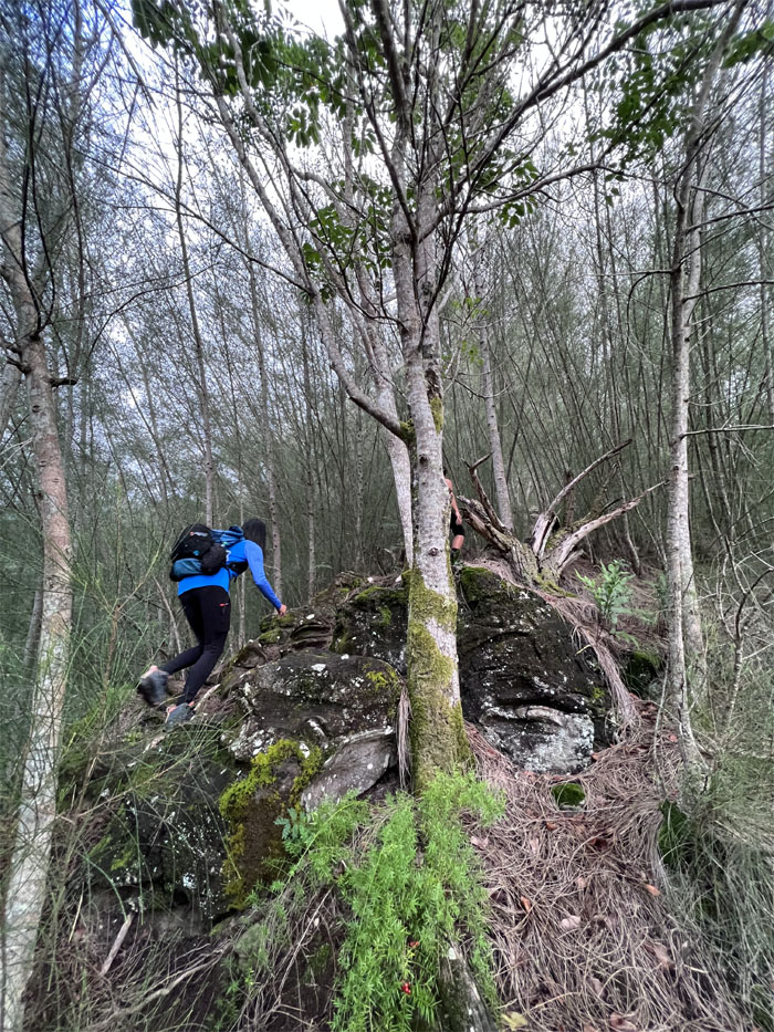
The climb was short, steep and taxing.
Hahaione Valley
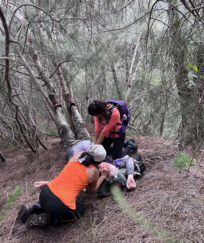
Somebody needed assistance in the form of chest compressions and artificial ventilation to jumpstart his heart, in more ways than one.
Hahaione Valley
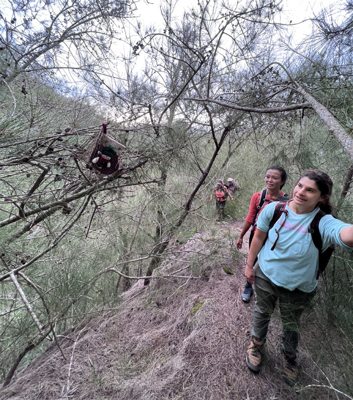
Christmas is still alive and well in the mountains. Well, parts of it.
Hahaione Valley
A random hiker soon caught up with us. Not that kind of random hiker.
Hahaione Valley
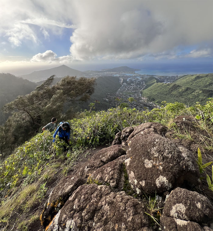
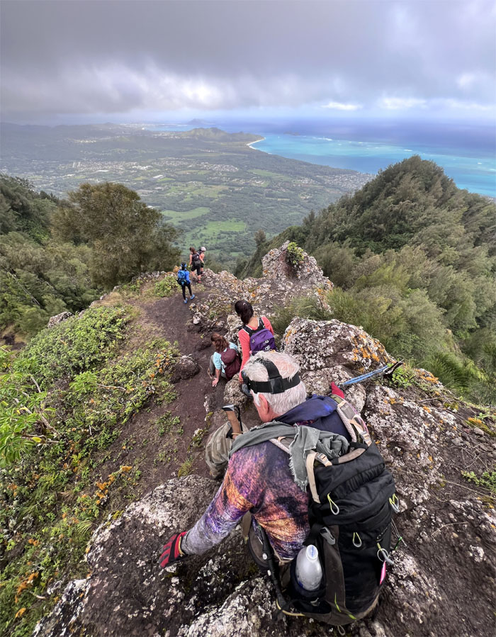
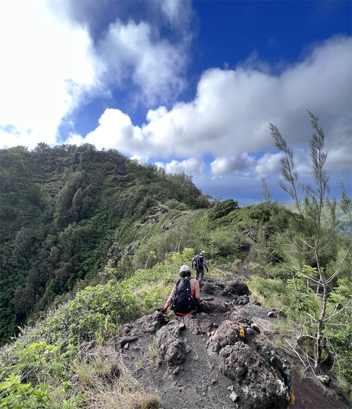
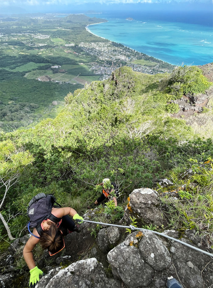
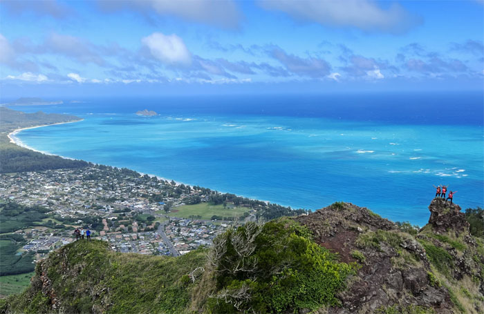
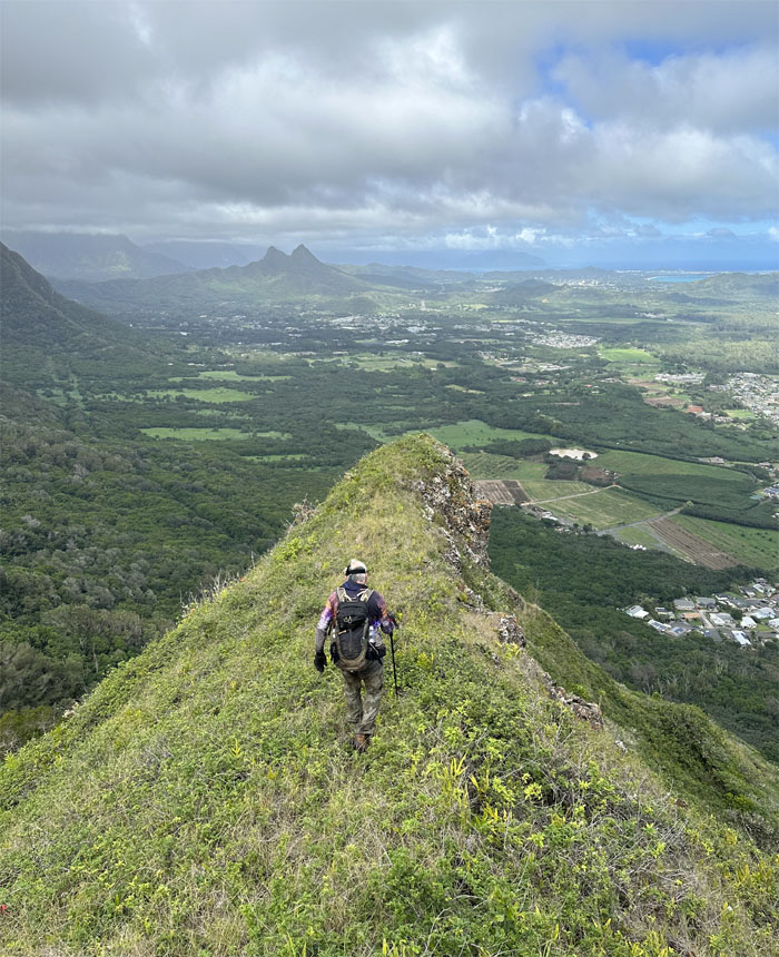
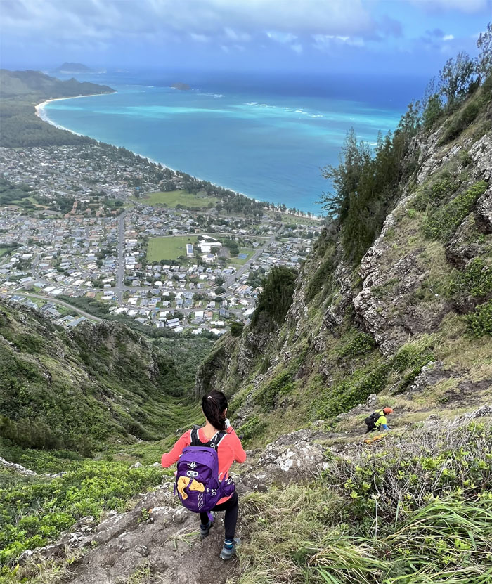
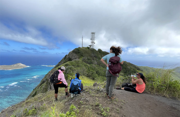
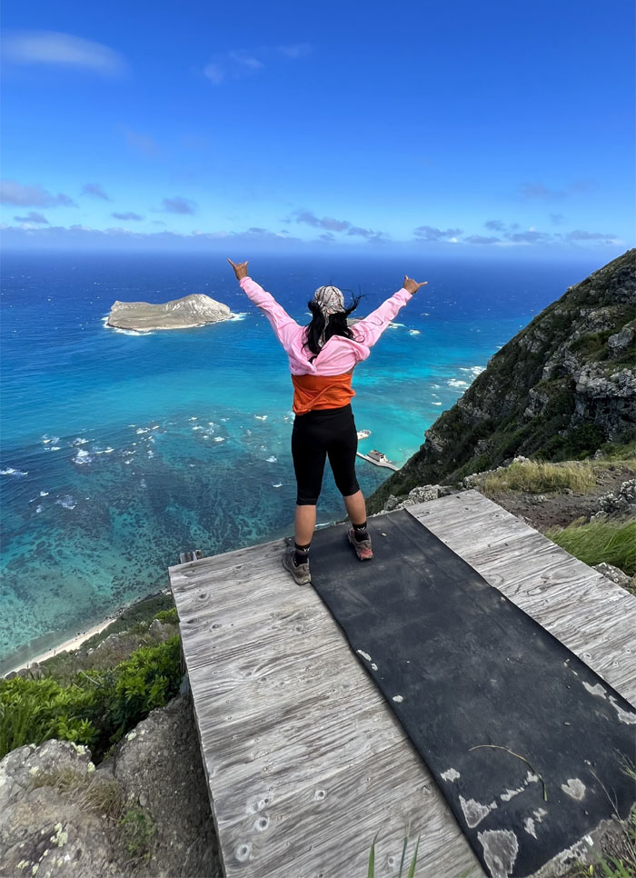
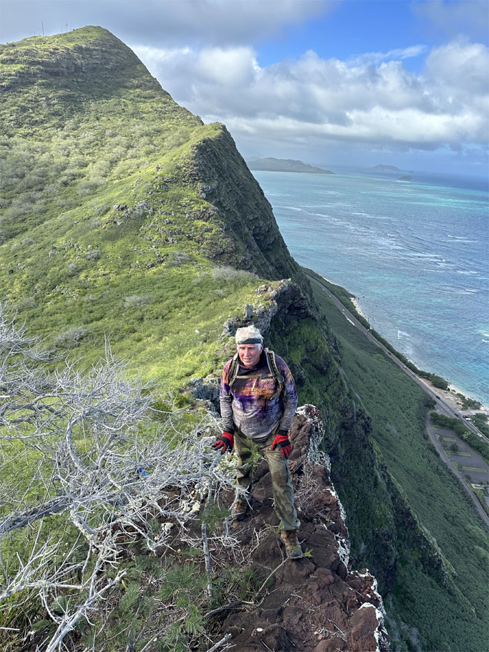
Everybody took turns sitting and standing on the protruding rock that afforded commanding views below us.
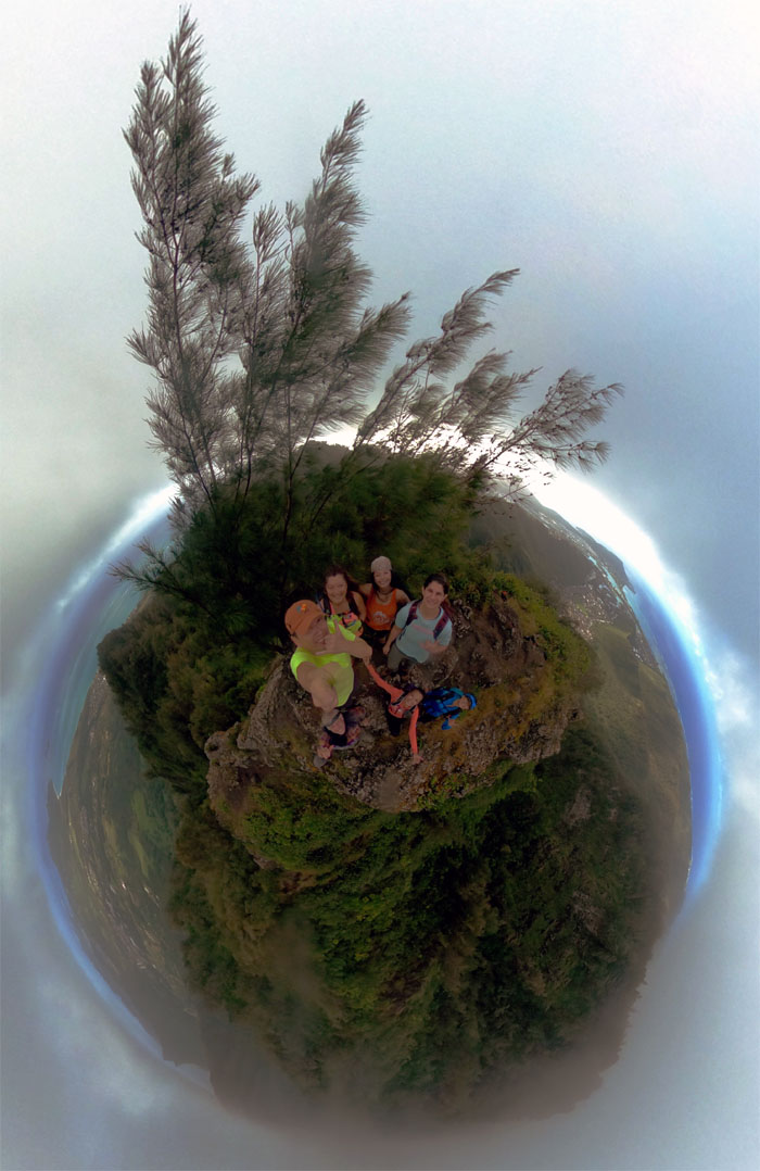
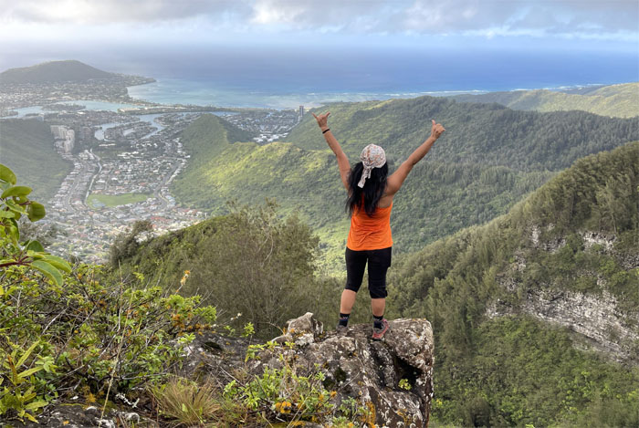
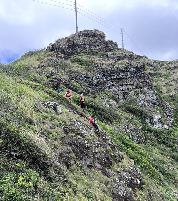
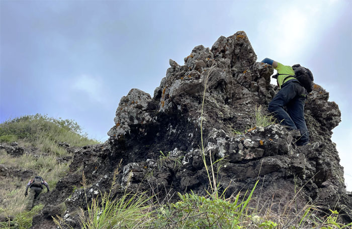
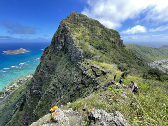
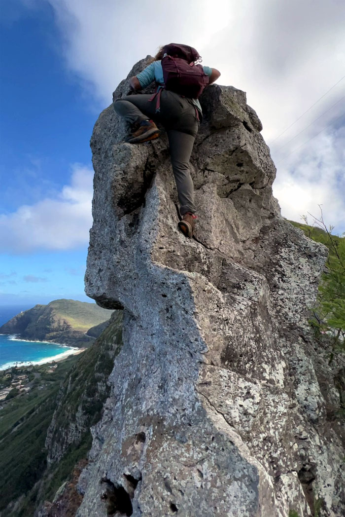
Hahaione Pyramid
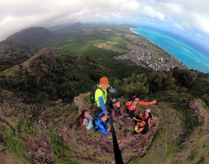
360 degree view at the top of the pyramidal rock.
Hahaione Pyramid
Are you spotting or scolding me?
Hahaione Pyramid
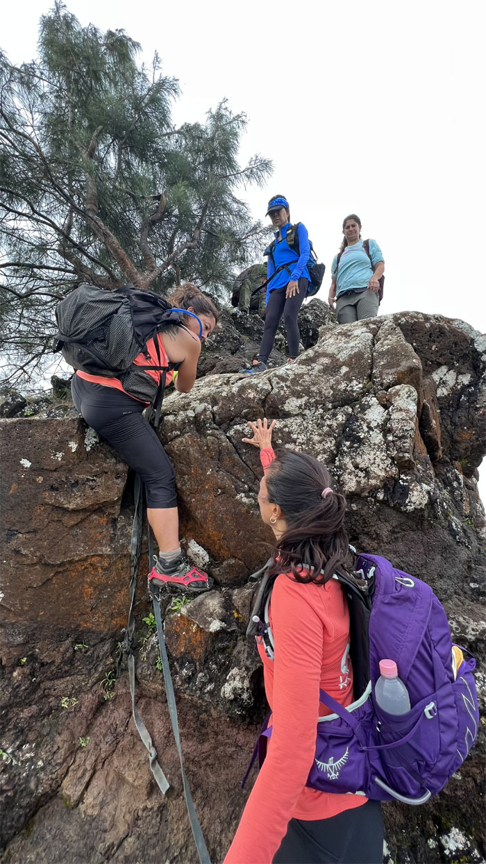
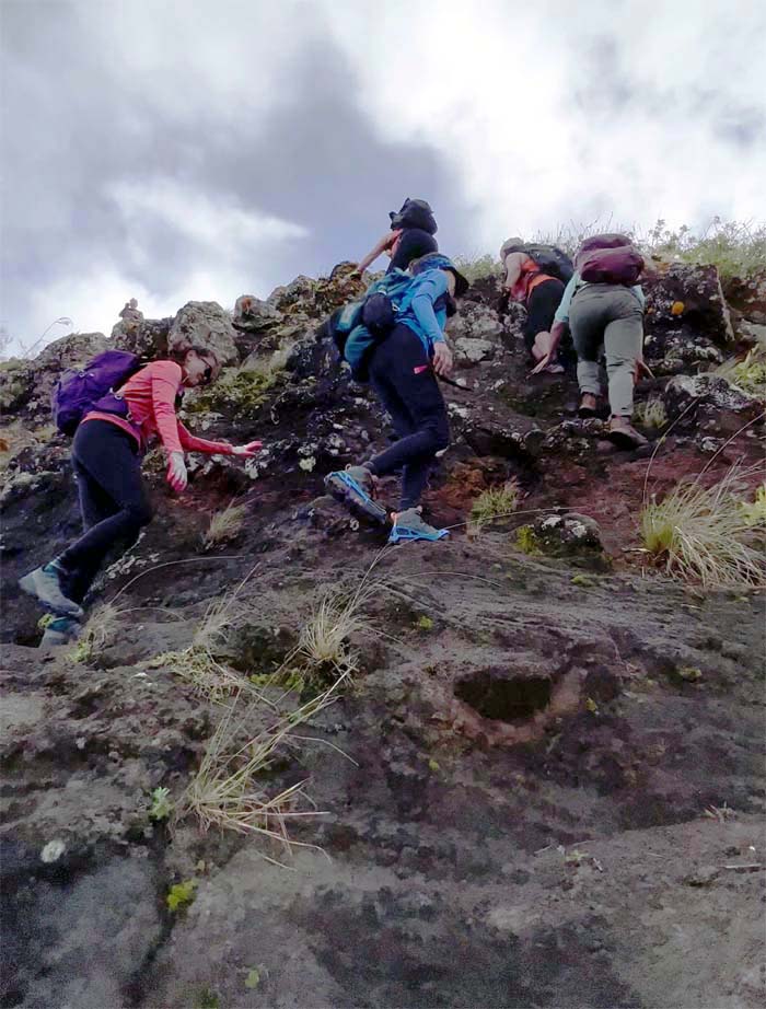
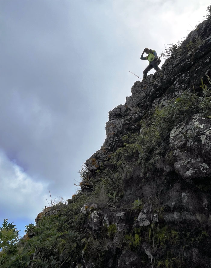
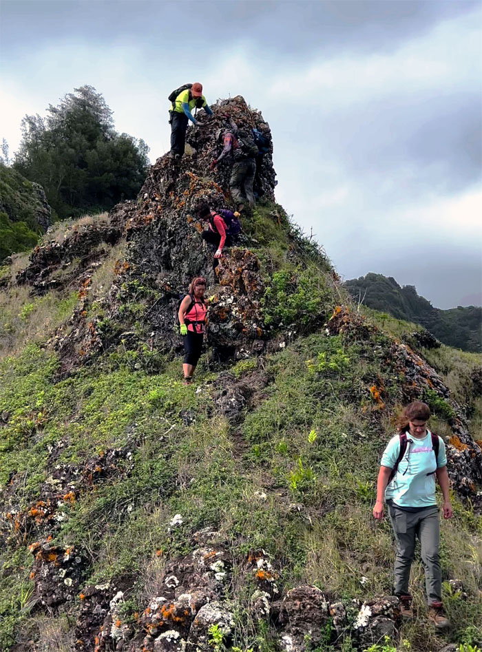
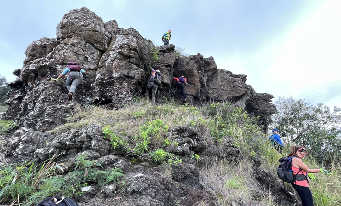
Climbing our way down from the summit.
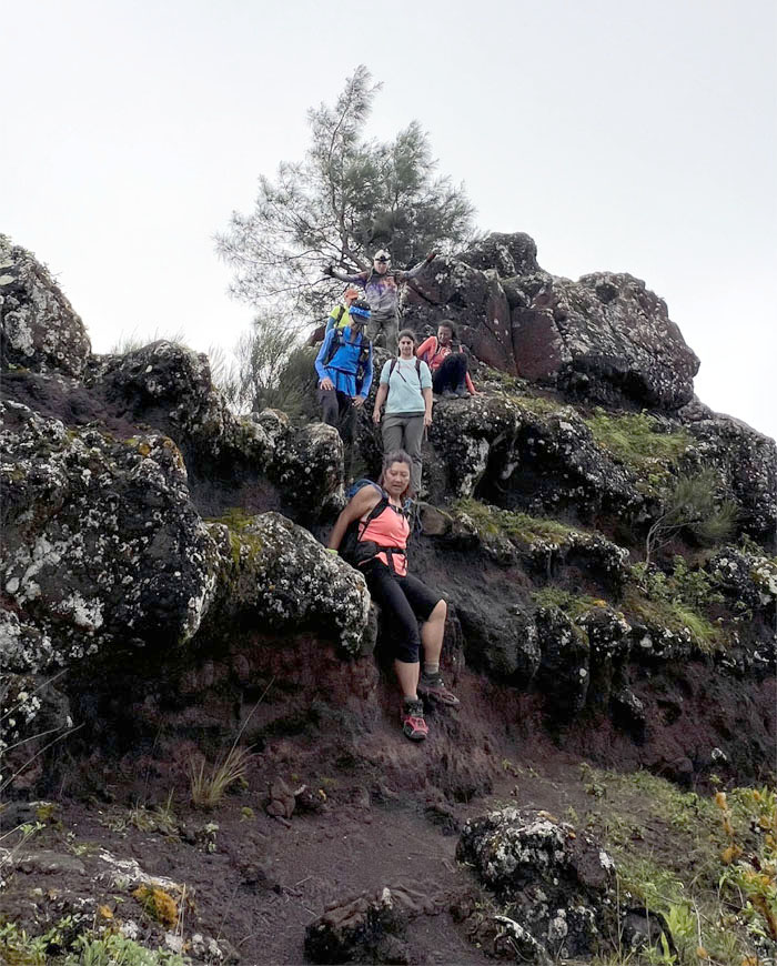
Hahaione Pyramid
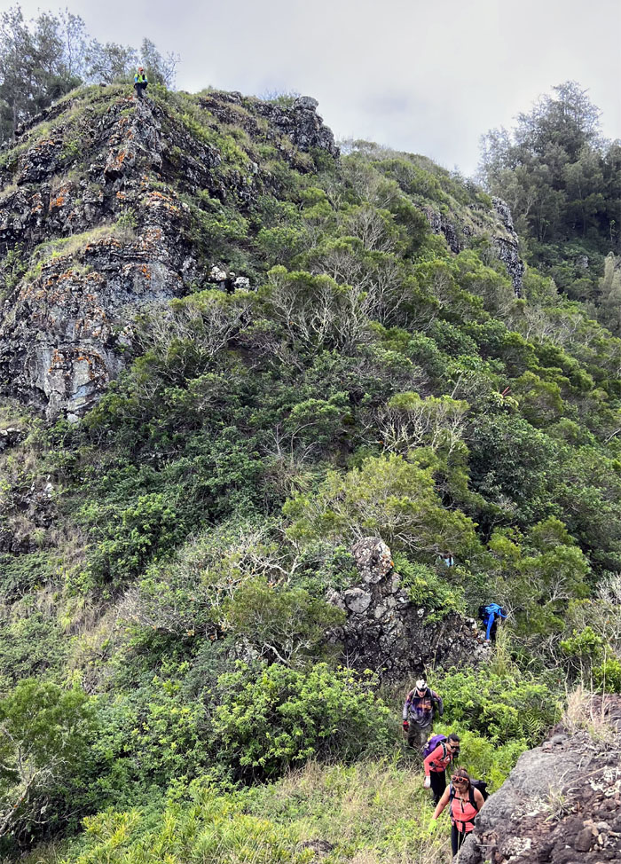
Traffic jam on the way down.
Hahaione Pyramid
Somebody was yelling that the trail was below us. Anybody got a roll of duct tape handy?
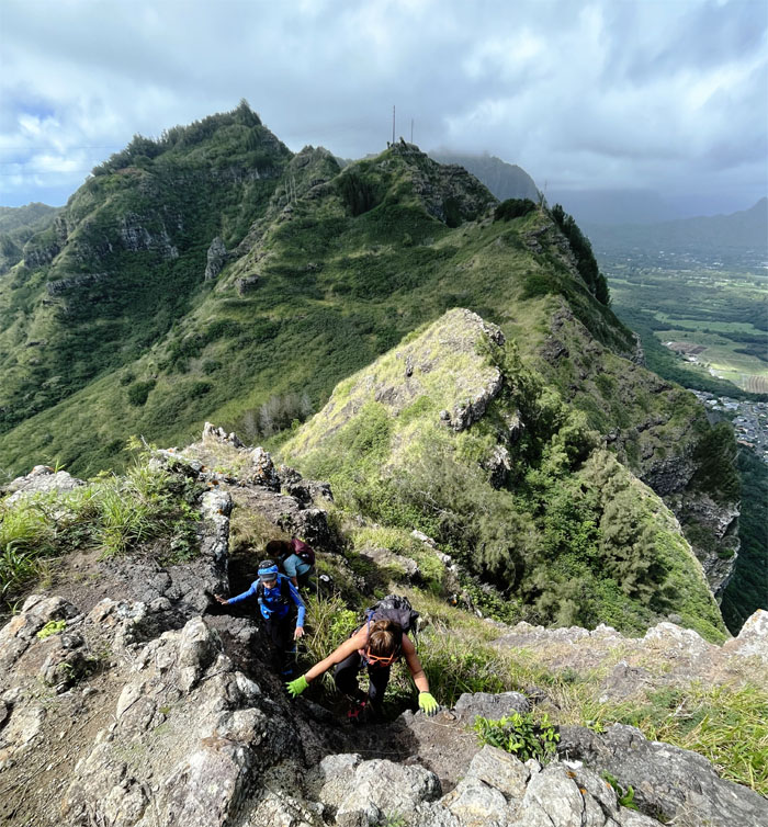
Ko’olau Summit Ridge Trail (KSRT)
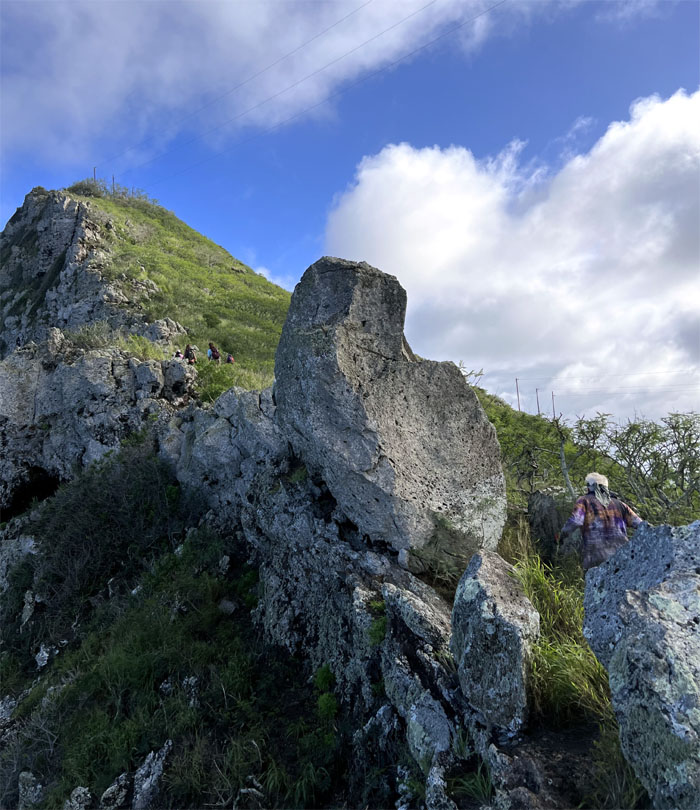
Leaving the triangular basaltic structure behind us.
KSRT
Making our way on the rocky ridge to the summit of Kaluanui.
Mariner’s Ridge Summit
The girls had a song to climb up the cliff with.
Mariner’s Ridge Summit
I only had the silence between my ears to keep me company. It was deafening.
Mariner’s Ridge Summit
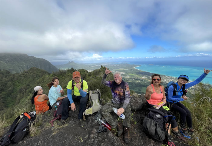
Group photo at the summit that Bishop Estate would like you to forget about.
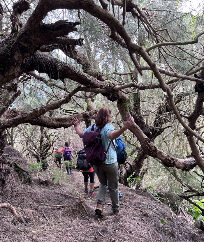
KSRT
Making our way underneath the thicket of tree branches.
KSRT
Chico on the exposed wind swept ridge line.
KSRT
Back in the relatively protected tree line.
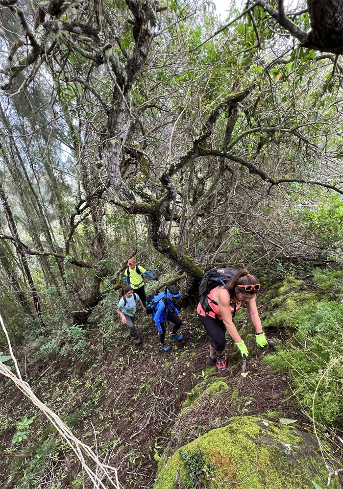
KSRT
Shuffling through the undergrowth of ferns.
KSRT
Does this electrical cord meet OSHA standards?
KSRT
Trying to keep my wits and my cap about me.
KSRT
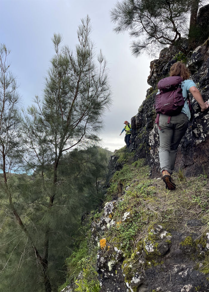
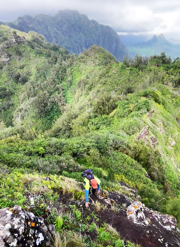
Contouring and climbing their way down the steep cliff.
KSRT
The group equally divided.
KSRT
Chico hiking towards a dead end.
KSRT
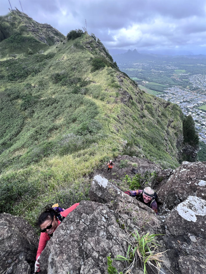
Group photo at the top of Hershey Kiss.
KSRT
Climbing down from the somewhat tear drop shaped rock.
Tom-Tom Summit
Panoramic view of the summit. The trail was named after Tom McGuire and Tom Cadle who rediscovered the ancient Hawaiian trail that connects the summit from Waimanalo.
KSRT
Making our way down from the powerline towers.
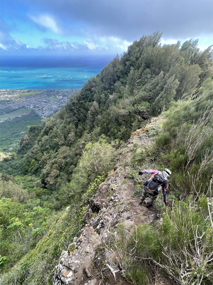
KSRT
Looking down the steep drop towards the town of Waimanalo.
KSRT
Some would climb. Some would contour.
KSRT
Slow race to the top.
KSRT
We all took our own ways to arrive at the same spot eventually.
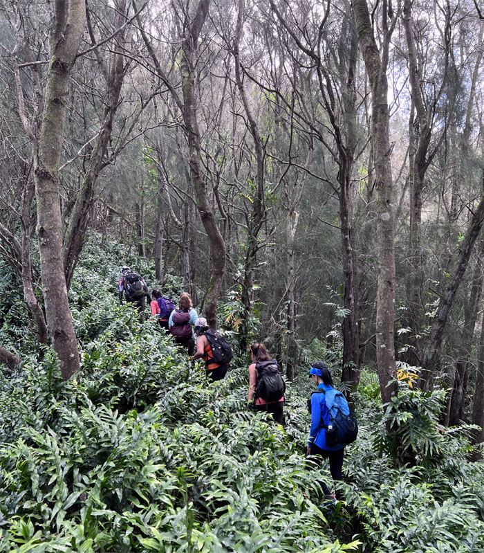
KSRT
Leaving the exposed trail for the ironwood forest.
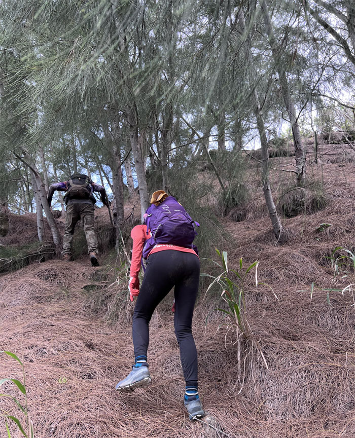
KSRT
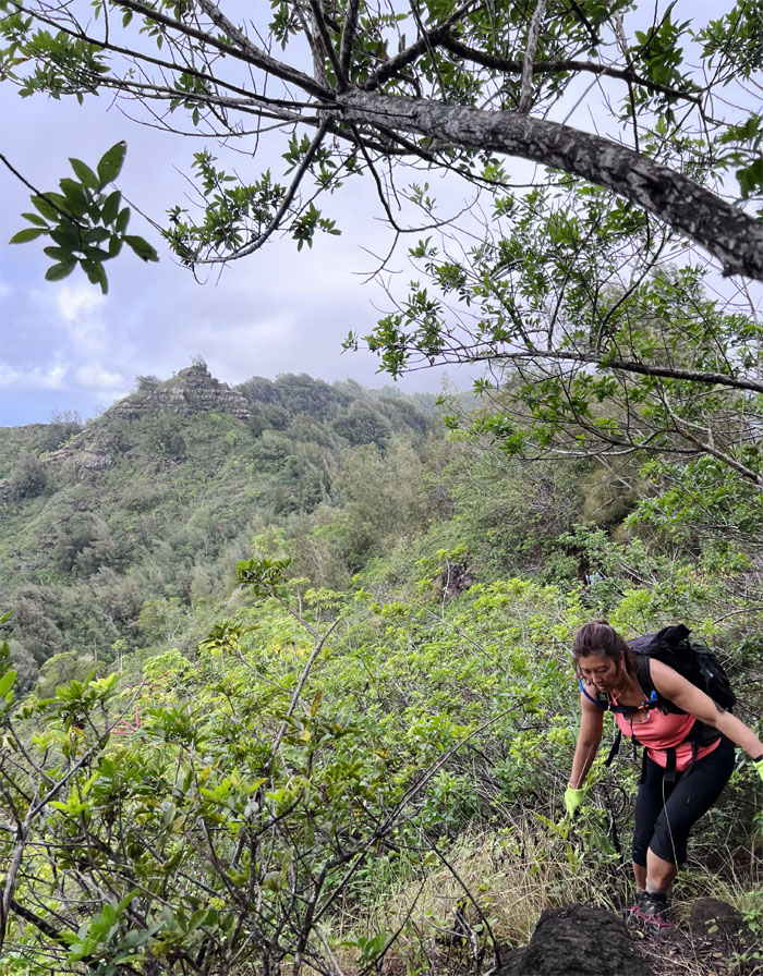
The arduous and seemingly slow climb up the pine needle covered hill.
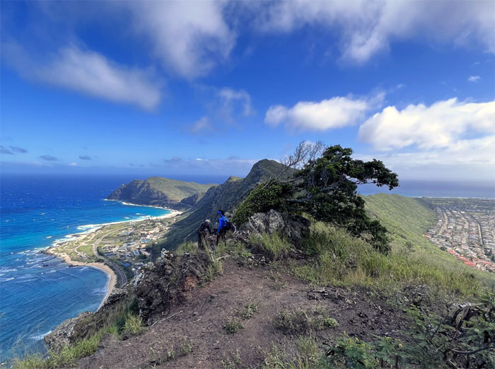
Kamiloiki Summit
Group photo at the summit of the little milo tree.
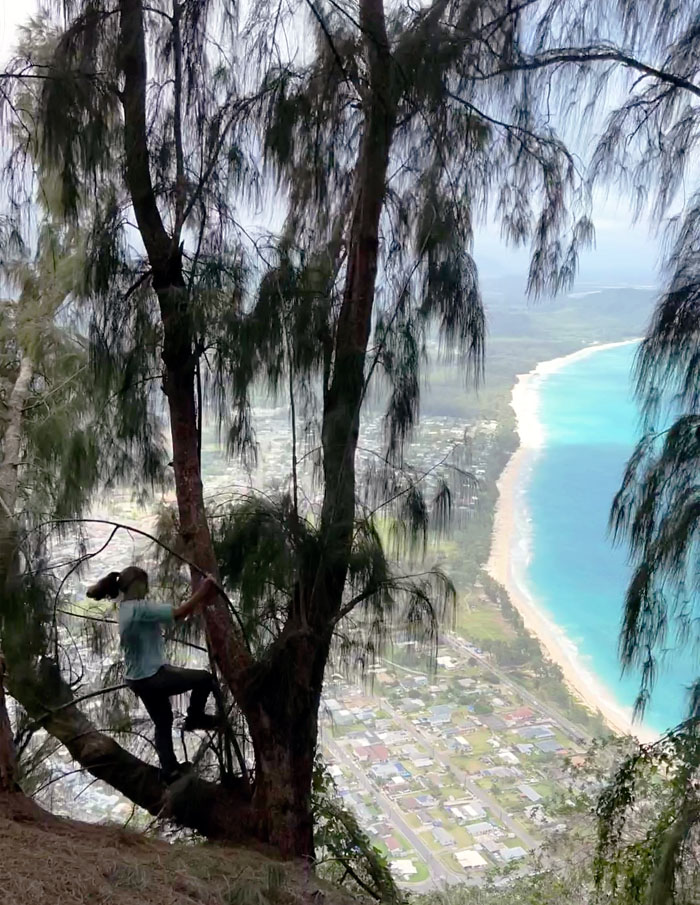
KSRT
Jen in the tree with a stunning view of the white sandy beaches of potable water.
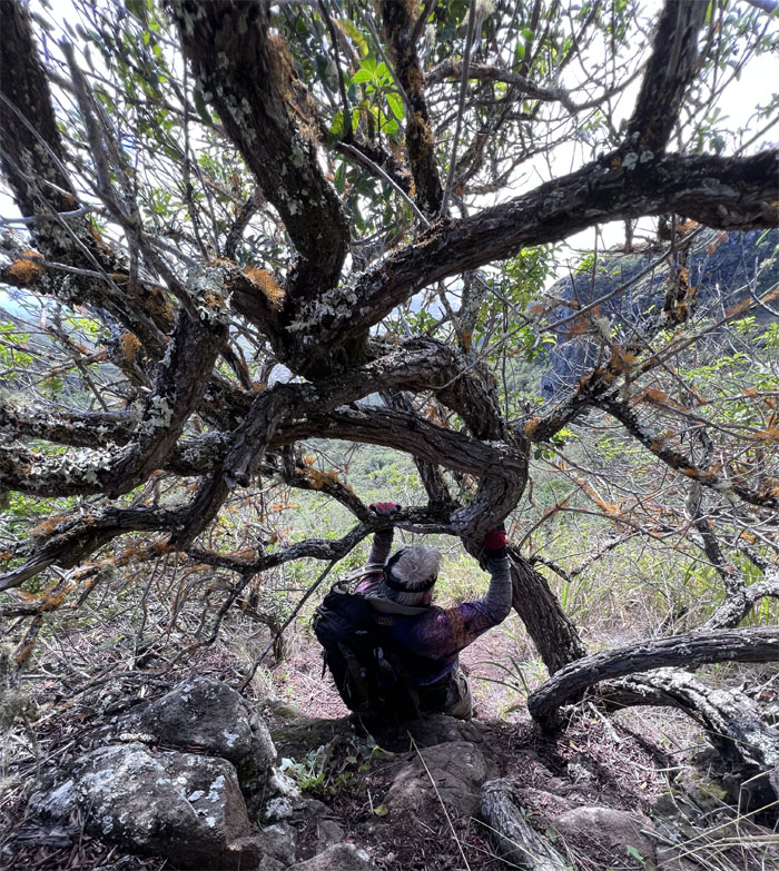
KSRT
Leaving the pine tree forest to crawl under thickets of tree branches.
KSRT
Dropping into the saddle.
KSRT
Climbing out of the lowest point between the two hills.
KSRT
Taking a water break in the shadow of the defunct Nike missile site OA-32 that was deactivated in 1970.
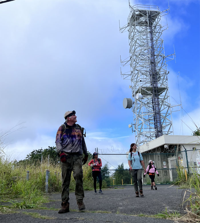
KSRT
Whereabouts is the Dead Man Cat’s Walk? Seven years too late.
KSRT
Passing the hang gliding marshal’s car on our way up to the platforms. Nothing to see here. You wasn’t here. Move along.
KSRT
I believe I can fly.
KSRT
I believe I can sleep.
KSRT
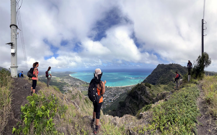
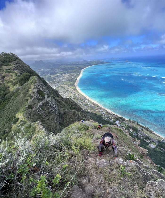
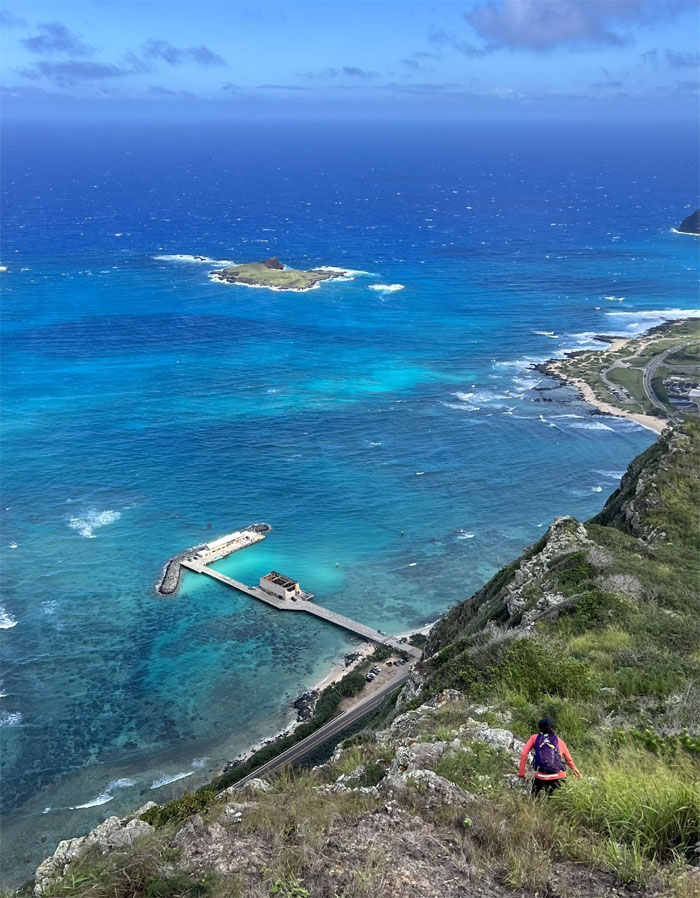
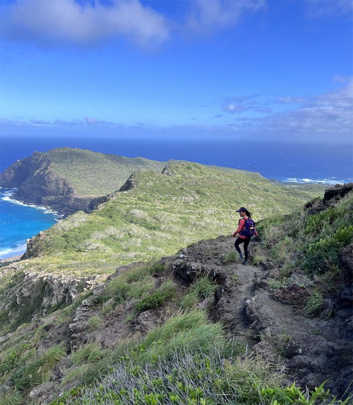
Dropping in elevation as we made our way along the rocky ridge above the coastline.
KSRT
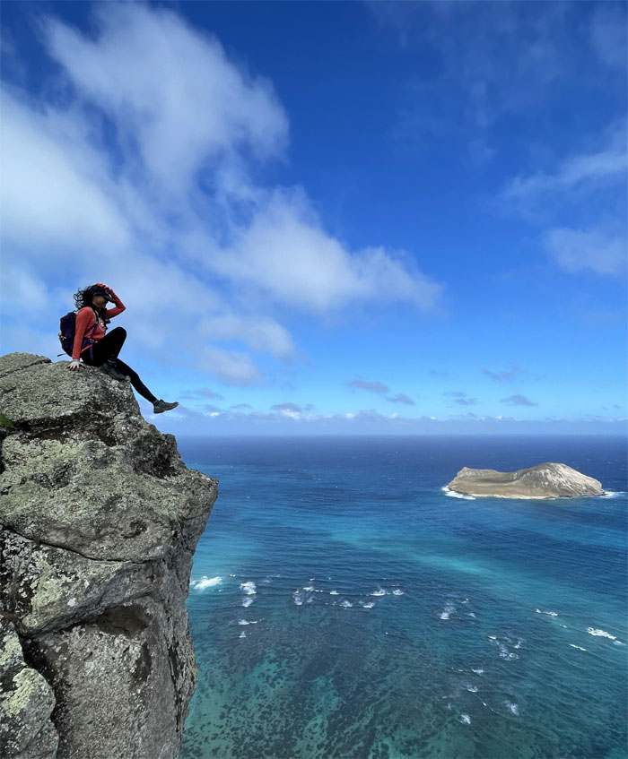
Sitting on the edge.
KSRT
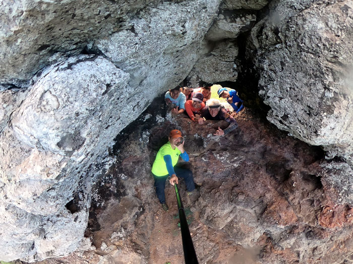
Puka in the ground.
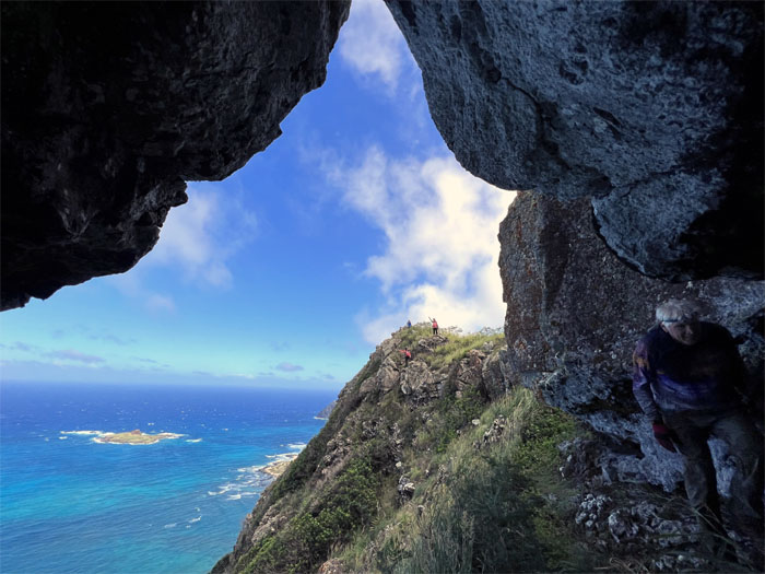
KSRT
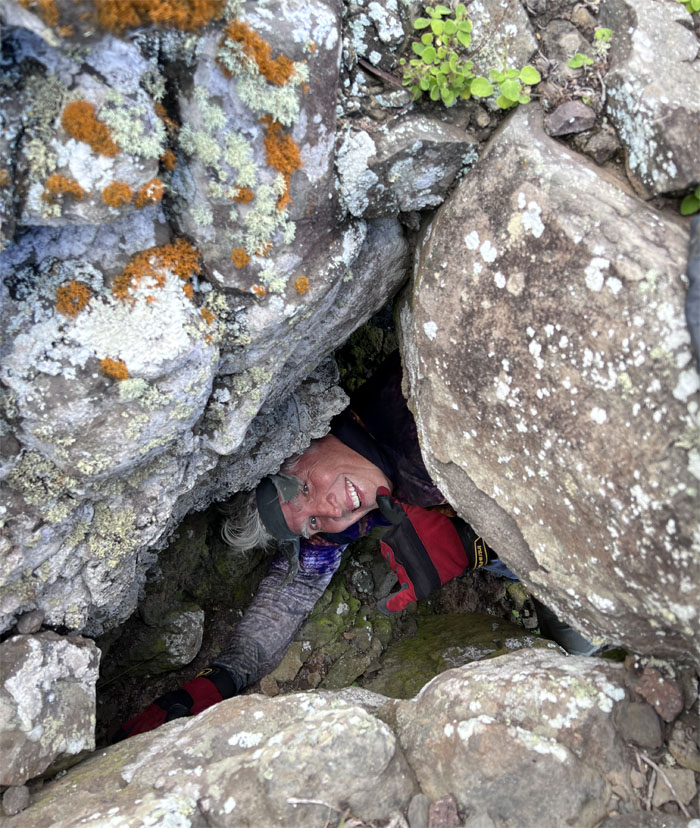
Hey, let’s go crawl into that cave!
KSRT
I think somebody satisfied their cave quota for the week.
KSRT
Making our way around the ladybug tree.
KSRT
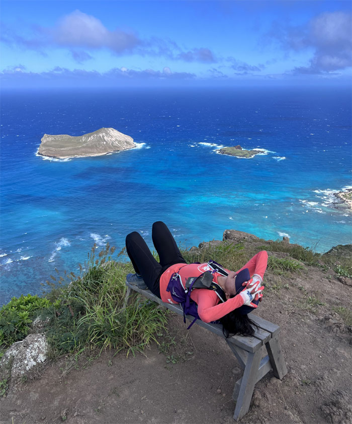
Tessa on her perch with a commanding view.
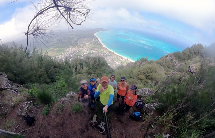
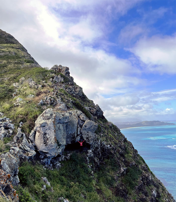
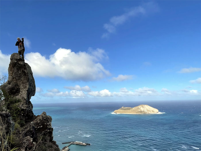
Makapu’u Puka
Group photo from a different perspective.
Makapu’u Puka
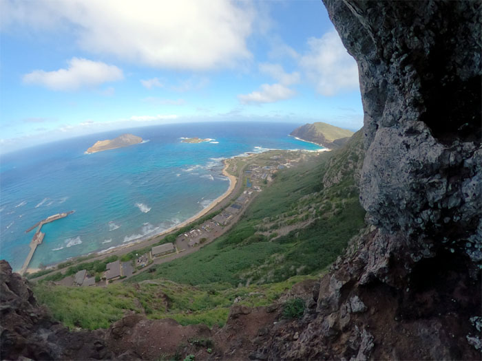
Unobstructed view.
Makapu’u Puka
I don’t know if it was my cold hand that made Chico jump that high.
Makapu’u Puka
My days as an urologist was over.
Makapu’u Stonehenge
Jen climbing up the vertical rock.
Makapu’u Stonehenge
Chico standing on top of the rock.
Makapu’u Stonehenge
Traversing the linear rocks as we left the puka behind us.
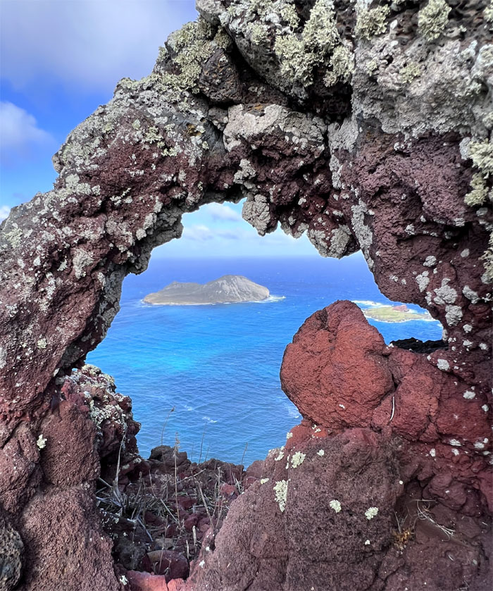
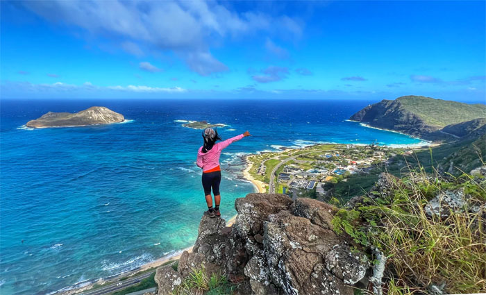
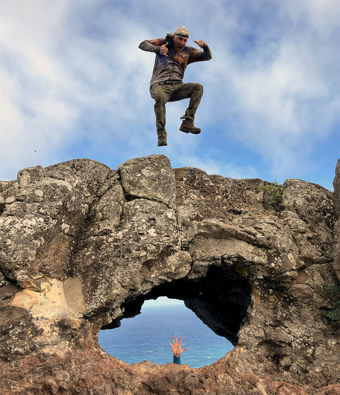
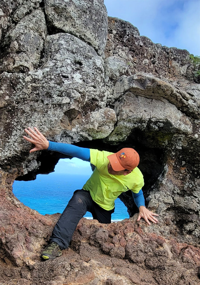
Makapu’u Puka Jr
Framing a view of Manana and Kaohikaipu islands through the miniature opening.
KSRT
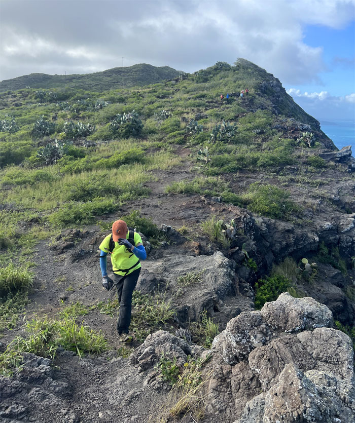
Climbing up the last hill. Promise?
KSRT
It was mostly all downhill from this point.
KSRT
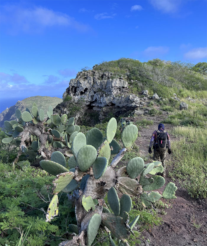
Clumps of cacti dominated this short stretch.
KSRT
Still trying to keep my wits and cap about me.
KSRT
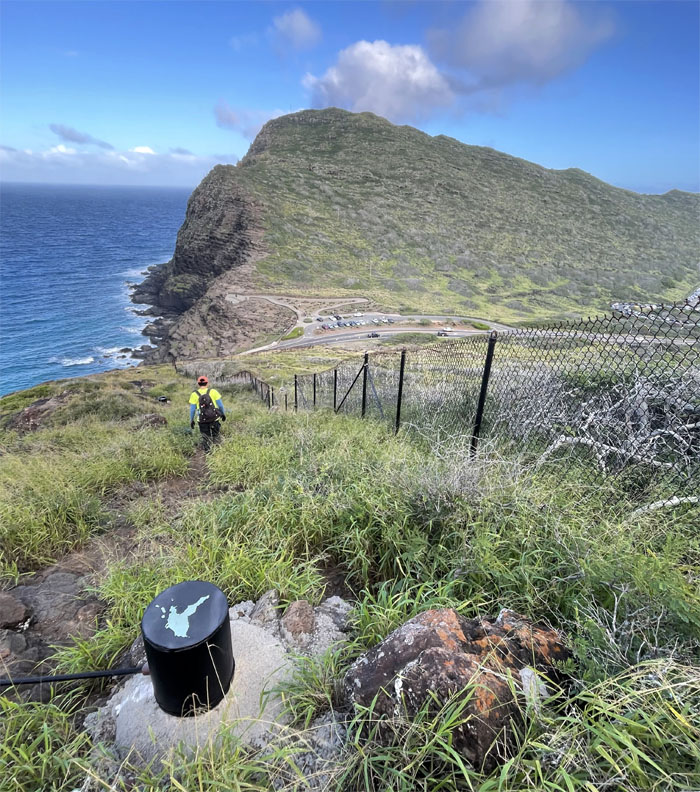
Following the fence line as we made our way down through the grass covered loose rock fields.
All pau
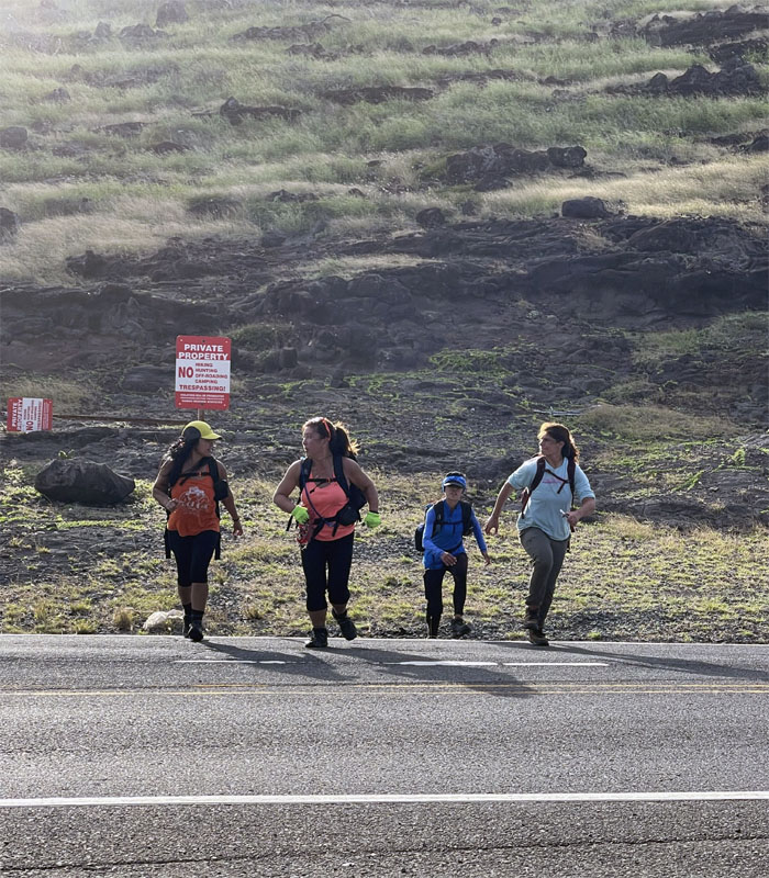
Everybody safely crossed the most dangerous part of the hike after looking both ways. Glad we got picked up by Lilia in the black truck and not the blue and white one. Post hike meal at Greek Marina. Not all of us agreed with the cuisine from the Greek diaspora.
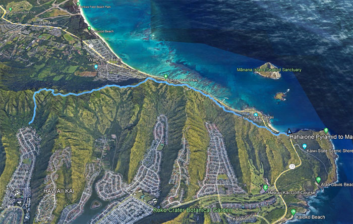
GPS Tracks
Our hike covered 5.49 miles through forested and exposed ridgelines that were tempered by overcast clouds and cooling trade winds along with good company.
Photos taken by Aida Gordon, Chico Cantu, Jen Odence, Lilyn Avendano, Quan Haberstroh, Tessa Bugay and yours truly. Not necessarily in order.
Note: I have been made aware that some hikers have been using my blog as a hiking guide and getting lost on the trails. Please note that this blog was made to document the hike for the crew(s) that did it. That is why some of my comments will seem to have no relevance or meaning to anybody outside of the crew(s) that hiked that trail. My blog was never meant as a hiking guide, so please do not treat it as such. If you find inspiration and entertainment from these hikes, that is more than enough. If you plan on replicating these hikes, do so in the knowledge that you should do your own research accordingly as trail conditions, access, legalities and so forth are constantly in flux. What was current today is most likely yesterdays news. Please be prepared to accept any risks and responsibilities on your own as you should know your own limitations, experience and abilities before you even set foot on a trail, as even the “simplest” or “easiest” of trails can present potential pitfalls for even the most “experienced” hikers. One should also always let somebody know of your hiking plans in case something doesn’t go as planned, better safe than sorry.
{ 4 comments… read them below or add one }
We g9t really nice weather! Thanks for a great hike and thanks for not going too fast! Love the frequent breaks!
Aloha Aida,
Yep thank heavens for small favors that made the hike tolerable and fun.
Mahalo
Ohhhh!!! Love this hike! The group so funny and the weather was great! Laughter all da way til the end lol
Aloha Tessa,
Yep, laughs and cool weather made for a great day!
Mahalo