
Back to back hikes that replaced the overgrown hike with the muddiest one in the mountains.
Laie Trail
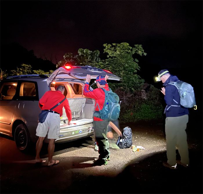
Thanks to Ferlino for driving Akira, Chris, Tessa, and myself all the way into the road to start at the trailhead. Saved us a whole ten minutes!
Laie Trail
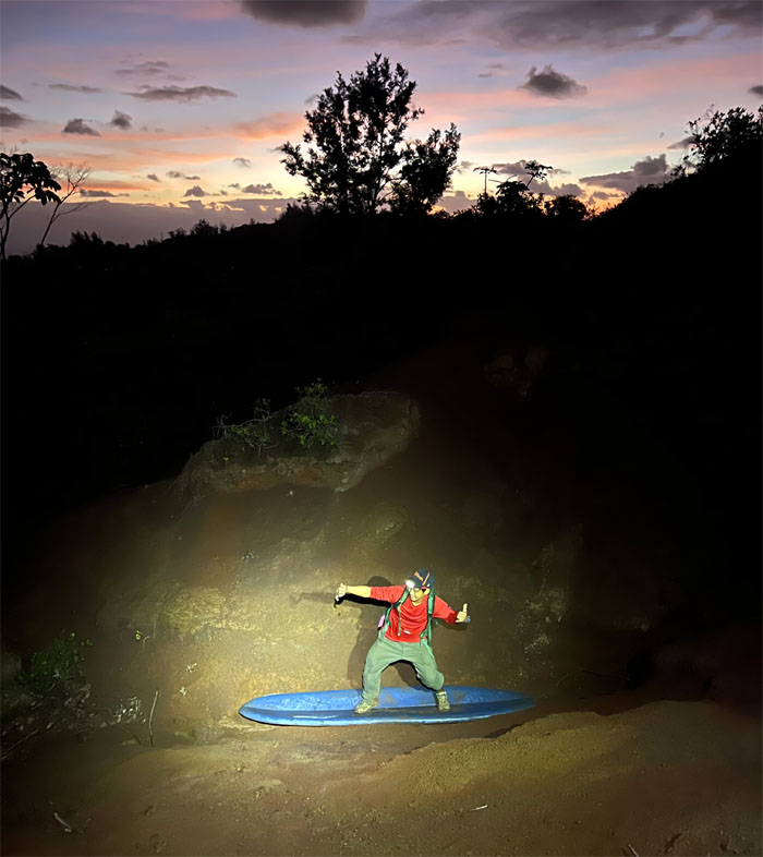
Chris giving the surf report from the mountains.
Laie Trail
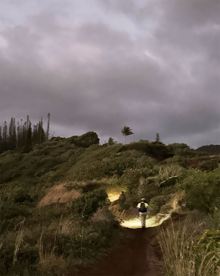
Hiking by artificial illumination.
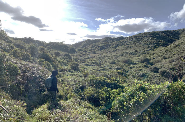
Laie Trail
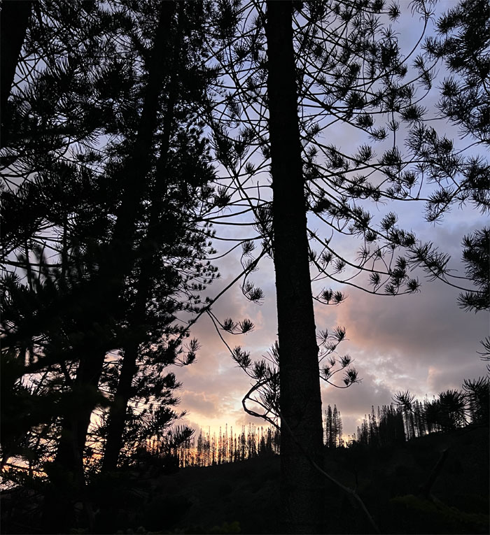
The sunrise peeking through the grove of Norfolk pine trees.
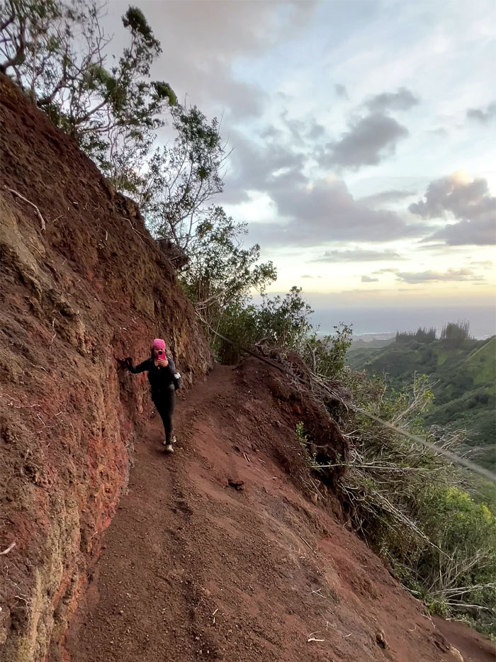
Laie Trail
Traversing the cleaned up landslide.
Laie Trail
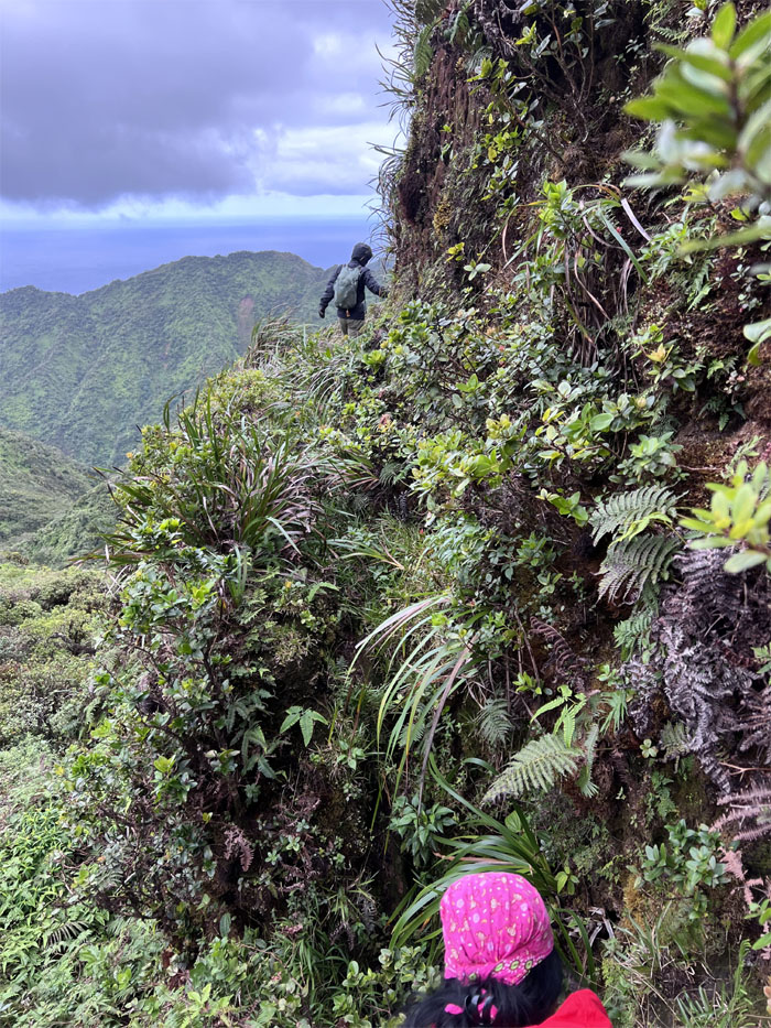
Is this the summit or the falls? Trying to fool the new guy.
Laie Trail
Akira poking his head out of one of numerous trenches that were dug on the side of the trail during WW2. They were to be packed with explosives and set off in case the Japanese military had invaded Oahu after the attack on Pearl Harbor and wreck the trail.
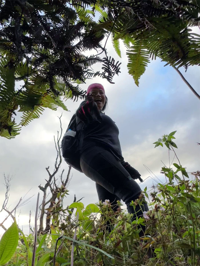
Laie Trail
Some people are not easily fooled or scared.
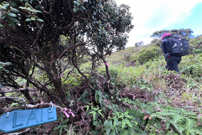
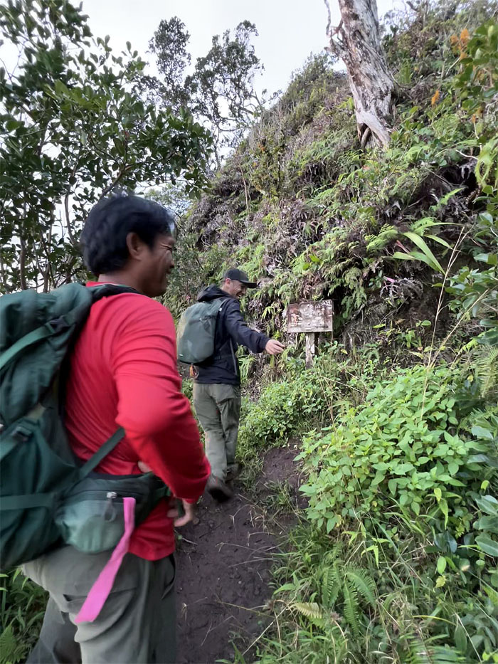
Laie Trail
Passing the replacement sign on our way to the summit.
Laie Summit
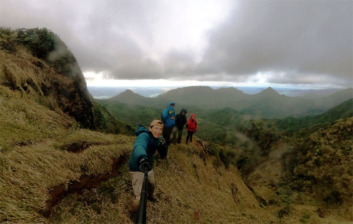
Enjoying outstanding panoramic views of the Windward and Leeward sides at the 2,240′ foxhole.
Ko’olau Summit Trail (KST)
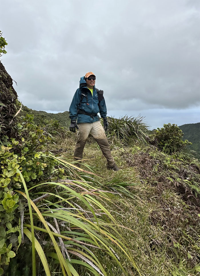
Stepping foot on the spine of the Ko’olau Mountains.
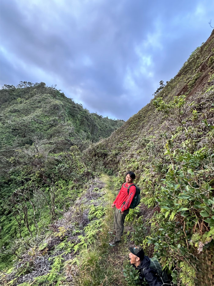
KST
Contouring our way through the mountains.
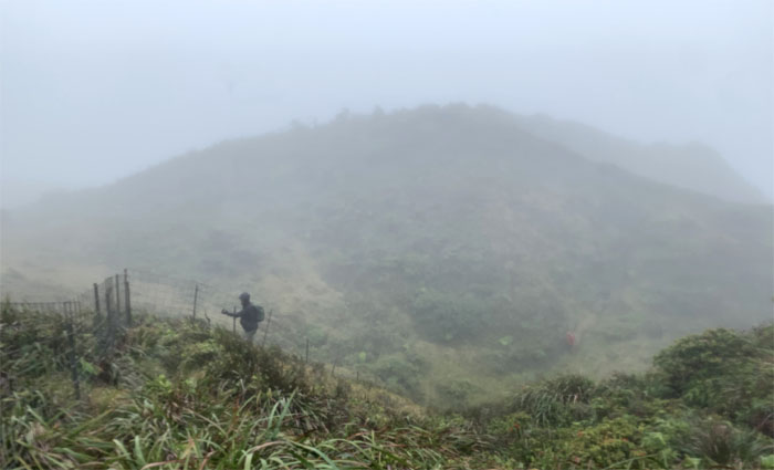
KST
The group crossing the bowl shaped depression.
KST
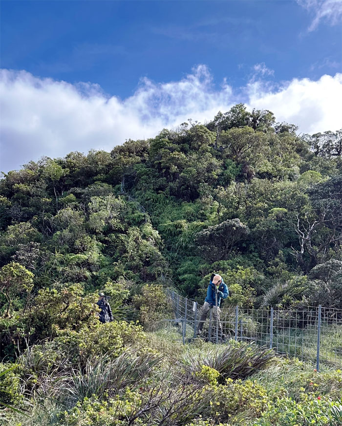
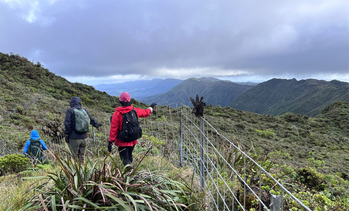
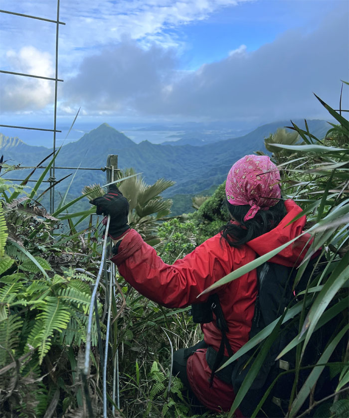
Initial contact with the fence on the trail.
KST
Traversing through the uluhe carpeted trail.
KST
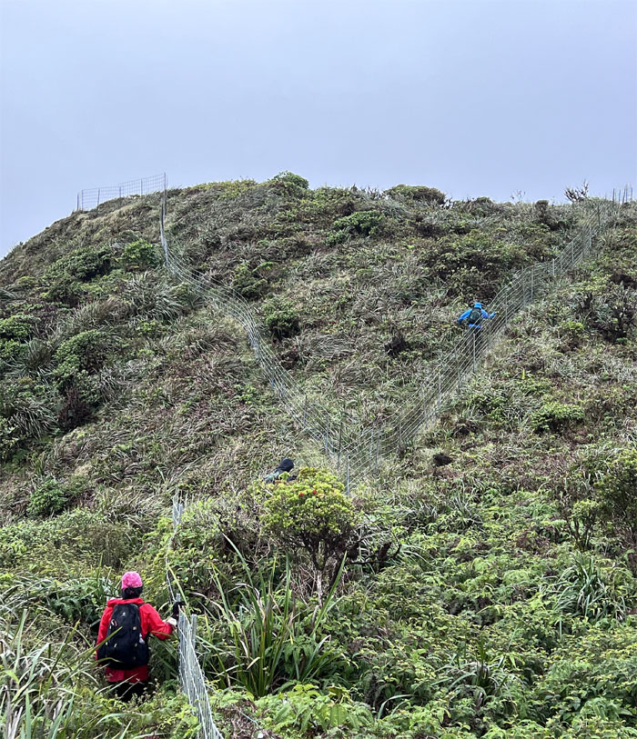
Climbing up the steep fenced hill.
KST
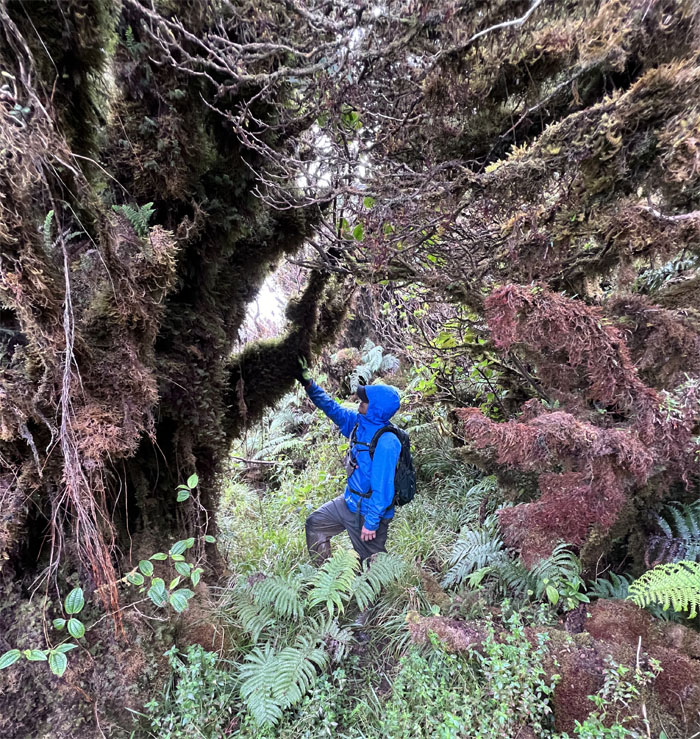
Akira embracing the suck.
KST
Why did the hikers cross the fence? To get out of the cold biting wind.
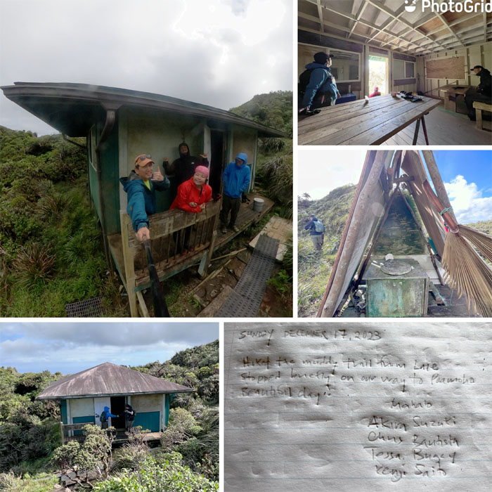
Koloa Cabin
Brief stop at the largest cabin on the KST.
KST
Back on the trail again.
KST
Tessa climbing in and out of the notch.
KST
Rounding the corner on one of the few sections of the trail that was devoid of overgrowth and mud.
KST
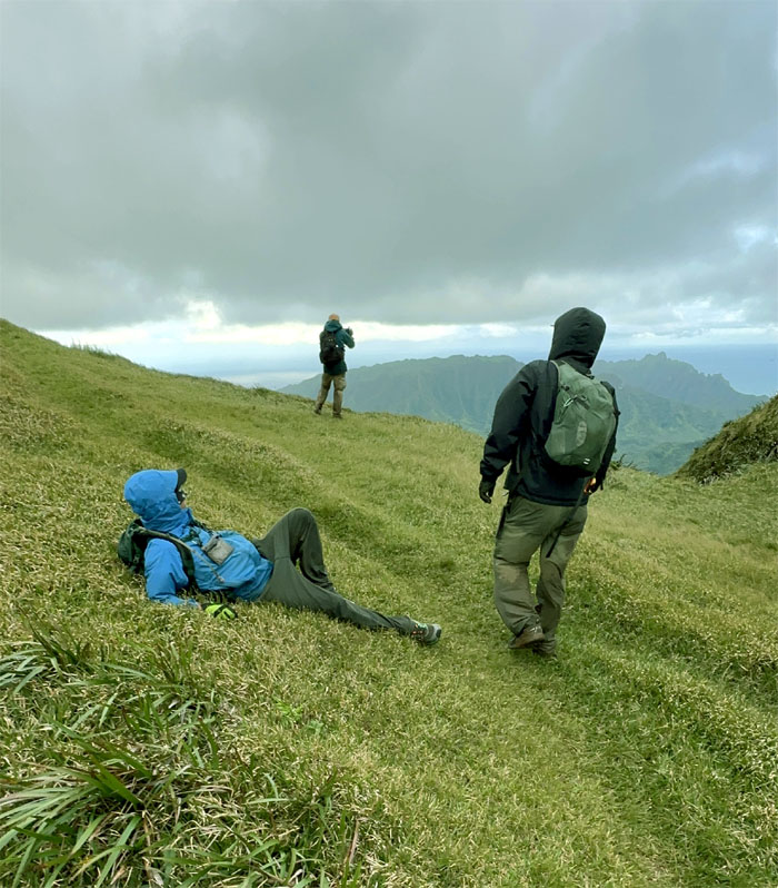
Who pushed Tessa down? The wind? The clouds? Akira?
KST
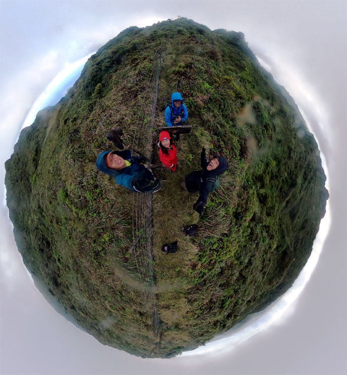
Vangee training with the speed bag for his upcoming match with Naoya “The Monster” Inoue.
KST
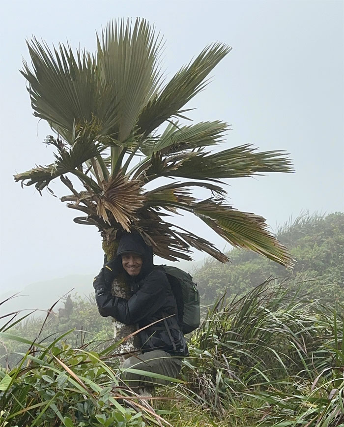
Tree hugger.
KST
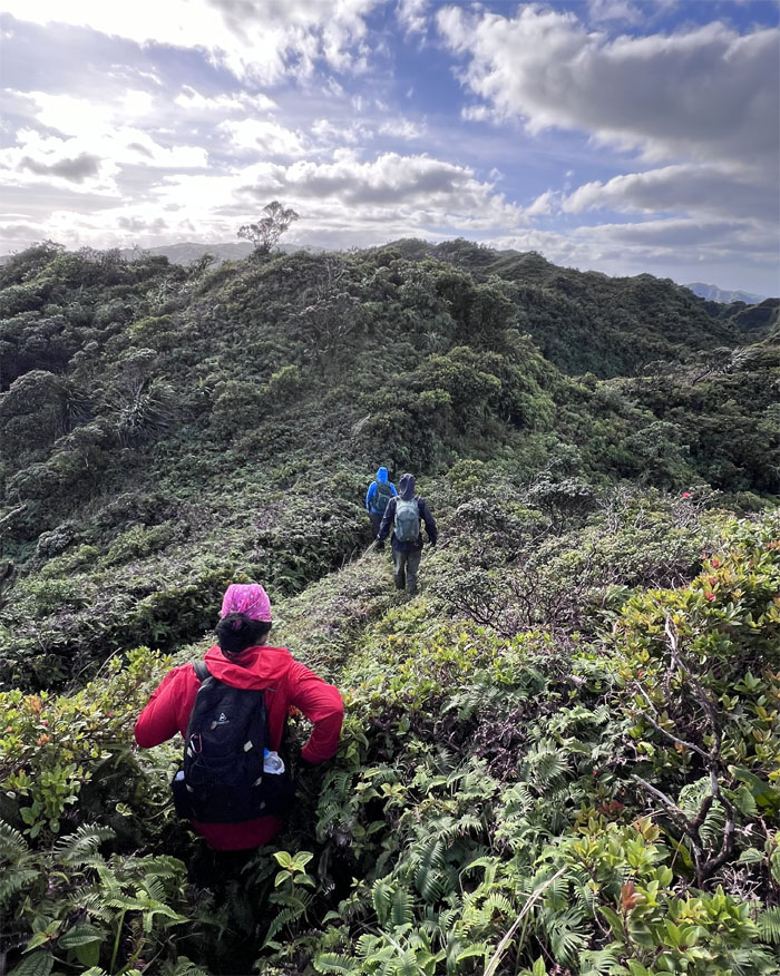
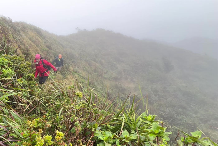
Winding our way through the mountains.
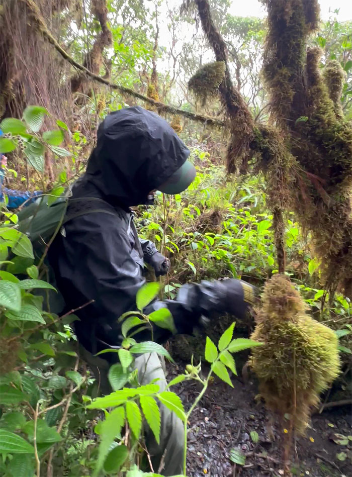
KST
Approaching the group of mossed over trees that signaled we were close to the summit.
Papali Summit
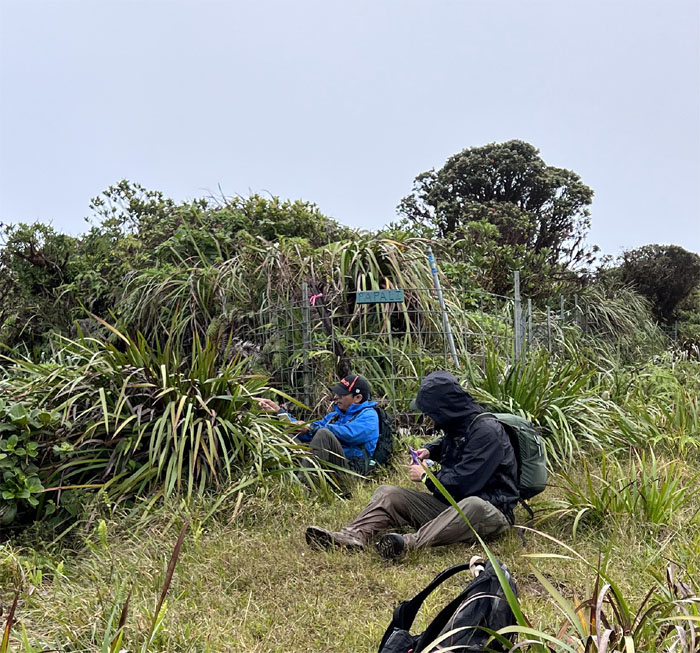
A much needed break from the exhausting mud and overgrowth on the trail.
KST
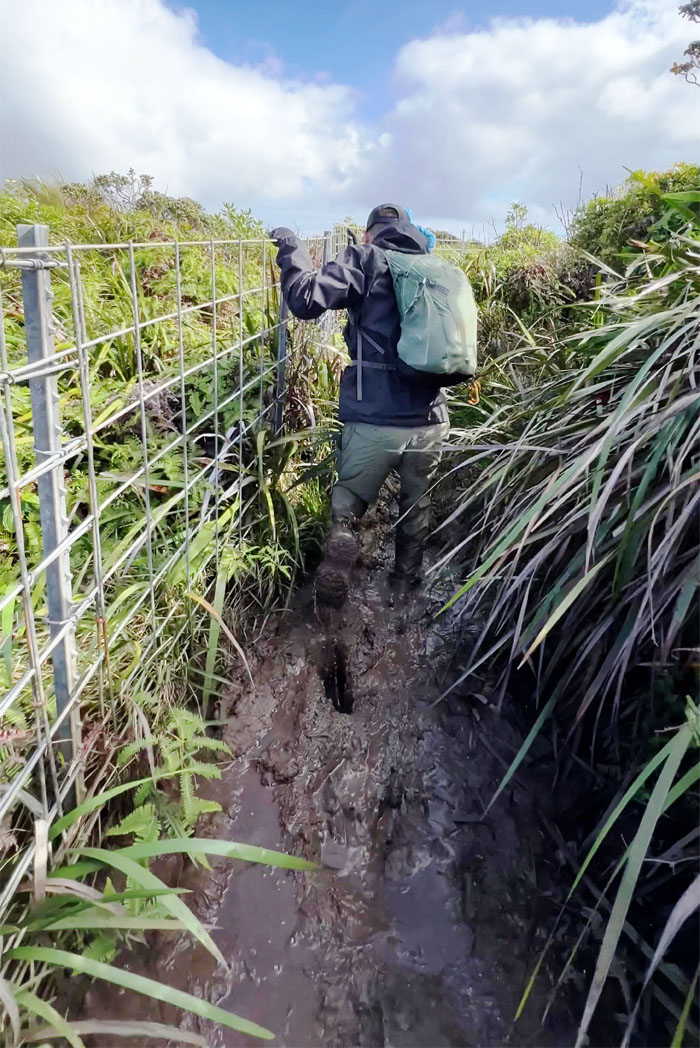
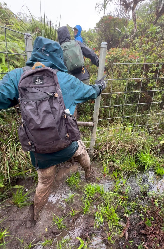
Sole and soul sucking mud as we crossed the gated fence.
Rabbit Hole
The KST sign has seen better times.
KST
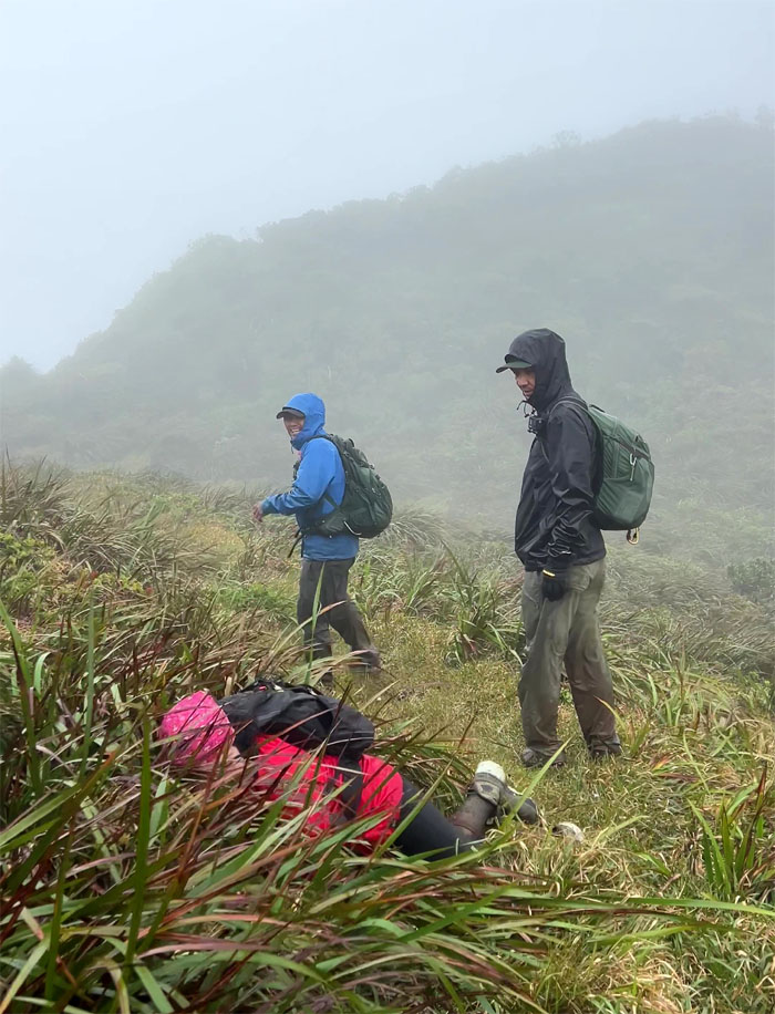
They were four constant companions on our hike today: mud, overgrowth, fence and clouds.
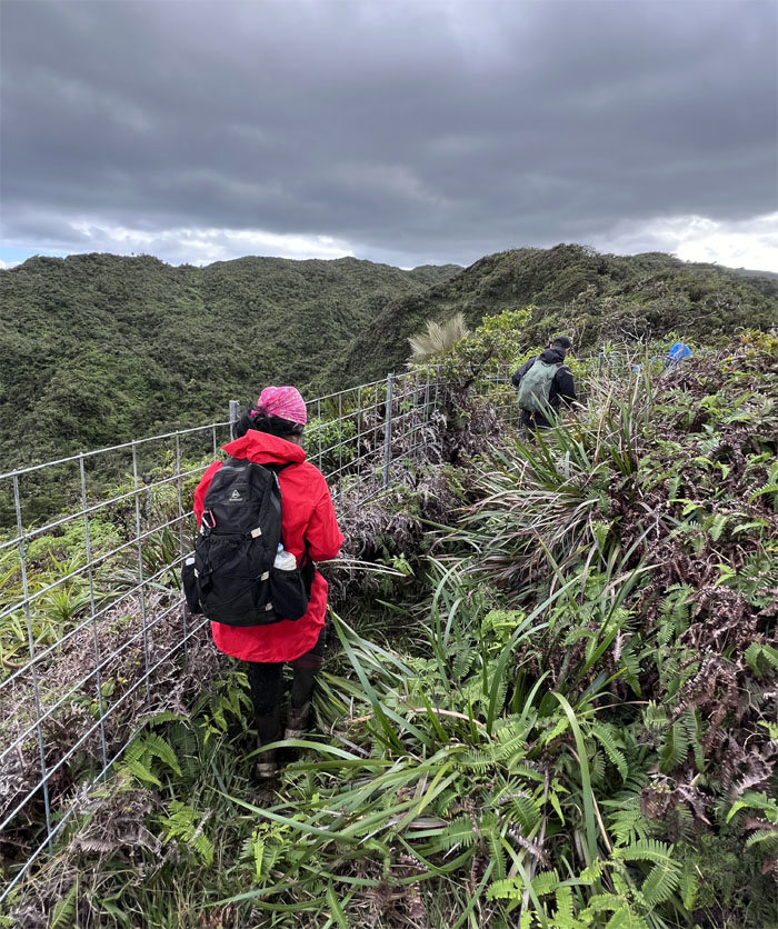
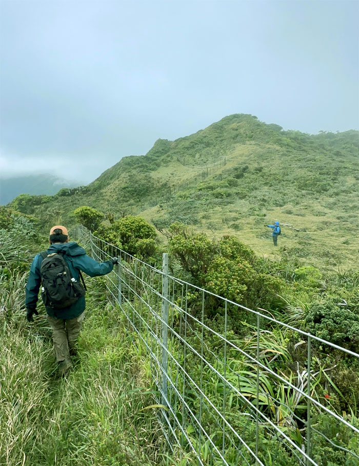
KST
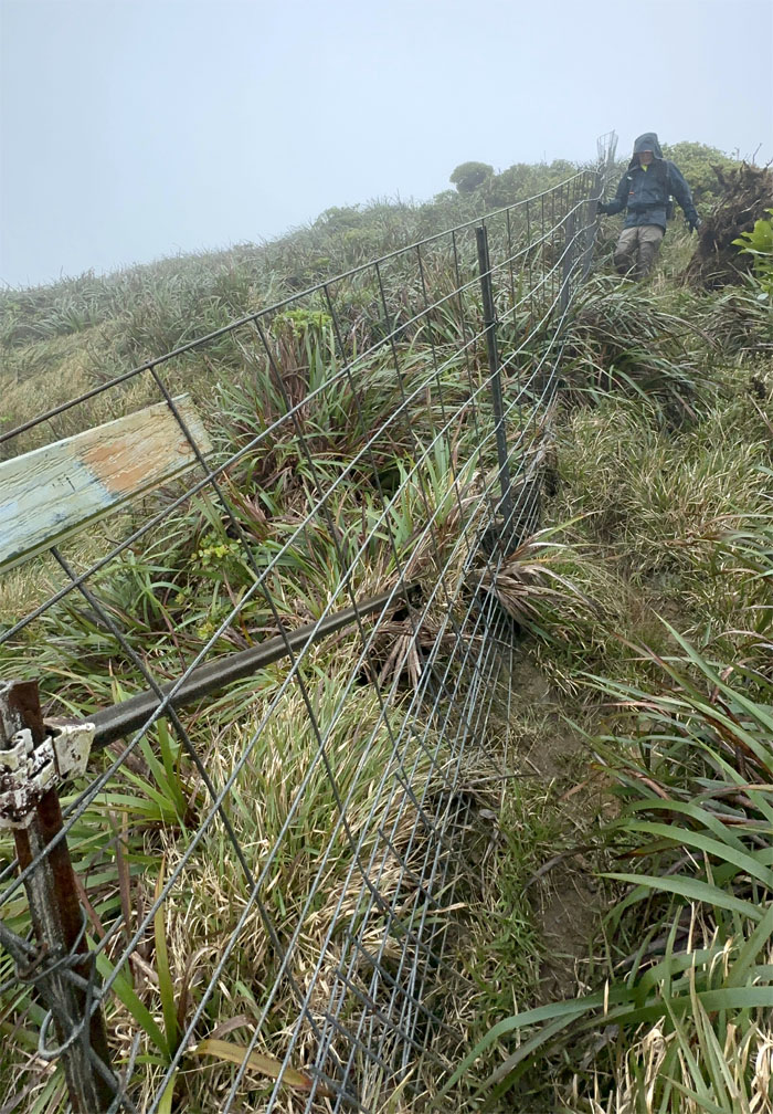
Navigating through the KST has been made much easier with the fence line.
KST
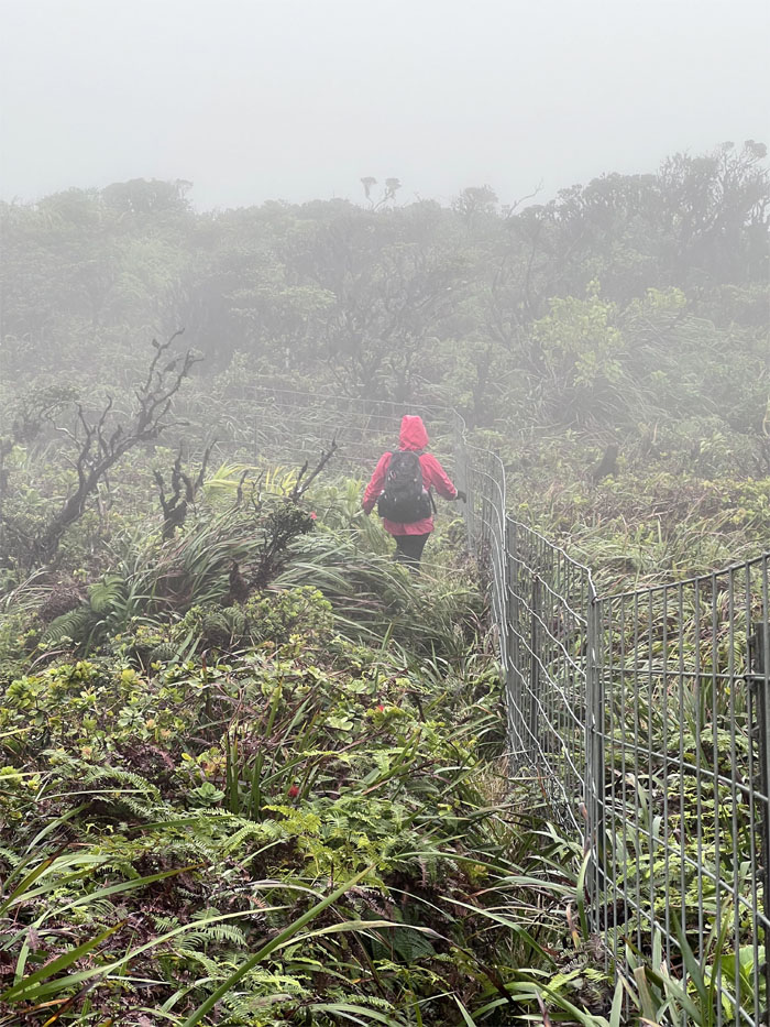
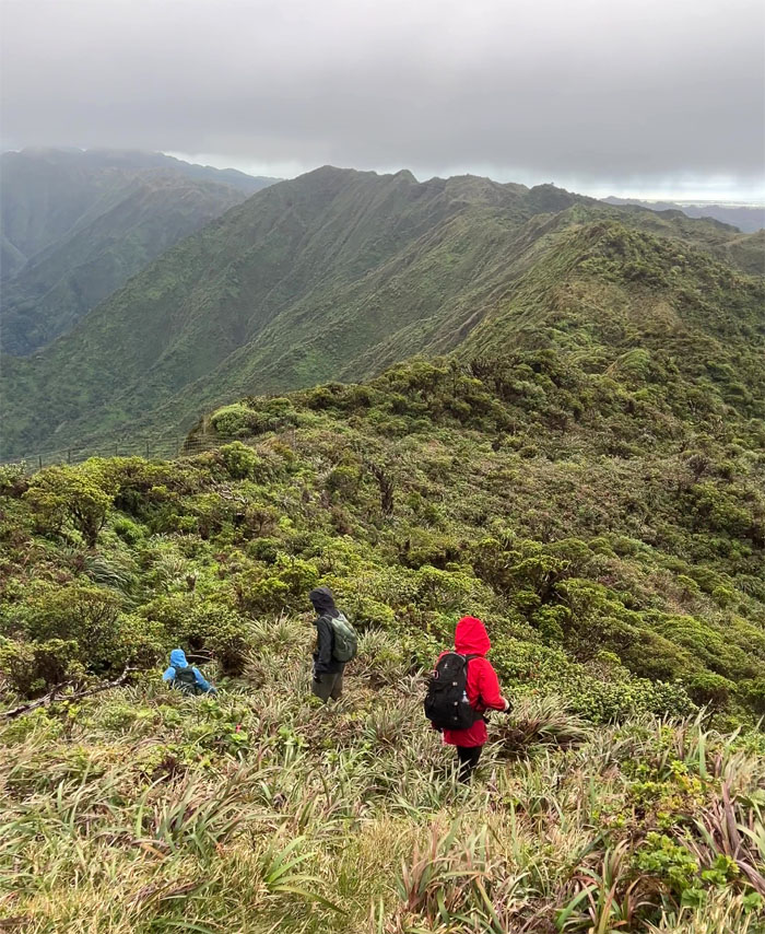
Traversing through the cloud soaked rolling hills.
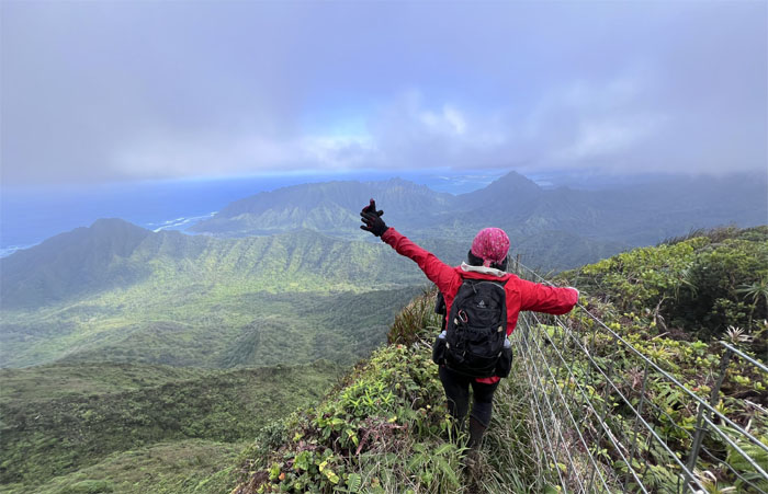
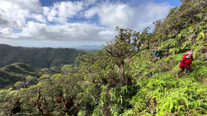
KST
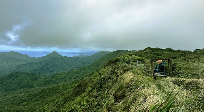
The clouds finally relented and cooperated in providing us with valley and coastal views.
KST
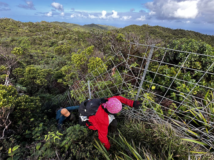
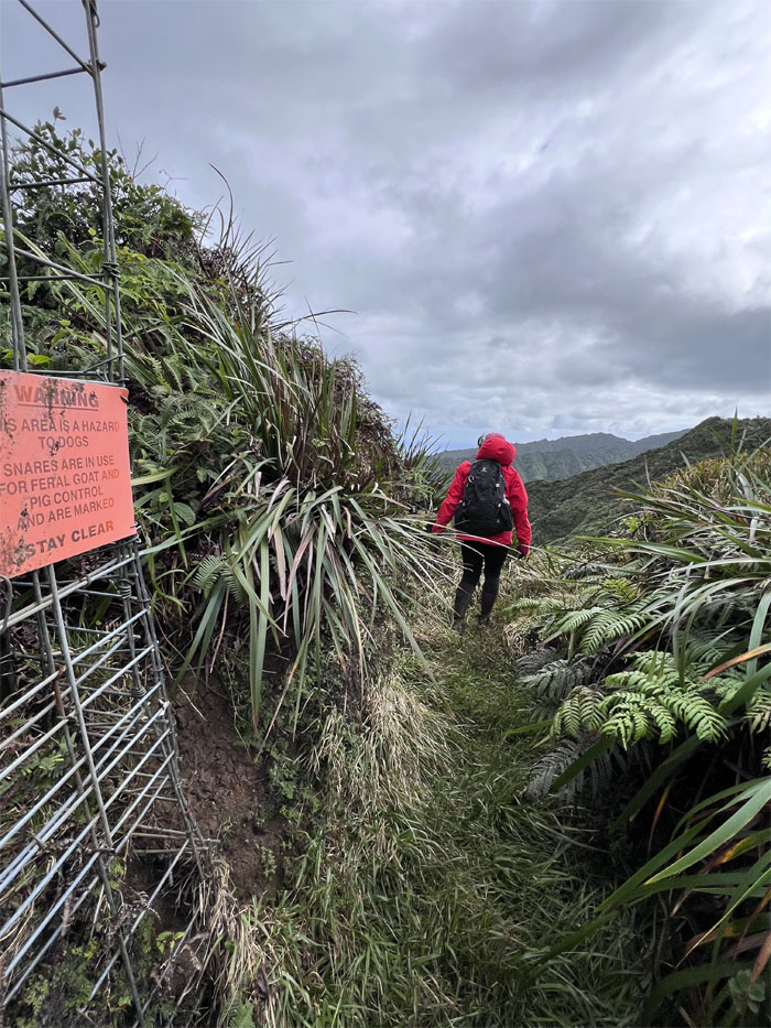
Crossing the fence and meadow to reach the other side.
KST
Mountain views in the background.
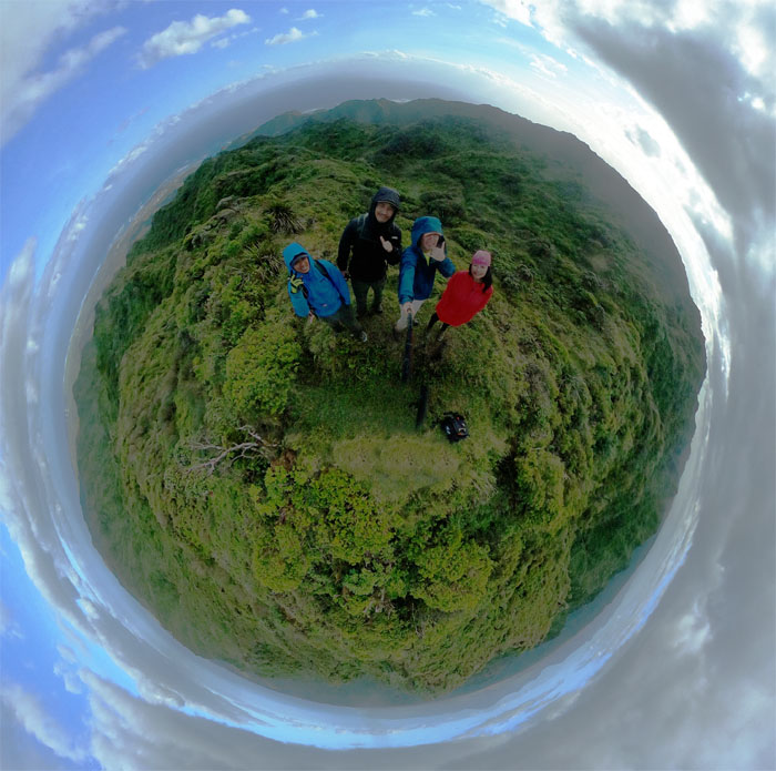
Da Boot
Group photo at the iconic boot KST sign junction. The boot has seen better days as well.
KST
Talk to the glove.
KST
Staying on the right as we climbed up another hill.
KST
Leaving the fence temporarily behind as we descended down to the mud soaked trail.
KST
Exiting the gate to contour around the ridge line.
KST
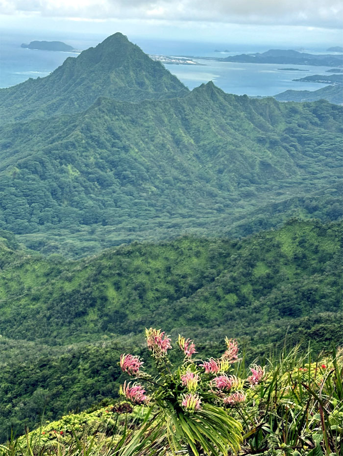
Flowering lobelia against the backdrop of Pu’u Ohulehule.
KST
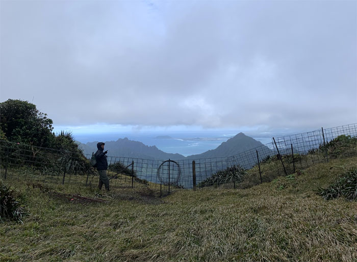
Entering our last gate on the KST.
Poamoho Summit
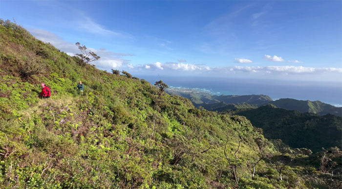
We pushed against the wind to make our way to promising views of Punalu’u and Kahana Valleys.
Poamoho Summit
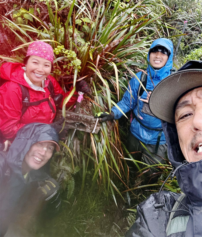
Group photo at the 2,520′ grassy hump.
Poamoho Summit
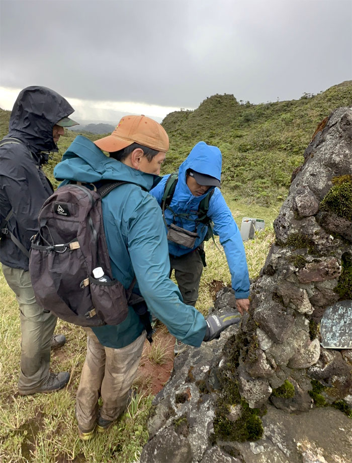
Checking out our mountain mileage at the Cline Memorial.
Poamoho Trail
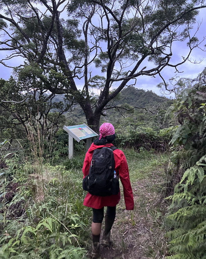
Halfway to the trailhead.
Poamoho Trail
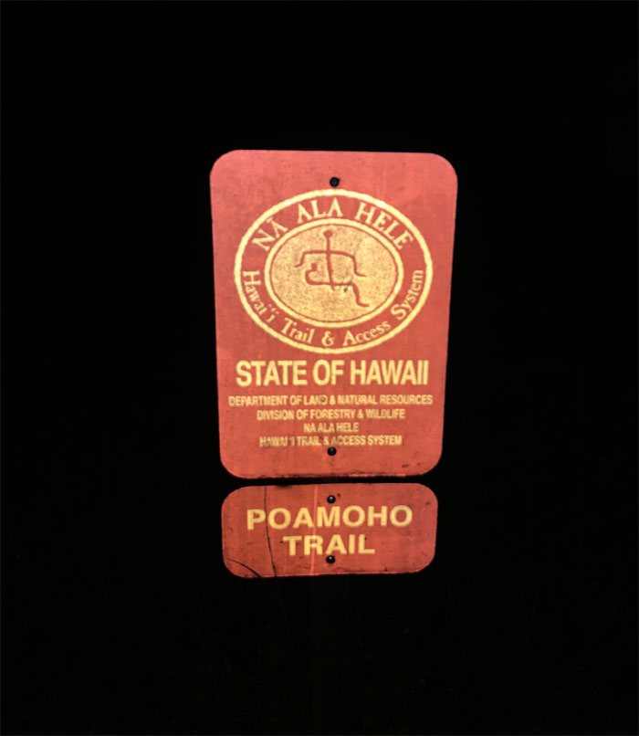
Reflective trailhead.
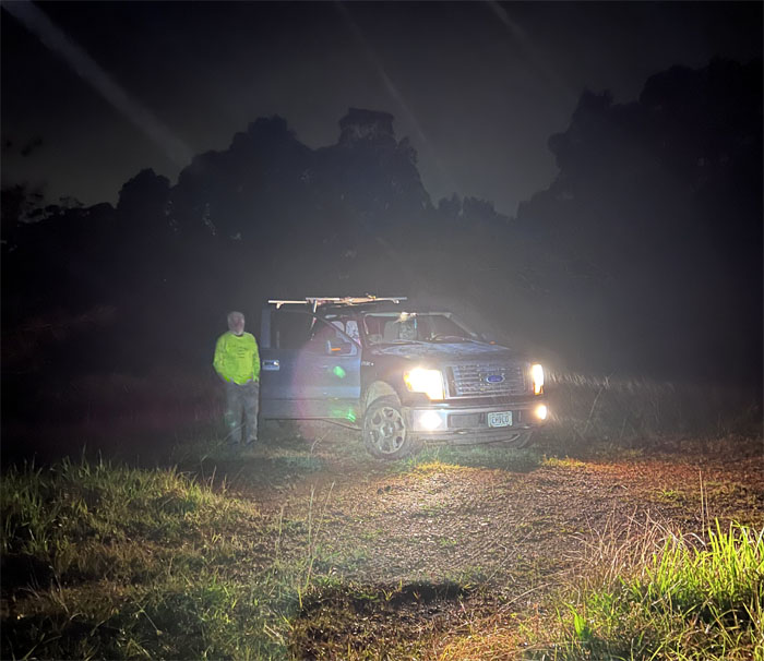
Poamoho Road
A big shout out to Chico who drove up 4.4 miles up the road which meant we only had to walk roughly 1.6 miles down the overgrown and puddled road. Thanks also to Gordon and Nick for getting the gate combination over to us.
All pau
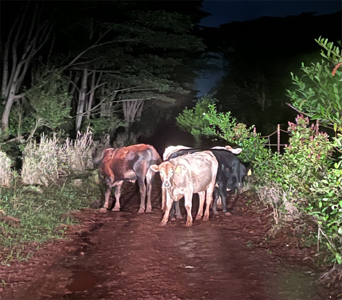
We ran into a cow blockade further down the road, infinitely preferable than a cow stampede. Glad we were safely encased in a truck when our paths met, otherwise we would have to learn to be paniolos on the job.
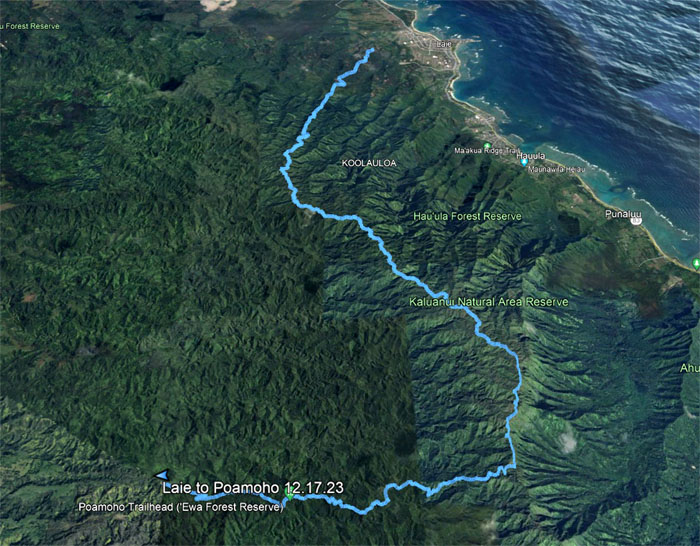
GPS Tracks
Our muddy hike covered 16.72 miles that could have been longer if not for Chico’s timely intervention. Punishing hike with old and new friends. Post hike meal at Popeyes on base where leaving our muddy tracks on a freshly mopped floor was not well appreciated.
Photos taken by Akira Suzuki, Chris Bautista, Tessa Bugay, and yours truly. Not necessarily in order.
Note: I have been made aware that some hikers have been using my blog as a hiking guide and getting lost on the trails. Please note that this blog was made to document the hike for the crew(s) that did it. That is why some of my comments will seem to have no relevance or meaning to anybody outside of the crew(s) that hiked that trail. My blog was never meant as a hiking guide, so please do not treat it as such. If you find inspiration and entertainment from these hikes, that is more than enough. If you plan on replicating these hikes, do so in the knowledge that you should do your own research accordingly as trail conditions, access, legalities and so forth are constantly in flux. What was current today is most likely yesterdays news. Please be prepared to accept any risks and responsibilities on your own as you should know your own limitations, experience and abilities before you even set foot on a trail, as even the “simplest” or “easiest” of trails can present potential pitfalls for even the most “experienced” hikers. One should also always let somebody know of your hiking plans in case something doesn’t go as planned, better safe than sorry.
{ 6 comments… read them below or add one }
Hi Kenji! Awesome hike. I also do urban hikes. I think I used to run into your trip reports on a .edu blog? Long time ago. I think I remember reading one about Lulumalu falls like 15 years ago. Was that yours?
I have always wanted to hike up to Poamoho. How long is the dirt road?
Aloha Trevor,
Thanks. Nope, you must have me confused with somebody else. Never did use a blog on a higher education server. The road is roughly six miles long and would be made a lot easier with a permit and 4×4.
Maybe we’ll bump into each other one day.
Mahalo
Haha, you guys can’t scare me. I have a 3rd eye in the side of my head lmao.. I still tryin to figure out how i fell while standing lol.. So much fun hiking w/ you guys.. Hai! Hai! Arigato, til next time
Aloha Tessa,
LOL. Ok, gonna have to try harder to scare you next time. The winds pushed you over. lol.
Mahalo
Hey Kenji! I was planning on doing this trail in a few days with a friend and was wondering if I could get your GPS coordinates for it? North KST is so hard to follow properly…
Aloha Daniel,
The tracks were sent. Have fun.
Mahalo