
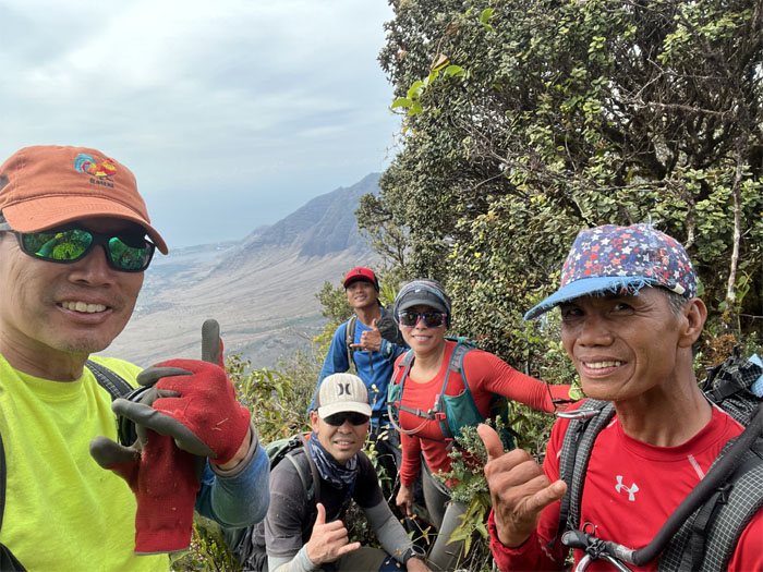
Chris, Ferlino and myself decided to traverse the entire Waianae Mountain Range this Veteran’s Day Weekend. From the other side.
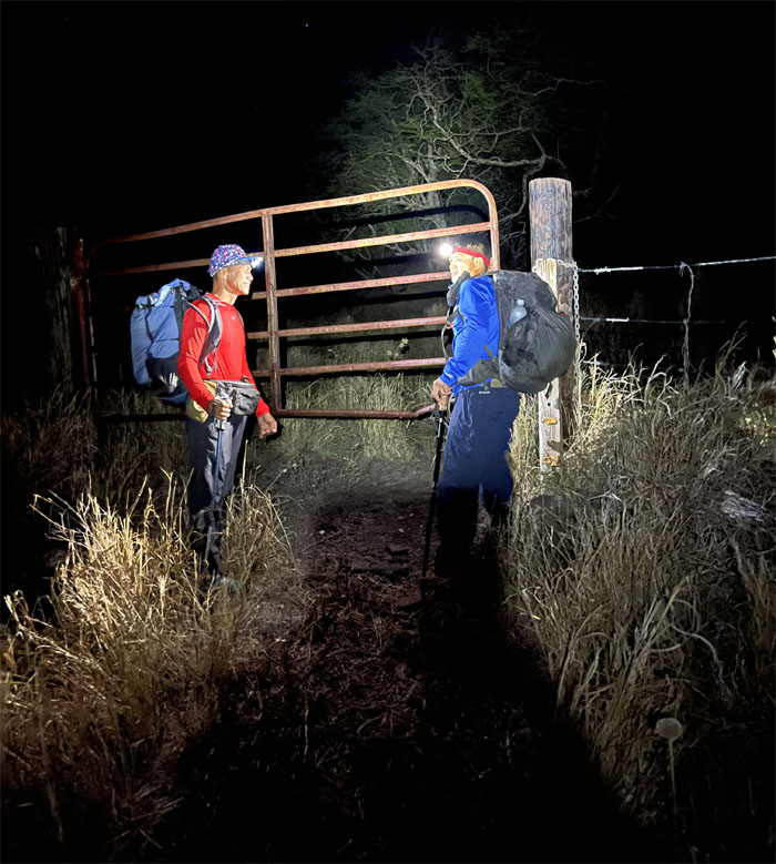
Nanakuli Valley
Day 1
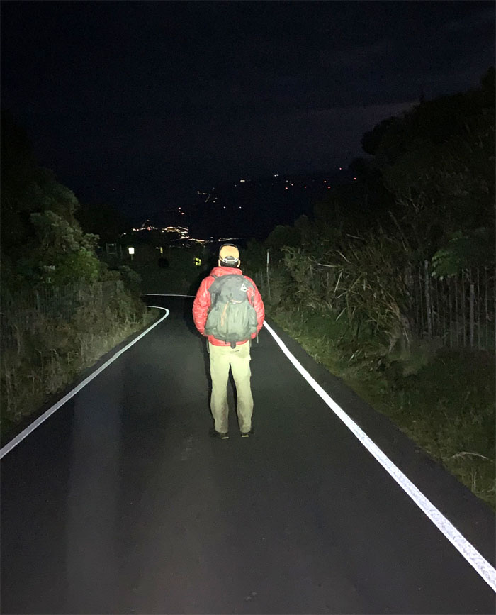
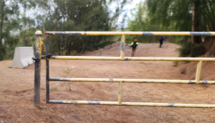
Thanks to Jasmin for dropping us in the kiawe infested valley.
Nanakuli Valley
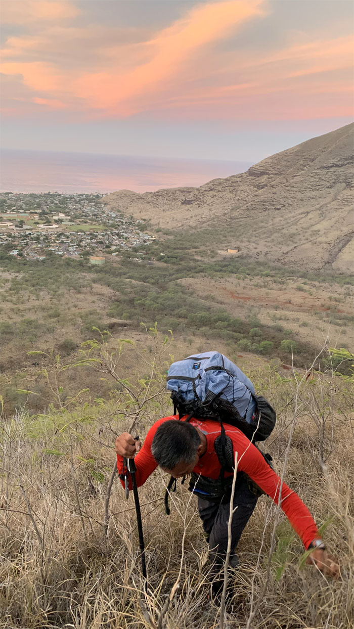
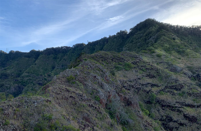
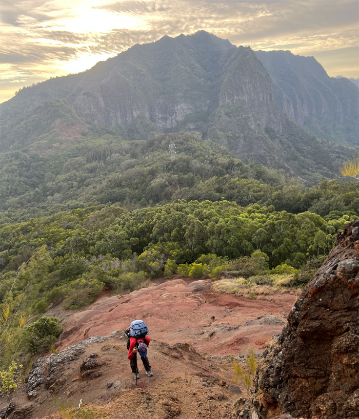
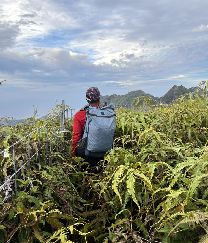
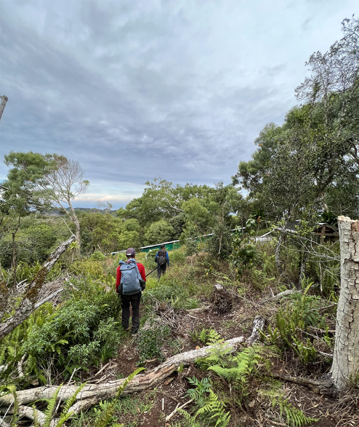
The chilly morning was soon replaced by the heat and humidity of the valley as we made the short and stiff climb to gain the ridge line. Photo by Chris Bautista.
Nanakuli Ridge
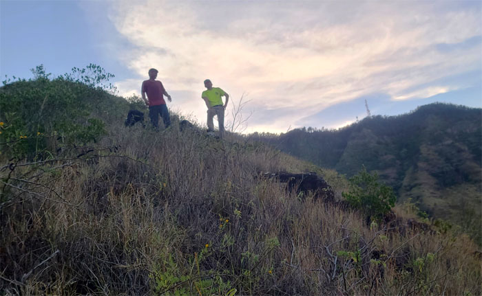
Escaping the oppressive sauna box as we gained the ridge line. Photo by Ferlino Carinio.

Nanakuli Ridge
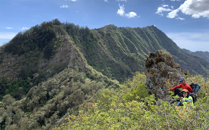
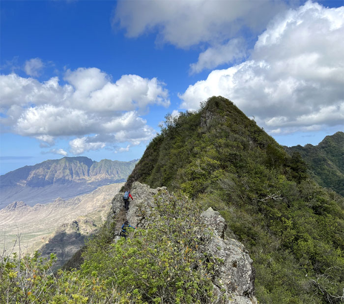
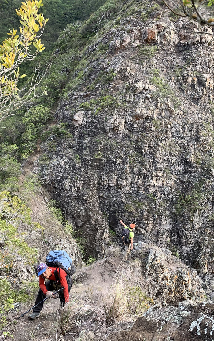
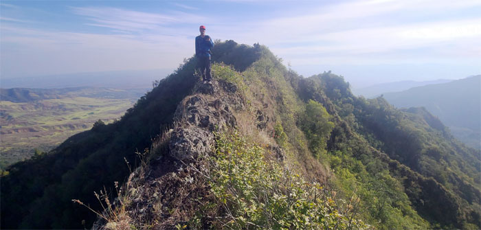
Standing out on the rocky ridge line. Photo by Chris Bautista.
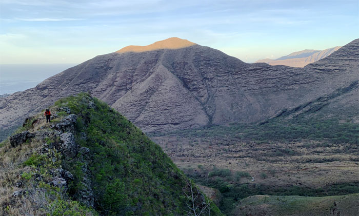
Nanakuli Ridge
Looking back as the rising sun torched the top of Heleakala ridge. Photo by Chris Bautista.
Nanakuli Ridge
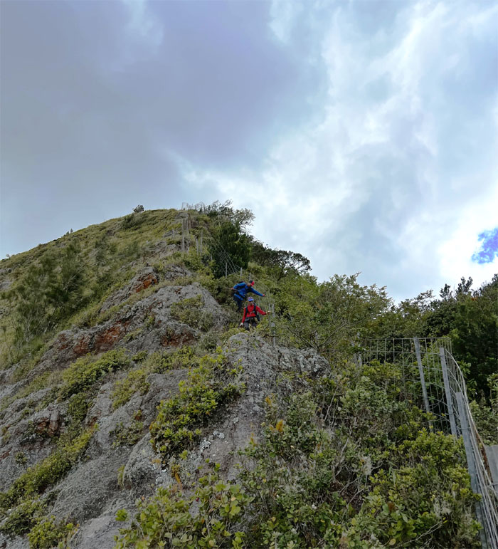
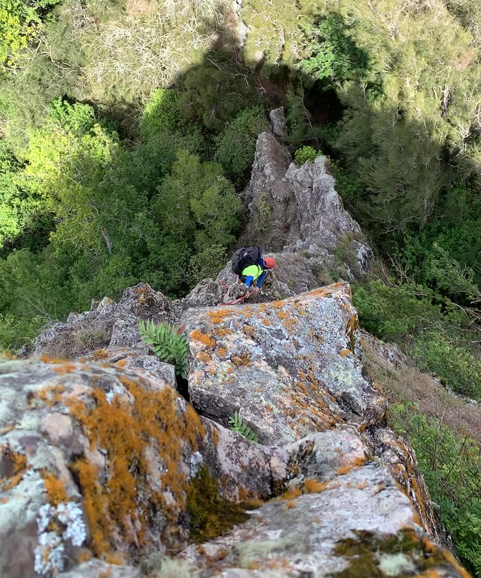
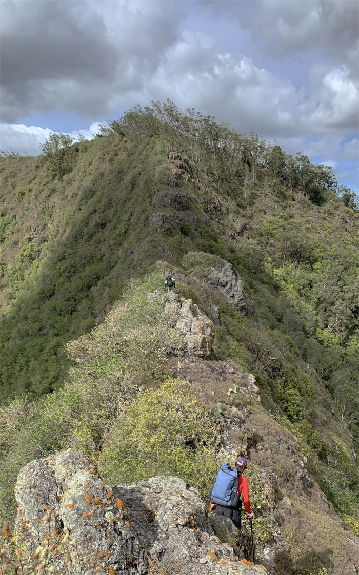
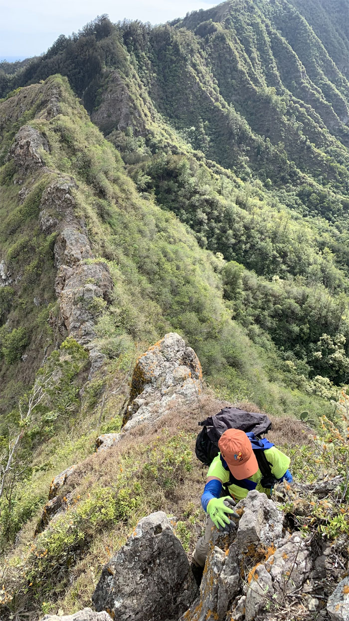
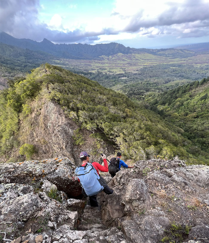
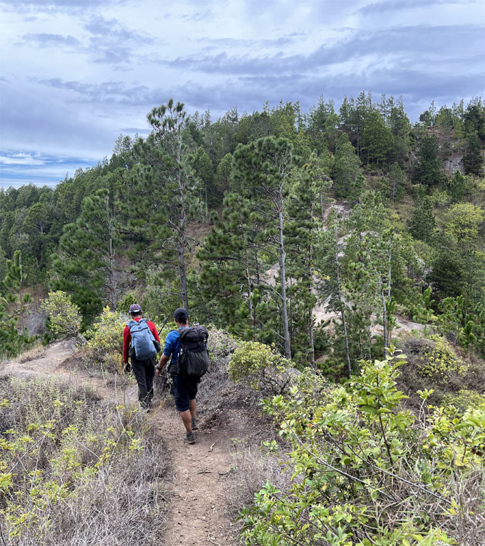
Climbing up the exposed ridge to gain the shade of the forested canopy at the top. Photo by Chris Bautista
Nanakuli Ridge
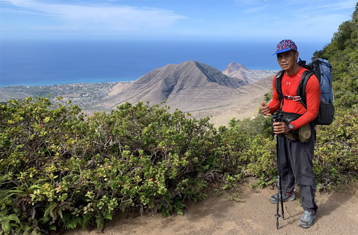
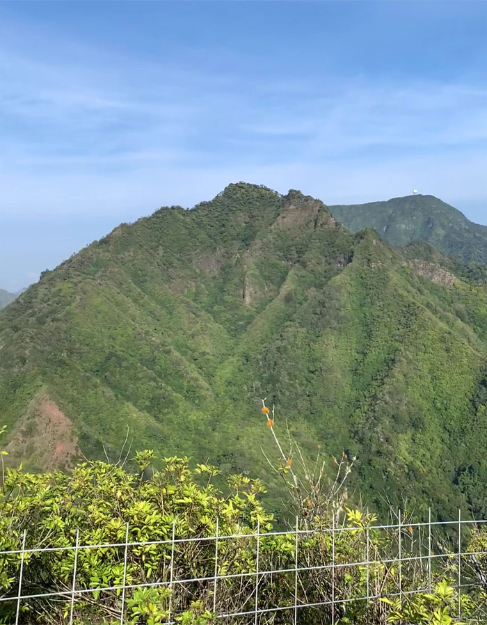
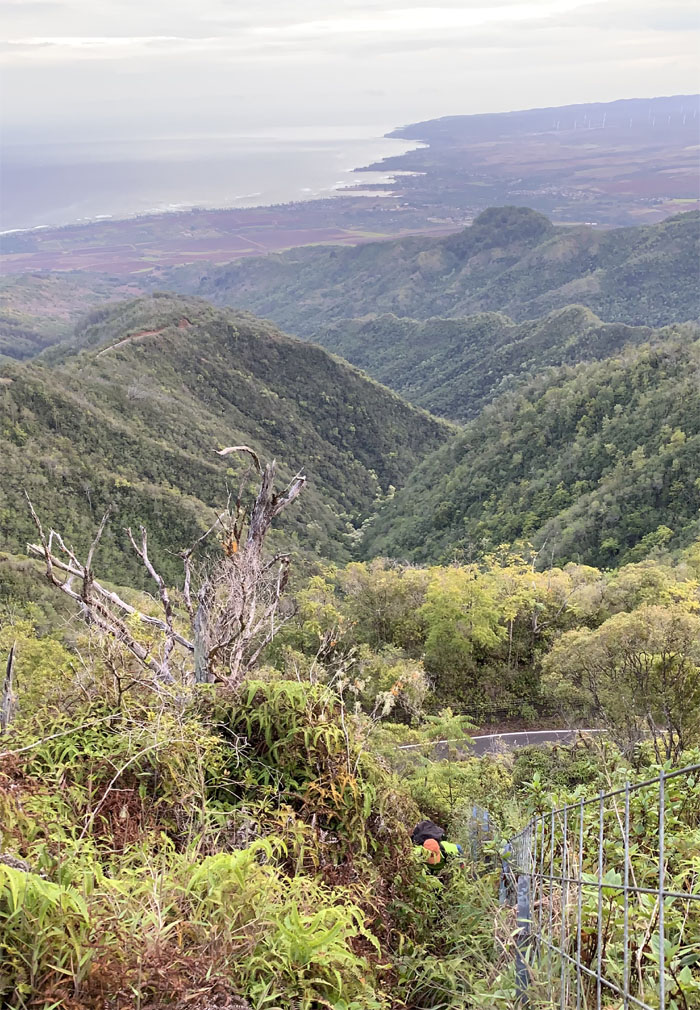
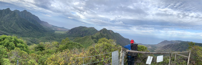
Looking back over into the largest coastal valley on the island that is also home to two of the tallest antenna towers in the Western hemisphere. Photo by Chris Bautista.
Nanakuli Ridge
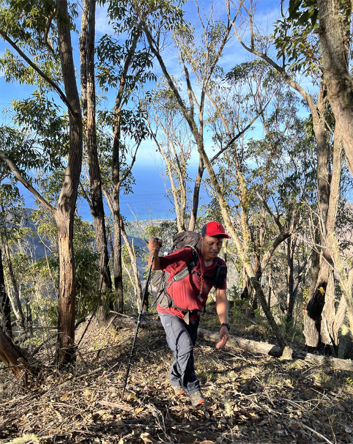
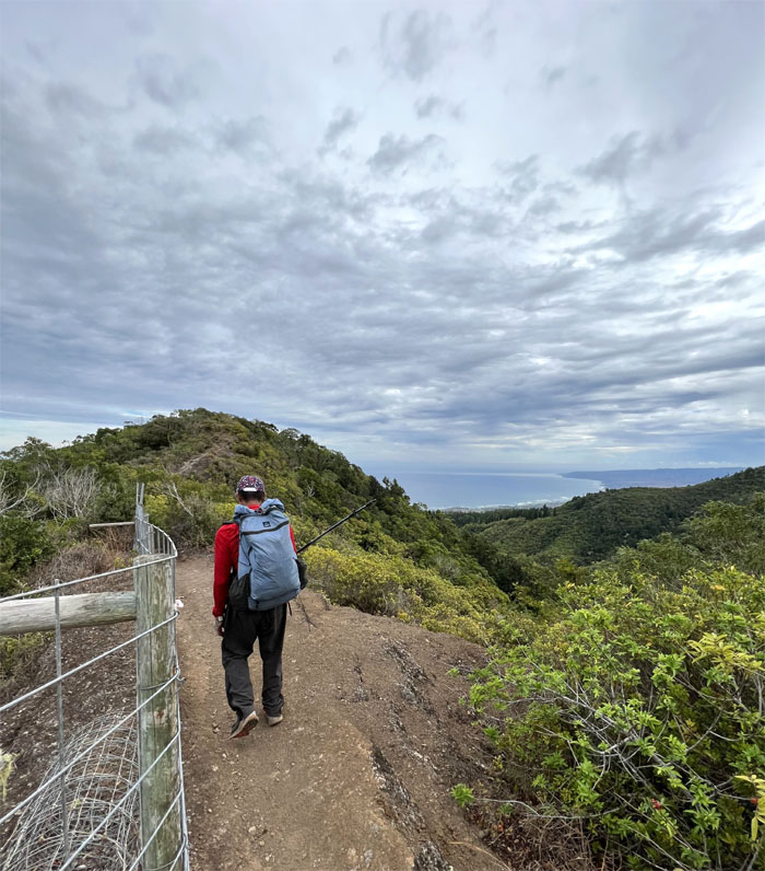
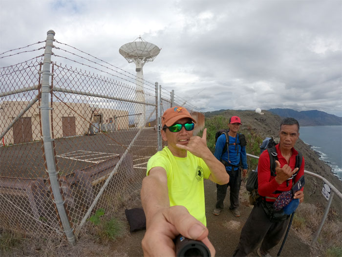
Chris coming up the sweaty hill.
Palehua
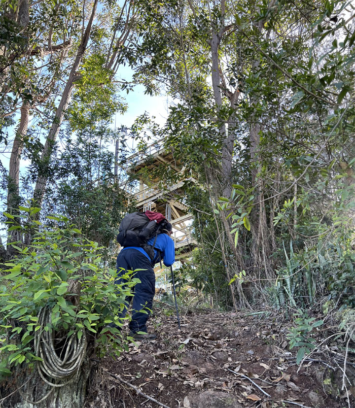
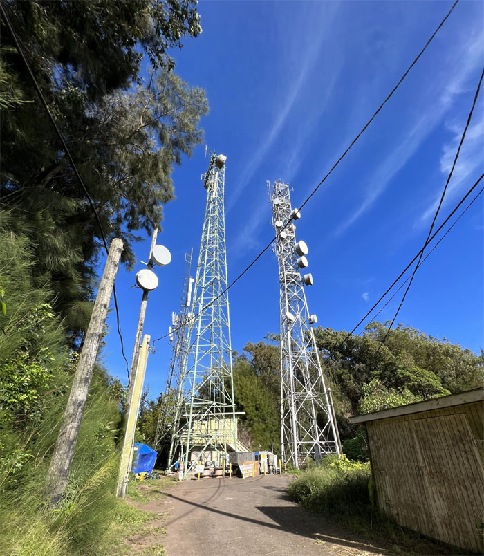
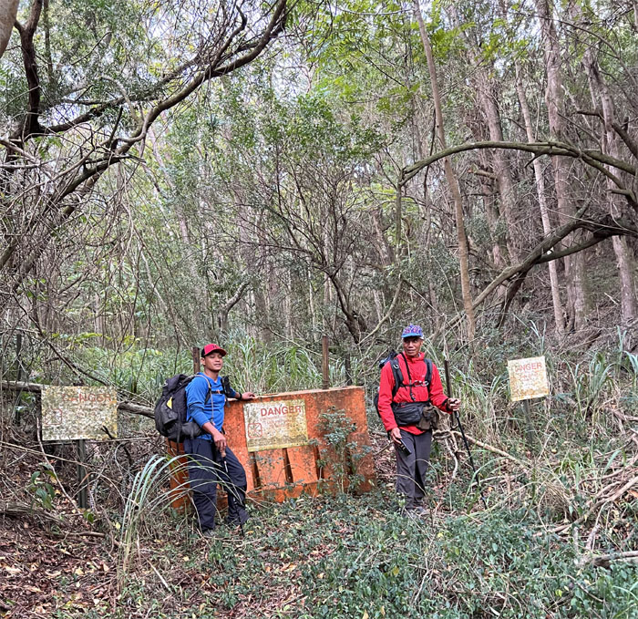
Running across one of many military or government structures that dot the island.
Palehua
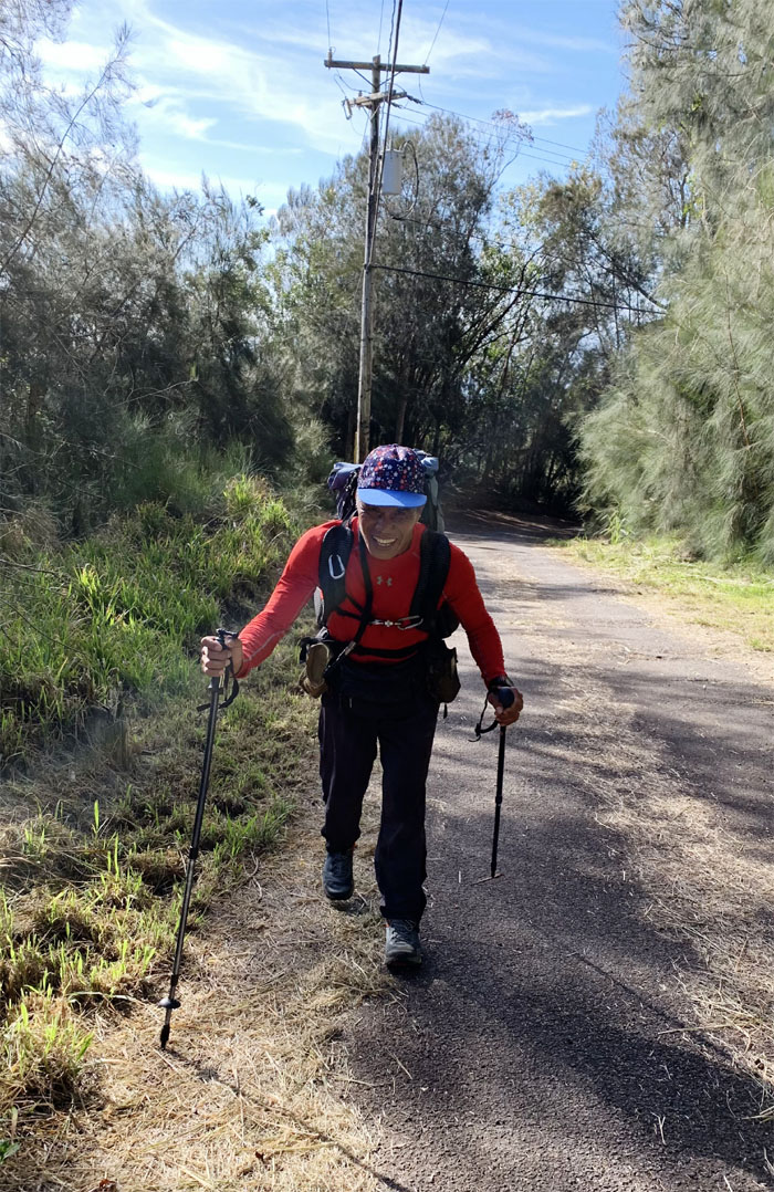
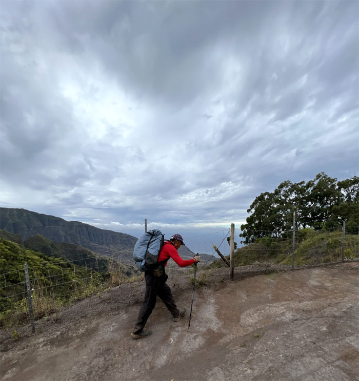
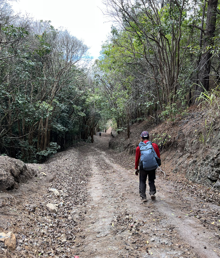
Ferlino making good use of his hiking poles on the paved road. Photo by Chris Bautista.
Palehua
What many call the “official” start or end of the Waianae Summit Trail.
Palehua
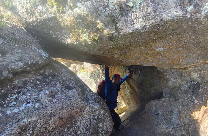
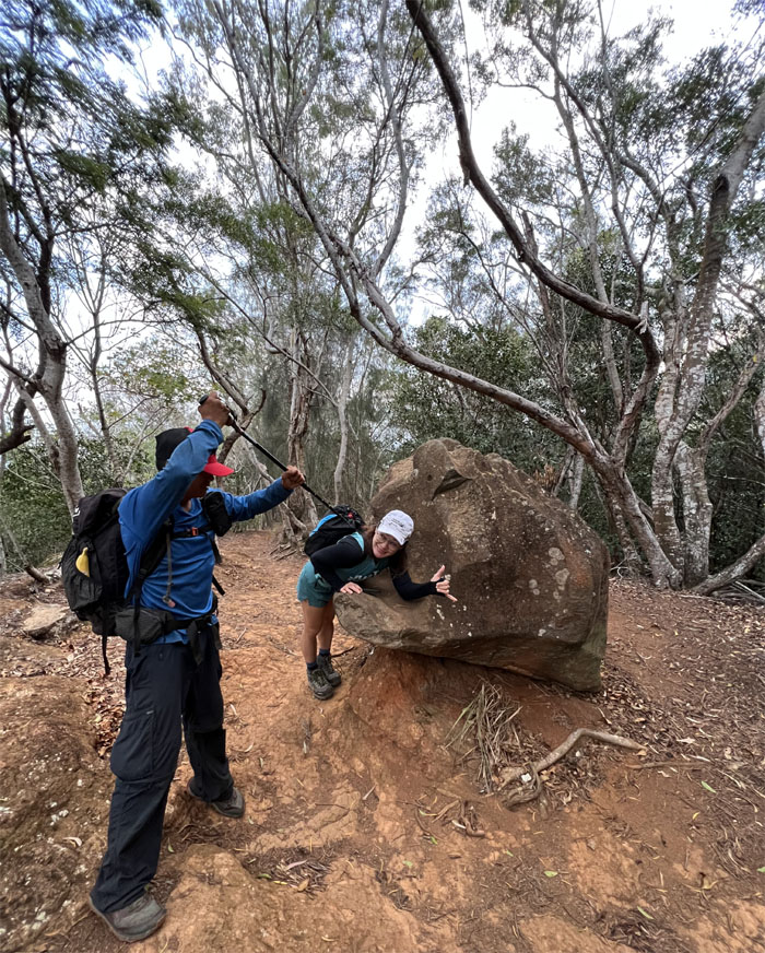
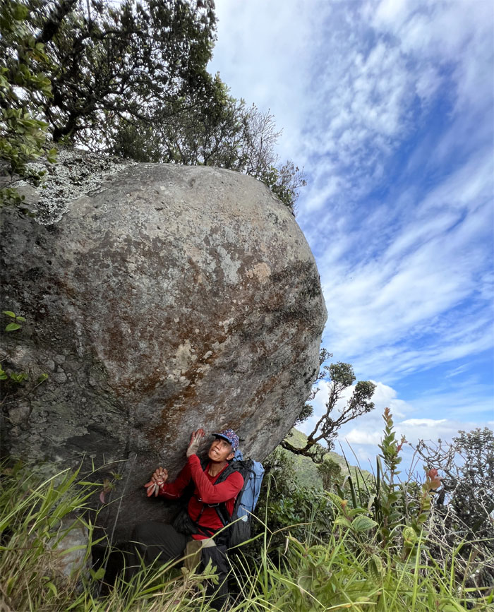
Chris rolling through the Indiana Jones boulders after passing Mauna Kapu which once had a heiau at the point. Photo by Ferlino Carinio.
Palehua
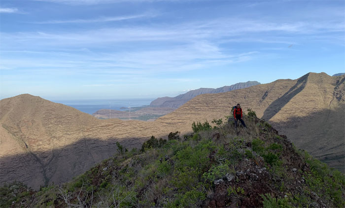
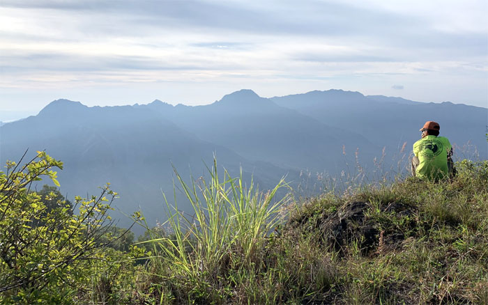
Ferlino overlooking the valley views. Photo by Chris Bautista.
Palehua
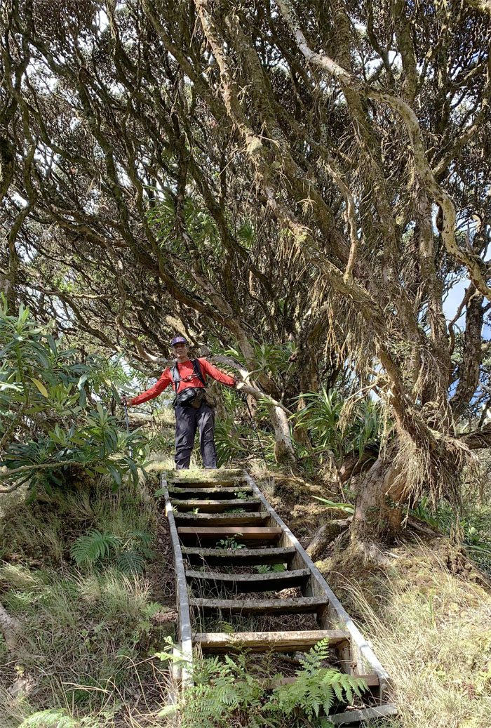
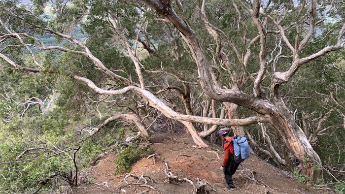
Going up the staircase after we passed an area rich in endemic fauna and flora. Photo by Chris Bautista.
Palikea
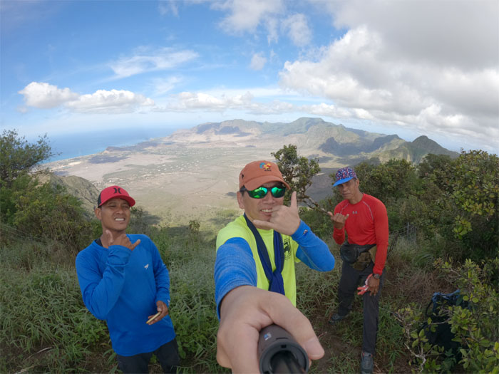
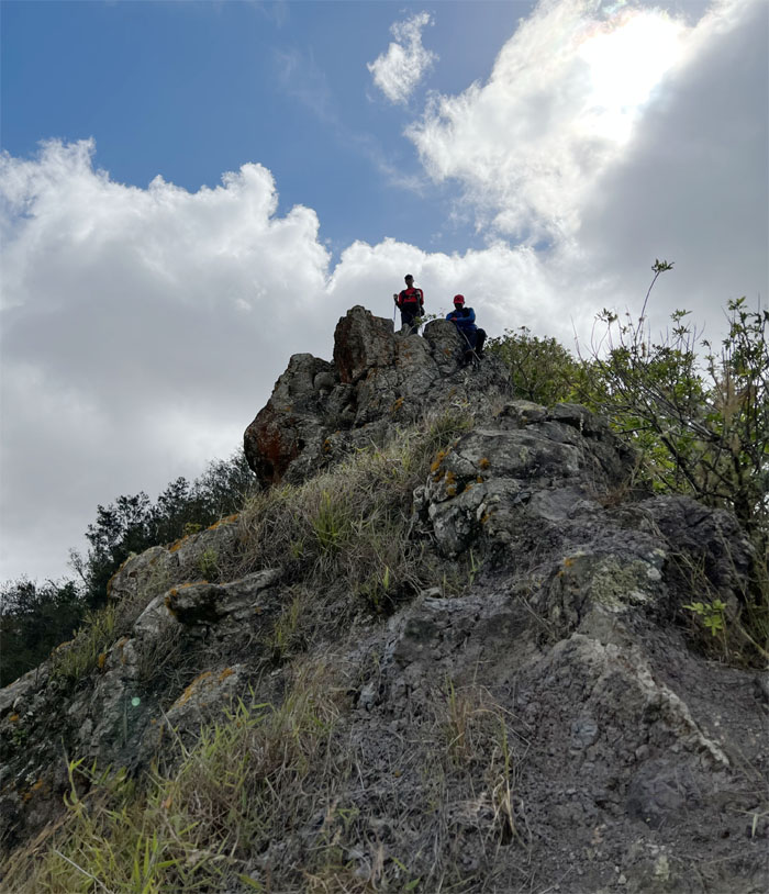
Group photo at the 3,098′ ti leaf summit.
Heleakala
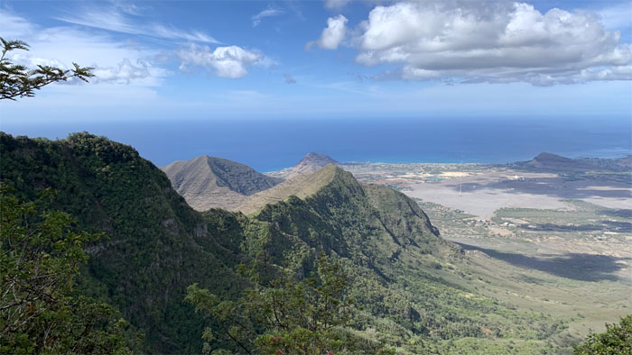
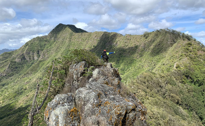
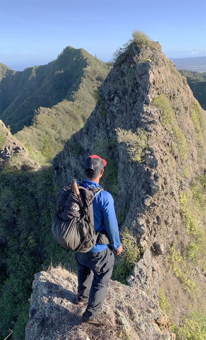
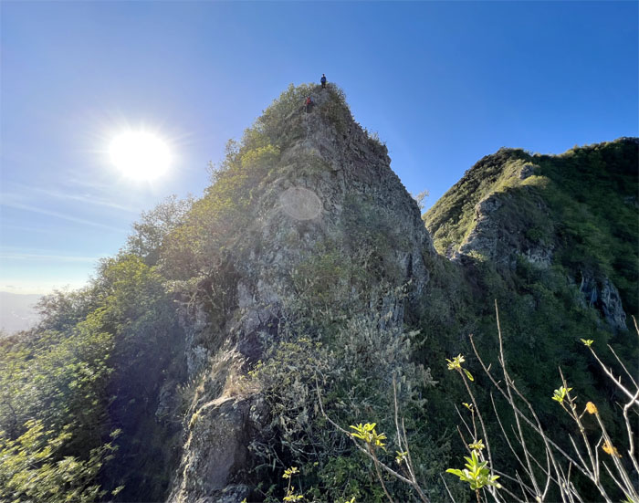
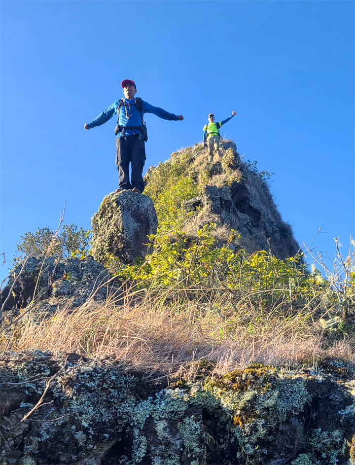
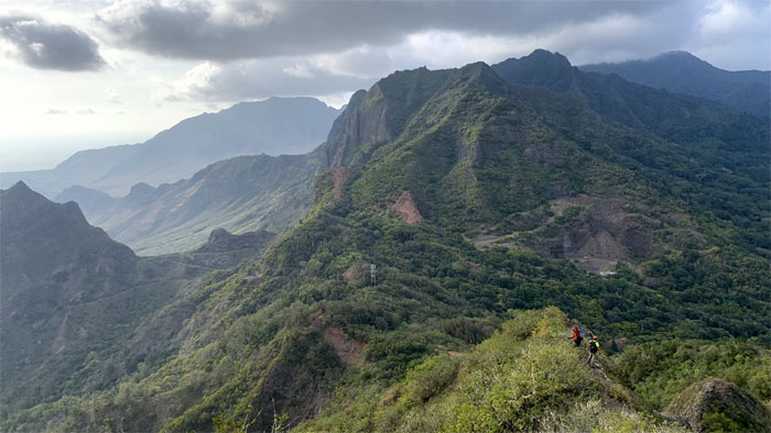
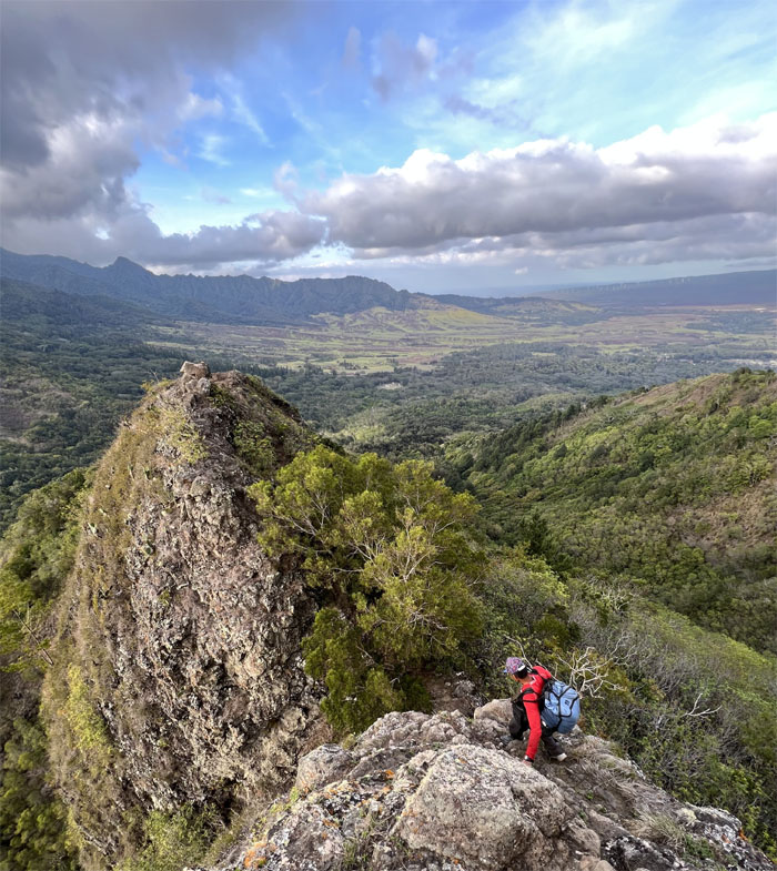
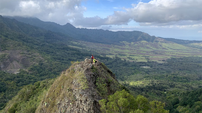
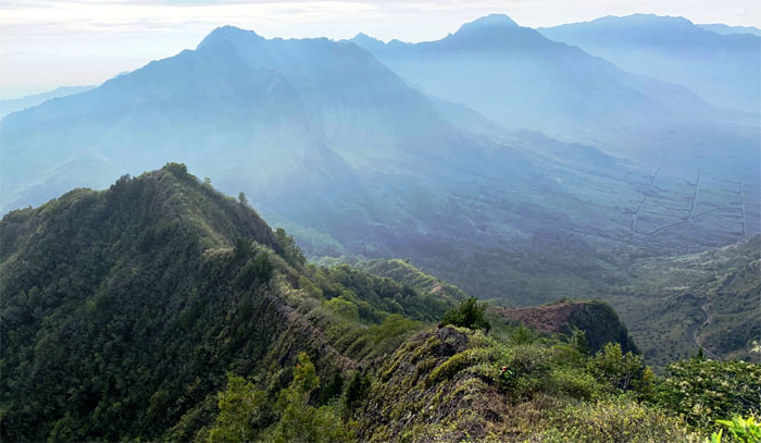
Looking at the ridge that descends to the “Hawaiian Pyramid.” Photo by Chris Bautista.
Waianae Summit Trail (WST)
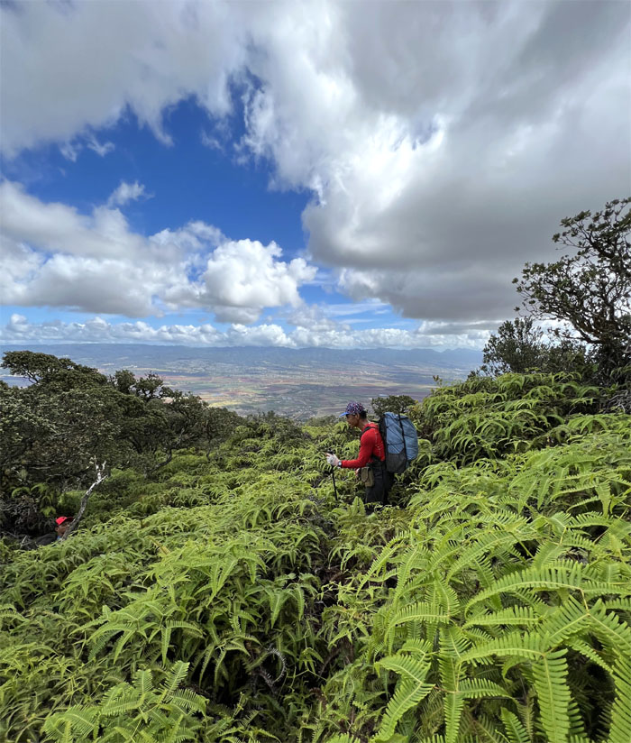
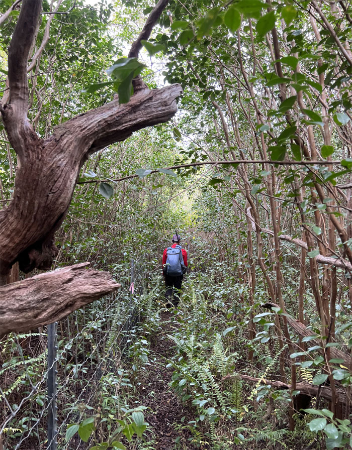
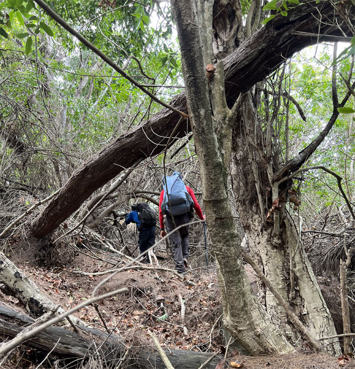
Awash in a sea of uluhe ferns, clawing and scratching us as we went down.
WST
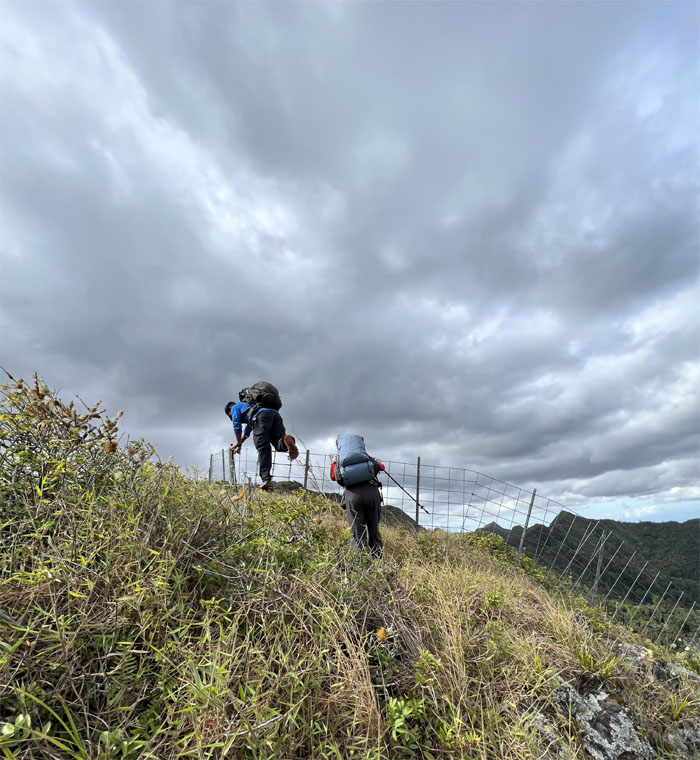
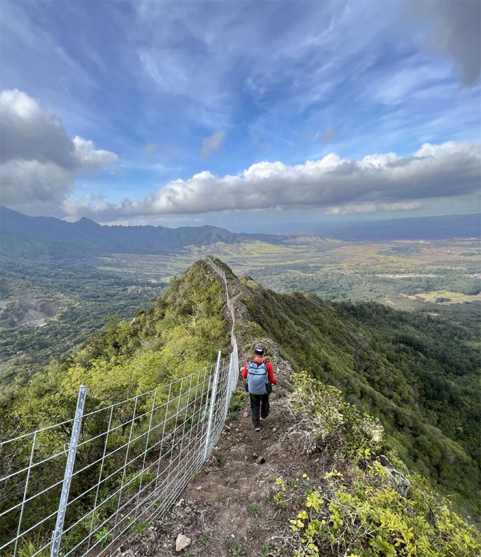
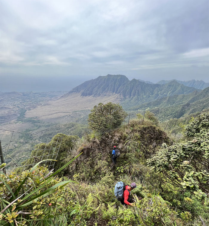
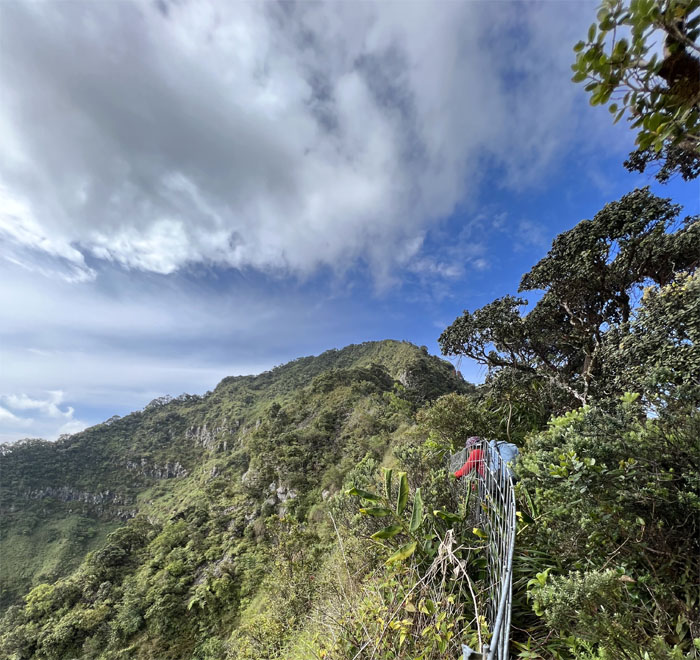
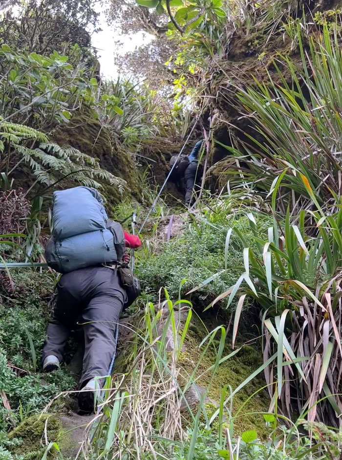
Following the fenced ridge as we lost some of the elevation we had just gained.
WST
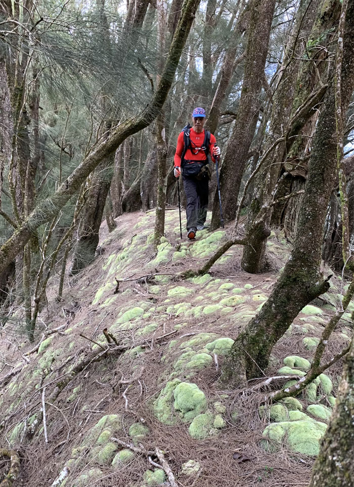
Treading softly on the mossy corridor. Photo by Chris Bautista.
WST
Getting ready to drop into the pass. Photo by Chris Bautista.
WST
Come on down and join the fun!
Pohakea Pass
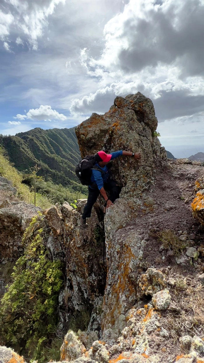
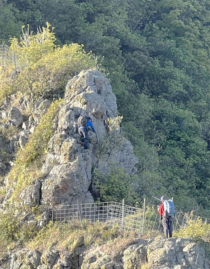
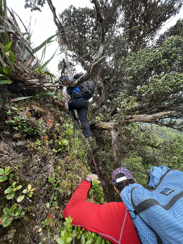
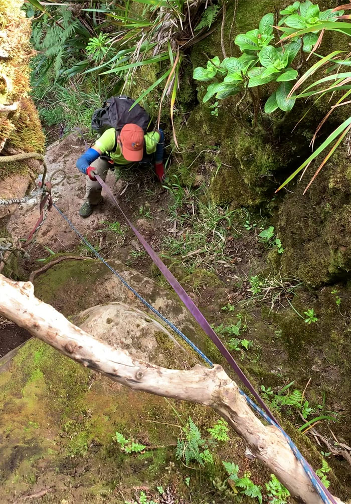
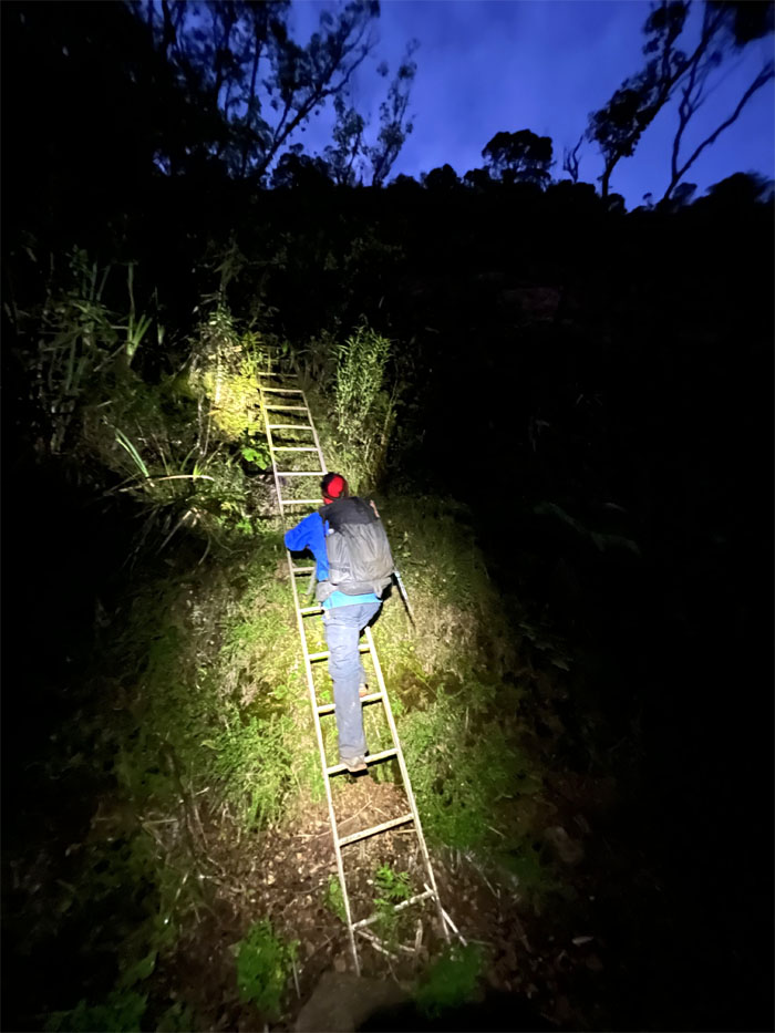
Climbing down the 80′ cliff. Photo by Chris Bautista.
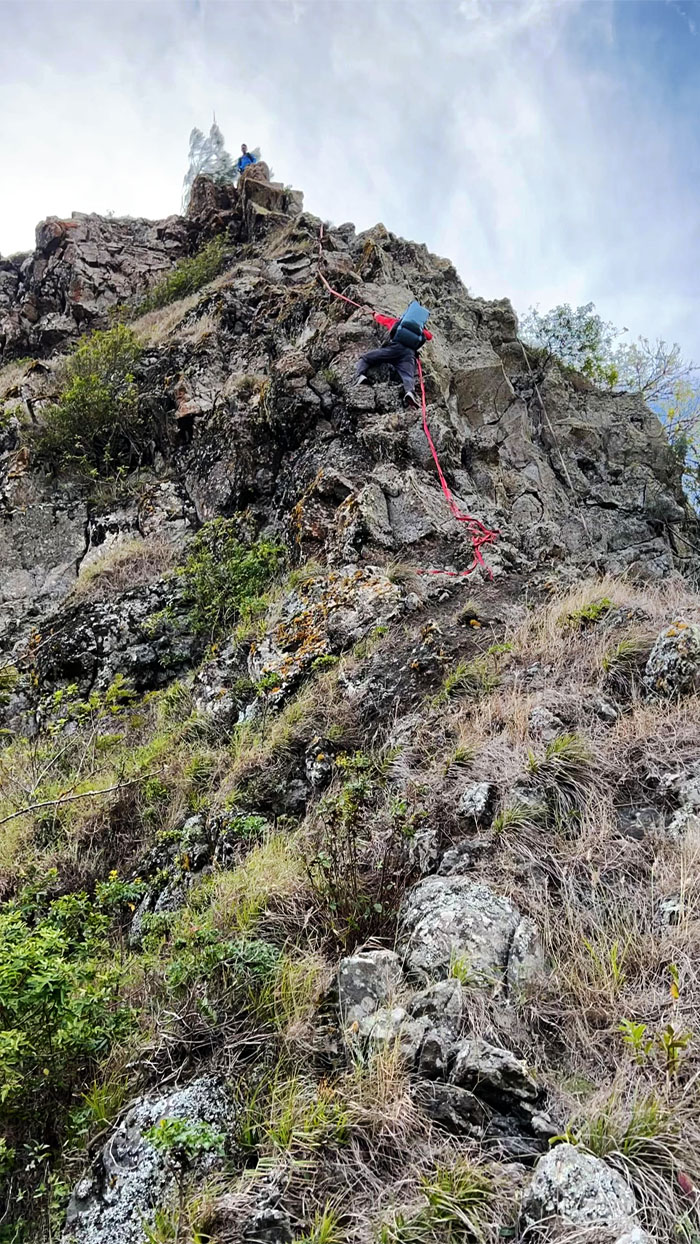
Pohakea Pass
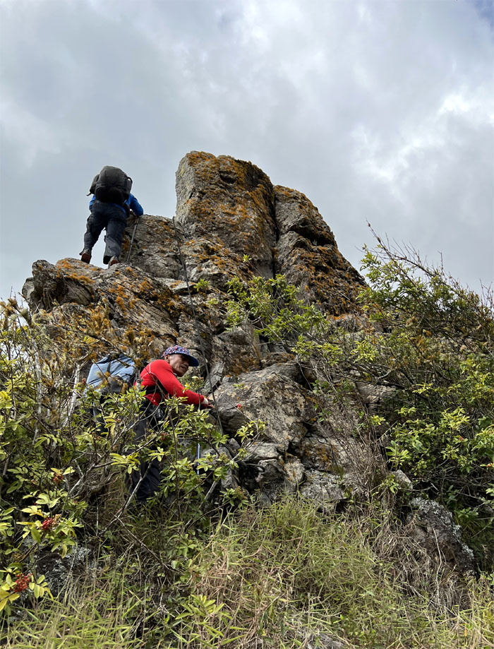
Ferlino finally getting to climb the pass after so many missed attempts.
Pohakea Pass
Chris about to climb off the pass.
WST
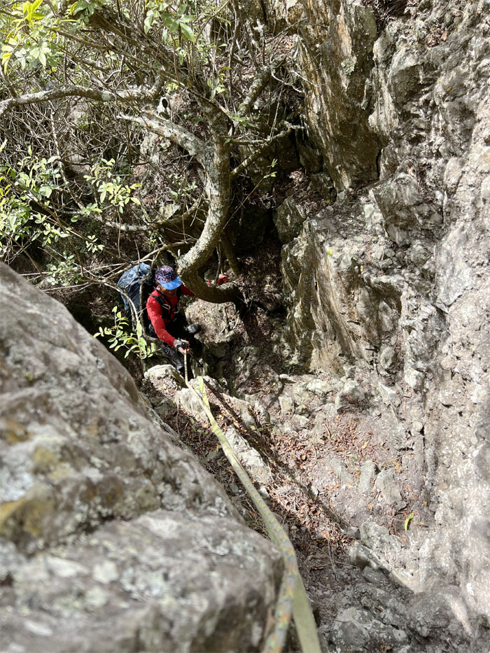
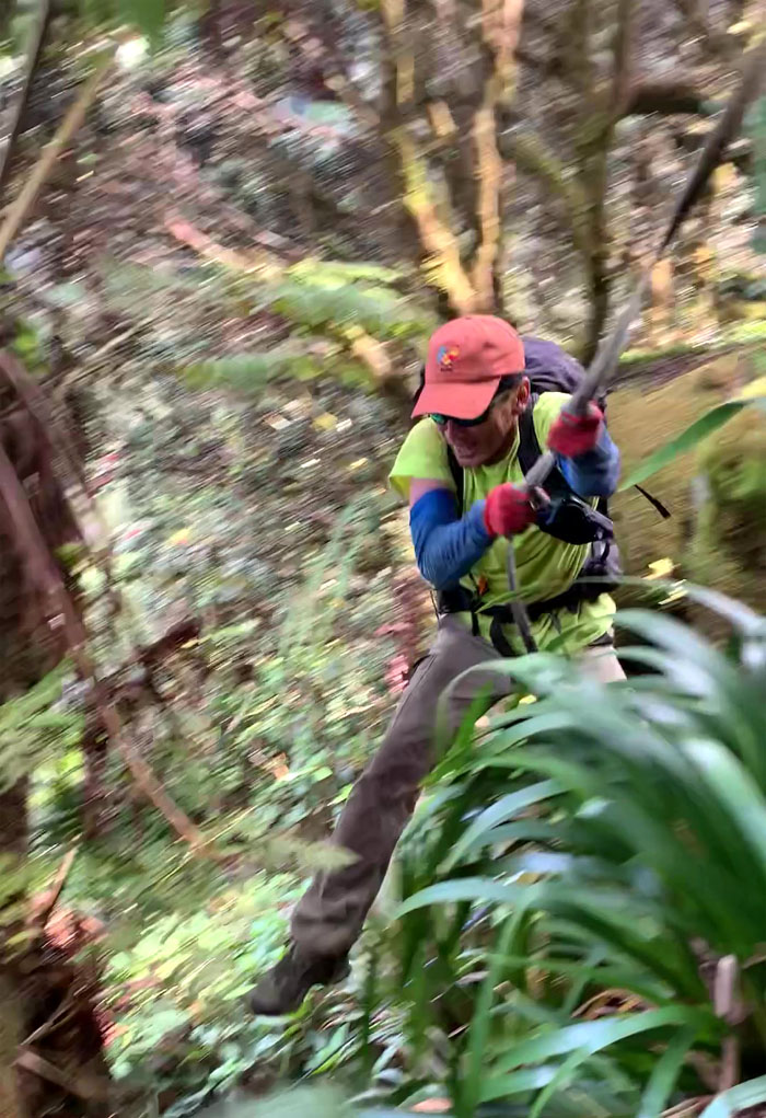
Ferlino climbing up the crack.
WST
Back on the ridge line to have the sun shining down on our sweaty faces. Photo by Chris Bautista.
WST
We still had a little more rock climbing and scrambling ahead of us. Nothing to break a sweat over. Photo by Chris Bautista.
WST
Chris pulling himself up and around a rock blocking the ridge line.
WST
Nature’s rock climbing gym. Free. Just pay with your sweat and hopefully no blood.
WST
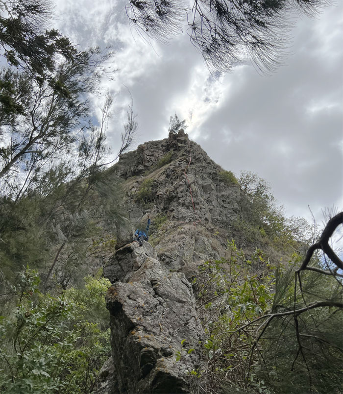
Putting distance between us and the imposing and intimidating pass. Photo by Chris Bautista.
WST
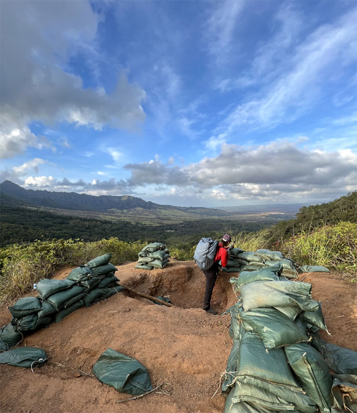
Climbing over the fence to continue our climb along the rocky ridge line.
Camp Kaua
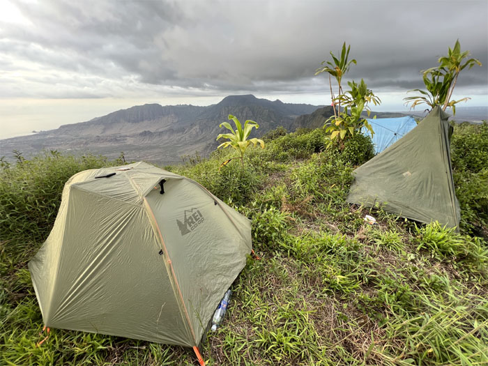
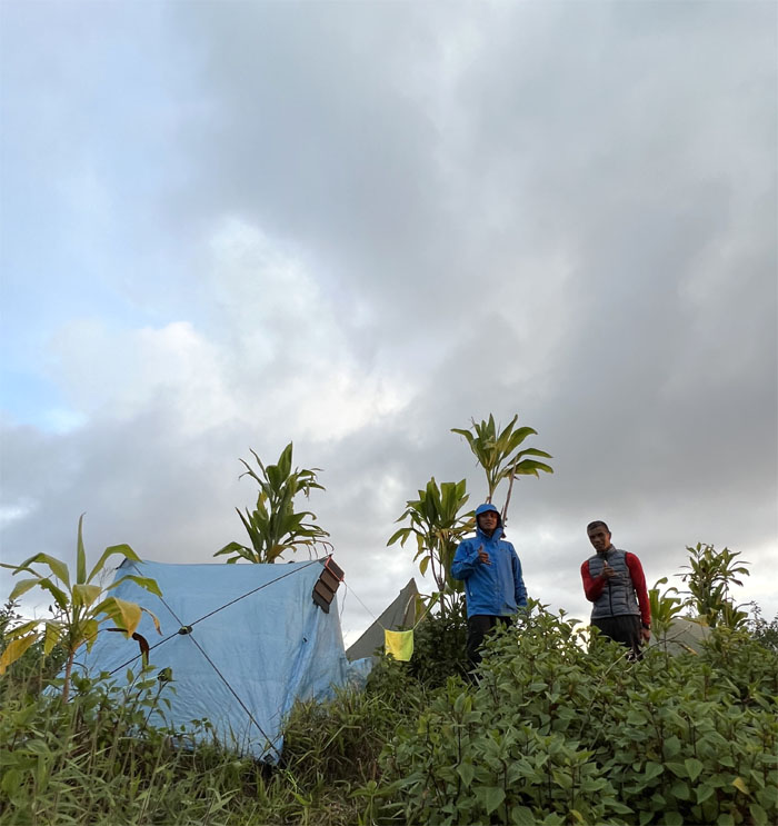
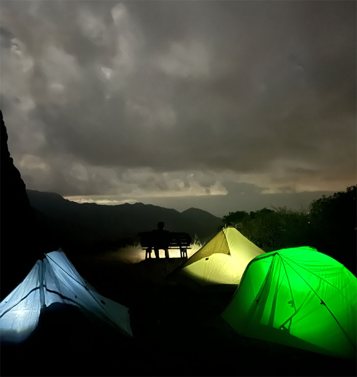
We set up camp at the 3,127′ grassy summit.
Camp Kaua
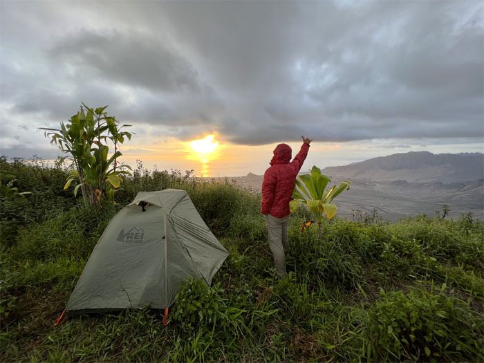
Watching the sunset. Photo by Chris Bautista.
Camp Kaua
Good night from the third highest peak on the island.
Pu’u Kaua
Day 2
We broke down camp and welcomed the second day of our hike.
WST
Some people had to take the harder way instead of the contour. To each their own.
WST
Ferlino climbing his way down to the first obstacle. Sliding down works as well. Photo by Chris Bautista.
WST
Chris climbing down the rockface.
Gorilla Heads
Looking at the backside of the larger of the gorilla head obstacles. Photo by Ferlino Carinio.
Gorilla Heads
Ferlino climbing up and over the boulder.
Gorilla Heads
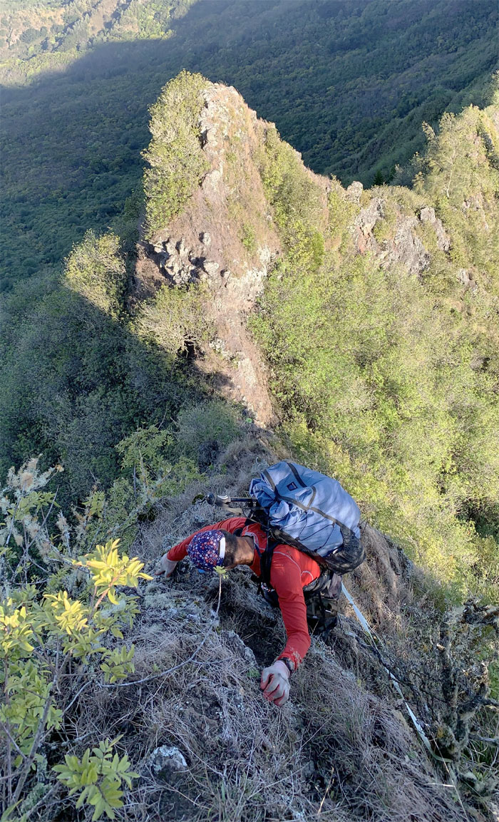
Going down the frontside of the crumbly rockface. Photo by Chris Bautista.
Gorilla Heads
Watching Chris and Ferlino making their way down.
Gorilla Heads
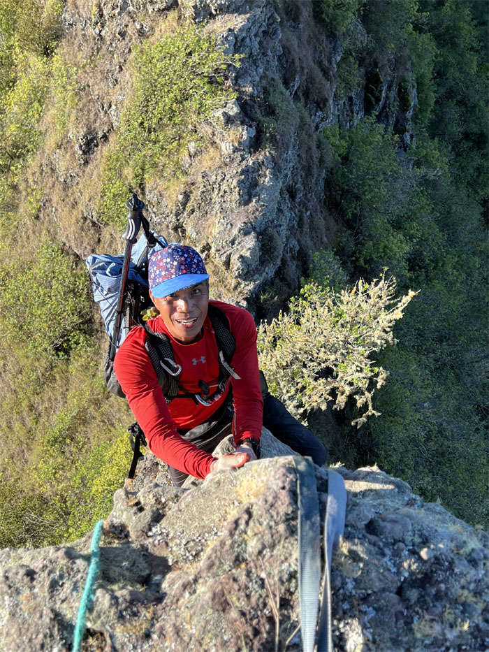
Chris the Redeemer and a photobomber on the smaller rockface. Photo by Ferlino Carinio.
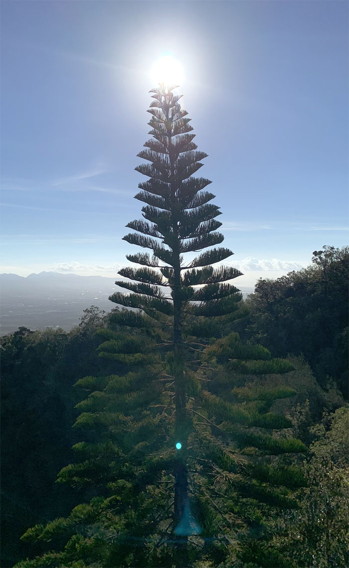
WST
O Tannenbaum. 42 days to be exact. Photo by Chris Bautista.
WST
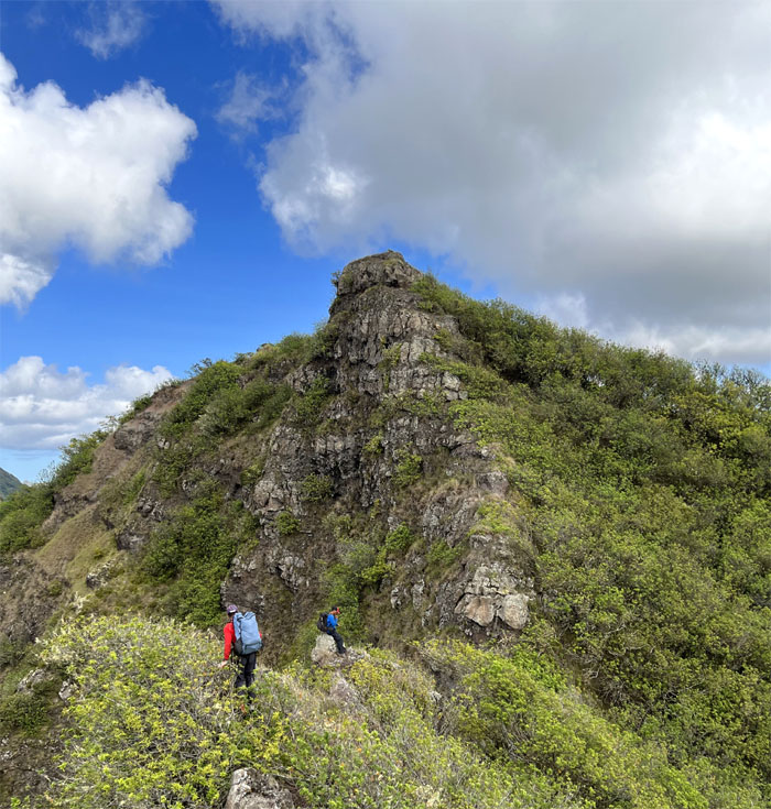
Approaching the summit of Kanehoa.
WST
Scrambling over the rocky section after we left the 2,778′ summit.
Pu’u Hapapa
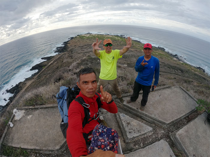
Group photo on the squared off pad with wrap around views of the island. I have it on good authority that the actual 2,883′ summit was more up the hill.
Pu’u Hapapa
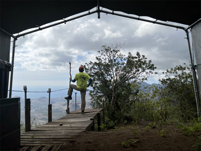
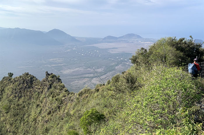
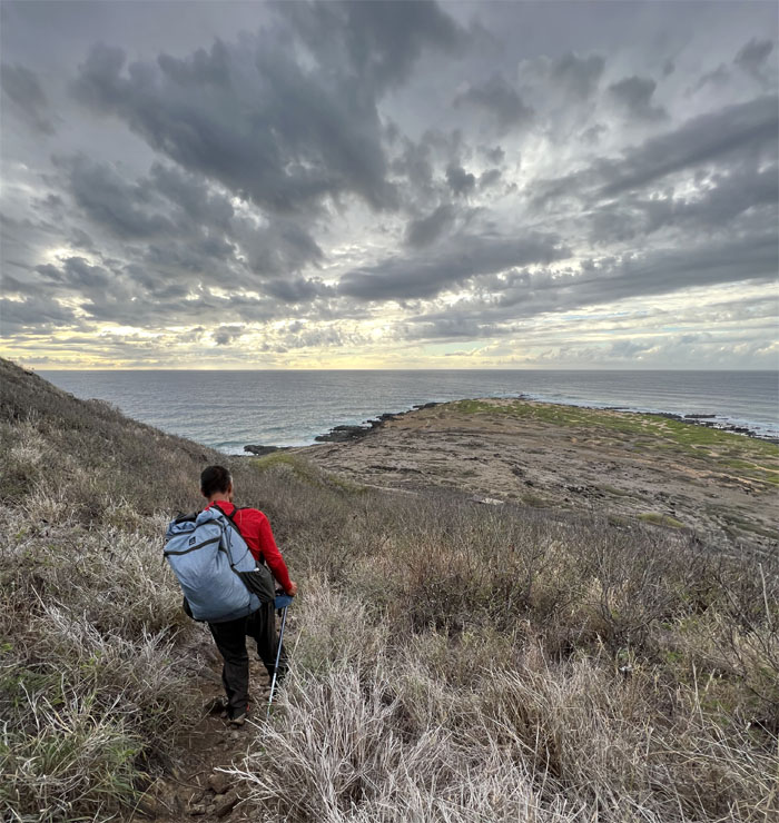
Enjoying the coastal views below from the pallet runway. Photo by Chris Bautista.
Pu’u Hapapa
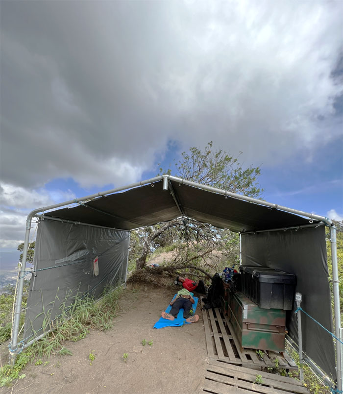
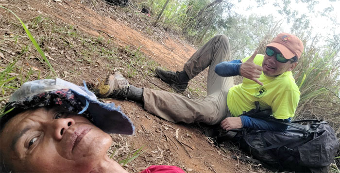
Taking shelter from the brutal afternoon sun where we took a short nap.
Hapapa Trail
We woke up refreshed and resumed our hike down the ubiquitous fence line.
Hapapa Trail
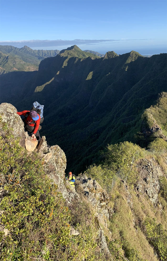
Going down the exposed and rocky ridge. Photo by Chris Bautista.
Hapapa Trail
Ferlino approaching the second notch.
Hapapa Trail
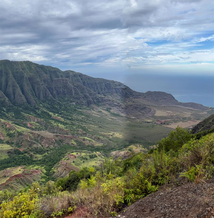
Panoramic views from the top of the notch. Photo by Chris Bautista.
Hapapa Trail
Descending down towards the larger notch.
Hapapa Trail
Looking back at the sheer cliff. Photo by Chris Bautista.
Hapapa Trail
Sliding our way down through the stand of paperbark trees. Photo by Chris Bautista.
Hapapa Trail
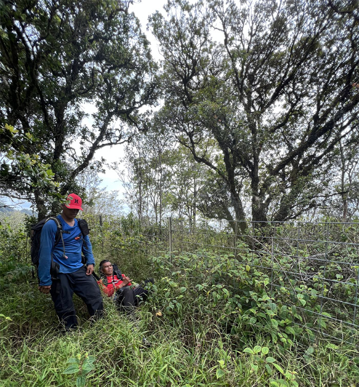
Ferlino checking out a possible camp site. It was rejected for not meeting milspecs.
Kolekole Pass
We set up camp at the lowest point in the Waiane Mountain Range. Thanks to Chris who met Mia down the road to pick up our doordash delivery from Popeye’s.
Kolekole Pass
Day 3
We broke down camp as a steady stream of hikers started to show up. Mahalo to CJ for bringing us unexpected breakfast and other goodies.
Kolekole Pass Rock
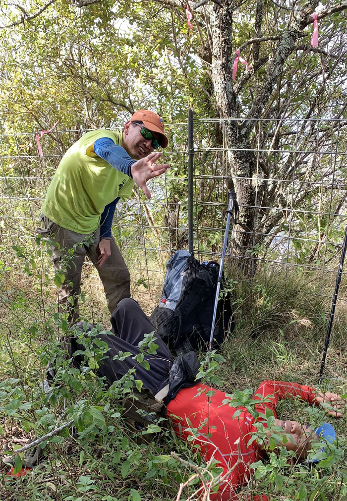
It’s hard to find a person to play the victim in a realistic manner.
Kolekole Pass
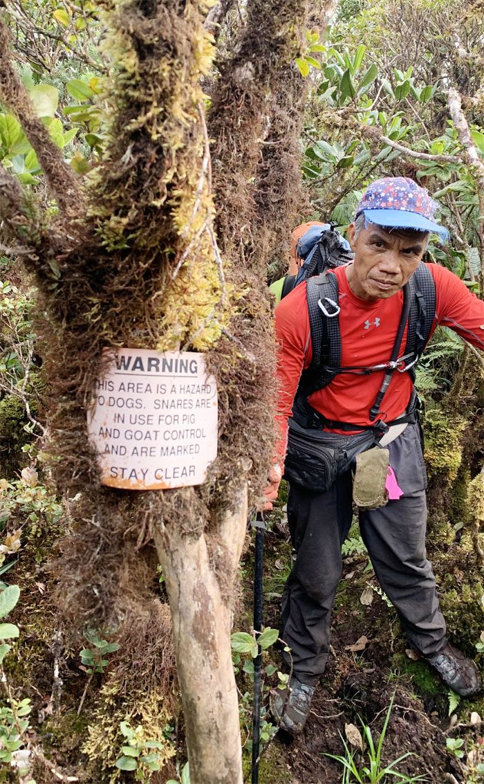
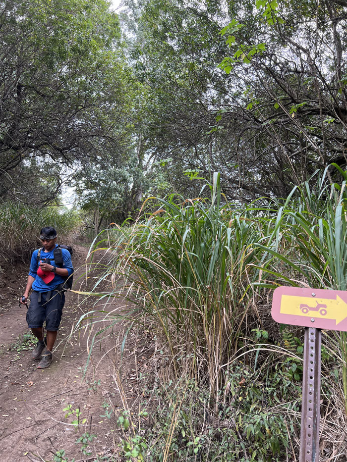
Who brought the metal detector? I guess we have to tread softly.
Kalena Trail
Going up the stiff and eroded climb as the sun broke over the mountains behind us.
Kalena Trail
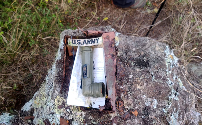
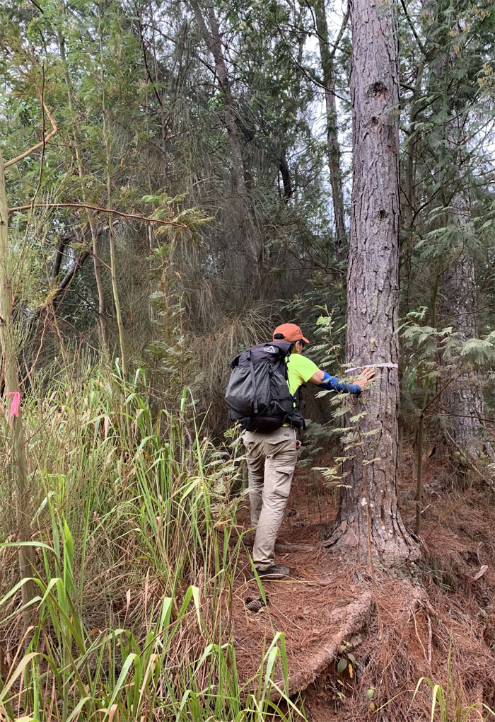
A military geocache that has seen better days. Time for a new ammo can. Photo by Ferlino Carinio.
Kalena Trail
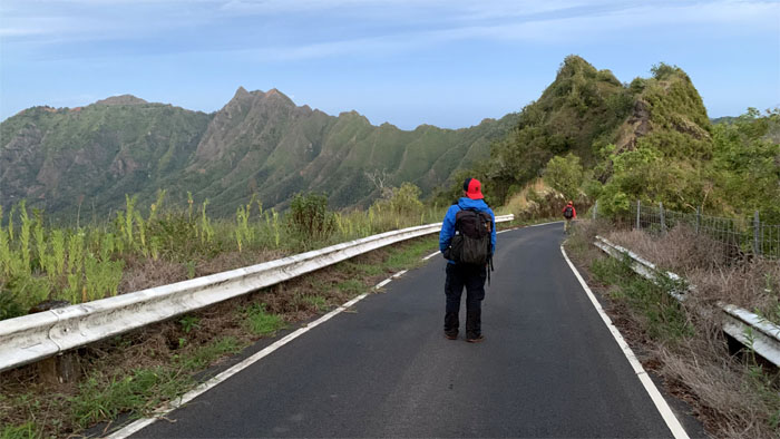
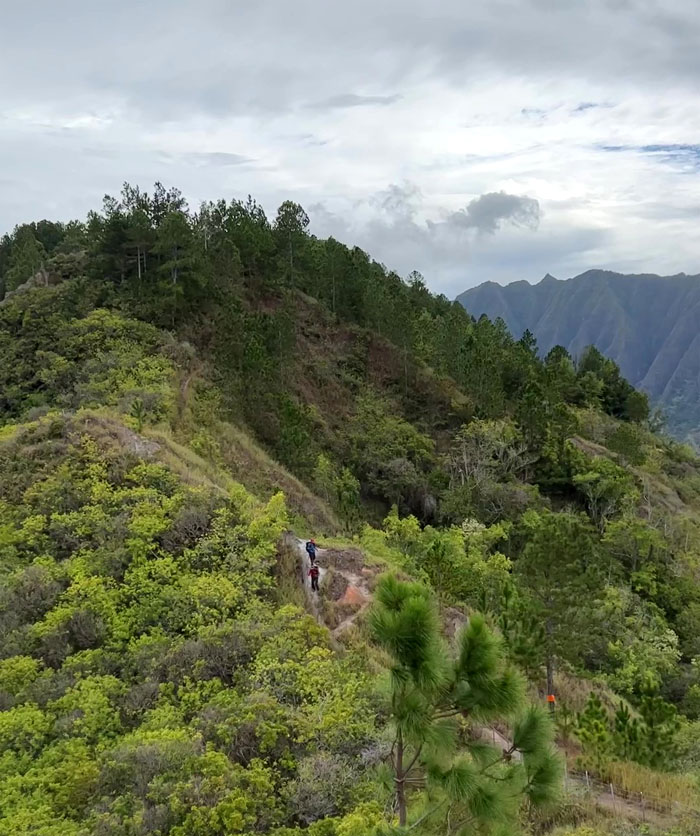
Hiking on the ridge line with the hazy mountains behind us. Photo by Chris Bautista.
Kalena Trail
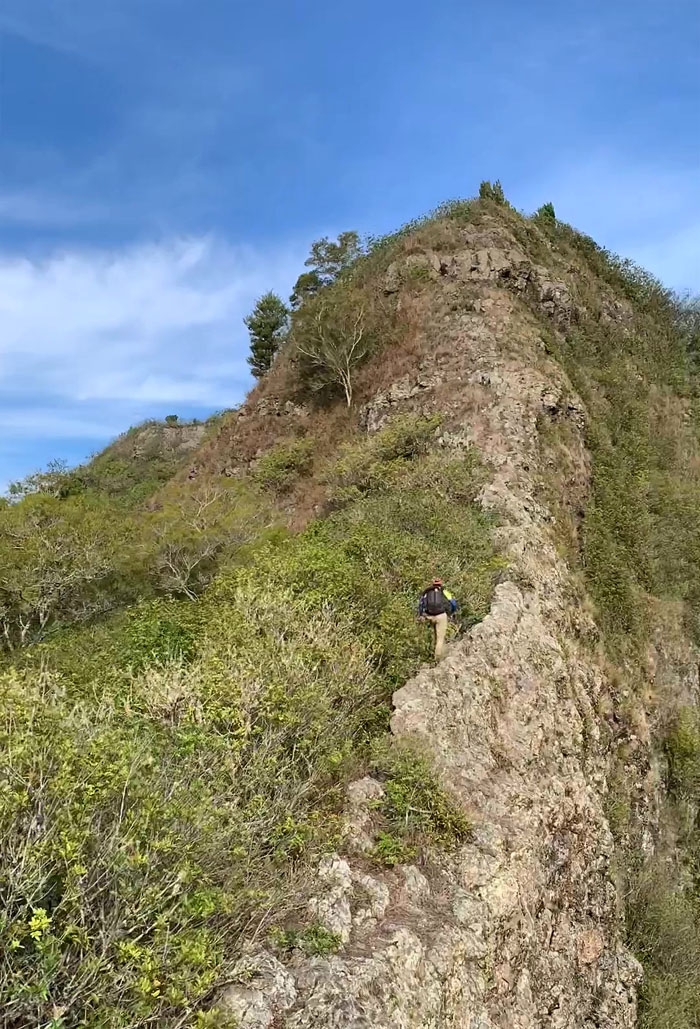
Scrambling up the narrow rock dike. Photo by Chris Bautista.
Kalena Trail
Clear views of both of our destinations – Kalena and Ka’ala, the two highest peaks on the island. Photo by Chris Bautista.
Kalena Trail
Enjoying the morning mountain views. Photo by Chris Bautista.
Kalena Trail
Chris traversing another narrow dike on the trail. Photo by Ferlino Carinio.
Kalena Trail
Ferlino passing sexxxy ridge as he followed the fence line. Photo by Chris Bautista.
Star Trek
Live long and prosper. Man down. The search for more cardio. Photo by Chris Bautista.
Kalena Trail
Hiking up the final and steep climb to the 3,504′ summit. Photo by Chris Bautista.
Pu’u Kalena
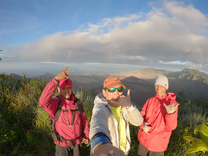
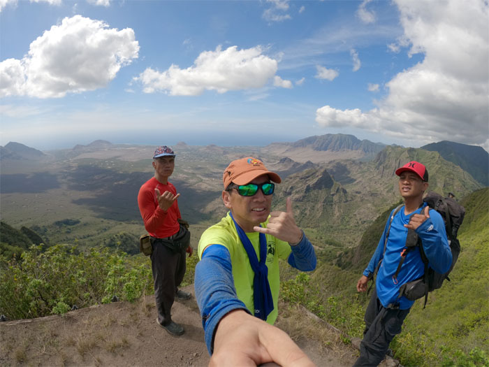
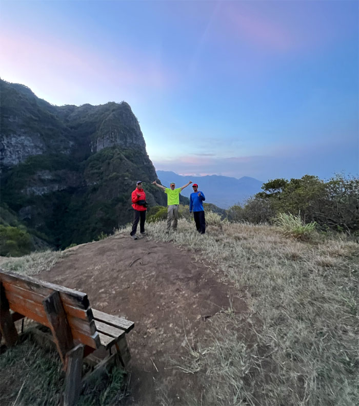
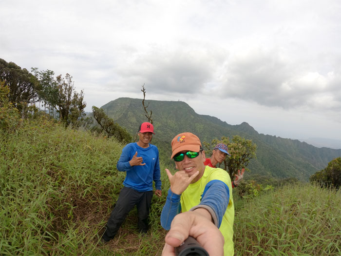
Group photo at the second highest peak on the island.
Pu’u Kalena
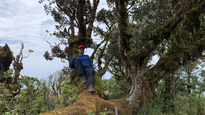
Chris enjoying the shade from the sun on the moss carpeted ohia tree.
WST
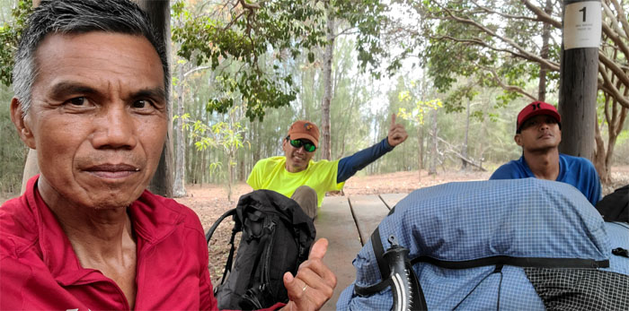
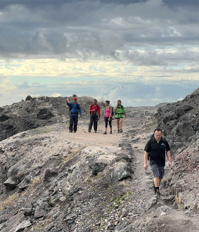
We ran into two other hikers, Takashi and Susy, coming from the other direction.
WST
Chris and Ferlino contouring up the ridge line.
WST
Climbing in and out of the split fence line.
Hobbs
Resting before the final leg to the highest peak on the island.
WST
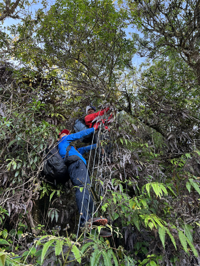
Pushing through the thick and thorny overgrowth. Punctures for days.
WST
Somebody didn’t let the weight of the hike crush his spirit.
WST
I didn’t know this swing determines if you are a goat or monkey. Photo by Chris Bautista.
WST
Going up the steep and moss slicked boulders.
WST
Pulling myself up. It was rather taxing I must admit. Photo by Chris Bautista.
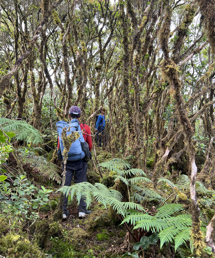
Ka’ala Bog
Wandering through the misty rainforest home to endemic fauna and flora.
Ka’ala Bog
Meeting up with the boardwalk. We have no dogs. Photo by Chris Bautista.
Ka’ala Bog
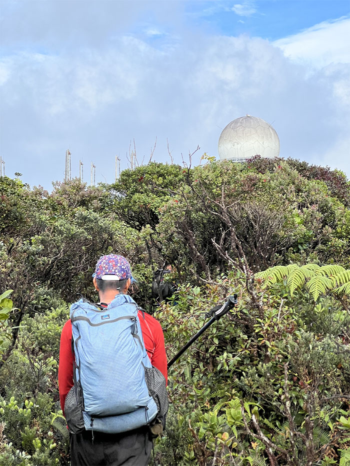
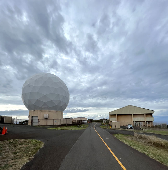
Ferlino approaching the 4,025′ summit and radar installation.
Camp Ka’ala
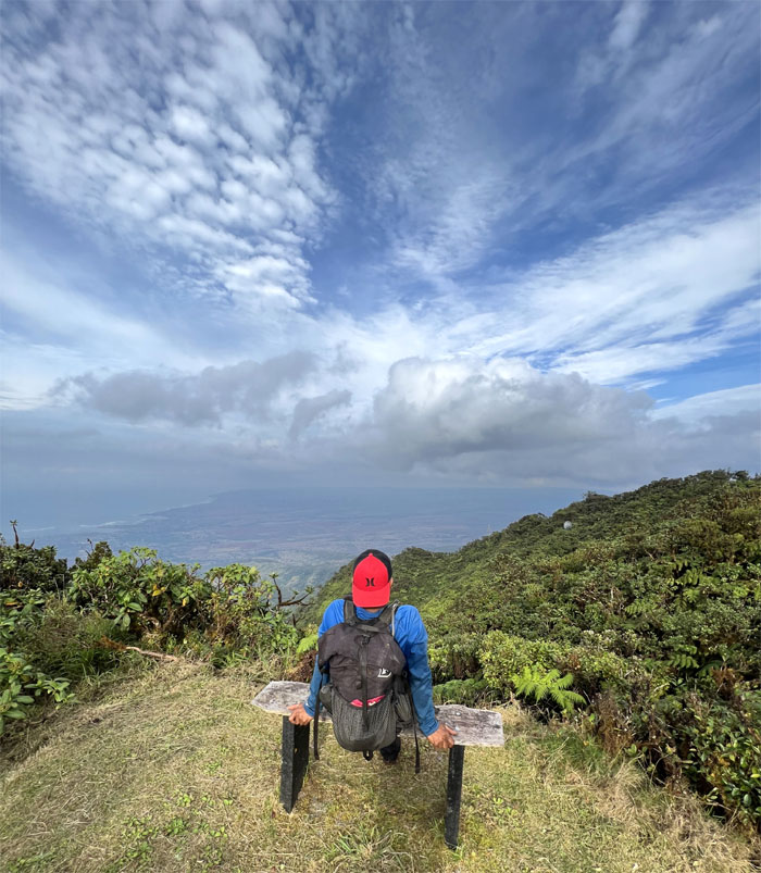
Bench with a view.
Camp Ka’ala
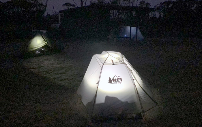
We set up camp after a worker nearby told us to be careful and spun some supernatural stories about this area. Sleep tight and don’t let the ghosts bite. Photo by Chris Bautista.
Mount Ka’ala
Day 4
We woke up and broke down camp after a ghost free experience on the highest peak on the island. Photo by Chris Bautista.
Mount Ka’ala
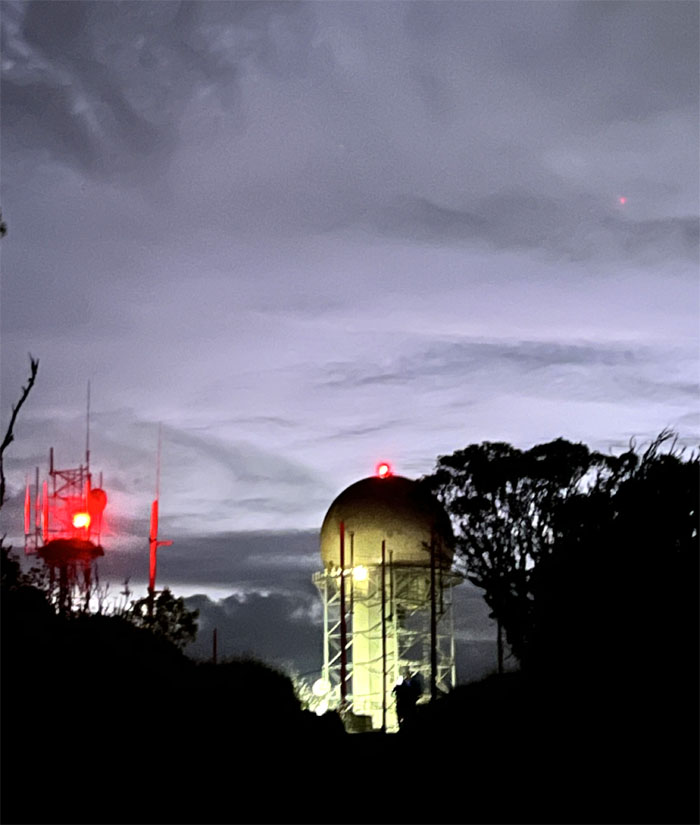
Looking back at the red blinking lights of the radar installation.
Mount Ka’ala
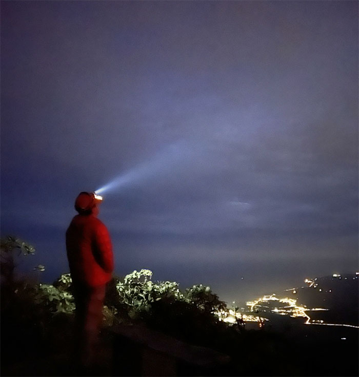
Walking down the road with the twinkling city lights of Waialua and Haleiwa in front of us. Photo by Chris Bautista.
Mount Ka’ala
Chris checking out the secret route to Stairway to Heaven. Hush hush.
Mount Ka’ala
Only one way traffic on the road this morning. Photo by Ferlino Carinio.
WST
Leaving the road and going up the steep flank of the ridge. Photo by Chris Bautista.
WST
The fence line served as our navigational aid in the dense sea of uluhe overgrowth.
Three Corners
Chris checking out the valley views of Makaha and Makua in front of him, Mokuleia was behind him. Photo by Ferlino Carinio.
WST
Leaving the roughly 2,800′ hill as we followed the fence through dips and peaks along the way.
Makua Valley
Looking down into the valley where ancient Hawaiians believed man was first created. The original inhabitants were slowly driven out by the roaming cattle from nearby ranches and then completely evicted by the US military who wanted the verdant valley home to three temples and other endemic fauna and flora for bombing practice. The lease is set to expire in 2029. Let’s see if the land is returned as promised by the US military.
WST
Contouring off the ridge where we passed a snail habitat and a spread of blue flags denoting endemic plants.
WST
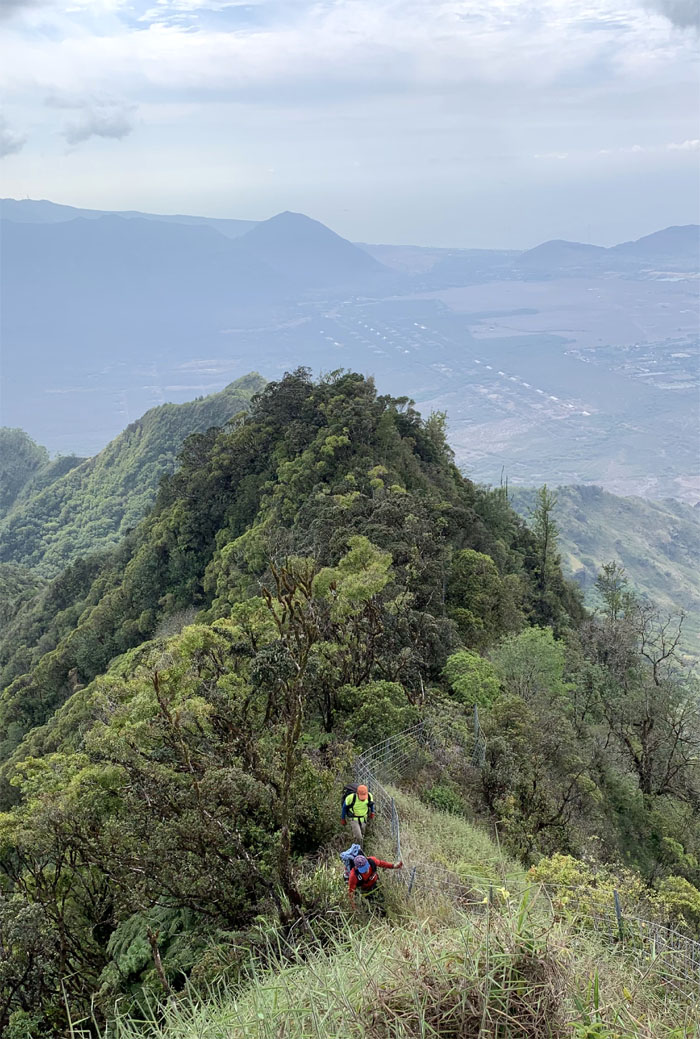
Back on the exposed fenced ridge line with coastal, valley and mountain views.
WST
Ferlino was too busy hiking to enjoy the splendid views of Makua Valley.
WST
Chris walking down the trail to connect to the jeep road.
WST
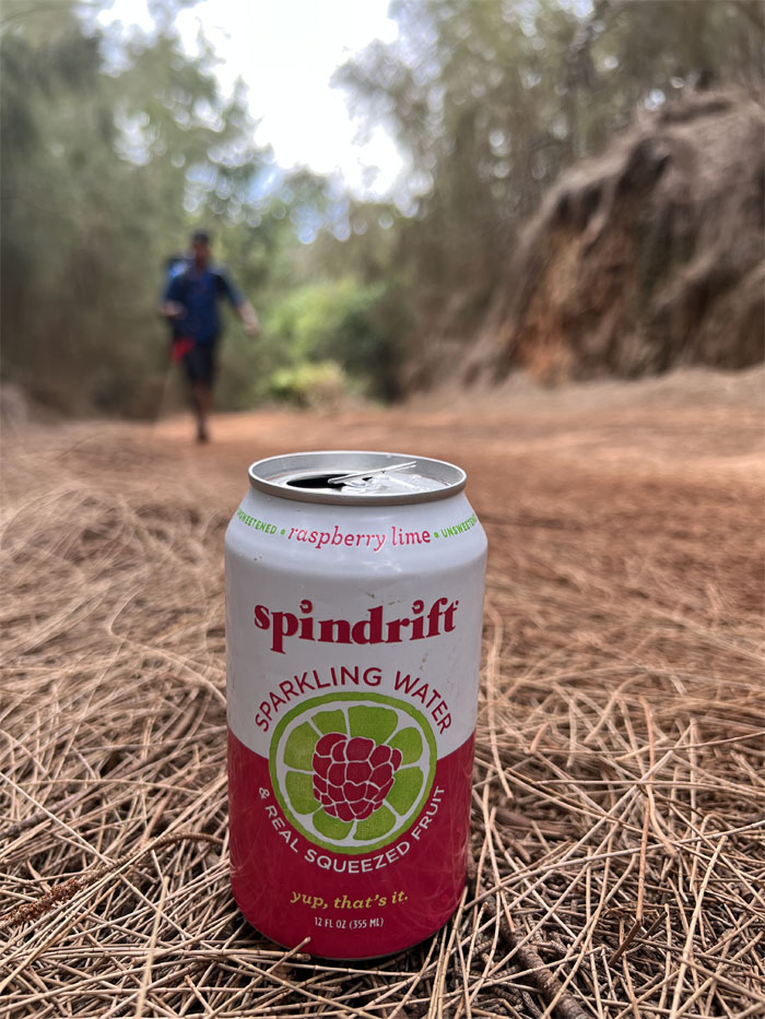
I flagged down one of the many 4×4 trucks driving on the road to see if any kind souls would sell us some ice cold soda. Shout out to the lovely couple that gave me a can of sparkling water to be split three ways. A cold beverage on a hot day on a dusty road never tasted so good.
WST
Leaving the jeep road. Photo by Chris Bautista.
Kuaokala Trail
Can somebody get me a soda? Sorry, Chris was only making hot Korean ramen. Photo by Ferlino Carinio.
Kuaokala Trail
Chris and Ferlino making their way through the pine forests and towards where I was sitting on top of the dodo rock.
Kuaokala Trail
Heading to the Makua Rim trail.
Kuaokala Trail
Where are those 4×4’s when you need them?
Kuaokala Trail
Taking a short break underneath the picnic shelter before our final push to the end. Photo by Ferlino Carinio.
Kuaokala Trail
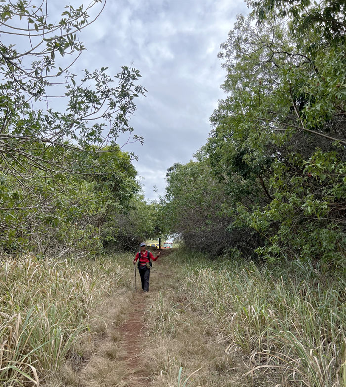
Enjoying the wide open trail while we can.
Kuaokala Trail
In search of a suitable trail. Photo by Ferlino Carinio.
Kaena Point
Trying to stay on the off-beaten track is always a challenge.
Kaena Point
Putting the bushwhacking behind us.
Kaena Point
Straying off the off-beaten track after we lost the stalking truck.
Kaena Point
Our ten minutes of stress induced anxiety were finally over.
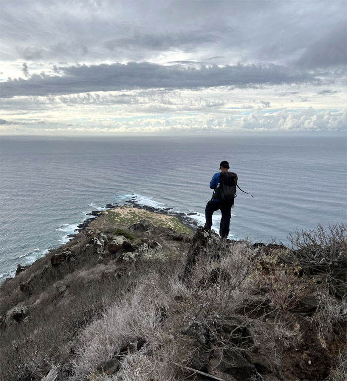
Kaena Point
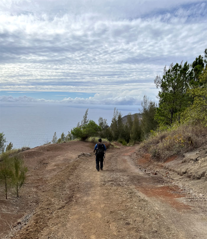
Chris overlooking the westernmost point on the island, a place that ancient Hawaiians called the “leaping place for the souls.”
Kaena Point
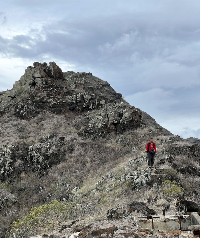
Ferlino coming down from the mountain.
Kaena Point
Looking out towards the ocean where a little known volcano, Kaena, sank over two million years ago. Kaena along with Waianae and Ko’olau helped to create the island of Oahu. Photo by Chris Bautista.
Kaena Point
#17. Group photo celebrating our first, third and eighth time finishing the entire Waianae Summit Trail. This also marked my twenty-first cumulative completions of both the KST and WST. 21 for 2021. Photo by Ferlino Carinio.
Kaena Point
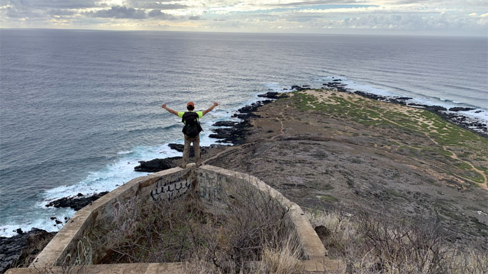
Somebody could already taste the ice cold soda coming down the grassy and rocky ridge.
Kaena Point
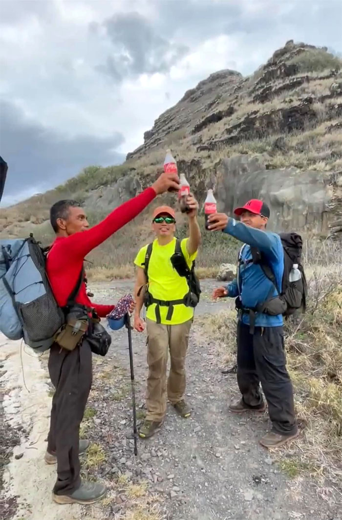
Thanks to Art, Lilyn and Quan for meeting us with cold carbonated beverages at the base of the ridge. It’s the little things that can pick you up after a long weekend. Photo by Quan Haberstroh.
Kaena Point
Hiking our way back over the two mile long trail that follows remnants of railroad tracks and home to cliffs harboring tidepools, arches and abandoned vehicles.
Kaena Point
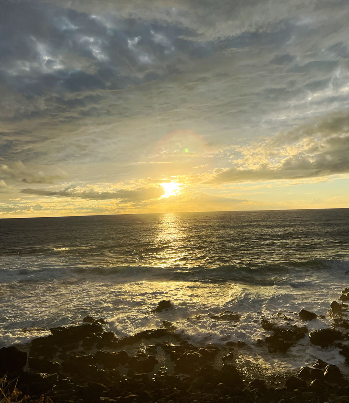
No green flash for us, but the sunset was still striking.
Kaena Point
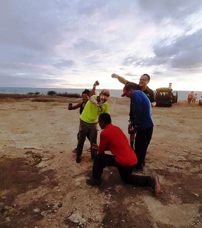
Obviously the coordination to pull off a triple champagne dousing was a little beyond us. But everybody still got wet. Photo by Jasmin Carinio.
Electric Beach
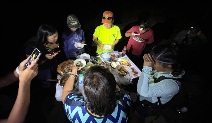
Plenty thanks as well to Aida, Jasmin, Marilyn and Tessa for joining us with enough delicious food to whet our caloric deficit. Photo by Ferlino Carinio.
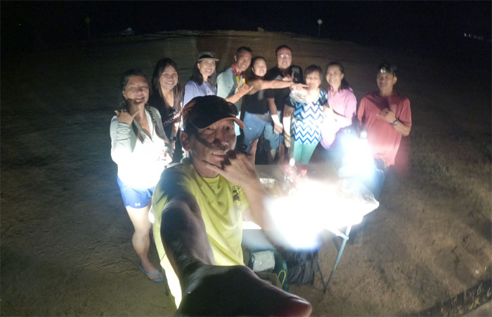
All pau
Our bellies were full and our hearts content. Thanks again to everybody that came out and supported us. Much mahalos!
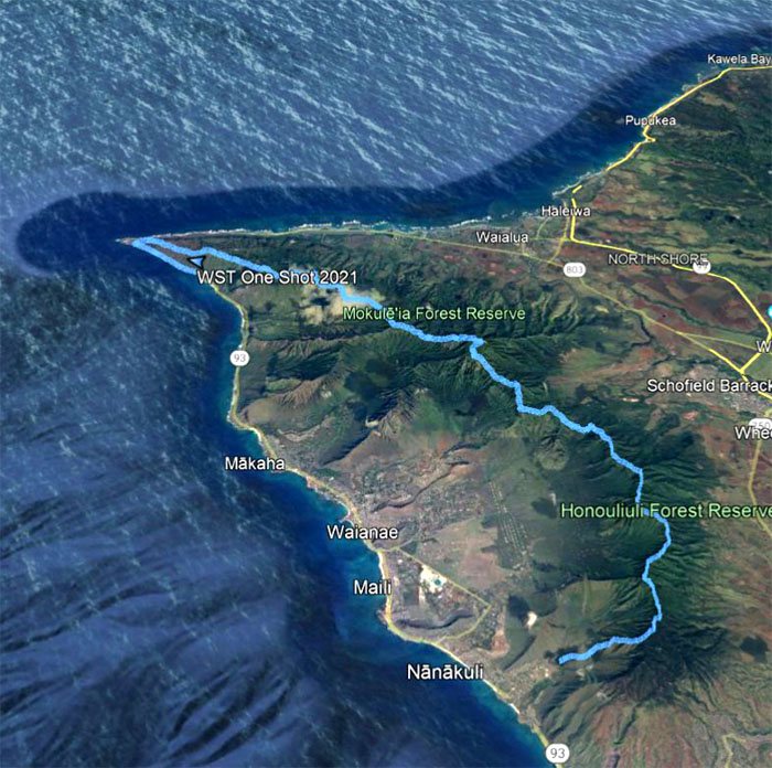
GPS Tracks
Our original three day hike turned four day hike due to technical difficulties covered 28.6 miles through the entire Waianae Summit Trail. The hike was filled with soaring temperatures, rough terrain and unmatched views. Best of all, it was done with and the support from great friends.
Note: I have been made aware that some hikers have been using my blog as a hiking guide and getting lost on the trails. Please note that this blog was made to document the hike for the crew(s) that did it. That is why some of my comments will seem to have no relevance or meaning to anybody outside of the crew(s) that hiked that trail. My blog was never meant as a hiking guide, so please do not treat it as such. If you find inspiration and entertainment from these hikes, that is more than enough. If you plan on replicating these hikes, do so in the knowledge that you should do your own research accordingly as trail conditions, access, legalities and so forth are constantly in flux. What was current today is most likely yesterdays news. Please be prepared to accept any risks and responsibilities on your own as you should know your own limitations, experience and abilities before you even set foot on a trail, as even the “simplest” or “easiest” of trails can present potential pitfalls for even the most “experienced” hikers.
{ 4 comments… read them below or add one }
Thank you so much Kenji Saito for not giving up on me and mush encouragement. Kambata ???? I’m forever grateful.
Aloha Ferlino,
You’re welcome! Like I said, we started together and we will end it together. Glad we all finished together safe and sound!
Mahalo
Hi Kenji, it was great to see you guys on the trail!
Wow… quite a journey. I thought next day we met was rain but glad it looked hold off. Nice write-up as always.
Aloha Takashi,
Thanks. It was a pleasant surprise to see you guys on the trail as well. Happy trails.
Mahalo